494 entries match your criteria. The first 100 are listed. Next 100 ⊳
NYC Parks Historical Markers
The purpose of this NYC Parks & Recreation program is to place historical identification markers which describe the history of the site, park improvements, and the biography of the person for whom the park is named.
These historical signs also offer virtual and physical context to parks, playgrounds, monuments, and landmarks across New York City.
On Soundview Avenue south of Randall Avenue, on the right when traveling north.
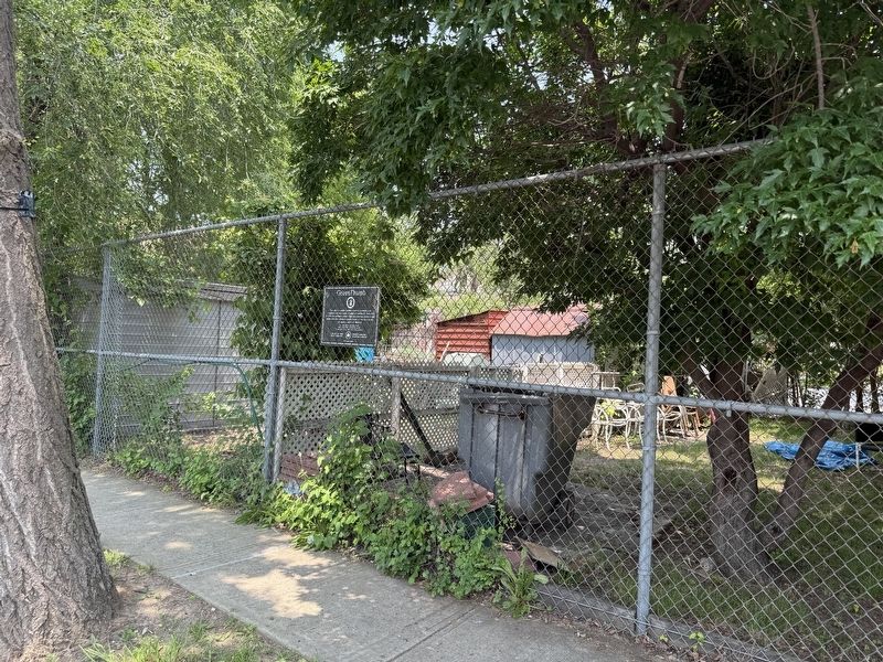
This site is a public garden which is maintained by neighborhood volunteers through GreenThumb. Founded in 1978, GreenThumb helps local residents transform vacant properties into attractive green spaces. If you want to join this garden, call (212) . . . — — Map (db m275081) HM
On Gildersleeve Avenue east of Husson Avenue, on the right when traveling east.
This site is a public garden which is maintained by neighborhood volunteers through GreenThumb. Founded in 1978, GreenThumb helps local residents transform vacant properties into attractive green spaces. If you want to join this garden, call (212) . . . — — Map (db m275082) HM
Near Leland Avenue at O'Brien Avenue, on the right when traveling south.
Salt marshes play a vital role in our coastal waters. These ecosystems protect the shoreline from erosion, filter pollutants from the water, and provide a rich wildlife habitat.
In the last 200 years, more than 80% of New York City's . . . — — Map (db m275015) HM
Near Exterior Street north of East 150th Street, on the right when traveling south.
The lower Hudson Valley and the Bronx Terminal Market share a rich and colorful past.
Macomb's Dam Across the Harlem River
In 1814, Robert Macomb built a dam and toll bridge across the Harlem River in the vicinity of . . . — — Map (db m241545) HM
Near East 161 Street west of Grand Concourse, on the right when traveling west.
The Heinrich Heine Fountain (also known as the Lorelei Fountain) honors the German poet, writer, and social dissident Heinrich Heine (1797-1856), whose poem Die Lorelei immortalized the mysterious creature of romantic legend.
Born in . . . — — Map (db m228750) HM
Near Exterior Street 0.2 miles north of East 150th Street, on the right when traveling south. Reported unreadable.
The Bronx Terminal Market served as the distribution point for thousands of food products satisfying the varied tastes of New Yorkers.
The Market was Open to Everyone
The Bronx Terminal Market served communities in the Bronx . . . — — Map (db m241552) HM
Near Exterior Street 0.3 miles north of East 150th Street, on the right when traveling south.
The Power House, an engineering marvel of the 1920s, housed mechanical equipment vital to the operations of the Bronx Terminal Market.
The Power House
The only building remaining on the site of the Bronx Terminal Market, the . . . — — Map (db m241540) HM
Near Exterior Street north of East 150th Street, on the left when traveling north.
The Bronx Terminal Market's road, rail, and water links brought vast amounts of food into New York City.
Delivery Trucks at the Market
Trucks were a constant fixture at the Bronx Terminal Market. The long rows of narrow stores . . . — — Map (db m241555) HM
On East 176th Street west of Prospect Avenue, on the right when traveling west.
What was here before?
Tremont was formerly known as Upper Morrisania for the Morris family who owned the land. The neighborhood's first postmaster, Hiram Tarbox (1817-1904), suggested a change in name to avoid having mail confused between . . . — — Map (db m311640) HM
On Crawford Avenue at Palmer Avenue, on the left when traveling east on Crawford Avenue.
Seton Falls Park derives its name from the prominent waterfalls built in the park by the Seton Family. In the 19th century, these landowners were instrumental in the political and social affairs of what was then the town of East Chester. The . . . — — Map (db m271246) HM
Near Thomas E. Brown Avenue north of Crawford Avenue, on the right when traveling north.
Seton Falls Park derives its name from the prominent waterfalls built in the park by the Seton Family. In the 19th century, these landowners were instrumental in the political and social affairs of what was then the town of East Chester. The . . . — — Map (db m271250) HM
On Thomas E. Brown Avenue north of Shieffelin Avenue, on the right when traveling north.
Seton Falls Park derives its name from the prominent waterfalls built in the park by the Seton Family. In the 19th century, these landowners were instrumental in the political and social affairs of what was then the town of East Chester. The . . . — — Map (db m271252) HM
On Crawford Avenue at Boller Avenue, on the left when traveling east on Crawford Avenue. Reported unreadable.
Seton Falls Park derives its name from the prominent waterfalls built in the park by the Seton Family. In the 19th century, these landowners were instrumental in the political and social affairs of what was then the town of East Chester. The . . . — — Map (db m271254) HM
Near Broadway (U.S. 9) north of Manhattan College Parkway, on the right when traveling north. Reported permanently removed.
Memorial Grove was created to honor Bronx men who served in World War II and Korea. The grove is shaded by Pin oaks (Quercus palustris), Red oaks (Quercus rubra), and Norway maples (Acer platanoides). Memorial Grove was first planted in 1949 to . . . — — Map (db m53839) HM
Near Broadway (Route 9) north of Manhattan College Parkway, on the right when traveling north.
Memorial Grove was originally planted as a living tribute to the local servicemen who lost their lives while fighting for their country. Designed in 1949 by NYC Parks and the Peter G. Lehman Post No. 8646 of the Veterans of Foreign Wars, the . . . — — Map (db m275193) HM
Near Broadway (U.S. 9) north of Manhattan, on the right when traveling north.
Memorial Grove was originally planted as a living tribute to the local servicemen who lost their lives while fighting for their country. Designed in 1949 by NYC Parks and the Peter G. Lehman Post No. 8646 of the Veterans of Foreign Wars, the . . . — — Map (db m275194) HM
On Broadway (U.S. 9) north of Manhattan College Parkway, on the right when traveling north.
Memorial Grove was originally planted as a living tribute to the local servicemen who lost their lives while fighting for their country. Designed in 1949 by NYC Parks and the Peter G. Lehman Post No. 8646 of the Veterans of Foreign Wars, the . . . — — Map (db m278473) HM
On Broadway (U.S. 9) just north of Manhattan College Parkway, on the right when traveling north.
What was here before?
Some 20,000 years ago, New York was buried beneath massive glaciers. When the ice receded, it left behind the distinct landscape of Van Cortland Park—steep ridges, smooth hillsides, and open flats—and exposed its three . . . — — Map (db m275192) HM
On Broadway (U.S. 9) south of West 242nd Street, on the right when traveling north.
Located along Broadway and West 242 Street, Van Cortlandt Stadium takes its name from the Van Cortlandt Family who occupied the land from 1699 to 1888. The Weckquasgeek Lenape Native American tribe lived on this site in 1639 when the Dutch East . . . — — Map (db m275191) HM
On East Fordham Road west of Kingsbridge Road, on the right when traveling west.
What was here before?
This area of the Bronx is known as Fordham Manor, which was one of four manors established through feudal grants that allowed the landowner the right to build mills and institute a court system to try their tenants. It . . . — — Map (db m275768) HM
On East Fordham Road west of East Kingsbridge Road when traveling east. Reported damaged.
What was here before?
This area of the Bronx is known as Fordham Manor, which was one of four manors established through feudal grants that allowed the landowner the right to build mills and institute a court system to try their tenants. It . . . — — Map (db m275770) HM
On University Avenue at West Fordham Road, on the right when traveling south on University Avenue.
What was here before?
This site was once occupied by the First Reformed Dutch Church, which was built in 1705. The congregation's property was considerable due to the 1684 bequest of the Manor of Fordham, which extended from the Hudson . . . — — Map (db m278365) HM
On Grand Concourse at East 193rd Street, on the right when traveling north on Grand Concourse.
About the Cottage
The Edgar Allan Poe Cottage, built circa 1812, is the final home of the famed writer. At the time that Poe, his ailing wife, Virginia, and mother-in-law, Mrs. Maria Clemm, moved in during the spring of 1846, the house was . . . — — Map (db m275753) HM
On West Fordham Road at Aqueduct Walk, on the right when traveling west on West Fordham Road.
Aqueduct History
Between 1837 and 1842, the Croton Aqueduct profoundly changed New York City by providing abundant clean water from the Croton River in northern Westchester County. Local wells, springs and ponds had gradually become . . . — — Map (db m278362) HM
On Grand Concourse at East 192nd Street, on the right when traveling north on Grand Concourse. Reported damaged.
What was here before?
Poe Cottage originally occupied a triangular plot where Kingsbridge Road turned east on the hill above what is now Fordham Road. Across the street was an apple orchard on land that is now Poe Park.
The white frame . . . — — Map (db m275754) HM
On East Fordham Road at Webster Avenue, on the left when traveling east on East Fordham Road.
This small park is a vestige of a far larger estate once called "Rose Hill" by its owner, Roger Watt. His lands covered a tract now occupied by Fordham University and additional territory extending to the present day New York Botanical Garden in . . . — — Map (db m275838) HM
On Bronx River Greenway south of East 177th Street, on the right when traveling south.
The Bronx River is 23 miles long, beginning in Westchester County and flowing to the Long Island Sound. It is the only freshwater river in New York City. Before European settlement, the Lenape people lived in this area. The Bronx River had many . . . — — Map (db m275086) HM
On Bryant Avenue north of Westchester Avenue, on the left when traveling south.
Although some believe that this triangle and the adjacent avenue are named for Bronx Revolutionary War hero Captain Bryant, they are more likely named in honor of William Cullen Bryant (1794-1878), distinguished poet, journalist, and . . . — — Map (db m275111) HM
On Longfellow Avenue north of East 165th Street, on the right when traveling north.
This Bronx park honors one of the most notable American poets of the 19th century, Henry Wadsworth Longfellow (1807-1882).
Born in Portland, Massachusetts (now Maine), Henry Longfellow graduated from Bowdoin College in 1825. After graduation . . . — — Map (db m275112) HM
On Aldus Street at Bryant Avenue, on the right when traveling east on Aldus Street.
Lyons Square, bounded by Bruckner Boulevard, Aldus Street, Longfellow Avenue, and Bryant Avenue, was named for landowner and Civil War veteran James L. Lyons by the Board of Aldermen on April 17, 1928. Shielded by a raised perimeter of trees from . . . — — Map (db m275091) HM
On Bryant Street at Bruckner Boulevard, on the left when traveling south on Bryant Street.
Lyons Square, bounded by Bruckner Boulevard, Aldus Street, Longfellow Avenue, and Bryant Avenue, was named for landowner and Civil War veteran James L. Lyons by the Board of Aldermen on April 17, 1928. Shielded by a raised perimeter of trees from . . . — — Map (db m275094) HM
On Bryant Avenue south of Aldus Street, on the left when traveling south.
What was here before?
Lyons Square Playground sits on the edge of the Hunts Point area of the Bronx, which was first populated by the Weckquaesgeek. Edward Jessup and John Richardson, European settlers who arrived in 1663, purchased the . . . — — Map (db m275092) HM
On Hoe Avenue south of East 165th Street, on the left when traveling north.
"'Tis pleasant, sure, to see one's name in print." —Lord Byron
This park pays tribute to three pioneers in the printing field: Colonel Richard Morris Hoe (1812-1886), Johann Gutenburg (c1400-c1468), and Aldo . . . — — Map (db m275129) HM
On Hoe Avenue just north of Aldus Street, on the left when traveling north.
"'Tis pleasant, sure, to see one's name in print." —Lord Byron
This park pays tribute to three pioneers in the printing field: Colonel Richard Morris Hoe (1812-1886), Johann Gutenburg (c1400-c1468), and Aldo . . . — — Map (db m275133) HM
On Bronx River Greenway north of Westchester Avenue, on the left when traveling south.
Built in 1907, this bascule bridge is a type of drawbridge. It used a weight on one end to raise the structure when ships needed to pass through on the river. The bridge originally had three independent spans, one for each of railroad track. They . . . — — Map (db m275087) HM
On Boscobel Place east of University Avenue, on the left when traveling east.
What was here before?
This site was once part of real estate developer William B. Ogden's (1805–1877) estate, Villa Boscobel. In addition to his real estate business, he was also the first mayor of Chicago (1837–1838) and the first . . . — — Map (db m311645) HM
On Nelson Avenue at West 170th Street, on the left when traveling south on Nelson Avenue.
What was here before?
This site was part of the Devoe estate, a wealthy family who were congregants at the First Reformed Dutch Church and descendants of Daniel Turnier, who acquired the lower section of the Fordham Patent of 1676. In 1868, . . . — — Map (db m311648) HM
On Shakespeare Avenue south of West 169th Street, on the right when traveling north.
This site is a public garden which is maintained by neighborhood volunteers through GreenThumb. Founded in 1978, GreenThumb helps local residents transform vacant properties into attractive green spaces. If you want to join this garden, call . . . — — Map (db m311646) HM
On East 161 Street at Jerome Avenue, on the right when traveling west on East 161 Street.
The Highbridge World War I Memorial, popularly known as the Highbridge Doughboy originally stood proudly at a small park triangle at Ogden and University Avenues in the University Heights or Highbridge section of the Bronx. It . . . — — Map (db m228746) HM
On University Avenue at West 170th Street, on the left when traveling north on University Avenue.
High Bridge, Bronx
The greatest engineering challenge in constructing the Old Croton Aqueduct was designing the best method for bringing the water across the Harlem River. To accomplish this, the engineers built the High Bridge, the most . . . — — Map (db m283188) HM
On Jerome Avenue north of East 164th Street, on the right when traveling north.
What was here before?
A creek, called Metipathe by the Lenape, once ran through this land into the Harlem River after following a course along what are now River and Jerome Avenues. When European settlers arrived, the creek was sold to John . . . — — Map (db m228714) HM
On University Avenue south of West 170th Street when traveling north.
What was here before?
In 1671, Governor Francis Lovelace (1621-1675) granted 1,250 acres, including this site, which extended from the Bronx River to the Harlem River, to John Archer (1630-1684). The land was farmed by early settlers such . . . — — Map (db m283182) HM
On Viele Avenue just east of Casanova Street, on the right when traveling east.
Barretto Point Park, a popular waterfront park in Hunts Point, opened in 2006. The park is named after Francis J. Barretto, a 19th century merchant and State Assemblyman of Westchester County who owned an estate in the area.
The neighborhood . . . — — Map (db m274948) HM
On Longwood Avenue at Spofford Avenue when traveling north on Longwood Avenue.
This triangle is named for Walter Fufidio (1924-1945), a native of Hunts Point in the Bronx who was killed in the bloody battle of Iwo Jima during World War II. Enlisting in the Marines at the age of 19, Fufidio participated in the Pacific . . . — — Map (db m275012) HM
Near Viele Avenue at Tiffany Street, on the left when traveling west.
Looking out across the East River towards Manhattan are the North and South Brother Islands. The island closest to Barretto Point Park is North Brother Island, the site of the worst maritime disaster in New York City's history.
On June 15, . . . — — Map (db m275005) HM
On Oak Point Avenue just west of Hunts Point Avenue, on the right when traveling east.
The property of Joseph Rodman Drake Park in the Hunts Point area of the Bronx is located in what was once a Weckquaesgeek Indian settlement. In the late 17th century Thomas Hunt—for whom the neighborhood is named—acquired a large estate that . . . — — Map (db m274923) HM
On Lafayette Avenue east of Edgewater Road when traveling east.
One of the little known marvels of the New York City landscape, the 23-mile Bronx River descents more than 400 feet as it winds its way from the Kensico dam in Westchester County to its mouth in the Bronx where it joins the East River. It is the . . . — — Map (db m274921) HM
Near Viele Avenue at Tiffany Street, on the left when traveling west.
Barretto Point Park — Opened 2006
North Brother Island is best known for housing Riverside Hospital, which opened in 1886 to quarantine and treat people with contagious diseases. Originally named Smallpox Hospital, it was founded in the . . . — — Map (db m275009) HM
On West 230th Street at Marble Hill Avenue, on the left when traveling west on West 230th Street.
Marble Hill Playground is located on Marble Hill Avenue, between West 228th and West 230th Streets. The City of New York acquired this property, along with the area that comprises the Marble Hill Houses, on August 26, 1948. The Board of Estimate . . . — — Map (db m226347) HM
On East 163rd Street east of Melrose Avenue, on the right when traveling east.
What was here before?
A Scottish surveyor named the Bronx neighborhood of Melrose in tribute to Sir Walter Scott's (1771-1832) popular work Melrose Abbey. This part of the southeastern Bronx was part of the land granted to the Morris . . . — — Map (db m241502) HM
On East 161st Street west of Courtlandt Avenue, on the right when traveling west.
This park at the intersection of Courtlandt Avenue, East 161st, and East 162nd Streets in the Bronx neighborhood of Melrose takes its name from the nearby railroad station.
A Scottish surveyor named the Bronx neighborhood of Melrose as a . . . — — Map (db m241504) HM
On Cedar Avenue south of West 179th Street, on the right when traveling north.
What was here before?
This site was once part of the estate of Hugh N. Camp (1827-1895), a leading figure in the sugar refining industry until 1870.
How did this site become a playground?
The City acquired the property in 1884 . . . — — Map (db m311644) HM
On University Avenue at Featherbed Lane, on the right when traveling north on University Avenue.
What was here before?
This landscaped triangle is bounded to the west by Martin Luther King Jr. Boulevard, also known as University Avenue. This street and neighborhood of University Heights to the north reference New York University, which . . . — — Map (db m278158) HM
On Grand Concourse south of East 149th Street, on the right when traveling south.
What was here before?
In the 1930s, the Interborough Rapid Transit Company used this site for storage of materials used in subway operations. It also contained a field office of the Board of Transportation.
For several decades, this . . . — — Map (db m241535) HM
Near East 143th Street east of Beekman Avenue, on the right when traveling west.
What was here before?
This site was once part of the estate of Jonas Bronck (1600-1643), for whom the Bronx is named. Later, the land was held by the family of Gouverneur Morris (1752-1816), an author of the U.S. Constitution. After 1857, . . . — — Map (db m275848) HM
On East 138th Street west of Cypress Avenue, on the right when traveling east. Reported permanently removed.
This site is a public garden which is maintained by neighborhood volunteers through GreenThumb. Founded in 1978, GreenThumb helps local residents transform vacant properties into attractive green spaces. If you want to join this garden, call (212) . . . — — Map (db m275847) HM
On Jackson Avenue south of East 147th Street, on the right when traveling south.
What was here before?
This site was once part of the estate of Jonas Bronck (1600-43) for whom the Bronx is named. The land was later held by the family of Gouverneur Morris (1752-1816), one of the authors of the U.S. Constitution. After . . . — — Map (db m275851) HM
On Saint Ann's Avenue at East 139th Street, on the right when traveling south on Saint Ann's Avenue.
Padre Plaza honors Father Roger Giglio (1943-1990), founder of St. Benedict the Moor Neighborhood Center. A native of Woburn, Massachusetts, Father Giglio was ordained in 1970 and served as the director of the Christian Formation Retreat Center . . . — — Map (db m209734) HM
On East 135th Street just west of Willis Avenue, on the right when traveling west.
What was here before?
In 1938, a site adjacent to this playground was surveyed and acquired by the City. At that time, there were five brick residences along Alexander Avenue, ten wood-framed residences, and two garages along East 136th . . . — — Map (db m209721) HM
On East 140th Street just west of Brook Avenue, on the right when traveling east.
This playground is named for the Saw Mill Creek, also known as the Mill Brook, which once flowed by this parkland. The creek originated in Gates Place in the North Bronx, ran along what is now Brook and Webster Avenues, and emptied into the Bronx . . . — — Map (db m209723) HM
On East 149th Street at St. Ann's Avenue, on the right when traveling east on East 149th Street.
What was here before?
This site was once part of the estate of Jonas Bronck (1600-1643), for whom the Bronx is named. During the Revolutionary War, a group of Loyalist military refugees camped here. Years later, the land was held by the . . . — — Map (db m275852) HM
On Mosholu Avenue at West 254th Street, on the left when traveling north on Mosholu Avenue.
Vinmont Veteran Park serves as a memorial honoring local veterans who served their country in past wars. the park is named after both the surrounding Vinmont neighborhood and adjacent Vinmont Road. These, in turn, are named after Robert C. . . . — — Map (db m193300) HM
On Bainbridge Avenue south of Reservoir Oval West, on the right when traveling north.
This granite statue represents the prototypical Union soldier, in military dress, with musket in hand. John Grignola (1861-1912) was commissioned originally to create this piece as a Civil War monument in Woodlawn Cemetery. Never placed there, it . . . — — Map (db m275751) HM
On Bainbridge Avenue north of Reservoir Oval East, on the right when traveling north.
About the House
The Valentine-Varian House stands today as The Bronx's second oldest house. During the Revolutionary War (1776-1783), the home was occupied by British, Hessian, and American troops. Financial ruin forced the owner, Isaac . . . — — Map (db m275750) HM
On Reservoir Oval East east of Bainbridge Avenue, on the left when traveling east.
This nearly 20-acre recreational facility was once the Williamsbridge Reservoir. In May 1887 the City of New York acquired the property northeast of Bainbridge Avenue and East 207th Street, opening the reservoir two years later. Measuring 925 . . . — — Map (db m275748) HM
On East 174th Street east of Ward Avenue, on the right when traveling west.
What was here before?
This site was once part of the estate of William Watson (1849-1917) known as "Willmount." Watson owned a substantial amount of land in the Bronx. His estate extended from the Bronx River at West Farms Square, across . . . — — Map (db m275114) HM
What was here before?
This park is in Unionport, which in the early 1900s was one of the Westchester towns that became part of the Bronx. Unlike the cultivated estates of Morrisania and West Farms, Unionport was characterized by dirt roads, . . . — — Map (db m311641) HM
On Hugh J. Grant Circle at Metropolitan Avenue on Hugh J. Grant Circle.
What was here before?
This site was once a tract of farmland owned by the Pugsley family in the early 19th century. The land became part of the Cobb and Larkin family farms in the late 1800s, until the City acquired it incrementally in the . . . — — Map (db m238051) HM
On Cross Bronx Expressway at Cross Bronx Expressway, on the right when traveling south on Cross Bronx Expressway.
What was here before?
This site was once part of the Mapes farm. The Mapes family were prominent Bronx landowners and businesspeople who were among the earliest colonial settlers of this area. They operated three stores in the West Farms . . . — — Map (db m311643) HM
Near Shore Road north of Orchard Beach Road, on the right when traveling north.
About the Mansion
Originally inhabited by the Lenape since circa 1000 A.D., this site was acquired in 1654 by Connecticut physician Thomas Pell through a treaty with five Lenape Chiefs: Shawan Orockquot, Poquorum, Anooke, Wawhamkus, and . . . — — Map (db m275843) HM
Near Charles J. Cimi Place east of Westchester Avenue, on the right when traveling north.
How did this become a monument?
The efforts to create a Memorial Grove coincided with a plan to erect a unified monument that would honor all servicemen from the Bronx. Bronx Parks Commissioner Thomas J. Dolen submitted plans for the war . . . — — Map (db m259985) HM
On Orchard Beach Road 0.2 miles west of Park Drive, on the right when traveling east. Reported permanently removed.
Glover’s Rock marks the site of the Battle of Pell’s Point on October 18, 1776. Before the American Revolution, the Siwanoy Native Americans used the rock as a lookout point along their trading route. The glacial granite rock is now named for . . . — — Map (db m98622) HM
On Orchard Beach Road west of Park Drive, on the right when traveling east.
Who is this monument dedicated to?
This large, glacial granite rock is named for Colonel John Glover (1732-1797) who, on Oct. 18, 1776, led a brigade of 843 Americans against British General William Howe (1720-1814) and 4,000 British . . . — — Map (db m275845) HM
Near Independence Avenue north of West 227th Street, on the left when traveling north.
Who is this monument dedicated to?
This monument commemorates English explorer and navigator Henry Hudson (1575-1611), who is credited as the first European to "discover" the North River, later named for him. On Sept. 2, 1609, Hudson, the . . . — — Map (db m304283) HM
On Independence Avenue at Henry Hudson Parkway West, on the left when traveling north on Independence Avenue.
What was here before?
This once-wooded bluff was home to Native Americans, and its commanding views up and down river served as an advantageous lookout. Europeans later settled in Spuyten Duyvil, and burgeoning iron foundries along the . . . — — Map (db m304287) HM
On Balcom Avenue at Dewey Avenue, on the right when traveling south on Balcom Avenue.
With a dramatic vista of the East River and Westchester Creek, this large park is approximately half the size of Central Park. Though Ferry Point Park has grown in area by landfill, the original parcel of 171 acres first came under Parks . . . — — Map (db m294892) HM
On Balcom Avenue at Schley Avenue, on the right when traveling south on Balcom Avenue.
With a dramatic vista of the East River and Westchester Creek, this large park is approximately half the size of Central Park. Though Ferry Point Park has grown in area by landfill, the original parcel of 171 acres first came under Parks . . . — — Map (db m294894) HM
On Arthur Avenue at East Tremont Avenue, on the right when traveling south on Arthur Avenue.
What was here before?
The rolling terrain of Tremont, named for three local hills—Fairmont, Mt. Eden and Mt. Hope—was once rural countryside and part of Westchester County. Later annexed to New York City, this property was long occupied by . . . — — Map (db m311639) HM
On Watson Avenue east of Virginia Avenue, on the right when traveling east.
This playground honors Yadira Arroyo (1972-2017), an emergency medical technician who lost her life in the line of duty.
Arroyo was a longtime Bronx resident who was known for her giving nature and kindheartedness. She volunteered at her . . . — — Map (db m275860) HM
On John Kieran Nature Trail north of Empire State Trail, on the right when traveling north.
What was here before?
Located along the eastern edge of the Kingsbridge Burial Ground, this area has been identified as a burial site of enslaved Africans who lived on the Van Cortlandt family plantation. They were responsible for its . . . — — Map (db m278477) HM
On Old Putnam Trail north of John Kieran Nature Trail, on the left when traveling north.
The Grand Central Stones in Van Cortlandt Park are a surprising and important part of the history of Grand Central Terminal, one of the nation's most important buildings, and a lesson in the built history of New York City.
In November 1905, . . . — — Map (db m275236) HM
Near Broadway (U.S. 9) north of Manhattan College Parkway, on the right when traveling north.
Who is this monument dedicated to?
General Josiah Porter (1830-1894) is reputed to have been the first Harvard College graduate to enlist in the Union army during the Civil War. He was made a first lieutenant in the Massachusetts Volunteers . . . — — Map (db m275197) HM
On John Kieran Nature Trail north of Empire State Trail, on the right when traveling north.
What was here before?
The Kingsbridge Burial Ground is located on the grounds of Van Cortlandt Park and dates to the 17th century. This plot of land was used by some of the area's earliest colonial settlers, including members of the . . . — — Map (db m310552) HM
On John Kieran Nature Trail north of Van Cortlandt Park, on the left when traveling north.
Van Cortlandt Park
The City of New York acquired the land that was to become Van Cortlandt Park—more than a thousand acres in the northwest Bronx—in1888. it is the third largest park in New York City and offers connections to . . . — — Map (db m275269) HM
Near Broadway (U.S. 9) north of Manhattan College Parkway, on the right when traveling north. Reported permanently removed.
This Revolutionary War landmark is the oldest house in the Bronx and became the first historic house museum in New York City. It is a National Historic Landmark listed on the National Register of Historic Places and is a proud New York City . . . — — Map (db m53830) HM
On Broadway (U.S. 9) north of Manhattan College Parkway.
About the House
Built of native fieldstone in the vernacular English Georgian style in 1748, Van Cortlandt House is the oldest surviving building in The Bronx. van Cortlandt House was the centerpiece of a large provisioning plantation. . . . — — Map (db m275196) HM
Near John Kieran Nature Trail north of Empire State Trail, on the right when traveling north.
My body I commit to the earth, to be buried in a family vault which I intend to build on my plantation. If I do not cause the vault to be built in my lifetime, my executors are to build it, and deposit my remains therein.
— . . . — — Map (db m278474) HM
On Cruger Avenue at Magenta Street, on the left when traveling south on Cruger Avenue. Reported damaged.
What was here before?
This parcel was part of the former estate of Lorillard Spencer (1860-1912), descendant of Pierre Abraham Lorillard (1742-1776), a French Huguenot merchant who started a prosperous tobacco company in 1760. The Lorillard . . . — — Map (db m310449) HM
On White Plains Road at Gun Hill Road, in the median on White Plains Road.
What was here before?
In the eighteenth century, John Williams had a farm on the east bank of the Bronx River, and some credit him with building the first Bronx River crossing. Though the story is unproven, his farm was closest to the . . . — — Map (db m271261) HM
On White Plains Road south of East 212th Street, in the median. Reported permanently removed.
The name of this site comes from a bridge across the Bronx River that was named for John Williams. In the 18th century, Williams had a farm on the east bank of the Bronx River in the vicinity of Gun Hill Road and White Plains Road. Some credit . . . — — Map (db m271255) HM
On Tinton Avenue south of East 156th Street, on the right when traveling north.
What was here before?
This area of the South Bronx was inhabited by the Siwanoy for thousands of years. This Munsee-speaking tribe was part of the Wappinger Confederacy, and the territory stretched from Hell Gate to the lower Hudson Valley. . . . — — Map (db m310469) HM
On East 156th Street west of Forest Avenue, on the right when traveling east.
This playground honors Captain Manuel Rivera (1959-1991), a South Bronx native and one of the first casualties of the Persian Gulf War (1990-1991). Rivera grew up in the nearby John Adams Houses in Melrose. From a young age, his goal was to . . . — — Map (db m275854) HM
On Colonial Road at 68th Street, on the right when traveling south on Colonial Road.
What was here before?
The Canarsie lived in and around present-day Owl's Head Park, fishing in the Hudson River and New York Harbor, collecting oysters on the shore, and farming the fertile outwash plain. The first Europeans to settle this . . . — — Map (db m293113) HM
On Colonial Road at 67th Street, on the right when traveling south on Colonial Road.
What was here before?
The Canarsie lived in and around present-day Owl's Head Park, fishing in the Hudson River and New York Harbor, collecting oysters on the shore, and farming the fertile outwash plain. The first Europeans to settle this . . . — — Map (db m293114) HM
On 4th Avenue at Shore Road, on the right when traveling south on 4th Avenue.
What was here before?
This site is located on a terminal moraine that extends from New Jersey to the end of Long Island. The moraine marks the place where the 10,000-year-old Wisconsin glacier deposited boulders, rocks, soil, and debris. . . . — — Map (db m293116) HM
On 4th Avenue at 67th Street, on the right on 4th Avenue.
What was here before?
This site is located on a terminal moraine that extends from New Jersey to the end of Long Island. The moraine marks the place where the 10,000-year-old Wisconsin glacier deposited boulders, rocks, soil, and debris. . . . — — Map (db m293117) HM
On Marcy Avenue just south of Kosciuszko Street, on the left when traveling north.
Banneker Playground is named in honor of Benjamin Banneker (1731-1806) a noted African-American writer and mathematician. Born a free man in Maryland, Banneker worked much of his life on the family farm. By the age of twenty-two, Banneker had . . . — — Map (db m253915) HM
On Kosciuszko Street east of Lewis Avenue, on the left when traveling east.
This Bedford-Stuyvesant playground is named after First Lady and United Nations Delegate Eleanor Roosevelt (1884-1962). A niece of President Theodore Roosevelt (1858-1919), Anna Eleanor Roosevelt was born into a socially prominent New York . . . — — Map (db m265028) HM
On Monroe Street east of Patchen Avenue, on the left when traveling west.
This site is a public garden which is maintained by neighborhood volunteers through GreenThumb. Founded in 1978, GreenThumb helps local residents transform vacant properties into attractive green spaces. If you want to join this garden, call (212) . . . — — Map (db m265026) HM
On Monroe Street just east of Marcy Avenue, on the left when traveling west.
This playground is named to honor Hattie Carthan (1900-1984), a Bedford-Stuyvesant resident who always had an interest in trees, but whose environmental conservation efforts stemmed from watching the natural environment in her neighborhood . . . — — Map (db m253917) HM
494 entries matched your criteria. The first 100 are listed above. Next 100 ⊳