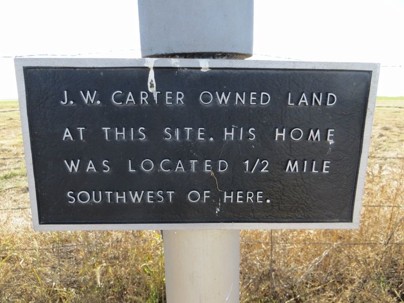
The first permanent settlers in Castro County, the James W. Carter family moved to this area in 1884. A tent and dugout served as home until a house was constructed (100 yds. W). Their cattle, which they brought with them, were marked with the 7-UP . . . — — Map (db m100517) HM
This site was set aside as the Dimmitt town square in 1891, the year Castro County was formally organized. Temporary court facilities were set up in J. N. Morrison's office while the first courthouse was built. An ornate two-story structure, it . . . — — Map (db m91116) HM
Tennessee native Jeff T. Gilbreath moved his family to this area in 1905. The owner of a local mercantile store, he built this house in 1909. He sold it in 1910 to county attorney Mark Cowsert, whose family lived here until 1912. The house changed . . . — — Map (db m91115) HM
Comanches used Running Water & Frio
Draws in this area as trailways for
hunting & trade with Comancheros
Arrow Sculptor: Charles A Smith
— — Map (db m167621) HM
At an 1891 meeting to discuss the selection of a Castro County seat, words were exchanged between Ira Aten, a retired Texas Ranger speaking on behalf of Castro City, and Andrew McClelland, a spokesman for Dimmitt. The inflammatory remarks led to a . . . — — Map (db m91118) HM
Encompassing land in ten counties of the Texas Panhandle. The XIT Ranch was established through the exchange of public lands to finance construction of the state capitol. In 1887, it was divided into seven divisions, the largest of which, the . . . — — Map (db m153247) HM
In 1876, English native John Summerfield (1885-1918) began his work locating and surveying millions of acres of land in present-day Randall, Deaf Smith, Castro and Swisher counties. One of the earth monuments he erected that year was . . . — — Map (db m91120) HM
In 1879, the Texas legislature appropriated land covering
multiple counties in northwest Texas as payment for
construction of a new state capitol building. The land became the XIT Ranch and included parts of western and southern
Castro County. . . . — — Map (db m228351) HM
This chapel is one of the few physical reminders of the days this site served as an Italian Prisoner of War Camp during World War II. The prisoners, several of them fine artisans and craftsmen, designed and built the chapel, crafting the concrete . . . — — Map (db m218971) HM
Near this site during World War II the Hereford Military Reservation and Reception Center, a prisoner of war camp, was established. During nearly three years of operation, approximately 7000 Italian soldiers were imprisoned. Through their work on . . . — — Map (db m218970) HM
The history of Holy Family Catholic Church parallels that of the town of Nazareth. The families of brothers V. A., J. A. and T. P. McCormick and other Irish families came to this area from New York in the early 1890s. The Rev. Joseph Reisdorff . . . — — Map (db m91124) HM
In 1902, Joseph Reisdorff, pastor and colonizer of Nazareth, devoted land donated by Wilhelmina Thier to be Holy Family Cemetery. First interment was the body of Anna Lackerman in August 1906. Reflecting Nazareth’s heritage, nine early tombstones . . . — — Map (db m91125) HM
For 90 years, starting in 1905, Nazareth residents purchased goods here. The original wood-framed structure, built by Fred Heidgerken with living quarters above, opened its main floor to home shopping needs and the storing and selling of fresh meat . . . — — Map (db m91122) HM
Formed from Young and Bexar
Territories
Created • Organized
August 21, 1876 • April 11, 1887
Named in honor of
George Campbell Childress
1804 – 1841
A member of the Convention
in 1836
Co-author of the Texas . . . — — Map (db m96825) HM
The Childress Post Office was established in 1887, and in 1935 this post office building was constructed on the site formerly occupied by the First Methodist Church. Reflecting the Spanish Colonial style of architecture, it features round-arched . . . — — Map (db m100180) HM
Born 1840. Came from Illinois to Texas, 1859. During Civil War rose from private, 1st Texas Artillery, to Colonel in 16th Cavalry. Was in bloody battles of Shiloh, Chickamauga, Nashville, Richmond. After war, when "didn't have 2 pairs of pants", . . . — — Map (db m96647) HM
In 1872, Frank Collinson, an English born adventurer, came to Texas to be a cowboy. After a few years of trailing the big cattle herds north, he turned his attention to the burgeoning Buffalo hide trade that was taking root at Texas towns such as . . . — — Map (db m100181) HM
In hostile Indian years of 1866-71, route of great cattle drives from Texas to U.S. forts in Colorado and New Mexico.
Col. Charles Goodnight, trailblazer, drove thousands of cattle to water here. Site later (1886) became Childress. Cattle . . . — — Map (db m47660) HM
Morgan Hospital
One of the earliest medical care facilities in Childress, this double-galleried building was constructed in 1916 to house the clinic of Dr. J.D. Michie and Dr. H.D. Barnes. Nine years later it was purchased by Dr. T.M. Morgan, who . . . — — Map (db m100178) HM
Recreation and hospitality center for early Childress; in Spanish Mission Revival style architecture. Built 1903, after citizens, led by R.H. Norris and Dr. J.H. Cristler, attracted Fort Worth & Denver Railway shops and division offices here. Among . . . — — Map (db m100177) HM
F.M. Phipps and G.S. Layton opened the Palace Theater in 1926. The theater suffered two fires, the second burning it to the ground in 1936. Phipps' widow, Mable, and Layton's son G.R. hired W. Scott Dunne of Dallas to design a new moviehouse at the . . . — — Map (db m100179) HM
Quanah Parker & Comanches camped here at Childress Springs when traveling N/S Trail, now U.S. 83 Arrow sculptor: Charles A. Smith — — Map (db m280386) HM
Texas Historic Cemetery
Needwood Church and School - 1890
✟ ✟ Needwood Cemetery - 1894 ✟ ✟
Needwood Cemetery Association - 1992
Founded by Bailey Stinson & Irma Morgan
O God, above all creations Thy . . . — — Map (db m152793) HM WM
Once the center of a thriving agricultural community, Nicholson School was named for county judge Arthur Clyde Nicholson, during whose term the school was opened in 1915. As Nicholson School increased in enrollment, reaching a peak of 150 students . . . — — Map (db m48387) HM
The community of Lutie, named for early settler Lutie Gresham Templeton. Traces its history to 1909. Two years previously, local citizens had formed the Pleasant Valley School about one mile northeast of the townsite. Community leaders moved the . . . — — Map (db m305129) HM
In 1852, Capt. R.B. Marcy led a survey expedition along the Red River to document the river's channel and related streams. The team, which included Capt. G.B. McLellan of the Corps of Engineers, entered the Texas panhandle June 10, 1852 and arrived . . . — — Map (db m100229) HM
Formed from Young and Bexar
Territories
Created • Organized
August 21, 1876 • November 4, 1890
Named in Honor of
James Collinsworth
1806-1838
The first Chief Justice of the
Republic of Texas. Signer of the
Declaration of . . . — — Map (db m100235) HM
Original hospital on this site (first in county) was built in 1917 by L.H. Stall. One of the two surgeons then practicing here, Dr. Elmer Wood Jones (1891-1962), bought the facility in 1924. In 1935 he built a 15-bed hospital of fieldstone on the . . . — — Map (db m100231) HM
Located in northwest Collingsworth County, the Dozier Cemetery was named after the Dozier Creek and a nearby cowboy camp at the head of the creek. This area has been inhabited for thousands of years as evidenced by archeological evidence of . . . — — Map (db m152670) HM
Organized in 1890 by the Rev. J.H. Linderman and a small group of charter members, this congregation was the only Methodist church in the county by 1984. The first worship services were held in a small wooden building which also served as the first . . . — — Map (db m100234) HM
Originating in the late 19th and early 20th centuries, most Collingsworth County communities were small settlements that grew up around area ranches. A number of Methodist congregations were formed throughout the county by circuit-riding ministers. . . . — — Map (db m100233) HM
Bricks visible in the facade of this structure were left over from construction of the first Collingsworth County Courthouse in 1893. Contractor, J.A. White built the courthouse of locally-made bricks and then, with the extra materials, erected this . . . — — Map (db m100232) HM
Among the earliest settlers of this area were J.E. & Mary Jane Blevins and their children. Arriving in 1902, they were soon involved in the organization of a community school, post office, and church. J.E. & Mary Jane Blevins donated land for each . . . — — Map (db m152665) HM
Comanches once hunted Buffalo on
Salt Fork of the Red and Buck Creek
in present day Collingsworth Co.
Arrow Sculptor: Charles A Smith
— — Map (db m152673) HM
Owned by Scottish Earls of Aberdeen and Tweedmouth. The headquarters were at Aberdeen (about 7 mi NE). Starting with 14,745 cattle, the Rocking Chair made profits for a few years, then failed. In north part of county are hills bearing . . . — — Map (db m100275) HM
In 1893, the men of the newly-settled Dozier Community built a one-room schoolhouse to serve the educational needs of the children of that town and the surrounding farming and ranching area. Seigniora Russell (Laune) served as the first . . . — — Map (db m152708) HM
On June 10, 1933, Mr. and Mrs. Sam Pritchard and family saw from their home on the bluff (west) the plunge of an auto into Red River. Rescuing the victims, unrecognized as Bonnie Parker and Clyde and Buck Barrow, they sent for help. . . . — — Map (db m16269) HM
Memorial to The 305th Airdrome Squadron
Organized at Dalhart Army Air Base April 1943 Dedicated To
Our First Commander Major Frank H. Blakey
Killed in New Guinea June 1944 And To Our Last Commander 1st Lt. Joel D. Burt World War . . . — — Map (db m128298) WM
Dallam and Hartley Counties’ generally flat terrain, thermal activity, dry, clear skies and a local bond to purchase more than 3,000 acres of land southwest of Dalhart resulted in the opening of a training site during World War II. In May 1942, . . . — — Map (db m93204) HM
In Memory of Dalhart High School Boys
who gave their lives in World War II
• Alva L. Clary • W. R. Corkhill • Guy Dugger • J. R. Fox, Jr. • Perry Thomas Frederick • Judson Giddings • Pruitt Garner • John W. Gill • Raymond A. Gussenhoven • . . . — — Map (db m128297) WM
Dallam County Created 1876. Organized 1891.
Named for James W. Dallam who was born in Baltimore Sept. 24, 1818. Educated at Brown University. Came to Texas 1839. Author of Dallam’s Digest of the Decisions of the Supreme Court of the Republic of . . . — — Map (db m128296) HM
Formed from Young and Bexar
territories
Created Organized
August 21, 1876 July 28, 1891
Named in honor of James W. Dallam
1818-1847
Compiler of digest of decisions
of Supreme Court of the
Republic of Texas, 1845 . . . — — Map (db m88747) HM
Created in 1876 and organized in 1891, Dallam County was named for Republic of Texas Attorney James W. Dallam (1818-1847). Texline, located on the line of the Fort Worth and Denver City Railroad and the only town in the county when it was organized, . . . — — Map (db m93206) HM
Those who gave their lives for our American way of life Beard, Lowell B. • Bonham, Billy • Bowling, Edgar H. • Bradford, Robert J. • Brosseau, Donald L. • Burgess, Oda D. • Catledge, Roy • Clary, Alva L. • Cole, Richard B. • Cook, Paul B. • . . . — — Map (db m214123) WM
Great Texas ranch of international fame. Payment made in an 1882 contract for the construction of granite capitol building in Austin. As contractors, some out-of-state investors (headed by the wealthy Chicago merchants, John V. and Senator C.B. . . . — — Map (db m93238) HM
This is a two-sided markerSide A:
He was an American pilot who valiantly sacrificed his life in China for the War of Resistance against Japanese Aggression. The Chinese people will forever remember his name, James R. Fox, Jr. . . . — — Map (db m93233) HM WM
Chronicler of a unique era in the history of the Southwest. Born in Belton, Mo. At 17, taught school in Indian Territory (Okla.) In 1907, she married Robert L. Duke, a ranch hand who had risen to division manager of the XIT Ranch (then world's . . . — — Map (db m93239) HM
1860 C. Quanah & Buckskin Charlie met near Dalhart to make a peace treaty between Comanches & Southern Utes. Arrow sculptor: Charles A. Smith — — Map (db m280387) HM
Organized by 1902. Church built in 1910. Previously, congregation had worshipped in other churches, a bank, and Felton Opera House.
Consecrated on January 8, 1911, in first episcopal act of the Rt. Rev. E. A. Temple, Bishop of the North Texas . . . — — Map (db m93205) HM
This plaque is in commemoration of the Sesquicentennial, celebrating Independence of Texas from Mexico 150 years ago, and the Golden Anniversary of the XIT Rodeo & Reunion, which had its origin in 1936 as a Reunion of men who worked on the XIT . . . — — Map (db m93232) HM
Had second post office in county, in 1889. Named by pioneers who saw here the “Dawning of a New Country.” Santa Fe Railroad Station House (a box car) was first building on site, 1905. Town was developed by W.E. Neal and sons in 1914, . . . — — Map (db m56019) HM
Formed from Young and Bexar
Territories
Created August 21, 1876
Organized October 3, 1890
Named in honor of
Erastus “Deaf” Smith
1787-1837
Came to Texas in 1821
Rendered valuable service as a scout and
spy during . . . — — Map (db m56022) HM
Brick with marble veneer and interior. Second marble courthouse built in U.S.
Cost was $125,000. After hotly-contested bond issue election, Judge John Slaton and winners paraded down Main Street behind the band.
Recorded Texas . . . — — Map (db m56023) HM
Since its establishment in 1914 Saint Anthony's Catholic School has played a prominent role in preparing young students for advanced classwork. Initial classes were held in a former Deaf Smith County Courthouse converted for church purposes by . . . — — Map (db m155241) HM
Here as in many Texas counties, ghost towns and ghost post offices outnumber living ones. La Plata (formerly Grenada) thrived as county seat and was a major stop of New Mexico-Amarillo Road, 1880s and 90s. Its 28 houses and businesses were removed . . . — — Map (db m155119) HM
Hereford College opened 1902 as co-educational public school in newly-built, 3-story main building. By 1903, college was transferred to Christian Church for needed financial support. Renamed Add-Ran College. The next year, name changed to . . . — — Map (db m150399) HM
In 1898, a relocated frame schoolhouse served students of Hereford. New buildings came as attendance increased, and in 1916 the school board converted the former Hereford Christian College building into a high school. Rural school consolidation . . . — — Map (db m153253) HM
First county seat of Deaf Smith County. Grenada was chosen as the county seat in the election separating Deaf Smith County from Oldham County on Oct. 3, 1890. The name was changed to La Plata (sometimes spelled La Platta). A year later all . . . — — Map (db m151409) HM
Established by the Mothers' Club, founded in 1909. Site, a 1910 gift of Mr. and Mrs. E. O. Thomas, was improved with walks and shade trees. In 1934 the sponsor group changed its name to "The Pioneer Study Club." With the help of the city of . . . — — Map (db m150391) HM
A wind-driven machine for pumping water. Its use made gardening easier and led to irrigated farming on arid High Plains. With barbed wire, it enabled settlers and stockmen to penetrate region in 1870s.
Town had name “Windmill City” . . . — — Map (db m56021) HM
A prisoner of war camp, used primarily for Italian soldiers, was in operation near this site during World War II. Known as the Hereford Military Reservation and Reception Center, it was first used in 1943 for prisoners captured in an invasion of . . . — — Map (db m56025) HM
Comanches & Kiowas hunted Summer and Fall in this area due to its good water, tall grass & wild game
Arrow sculptor: Charles A. Smith — — Map (db m155114) HM
Comanches Kiowas & other Indians left tepee rings & arrowheads near Tierra Blanca & Palo Duro Creeks Arrow sculptor: Charles A. Smith Foundation Provided by Dan & Sharon Eytcheson – Owners Hereford Heritage Funeral Home Project by . . . — — Map (db m155115) HM
In 1901 Alabama-born E. B. Black (1866-1945) brought his family to Hereford from Cleburne, Texas. He opened a furniture store and became a prosperous merchant and rancher. In 1909 Black hired contractor Emmett Vanderburgh to build this late . . . — — Map (db m153250) HM
Land developer S.S. Evants built this home in 1906. The following year Alex Thompson (1883-1956) bought the house and then sold it to his mother Jennie Thompson in 1908. Thompson, his wife Audrey (Argo), and their two daughters lived here with his . . . — — Map (db m153254) HM
Hereford's "miracle water" was brought to national fame in 1941 when Dr. Edward Taylor, State Dental Officer, told the American Dental Association that tooth decay was almost unknown here. This ideal situation had been discovered by a local . . . — — Map (db m150394) HM
Hereford's mid-1913 equipment to fight fires. Hand-propelled, or (at a $5 bonus) hauled by the auto or horses of a bystander. Reel cost only $133, but in two months was discarded: a motor truck with ladders was bought. Prior to 1913 the fire wagon . . . — — Map (db m290765) HM
Palo Duro Baptist Church has its origins in Union School, which was built by settlers around 1893. Area residents held a non-denominational Sunday school in the facility. In 1901, Baptists living in the Palo Duro community, named for the creek that . . . — — Map (db m91731) HM
Early settlers to this area included the J.C. Womble family, which came in January 1892. The next year, the community obtained land on which to build a schoolhouse, known as the Union School. In May 1893, George D. Whitfield, a young cowboy, was . . . — — Map (db m91719) HM
The town of Clarendon began with an effort led by the Rev. Lewis H. Carhart as he strived to create a colony based on Christianity, temperance and education. To promote the settlement, he created The Clarendon News, publishing the first . . . — — Map (db m100419) HM
Pioneer area settler Henry S. Boydstun (1858-1942), a native of Illinois, moved his family to this area in 1890. That year, his infant son, Eddie, died and was buried in the southwest corner of the family farm. In 1898, Boydstun deeded two acres . . . — — Map (db m290790) HM
Oldest church continuously in use (in earliest Episcopal parish) in the Texas Panhandle. The first services were held by the Rev. Mr. Townsend of Dallas Diocese in the J. B. McClelland Ranch house, Nov. 1877. On site given 1891 by Isaac W. Carhart, . . . — — Map (db m100427) HM
In this first cemetery of Donley County, sixteen rods west lie the first dead of Old Clarendon. Here white civilization sank its roots in sadness and from the graves in this sacred acre strong pioneer spirits turned to face the future with greater . . . — — Map (db m151697) HM
On April 2, 1898, the first college in the Texas Panhandle,
Clarendon College and University Training School
(Clarendon College), was organized by the Methodist Church
Conference. The college's doors opened in the town of
Clarendon on . . . — — Map (db m151615) HM
Formed from Young and Bexar
territories
Created • Organized
August 21, 1876 • March 22, 1882
Named in honor of
Stockton P. Donley
1821 – 1871
a Confederate officer
elected to the Texas Supreme
Bench in 1866 . . . — — Map (db m96829) HM
Designed by the architectural firm of Bulger and Rapp, and built by Troutman Brothers Contractors, both of Trinidad, Colorado, this distinctive public building opened in November 1891. The original Romanesque Revival design included prominent . . . — — Map (db m96676) HM
When the Rev. Lewis H. Carhart, a Methodist minister, founded Clarendon, he envisioned it as a religious and educational center. The town was established in 1878 near the junction of Carroll Creek and the Salt Fork of the Red River, six miles north . . . — — Map (db m100426) HM
For more than a century, this site has been the location of a funeral home, a vital community business serving a widespread area of the Panhandle. Kentucky native Pleasant Andrew Buntin (1849-1941) brought his family to Texas in 1879, settling . . . — — Map (db m96828) HM
Outstanding peace officer. Sheriff of Donley County, Nov. 1905 to Jan. 1, 1916 - era when large ranches were being subdivided into farms. Born in Sulphur Springs. Was a Methodist. Married Allie Graves. Had a son and daughter. Died in Clarendon. . . . — — Map (db m170332) HM
Settlement of this area of Donley County began in the late 19th century, before the town of Jericho was founded as a station on the Chicago, Rock Island and Gulf rail line about 1902. Early community burials took place in the pasture near this . . . — — Map (db m100417) HM
Quanah Parker & Charles Goodnight shared mutual respect, reflected in letters at Saints' Roost Museum.
Arrow Sculptor: Charles A Smith — — Map (db m152657) HM
There are two markers on a single post
Local merchants J. G. and F. D. Martin built this house in 1904. Rancher James M. Calhoun owned the property from 1910 to 1914 and cattleman Robert H. Muir from 1914 to 1926. Muir sold the residence . . . — — Map (db m100428) HM
The community of Clarendon was established in 1878 as a Protestant community by Methodist Minister Lewis Henry Carhart. The construction of the Fort Worth-Denver railway in the Panhandle in 1887, and the selection of Clarendon as a division point on . . . — — Map (db m100430) HM
Following the relocation of Clarendon along the railroad in 1887, the African American population began to grow. By the 1890s, African Americans were searching for their own place of worship in the growing community. For a time, they gathered in . . . — — Map (db m151616) HM
County named for Texas Confederate Stockton P. Donley 1821 - 1871 Came to Texas from Kentucky 1846. Dist. Attorney 1853. Enlisted private 7th Tex. Infantry 1861, made Lieutenant. Captured with regiment after bitter fight at Seige Fort Donelson Tenn. . . . — — Map (db m96827) HM
A road older than recorded history; carved out in centuries of wintertime travel to the south, spring migration to the north, by millions of bison and by Indians who lived by hunting these large animals. Important in era of Texas Panhandle . . . — — Map (db m169815) HM
Historically significant for its associations with rancher Alfred Rowe and the now-extinct community of Rowe, this burial ground is a reflection of early area farming and ranching efforts and the harshness of pioneer life as permanent settlement . . . — — Map (db m151619) HM
Route 66, known as "The Main Street of America", "The Mother Road" and "The Will
Rogers Highway" served as the lifeline for the World War II effort and thousands
of families that fled to escape "The Dust Bowl Era". Passage along Route 66 . . . — — Map (db m163912) HM
"Between Shamrock and Amarillo, Route 66 crossed cattle country where four wire
gates blocked auto traffic in the 1920's.
Travelers had to stop, open each gate, pass
through, and close the gate behind them."
(From "Along Route 66", by Quinta . . . — — Map (db m163940) HM
US 66 snakes its way through 2448 miles of the American Midwest and southwest along its journey it crosses many territories of varying scenic terrains. Including in these territories are the lands of many Native American nations. . . . — — Map (db m163938) HM
Completed by 1938, runs a distance of 2448 miles across three time zones, and
through eight states: Illinois, Missouri, Kansas, Oklahoma, Texas, New Mexico,
Arizona and California. The original intent was that the alignment would connect
the . . . — — Map (db m163911) HM
For westbound travelers crossing into Texas, Route
66 provided the first glimpses of changes in the
landscape and architecture. Buildings of the
Southwest featured Adobe, Art Deco, and Mission
styles amid landscapes of prairie and . . . — — Map (db m163923) HM
The new Route 66 grew quickly in use and legend and
was named "Main Street USA" and "The Mother Road" by
travelers who required services never before known.
Blacksmith shops became garages, sidewalk gas pumps
grew to service stations. Hotel . . . — — Map (db m163939) HM
Route 66 was conceived in the mid 1920's by Oklahoma Highway Commissioner Cyrus
Stevens Acery and the U.S. Bureau of Public Roads. The vision was of an all-weather
paved highway stretching from densely populated Chicago and the Midwest to
the . . . — — Map (db m163910) HM
The first legendary event to take place along Route 66 was in 1923 when sports
promoter C.C Pyle and the US Highway 66 Association promoted a transcontinental
footrace that later became known as the Bunion Derby. The race started in . . . — — Map (db m163930) HM
Route 66 was finished just as the first wave of new
cars came off the post war assembly lines. For many
Americans, it symbolized an unparalleled freedom
and mobility for every individual who could own and
operate an automobile. Route 66 . . . — — Map (db m163925) HM
Poor agricultural practices and sustained drought
throughout the Southern Plains during the 1930's
left the land barren of growing crops. Strong winds
whipped across the empty fields creating huge black
clouds of dust traveling across . . . — — Map (db m163918) HM
Route 66 was pieced together from rural dirt roads,
farm-to-market roads, and by connecting U.S. highways
25, 31, 52, 60, 62 and 150. The name was assigned on
November 11, 1926 when state politicians discovered,
after a heated debate, that the . . . — — Map (db m163921) HM
Route 66 was the first paved road to link the Midwest to the Pacific Coast. Prior
to its construction in 1926, there had been no roadway on which anyone in a motor
vehicle could easily travel cross-country. Route 66 represents the . . . — — Map (db m163917) HM
675 entries matched your criteria. Entries 101 through 200 are listed above. ⊲ Previous 100 — Next 100 ⊳