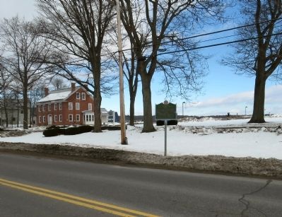
Near this site stood the first Public School in Vermont for special training of teachers. It burned in 1893; rebuilt at a cost of $12,000 in 1894. Many of the 1623 graduates had long and distinguished careers in the educational professions. Four . . . — — Map (db m79924) HM
Centuries ago this area was part of the town square
The Main Street Road wound its way north of the church and
grade school, met up with the South Randolph Road & Granger Street.
Granger Street was between this building and the cemetery.
The . . . — — Map (db m313088) HM
In the 1790s a body of ore was discovered here, leading to the production of copperas from 1809 - 1880s and the intermittent production of copper from 1832 - 1958. The mine site covered 850 acres, and over three million tons of ore were extracted . . . — — Map (db m64920) HM
Justin Smith Morrill 1810-1898
Born in Strafford Village, Justin S. Morrill was the son of a blacksmith. He entered politics in 1854 serving in the United States Congress for a total of nearly 44 years. As a member of the House of . . . — — Map (db m104075) HM
Strafford was granted its charter on August 12, 1761. Land near here was chosen for the town's first settlement by its earliest pioneers, Ezekiel Parish and Frederick Smith. Both men with their families established homesteads in this vicinity by . . . — — Map (db m107647) HM
Born April 14, 1810, Senator Morrill served 43 years in the Congress. He won unique fame as author of the Morrill Acts, signed by Abraham Lincoln, 1862. These established our land-grant colleges and universities, securing and broadening higher . . . — — Map (db m65008) HM
The Town of Strafford received its charter on August 12, 1761. By the 1790s the area surrounding the Common, known as Strafford Village, became the town center with a mill dam and mill, several homes, an inn, and a store. The Strafford Village . . . — — Map (db m100958) HM
In this area, what may have been the first use of hot blast to smelt copper adjacent to a mine in the United States took place. During the winter of 1833-1834, Isaac Tyson, Jr., invented a hot-blast system for smelting copper. Assisted by smelting . . . — — Map (db m94486) HM
On this site stood the original Thetford Academy. Co-educational from the start, it was founded in 1819 by Thetford citizens led by Rev. Asa Burton and Judge Simeon Short. The academic building with belfry and separate doors for boys and girls . . . — — Map (db m136062) HM
This fair, founded in 1867 and held by the Union Agricultural Society on this site since 1875, was named "The World's Fair' by Lt. Governor Burnham Martin. The annual celebration reflects accomplishments of farmers and families by reinforcing their . . . — — Map (db m85974) HM
On the Tunbridge hilltop, across the meadow, three hundred Indians, led by the British in the wanning years of the Revolutionary War, laid in wait the night of Oct. 15, 1780. As dawn approached on the 16th, they began their pillaging, reducing . . . — — Map (db m73916) HM
( north face )
S. C. Smith Post No. 57 G.A.R.
Julius Lazelle · J. A. Dickey · C. O. Slack · F. V. Jefferds · L. D. Parkhurst · E. W. Whitcomb · A. R. Nelson · C. S. George · A. F. Bohonon · D. P. Smith · C. H. Smith · T. F. S. Thurber · . . . — — Map (db m157923) WM
Washington Vermont
To All Those Who Served In The Armed Forces
World War I
Baker Robert · Beede Clarence · Bigelow Harold · Bradbury William · Burnham Guy ★ · Calef Allan · Chaples Edward · Clough Arthur · Compo Alexander · Corrigan . . . — — Map (db m157938) WM
At this point began the so called Hazen Road, running northerly 54 miles to Hazen's Notch in Westfield. Recommended to General Washington by General Jacob Bayley, built by General Bayley, as far as Cabot in 1776. Completed by General Moses Hazen . . . — — Map (db m280408) HM
They gave their lives in order to
protect our freedoms
Albert Bailey
Donald Bidwell
Frank Farnsworth
Robert Flanders
Leon LaMarre
Wells River, Vermont — — Map (db m280415) WM
Thomas Davenport was born on the West Hill in 1802 and worked in a blacksmith shop by the village stream. Later, in Brandon, invented the first commutator, and, in 1837, patented the first electric motor. — — Map (db m86037) HM
Born on the West Hill July 9, 1802. Died at the age of 49, July 6 1851, in Salisbury, VT. Buried in Brandon. Near this tablet stood the blacksmith shop where he learned his trade. He invented and made the first ELECTRIC MOTOR in Brandon, Vermont . . . — — Map (db m86038) HM
Williamstown was established in 1780 by Elijah Paine and was formally chartered one year later on August 9, 1781. The first settlers lived on West Hill, along present-day Stone Road. By the mid-1800s, development had shifted from the two hills into . . . — — Map (db m103775) HM
Mechanicsville was a village center in the Town of Mount Holly, which was chartered in 1792. The village prospered with the growth of water-powered manufacturing, that included sawmills, gristmills, wheelwrights, furniture shops, and the A.P. Chase . . . — — Map (db m78153) HM
Killed in Battle
Capt. Geo. B. Davenport, May 5, 1864
Capt. Chas. J. Ormsbee, May 5, 1864
Lieut. Hiram Bailey, June 3, 1864
Sergt. Ezra P. West, June 29, 1862
Corp. Chas. A. Ford, April 2, 1865
Hadley P. Ford, May 16, 1864
John . . . — — Map (db m136383) WM
Established in 1915, the program served Vermonters with mental retardation and developmental disabilities continuously until 1993. Founded as the Brandon State School for Feebleminded Children, the name was changed to Brandon State School in 1929 . . . — — Map (db m76003) HM
Ironworking began at Forest Dale in 1810 using local ore. By 1823 a blast furnace was producing pig iron and a variety of ornamental iron. The Green Mountain Iron Company acquired the facility in 1854 to produce parlor stoves. The furnace was . . . — — Map (db m78178) HM
The ‘little giant’ of national politics, born in Brandon in 1813, later moved to Middlebury to learn cabinet making. Returning to Brandon, he attended the Academy. Moving to Illinois in 1833, his career merged with the stream of American politics, . . . — — Map (db m76006) HM
(side 1)
Teacher Lawyer Orator Statesman
United States Senator from Illinois 1847 to 1861
Democratic candidate for President of United States
against Abraham Lincoln. Loyal supporter of Lincoln and
the Union in the early days . . . — — Map (db m136876) HM
In Memory of
Thomas Davenport
1802-1851
The inventor of the electric motor
Near this spot stood the building where he developed his invention
This tablet is placed here by Allied Electrical Associations in America, in recognition of the . . . — — Map (db m246139) HM
On this site Castleton State College, Vermont’s first college and the eighteenth oldest in the nation, was first established as the Rutland County Grammar School, chartered by the General Assembly of the Republic of Vermont on October 15, 1787. The . . . — — Map (db m78184) HM
Conflict – Site of Fort Warren 1777 – 1779 Erected under the auspices of Ann Story Chapter Daughters of the American Revolution 1904 — — Map (db m105476) HM
Directly east is the elevation of Fort Warren, built in 1779 for defense of the northern frontier. The road from the north was route of American retreat before Burgoyne, protected by Col. Seth Warner’s rearguard action at the Battle of Hubbardton, . . . — — Map (db m78183) HM
American portrait and landscape painter, James Hope excelled at capturing the beauty of mid-19th century Vermont. He is best known for his five large paintings of the Civil War Battle of Antietam in Maryland done from sketches made while serving as . . . — — Map (db m95452) HM
Marking The Meeting Place of Ethan Allen and Benedict Arnold on their Historic March to Fort Ticonderoga May 9, 1775 Dedicated 1941 Vermont Sesquicentennial — — Map (db m105475) HM
Castleton Medical College was the first such college in Vermont. This structure, built in 1821, was originally located on Main Street west of the present town library. In 1864 a leading citizen presented the building to Harriet Haskell, Principal . . . — — Map (db m78198) HM
Drilling the first modern oil well in the United States on August 27, 1859 at Titusville, Penna., Drake struck oil at 69 feet and launched one of the world’s great industries. On a farm on Drake Road, near this spot, he lived as a boy and attended . . . — — Map (db m78199) HM
In 1843, John Cain erected a slate pencil mill along Sucker Brook. Benjamin and James Adams bought the mill in 1853, and began mass-producing slate pencils as the Adams Manufacturing Co. Soon, after acquiring more land and business partners, the . . . — — Map (db m97291) HM
The Center Rutland Depot is a classic example of an early 1900's rail station. Built at the junction of the Delaware and Hudson and Rutland Railroads, the depot served the area's passenger and freight customers until the late 1950's. — — Map (db m77980) HM
James Mead, Rutland's first settler, arrived at these falls on the Otter Creek in 1769. The next year he and his family were given shelter by members of the Caughnawaga tribe while they finished their log cabin. Mead built saw and grist mills on the . . . — — Map (db m77440) HM
The last of a dozen mills that dotted Mill River during the 18th & 19th century. Kingsley Grist Mill stands just upstream of the 1870 Town lattice truss covered bridge.
Kingsley's Mill, the only mill ever designed and built by nationally known . . . — — Map (db m74431) HM
John Porter Bowman and Laurel Hall
John Bowman was born in 1816 in his grandparents’ tavern at Pierce’s Corner, VT. At 15 he began working in tanneries in Rutland and New York. In the 1840s he opened Tannery Crossing in Cuttingsville and, . . . — — Map (db m199457) HM
Mother, wife, writer, humanitarian, and civil rights activist, Pearl Buck was the first American woman to receive the Pulitzer and Nobel prizes for literature. A visionary, she worked to cross political and cultural barriers to further . . . — — Map (db m95455) HM
At the original settlement in East Poultney, Horace Greeley, founder of the "New York Tribune", worked on the "Northern Spectator", 1826-1830. George Jones, co-founder of the "N.Y. Times", also came from here. — — Map (db m78256) HM
Jeffrey Brace was born in West Africa with the name Boyrereau Brinch. At sixteen he was captured by European slave traders, shipped to Barbados, sold to a ship's captain, and eventually arrived in New England. Some years later, while still enslaved, . . . — — Map (db m60663) HM
To our country's defenders of Poultney,VT. Erected in grateful memory of their heroic service by Mrs. Josephine L. Lewis in memory of her husband Col. Judson A. Lewis. — — Map (db m60775) HM
This area of Vermont is known for its high quality slate; the first quarry was opened on Scotch Hill in 1839 by Alonson Allen & Caleb Ranney. Allen began the first manufacture of roofing slate in Vermont in 1848. By 1869 there were seventeen . . . — — Map (db m78200) HM
Matthew Lyon, Irish-born leading grantee, built grist, saw and paper mills here, 1783, and a forge above. He ran first store, inn, and newspaper. As Congressman from Vermont he was jailed under the Sedition Law and later elected from Kentucky and . . . — — Map (db m78211) HM
Ralph Kehoe
1928 -1989
Athlete, War Hero,
Coach and Teacher
First Four Letter UVM Athlete
1973 UVM Hall of Fame
Korean War Silver and Bronze [S]tars, Purple Heart
1954 – 58 FHHS coach and teacher
1956 – 57 state and . . . — — Map (db m109317) HM WM
Dedicated to those
who have served
their country
in time of need
“. . . and they shall beat their swords
into plowshares, and their spears into
pruninghooks: nation shall not lift
up sword against nation, neither shall
they . . . — — Map (db m109316) WM
Honor Roll
Ebenezer Bull • William P. Cain • Michele Fumarola
George N. Greene • William H. Griffith • Charles E. Ingalls
Harold S. Metcalf • Carl W. Mooney • Gordon W. Preston
Harley R. Streeter • Emil Trombley • Joseph Vinci • George . . . — — Map (db m109315) WM
Ruth Stone (1915-2011) purchased this property in 1956, and for the next 55 years it provided inspiration for her writing and a haven for the many students and colleagues she welcomed. She published her first book of poetry in 1959, the same year . . . — — Map (db m135842) HM
Here on July 7, 1777 a successful rearguard action by Colonel Seth Warner’s Vermont, Massachusetts, and New Hampshire troops ended British pursuit under Generals Frazer and Reldesel. Thus, General St. Claire’s American army, retreating from Fort . . . — — Map (db m74470) HM
On July 5 and 6, 1777, American forces withdrew from Mount Independence and
Fort Ticonderoga as the British pursued. They traveled over the military road built in the fall of 1776 to connect Mount Independence with sites on the
Connecticut . . . — — Map (db m201705) HM
Directly in front of you stands the majestic Mount Zion. From its summit the whole battlefield can be seen and it may have served as a lookout for Tory and Indian scouts who were surveying the area for the British shortly before the battle. The . . . — — Map (db m11408) HM
After the British attacked Monument Hill, the Americans withdrew to
a position behind a log fence on the east side of the Castleton Road.
As the battle continued, American Colonel
Seth Warner, his men, and others near the
Castleton Road . . . — — Map (db m201955) HM
Directly ahead, through the gap in the hills, ran the Military Road which connected the American garrison at Mount Independence on Lake Champlain with sites on the Connecticut River. American forces used this road as their escape route during . . . — — Map (db m202032) HM
Most of the battle waged back and forth in this field until the Americans were finally forced across the Castleton Road to the east. They took up a position there behind a log and stone fence. After some heavy fighting, Colonel Hale’s 2nd New . . . — — Map (db m202036) HM
The Americans took up
a position behind the
high log and stone fence
across the Castleton
Road to the east, being
forced there by the
British. After heavy
fighting, remnants of
the 2nd New Hampshire
Regiment moved back
across the road, . . . — — Map (db m201993) HM
The only battle fought in Vermont during the Revolution Right side of Monument: This monument erected by citizens of Hubbardton and vicinity July 7, 1859 Back of Monument: Hubbardton Battle fought on this ground July 7, 1777 Bottom of . . . — — Map (db m9230) WM
American Colonel
Ebenezer Francis, his
11th Massachusetts
Regiment, and selected
units from other
regiments encamped
along this hilltop the
night of July 6. Colonel
Seth Warner and his
Green Mountain Boys
made camp to the left,
down the . . . — — Map (db m201746) HM
Colonel Ebenezer Francis and his 11th Continental Regiment from Massachusetts encamped along this hilltop on the night of July 6th. To the left, down the hill toward the Selleck cabin, were Seth Warner and his Green Mountain Boys; to the right was . . . — — Map (db m202031) HM
Vermont is a state of bumpy back roads that lead to wonderful discoveries. Sometimes, a perfect swimming hole, other times a field of rare wildflowers. Hubbardton is such a discovery, a small rural town with a lot of heart and many beautiful . . . — — Map (db m201668) HM
John and Sarah Selleck built their cabin near the Castleton Road when they moved to Hubbardton from Connecticut in 1775. Like many other families, they had come here to farm and raise their families away from the crowding and turmoil in the coastal . . . — — Map (db m202034) HM
In 1775 John and Sarah
Selleck, who moved
to Hubbardton from
Connecticut, built their
cabin here near the
Castleton Road. They
wanted a farm to raise
their family away from
the crowded coastal
area. In the fall of 1776,
the newly built . . . — — Map (db m201992) HM
The only battle fought on Vermont soil during the American Revolution took place on these fields. Viewed as a rear guard action, this battle was important because it slowed the progress of the British and German pursuers long enough for the main . . . — — Map (db m202033) HM
Starting here, follow the path to your right to the top of Monument Hill. A series of signs identify battle landmarks and explain the battle action that unfolded here. Enjoy exploring!
On July 5 and 6, 1777, the Northern American Army . . . — — Map (db m201688) HM
A meetinghouse or town hall has existed on this site since about 1800. The land was donated to the town of Ira in 1797 by Thomas and Benoni Collins for the purpose of constructing a meetinghouse and school. Thomas Collins purchased the land after it . . . — — Map (db m150440) HM
1861 • Civil War • 1865
Lawson E Barber · John L Batchelder · Charles P Bateman · John T Bour
Oliver E Brewster · George Brown · William Coole · Cornelius P Curtis
Henry T Davis · Albert Fish · Henry Flagg · James H Fowler · James S Fox . . . — — Map (db m229680) WM
Long Trail Lodge was built on the south side of Sherburne Pass in 1923 as a gift to the Green Mountain Club by Mortimer Proctor, former club president and later governor of Vermont. The rustic-style clubhouse, built of timber and stone from the . . . — — Map (db m304080) HM
Southward appears the summit of Mt. Killington, once called Pisgah, on which Rev. Samuel Peters claimed he christened the wilderness with the name "Verd-mont" in 1763. Most historians give credit to Dr. Thomas Young’s letter "to the inhabitants of . . . — — Map (db m78175) HM
Born in Rutland, Ripley enlisted in the 9th Vermont in 1862 and fought at Harper’s Ferry, Chaffin’s Farm and Second Fair Oaks. As brigade commander of the Army of the James, the general led the first Union troops into the Confederate capitol of . . . — — Map (db m103338) HM
Near this location lived "Captain John" Vincent, a member of the Caughnawaga tribe. An admirer of General George Washington, Captain John became a firm friend of the Colonies. He accompanied Benedict Arnold and Richard Montgomery to guide American . . . — — Map (db m78176) HM
Near this site Albert W. Gray manufactured his horse power treadmills, which he invented and patented in 1844 and 1856. He also invented a corn sheller, patented in 1836, and a machine for making wrought iron nails.
For over 50 years the shop, . . . — — Map (db m60664) HM
During construction of what became the Rutland Railroad, two important events occurred in Mount Holly. In 1848, a construction crew discovered the tusk and tooth of a woolly mammoth in the nearby wetland. These are on display in the Community . . . — — Map (db m104493) HM
dedicated by the citizens of Pawlet
to those of their number who offered their lives
in the Great War of Nations 1914- 1918
(four names)
they gave the last full measure of devotion
(sixty three names)
(one nurse)
(two Student Army Training . . . — — Map (db m134476) WM
Pawlet Town Hall was built cooperatively by the town and local merchant Marcellus Wheeler, to be the seat of town government and to provide commercial space. Prominent features of this Victorian-era building are the Italianate-style cupola, . . . — — Map (db m136965) HM
1781 – Pittsfield, Vermont -1981
Dedicated To All Who Served Our Country
World War I
Annis, Mabelle L. •
Forsha, Edmund R. •
Gomo, Elmer C. •
Gomo, Frank •
Grandy, William C. •
Holland, Thomas H. •
Kantor, . . . — — Map (db m157061) WM
Erected in 1780
Stood on this ground
Caleb Houghton
Born Bolton Ms. 1760
Member of Capt. Saffords Co.
Maj. Allen's Detach.
Stationed at this fort
was killed by an Indian
half a mile south
July 15, 1780.
His remains were moved . . . — — Map (db m136551) HM
One of four covered bridges in the town of Pittsford, this 139’ Town lattice truss bridge was built in 1842 by Asa Nourse. During the 1927 flood the bridge floated off its abutments and ended up in a field over a mile down stream. During the winter . . . — — Map (db m61393) HM
A sawmill was built in 1798 by Pittsford's Woodruff family about 275 feet to the north on Sugar Hollow Brook, a Furnace Brook tributary. The mill was replaced and a dam built c.1870 by the Norse family. An ice house was added, with ice cut from the . . . — — Map (db m97284) HM
Side 1 In 1791, Israel Keith built an iron blast furnace two miles east of here, adjacent to what is now Furnace Brook. Materials for the smelting process included iron ore, manganese, and charcoal from Chittenden, with limestone flux from . . . — — Map (db m103340) HM
The Colonial revival building, designed by Scopes & Feustmann of Saranac Lake, NY, was constructed and endowed by Redfield Proctor and his family as a private pay institution for the treatment of Tuberculosis. Completed in 1907, the center building . . . — — Map (db m76008) HM
Village of Pittsford Mills
This area of Pittsford was originally known as
Pittsford Mills. Development began in the late 18th
century with two waterfalls on Furnace Brook
supplying power for gristmills, sawmills, and an oil
mill. The . . . — — Map (db m277945) HM
About 400 million years ago in this region, layers of sediment, accumulated in ocean waters, were
subjected to intense pressure and heat during tectonic and mountain building action causing a
metamorphism of minerals collectively known as . . . — — Map (db m229704) HM
Slate was first discovered in 1839 and later worked by Col. Alonson Allen at the Scotch Hill Quarry near Fair Haven in 1848. The Hooker brothers opened the Poultney Eureka Quarry in 1851. At the peak in the 1890's there were more than 80 quarries . . . — — Map (db m229714) HM
One of the first Methodist churches erected in Vermont, the Old Stone Church was built ca. 1822 with limestone from Whitehall, NY, and marble quarried in Tinmouth, VT. The church, set high atop Stone Church Hill, created a town center and prompted . . . — — Map (db m233726) HM
Otter Creek was a passageway for Native Americans traveling across what is now Vermont from the Connecticut River to Lake Champlain. They called the falls here “The Great Falls” which at 123’ are the highest in Vermont. John Sutherland, . . . — — Map (db m77971) HM
Dedicated to those who served our country in time of conflict
We cherish their sacrifice loyalty and honor
A list of 20 names follows from World War I, World War II, Korea, Vietnam, Operation Iraqi Freedom — — Map (db m106413) WM
594 entries matched your criteria. Entries 101 through 200 are listed above. ⊲ Previous 100 — Next 100 ⊳