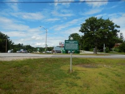
Extending 36 miles from Piscataqua Bridge in Durham to the Merrimack River in East Concord, this highway was originally a toll road. The first of more than 80 New Hampshire turnpikes built by private corporations in the nineteenth century, this was . . . — — Map (db m77814) HM
Upon invitation of President Monroe, issued at the request of the Congress, Marquis de LaFayette, Revolutionary War hero, revisited the United States for a goodwill tour which included an extensive visit to New Hampshire towns. He passed this spot . . . — — Map (db m291482) HM
This property has been
placed on the
National Register
of Historic Places
by the United States
Department of the Interior
Circa 1840 — — Map (db m260846) HM
In grateful tribute to those of Northwood who honorably served in the Armed Forces of their country.
Below is listed several campaigns:
Korea • Viet Nam • Lebanon-Grenada • Panama • Persian Gulf — — Map (db m96963) WM
Northwood Honor Roll
Dec. 7, 1941 - Sept. 2, 1945
There are 3 columns of names listed alphabetically, with 6 of the names having a star listed, indicating they died in the service of their country. — — Map (db m96962) WM
Site of Meeting House 1781-1847 Center School House 1793-1996 Town House 1847 Shoe Shop ca. 1880 Moved Here - 1968 First N.H. Turnpike 1802 — — Map (db m76453) HM
1917 Honor Roll 1919
In grateful appreciation of the men of Northwood who served in the World War.
35 names are inscribed 1 with a star indicating that the soldier gave his life in the service. — — Map (db m96961) WM
The Town of Nottingham was created by a Royal Charter in 1722. A plan of the town was completed in 1724; at that time the design of the Nottingham Square was laid out with house lots and the intersecting streets Bow, Fish, King and North. The . . . — — Map (db m235102) HM
On this site were leased lots provided by the North Church Parish dating from 1709. One such parcel was the home of Hunking Wentworth, Chairman of the Committee of Public Safety and zealous patriot on behalf of the American Revolution. The site . . . — — Map (db m76460) HM
(left panel)
I stand for the Ancestors Here and Beyond
I stand for those who feel anger
I stand for those who were treated unjustly
I stand for those who were taken from their loved ones
I stand for those who suffered . . . — — Map (db m115995) HM
People of African origin or descent have been part of Portsmouth since at least 1645. This waterfront was an entry port for enslaved people arriving in New Hampshire during the 1600s and 1700s. Ships brought black children and adults . . . — — Map (db m298168) HM
Poet, writer, artist was born here June 29, 1835
Author of Among the Isles of Shoals and An Island Garden
She died on Appledore August 26, 1894 — — Map (db m96976) HM
Colonel Tobias Lear
was born in this house in 1760.
He was George Washington’s Secretary
from 1783 to 1799.
Washington visited here in 1789.
This tablet is placed by the Society
of the Sons of the Revolution
of the State of New . . . — — Map (db m115969) HM
“This monument is dedicated to the 129 gallant men, military and civilian who went down with their ship off New England’s continental shelf on 10 April 1963”
( The names of the 129 men aboard follow. ) — — Map (db m149119) HM
Frank Jones (1832-1902) was a Barrington-born farmboy who came to Portsmouth as a teenager and literally rose from rags to riches in a remarkable short time. A man of boundless energy and daring, he parlayed the fortune he amassed as a brewer . . . — — Map (db m76456) HM
The land for this park was given to the city by Miss Eliza A. Haven through a bequest following her death in 1897. The last direct descendant of Dr. Samuel Haven, who stipulated in his will that the ancestral family mansion be “taken . . . — — Map (db m97042) HM
Moffatt - Ladd House & Garden This tree was planted in 1776 when William Whipple (1730 – 1785) returned home from Philadelphia after signing The Declaration of Independence. — — Map (db m105538) HM
In the midst of the American Revolution in 1777, James, enslaved by tavern owner John Stavers, was ordered to stop a zealous patriot from chopping down the tavern sign. Although James nearly killed the man, it was his owner, a suspected Tory, who . . . — — Map (db m115986) HM
Jim Sergeant enlisted in the US Navy on June 25, 1964. Following Boot Camp and internal Communications training, Jim served tours aboard the Naval Nuclear Power School, Vallejo, CA; Nuclear Power Training Unit, Schenectady, NY; and USS Tattnall . . . — — Map (db m186281) HM
Has been designated a Registered National Historic Landmark Under the provisions of the Historic Sites Act of August 21, 1935 This site possesses exceptional value in commemorating or illustrating the history of the United States U.S. Department of . . . — — Map (db m116010) HM
Born in 1798 into a family of Portsmouth Mariners, John Samuel Blunt was apprenticed in the Boston workshop of artist John Ritto Penniman where, from age 14 to 21, he mastered the art of ornamentation. Here, he met other ambitious young artists who . . . — — Map (db m97040) HM
In 1717 Portsmouth's first identified black family was baptised by South Church.
Baptisms of enslaved people became more frequent in local churches; black marriages, however, were not included in town records until the Revolutionary Era, when . . . — — Map (db m115979) HM
Legend Records "Liberty, Property & no Stamps" on a flag flown on the first Portsmouth Liberty Pole in January 1766, in response to British attempts to tax products without American representation in Parliament, the Portsmouth Sons of Liberty . . . — — Map (db m76579) HM
Photo 1 The memorial bridge was constructed between 1920 and 1923 and demolished in 2012. It was the second bridge built across the fast and deep waters of Portsmouth Harbor. The 1923 bridge was the first vertical lift bridge constructed . . . — — Map (db m97036) HM
[Upper Marker:]
22/26 Market Square
Built 1803
The Oldest Bank Building
New Hampshire Bank 1803-1842
Portsmouth Savings Bank 1823-C.1950
Piscataqua Bank 1842-1863
Piscataqua Exchange Bank 1844-1863
First National Bank of . . . — — Map (db m74731) HM
Until the mid 1800's, most New England churches assigned pews to parishioners by their social rank. Black people, enslaved or free, usually were seated as far as possible from the pulpit.
Negro pews in the North Meetinghouse, which stood here from . . . — — Map (db m115983) HM
In 1915 the congregation of the People's Baptist Church which had been meeting in the South Ward Hall for more than twenty-five years, brought this 1857 building for $1200. Though officially Baptist, its membership was multidenominational. For . . . — — Map (db m115984) HM
This memorial is dedicated to the 78 men who lost their lives serving their country on the submarine USS Capelin SS289 in the Celebes Sea in December 1943 — — Map (db m186259) WM
The town of Portmouth purchased this land in 1753 for 150 pounds from Col. John Hart, Commander of the N.H. Regiment at Louisburg. General William Whipple, signer of the Declaration of Independence, Gov. John Langdon, signer of the Constitution, . . . — — Map (db m74579) HM
Between the late 1600s and the mid-1900s this part of the Piscataqua River waterfront played a significant role in the areas marine commerce and shipbuilding economy.
This is the site of the famous Portsmouth Pier.
Chartered in 1798, the 340-foot . . . — — Map (db m115997) HM
While his father Capt. John Porter, U.S.N.
Commanded the Portsmouth Navy Yard.
Graduated West Point, July 1845
Distinguished himself and was wounded in War with Mexico
1846-1847.
Instructor of Artillery and Cavalry
West Point . . . — — Map (db m94764) HM
The Oracle House is one of the oldest houses in New England. it was built by the Honorable Richard Wibird, an officer in the British Royal Navy, wealthy merchant, member of The King's Council and a benefactor of Harvard College. — — Map (db m23380) HM
This burial ground was established in 1754 on land deeded to the town of Portsmouth by the Pickering family and situated in a waterfront area once known as "Pickering's Neck." It is the final resting place of many members of Portsmouth’s most . . . — — Map (db m245113) HM
This burial ground has some of the finest Colonial Era gravestones in northern New England. Portsmouth residents patronized Massachusetts gravestone carvers until the early 1800s. Among the artists whose work can be found here are Bostonians . . . — — Map (db m76581) HM
This cemetery was formally established in 1671 on land given to the town by Captain John Pickering. The land was used for burials prior to this time, but because Pickering retained the right to graze his cattle here, many of the earliest . . . — — Map (db m76582) HM
In recognition of the dedicated craftsmen of the Portsmouth Naval Shipyard who built and maintain the finest submarines in the world, the crews who sail them and the selfless volunteers whose untiring efforts contribute to the success of Albacore . . . — — Map (db m186282) WM
The Portsmouth Navy Yard was established in 1800 when the federal government perceived a need to expand the Navy in order to counter French privateer attacks against merchant shipping.
It has served varied functions over the years, first . . . — — Map (db m115967) HM
In 1833 a group of prominent Portsmouth merchants organized The Marine Railway Company and installed a set of tracks from the water to the brick machine house still standing near this site. When coupled with two horses, the machinery would, as the . . . — — Map (db m96681) HM
The revival of Portsmouth’s commerce after the American Revolution spurred the development of new roads, bridges, and wharves. In 1795, several leading merchants incorporated as the Proprietors of the Portsmouth Pier.
This private company . . . — — Map (db m116003) HM
Honor * Protect* Remember
Plaque 1
Portsmouth Memorial Park Dedicated November 2013 Displayed at the center of this memorial, are the granite foundation abutments that supported the memorial bridge for eighty-eight years, memorializing . . . — — Map (db m85413) WM
Prince, enslaved by General William Whipple and his wife Katharine Moffatt, accompanied the general through several battles of the American Revolution but was not freed until 1784. In 1779, however, Prince and Winsor were two of twenty African-born . . . — — Map (db m115985) HM
From the mid-nineteenth century into the early years of the twentieth century, most of Portsmouth's houses of ill-fame and low-class saloons were concentrated on Water Street, (today Marcy Street). City officials and the police gave unofficial . . . — — Map (db m96183) HM
Dedicated to those men who made the supreme sacrifice in WWII for God and Country. Robert A. Anderson • James R. Birt • Raymond F. Burns • Paula A. Doble • Russell A. Hanscom • Robert A. Harrison • Guy House • Howard L. Hunt • Peter G. Phillippe . . . — — Map (db m96776) WM
Sheafe Warehouse is one of America’s best-preserved examples of early 18th century waterfront architecture. It was originally built on interlocked tree trunks known as “cobwork” barely above the level of high tide. An overhanging second . . . — — Map (db m96978) HM
Siras, in 1783, contracted with John Langdon to serve as a “domestic servant."
Among Langdon's papers, itemized bills for "Siras de Bruce" confirm descriptions of his resplendent, even dazzling attire: white breeches, blue or black coats, silk . . . — — Map (db m115981) HM
In colonial Portsmouth, segregation applied in death as in life. City officials approved a plan in 1705 that set aside this city block for a "Negro Burying Ground." It was close to town, but pushed to what was then its outer edge. By 1813, houses . . . — — Map (db m115977) HM
(north face)
Gettysburg
In honor of the men
of
Portsmouth
who gave
their services on the
land and on the sea
in the war which
preserved the Union
of the States this
monument is erected
by grateful citizens. . . . — — Map (db m85415) WM
The Wharves at Bow and Ceres Streets at the base of Spring Hill (as the site was called) were once bustling hubs of waterfront commerce. Built in the late eighteenth century, the waterfront wharves were most active during the Piscataqua region's . . . — — Map (db m115968) HM
U.S. Navy submarines paid heavily for their success in World War II. A total of 374 officers and 3131 men are on board these 52 U.S. submarines still on “patrol”.
We shall never forget that it was our submarines that held the . . . — — Map (db m149124) WM
First Permanent Jewish House of Worship in New Hampshire Star of David New Hampshire's Jewish community dates back to the pre colonial ear. Temple Israel, established as a formally organized community in 1910, affirmed the American principles . . . — — Map (db m76462) HM
On Rindge’s Wharf, Portsmouth,
May 21, 1776,
six weeks before
The Declaration of Independence,
there was launched
The Continental Frigate “Raleigh,”
the First
American Man-of-War
built on the Piscataqua,
keel laid . . . — — Map (db m115998) HM
Located in Market Square Seat of Colonial Government, 1758 - 1776 The Declaration of Independence was read from the Building, July 18, 1776 President George Washington spoke from the Balcony, October 31, 1789 — — Map (db m76461) HM
This Greek Revival-style church was dedicated on February 15, 1826. Its architect and construction supervisor was Jonathon Folsom, a master builder. The exterior granite was quarried in Rockport, Massachusetts, transported to Portsmouth by water, . . . — — Map (db m96778) HM
September 5, 1905 - A day now commemorated statewide as Portsmouth Peace Treaty Day - marks the signing of the Portsmouth Peace Treaty at the Portsmouth Naval Shipyard. The Treaty brought to a close the first great war of the twentieth century, . . . — — Map (db m76455) HM
U.S.S. O9 SS-70
June 20, 1941
Dedicated to the shipmates who lost their lives on the U.S. O9 SS-70 off the coast of Portsmouth, New Hampshire
The names of the 33 U.S. Navy submariners and 2 civilian workers aboard are inscribed. . . . — — Map (db m149123) HM
U.S.S. Squalus SS-192
May 23, 1939
Dedicated to the shipmates who lost their lives on the U.S. Squalus SS-192 off the coast of Portsmouth, New Hampshire
The names of the 22 U.S. Navy submariners and 2 civilian workers aboard are inscribed. . . . — — Map (db m149122) HM
Established in 1844, the gravestones of Union Cemetery contrast with those in neighboring North Cemetery which is almost a century older. Nearly all the stones are white limestone or marble, with Victorian floral relief carving. Some monuments are . . . — — Map (db m245153) HM
The Bypass was part of a major New Deal project to move U.S. Route 1 traffic away from the congested streets of downtown Portsmouth. The Bypass created a second Piscataqua River crossing into Maine via the Interstate (Sarah M. Long) Bridge. The . . . — — Map (db m235619) HM
This memorial is dedicated to the 86 men who lost their lives serving their country on the submarine USS Albacore (SS-218) 7 November 1944
Barber, Walter H. Jr. •
Baumer, Kenneth R. •
Bigelow, Henry F. •
Blackmon, Edward B. • . . . — — Map (db m231301) WM
The receiving station for the first Atlantic cable, laid in 1874, is located on Old Beach Road opposite this location. The remains of the Sunken Forest (remnants of the Ice Age) may be seen at low tide. Intermingled with these gnarled stumps is the . . . — — Map (db m74580) HM
About six miles offshore, these nine rocky islands served Europeans as a fishing station before the first mainland settlements were made in 1623. Capt. John Smith (1580-1631) named the group "Smiths Isles" in 1614. The codfish that "shoaled" or . . . — — Map (db m165413) HM
Other Names for Pulpit Rock Tower: Gun Battery Fire Control Station; and Harbor Defense Unit and Base End
Station (#142).
Height:
73 feet
Levels:
8 (plus basement and roof deck)
Built:
1943
Purpose: The Tower was . . . — — Map (db m162688) HM
Origins of New England
John Smith’s map and widely read book “A Description of New England” detailed the region’s teeming fishing banks, abundant game, clean rivers, vast forests and native people. The book had a major influence . . . — — Map (db m165414) HM
Pulpit Rock
Fire Control Tower
is listed in the
National Register
of Historic Places
by the United States
Department of the Interior
1943 — — Map (db m162686) HM
Dedicated to the memory of the Men of Rye who fought in the Revolutionary War The War of 1812
Civil War 2 rows with 43 names Spanish War 2 rows, 2 names
Dedicated to the memory of the Men and Women of Rye Who served our Nation in World War . . . — — Map (db m107449) WM
Located near the summit of mystery hill is a
massive complex of stone chambers, walls and large
standing stones, both radio-carbon dating (C-14) and the
placement of the astronomically oriented standing stones
indicate this site was constructed . . . — — Map (db m160683) HM
Native American Dugout Canoe
The dugout canoe was made from giant white pines. They were burned hollow then scraped smooth using different kinds of shells gathered from the ocean. The outer part of the canoe was shaped being stone ratchets. . . . — — Map (db m160688) HM
The Wigwam
[Unreadable]
The Fire Pit
The fire pit was built [unreadable] sere as heat and cooking area meant to serve two families. The ondel would fit through the hole at the top of the wigwam.
The Bedding
Beds were . . . — — Map (db m160686) HM
A cordwainer (shoemaker) by trade, Jonathan Pattee used
this portion of the site as the foundation for his house. The
wooden structure burned in 1855. Pattee's techniques for
stonework were cruder and more utilitarian then those of
the original . . . — — Map (db m160689) HM
Long before the arrival of European methods of farming,
the indigenous peoples of the region practiced an agricultural
technique known as the Three Sisters. Codified into the native
oral tradition, this practice of planting corn, beans, and . . . — — Map (db m160685) HM
This rock, originally in the middle of Hampton River, indicated the start of the boundary line surveyed by Capt. Nicholas Shapley and marked by him AD 1657-HB and SH to determine the line between Hampton and Salisbury. HB meaning. Hampton Bound and . . . — — Map (db m223644) HM
Based on the 1640 southern boundary of Bachiler's farm, it was surveyed by Capt. Nicholas Shapley in 1657, dividing the Province of New Hampshire from the Massachusetts Bay Colony 1689-1741.
In 1662 three Quaker women, being banished from the . . . — — Map (db m115419) HM
David Pingree of Salem, MA, financed the
building of the Brown Library in 1892 in memory
of his cousin Augustus S. Brown (1834-1892),
the son of Dr. Sewall Brown (1798-1850) of
Seabrook. In 1933, Mr. Pingree bequeathed
$15,000 to the library, . . . — — Map (db m162690) HM
The reinterred graves of two members of the Balch Household are in Pine Grove Cemetery. Rev. Benjamin Balch (1743-1815) was the first chaplain of the Continental Navy and earned the title of “Fighting Parson,” then served as the pastor of the local . . . — — Map (db m235105) HM
Granted in 1719 to encourage industrial development in the province and called New Portsmouth, this two-mile wide strip of land was set aside to provide homesites for imported workers at the Lamprey Ironworks. Wood from this strip was converted to . . . — — Map (db m152149) HM
Central (Lower) Square, just after the turn of the 20th century, shows the bustling business activity at the intersection of Central Avenue and Washington Street. On the right is the Masonic Temple housing, among many other businesses, Frank . . . — — Map (db m152208) HM
This photo of Central Square (now called Lower Square), at the intersection of Central Avenue and Washington Street, was taken between 1895 and 1906. Dominating the right side is the Strafford Bank building, erected for $100,000 in 1895. The . . . — — Map (db m152211) HM
In November 1983, while living in Dover, Kevin Eastman and Peter Laird created a cast of Ninja weapon-wielding turtles during a late-night drawing session. Amused by the absurdity of the idea the duo developed the story of four teenage turtle . . . — — Map (db m235874) HM
Front Inscription In commemoration of the men of Dover who served their country on land and sea in the war for the Union 1861-1865 Dover
Rear Inscription Presented to the city of Dover by their comrade Daniel Hall 1912 Dulce et . . . — — Map (db m95550) WM
Erected by the City of Dover in memory of Lieut. Donald W. Libby who died in France in the service of his country October 5, 1918. Dedicated 1926 — — Map (db m95607) WM
1917-1919
In honor of the citizens of Dover who served their country in the World War
Fifteen names have * and are separated from the rest of the listed names, these are the names of those killed due to the war
There are 3 panels with 639 . . . — — Map (db m95562) HM WM
Erected by the City of Dover in memory of Fabien Parent who died in France in the service of his country September 28, 1918. Dedicated 1927. — — Map (db m95608) WM
Dover’s two largest retail chain stores can be seen on opposite sides of Central Avenue: Montgomery Ward, on the left, faced J.J. Newberry's on the corner of Second Street. The “new” Morrill Block, rebuilt after a devastating fire in . . . — — Map (db m152218) HM
Dover's Black Day began with a record breaking rainfall March 1 & 2, 1896 which ravaged downtown Dover. The Central Avenue bridge was swept away by torrents of rushing water and ice floes; several stores and offices in the Bracewell Building . . . — — Map (db m217308) HM
Dover’s City Hall and Opera House burned at this location on August 3, 1933. The first two city halls, located at the corner of Washington Street and Central Avenue (where the Masonic Temple now stands) had also burned, respectively, in 1866 . . . — — Map (db m152210) HM
Dover’s early settlers lived in relative peace with the local Pennacook tribe, learning hunting, fishing, and farming skills from the natives in the early 17th century. Passaconaway, highly respected leader of the Pennacook Confederacy, forged . . . — — Map (db m152213) HM
Noted preacher, educator, naturalist and historian. Born Boston, Mass. Harvard College 1762. School teacher at Portsmouth and Greenland. Pastor of First Congregational Church at nearby Dover, 1766-1786. Published first History of New Hampshire. . . . — — Map (db m224729) HM
These early 19th century storefronts have always been at the heart of Dover's downtown business district. In this ca. 1950 photo (left), is Sweetlands, John N. Vatistas proprietor, which opened in the mid-1940s. By the '70s, still in the . . . — — Map (db m152212) HM
New Hampshire lawyer, politician and noted abolitionist, Hale lived in this home for nearly 40 years, until his death. During this time, he was elected to the U.S. Congress as a Democrat in 1842, to the U.S. Senate as an Independent in 1847 and . . . — — Map (db m235894) HM