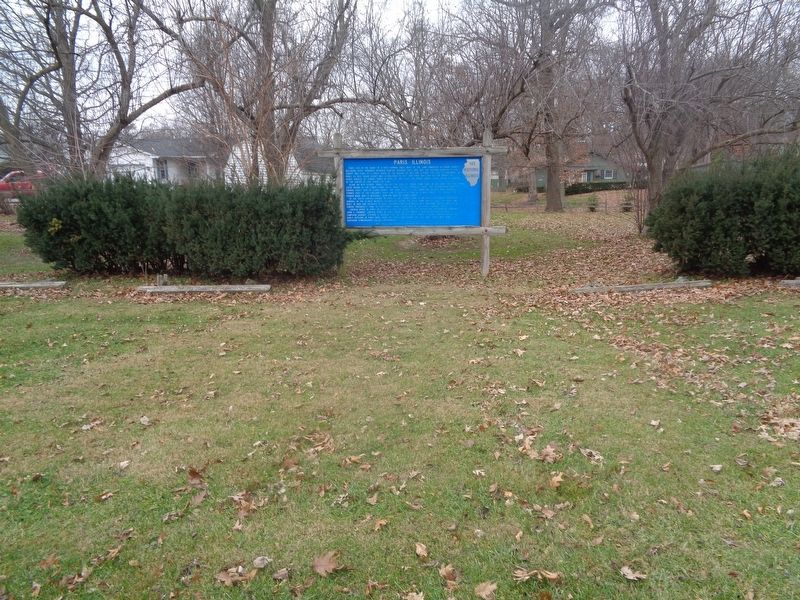
Paris lies in the heart of a rich farming area. Most of the land embraced in Edgar County, including Paris, remained Kickapoo hunting grounds until 1819, but the eastern quarter of the county was part of a tract ceded by the Indians in 1809 and . . . — — Map (db m188363) HM
In 1834, Joseph Smith, prophet of the Church of Jesus Christ of Latter-Day Saints (LDS), together with about 200 LDS Volunteers from Kirtland, Ohio, marched to assist threatened church members in Jackson County, Missouri. Called “Zion’s . . . — — Map (db m23351) HM
The fertile prairies in Illinois attracted the attention of French fur trader Louis Jolliet and Father Jacques Marquette as they explored the Mississippi and Illinois Rivers in 1673. France claimed this region until 1763 when she surrendered it to . . . — — Map (db m131294) HM
Spoke in the oak grove of General William Pickering north of here in the presidential campaign of 1840. He was stumping southern Illinois as a Whig elector for General William Henry Harrison in the Tippecanoe and Tyler Too Campaign. In 1861 . . . — — Map (db m154578) HM
The former village of Wanborough, Illinois, was established in August 1818 by English settler and entrepreneur Morris Birkbeck. A center of commerce for his fellow countrymen emigrating to the English settlement in Edwards County, Wanborough once . . . — — Map (db m177846) HM
Vandalia was the western terminus of the Cumberland or National Road which extended eighty feet wide for 591 miles from Cumberland, Maryland through Pennsylvania, Ohio, and Indiana. Illinois construction by the Federal Government began in 1811 and . . . — — Map (db m42345) HM
The first capitol building owned by the State was erected on this site. It was a thirty by forty feet two-story frame structure. The Second and Third Illinois General Assemblies met here, the House on the first floor and the Senate on the second. . . . — — Map (db m42366) HM
In 1836 Colonel Abner Flack took over the large three-story frame building which stood here and operated it under the name Vandalia Inn. In 1853-1854 it was the headquarters for Chief Engineer Charles F. Jones, in charge of construction of the . . . — — Map (db m42347) HM
The Illinois General Assembly donated five lots in Vandalia to promote the construction of a church for the use of all denominations. The forty-five by sixty feet one-story frame structure erected in the summer of 1823 was used primarily by the . . . — — Map (db m42340) HM
The Illinois General Assembly authorized Governor Edward Coles in 1823 to convey to Vandalia one and one-half acres for a state burial ground. Here were buried four members of the legislature and several state officials who died while in office. . . . — — Map (db m42371) HM
This is the site of a two-story frame building occupied by Robert Blackwell, State Printer 1818-1832, and publisher of the Laws of the United States. In 1823 he became publisher of the Illinois Intelligencer newspaper. The first periodical in . . . — — Map (db m42348) HM
On this site lived Robert K. McLaughlin, State Treasurer 1820-1823, State Senator 1828-1832, 1836-1837, and Register of the United States Land Office 1837-1845. Here the Governors of Illinois resided when the Legislature was in session. The . . . — — Map (db m42339) HM
The second state capitol owned by the State was a two-story brick building erected here in 1824, using the walls of the first State Bank which burned January 28, 1823. Abraham Lincoln was a member of the House in the 1834-1835 and 1835-1836 . . . — — Map (db m42351) HM
Colonel Robert Blackwell's new two-story frame store and boarding house opened on this site in time for the convening of the Ninth General Assembly on December 1, 1834. He advertised board and lodging for 'thirty or forty.' — — Map (db m144303) HM
Here stood a two-story log building erected in 1819 for Ferdinand Ernst who brought the German colony to Vandalia. Named Union Hall, it was operated as a hotel. After Ernst's death in 1823 it was managed by E.M. Townsend, and from April 1825 by . . . — — Map (db m42363) HM
The third capitol building owned by the state was restored as a memorial in 1933. It was the capitol from December 3, 1836 to July 4, 1839. Abraham Lincoln was a member of the House during the three sessions of the legislature held in this . . . — — Map (db m42346) HM
One-room schoolhouses in Illinois date from the 1855 free school law, which gave local townships the incentive to create school districts with elected boards that could levy taxes to support the schools and pay teachers. It is estimated Illinois . . . — — Map (db m176682) HM
The Ottawa Travel Road begins in Danville. Of prehistoric origin it was used until the early 1850's. It wandered northwest following higher ground, fording streams and detouring around seasonal obstructions. Here at Ten Mile Grove it divided, one . . . — — Map (db m157152) HM
John A. Logan 1826-1886, U.S. Representative 1859-1862, 1867-1871 Civil War General 1861-1865, U.S. Senator, 1871-1877, 1879-1886; Vice presidential Candidate with James Blaine 1884. He established Memorial Day as a National holiday in 1868. . . . — — Map (db m154532) HM
In the late summer of 1963, four musicians from Liverpool, England — John Lennon, Paul McCartney, George Harrison, and Ringo Starr — collectively known as the Beatles, were poised to conquer pop culture and music history. With three hit . . . — — Map (db m166711) HM
Lewistown Trail, from Springfield to Galena via Lewistown, was one of the main routes to the Galena Lead Mines from 1827 to 1837. The Trail crossed the Illinois River at Havana, where Ossian M. Ross, the founder of Lewistown, operated a ferry. He . . . — — Map (db m129216) HM
Jonathan Boone, an older brother of the famous pathfinder Daniel Boone, built a mill on this site about 1800. He was born in Pennsylvania in 1730 and died here about 1808. His son Joseph continued to operate the mill. In 1813 Joseph was named to . . . — — Map (db m177836) HM
In 1816 Congress appropriated $8000 to survey and construct a road from Kaskaskia on the Mississippi to Shawneetown on the Ohio. It became an important East-West thoroughfare for settlers entering the Illinois Territory. At this point the Goshen . . . — — Map (db m154635) HM
This was the original site of the home of John Marshall, one of the founders and president of the Bank of Illinois, the first bank chartered by the Illinois Territorial Legislature. The charter was issued in 1816. The bank opened at Shawneetown . . . — — Map (db m60312) HM
One of Shawneetown's earliest brick buildings, Rawlings' Hotel, stood on this lot. It was built in 1821-1822 for Moses Rawlings, who owned until 1841. On May 7, 1825, it was the site of a reception held for the Marquis de Lafayette during his . . . — — Map (db m154634) HM
Born in Ireland in 1814, Michael K. Lawler came here to Gallatin County in 1819. After serving as a captain in the Mexican War, he lived on his farm near here until the outbreak of the Civil War. In May 1861 he recruited the 18th Illinois Volunteer . . . — — Map (db m154627) HM
James H. Wilson, American Army officer, engineer, and author, was born in 1837 on his family's farm about a mile south of here. He attended Shawneetown schools, McKendree College, and the United States Military Academy. In the spring of 1864, during . . . — — Map (db m154626) HM
Thomas Carlin, sixth elected Governor of Illinois (1838-1842), was an early settler of Illinois and a prominent figure in organizing Greene County and establishing Carrollton as its county seat in 1821.
Born in Kentucky in 1789, Carlin came to . . . — — Map (db m142746) HM
The Diamond Mine of the Wilmington Coal Mining and Manufacturing Company, located near Braidwood on the Grundy-Will County line, was the site of a major mine disaster in Illinois.
The mine was on a marshy tract of land that had no natural . . . — — Map (db m6868) HM
In the old Carthage jail, which stands one block south of here, Joseph and Hyrum Smith, Prophet and Patriarch of the Mormon Church, were killed by a mob on June 27, 1844. Two years later the Mormons withdrew from Illinois, where they had settled in . . . — — Map (db m57872) HM
The fertile prairies of Illinois attracted the attention of French trader Louis Jolliet and Father Jacques Marquette as they explored the Mississippi and Illinois Rivers in 1673. France claimed this region until 1763 when he surrendered it to Great . . . — — Map (db m55419) HM
In 1673 the areas of the Mississippi and Illinois Rivers were explored by Frenchmen Louis Joliet and Father Jacques Marquette. Their voyages resulted in French claims on the area until 1763 when, by the Treaty of Paris, France ceded the land to . . . — — Map (db m55418) HM
In 1839 the Mormons, or Latter Day Saints, settled at Nauvoo and made it their chief city. During their residence its population reached 15,000. After long friction with non-Mormons the Mormons were expelled in 1846. Three years later French . . . — — Map (db m316203) HM
In 1839 the Mormons, or Latter Day Saints, settled at Nauvoo and made it their chief city. During their residence its population reached 15,000. After long friction with non-Mormons the Mormons were expelled in 1846. Three years later French . . . — — Map (db m316204) HM
Nauvoo was once the site of a Sauk and Fox village. After the Indians moved west of the Mississippi, promoters attempted to develop town sites here but the marshy bottom lands attracted few settlers.
In 1839, the Mormon Prophet Joseph Smith . . . — — Map (db m55432) HM
A communal society of French Icarians was established at Nauvoo in 1849. Led by Etienne Cabet, a French political theorist, the Icarians believed that all property must be held communally. The community was incorporated by the Illinois General . . . — — Map (db m55442) HM
Here once stood the thriving community of Green Plains. Established in the early 1830s, the settlement straddled four Hancock County townships and included log homes, a store, a blacksmith shop, a post office, and several cemeteries. Levi Williams, . . . — — Map (db m243818) HM
Fluorite, the official Illinois state mineral, was discovered in 1839 by James Anderson while digging a well near Fairview Landing one half mile SW of this site. Fluorite was a waste product until the steel industry began using the mineral in their . . . — — Map (db m154632) HM
Two miles north of here, religious dissident immigrants from Sweden founded the communal society of Bishop Hill in 1846. The charismatic Erik Jansson lead the society spiritually and temporally until 1850 when he was murdered. By 1854, a total of . . . — — Map (db m177481) HM
This was the home of Fred Francis, inventor and innovator, artist and poet. Born near Kewanee in 1856, he graduated from the Illinois Industrial University, Urbana, in 1878. While there, he was one of the designers and builders of the 'Class of 78' . . . — — Map (db m213643) HM
During the campaign for U.S. Senate in 1858, Abraham
Lincoln arrived in Kewanee by train from Macomb the
morning of October 27, 1858. Lincoln traveled by
carriage to Toulon to deliver a speech before
returning to Kewanee later the same day. . . . — — Map (db m202328) HM
This East-West road crossing Route 78 is one of the few intact segments of the Great Sauk Trail from the Mississippi River to Lake Erie. It was blazed along this glacial moraine by buffalo thousands of years ago as they traveled around Lake Wenno, . . . — — Map (db m213646) HM
Benjamin Dann Walsh, Illinois state entomologist from 1867 to 1869, was a pioneer in
the application of insect study to agriculture. Born in England in 1808, he earned his
master's degree from Trinity College, Cambridge, England in 1833. Though . . . — — Map (db m230168) HM
Benjamin Dann Walsh, Illinois state entomologist from 1867 to 1869, was a pioneer in
the application of insect study to agriculture. Born in England in 1808, he earned his
master's degree from Trinity College, Cambridge, England in 1833. Though . . . — — Map (db m230180) HM
For many years Butterfield Trail was one of the main routes from East Central Illinois to the Chicago area. In 1831 Ben Butterfield marked out the rail from Danville to Lockport where he had settled the previous year. The trail crossed Spring Creek . . . — — Map (db m164819) HM
In the third year of the American War for Independence, Lt. Col. George Rogers Clark and his army of 170 Virginia volunteers camped 5 miles southeast of here. On July 2, 1778, Clark made the fourth of five camps on his march from Fort Massac to . . . — — Map (db m161442) HM
The evolution of Southern Illinois University began here in 1856 when Presbyterians founded Carbondale College. Suffering hardships during the Civil War, the college was sold to the First Christian Church in the mid 1860s and renamed Southern . . . — — Map (db m161077) HM
On April 23, 1861, eleven days after Confederates fired on Fort Sumter, the cofounder of Carbondale, Daniel Harmon Brush, called a public meeting on this town square. Brush delivered a patriotic speech in support of the Union. Two days later, Brush . . . — — Map (db m161965) HM
On April 29, 1866, over 200 veterans and several thousand citizens gathered at Woodlawn Cemetery to honor those who had died in the Civil War. General John A. Logan delivered the keynote address, saying "Every man's life belongs to his country, and . . . — — Map (db m161076) HM
Lindorf Ozburn, born in Jackson County, Illinois in 1823, married Diza Glenn, John A. Logan's cousin. Ozburn, who served with Logan in the Mexican War, joined the Illinois 31st Infantry at the beginning of the Civil War. On Logan's promotion to . . . — — Map (db m208665) HM
In July 1861, J.D. Wheatley of Duquoin wrote Illinois Governor Richard Yates that a Confederate company was drilling in Murphysboro. A Union officer sent to investigate discovered a group of men in uniforms made of red and white bed ticking drilling . . . — — Map (db m160953) HM
Dr. Conrad Will, the "Father of Jackson County," was born in Pennsylvania in 1779 and came to Illinois in 1813. He was a physician but also operated a grist mill, tannery, and salt works. He was one of the founders of Jackson County and in 1816 . . . — — Map (db m160951) HM
Dr. John Logan, born in Ireland in 1788, came to America with his family in 1793. He moved to Jackson County in 1822 where he married Elizabeth Jenkins. Dr. Logan served four terms in the Illinois Legislature and became a friend of Abraham Lincoln. . . . — — Map (db m161005) HM
Elizabeth Jenkins, born in 1803 in North Carolina, married Dr. John Logan in 1825. When her son, John A. Logan, joined the Union Army in 1861, Elizabeth refused to speak to him. In this, she reflected the strong Southern feelings held across Egypt, . . . — — Map (db m161007) HM
The first coal mine in Illinois was located one-half mile south of here along the south bank of the Big Muddy River. William Boone and his indentured servant, a man named Peter, loaded a small raft with coal from an outcropping and, after floating . . . — — Map (db m160955) HM
Lt. Col. Clark and his troop of 170 Virginians camped near here on July 2, 1778. It was their third campsite during a march from Fort Massac to Kaskaskia to capture that post from the British. Earlier that day, the troop was lost for a time on . . . — — Map (db m161008) HM
In August 1862, federal authorities detained Israel Blanchard, John A. Logan's brother-in-law, as he walked near the court house. Blanchard was subsequently taken to the Logan Hotel, and arrested on vague charges related to alleged anti-war . . . — — Map (db m161006) HM
On January 10, 1816, Jackson County, created from Randolph and Johnson counties, became Illinois' ninth county. It was named for General (later President) Andrew Jackson, hero of the Battle of New Orleans. The county's first seat, Brownsville, . . . — — Map (db m160952) HM
Murphysboro celebrated its first Logan Day on August 3, 1914. This was Illinois’ second Logan Day, the first occurred in Chicago in 1897. Logan Day brought 25,000 people to Murphysboro. Among the attendees were Illinois Governor Edward F. Dunne, . . . — — Map (db m119541) HM
John A. Logan was born here in 1826. He fought in the Battle of Bullrun as a Democratic U.S. Congressman. Logan joined the Union Army and before the Civil War's end he earned the rank of Major General. Experiences in the war changed Logan from a . . . — — Map (db m161003) HM
Their term of service being up in February 1865, 205 members of the 56th Illinois Infantry chose to muster out. Before doing so they fought at Bentonville, North Carolina, the regiment's final engagement. Their journey home began March 29th, . . . — — Map (db m203167) HM
This building was constructed for the Southern Division of the Illinois Supreme Court, one of three divisions created by the Constitution of 1848. Court met in lodge halls in Mount Vernon prior to completion of the center section of this building . . . — — Map (db m61702) HM
The Atkinson Cemetery was established March 11, 1875, by James Atkinson, who granted the land as a community burial ground. The first recorded burial (1843) was of Sarah A. Short, daughter of Thomas Jefferson and Martha "Patsy" (Maddux) Short. The . . . — — Map (db m236731) HM
The Goshen Road was one of the main arteries of travel in the early 1800's, when Illinois was frontier country. The road ran in a Northwesterly direction from Shawneetown to Edwardsville - A distance of more than 150 miles. Shawneetown and . . . — — Map (db m88993) HM
In 1834 Dr. Silas Hamilton, physician and humanitarian, bequeathed $4,000 for construction and operation of a building for educational and religious purposes. A stone schoolhouse was opened in 1836, and the tuition-free education for local . . . — — Map (db m142751) HM
Prior to 1820, Indians and occasional white traders occupied LaPointe, the name given to the present site of Galena. The settlement grew rapidly in 1823 and 1824 as each boat deposited new arrivals on the banks of the Fever (now Galena) River. . . . — — Map (db m308291) HM
Prior to 1820, Indians and occasional white traders occupied LaPointe, the name given to the present site of Galena. The settlement grew rapidly in 1823 and 1824 as each boat deposited new arrivals on the banks of the Fever (now Galena) River. . . . — — Map (db m308292) HM
Opened in April, 1855, the five-story, 240 room De Soto House was “the largest and most luxurious hotel in the West.” Abraham Lincoln spoke from its balcony in 1856 and Stephen A. Douglas in 1858. Ulysses S. Grant maintained his 1868 . . . — — Map (db m72275) HM
Evangelist William "Billy" Sunday and his wife Helen "Ma" Sunday owned this farm, 1899-1913, and spent their summers here. Ma was born on the farm. Billy was born in Ames, Iowa, in 1862. He played outfield for Chicago and other National League . . . — — Map (db m55486) HM
Gail Borden, pioneer in the food preservative industry, established a milk condensing plant on this site in 1865. His discovery incorporated a process by which water was evaporated from milk, and sugar added as a preservative. This process, patented . . . — — Map (db m63650) HM
From 1866 to 1966 this site was occupied by the Elgin National Watch Company. This was the first watch factory built west of the Alleghenies and grew to become the world's largest. During its lifetime over 60 million 'Elgin' watches were . . . — — Map (db m55455) HM
This marker is along the “south leg” of the Elgin road races. Beginning in 1910, many leading drivers and mechanics competed here in grueling tests of speed and endurance that contributed to the development of the modern automobile. . . . — — Map (db m55454) HM
For more than 70 years this site was occupied by the Illinois Watch Case Company. The firm was a leader in the domestic watch industry and by the 1920s had produced more than 30 million watch cases.
A subsidiary produced jewelry goods, lockets, . . . — — Map (db m55458) HM
The stone posts located 75 yards to the south of this sign mark the front gate of the house occupied by then-Colonel George C. Marshall, Jr. and his wife, Katherine, in 1936. Marshall lived here while serving with the Illinois National Guard in . . . — — Map (db m316200) HM
Allan Pinkerton, famous detective, had his home and cooperage on this lot, 1844-1850. Here he sheltered and employed slaves escaping to freedom. After helping to capture some counterfeiters, he became deputy sheriff of Kane County in 1848. In 1850 . . . — — Map (db m55485) HM
Bourbonnais Grove’s first families came from Quebec’s Upper St. Lawrence Valley in the 1830s and ’40s to settle what would become the largest 19th century French-Canadian agrarian village in Illinois. Some immigrants moved on to found St. Anne, St. . . . — — Map (db m105623) HM
Thomas Durham bought 160 acres on this site in 1835 from Gurdon S. Hubbard. Known as the Jonveau Reserve, the land lay in an area called Bourbonnais Grove. Durham opened 20 acres for cultivation. In January 1836, parts of Cook and Iroquois Counties . . . — — Map (db m105729) HM
This trail was blazed by Gurdon S. Hubbard, 1822–1824, connecting the trading posts of the American Fur Company between Vincennes and Chicago. Momence, near the upper crossing of the Kankakee River, is on this trail. Known also as the . . . — — Map (db m105838) HM
Before the abolition of slavery, a movement was established throughout the United States to help enslaved African Americans escape north into free states and Canada. Known as the "Underground Railroad," this network was comprised of communities, . . . — — Map (db m297045) HM
The northern boundary of Illinois as prescribed in the Ordinance of 1787 was an East and West line from the Southern tip of Lake Michigan at approximately 41° 38', passing through this region to the Mississippi River. When Illinois applied for . . . — — Map (db m193168) HM
Carl Sandburg, poet and historian, was born in this modest three-room cottage
on January 6, 1878. He was the son of a Swedish immigrant railroad worker. Carl
attended Lombard College in Galesburg, and his first poetry was published in
this town. . . . — — Map (db m150543) HM
On October 7, 1858, Abraham Lincoln and Stephan A. Douglas met in Galesburg for the fifth of seven joint debates. From a platform erected along the east side of Old Main on the Knox College campus, Lincoln said: "He is blowing out the moral lights . . . — — Map (db m316206) HM
In this area stood a Potawatomi village when Michael Fraker arrived from Kentucky about 1830. With kindness and understanding he negotiated a peaceful settlement with the Indians and became the first permanent settler in northeastern Knox County. . . . — — Map (db m150572) HM
This U.S. Army Post was named after Civil War Cavalry General Philip Sheridan, to honor his many services to Chicago (1868-1883).
The Commercial Club of Chicago, concerned since 1877 with the need for a military garrison, was motivated by the . . . — — Map (db m55515) HM
In 1837 William Dwyer, his wife Mary, and her brother, Dr. Richard Murphy, established a claim to the property on this site and created what was known as the Dwyer Settlement. The Dwyer homestead included a tavern and one of the three stage stops . . . — — Map (db m66619) HM
The fertile prairies in Illinois attracted the attention of French trader Louis Jolliet and Father Jacques Marquette as they explored the Mississippi and Illinois Rivers in 1673. France claimed this region until 1763 when she surrendered it to Great . . . — — Map (db m272438) HM
Adlai Ewing Stevenson – Governor of Illinois from 1949 to 1953, twice the Democratic Party nominee for president, and United States Ambassador to the United Nations – built this residence in 1938. Known as "The Farm," the house, outbuildings, and . . . — — Map (db m41247) HM
The Washburn and Moen Manufacturing Company of Worcester, MA. established a wire mill – The Waukegan Works – east of this location along Lake Michigan. The land for its Illinois operation was purchased January 16, 1891, on the recommendation of its . . . — — Map (db m38184) HM
On June 12, 1924, the largest train robbery in U.S. history occurred near here. Bandits boarded the train in Chicago and forced postal clerks to surrender sacks containing more than two-million dollars in securities and cash. Local police . . . — — Map (db m54066) HM
In 1840, Andrew C. Cook and his wife Mary Oakes came to Wauconda Township from Vermont, via the Erie Canal, the Great Lakes to Chicago and then to Wauconda. They purchased 380 acres of land at $1.25 per acre. A log cabin was erected before clearing . . . — — Map (db m54062) HM
From 1912 to 1962, Bowen Park was the site of the Joseph T. Bowen Country Club, owned by the Hull-House Association of Chicago. Here, children from many national, racial and religious backgrounds learned to respect each other and the environment. . . . — — Map (db m54019) HM
John Huston Finley was born on a farm east of Grand Ridge and attended Grand
Ridge Elementary School. He graduated from Ottawa High School as valedictorian in
1882, and earned his undergraduate degree at Knox College in 1887. He went on to
Johns . . . — — Map (db m239246) HM
The story of the twin cities of LaSalle and Peru is closely interwoven with the history of the Illinois River and the Illinois and Michigan Canal. In 1673, Jacques Marquette and Louis Jolliet passed through this area by way of the Illinois River . . . — — Map (db m316218) HM
On July 19, 1932, unemployed workers marched toward the Marseilles
Dam, which was using out-of-state workers for a major project. As the
local workers reached the site, gunfire exploded from the dam site. 21
protesting workers were wounded and . . . — — Map (db m239352) HM
In 1932 the national economic crisis of the Great Depression was still
growing. Workers had no legal right to organize unions, and had little
power individually to prevent lowering standards of living, but an
unemployed movement had formed. Near . . . — — Map (db m239351) HM
Here is commemorated the 100th anniversary of the first permanent Norwegian settlement in the United States by Cleng Peerson and other pioneers from Norway. They and their descendants, who still live here have contributed largely to the development . . . — — Map (db m309627) HM
On the eminence to the southwest stood Fort Wilbourn, where the Third Army of Illinois volunteers was mustered in for service in the Black Hawk War. Here on June 16, 1832 Abraham Lincoln enlisted as a private in Jacob M. Early's company, his third . . . — — Map (db m184997) HM
In the autumn of 1861 the valley before you, bounded by bluff, creek, and river, was known as Camp Hunter. Here on September 26, the 4th Illinois Cavalry mustered for duty, beginning military training and a three-year enlistment. White tents . . . — — Map (db m185004) HM
On August 21, 1858, the first of seven debates between Abraham Lincoln and United States Senator Stephen A. Douglas took place in this park. Approximately 10,000 people gathered to hear the two candidates discuss the question of slavery in America. . . . — — Map (db m65299) HM
Clyde William Tombaugh was born near Reading (south of Streator) in 1906. He attended Heenanville Grade School and Streator High School and became interested in astronomy at an early age. In 1922 his family moved to Kansas. He built telescopes and . . . — — Map (db m145184) HM
447 entries matched your criteria. Entries 101 through 200 are listed above. ⊲ Previous 100 — Next 100 ⊳