A Manufacturing Town
All major roads and rail-lines run through Amherst, making it a natural gateway into Nova Scotia. The town is also in the middle of a rich agricultural and coal-mining area.
Amherst became a major manufacturing town in . . . — — Map (db m112104) HM
[Face]
The Acadian village of Beaubassin on this site was founded by settlers from Port Royal around 1672. Upon the arrival of Major Charles Lawrence with British troops in April 1750, the French authorities had the village destroyed in . . . — — Map (db m106953) HM
This area was the site of the Acadian village of Beaubassin, first known Bourgeois settlement. Raided in 1696 and again in 1703 by a force from Boston under Captain Ben Church. Occupied by French troops in 1746 who travelled on snowshoes in . . . — — Map (db m106951) HM
The First Nations
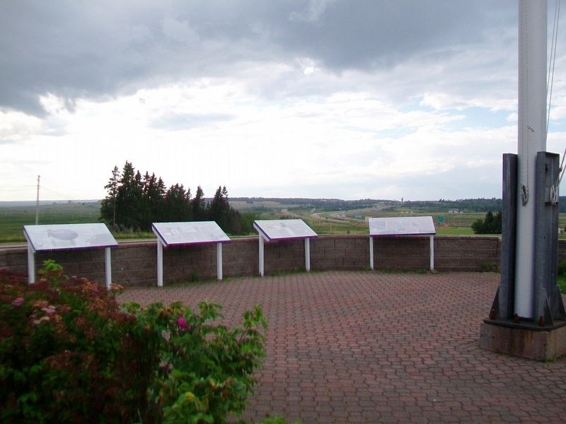
Native peoples have lived around the Chignecto Isthmus for thousands of years. Travelling in family groups and small nomadic bands, they moved from area to area harvesting seasonal food sources.
Early French explorers . . . — — Map (db m112112) HM
Fort Lawrence
In the 18th century, the Chignecto Isthmus played an important role in the struggle between France and Britain for North American supremacy. In 1713 the Treaty of Utrecht had failed to clearly establish the border of Nova . . . — — Map (db m112110) HM
Geology
This area is located in the Carboniferous Lowlands of Nova Scotia. The underlying bedrock is sedimentary with varying proportions of sandstone and mudstone. In some areas where the bedrock has been folded, the sandstone has been . . . — — Map (db m108707) HM
Fondateur, vers 1672, de Beaubassin premier établissement dans la région de la rivière Missagouèche et initiateur de l'agriculture maraîchère en Acadie
Jacob Bourgeois arriva à Port-Royal en 1641 à titre de chirurgien pour la colonie . . . — — Map (db m107012) HM
Born at Wallace Bridge, Newcomb moved to the United States in 1853. Graduating from Harvard he became Professor of Mathematics in the U.S. Navy and was assigned to the Naval Observatory. He was soon recognized as an authority on mathematical . . . — — Map (db m108085) HM
Bill was from Wallace, where his grandfather worked in the quarry and kept the lighthouse. His father was the village doctor until their move to the backwoods of northern Quebec. While there, Bill was home schooled by his mother until age 14, when . . . — — Map (db m108089) HM
Pugwash sits on top the largest salt deposit in Atlantic Canada. The train tracks, bridges, and wharves that defined the tapestry of the village infrastructure changed significantly over the decades as local industry evolved, including the . . . — — Map (db m108068) HM
While lobster boats have filled the local wharves for generations, the community's most unique feature may have been the 130 ft. (39.6m) smoke stack belonging to Nova Scotia Clayworks on the opposite side of the harbour. Started in 1889, the . . . — — Map (db m108078) HM
The deep harbour of Pugwash has a long and storied seafaring heritage, with many eras of ships carrying lumber and raw materials up and down the Eastern Seaboard.
[Historic Pugwash photos]
"Peace cannot be kept by force; it can only be . . . — — Map (db m108080) HM
The Pugwash Railway Station, completed in 1892, is one of only two stations designed by Sir Sandford Fleming that is still standing in Nova Scotia. The station is also famous for its part in the 1957 "Thinkers Conference" where Pugwash native . . . — — Map (db m108069) HM
Historically, the main streets were lined with hotels, merchants, and services one would expect of a long-standing port village. The village endured seven devastating fires between 1877 to 1929 that permanently changed the street-scape . . . — — Map (db m108083) HM
The station was built in 1888. Rail service to Pugwash commenced in 1890 and ceased in 1993. Five miles of track linked Pugwash to the Shortline at Pugwash Junction. The Shortline ran from Pictou to Oxford Junction linking it with the rail track . . . — — Map (db m108070) HM
All of the community celebrations culminate on Water Street. Canada Day has been celebrated in Pugwash since 1951 with festivities called "The Gathering of the Clans" paying homage to some of its founding settlers. This is also the reason many of . . . — — Map (db m108076) HM
The Mary Crowley monument is the first public monument in honour of a Canadian-born female. It was erected in 1870 following a unanimous vote of the Nova Scotia Legislature. "Mary E. Crowley lies beneath this sod, a victim to fraternal love, having . . . — — Map (db m140763) HM
The Pugwash Conferences on Science & World Affairs
The Pugwash Conferences take their names from the location of the first meeting, held in 1957, in the village of Pugwash, Nova Scotia, birthplace of their host, American philanthropist Cyrus . . . — — Map (db m108075) HM
”There Can Be No Winners in a Nuclear War.” Russell — Einstein Manifesto, July 9, 1955 A Welcome Retreat In 1955, Cyrus Eaton began hosting meetings of scholars, educators and social reformers in Pugwash. He . . . — — Map (db m150367) HM
English:
In 1957, at the height of the Cold War, the first Pugwash Conference on Science and World Affairs took place in this serene setting. Hosted by philanthropist Cyrus Eaton, top-level scientists from both sides of the Iron . . . — — Map (db m140759) HM
[Great War Honored Dead]
Douglas Langille • Harold Esty Benjamin
Percy Erle Benjamin • William McLean Borden
Cecil Raymond Richards • Frederick Elias King
Frank Demings • Harry Hector McLellan
Andrew Gray McPherson • George Selig . . . — — Map (db m108059) WM
World War I
1914 - 1918
William Baird • James Bathgate • Alexander Craib
James Crooks • Kenneth Hape • Charles MacNutt
Elmer MacNutt • Wellsley McCann • Daniel Reeves
Chester Slack • Harold Slack • Gordon Tingley
Renton Fisher • . . . — — Map (db m108094) WM
Important as a centre for the North Atlantic fisheries from
the 16th century, the islands in Canso Harbour offered a
safe haven for fishermen. First frequented by the French
and Basques, the area became the site of an extensive . . . — — Map (db m138598) HM
To the Glory of God and in loving memory of those who made the supreme sacrifice in the World War
Canso
Louis Dort, Vernon Earle,
Roy Greencorn, Lee Martin Hart,
Arthur S. Horton, James B. Keating,
Percy J. Lumsden, James Arthur Manuel, . . . — — Map (db m140441) WM
Only a century ago the spars of many schooners filled this harbour. Vessels from Lunenburg and the "Boston States" entered to take on bait, ice and water before sailing to the banks offshore.
Canso shipyards constructed smaller coastal . . . — — Map (db m140521) HM
On July 13, 2006
a Canadian Forces helicopter
from 413 Transport
and Rescue Squadron
carrying seven crew members
who were exercising rescue
techniques with local
Canadian Coast Guard
auxiliary members
crashed in Canso Harbour. . . . — — Map (db m139669) HM
During the seventeenth century French fishermen came from Cape Breton, across Chedabucto Bay, to fish for cod in thirty foot shallops. Later, the New England colonists came in their schooners. They fished the Banks and dried their fish . . . — — Map (db m140536) HM
On
May 23, 1881, the steamer Faraday landed a transatlantic telegraph cable at Dover Bay. The cable allowed the news of Europe to flash underneath the ocean for 2,531 nautical miles.
The European news arrived in Canso and Hazel Hill . . . — — Map (db m140501) HM
This is a place where seafaring people found shelter from the
harshness of the Northwest Atlantic. It is the most easterly point of mainland Nova Scotia, remote
and exposed upon Chedabucto peninsula, yet close to the fishing banks so . . . — — Map (db m140505) HM
Fishermen sailed to this coast before the earliest explorers. In the early 1600s French and Basque fishermen dropped handlines in the waters.
By 1725 New Englanders were pulling in cod worth 150,000 pounds (New England currency) . . . — — Map (db m140554) HM
During this three year period approximately 180
officers and men operated, serviced, or otherwise
gave support to a radar unit on this site. — — Map (db m139278) HM
Welcome to #5 Radar Unit. RCAF Queensport / Cole Harbour.
Bienvenue à Ja Sieme unité de radar deP'ARC, située à Queensport / Cole Harbour.
This base, along with ten others situated along the rocky shores of Nova Scotia,
Was tasked with . . . — — Map (db m139288) HM
The Court House was constructed in 1842-43. It was the third court house built in Guysborough, the original administrative centre of Sydney County from 1785-1827. Sydney County included present-day Guysborough and Antigonish Counties.
Built in . . . — — Map (db m139264) HM
Born at Port Shoreham, N.S., educated at Guysborough Academy and at McGill, Tory served as professor at McGill (1893-1905), Principal of McGill College, Vancouver (1906-7), first President of the University of Alberta (1908-28), and . . . — — Map (db m138221) HM
The Voyage of Prince Henry Sinclair to the New World in 1398
On June 2, 1398 Henry Sinclair allegedly set foot in North America on the sandbar of Guysborough Harbour. His fleet consisted of 12 ships with between 200-300 men on board, a . . . — — Map (db m139656)
The first settlers of Port Royal must have been aware of the extraordinary fertility of the immense salt marshes that surrounded them The height of the wild grasses alone would have been a clear sign of very productive soil. Until the . . . — — Map (db m141244) HM
Many of the Acadians who escaped, or survived the Great Upheaval of 1755 to 1763, either died of exposure, or were captured and imprisoned as "Prisoners of War". Makeshift detention centers were often old trading posts such as Fort Edward . . . — — Map (db m141399) HM
This monument is the creation of Raymond Delorey of Larrys River and the idea was conceived by members of "la Société des Acadiens de la Région de Tor Baie” under the direction of its Executive, President, Jude Avery, Vice President, . . . — — Map (db m141175) HM
In 1603, Henry IV, King of France, granted Pierre Dugas, Sieur de Monts, the right to colonize lands in North America between the 40th and 60th degree north latitude. Along with the right to colonize that extensive region, his company was . . . — — Map (db m141181) HM
Grand Pré (large meadow) settlement began in 1682 when a few families from Port Royal moved there. It is situated near the shores of Minas Basin, an inlet that empties into the Bay of Fundy. By 1707, the population had grown to 580 . . . — — Map (db m141256) HM
Welcome to our Commemorative Park!
This development is a direct result of a cultural awakening following local festivities in 2004, in conjunction with the World Congress of Acadians, which was celebrated throughout Nova Scotia. Our people . . . — — Map (db m141146) HM
French cartographer and geographer, Samuel de Champlain met Basque fisherman and fishery entrepreneur, Captain Savalette, on the north shores of Tor Bay in 1607. According to authenticated records, Champlain and a group of explorers, . . . — — Map (db m141209) HM
Arriving in 1604, the French settlers built a fort on a small island named Ile Ste Croix at the mouth of the Ste. Croix River, which separates present day New Brunswick and Maine. After a disastrous winter, where 35 of the 79 men died of . . . — — Map (db m141190) HM
After many visits to this eastern coastline region of mainland Nova Scotia between the years 1763 and 1797, a determined group of Acadian families from Chezzetcook, who were once again searching for peace and freedom, decided that the . . . — — Map (db m141401) HM
With the founding of Halifax in 1749 as a British naval base, the Acadians became the target of concern and possible displacement. Demands on them to accept and sign an "oath of allegiance” to the British crown were made several . . . — — Map (db m141258) HM
The Deportation began in 1755 and ended with the signing of the Treaty of Paris in 1763. This Treaty not only ended what was perhaps the greatest human atrocity committed in British North America but it also gave Acadians the right to . . . — — Map (db m141389) HM
Over the next eight years, or until the signing of the Treaty of Paris in 1763, the Great Upheaval continued in what has become known as the first act of "ethnic cleansing” in North America. In an ill-conceived and desperate plan . . . — — Map (db m141274) HM
To commemorate the landing at Tor Bay (Port Faraday) on September 15, 1875, of the first direct commercial cable to successfully transmit messages from England
to the mainland of North America — — Map (db m138590) HM
Every summer for more than 40 years,
beginning in 1565, this Basque fisherman
from Saint-Jean-de-Euz sailed to Eskikewa'kik,
a district of Mi’kma’ki within the traditional
territory of the Mi'kmaq. Here, his crew
caught codfish, which . . . — — Map (db m138605) HM
Welcome to Place Savalette This park has been developed to mark and explain the site of the historic 1607 meeting between Basque fisherman/entrepreneur, Captain Savalette and explorer/cartographer Samuel de Champlain
on the shores . . . — — Map (db m139825) HM
Early European Settlers
The first European settlers of Queensport -- then known as Crow Harbour – bore family names of Digdon, Lamb, Lindsay, Sherlock, and Smith. The latter two families established a large fishing enterprise in the . . . — — Map (db m140674) HM
A Community linked to the Sea
Queensport was a fishing village community long before the first European settlers arrived here in the 1700s. Each spring and summer, the aboriginal Mi’kmaq would gather to harvest fish, one of the most . . . — — Map (db m141232) HM
Folklore of Whitehead
In April of about 1880, a brig sailed into Whitehead Harbour, claiming to be headed to Greenland whaling. Strangely, it had no name, and no one was allowed aboard or ashore. They stayed in harbor about a week. . . . — — Map (db m140380) HM
Village of Port Felix/Molasses Harbour
Early Acadians called Port Felix Molasses Harbour because of a keg of molasses washing up on shore. Many Acadian settlers arrived about 1797 after
the fall of Louisbourg. Following the American . . . — — Map (db m140390) HM
The Whitehead Canal is located between Whitehead Harbour and Witch Cove. Prior to its construction, fishermen had to haul their
boats over a narrow beach between Whitehead and Molasses Harbour (now Port Felix) at a spot known as "The Haulover". . . . — — Map (db m139515) HM
Early names of the community were Martingot and Tete Blanche.
Lovell's 1871 Directory of Nova Scotia said "Whitehaven is a fishing settlement intended to be the terminus of the inter-colonial railway. The harbour is one of the finest on the . . . — — Map (db m140352) HM
Many yards in Whitehead boast a lilac bush which originated from the lilac bushes in Yankee Cove
Kayak/boating enthusiasts love the scenic voyage through "The Runs” via Yankee Cove & The Basin.
1760 – Seasonal fishermen began . . . — — Map (db m140377) HM
In 2000, to commemorate a century of service, Canadian Military Engineers embarked on a three-year program of assisting communities along the Trans Canada Trail to construct and restore bridges. Thirty of these bridges are shown here.
For the . . . — — Map (db m113207) HM
Lake Micmac was smaller
Lake Micmac was considerably smaller before the Canal was begun. Evidence for this can be found in the cove to the west where the remains of a forest and marsh area can be seen under the surface of the Lake. To the . . . — — Map (db m78081) HM
Man-made Bank
You are now walking on a man made bank which forms one side of the canal cut. This wall of earth and stone was necessary to contain the depth of water needed to float the barges. During the first phase of the canal . . . — — Map (db m78100) HM
Canal Camp
You are looking at a part of the remains of what was known as the “Canal Camp.” The row of stones in this area represent the largest feature found to day at Port Wallace. An archeological investigation was carried out . . . — — Map (db m77987) HM
Lock 2
You are now looking at the upper sill of Lock 2. The chambers of the first five Locks on the Canal are approximately 21 meters long and 5.5 meters wide.
Therefore the boats and barges used on the system had to be able to fit . . . — — Map (db m78083) HM
Cutting the Canal
You are now standing about one third of the way between Lake Micmac to the South (left) and Lake Charles to the North (right). Before canal construction began in 1826 there was no flow of water between these two lakes. The . . . — — Map (db m77986) HM
Benching
As you look down the Cut you will see, on the left or East bank, stone walls separated by narrow, flat terraces. This construction technique was used by the canal workers to prevent the earth from sliding down the bank. It was . . . — — Map (db m78117) HM
Hard Digging!
From this location you can begin to appreciate the enormous task which faced the canal workers. Prior to 1826 this canal cut or trench did not exist and all of the earth and rock had to be removed. Unlike the lower part of the . . . — — Map (db m78105) HM
At the point you are approximately 26 meters above sea level, almost at the height of Lake Charles from which the water flows in two directions - south to the Harbour and north to the Bay of Fundy. To get to this point vessels would have traveled . . . — — Map (db m78147) HM
Vessels entering Lock two, traveling northward, were approximately 19 meters above the level of the Harbour. This lock would raise them another three or four meters enabling them the make their way along the canal to Lock three. This present lock . . . — — Map (db m78148) HM
In August 1750, the 504 ton ship Alderney arrived after a month's sail from England with 353 settlers, who made their first landing near the sawmill site. They laid out 184 building lots, 50 feet by 100, and named the settlement after the . . . — — Map (db m113104) HM
Navvies
The most concentrated number of features belonging to the Canal Camp are located in this area beneath the trees and along the roadway. You can still make out the remains of several stone foundations. A plan of this area prepared in . . . — — Map (db m77988) HM
A Dwelling for Two Families
Imagine this structure on top of the stone foundation in front of you. This home would be similar to the one at Site No. 9. However this structure is larger and contains two small stone hearths. When excavated in . . . — — Map (db m78104) HM
Dwelling Cabin
This feature represents an example of cultural transfer by emigrants to Canada from their homeland. This dwelling cabin strongly resembles the description of the cabins of the working poor in Northern Scotland and Ireland, as . . . — — Map (db m78101) HM
Location of prominent historical characters at the ground breaking ceremony
General location of the official ground breaking ceremony, July 25th, 1826. Looking south from the walking bridge you are viewing the general location of the . . . — — Map (db m78078) HM
Possibly a Storage Building for Powder
This is the only example of this style of structure found anywhere along the canal. While the Archaeologists are uncertain about its use, it may have been a storage area for black powder used to blast the . . . — — Map (db m78106) HM
From 1826 to 1831, canal labourers constructed two locks and the “deep cut” between Lake Charles and Lake Micmac. During these years, upwards of 250 workers and their families lived here. The locks were rebuilt and operated between 1858 . . . — — Map (db m77956) HM
This is the starboard propeller of the Canadian coastguard [sic - Coast Guard] Icebreaker, John A. MacDonald [sic - Macdonald]. The propeller was damaged while the John A. MacDonald was assisting the 115,000 ton oil tanker, SS Manhattan, in her . . . — — Map (db m113082) HM
Sullivan’s Pond was a vital feature of the historic Shubenacadie Canal, the traditional water route of Mi’kmaq Indians connecting the harbour at Dartmouth with Minas Pasin and the Bay of Fundy. When the Canal operated, from 1861 to 1870, water . . . — — Map (db m108732) HM
Highest point of the Canal
Ahead you will see Lake Charles which is the highest body of water in the Canal system. From this lake, water flows south to the Halifax Harbour and north to the Bay of Fundy. You are now approx. 29 meters (95 feet) . . . — — Map (db m78115) HM
Lock 3
When first built this lock was made entirely of granite blocks, as represented by the end walls. Like the other structures of the Canal, this lock fell into disrepair between 1831 and 1854. It was completely rebuilt by Charles Fairbanks . . . — — Map (db m77985) HM
The Blacksmith’s Shop
Excavated by Dr. Davis in 1985, this forge operated during both the first construction period (1820s) and the second (1850s). It was here that workers and masons would have their tools repaired and stone picks . . . — — Map (db m77982) HM
This totem pole, carved by three Kwakiutl Indian carvers from a log of western red cedar, is a gift to the 1969 Canada Games Society on the occasion of the first Canadian Summer Games, held in the twin cities of Halifax and Dartmouth, Nova Scotia. . . . — — Map (db m108731) HM
Lock 2
Looking north from the walking bridge you see Lock 2. This lock was the first to be constructed on the Canal. Initially the lock was built totally of granite blocks (British construction method), as seen on the east wall. After the . . . — — Map (db m78077) HM
An avid walker, trail enthusiast, leader, mentor and diligent worker, Vera B. Stone defines the Trans Canada Trail movement in Nova Scotia. As a founding member and a longstanding Chair for the Trans Canada Trail Committee of the Nova Scotia . . . — — Map (db m113189) HM
A water control structure
The man-made holding pond in front of you helped to maintain the level of the canal when the lock was in operation. The water in this holding pond had two purposes. It helped maintain the water level in the dry . . . — — Map (db m78102) HM
Wild roses add beauty and colour to roadsides, open woods, prairies, and rocky places all across Canada. They may have pink or white flowers, be with or without thorns, and stand as high as 2.5 metres. Wild roses are considered a weed in many . . . — — Map (db m113194) HM
The year is 1821. You are looking south in the Grand Parade towards Saint Paul's, the oldest Anglican church in Canada. Turn and face north: the fine building you see is not City Hall, but "old" Dalhousie College.
In a long, often acrimonious, . . . — — Map (db m139592) HM
English
Built about 1819 by John Black, successful merchant and Executive Councillor (1813-23), this house is a notable example of the finest Halifax residences of its day - the first important era of stone construction in the town. James . . . — — Map (db m77657) HM
Erected
by the
Commissioners
of the
Public Gardens
in commemoration
of the services
of our
Citizen Soldiers
in the
South African
Campaign
1899~1902 — — Map (db m112796) WM
The corps was formed in Nova Scotia and elsewhere across Canada in 1937, on the instigation of the Canadian Government, to find employment for worthy older veterans.
Its organization was patterned along military lines of the British Corps of . . . — — Map (db m77805) HM
Proudly serving Canada and their fellow citizens at home and abroad.
In a new and awesome land that was to become Canada, adventurous French and British military engineers surveyed the colossal, mapped the incredible and built the . . . — — Map (db m113199) HM
The sailor statue represents those valiant young Canadians who served in both war and peace is symbolic of the thousands of sailors who were instrumental in the victory at sea and a fitting acknowledgement to those who continue to maintain the peace. — — Map (db m77597) WM
English
Before the voyages that brought him world fame as Captain Cook, this British Royal Navy officier complied navigational charts for the coasts of Quebec and Nova Scotia. While based in Halifax from 1758 to 1762, he learned . . . — — Map (db m77953) HM
English
These gravestones were all carved by hand, using chisels and wooden mallets. Many of the old slate stones were quarried and carved around Massachusetts Bay, and shipped to Halifax before the American Revolution. By the 1770s local . . . — — Map (db m77782) HM
English:
This building, erected in 1860, provides a rare and early example of a full cast iron facade in Canada. Used in construction since the 1770s, cast iron had become a popular decorative material by the mid-19th century . . . — — Map (db m139596) HM
Dedicated to the original Irish
settlers of 1749 and to the
contributions of the Irish
community to Halifax, to
Nova Scotia and to Canada
Tíolactha do na hÉireannaigh a
bhain fúthu í Halifax sa bhliain
1749 is mar aitheantas da . . . — — Map (db m113130) HM
Charles Morris was Nova Scotia’s Chief Surveyor and one of he first residents of Halifax.
In 1750, on order from the founder of Halifax, Edward Cornwallis, Morris began surveying the entire peninsula, laying out new suburbs and 240 acres of . . . — — Map (db m77647) HM
499 entries matched your criteria. Entries 101 through 200 are listed above. ⊲ Previous 100 — Next 100 ⊳