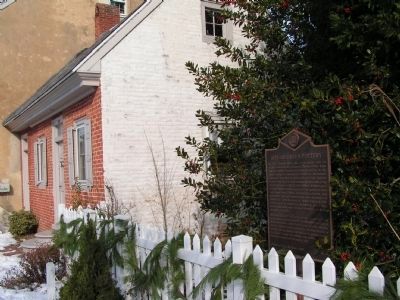
In 1764, Thomas Green sold a one-quarter acre lot at this location to his grandson, Charles Green. Some time thereafter, Charles established a facility for the manufacturing of redware pottery on this site. The business is known to have been in . . . — — Map (db m39678) HM
The roots of Methodism in this community can be traced to the organization of a local “society” in the 1770’s. Meetings were held in private homes before a frame structure was built here circa 1786 on land provided by Col. Allan McLane, . . . — — Map (db m39027) HM
The first religious organization to hold services in Duck Creek Hundred - 1705. Property transferred to Duck Creek Historical Society - 1962. Michael Desmond, Jr's Eagle Scout Restoration Project - 2002. — — Map (db m39711) HM
In the spring of 1869, the Commissioners of Smyrna approved a plan to erect a Town Hall. Responding to the long-held desire of the citizens for a venue for public gatherings, architect Richard Mitchell designed the building to include a “hall” on . . . — — Map (db m39030) HM
Founded in 1740, St. Peter's was originally located near Duck Creek on the old King's Highway. In 1762 the congregation moved to a newly constructed stone chapel on the site of St. Peter's Cemetery. When the chapel fell into disrepair, the . . . — — Map (db m141377) HM
This longtime Smyrna landmark was constructed by Robert Holliday in the late 18th century. The first known residents of the home are believed to have been the family of his daughter, Susannah Holliday Wilson. The origin of the name “The Barracks” is . . . — — Map (db m39029) HM
The Gray Box Chateau
24 North Main Street
has been placed on the
National Register
of Historic Places
by the United States
Department of the Interior
1764 — — Map (db m174313) HM
The John Cummins Mansion has been placed on the National Register of Historic Places by the United States Department of the Interior May 23, 1980 — — Map (db m174312) HM
In 1919, a new era for education in Delaware was initiated when a statewide effort to replace old and outdated facilities was undertaken. In 1922, the new Smyrna Colored School opened its doors for African-Americans and other persons of color . . . — — Map (db m141287) HM
Thornley
House
circa 1920
has been placed on the
National Register
of Historic Places
by the United States
Department of the Interior
— — Map (db m174551) HM
The name Union Cemetery is derived from the fact that this burial site was created to inter deceased members affiliated with the African-American houses of worship in this area. Originally owned by James and Hester Till, the land for the cemetery . . . — — Map (db m130460) HM
Delaware’s first Jewish farmers, Isaac and Ida Beinoff, settled here in 1897. Like those to follow, they were recent immigrants fleeing poverty and oppression in their native Russia. Between 1912 and 1929, the Jewish Agriculture Society, based in . . . — — Map (db m142529) HM
Formerly part of Murderkill Hundred, originally called Motherkill Hundred, kill meaning creek in Dutch. Original boundaries were St. Jones Creek on north, and Murderkill Creek on south, extending from Delaware River to Maryland line. In 1867, . . . — — Map (db m51113) HM
Samuel D. Burris, a free African-American conductor on the Underground Railroad resided in the Willow Grove area during the 1840s. He helped enslaved people find their pathway to freedom in Philadelphia. Caught for aiding and abetting runaway slaves . . . — — Map (db m142503) HM
Delaware Bay developed further as rising seas spread over the coastal plain, spurring formation of brackish water tidal marshes along its edges. Sea levels were 60 feet lower than they are today.
Woodland Periods of Habitation on Delmarva [unreadable] BC - 1600 AD
Native people were expert fishers and [unreadable] of the estuary shaped the rhythms [unreadable] lives. They moved [unreadable] tap . . . — — Map (db m247124) HM
With the end of the last ice age, Delaware Bay formed as melting glaciers to the north caused sea level rise. Sea levels were 100 feet lower, and the coastline was 60-80 miles further east than they are today.
State Consolidated District No. 1 was authorized and created on July 1, 1915. Seven months later on February 28, 1916, voters of the district approved the request of the State Board of Education by a vote of 52 to 1 to bond together schools in . . . — — Map (db m94381) HM
Efforts to establish rail transportation in Delaware were realized in 1832 with the completion of the New Castle and Frenchtown Railroad connecting shipping traffic on the Chesapeake Bay and Delaware River. The promise of railroads was clearly . . . — — Map (db m39604) HM
The construction of the Delaware Railroad in the 1850s led to the establishment of the Delmarva Peninsula’s first and most important north-south railway transportation artery. Proximity to the nearby community of Camden resulted in the location of a . . . — — Map (db m39603) HM
In 1677, John Grubb (1652-1708) came from Stoke Climsland, Cornwall and settled on the Delaware River at "Grubb's Landing." He was one of the first Englishmen in Delaware.
John and his wife Frances raised nine children: Emanuel Grubb . . . — — Map (db m144195) HM
The Harvey Farm was purchased in 1922 to become the Village of Ardentown. In 1931, the barn, believed to have been built in the 1890s, was converted into the Robin Hood Theatre, a professional summer theater. Film and stage actors including Barbara . . . — — Map (db m239625) HM
Arden is an intentional community, founded in 1900 by social reformers Frank Stephens, a sculptor, and Will Price, an architect, to create a society based on Henry George’s Single Tax economics and William Morris’s arts and crafts philosophy. . . . — — Map (db m239057) HM
The African Union Church (AUC) of Christiana Bridge built a wood-framed church on this site in 1819. The AUC was the first incorporated religious group in the country controlled entirely by African Americans. The congregation replaced the structure . . . — — Map (db m243662) HM
President Abraham Lincoln delivered the Gettysburg Address on November 19, 1863, at the dedication of the Soldiers' National Cemetery in Gettysburg, Pennsylvania, an early national cemetery for the Civil War dead. Starting in 1909, a date . . . — — Map (db m184904) HM WM
Named for James Boswell who was born in 1740 in Edinburgh, Scotland and was educated at Utrecht and Edinburgh University. Although a lawyer by profession, Boswell traveled widely in Europe and wrote at length of his journeys with skill and wit. The . . . — — Map (db m146784) HM
[Medal of Honor Recipients markers]
Here interred, with full military honors, at dedication services
on October 15, 1989, are inscriptions conveyed from state and
national monuments, symbolically representing those Delawareans
who made . . . — — Map (db m184901) HM WM
Lums Pond State Park
The pond has existed since 1735 when St. Georges Creek was dammed to power a sawmill. when the Lum family acquired the mill after 1809, they lent their name to the pond. Some twenty years later, Lums Pond provided water . . . — — Map (db m238407) HM
Since World War I more than 91,000 American
soldiers[, sailors, airmen, and marines] are unaccounted for.
This unoccupied seat is dedicated to the memory of
[t]hese brave men and women and to the
[s]acrifices each made in serving this . . . — — Map (db m184896) HM WM
Born in Wilmington, Delaware, on January 12, 1919, James P. Connor entered the U.S. Army in January 1941. As a member of the 7th Infantry, 3rd Division, he was a participant in the amphibious landing at Cape Cavalaire in southern France. On August . . . — — Map (db m144315) HM
John Barbour was born about 1316 and died in 1396. He was a native of Aberdeen, Scotland, a well educated man and for 40 years served as Archdeacon of St. Machar Cathedral.
In the mid 14th century there were no Scottish universities. John . . . — — Map (db m146790) HM
The trail you are standing on is surrounded by clues to this area's history. Some clues are clearly visible. Others are in the ground where you cannot see them. Archaeologists and historians study all these clues along with written records to . . . — — Map (db m227729) HM
The War Years
In 1944 and 1945, William duPont, Jr. hosted three important tennis championships at Bellevue. The events brought national recognition to duPont's role in promoting tennis and to the sports center he created on this estate. . . . — — Map (db m240851) HM
Established in 1917 as part of the esteemed General Federation of Women's Clubs, The Blue Rock Community Club (BRCC) provided an important social and service-oriented outlet for women. Beginning with just 11 founding members, the Club became an . . . — — Map (db m94235) HM
Charles A. "Chazz" Salkin's 35-year career with Delaware State Parks began as Director of the Young Adult Conservation Corps at Bellevue State Park in 1978 and culminated in an unprecedented 21-year tenure as Director of the Delaware Division of . . . — — Map (db m240845) HM
This was one of the first trees sent back to Europe from the New World. Tea made from the roots was given to women during childbirth and was also made into cough medicine. — — Map (db m240846) HM
Tennis Champion and Champion for Tennis
Margaret Osborne was already tennis champion when she married William duPont, Jr. in 1947. She went on to win titles both in this country and Europe, while working in Delaware to advance the game of . . . — — Map (db m240849) HM
Mount Pleasant ME Church formed in 1837 as an outgrowth of local camp meetings. Construction on the simple stone church began in 1838 and a cemetery was established in 1841. In 1893, Mount Pleasant added stained glass windows, a raised pulpit, and . . . — — Map (db m140549) HM
Welcome to the Mount Pleasant Episcopal Cemetery, first established in 1841. There are 110 known graves and several unknown or unmarked graves. Members of both the Methodist Episcopal Church (1841-1960) and the Church of Christ (1961-1996) are . . . — — Map (db m240844) HM WM
On February 12, 1829, the Delaware Legislature passed the “Act for the establishment of free schools.” To meet the educational needs of the area’s youth, local residents formed a committee that purchased a parcel of land from Joseph Orr in 1830 for . . . — — Map (db m80519) HM
Once the summer home of a prosperous Wilmington businessman and his family, the Cauffiel House has changed little since it was built in the late 1920s. The colonial style brick house still looks down to the Delaware River over land that was . . . — — Map (db m227941) HM
The Bellevue Transformation
After inheriting Bellevue from his father in 1928, William duPont, Jr. transformed the estate to reflect his own passions. DuPont was a man who loved his time on horseback and on the tennis court, and Bellevue . . . — — Map (db m240848) HM
General Lafayette enroute to Virginia, to command expedition against Benedict Arnold, landed 1500 troops here, with cannon, stores, and ammunition, March 2, 1781. Council of Maryland issued warrant to impress carriages, teams and drivers for his . . . — — Map (db m145051) HM
An Act of the Second Continental Congress established the Delaware Regiment on December 9, 1775. Delawareans were eager to fight for independence from Great Britain, and the regiment quickly grew to over 700 men in 1776. The regiment was initially . . . — — Map (db m145050) HM
Known in its early days as the "Presbyterian Church at Christiana Bridge," this congregation was organized in the 1730s. A church structure was built on this site soon after and a graveyard was established by the mid-18th century. Rev. Charles . . . — — Map (db m145161) HM
Formal education for African American children in Christiana began in the 1880s with the construction of a one-room schoolhouse. Many African American schools in existence at this time were marked by dilapidated facilities, a lack of running water, . . . — — Map (db m145173) HM
The origin of this congregation may be traced to the earliest days of Methodism in America. In March, 1771, Joseph Pilmore, one of the first Methodist missionaries from England, preached outdoors at Christiana. Upon returning in 1773, Pilmore noted . . . — — Map (db m145164) HM
In 1813 a group of African-American Methodists led by Peter Spencer formed an independent denomination that came to be known as the African Union Church. It was the first incorporated religious body in the United States controlled entirely by . . . — — Map (db m145162) HM
Operated flour mill one-fourth mile south. Was captain in French and Indian War. In American Revolution was member of Boston Relief Committee, colonel of Delaware battalion of famous "Flying Camp," Brigadier General of Delaware militia and first . . . — — Map (db m67210) HM
Colonel George Talbot , cousin of Lord Baltimore, in defiance of William Penn's claim to Delaware, erected a fort nearby, 1684, on land of the Widow Ogle. Talbot dispossessed settlers between here and Iron Hill who refused to acknowledge Baltimore . . . — — Map (db m145052) HM
Colonial River Port and Crossroads
A National Historic District
1684
[reverse side]
Named for Queen Christina of Sweden
Home of Col. John Read
Landing of Marquis de Lafayette and 1500 Troops. March 1781
Major colonial . . . — — Map (db m145361)
This was once the home of John Jakob Raskob (1879-1950), financier, DuPont and General Motors executive, Chairman of the Democratic National Committee, and developer of the Empire State Building. Known as "The Patio," his palatial home was . . . — — Map (db m14697) HM
The roots of this congregation can be traced to 1843 and the missionary efforts of Rev. Greenbury W. Ridgely and the Rt. Rev. Alfred Lee, who conducted services every other Sunday in the Claymont Stone School. The church was accepted into the . . . — — Map (db m154091) HM
Also known as Naaman's Creek School No. 1, THE CLAYMONT STONE SCHOOL was built on land donated by John Dickinson, the "Penman of the American Revolution," in 1805. The building was expanded and renovated in 1905. Evidence suggests that it may have . . . — — Map (db m146379) HM
John Grubb, one of the original English settlers in Delaware, acquired a one-third interest in a 600 acre tract of land at this location in 1680. Several generations passed and the Grubb family greatly increased their land holdings in the area . . . — — Map (db m146375) HM
The industrial expansion of Brandywine Hundred in the late 19th and early 20th centuries was largely reflective of national trends in the growth and development of heavy industry. As large corporations moved to locations outside of major cities, . . . — — Map (db m154138) HM
To those who have
served in peace, we are
thankful for their
steady watch and
perseverance. To those
who have seen battle,
we know there are no
unwounded comrades
Those who gave their
lives that others may
live . . . — — Map (db m154166) WM
Constructed 1924-25. Also known as the Green Street School. Prominent in United States history as the first public high school in the 17 segregated states to be legally integrated.
In January 1951, eight black students applied for admission. Due . . . — — Map (db m14705) HM
The oldest portion of this structure is believed to have been built circa 1730. In the 1740s the house and surrounding property were sold to Philadelphia merchant Thomas Robinson. Other holdings included a milling operation and landing on nearby . . . — — Map (db m14704) HM
The home of world-renowned illustrator Felix O.C. Darley (1822-1888). Built in the late 18th century and enlarged several times during the first half of the 19th century, the house was purchased by Darley in 1863 and renamed "The Wren's Nest." . . . — — Map (db m14137) HM
This was once the estate of prominent financier and industrialist John Raskob and his wife, Helena Springer Green and family. Constructed 1916-1918, it is considered to be one of the finest examples of neo-Renaissance architecture in America. Known . . . — — Map (db m260251) HM
In honor of the men and women of Worthland community who served in the Armed Forces in World War II
Anderson, Clarence M. •
Baker, Ira •
Bane, William R. •
Barnes, John M. •
Bevando, John J. •
Bierley, Levi •
Bryson, Raymond . . . — — Map (db m251427) WM
In 1835 five trustees of the African Union Church purchased this half acre of land for $80, thereby establishing a church, now razed, and cemetery. Throughout its active years the church and cemetery served the residents of Polktown, one of the . . . — — Map (db m244708) HM
By the turn of the century, Fort Delaware had become part of a coastal defense system, linking Fort Mott in New Jersey and Fort Dupont in Delaware. Batteries* Hentig and Dodd, which each housed two rapid-fire guns, were intended to furnish . . . — — Map (db m21662) HM
Although the idea of a waterway crossing the upper Delmarva peninsula was suggested in the 1600s, the canal did not become a reality until 1829. Over 2,600 workers, including many Irish immigrant and African-American laborers, dug the canal with . . . — — Map (db m174514) HM
Fort DuPont’s chapel was constructed in 1941 to meet the spiritual needs of soldiers preparing to go abroad. The spire on this chapel indicates its non-denominational status.
The Army considered wooden structures “temporary.” Most of the wooden . . . — — Map (db m156151) HM
In 1847, the Reverend Andrew F. Freeman and the Reverend Thomas F. Billop were appointed as a committee to organize and solicit subscriptions for a Protestant Episcopal church in Delaware City. The parish was formally organized on May 28, 1848, . . . — — Map (db m10208) HM
The British attack on Lewes, Delaware, during the War of 1812 demonstrated the need for forts to protect the Delaware River and the ports of Wilmington and Philadelphia. The War Department recognized Pea Patch Island's strategic location and . . . — — Map (db m174520) HM
This building, formerly known as Delaware City School #118C, served as a school for the African American students of Delaware City between the years of 1922 and 1961. During these years 13 teachers taught over 300 students. — — Map (db m174522) HM
Constructed in 1910 at the head of Officers Row, the Commanding Officer Quarters sits on what was once Delaware City farmland.
The building is prominently located on the north corner of the Parade Ground, a highly visible and dominating . . . — — Map (db m189100) HM
These brick were brought from England in the 17th Century and used in the construction of Lord Fairfax Mansion at Belvoir, Virginia, 1736. — — Map (db m174452) HM
March 17, 1887 First Organized;
January 23, 1889 Delaware City Hose Co.;
July 9, 1924 Reorganized Delaware City Fire Co. No. 1;
January 29, 1926 Incorporated;
November 7, 2004 815 Fifth St. — — Map (db m140485) HM
In the years prior to WW II, many of the local citizens were watermen and made their living from the river. If a boat crew was in distress and needed assistance, other boat owners from town would navigate their craft to make the needed rescue. . . . — — Map (db m189888) HM
In 1919 Delaware radically altered its state school system, opening a new era in the education of African-American youth. Progress was stimulated by the efforts of the Delaware School Auxiliary Association and its primary supporter, P.S. duPont, who . . . — — Map (db m10445) HM
In 1914, the Equal Suffrage Study Club, founded by and for African American women, encouraged the public to campaign for women's voting rights and inclusion of African American women. This club was one of Delaware's most active suffrage . . . — — Map (db m205501) HM
The river marshes around Delaware City provided the ideal habitat for fishes, waterfowl and muskrats. In the 1800s, local residents thought this wildlife would always be available and abundant.
The harvesting of fish and birds in excessive . . . — — Map (db m174497) HM
As operations at Fort Dupont continued to expand, so did the need for additional housing.
The solution? Utilize surplus housing from nearby Fort Mott, New Jersey, which was in caretaker status. In December 1931, the 1st Engineers rolled . . . — — Map (db m174451) HM
Located in the Delaware River, Fort Delaware was
built by the federal government on Pea Patch Island
in the mid-1800s as a coastal defense fortification to protect the ports of Wilmington and Philadelphia. During the Civil War. Union forces housed . . . — — Map (db m298223) HM
This fort was originally established in 1863 as the Ten Gun Battery opposite Fort Delaware. In 1897 construction began on concrete gun batteries armed with long-range rifles, rapid-fire rifles and mortars. The fort was renamed in honor of Rear . . . — — Map (db m140397) HM
The U.S Army’s World War II XIII Corps (Dec ’42-Sept ’45) stationed its headquarters at Ft. DuPont (May ’43-June’44) prior to transferring to Eto. XIII Corps troops reached the Elbe River, near Tangermunde, Germany, in April 1945, the closest that . . . — — Map (db m140451) WM
Ten separate granite block formed each gun embrasure. Granite could absorb the shock of enemy fire, and thus protect the troops within the fort's walls. The iron shutters on the outside of the embrasure were designed to shield the gun crews from . . . — — Map (db m174814) HM
Just a half-mile off Delaware City's Battery Park, Pea Patch Island is home to a large colony of herons in America. While Fort Delaware occupies the southern end of the island, nine species of wading birds have settled on the marshy, forested . . . — — Map (db m189915) HM
Delaware City’s story begins in 1801 when the Newbold brothers, Barzilla, Clayton, and John, of New Jersey, acquired 1600 acres of land on the Delaware River, John Newbold built a wharf that became a center for trading and shipping grain, giving . . . — — Map (db m189478) HM
1934 entries matched your criteria. Entries 301 through 400 are listed above. ⊲ Previous 100 — Next 100 ⊳