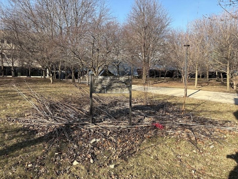
On Narragansett Avenue south of Montrose Avenue. Reported unreadable.
The garden in front of you includes representative species of plants that once thrived in the Chicago [unreadable, likely "area before"] settlement began. [A few unreadable words] histories of Chicago that describe plants like these as far as the . . . — — Map (db m267935) HM
On West Jackson Boulevard at South Albany Avenue, on the left when traveling west on West Jackson Boulevard.
Erected in honor of
Our Sorrowful Mother
by
the Novenites of Chicago
The first Novena devotion
was held here on
January 8, 1937
Blessed on the feast of
Our Sorrowful Mother
September 20, 1942
Mother of Sorrows
pray for . . . — — Map (db m244572) HM
On North Central Park Avenue north of Lake Street, on the right when traveling south.
Originally known as Central Park, Garfield Park was conceived as the centerpiece of the West Park System in 1869, and was renamed after President James Garfield's assassination in 1881. Plans for the entire ensemble of Humboldt, Garfield, Douglas . . . — — Map (db m241108) HM
On Central Park Avenue at Lake Street on Central Park Avenue.
In 1871, William Le Baron Jenney (best known for his innovations in skyscraper technology) created a master plan for the city's West Park District, consisting of three parks and connecting boulevards. In what would later become Garfield Park, he . . . — — Map (db m241133) HM
On Lake Street near Central Park Avenue, on the right when traveling west.
Chicago’s Boulevards are one of the city’s most overlooked treasures, and one of the largest and oldest boulevard systems in the nation. The 28-mile system contains 540 acres of green space, and provides a link between seven inland parks and . . . — — Map (db m241131) HM
On West Walnut Street east of North Francisco Avenue, on the left when traveling east.
Commissioned by prominent real estate developer Edward Carson Waller to meet the demand for affordable housing, these apartments are considered among the earliest examples of subsidized housing in Chicago. The simplified design of the facade . . . — — Map (db m294369) HM
On West Fulton Boulevard east of Central Park Avenue.
The Wangari Maathai Natural Garden is home to plants native to Illinois. Native plants are naturally suited to survive in our soils and climate and provide multiple benefits:
They require less water than other gardens
They require no . . . — — Map (db m294370) HM
On West Fulton Boulevard east of Central Park Avenue, on the right when traveling east.
Wangari Maathai was awarded the Nobel Peace Prize in 2004 for her work to empower communities worldwide to protect the environment and to promote cultures of peace. Dr. Maathai was the first woman in East Africa to earn a PhD. She is currently a . . . — — Map (db m294371) HM
On East 53rd Street at South Shore Drive, on the right when traveling east on East 53rd Street.
Harold Washington
Politician
1922 - 1987
Harold Washington’s election in 1983 as Chicago’s first
black mayor gained national attention. He won with the
support of a “rainbow coalition” of blacks, Hispanics,
Asians, liberal . . . — — Map (db m188263) HM
On South Avenue O at East 117th Street, on the right when traveling north on South Avenue O.
Ed Blaszak, a local resident and employee of Republic Steel, designed the sculpture in 1981. His work conveys the interrelationship between the once towering steel industry, seen here in the 6 tall bars, and the people of Chicago's Southeast side, . . . — — Map (db m305968) HM
On South Avenue G at South Crilly Drive on South Avenue G.
This cast-concrete park fieldhouse is an excellent example of the Classical Revival architectural style and is comprised of a large central pavilion, flanked by two gymnasium wings. Its design elements feature eyebrow dormers, large-scale . . . — — Map (db m252550) HM
On South Indianapolis Avenue (U.S. 41) at South Ewing Avenue on South Indianapolis Avenue.
M-60 Main Battle Tank
54 ton 105 MM. gun. 50 cal. machine gun.
750 HP diesel engine. 4 man crew.
This type used in "Desert Storm" 1991
A memorial to all of the men and women from
the East Side neighborhood who answered
our country's . . . — — Map (db m237905) WM
This Illinois - Indiana state boundary marker is one of the oldest landmarks in the Chicagoland area. It was constructed in 1838 under the direction of the United States Surveyor General to commemorate the establishment of the common boundary . . . — — Map (db m237902) HM
On South Avenue O near East 117th Street, on the right when traveling north.
In memory of
Hilding Anderson •
Alfred Causey •
Leo Francisco •
Earl Handley •
Otis Jones •
Sam Popovich •
Kenneth W. Reed •
Anthony Tagliori •
Lee Tisdale •
Joseph Rothmund
Martyrs—Heroes—Unionists
Shot down May 30, . . . — — Map (db m305958) HM
On South Avenue O at East 117th Street, on the right when traveling north on South Avenue O.
In memory of
Hilding Anderson •
Alfred Causey •
Leo Francisco •
Earl Handley •
Otis Jones •
Sam Popovich •
Kenneth W. Reed •
Anthony Tagliori •
Lee Tisdale •
Joseph Rothmund
Martyrs—Heroes—Unionists
Shot down May . . . — — Map (db m305964) HM
On East 117th Street near South Avenue O, on the right when traveling west.
This area, which was prairie land in 1937, was the site of the Memorial Day Massacre on May 30, 1937. On that day, about 1500 striking steelworkers, their families, and supporters marched near the entrance of Republic Steel at 118th and Burley . . . — — Map (db m305977) HM
On South Avenue O at East 117th Street, on the right when traveling north on South Avenue O.
Long hours, low wages, and unfair policies prevailed as the Steel Workers Organizing Committee, or SWOC, reached out to workers in 1936. While US Steel, the industry giant, signed a contract with SWOC in March 1937, other smaller companies or . . . — — Map (db m305972) HM
On North Sheridan Road 0.1 miles north of Rosemont Avenue.
This Prairie-style house was designed by one of the finest progressive Chicago architects of the early 20th century and is one of the finest remaining mansions on North Sheridan Road. Roughly rectangular in form, the house has both foliate and . . . — — Map (db m287281) HM
Erected by the citizens of Edison Park in honor of our boys who served in the Army and Navy of the USA during the World War.
Edison Park Honor Roll World War
(Names not transcribed) — — Map (db m115976) WM
When it opened in 1930, this Art Deco-style bank building projected a stylish image to what was one of the busiest commercial districts in Chicago. Characteristics of the Art Deco include the building's sleek limestone façade, geometric ornament, . . . — — Map (db m314337) HM
On South Harvard Avenue at West Marquette Road, on the left when traveling south on South Harvard Avenue.
This light-brown brick church, built as the Fourth Church of Christ, Scientist, is an architecturally significant religious building designed in the Classical Revival style. It was designed by one of Chicago's most significant late 19th-century . . . — — Map (db m314343) HM
On South Stewart Avenue north of West Normal Parkway, on the right when traveling south.
This handsome church is a Gothic Revival-style building clad in yellow-hued Joliet limestone with handsome exterior detailing including its steeply-pitched, cross-gable root and pointed-arch windows and doors, and a distinctive interior with an . . . — — Map (db m314338) HM
On South Yale Avenue at West 66th Avenue on South Yale Avenue.
This building, an excellent "first-generation" tall apartment building, is designed in the Richardsonian Romanesque style with Classical-style details. It has a rare enclosed interior atrium, topped by a glass-and-iron skylight, off of which open . . . — — Map (db m314341) HM
Near North Forest Glen Avenue south of North Latham Avenue, on the right when traveling north.
This vernacular carpenter-builder house is one of the oldest-surviving buildings in the Forest Glen neighborhood. It has Queen Anne-style wood details typical of the carpenter guides popular at the time and is remarkably intact. It was built by . . . — — Map (db m248200) HM
On North Mandell Avenue east of North McClellan Avenue, on the right when traveling east.
Welcome to Mary Berkemeier Quinn Park-of-Trees. This scenic grove of native trees was a gift to the Chicago Park District from Edward M. Quinn — whose house and garage formerly stood here — in memory of his wife, Mary. He instructed in his Will that . . . — — Map (db m242958) HM
On North Prescott Avenue at North Livermore Avenue, on the right when traveling west on North Prescott Avenue.
This distinctive example of a railroad suburb, platted in 1894, was built near the Chicago, Milwaukee & St. Paul Railroad, and many early residents were company officials. — — Map (db m242955) HM
On Noth Kilbourn Avenue at North Rodgers Avenue, on the right when traveling south on Noth Kilbourn Avenue.
The tree which stood here until 1933, marked the Northern Boundary of the Fort Dearborn Reservation, the trail to Lake Geneva, the center of Billy Caldwell’s (Chief Sauganash) Reservation, and the site of the Indian Treaty of 1835. — — Map (db m55577) HM
On Peterson Avenue (U.S. 14) at Forest Glen Avenue, on the right when traveling west on Peterson Avenue.
Dedicated to the
men and women of Sauganash
who served their country in
1941 •World War II • 1945
[Honor Roll of Veterans]
[Died in Service]
Lemuel Day • J. Donald Gibe
John T. Hartney • Elmer Julius
Charles Kulieke • Theodore . . . — — Map (db m94318) HM
On North Elston Avenue at North La Crosse Avenue, on the right when traveling north on North Elston Avenue.
This memorial spire and cross is erected to the Glory of God in salutary tribute to the memory of our founders and to all who have dedicated themselves to the mission of this church upon its 75th anniversary.
On October 8, 1893, our pioneer . . . — — Map (db m136423) HM
On Shakespeare Street east of Newland Avenue, on the right.
The image depicts a plan for Rutherford Sayre Park that renowned landscape architect, Jens Jensen, created in 1909. Jensen, who was born in Denmark, immigrated to the United States in 1884 and found his way to Chicago to work for what was then known . . . — — Map (db m265218) HM
Near Shakespeare Avenue north of New England Avenue, on the right when traveling west.
Prairie:
Prairies once covered much of Illinois, but very few original prairies remain today. Prairies are dominated by grasses and wildflowers, with few trees. Hundreds of species of native flora have been observed in Illinois prairies, . . . — — Map (db m265217) HM
On Shakespeare Avenue north of New England Avenue, on the right.
These native plants aren't just pretty to look at. They actually reduce flooding naturally by soaking up rainwater! They also reduce runoff, which can enter the sewer system and contribute to basement back-ups and sewer overflows to our rivers.
. . . — — Map (db m265214) HM
Welcome to Rutherford Sayre Natural Area. The process of converting these four acres of the park from turf grass to native habitat began in 2019. This transformation is not only providing food and shelter for pollinators like birds, butterflies, and . . . — — Map (db m265224) HM
On Oak Park Avenue north of Shakespeare Avenue, on the right when traveling south.
Welcome to Rutherford Sayre Natural Area. The process of converting these four acres of the park from turf grass to native habitat began in 2019. This transformation is not only providing food and shelter for pollinators like birds, butterflies, and . . . — — Map (db m265225) HM
On Shakespeare Avenue near New England Avenue, on the right.
Welcome to Rutherford Sayre Nature Garden and Natural Area. This is a special section of the larger Rutherford Sayre Park that showcases native plants of the Chicago region. A wrought-iron fence frames the Nature Garden, where native plants have . . . — — Map (db m265213) HM
On West Armitage Avenue east of North Nordica Avenue, on the right when traveling west.
The genesis of the house is perhaps unlike any other in Chicago for it was built as a grand prize for a raffle sponsored by the St. William Catholic parish located nearby. The name Miracle House first appeared on the raffle tickets, and it has . . . — — Map (db m268952) HM
On South Hamlin Boulevard north of West Washington Boulevard, on the left when traveling south.
[East-facing side:]
A tribute
to those of the
132nd Infantry
(2nd Ill.)
who gave their lives
in the service
of our country
[North-facing side:]
Organized Dec. 21, 1875
Service
War with Spain
(Cuban occupation) . . . — — Map (db m243644) WM
Near Lake Street west of Central Park Avenue, on the right.
The name says it all... The City Garden integrates city, through and through. Urban hardy plantings, garden "communities" that meld easily one to the next, recycled bits of cityscape — this is a garden that has urban greening at its core. Its . . . — — Map (db m263819) HM
On North Central Park Avenue north of Lake Street.
Corn: The Heart of Many Cultures
Corn is one of the oldest and most important crops in the Amréicas. Native peoples, especially in what is now Mexico and Central América, first grew corn over 7,000 years ago. They saw it as a sacred gift from . . . — — Map (db m294374) HM
On West Warren Boulevard east of North Kedzie Avenue, on the right when traveling east.
Finley Peter Dunne
Journalist
1867 - 1936
One of the most memorable characters in
Chicago literature is Martin Dooley, the
loquacious and opinionated Irish immigrant
who tended bar along Archer Avenue in
the Bridgeport . . . — — Map (db m188239) HM
On South Hamlin Boulevard at West Madison Street, on the right when traveling north on South Hamlin Boulevard.
Originally known as Central Park, Garfield Park was conceived as the centerpiece of the West Park System in 1869, and was renamed after President James Garfield's assassination in 1881. Plans for the entire ensemble of Humboldt, Garfield, Douglas . . . — — Map (db m243680) HM
On North Hamlin Avenue south of West Lake Street, on the right when traveling north.
Originally known as Central Park, Garfield Park was conceived as the centerpiece of the West Park System in 1869, and was renamed after President James Garfield's assassination in 1881. Plans for the entire ensemble of Humboldt, Garfield, Douglas . . . — — Map (db m243684) HM
On West Congress Parkway at Independence Boulevard, on the right when traveling west on West Congress Parkway.
In 1871, William Le Baron Jenney (best known for his innovations in skyscraper technology) created a master plan for the city's West Park District, consisting of three parks and connecting boulevards. In what would later become Garfield Park, he . . . — — Map (db m244569) HM
On South Central Park Boulevard at West Jackson Boulevard on South Central Park Boulevard.
Originally known as Central Park, Garfield Park was conceived as the centerpiece of the West Park System in 1869, and was renamed after President James Garfield's assassination in 1881. Plans for the entire ensemble of Humboldt, Garfield, Douglas . . . — — Map (db m244575) HM
On West Madison Street at Homan Avenue, on the right when traveling west on West Madison Street.
Originally known as Central Park, Garfield Park was conceived as the centerpiece of the West Park System in 1869, and was renamed after President James Garfield's assassination in 1881. Plans for the entire ensemble of Humboldt, Garfield, Douglas . . . — — Map (db m244582) HM
On South Central Park Boulevard near Madison Street, on the right when traveling north.
Originally known as Central Park, Garfield Park was conceived as the centerpiece of the West Park System in 1869, and was renamed after President James Garfield's assassination in 1881. Plans for the entire ensemble of Humboldt, Garfield, Douglas . . . — — Map (db m244584) HM
On West Lake Street west of North Homan Avenue, on the left when traveling west.
Originally known as Central Park, Garfield Park was conceived as the centerpiece of the West Park System in 1869, and was renamed after President James Garfield's assassination in 1881. Plans for the entire ensemble of Humboldt, Garfield, Douglas . . . — — Map (db m244586) HM
The water lilies in this water garden are native to the sub-tropical and tropical habitats in Africa, Asia, and the Americas.
This pride and joy of the water garden contains amazing variety. We have lilies in an array of gem-like . . . — — Map (db m263826) HM
On North Central Park Avenue 0.1 miles north of West Washington Boulevard, on the left when traveling north.
The Garfield Park Fieldhouse, constructed in 1928 as the West Park Commission administrative headquarters, is one of the most lavish buildings on Chicago's west side. Designed by architects Michaelsen & Rognstad this "Gold Dome Building" has a 23 . . . — — Map (db m243639) HM
On North Central Park Avenue 0.1 miles south of West Washington Boulevard, on the right when traveling south.
Built to serve as the headquarters of the West Park Commission, this building was converted into a fieldhouse with the formation of the Chicago Park District in 1934. It is a fine example of Spanish Baroque Revival style of architecture, with its . . . — — Map (db m313746) HM
Near North Central Park Avenue 0.2 miles north of West Washington Boulevard, on the left when traveling north.
Butterflies, birds, fish, and other wildlife find food and shelter at Garfield Park Natural Area. People find fresh air and explore nature throughout the seasons. Stroll along the paths to enjoy the scenic and natural areas of Garfield Park. . . . — — Map (db m243681) HM
On Schraeder Drive west of North Central Park Avenue, on the right when traveling east.
Butterflies, birds, fish, and other wildlife find food and shelter at Garfield Park Natural Area. People find fresh air and explore nature throughout the seasons. Stroll along the paths to enjoy the scenic and natural areas of Garfield Park. . . . — — Map (db m243682) HM
On North McCrea Drive north of West Washington Boulevard, on the right when traveling north.
Butterflies, birds, fish, and other wildlife find food and shelter at Garfield Park Natural Area. People find fresh air and explore nature throughout the seasons. Stroll along the paths to enjoy the scenic and natural areas of Garfield Park. . . . — — Map (db m243683) HM
On Central Park Avenue north of Washington Boulevard, on the right when traveling north.
Butterflies, birds, fish, and other wildlife find food and shelter at Garfield Park Natural Area. People find fresh air and explore nature throughout the seasons. Stroll along the paths to enjoy the scenic and natural areas of Garfield Park.
. . . — — Map (db m265926) HM
On West Washington Boulevard at North Kostner Avenue, on the right when traveling west on West Washington Boulevard.
George Halas
Football Coach
1895-1983
For half a century, George “Papa Bear” Halas was
synonymous with the Chicago Bears. Founder of
the football team, he was the team’s coach for 40
years and general manager for an additional . . . — — Map (db m188238) HM
On Central Park Avenue 0.1 miles north of Washington Boulevard, on the right.
Prairies
Prairies once covered most of Illinois. Their deep and expansive root systems stabilize the soil, absorb water, and allow them to survive fire, drought, and cold winters. Only 0.01% of the original prairie remains. Prairie plantings . . . — — Map (db m265930) HM
On Schraeder Drive 0.1 miles west of Central Park Avenue, on the left when traveling west.
Prairies
Prairies once covered most of Illinois. Their deep and expansive root systems stabilize the soil, absorb water, and allow them to survive fire, drought, and cold winters. Only 0.01% of the original prairie remains. Prairie plantings . . . — — Map (db m265932) HM
Near North Central Park Avenue north of Lake Street, on the right when traveling south.
Okra is not just a vegetable-it's a plant with a strong history.
It first grew in West Africa and came to América with enslaved Africans. Some people carried okra seeds in their hair or clothes to keep part of their culture with them.
In the . . . — — Map (db m294373) HM
On Washington Boulevard 0.2 miles east of Hamlin Street, on the right when traveling west.
The Talking Trees Project recognizes three community leaders in Garfield Park. Listen to their heartfelt stories about their strong connections to the park and their contributions to the community.
Rev. Donald McFadden
Rev. Donald . . . — — Map (db m265922) HM
On Central Park Avenue 0.1 miles north of Washington Boulevard, on the right when traveling south.
The Talking Trees Project recognizes three community leaders in Garfield Park. Listen to their heartfelt stories about their strong connections to the park and their contributions to the community.
Jim Hobson
After 31 years, Jim Hobson . . . — — Map (db m265927) HM
On West Congress Parkway at South Independence Boulevard, on the right when traveling west on West Congress Parkway.
Chicago’s Boulevards are one of the city’s most overlooked treasures, and one of the largest and oldest boulevard systems in the nation. The 28-mile system contains 540 acres of green space, and provides a link between seven inland parks and . . . — — Map (db m244568) HM
On 55th Street at Archer Avenue, on the left when traveling east on 55th Street.
[Text of primary memorial:]
We, the citizens of Clearing, dedicate this memorial to the members of this land of liberty that fought and gave their lives in Viet Nam defending our way of life - the American way
On West Division Street, on the left when traveling east.
During the 1960's Chicago's 'Barmaids Ordinance'
prohibited women, unrelated to the owner,
from tending bar in Chicago.
In 1970, the owners of this
establishment hired airline
Stewardesses to tend bar in
defiance of City Ordinance. . . . — — Map (db m180591) HM
On Cedar Street 0.1 miles west of North Lake Shore Drive, on the right when traveling east.
49 East Cedar Street
C. 1909
Designed and owned by Benjamin Marshall, architect
has been listed on the
Illinois Register of Historic Places
by the Illinois Historic Preservation Agency — — Map (db m267058) HM
The clarity, simplicity, and order of the Madlener House make it an outstanding residence in the tradition of the Chicago and Prairie schools of architecture. It has the massing, logic, and dignity of a Renaissance palace, yet is a thoroughly modern . . . — — Map (db m261352) HM
On North Lake Shore Drive at Banks Street, on the left when traveling north on North Lake Shore Drive.
The 1870 marriage of Bertha Honore and Potter Palmer united two of the wealthiest and most influential families of 19th century Chicago. Both were strong-willed individualists who used their economic power and social positions to carry out their . . . — — Map (db m188620) HM
On East Bellevue Place east of North State Street, on the left when traveling east.
Bryan Lathrop House
McKim, Mead and White, architects
1892
Drawing inspiration from the neo-classical styles of
the eighteenth century, Charles Follen McKim here
created a residence of great dignity and elegance.
The clarity and . . . — — Map (db m180726) HM
On North Avenue at North Dearborn Street, on the right when traveling west on North Avenue.
Chicago's early Catholic Cemetery ran from North Av. south to Schiller St., and Dearborn St. to the lake, now Astor St. Established in 1845, it existed until the 1871 Chicago Fire charred the grounds. Like the City Cemetery to the north, not all . . . — — Map (db m10665) HM
On N. State Parkway at Goethe Street on N. State Parkway.
A crossroads in the development of Oekology (Ecology) at the turn of the century.
Named for Dr. Frank Spooner Churchill an early pediatrician, medical inspector of Chicago's Board of Health who pioneered reforms in pure food, water, air and . . . — — Map (db m229292) HM
On North Dearborn Street north of Division Street.
Ernest Hemingway great American author and his wife, Hadley, lived here at 1239 North Dearborn in an apartment on the fourth floor after returning from their honeymoon in Wisconsin in Sept. 1921 — — Map (db m289952) HM
This rare Art Moderne-style design is also one of the city's best examples of pre-World War II modernism. Further distinguishing the building is its handcrafted ornamentation by prominent artist Edgar Miller. The 12 residential units front on a . . . — — Map (db m235355) HM
On North Astor Street at East Banks Street, on the right when traveling north on North Astor Street.
Irna Phillips
Script Writer
1901-1973
The "mother of the soap opera," Irna Phillips
single-handedly created a unique form of entertainment
that began on radio but reached its biggest audience
through television.
Phillips's . . . — — Map (db m188085) HM
On North Astor Street at East Schiller Street, on the right when traveling north on North Astor Street.
has been designated a
National Historic Landmark
This home, designed in 1891 by Louis Sullivan and
Frank Lloyd Wright, is an important work in the
development of modern residential architecture
and possesses national significance . . . — — Map (db m188276) HM
John Wellborn Root
Architect
1850-1891
John Wellborn Root's architectural designs
helped to establish Chicago as the
birthplace of modern architecture.
After the Great Fire of 1871, Root came
here from New York City to . . . — — Map (db m188509) HM
On North Astor Street, on the right when traveling south.
Louise DeKoven Bowen
Social Reformer
1859 - 1953
Although she lived with all the privileges of wealth,
Louise DeKoven Bowen dedicated her life to social
reform in Chicago. Her tireless efforts for the rights
of women, children, . . . — — Map (db m188525) HM
On Rush Street near Bellevue Place, on the left when traveling north.
This structure by architect Birch Burdette Long was the winning design of a competition held about 1895. Mr. Long was a member of the Frank Lloyd Wright staff and later became a nationally prominent architectural renderer. This shelter and park . . . — — Map (db m267055) HM
On East Burton Place near Astor Street, on the right when traveling west.
Originally built in 1891 for Elinor "Cissy" Patterson by architect Stanford White and late enlarged and occupied by Cyrus H. McCormick. This landmark property is now individual condominium residences. — — Map (db m132002) HM
Robert McCormick
Newspaper editor and publisher
1880 - 1955
Robert McCormick, known as “the Colonel” for his
service in World War I, served as editor and
publisher of the Chicago Tribune for 30 years. He
made the . . . — — Map (db m188582) HM
On North Dearborn Parkway north of Schiller Street.
Chester H. Walcott, architect
Bennett, Parsons & Frost
consulting architects
awarded
the Lake Shore Trust & Savings Bank's
Gold Medal
for the most beautiful remodeled building
by the jury of the Chicago chapter,
American Institute of . . . — — Map (db m242577) HM
On North Dearborn Street north of Goethe Street, on the right when traveling south.
Built to provide a safe, supportive, and economical residence for young women studying the arts, this was one of a number of structures designed for artists around the turn of the century, indicative of a growing appreciation for the arts in urban . . . — — Map (db m242449) HM
On North Dearborn Street at West Division Street, on the left when traveling north on North Dearborn Street.
This is the 1000th Walgreen Drugstore. Walgreen Co. was founded in 1901 on Chicago’s South Side by Charles L. Walgreen, Sr. A replica of the original store can be seen at the Museum of Science and Industry, Chicago, Illinois. — — Map (db m180342) HM
On Wooden Alley at N. State Parkway on Wooden Alley.
Built: 1909 Restored: 2011
Listed on The National Register Of Historic Places on May 22, 2002. Located within The Astor Street Chicago Landmark District, designated on December 19, 1975
This alley stretching between N. Astor and N. State . . . — — Map (db m132068) HM
Near 134th Place at St. Lawrence Avenue, on the right when traveling east.
Although Illinois was established as a "free" state in 1818, federal laws that had been enacted since 1793 permitted the recapture and return of runaway enslaved people within U.S. territory. Beginning in the 1830s, freedom seekers were . . . — — Map (db m261062) HM
On 134th Place at St. Lawrence Avenue, on the right when traveling east on 134th Place.
From the 1830s until the Civil War, many enslaved African descendants in the South escaped to Chicago on their way to freedom in Canada. Black and white abolitionists in the region were part of the networks of assistance known as the Underground . . . — — Map (db m261050) HM
On 134th Place at St. Lawrence Avenue, on the right when traveling east on 134th Place.
Prior to the Civil War, an estimated 3,000 to 4,500 African descendants traveled to the Chicago region to escape slavery in the South. Responding to their journeys, Black and White abolitionists in Chicago and across the region formed . . . — — Map (db m261052) HM
On North Avenue (Illinois Route 64) 0.1 miles west of Kingsbury Street, on the right when traveling east.
• Asymmetrical "bob-tail" style swing-span bridge
• Designed by Chicago, Milwaukee & St. Paul Railway (Milwaukee Road)
• Superstructure is made from 210 tons of steel, with a 140 ton concrete counterweight
• Bridge spans 120 feet over the . . . — — Map (db m261144) HM
On South Calumet Avenue north of East 42nd Street, on the right when traveling south.
The people of West Africa used Adinkra symbols to adorn cloth which African royals wore to important ceremonies. Originating from the Gyaman people of Ghana and la Côte d'Ivoire, the symbols have assumed global importance and are now found in logos, . . . — — Map (db m312353) HM
On South Martin Luther King Jr Drive at East 41st Street, on the right when traveling north on South Martin Luther King Jr Drive.
Bessie Coleman
Aviatrix
1892-1926
During the mid-1910s, Bessie Coleman moved from Texas to
Chicago, first working as a manicurist at the White Sox Barber
Shop and later running a chili parlor on the corner of 35th Street
and . . . — — Map (db m180888) HM
On South Vincennes Avenue near East 45th Street, on the right when traveling north.
Ebenezer Missionary Baptist Church
(Originally, Isaiah Temple)
Dankmar Adler, architect
1898-99
Built as one of Chicago's early Reform Judaism synagogues, this
Classical Revivial-style building is the last building designed by
famed . . . — — Map (db m188631) HM
On East 44th Street east of South Martin Luther King Jr Drive, on the right when traveling east.
Louis "Satchmo" Armstrong
Jazz Musician
1898 - 1971
One of the most gifted musicians in the history of jazz,
Louis Armstrong spent his most inventive years—1925
to 1929—playing the clubs of Chicago’s Black Belt,
especially the . . . — — Map (db m180936) HM
On South King Drive, on the right when traveling south.
Melissia Ann Elam Home
Henry L. Newhouse, Architect
1903
This Chateauesque mansion was purchased in the 1920s by Melissia Ann Elam, who [illegible] in Chicago. — — Map (db m181855) HM
On South Vincennes Avenue north of East 41st Street, on the right when traveling north.
Nat "King" Cole
Musician
1919 - 1965
Nat "King" Cole's warm, relaxed, velvety
voice made him a best-selling recording
star. His 1949 hit "Mona Lisa" sold more
than three million copies, and in 1956 he
became the first . . . — — Map (db m180615) HM
On South King Drive, on the right when traveling south.
Oscar DePriest
Politician
1871-1951
Shrewd, smart and street savvy, Oscar
DePriest was a natural politician. He
became Chicago’s first black alderman
and the first black congressman elected
from a northern state.
Born in . . . — — Map (db m181271) HM
3137 entries matched your criteria. Entries 401 through 500 are listed above. ⊲ Previous 100 — Next 100 ⊳