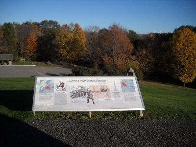
Near New York State Route 67, on the left when traveling east.
The River Crossing Travelers on the road to Bennington in 1777 crossed the Walloomsac River on a bridge where today’s bridge stands at the foot of this hill. To defend this important crossing, Baum placed his Brunswick grenadiers and a few . . . — — Map (db m36790) HM
On U.S. 20 at Gravel Road (County Route 101), on the left when traveling north on U.S. 20.
Routes of the armies of
General John Sullivan
and
General James Clinton
1779
An expedition against the hostile Indian nations which checked the aggression of the English and Indians on the frontiers of New York and Pennsylvania, . . . — — Map (db m8069) HM
On Sickels Avenue, on the left when traveling north.
Army of Northern Virginia Hill's Corps Anderson's Division Wilcox's Brigade 8th. 9th. 10th. 11th. 14th. Alabama Infantry July 2 Formed line in forenoon the 10th and 11th Regiments taking position on the right after a severe skirmish with a Union . . . — — Map (db m17369) HM
On Main Street (Vermont Route 2A) at Cobbleview Drive, on the right when traveling east on Main Street.
By 1763, the English had driven the French armies from Canada making the Champlain Valley safe for settlement. In the same year, King George III chartered Colchester Township on the Onion River - now known as the Winooski. In 1773, Ira Allen's . . . — — Map (db m86658) HM
On Main Street (U.S. 5) south of Chapel Street, on the right when traveling south.
{East side} Patriot A pioneer of strong unselfish purpose A patriot of uncompromising fidelity A soldier unstained by personal ambition A citizen ever devoted to the public good {South side} Soldier French and Indian war . . . — — Map (db m88114) HM
On N. Main Street (U.S. 7) 0.1 miles north of School Street ( Route 140), on the right when traveling north.
In this brick building, constructed by his great-grandfather in 1818, Paul P. Harris attended school as a youth and received his elementary education. Many years later, Mr. Harris expressed the conviction that it was during his boyhood in . . . — — Map (db m95454) HM
On Vermont Route 11 just east of Perley Gordon Road, on the left when traveling east.
The Eureka Schoolhouse, constructed between 1785 and 1790, is Vermont’s oldest one-room school and one of the few surviving 18th century public buildings in the state. It was originally located in the “Eureka Four Corners,” northeast of . . . — — Map (db m74965) HM
On North Airport Drive (Virginia Route 156) 0.7 miles east of Interstate 295, on the left when traveling east.
Here stood Grapevine Bridge across which, on the night of June 27, 1862, part of McClellan's Army moved in changing base from the Pamunkey to the James after the Battle of Gaines' Mill. "Stonewall" Jackson pursued, June 29. — — Map (db m15656) HM
On North Airport Drive (Virginia Route 156) 0.7 miles east of Interstate 295, on the left when traveling east.
Here Sumner crossed the river to reinforce the part of McClellan's army fighting at Fair Oaks, May 31, 1862. Here a part of Porter's force crossed in the night of June 27, 1862 after the battle of Gaines's Mill. Here Stonewall Jackson, rebuilding . . . — — Map (db m15655) HM
Capital-Montpelier
English colonists from nearby Massachusetts established the first permanent settlement in 1724. Following a dispute over the territory between New Hampshire and New York, King George III granted it to New York. New Hampshire . . . — — Map (db m97944) HM
Near Sudley Road (State Road 234), on the right when traveling north.
July 21, 1861 11:00 a.m. 2nd Brigade (Bartow) Army of the Shenandoah (Johnson), CSA 8th Georgia Infantry Lt. Col. W.M. Gardner "Away we went straight into the teeth of the murderous fire. We entered a thicket and were within 100 yards of . . . — — Map (db m9731) HM
On North Main Street at Capitol Street, on the right when traveling south on North Main Street.
Born in Londonderry N.H. Aug 28 1728 Died in Manchester N.H. May 8 1822 Erected by the State of New Hampshire A.D. 1890 Bennington Bunker Hill — — Map (db m77061) HM
In the spring of 1777 the outcome of the American Revolution was very much in question. A huge British army in Canada began to move south along the New York side of Lake Champlain as part of a plan to cut off New England from the rest of the . . . — — Map (db m307190) HM
Purchased and moved to this site in 1930 by Milton and Eva B. "Short" Seeley, these kennels produced sled dogs for exploration, racing, and showing. For almost 50 years Chinook Kennels exerted a profound influence upon the Alaskan Malamute and . . . — — Map (db m95817) HM
Near St. George Street close to St. Anthony Street, on the left when traveling west.
In commemoration of the captures of Port Royal by New England expeditions under Maj. Robert Sedgwick 1654 and Colonel Francis Nicholson 1710. In this second expedition Col. Samuel Vetch was Adjutant-General. There were 36 transports, 4 ships of 60 . . . — — Map (db m78439) HM
On Franklin Street at Pine Street, on the left when traveling north on Franklin Street.
This home was built by Samuel E. Holden in 1886. Mr. Holden was born in Concord, New Hampshire, Feb. 1845. During his youth he gained experience in the wool industry. At the time of the Civil War Holden served with the New Hampshire Volunteers. He . . . — — Map (db m237645) HM
On Turner Road 1 mile west of National Trails Highway, on the left when traveling west.
Since ancient times, indigenous peoples have used the many networks of trails in the East Mojave Desert for both seasonal migration and to carry on trade with coastal Indians. Most of these trails converged at narrow passes and safe river crossings. . . . — — Map (db m73550) HM
On Brady Road south of Mandarin Road, on the left when traveling south.
(side 1)
James Hall
Soldier of the Revolution
James Hall was born on October 8, 1760, in Keene, New Hampshire. Records of the Continental Army indicate that James Hall of Keene was mustered into service about August 20, 1776. . . . — — Map (db m171493) HM WM
On U.S. 84 near Gordon Street (State Road 15 /121), on the right when traveling west.
This County, created by Act of the Legislature December 18, 1857, is named for Franklin Pierce, New Hampshire Democrat and fourteenth President of the United States, 1853 to `57. He was a General in the Mexican War. Blackshear, incorporated . . . — — Map (db m24037) HM
America’s first teacher in space was Christa McAuliffe of New Hampshire. McCall, Idaho teacher Barbara Morgan, backup to Christa M. has accepted NASA’s offer to fly as the next teacher in space. David Marquart from Boise High School, was one of ten . . . — — Map (db m305306) HM
On East Washington Street (Illinois Route 106) 0.3 miles east of South Illinois Street, on the right when traveling east.
Michael Noyes was a native of New Hampshire and settled in Pittsfield in 1841, after having spent years in Pike County, Mo. He was the founder and editor of Pike County’s first newspaper in 1841, “The Sucker and Farmer’s Record.” He was . . . — — Map (db m128779) HM
On East Main Street (Ohio River Scenic Byway) (U.S. 421) just east of Walnut Street, on the left when traveling east.
The original weather vane which is on display in the fire house was hand crafted in John Adams’ tin shop by Peter Hoffman. He was erected in 1889 and stood watch for us until 1996, when he was damaged in a storm and placed in retirement. Well . . . — — Map (db m181499) HM
On Main Street (Alternate U.S. 41) north of Riddle Road, on the right when traveling north.
For Daniel Webster, 1782-1852, "Defender of the Constitution." Born in New Hampshire. Eight years United States House of Representatives, nineteen years U.S. Senate. A skilled legislator, persuasive debater, eloquent orator and constitutional . . . — — Map (db m123563) HM
Near Baxter Park Road (Maine Route 157), on the right when traveling north.
Baxter Peak – elevation- 5267 ft. Northern terminus of the Appalachian Trail A mountain footpath extending over 2000 miles to Springer Mtn. Georgia ← Thoreau Spring 1.0 m. ← Katahdin Stream Campground 5.2 . . . — — Map (db m67678) HM
On Boonsboro / Shepherdstown Pike (State Highway 34), on the right when traveling west.
U.S.A. Second Army Corps, Maj. Gen. Edwin V. Sumner, Commanding. (September 15 and 16, 1862.) Richardson's Division of the Second Corps, preceded by the 5th New Hampshire as skirmishers, led the infantry advance from South Mountain on the . . . — — Map (db m7143) HM
On Richardson Avenue, on the left when traveling east.
U.S.A. Second Army Corps. Caldwell's Brigade, Richardson's Division. Brig. General John C. Caldwell, Commanding. Organization 5th New Hampshire, 81st Pennsylvania, 7th, 61st, and 64th New York Infantry. (September 17, 1862) Caldwell's Brigade . . . — — Map (db m5539) HM
Near River Street at Salem Street, on the left when traveling south.
To the memory of revolutionary soldiers from Massachusetts and New Hampshire who lie in this burying ground in unmarked graves. Dedicated April 19, 1930 In Medford's Tercentenary year. — — Map (db m245270) HM WM
On Bunker Hill Street just west of Polk St, on the right when traveling west.
Established in 1810, this is Charlestown's second oldest burying ground, and the site of the left wing of Colonial forces at the Battle of Bunker Hill in 1775. A monument marks the location of the Rail Fence and Stone Wall fortified by the . . . — — Map (db m282110) HM
On West Mansion Street, on the right when traveling west.
On this foundation stood the log house of the Reverend John D. Pierce. Born in New Hampshire, Pierce moved to Marshall in 1831, where he founded the Congregational church. In 1834 he and Isaac Crary designed Michigan's school system, and from 1836 . . . — — Map (db m28394) HM
Near Daniel Webster Highway (U.S. 3) 1 mile south of US-Canadian Border Station, on the right when traveling south.
THE INDIAN STREAM REPUBLIC
Borders have always aroused intrigue and fascination. Behind closed doors are whispered well-kept secrets, and forgotten stories as well. The Indian Stream Republic is one of those stories.
The signing of the . . . — — Map (db m156549) HM
Near Glessner Road at Main Street (U.S. 302), in the median.
Here at the Rocks, her family's summer estate, this Chicago heiress pursued her passion for criminology in the 1940s-50s with the creation of 20 miniature dioramas depicting actual crime scenes with detailed accuracy. Called the Nutshell Studies of . . . — — Map (db m155120) HM
The "Poetry and Nature Trail" at The Frost Place was begun in 1997. When Frost lived here almost all the land was meadow, but it has experienced dramatic change over the years. Like much of the surrounding farmland, it was allowed to revert back . . . — — Map (db m280509) HM
On Emmerson Road east of New Hampshire Route 13, on the left when traveling east.
These two Revolutionary soldiers were settlers near here in the town of Monson (afterward Amherst, now Milford). Captain Crosby served with distinction at Bunker Hill and marched in defense of Ticonderoga in 1777 and of Rhode Island in 1778. He . . . — — Map (db m161187) HM
On River Street (New Hampshire Route 13) south of Howe Bridge Road, on the right when traveling south.
In Honor of the Memory of Ronald Charles Davis of New Boston who, as a Sergeant in Company B of the 8th Infantry Regiment, Gave His Life in the Honorable Service of His Country in Vietnam on January 23, 1970. This 3.3 Mile Section of New Hampshire . . . — — Map (db m235094) HM
On Deerfield Road at Depot Road, on the left when traveling east on Deerfield Road.
This plantation commemorates the Golden Jubilee Anniversary National Society Daughters of The American Revolution Established by the mutual efforts of The National Park Service, State Forestry and Recreation Department and the New Hampshire Society . . . — — Map (db m236163) HM
On Front Street, on the right when traveling north.
Founded by Rev. John Wheelwright in 1638, Exeter was one of the four original towns in the colony. Following New Hampshire’s provisional declaration of independence on January 5, 1776, it served as the capital of the new state during the period of . . . — — Map (db m75244) HM
On Daniel Street, on the right when traveling west.
Photo 1 The memorial bridge was constructed between 1920 and 1923 and demolished in 2012. It was the second bridge built across the fast and deep waters of Portsmouth Harbor. The 1923 bridge was the first vertical lift bridge constructed . . . — — Map (db m97036) HM
On Main Street (New Hampshire Route 12) at Depot Road, on the left when traveling north on Main Street.
South Panel 1861 In Memoriam 1865 Lists names Abbott to Kelly North Panel 1861 In Memoriam 1865 Lists names Keen to Way West Panel Honor Roll 1917-1919 Dedicated to the men of Charlestown New Hampshire who . . . — — Map (db m66283) WM
On Court Street at Moore Street, on the right when traveling west on Court Street.
In memory of the Honorable Brigadier Gen. Enoch Poor of the State of New Hampshire who departed this life on the 8 day of Sept. 1780 aged 44 Years.---------------Washington, Lafayette and a portion of the American army attended the burial of Gen. . . . — — Map (db m62951) HM
Near Jockey Hollow Road, on the left when traveling south.
John Stark, a New Hampshire frontiersman, fought at Bunker Hill, Trenton, and Princeton. His brigade of New Englanders defeated part of Burgoyne’s army at Bennington, the first of a series of blows which ended when Burgoyne surrendered at Saratoga . . . — — Map (db m25565) HM
On Clemmons Road (U.S. 158) 0.1 miles west of Lewisville Clemmons Road, on the left when traveling west.
A nine passenger Concord stagecoach built in 1872 for Edwin T. Clemmons by the Abbot-Downing Co. of Concord, New Hampshire. Named for his wife Harriet (Hattie) Butner. A gift to the people of Clemmons by the Wachovia Historical Society in 1993 and . . . — — Map (db m54285) HM
On Orange Street east of South 3rd Street (Business U.S. 17), on the right when traveling east.
Federal style house built for Richard Langdon (1753-1810), native of New Hampshire, merchant; and wife, Jane Dunbibin Ward. In 1812, the widow Jane married Samuel Russell Jocelyn (1764-1816), native of Connecticut, attorney. Purchased in 1829, by . . . — — Map (db m262773) HM
On East 3rd Street at Main Street, on the left when traveling west on East 3rd Street.
Salmon Portland Chase, a renowned lawyer and statesman, was born in Cornish, New Hampshire, on January 13, 1808. He came to Ohio in 1820 and attended Cincinnati College (1822-23). Chase returned to New Hampshire and graduated from Dartmouth . . . — — Map (db m24621) HM
On South Main Street (State Highway 199), on the right when traveling north.
In Sullivan's Expedition, the march that destroyed savagery and opened the Keystone and Empire States to civilization, four brigades furnished by the states of Pennsylvania, New York, New Jersey and New Hampshire, with Proctor's Artillery and Parr's . . . — — Map (db m33146) HM
On Curwensville Tyrone Highway (Pennsylvania Route 453) 0.1 miles west of Kellytown Road, on the right when traveling west.
On December 13, 1864, Co. C 16th VRC of the Union Army surrounded the Barnett log house at this site and requested the surrender of deserters and draft dodgers. Deserter Tom Adams fired and killed Union Soldier Edgar Reed of New Hampshire. Adams was . . . — — Map (db m107906) HM
On South 6th Street south of Market Street, on the right when traveling south.
Judge (c.1773-1848) was brought to Phila. in 1790 as the enslaved house servant of First Lady Martha Washington. She escaped from the President's House on May 21, 1796, to New Hampshire with the assistance of the city's African American community. . . . — — Map (db m265277) HM
Near Market Street (County Road 2004) just east of South 6th Street, on the right when traveling east. Reported permanently removed.
Still a fugitive in her seventies, Ona Judge Staines (earlier called Oney Judge) tells the story of her enslavement in the President's House and her escape to freedom, in 1796, to New Hampshire, where she married John Staines and had three children. — — Map (db m146654) HM
On Taft Street, on the right when traveling north.
Coventry High School and the National Student Council honor Maj. Gen. Nathanael Greene Rhode Island Delaware New Hampshire Maryland Massachusetts Virginia New York North Carolina Connecticut . . . — — Map (db m83411) HM
On North Roane Street (U.S. 27) at Walden Avenue, on the right when traveling north on North Roane Street.
Incorporated in 1891, this was to be an ideal industrial city, an object lesson for thrift, sobriety, superior intelligence and exalted moral character, where workers would be uncorrupted by Demon Rum. Named for Union General Walter Harriman, former . . . — — Map (db m150308) HM
On Vermont Route 125 just west of Frost Road, on the left when traveling east.
A distinguished American poet by recognition and a Vermonter by preference, Robert Frost was Poet Laureate of Vermont and for many years “First Citizen” of the Town of Ripton. He was long associated with the Middlebury College School of . . . — — Map (db m37171) HM
On Monument Circle at Monument Avenue, on the left when traveling east on Monument Circle.
Seth Warner came to Bennington in 1763, followed later by his cousins Ethan Allen and Remember Baker in an area known as the New Hampshire grants. In 1770, as the leaders of the Green Mountain Boys, the men joined forces against the threat of New . . . — — Map (db m303968) HM
On Monument Hill Road, on the left when traveling north.
Here on July 7, 1777 a successful rearguard action by Colonel Seth Warner’s Vermont, Massachusetts, and New Hampshire troops ended British pursuit under Generals Frazer and Reldesel. Thus, General St. Claire’s American army, retreating from Fort . . . — — Map (db m74470) HM
On Vermont Route 5, on the right when traveling north.
Northward stood the Cumberland County Courthouse, seat of New York's colonial administration. Opposition to holding a court session led to the "Massacre" of March 13, 1775. Here the New Hampshire Grants on Jan. 16, 1777, declared their independence . . . — — Map (db m94378) HM
Near Anderson-Wright Drive 0.4 miles north of Cold Harbor Road (Virginia Route 156), on the left when traveling south.
You are standing among entrenchments built by soldiers of the Union Eighteenth Corps less than ¼ mile from the front lines. At Cold Harbor regiments typically rotated out of the front lines every other day. This explains the many layers of reserve . . . — — Map (db m16522) HM
On New York Avenue at Lee Highway (U.S. 29), on the right when traveling south on New York Avenue.
August 29 & 30, 1862 Federal Artillery Position A succession of Union artillery batteries occupied this ridge throughout August 29 and 30, 1862. August 29 Company I, 1st Ohio Light Artillery Capt. Hubert Dilger (9-11 a.m.) 2nd Battery, New . . . — — Map (db m9855) HM
On Historical Tour Drive 0.9 miles west of Surrender Road (Virginia Route 634), on the left when traveling west.
Supplying the American Army was always critical. At Yorktown Colonel Timothy Pickering of Massachusetts, seconded by a man of his own choice, Lieutenant Colonel Henry Dearborn of New Hampshire, held the responsibility for Washington’s Quartermaster . . . — — Map (db m11120) HM
This 1991 Chance Rides Sea Dragon was purchased from New Hampshire based Fiesta Shows in 2013. The Sea Dragon is the first major project completed through the partnership between the Green Bay Parks, Recreation & Forestry Department and The Friends . . . — — Map (db m254337) HM
On Wauwatosa Avenue (State Highway 181) at Rogers Avenue, on the right when traveling south on Wauwatosa Avenue.
In 1844, Oliver Damon, wheelwright and cabinet-maker, migrated from New Hampshire to what is now Wauwatosa. He and his son-in-law, Jonathan Warren, built this house using oak and black walnut from land he purchased in 1841. In 1846 Damon’s son, . . . — — Map (db m93500) HM
On Highway 49 (Main Street) at Bridge Street, on the left when traveling north on Highway 49 (Main Street). Reported permanently removed.
This building, perhaps originally a livery stable, was the armory for the Coloma Greys, a local volunteer militia company. After the Greys disbanded in 1862, the building was used as a carriage house by Elias Weller, who lived in the large white . . . — — Map (db m17222) HM
A Brief History of Riverside, Illinois
1. In 1828, The Lawton brothers, David and Bernardus (Barney), came to the area and established an outpost. They chose the area for its proximity to the Chicago Portage and one of the busiest land trails . . . — — Map (db m233530) HM
On Main Street (U.S. 3) just south of Mechanic Street, on the right when traveling north.
Visit the communities of the Great North Woods to experience the history, natural beauty, and cultural heritage of this extraordinarily diverse and complex region.
Easily-cultivated and stone-free soils alongside the . . . — — Map (db m289864) HM
On Stark Highway South (New Hampshire Route 13) at Route 77, on the right when traveling south on Stark Highway South.
Built by her father, Capt. Caleb Page, c. 1759,
this was Molly Page's home in her youth and
as the wife of Gen. John Stark. Their first
son, Caleb, who served with his illustrious
father during the Revolution, was born here,
as was Molly's . . . — — Map (db m130082) HM
On West Main Street, on the right when traveling north.
Distinguished participant in the founding of the Republic as signer of the Declaration of Independence and Articles of Confederation, and prominent in this State as Chief Justice of two courts and first holder of the title of Governor. An innovator . . . — — Map (db m75245) HM
While his father Capt. John Porter, U.S.N.
Commanded the Portsmouth Navy Yard.
Graduated West Point, July 1845
Distinguished himself and was wounded in War with Mexico
1846-1847.
Instructor of Artillery and Cavalry
West Point . . . — — Map (db m94764) HM
Near Freehold Road (County Route 522), on the left when traveling east.
As the enemy withdrew their artillery and began withdrawing their infantry, Commander-in-Chief George Washington began a cautious offensive designed to boost American morale without risking the destruction of the Continental Army. First, . . . — — Map (db m14406) HM
Near River Road (U.S. 3) 1.3 miles north of West Road, on the left when traveling north.
Northeast corner of Vermont is a point at low water mark on the West side of the Connecticut River in Lat. 45 00’ 49.20” Long.
71 27’ 57.48” N 89 40’ E. 314 feet from center of this marker. — — Map (db m288421) HM
On Central Avenue (New Hampshire Route 9) south of First Street, on the right when traveling south.
Dover’s early settlers lived in relative peace with the local Pennacook tribe, learning hunting, fishing, and farming skills from the natives in the early 17th century. Passaconaway, highly respected leader of the Pennacook Confederacy, forged . . . — — Map (db m152213) HM
On Arlington Road west of Rogero Road, on the right when traveling west.
Captain Frederick W. Bruce, for whom Bruce Park is named, was born in New Hampshire in 1856. In 1869 young Bruce was sent to live with his uncle Elisha Bruce in St. Augustine, Florida, but that same year, at age 13, ran away to sea, an adventure . . . — — Map (db m93090) HM
Near South Washington Street south of West Hillside Road, on the right when traveling south.
John Dudley was born February 25, 1758 in Old Saybrook, Connecticut. In 1776 at the age of 18, he enlisted in the New Hampshire militia and served at Fort Ticonderoga in Colonel Reed's Regiment. There Dudley and the rest of the American troops . . . — — Map (db m230990) HM WM
Welcome to part of the Wabanaki homeland, Wabanakis—the People of the Dawnland—are the Indigenous peoples of northern New England and southeastern Canada. The four federally recognized peoples in Maine are the Penobscots, . . . — — Map (db m185980) HM
On Cambria Road, on the right when traveling north.
The people honored here are members of an American pioneering family.
This brief history is their story.
In 1628, young John Leavitt, newly arrived in America, became a settler at Hingham, Massachusetts. Two wives, Mary Lovett and Sarah . . . — — Map (db m204002) HM
The Appalachian Range stretches from the Canadian Border to the edge of the Mississippi, a distance of 3,000 miles. Today, a hiking trail follows the backbone of this range from Springer Mountain, Georgia to Mt. Katahdin, Maine: passing through 14 . . . — — Map (db m106091) HM
On Main Street at Lempster Mountain Road, on the left when traveling north on Main Street.
In 1776 Washington, New Hampshire, became the first town in the nation to be incorporated under the name of General Washington.
In the early 19th century two major turnpikes joined near the site of this wayside park: Second New Hampshire . . . — — Map (db m230400) HM
On Beulah Church Road (Virginia Route 633) at Glenharbor Lane, on the left when traveling north on Beulah Church Road.
General John H. Martindale’s division of the 18th Corps deployed on this ground prior to its participation in the Federal attack on the morning of June 3, 1864. At 4:30 a.m., the roughly 3,400 men of the division advanced toward strong Confederate . . . — — Map (db m90841) HM
Dave Hilton was born at York hospital, the son of Janet and Alva Hilton. Dave’s father was a firefighter/mechanic for the Ogunquit Fire Department and was from Moody, Maine. His mother grew up in Cape Neddick where her parents ran a country . . . — — Map (db m266230) HM
Near Crawford Notch Road (U.S. 302) 0.3 miles south of Mt. Clinton Road, on the right when traveling south.
Has been entered in the
National Register of Historic Places
by the United States Department of the Interior
Restoration of the Crawford Depot has been assisted with
a Federal Historic Preservation Fund matching grant
from the . . . — — Map (db m116631) HM
On Main Street at Pleasant Street, on the right when traveling west on Main Street.
The Jax Jr. had two distinguished predecessors at this location.
The first was the Premier Theater which John B. “Jack” Eames, “The Dean of New England Motion Picture Exhibitors,” purchased in 1920.
It was destroyed by . . . — — Map (db m116262) HM
On Gideon Road (County Road 3) 0.1 kilometers north of Longwoods Road, on the right when traveling north.
A native of New Hampshire who had come to Niagara in 1794, Tiffany was appointed King's Printer and published the official "Upper Canada Gazette" until 1797. He was not a Loyalist and the government, concerned by his American background, forced his . . . — — Map (db m274124) HM
On South Court Street at West Main Street, on the right when traveling south on South Court Street.
Located within Daniel Pratt Historic District, this park overlooks Autauga Creek and the manufacturing complex around which this New England style village developed. Daniel Pratt founded Prattville in 1839, and patterned the town after those of his . . . — — Map (db m27958) HM
On North Eufaula Avenue (U.S. 431) 0.1 miles north of Broad Street, in the median.
Built by John Hart about 1850, the Hart House is recognized as an outstanding example of pure Greek Revival architecture. Hart (c. 1805-1863) moved from New Hampshire and became a prominent merchant and farmer. When constructed, the house was on the . . . — — Map (db m48376) HM
Near Mohegan Ave. Pkwy. north of Williams Street, on the right when traveling north.
Captain Hopley Yeaton
Portsmouth, New Hampshire
1740 — 1812
A Patriot of 1776
In the War of American Independence
Captain Yeaton was active with the
Sons Of Liberty
As an officer he served with distinction
in the Continental . . . — — Map (db m205823) HM WM
On Fort Totten Drive Northeast north of Crittenden Street Northeast, on the right when traveling north.
Earthworks of Fort Totten are visible within the wooded area 50 yards at the top of this hill. Cannon mounted at Fort Totten helped repulse a Confederate attack on Fort Stevens, July 11-12, 1864. — — Map (db m2993) HM
On Chain Bridge Road Northwest north of MacArthur Boulevard Northwest, on the right when traveling north.
Built in the autumn of 1861 and enlarged in 1862, the battery was named for Gouveneur Kemble of Cold Spring, NY, a former superintendent of the West Point Foundry. The battery, which consisted of two 100-pound Parrott guns, was designed to sweep the . . . — — Map (db m142203) HM
Near Riverplace Boulevard (State Road 13) at Flagler Avenue.
General John McIntosh (c.) 1756-1826 was born in Darien Georgia. He assisted botanist William Bartram 1773-1774, and in 1774 they explored along the St. Johns River. His activities during the Revolutionary War included serving as a captain, . . . — — Map (db m138114) HM
On South Tennessee Street (Georgia Route 293) 0.1 miles north of Brook Drive, on the right when traveling north.
Amos Tappan Akerman, born in Portsmouth, New Hampshire, graduated from Dartmouth College and moved south. While tutoring the children of US Senator and former US Attorney General John Macpherson Berrien in Savannah, Akerman studied law and became an . . . — — Map (db m171181) HM
On Faceville Highway (Georgia Route 97) at Florida Street, on the right when traveling west on Faceville Highway.
Decatur County’s first industrialist was Ira Sanborn, a native of Concord, New Hampshire. Born in 1799, Sanborn came to Apalachicola, Florida about 1830 and later resettled in Quincy, Florida where he married Susan Woodson. In 1833 they moved to . . . — — Map (db m55924) HM
On South Pike Street north of West Grand Prairie Street, on the left when traveling north.
On this site stood the home of Augustus C. French (1808-1864) when he was elected the ninth Governor of Illinois.
The early settlers in Illinois came mostly from Southern States so that French, a native of New Hampshire, was the first "Yankee" . . . — — Map (db m23318) HM
Near Jackson Street south of Seventh Street, on the right when traveling south.
After his migration to Thibodaux from Kentucky in the early 1840s, Ewing practiced medicine with one of the founders of St. John's Episcopal Church, Dr. Thomas Williams. He took over Williams's practice upon the latter's death in 1849. In 1852, . . . — — Map (db m113361) HM
On East Lockwood Street west of North New Hampshire Street, on the left when traveling west.
In 1907, Guido Alexius and his sons Alfred, Cintio and John, founded Alexius Brothers and Company; and later his son Horace joined in the business. In 1915, this landmark establishment, originally a gym, was purchased. Later in the 20th century, . . . — — Map (db m124019) HM
On North New Hampshire Street at East Boston Street (Business U.S. 190), on the right when traveling north on North New Hampshire Street.
At the turn of the 20th century, Covington was famous for its healthful, healing environment. Excursionists came by schooner and by rail to breathe the pine-scented air and drink the pure waters. To accommodate the many guests, Covington, like other . . . — — Map (db m103558) HM
Fort Foster was built at the dawn of the 20th century, in an effort to shore up coastal defenses following the Spanish-American War. Today the site provides a unique platform to appreciate Maine’s coastal beauty.
Major Gen. John G. Foster . . . — — Map (db m185012) HM
Near South Potomac Street (Maryland Route 65) just north of West Memorial Boulevard, on the right when traveling south.
A native of New Hampshire, Mrs. Hamilton served as First Lady of Maryland during her husband's term as Governor from 1880 to 1884. In concert with her daughter Julia Briscoe, she began developing the Hamilton family summer estate "Oak Hill" into a . . . — — Map (db m146013) HM
On Dunker Church Road / Old Hagerstown Pike at Smoketown Road, on the right when traveling north on Dunker Church Road / Old Hagerstown Pike.
U.S.A. Greene's Division, Twelfth Army Corps. Brig. Gen. George Greene, Commanding. (September 17, 1862.) Greene's Division having turned the enemy's right in the East Woods advanced against the Confederate infantry north and east of this point, . . . — — Map (db m6335) HM
Near Old Burnside Bridge Road, on the left when traveling east.
U.S.A. Sturgis' Division, Ninth Army Corps. Brig. Gen. Samuel G. Sturgis, Commanding. September 17, 1862. On the night of September 16th, Sturgis' Division bivouacked on the eastern slope of the ridge bordering the east bank of the Anitetam to . . . — — Map (db m6445) HM
On Memorial St 0.1 miles east of Old Main St., on the right when traveling west.
Ancestor of all the name of Nims. Settled in Deerfield 1674. Fought under Capt. Turner 1676. Bought this home lot 1692. His house burned, his wife and seven children captured or killed by Indians in 1704. This New Hampshire boulder was erected by . . . — — Map (db m141115) HM
947 entries matched your criteria. Entries 401 through 500 are listed above. ⊲ Previous 100 — Next 100 ⊳
Thin black lines indicate changes in relevance. Between each pair of lines entries are ordered geographically but all have the same relevance.
* Inflectional forms of words are their plurals, singulars, and possessives as well as gramatical tenses and similar variations.