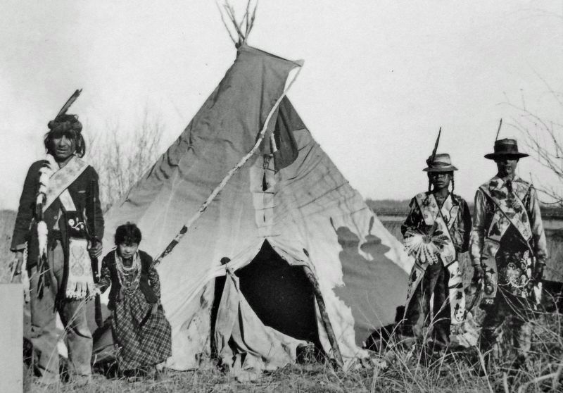
On 2nd Street South (County Road 1) just west of South Birch Avenue, on the right when traveling east.
Charles Hallock, a well-known New York naturalist and writer, referred to the area that would become the town of Hallock as "a Sportsman's Paradise." Hallock penned articles about its birds, grasses, flora, and wildlife for Harper's . . . — — Map (db m206298) HM
On 3rd Street (County Route 57) just west of Washington Avenue (King of Trails) (U.S. 75), on the right when traveling west.
Dedicated to the Men and Women of the United States of America who served in the Armed Forces to help further the cause of Freedom in the World for God and Country United States Army ☆ ☆ ☆ United States Marine Corps . . . — — Map (db m214158) WM
On 3rd Street (County Route 57) just west of Washington Avenue (King of Trails) (U.S. 75), on the right when traveling west.
The Battlefield Cross is a symbolic replacement of a cross on the battlefield or at the base camp for a soldier who has been killed. Made up of the soldier’s rifle with bayonet attached stuck into the ground, helmet on top, dog tags hanging from the . . . — — Map (db m214155) WM
Near East Johnson Avenue just east of Farm Avenue, on the right when traveling east.
Organized on Oct. 12, 1880, by 18 people as the Middle River Congregation, this church was built in 1893 and located in Alma Township. Name changed to Alma Lutheran on May 17, 1959, and the last service in this church before moving to the new one . . . — — Map (db m206299) HM
Organized on October 12, 1880, it was Marshall County's first Lutheran church and the second church formed in this county. This building was built in 1893 and was located in section 23 of Alma Township. It was used by Alma Lutheran until 1962 when a . . . — — Map (db m262779) HM
Near East Johnson Avenue just east of Farm Avenue, on the right when traveling east.
This country school was built in the 1880’s and located in Warrenton Twp. northeast of the town, Luna. The last school session was held in the spring of 1956. — — Map (db m307077) HM
On East Johnson Avenue just east of Farm Avenue, on the right when traveling east.
Mr. and Mrs. Ole G. Erickson came to Section 31 of Spruce Valley in 1885, from Wisconsin, where they lived for a short time after coming from Sweden. In 1897, Mr. Erickson made a pair of burs to grind feed, out of a field rock. Erickson sold them . . . — — Map (db m307072) HM
Near East Johnson Avenue just east of Farm Avenue, on the right when traveling east.
This log cabin was built in 1886 by Medore Landreville, a county farmer. He, his wife, and 14 children lived here. It was originally located in Bloomer Twp, 4 miles west, 2 miles north of Argyle. — — Map (db m307079) HM
Near East Johnson Avenue just east of Farm Avenue, on the right when traveling east.
The March Farm was started in 1886 and was located in and around March Railroad Siding, five miles west of Warren. The cook car was a portable kitchen built on a threshing machine chassis, that could be moved from field to field on this large . . . — — Map (db m307119) HM
On 3rd Avenue East just east of East Main Street (State Highway 9), on the right when traveling east.
In memory of the Norman County sons who gave their lives in the World War 1917 — 1919 this monument is dedicatedAlmer Aasgaard • Alfred T Aamodt • Fred K Allen • John P Ambuehl • Joseph M Anderson • Henry Anderson • Emil H Andree • Clarence H . . . — — Map (db m206444) WM
On Knight Avenue South at 1st Street West, on the left when traveling north on Knight Avenue South.
Four score and seven years ago our fathers brought forth on this continent, a new nation, conceived in Liberty, and dedicated to the proposition that all men are created equal. Now we are engaged in a great civil war, testing whether that nation, . . . — — Map (db m307065) HM
On North Ash Street just north of East Robert Street (U.S. 2), on the right when traveling north.
Dedicated to our Comrades of all Wars by Veterans of Foreign Wars of the United States Crookston Post No. 1902 and Auxiliary June 5, 1937 — — Map (db m307157) WM
On Demers Avenue (Business U.S. 2) just south of 3rd Avenue Northwest, on the right when traveling south.
Arthur Gustav Sorlie April 26, 1874 – August 28, 1928 Governor of North Dakota and Chairman of the State Highway Commission from January 1925 until his death. Resident of Grand Forks since 1903. Member of the City Council from 1909 to . . . — — Map (db m162662) HM
On Demers Avenue (County Highway 15) 0.2 miles west of 4th Street North, on the right when traveling west.
In 1875, located just north of this point on the east bank of the Red Lake River was the settlement known as Fisher’s Landing. It began as a terminus of exchange of freight and passengers from steamboats plying the Red Lake and Red Rivers to and . . . — — Map (db m307145) HM
Near U.S. 2 0.1 miles west of 370th Avenue Southwest, on the right when traveling west.
Welcome to Minnesota (south side)Known to her citizens as the North Star State or the Gopher State, Minnesota has never claimed to be the Land of giants. But two famous American giants do hail from Minnesota. The giant lumberjack Paul . . . — — Map (db m162685) HM
On Minnesota Avenue (County Highway 1) just west of Railway Street, on the left when traveling west.
[north side]1917 ☆ 1918 This memorial dedicated to the memory of Nels T. Wold awarded the Congressional Medal of Honor and Alvin Fengestad Henry J. Solie Thomas O. Evenson Gilbert O. Lesetmo Lauris Larson . . . — — Map (db m216283) WM
On Bottineau Avenue Northwest just east of Bridge Street Northwest, on the left when traveling east.
Last of the great voyageurs, supreme in his knowledge of the wilderness, he was a trusted guide, and an able negotiator with the Indian tribes for the United States Government and the State of Minnesota. He served his country well. . . . — — Map (db m307000) HM
Near Main Avenue North (State Highway 32) just north of Hill Street Northeast, on the left when traveling north.
This court house has been placed on the National Register of Historic Places by the United States Department of the Interior May of 1983 — — Map (db m206268) HM
On Center Street East (County Highway 72) just east of 2nd Avenue Southeast, on the right when traveling east.
The River The Roseau River is a 214-mile-long tributary of the Red River of the North. The river originates in the extensive wetlands of the Beltrami Island State Forest and runs north and west across Roseau County before entering . . . — — Map (db m267271) HM
Near 2nd Avenue Northeast just south of State Highway 11, on the left when traveling south.
This steel sculpture depicts the historical travels of the French Voyageur-Explorer La Vérendrye, who in 1733, with the guidance of Native Americans made his way here from the Great Lakes by way of Rainy River and Lake of the Woods. After portaging . . . — — Map (db m267299) HM
On Lake Street near end of Lake Street when traveling west.
Pierre Gaultier de Varennes, Sieur de La Verendrye, established Fort St. Charles on Lake of the Woods in 1732. A daring soldier, fur trader, and explorer, La Verendrye had the ambitious dream of finding the fabled "Western Sea" and sought to . . . — — Map (db m8375) HM
On Lake Street at First Street, on the right when traveling north on Lake Street.
The name Warroad bespeaks the Indian heritage of this town, once one of the largest Chippewa villages on Lake of the Woods. The Chippewa fought a long and fierce war against the Sioux for the lake's rice fields. Occupying the prairies of the Red . . . — — Map (db m8420) HM
On State Avenue (State Highway 11) at Lake Street NE, on the left when traveling north on State Avenue.
One mile east of this point, just north of the mouth of Warroad River, stood a post of the American Fur Company, built about 1820.
The French explorer LaVerendrye, and his party probably visited this region in 1732 en route to build Fort St. . . . — — Map (db m207752) HM
On Minnesota Avenue (County Highway 12) at 4th Street North, on the right when traveling east on Minnesota Avenue.
A great dog & friend of all who knew him. Strayed into the roundhouse one cold morning in March 1927.
___ Died April 23 1937.
"___ and there the faithful dog is found _____".
Article:
The city with fine churches, schools, . . . — — Map (db m261667) HM
On 5th St N at Beede Ave, on the left when traveling south on 5th St N.
AH-1 Cobra helicopter serial number 67-1565 saw action in the Vietnam War with D Troop, 1st Squadron, 1st Air Calvary. This aircraft was damaged on three different occasions while flying combat missions from 1968 to 1970. Two former crew members . . . — — Map (db m103089) HM WM
On U.S. 75 1 mile State Route 210, on the left when traveling south.
Named for John C. Breckenridge, vice-president of the United States from 1857 to 1861, the town was laid out in 1857. On August 23, 1862, its citizens were warned that the Sioux Indians were planning a raid on the town, and most of them fled to . . . — — Map (db m101275) HM
On Minnesota Avenue west of Pope Street, on the right when traveling west.
Breckenridge
Headwaters of the Red River of the North
Breckenridge, founded in 1857, has a current population of 3559 (2000 census). A progressive city, located at the juncture of three rivers, it is the gateway to the . . . — — Map (db m261716) HM
Near Nebraska Avenue 0.2 miles west of 2nd Street North, on the left when traveling west.
Many years ago on this site, by the waters of three rivers, stood the tipis of the Dakota and buffalo roamed freely. This carving, on an oak tree over 200 years old, honors the people of the Dakota Indian Nation and the heritage of Breckenridge. — — Map (db m261721) HM
Near Nebraska Avenue 0.2 miles west of 2nd Street North, on the right when traveling west.
Approximate site of the cabin of the first expedition to arrive in Breckenridge on January 29, 1857. The cabin was constructed in February of 1858. — — Map (db m261575) HM
Near Minnesota Avenue west of Pope Street, on the right when traveling west.
About 1734, traders employed by the Hudson's Bay Fur Trading Company encountered the headwaters of the Red River of the North, at Breckenridge. This historical site marks the convergence of the Otter Tail and Bois de Sioux Rivers to form the Red . . . — — Map (db m261569) HM
On Minnesota Avenue west of Pope Street, on the right when traveling west.
The Red River of the North is designated by the State of Minnesota as an official canoe and boating route. The Red River meanders northward 550 miles from its source in Breckenridge, Minnesota to Lake Winnipeg in Canada. The designated portion . . . — — Map (db m261709) HM
On Minnesota Avenue (County Highway 12) at 4th Street North, on the right when traveling east on Minnesota Avenue.
On October 25, 1871, St. Paul & Pacific Railroad spiked the last rail into Breckenridge. It celebrated one of the most memorable events in the history of Minnesota as iron bands connected the head of navigation on the Mississippi River with the head . . . — — Map (db m261651) HM
On Minnesota Avenue (County Highway 12) at 4th Street North, on the right when traveling east on Minnesota Avenue.
Wahpeton-Breckenridge St. Ry. Co. was the shortest interstate streetcar line in the nation. It ran from Breckenridge MN to its sister city of Wahpeton ND from 1910 to 1925. Approximately half of the 1.14 mile line was in each state.
[map of . . . — — Map (db m261663) HM
On 5th Street South (U.S. 75) south of Dacotah Avenue, on the right when traveling north.
World War I
1917 – 1918
Keith Edner ·
Alfred J. Lockman ·
August S. Gredvig ·
Adolph Pechlat ·
Frank H. Braun ·
Harry H. Hansen ·
Frank Duncan ·
Thomas Haraldson ·
Wilt Edwin Keller ·
Hjalmer Otteson ·
Gustav J. Pelvit . . . — — Map (db m262166) WM
On Prairie Chicken Road north of Minnesota Route 52, on the left when traveling north.
Rothsay is the Prairie Chicken capital of the world and that's only thanks to the concerted efforts to ensure that prairie and grassland have been preserved. These birds don't migrate and are quite territorial. I'll admit that I've never heard of a . . . — — Map (db m236430) HM
"In grateful recognition of the valor and sacrifice of the soldiers killed in action fought on these grounds, between the United States Forces under General George Crook and Sioux and Cheyenne Indians under Chief Crazy Horse. June 17, 1876. 3rd U.S. . . . — — Map (db m221578) HM WM
On Little Bighorn Battlefield Road, on the right when traveling north.
On August 10, 1983 a prairie fire swept over the battlefield, burning nearly 600 acres of dense, thick vegetation. In May and June of 1984 the National Park Service began an unprecedented systematic archeological survey of the Custer Battlefield. . . . — — Map (db m86810) HM
On Little Bighorn Battlefield Road, on the right when traveling south.
In memory of enlisted men 2nd and 7th U. S. Cavalry and 5th U. S, Infantry killed in action near Bear Paw, Montana September 30, 1877 < Left Side of Monument : > 7th U. S. Cavalry Troop A 1st Serg’t Geo. McDermott Serg’t Otto Derglew . . . — — Map (db m86873) HM
Near Little Bighorn Battlefield Road, on the right when traveling south.
This monument was originally erected at Ft. Keogh in 1881 to honor U.S. Army casualties from the 1877 Nez Perce War. PLEASE NOTE: “Hostile Indians” is in historical context with a term used for Native American enemies of the United . . . — — Map (db m86865) HM
This position was held by Co. L commanded by Lt. James Calhoun. It may have been used to hold off Chief Gall and his Sioux warriors and thus protect Custer's advance. From here these soldiers could have attracted Capt. Benteen's column and the pack . . . — — Map (db m21643) HM
On Little Bighorn Battlefield Road, on the right when traveling north.
After separate skirmishing, Custer’s command reunites here. Company L, under Lt. James Calhoun, skirmishes with Gall, Crow King, Two Moons, and other warriors. From here these soldiers could have attracted Capt. Benteen’s column and the pack . . . — — Map (db m86838) HM
After the battle, Sioux and Cheyenne removed their dead and buried them in tipis, scaffolds, and adjacent hillsides in the Little Bighorn valley. Southern Cheyenne Chief “Ve’ho’enohnenehe” (Lame White Man) and Northern Cheyenne . . . — — Map (db m86860) HM
On U.S. 212 at Frontage Road, on the right when traveling west on U.S. 212.
Plagued with the loss of the great buffalo herds, the confinement to reservations, disease, famine, and poverty, Chief Plenty Coups led the Crow people through a painful transition.
Gifted with vision, the power of impressive speech, honor . . . — — Map (db m85999) HM
The white markers on the knolls and in the ravines to the west and southwest show were the troopers of Co, C under Capt. Tom Custer and Co. E under Lt. Smith were found. The Indian encampment lay beyond on the flat across the river. — — Map (db m21645) HM
From this promontory 13 miles away in the Wolf Mountains, Custer's scouts observe the Lakota, and Cheyenne pony herd and evidence of a large village in the valley behind you. Convinced the Indians had spotted his regiment and would soon scatter, . . . — — Map (db m45580) HM
On Little Bighorn Battlefield Road, on the right when traveling south.
From the Crow’s Nest, a vantage point 14 miles away in the Wolf Mountains, Custer’s Crow and Arikara scouts saw evidence of the massive Lakota, Cheyenne, and Arapaho encampment. Convinced that he was discovered, Custer abandoned plans for a . . . — — Map (db m86817) HM
On Little Bighorn Battlefield Road, on the right when traveling north.
After the brief encounter near the river, Custer’s two companies retreat up the ravine to your right known as Deep Coulee. The remainder of Custer’s command skirmishes with warriors on the high ridge ½ mile to your right. Seizing the . . . — — Map (db m86831) HM
Near Little Bighorn Battlefield Road, on the right when traveling south.
Deep Ravine (Crazy Horse Gully & Grey Horse Ravine) was the scene of fierce fighting during the battle. Crazy Horse, and other Sioux and Cheyenne warriors crossed the Little Bighorn River (in front of you) and rode up the ravine during the attack . . . — — Map (db m86800) HM
On Little Bighorn Battlefield Road, on the right when traveling north.
Custer’s command deploys in the current national cemetery area and advances into the basin across the road to your left before withdrawing to Last Stand Hill. Toward the conclusion of the battle, soldiers from Company E moved toward the Deep . . . — — Map (db m86839) HM
On Little Bighorn Battlefield Road, on the right when traveling north.
Warriors ascend the large ravine behind you pursuing Custer’s troops. Soldiers retreat through the area to your front and right. Indians position themselves along the ridge to your left knows as Greasy Grass Ridge. Archeologists discovered numerous . . . — — Map (db m86834) HM
On Little Bighorn Battlefield Road, on the right when traveling south.
Custer National Cemetery, like Arlington National Cemetery, provides a final resting place for many generations of those who faithfully served in the United States armed forces. Here, Americans of many races and beliefs rest side by side. Relive . . . — — Map (db m86846) HM
On Little Bighorn Battlefield Road, on the right when traveling south.
On June 25, 1876, approximately 7,000 Lakota, Cheyenne, and Arapaho, including 1,500 – 2,000 warriors, encamped below on the Greasy Grass River (Little Bighorn). Under the political and spiritual leadership of Tatanka-Iyotanka (Sitting Bull), . . . — — Map (db m86814) HM
On Little Bighorn Battlefield Road, on the right when traveling north.
An Indian memorial to honor Native American participation in the Battle of the Little Bighorn, June 25-26, 1876, and change the name of Custer Battlefield National Monument to Little Bighorn National Monument, was authorized by Congress in 1991 . . . — — Map (db m86804) HM
On Little Bighorn Battlefield Road, on the right when traveling north.
The Indian charge shatters the Calhoun defense and crashes through the soldier position at right, held by Capt. Myles Keogh’s Company I, Crazy Horse and White Bull cut down the retreating soldiers who flee northwest along this ridge in an effort to . . . — — Map (db m86811) HM
On Little Bighorn Battlefield Road, on the right when traveling north.
This knoll was contested by Indians and soldiers. Some evidence indicates soldiers of Company C occupied this position since bodies of Sergeants Finckle and Finley were found here. Indian testimony suggests that Southern Cheyenne war leader Lame . . . — — Map (db m86836) HM
On Little Bighorn Battlefield Road, on the left when traveling north.
Lakota, Cheyenne, and Arapaho warriors surrounded this position near the climax of the battle. Lt. Col. George Armstrong Custer and approximately 41 men, shoot their horses for breastworks and fight to the death. Custer and several soldiers were . . . — — Map (db m86801) HM
On Little Bighorn Battlefield Road, in the median.
This area was occupied by troops A, B, D, G, H, K, and M, 7th. U.S. Cavalry, and the pack train when they were besieged by the Sioux Indians June 25th and 26th 1876. — — Map (db m21636) HM
In memory of
Officers and soldiers who fell near this place
fighting with the 7th United States Cavalry
against the Sioux Indians
on the 25th and 26th of June,
A.D. 1876
— — Map (db m7022) HM WM
On Little Bighorn Battlefield Road, on the left when traveling north.
Arikara “I shall not see you (sun) go down behind the mountains tonight …I am going home today, not the way we came, but in spirit, home to my people.”- Bloody Knife, Arikara (June 25, 1876) “These Old Scouts, today we remember them, . . . — — Map (db m87723) HM
Advancing down Reno Creek, Custer pauses at a tipi located behind this ridge. The tipi contains the remains of a Sans Arc warrior killed a week before at the Battle of the Rosebud. Indians flee toward the village, prompting Custer to order Reno's . . . — — Map (db m45581) HM
On Little Bighorn Battlefield Road, on the right when traveling north.
After leaving Cedar Coulee, Custer descends toward the Little Bighorn River in the ravine ahead known as Medicine Tail Coulee. Custer probably again divides his command: three companies likely ascend to the higher ridges beyond. Two companies . . . — — Map (db m86824) HM
On Little Bighorn Battlefield Road, on the right when traveling north.
As soldiers descend Medicine Tail Coulee, the Minniconjou and Cheyenne camps were on the western bank. Archeological evidence supports Indian testimony, that initial fighting took place on the flats near the river to your left and cutbank directly . . . — — Map (db m86827) HM
On Little Bighorn Battlefield Road, on the left when traveling north.
Following the battle, the Lakota and Cheyenne removed their dead and buried them in lodges, scaffolds, and the hillsides. Surviving members of the 7th Cavalry hastily buried the soldiers, Indian Scouts, and civilians on June 28, 1876. In 1877, . . . — — Map (db m86844) HM
This National Cemetery, established in 1886, is for interment of those who served honorably in the Armed Forces of the United States. their immediate families also have burial privileges.Many from indian battles of the northwest are buried here. . . . — — Map (db m45551) HM
On Little Bighorn Battlefield Road, on the right when traveling north.
Indian descendants of participants in the Battle of the Little Bighorn helped form the vision of the Indian Memorial. The “Peace Through Unity” theme was conceived by the late Enos Poor Bear, Sr. and Austin Two Moons. Together, they . . . — — Map (db m86806) HM
On Little Bighorn Battlefield Road, on the right when traveling south.
Under mounting pressure, Reno abandons the timber. His retreat disintegrates into a rout as pursuing warriors ride in amongst the troopers killing more than 30 soldiers. Indian casualties are few. Lakota and Cheyennes drive the cavalry across the . . . — — Map (db m86821) HM
On Little Bighorn Battlefield Road, on the right when traveling south.
After fording the Little Bighorn River one mile to your left, Reno’s battalion gallops down the valley below. Convinced he is vastly outnumbered, Reno dismounts, and forms a skirmish line across the valley floor, firing into the lodges. Warriors . . . — — Map (db m86819) HM
Reno's battalion of 175 soldiers, civilian personnel, and Arikara and Crow Scouts halt in the valley and form a thin skirmish line. Warriors race out from the village to oppose him. After 10 minutes of fighting Lakota and Cheyenne warriors outflank . . . — — Map (db m45583) HM
During Reno's retreat from the timber, Crazy Horse, Wooden Leg, Black Elk, and perhaps as many as 600 warriors chase the soldiers across the Little Bighorn River. Reno's casualties are 40 men killed and 13 wounded. The remnants of Reno's command . . . — — Map (db m45584) HM
After the battle, 39 cavalry horses that had been shot for breastworks during Custer’s Last Stand, were found among the dead on Last Stand Hill. In 1879, a temporary cordwood monument was erected by the Army on the crest of the hill. The area, . . . — — Map (db m45604) HM
June 25-26, 1876 - From the ridge to your right, Custer first views the village. Needing more information about the extent of the encampment, he moves further north. After witnessing the beginning of Reno's charge, Custer's five companies descend . . . — — Map (db m45587) HM
After an unsuccessful attack on the Indian camp in the valley, Major Reno and his battalion retreated to this vicinity where they were soon reinforced by Captain Benteen's battalion and the pack train. In an attempt to find and rejoin Custer they . . . — — Map (db m45554) HM
Reno occupies a defensive position in the timber. Determined to defend their village, warriors soon penetrate the woods, convincing Reno that the position is untenable. After fighting for 30 minutes, Reno retreats across the Little Bighorn River. — — Map (db m45585) HM
On Little Bighorn Battlefield Road, on the right when traveling north.
In an attempt to locate Custer, Company D under Captain Thomas Weir advances to this hilltop position without orders late on June 25. Weir may have witnessed the conclusion of the battle three miles ahead. He is later joined by Captain Benteen and . . . — — Map (db m86823) HM
This is the farthest point reached by Capt. Weir in his attempt to assist Custer. Minutes after arriving, his company was joined by Capt. Benteen's company and others. They remained about 45 minutes until mounting warrior pressure forced them back . . . — — Map (db m21640) HM
The hill in front of you was occupied by Lakota, and Cheyenne during the fight on Last Stand Hill. An unknown Sioux warrior wearing a warbonnet was killed here while firing his rifle at soldiers positioned behind a horse barricade on the crest of . . . — — Map (db m45593) HM
On Rosebud Road 1.5 miles west of State Highway 314.
Be silent, close you eyes, and listen to the breeze as it rustles through the prairie grasses. To many, the whispering sounds make this a spiritual place. Hunans have defined this lans by its uses and the emotions it stimulates.
First . . . — — Map (db m189806) HM
Near Rosebud Road near State Highway 314, on the right when traveling west.
"They made us many promises, more than I can remember, but they never kept but one: they promised to take our land and they took it." - Chief Red Cloud, Oglala Sioux
Major Conflicts of the Plains Indian War
August 19, 1854 Gratten . . . — — Map (db m189765) HM
Near Rosebud Road near State Highway 314, on the right when traveling west.
The words of those engaged in the Battle of the Rosebud, and the people still affected, tell a narrative of the conflict's significance.
Kase'eetsevo' estanevosehaesta'tanemo
(The Fight Where The Girl Saved Her Brother) . . . — — Map (db m224316) HM
Near Rosebud Road 1.5 miles west of State Highway 314, on the right.
Throughout time, the value of this place has been connected to its rich resources.
Indian families, area landowners, the State of Montana, heritage groups, and conservation organizations, each from their own perspective, acknowledge the . . . — — Map (db m189835) HM
On Garryowen Road, on the right when traveling south.
Garryowen, the old Irish tune, was the regimental marching song of the 7th U.S. Cavalry, General Custer's command.
The Battle of the Little Big Horn commenced in the valley just east of here June 25, 1876, after Custer had . . . — — Map (db m67897) HM
On Frontage Road (Interstate 90 at milepost 514), on the left when traveling south.
Where the Battle of Little Big Horn Began
June 25, 1876
(map of battlefield)
(showing Custer’s column, Reno’s column, Indian camp, Last Stand Hill)
Custer Battlefield Museum — — Map (db m98277) HM WM
On I-90 Frontage Road, on the left when traveling south.
On this site in 1876 the historic Battle of the Little Big Horn began. “When we stand side by side in the circle of no beginning and no ending, the first maker, creator of all things, is in the center. He hears the words of supplication and . . . — — Map (db m86022) HM
On North Custer Avenue near Fifth Street West when traveling north.
Building contractor Ernest Adler constructed these attached, flat roofed storefronts between 1914 and 1920. A German immigrant, Adler was one of Hardin’s most prolific builders. Situated on the edge of the business district, the one-story brick . . . — — Map (db m189252) HM
On West Third Street (Old U.S. Highway 87) at North Crow Avenue, on the right when traveling west on West Third Street (Old U.S. Highway 87).
Hardin women began raising money for a library in 1909. Numerous fundraisers followed, and in 1912 a hundred-book library opened in the home of Walter and Ella Fearis. After the city passed a mill levy in 1914, Walter Fearis wrote library benefactor . . . — — Map (db m189329) HM
On North Custer Avenue at 5th Street West, on the right when traveling north on North Custer Avenue.
Hardin women began raising money for a library in 1909. Numerous fundraisers followed, and in 1912 a hundred-book library opened in the home of Walter and Ella Fearis. After the city passed a mill levy in 1914, Walter Fearis wrote library benefactor . . . — — Map (db m189254) HM
On East Railway Street near North Central Avenue, on the right when traveling east.
Hardin’s first railroad depot was moved from Fort Custer after being cut into small sections and transported by train over the Big Horn Bridge. That depot was expanded in 1909, but was deemed inadequate after the homestead boom dramatically . . . — — Map (db m189370) HM
Captain Edward Ball, leading two companies of the Second Cavalry from the Montana Column, was ordered to scout along the Bighorn as far south as the 1868 ruins of Fort C.F. Smith. The detachment was then to cross over the divide to the Little . . . — — Map (db m189447) HM
3604 entries matched your criteria. The first 100 are listed above. Next 100 ⊳