Giles County. Area 369 square miles. Formed in 1806 from Montgomery, Tazewell, and Monroe, and named for William B. Giles, United States Senator and Governor of Virginia, 1827-1830. Mountain Lake is in this county.
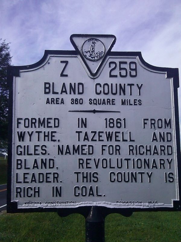
Bland . . . — — Map (db m99261) HM
Near here Adam Harmon, probably in 1750, established what is believed to be the first settlement in Giles County. Here, in 1755, he found Mary Ingles as she was making her way back to Draper's Meadows after her escape from the Indians. — — Map (db m41427) HM
West Virginia. West Virginia was long a part of Virginia. Morgan Morgan began the settlement of the region in 1727. A great battle with the Indians took place at Point Pleasant in 1774. West Virginia became a separate state of the Union in . . . — — Map (db m34767) HM
Giles County. Formed in 1806 from Montgomery, Tazewell and Monroe, and named for William B. Giles, United States Senator and Governor of Virginia, 1827–1830. Mountain Lake is in this county.
West Virginia. West Virginia was long a . . . — — Map (db m84134) HM
Named for the narrows in New River. The place was occupied by Confederate troops under French and Jackson in May, 1864. Combining with McCausland, they forced the Union General Crook to evacuate Blacksburg. Crook passed here on his way to West . . . — — Map (db m84143) HM
The New River is estimated to be more than 100 million years old, making it one of the oldest rivers in the world. It is a remnant of the prehistoric Teays River. The first written documentation of the New River was by explorers Thomas Batte and . . . — — Map (db m84135) HM
We honor
those who served
A tribute to the veterans of the Town of Narrows who gave their lives in the wars of our country
World War I
Robert H. Hale •
Samuel E. Johnson •
Herbert W. Morris
World War II . . . — — Map (db m305324) WM
1829
Andrew Johnston
House
has been placed on the
National Register
of Historic Places
by the United States
Department of the Interior — — Map (db m305323) HM
Giles County was formed from Montgomery, Monroe (now in West Virginia), and Tazewell Counties in 1806. It was named for William Branch Giles, United States senator from Virginia and later governor. North of here, the first court of Giles County was . . . — — Map (db m37528) HM
(Side 1)
1861-1865
To the Confederate soldiers of Giles County
Our Heroes
(Side 2)
Giles Co. furnished seven volunteer companies numbering about 800 men as follows:
Co D 7th Regiment Infantry
" F 24 " "
" H 36 " "
" . . . — — Map (db m162889) WM
(side 1)
Honor Roll
1917—1919
In memory of the men of Giles County who gave their lives in defense of their country in the World War.
Charles B. Davis • Leonard C. Duncan • W. Kyle Echols • Otey H. Elmore • Elcana J. . . . — — Map (db m162885) WM
These Grist Mill stones are from the Dave Bolton Mill
Kimbalton, Virginia Circa 1850
(Later known as the Kimball Mill)
Courtesy of Mrs. Norweta Wilburn
The mill was located near Caldwell's Store (1901-26) and the Kimballton Post Office. . . . — — Map (db m304966) HM
The town was laid off in 1806 when Giles County was formed, and named for Captain George Pearis, early settler. Established in 1808, it was first incorporated in 1835, and reincorporated in 1914. Here, in May 1862, Union troops under Colonel . . . — — Map (db m34811) HM
James Adair • Jacob Albert • John Alsup • Hezekiah Atkins • Milliton Atkins • Parker Atkins • James Bane Jr. • William Bradley • Lowe Brown • William Brown • Humphrey Brumfield • James Brumfield Jr. • James Brumfield Sr. • John Burke • Capt. . . . — — Map (db m162874) WM
This stepping stone was originally at the Pearisburg livery stable and was used to step from or to a horse or carriage onto the landing without soiling your shoes. The stable was located on the west side of the intersection of Mountain Lake . . . — — Map (db m305290) HM
A Revolutionary War soldier, was buried near this site in 1796. His services, extending over twenty years, include:
1758 French and Indian Wars
1774 Battle of Point Pleasant
1776 Erected Farley's Fort, near the New River.
1778 Fought in . . . — — Map (db m305072) HM
Near here is the original site of C.C.C. Company 1370-2386, known as Camp John J. Pershing, from 1933 to 1935, when it was moved to Nottoway County. Among the most popular New Deal programs, the Civilian Conservation Corps was designed to encourage . . . — — Map (db m34828) HM
To the sacred memory of
John-Jacob and Elizabeth (Helm) Snidow and their children: Barbara, Philip, Christian, Jacob, John, Theophilus and
two daughters.
John-Jacob, of Lancaster County, Pennsylvania, visited this vicinity ca. 1766. He went . . . — — Map (db m162890) HM
Jefferson National Forest
Not so long ago, in 1965, the Forest Service purchased the Cascades. A trail was built to finally open the falls to the public.
What is that thing?
This is the old boiler that provided power necessary to . . . — — Map (db m305073) HM
Giles County. Area 369 square miles. Formed in 1806 from Montgomery, Tazewell, and Monroe, and named for William B. Giles, United States Senator and Governor of Virginia, 1827-1830. Mountain Lake is in this county.
Pulaski . . . — — Map (db m41442) HM
The Reverend Robert Sayers Sheffey (1820-1902), although one of a kind as to style and personality, was a Methodist Circuit Rider in the classic frontier tradition. Celebrated for the intensity of his faith and prayer, as well as for his . . . — — Map (db m41428) HM
Adjacent to and named for this stream, Wabash Campground was exemplary of a religious and social institution, indeed of a way of life, which flourished during the 19th century. Hundreds of families would camp for two weeks or more while attending . . . — — Map (db m41429) HM
This coal car was one of many that were hoisted in and out of the mine. These cars were pulled by a hoist system. The cars were built with a low profile so that they could fit deep in the mine to be loaded without having to move the coal to the car . . . — — Map (db m95441) HM
The coal car hoist was the force that pulled the cars out of the mine. Each hoist used a large winch-like structure that was originally powered by steam. The picture you see below is of two miners being pulled out of the mine by the hoist system. — — Map (db m95445) HM
Here was the first foundation that pulled the coal cars from the mine. This foundation held the hoist that worked in sequence with a series of hoists to move the coal. The foundations are still here to this day because of the force that was put on . . . — — Map (db m95440) HM
Price's Fork is within the area often referred to as the German New River Settlement. Before 1745, German immigrants moved from Pennsylvania and began settling in this region within the Price's Fork-Tom's Creek area near and along the horseshoe . . . — — Map (db m42850) HM
The Commissary building was located here and served the community for their groceries as well as everyday household supplies. These concrete piers once supported the loading platform and post office that were in this building. The Commissary was . . . — — Map (db m95439) HM
Here remain just a few bricks and concrete that made the foundations of the hotel. This hotel was a large two-story boardinghouse for unmarried miners, new employees and visitors to the mines. The hotel also featured a single-story porch across the . . . — — Map (db m95438) HM
Here was the center of the entire Merrimac community: the Tipple was the largest and most prominent building here. Reaching 100 feet high, the Tipple was the loading station for the train, the Huckleberry. The Huckleberry would run directly through . . . — — Map (db m95443) HM
Five miles south lies the main campus of Virginia Polytechnic Institute and State University, founded in 1872 as a land-grant college specializing in agriculture and mechanical arts. The land-grant college system initiated scientific agricultural . . . — — Map (db m37520) HM
This elaborate Queen Anne Victorian home was built by Alexander Black, a great nephew of Blacksburg's founder, William Black. Alexander was also a prominent businessman who established the National Bank of Blacksburg in 1891, serving as its . . . — — Map (db m292760) HM
The Blacksburg Motor Company building was built by Robert and Mason Heavener, two well-respected Blacksburg businessmen. Robert Heavener was a prominent citizen serving on Town Council and the National Bank of Blacksburg Board of Directors. . . . — — Map (db m84769) HM
The Five Chimneys House was built in 1852, but the Queen Anne porch that is so distinctive was added 30 to 50 years later. The home underwent numerous renovations in the 1930s when A.G. Smith, a professor in the Virginia Tech Horticulture . . . — — Map (db m228180) HM
Built as a federal Works Progress Administration (WPA) project, the Armory is located on the former Blacksburg Public School Campus, where the local elementary and high schools originally stood. This building served as a National Guard armory and . . . — — Map (db m95446) HM
Nick Kappas emigrated from Greece in 1913 and located in Roanoke. After the VPI vs. VMI annual football game in Roanoke, VPI cadets who frequented a restaurant where Kappas worked, persuaded him to move to Blacksburg to open his own business. He . . . — — Map (db m84778) HM
William Howard Thomas of the Roanoke Valley built the Thomas-Conner House in 1878, for $10,000. He commissioned the Italianate-style home for his daughter Mary Virginia, who married John Conner, a professor of Mechanical Arts at Virginia . . . — — Map (db m292761) HM
Just northeast stood the home of William Black, the founder of Blacksburg. In 1797, he laid out a 16-block grid and petitioned the Virginia General Assembly to incorporate a town here; the legislature approved his petition on 13 January 1798. On 4 . . . — — Map (db m41436) HM
This cemetery is the final resting place for numerous Civil War veterans. It was originally the burial ground of the Black family, for whom the town is named. The cemetery later grew in size and eventually merged with the African American graveyard . . . — — Map (db m193950) HM
What is wrong with Stroubles Creek?
Stroubles Creek is considered “impaired” by the Virginia Department of Environmental Quality because it does not support a diverse community of aquatic insects and fish. The main pollutants are . . . — — Map (db m41473) HM
Main Street, near here, crosses a barely perceptible ridge line. This line divides water flowing east to the Atlantic Ocean, via the Roanoke River basin, from water flowing west to the Gulf of Mexico, via the New, Ohio, and Mississippi . . . — — Map (db m84779) HM
This c. 1820 slave cabin is
located on the site of
the Smithfield summer
kitchen. The cabin is
an authentic slave
cabin moved from
another Preston property
and reassembled on
the site in 1984. — — Map (db m162848) HM
April 16th, 2007
On April 16th, 2007, 32 innocent lives were lost in a senseless act of campus violence. Twenty-seven young, gifted graduate and undergraduate students died that day, two in Ambler Johnston Residence Hall, toward the south . . . — — Map (db m43722) HM
Professor 1903-1941
Dean, Academic Department 1915-1920
Chairman, English Department 1916-1941
Known as VPI’s godfather of extracurricular activities, Carol Montgomery Newman headed the English and Language Departments, taught English and . . . — — Map (db m274293) HM
Dean, Architecture and Urban Studies
1965-1979
University Distinguished Professor 1966-1979
Dean Emeritus 1979-1990
An innovative thinker, Charles H. Burchard organized Virginia Tech's College of Architecture and Urban Studies, creating a . . . — — Map (db m43015) HM
Department Head, Architectural
Engineering 1928-1956
The founder of VPI's Department of Architectural Engineering, forerunner of today's Architecture program, Clinton H. Gowgill guided the department's growth from 34 students and two . . . — — Map (db m43019) HM
Dean, School of Engineering 1928-1952
Director, Engineering Experiment Station
1932-1952
An engineer, educator, administrator, and author, Earl Bertram Norris worked professionally in the industrial field, taught mechanical engineering, and . . . — — Map (db m43038) HM
Enslaved People and the Prestons – William Preston purchased land at Draper's Meadows in 1773. There, enslaved people and indentured servants built a large house that Preston named Smithfield in honor of his wife, Susanna Smith Preston. . . . — — Map (db m228224) HM
Student 1901-1904
Faculty Member 1904-1954
Head, Department of Physics 1923-1954
As a student at Virginia Agricultural and Mechanical College and Polytechnic Institute (now Virgnia Tech), Frank Leigh Robeson helped draw plans for many campus . . . — — Map (db m43040) HM
Student, 1917-1920, 1921-1922
Six years after graduating from VPI, Fred Durham bought the C. Lee Cook Company, which merged with three other companies in 1955 to form Dover Corp., today a Fortune 500 manufacturing company. As president and . . . — — Map (db m43021) HM
Member, English Faculty 1930 - 1933
Dean, School of Applied Science and Business Administration 1950 - 1961
Dean, School of Science and General Studies 1961 - 1963
Dean, College of Arts and Sciences 1963 - 1965
C. P. Miles Professor of . . . — — Map (db m274310) HM
Faculty member 1900-1945
Head, Horticulture Department 1902-1908
Dean, School of Agriculture 1908-1945
An easy-going, amiable man, Harvey Lee Price served VPI for more than four decades after earning two degrees here. He moved quickly . . . — — Map (db m274303) HM
Professor 1903-1943
Dean of the College 1924-1943
Known for wise counsel and leadership, John Edward Williams earned wide respect during 40 years at VPI as a Mathematics professor and Dean of the College. An American Association for the . . . — — Map (db m274284) HM
Class of 1905
Master of Science 1906
A distinguished scientist, John H. Squires had a brilliant career as a chemist with E.I. DuPont de Nemours, GM Corporation, and American Cyanamid. He also taught at a college and was instrumental in . . . — — Map (db m43041) HM
President 1891-1907
Known as the “Father of VPI,” John McLaren McBryde laid the foundation for modern Virginia Tech. He increased bachelor's degree offerings, added graduate programs, created an infirmary, and christened the motto Ut Prosim. The . . . — — Map (db m43037) HM
Director, Agricultural Extension Services 1919-1945
President 1945-1947
Chancellor 1947-1956
President, VPI Foundation 1948-1962
Alumnus president John Redd Hutcheson worked tirelessly to prepare VPI for the flood of returning World War . . . — — Map (db m274294) HM
Class of 1925
Member, Board of Visitors 1963-1971
Board Chairman, Virginia Tech Foundation
1969-1973, 1986-1991
A generous benefactor of his Alma mater, John W. Hancock Jr. was an astute businessman who founded Roanoke Electric Steel . . . — — Map (db m43023) HM
The first alumnus president, Julian Ashby Burruss guided VPI through tremendous increases in faculty, student body, and degree offerings; vast growth in the physical plant; and efficient changes in administrative structure. He successfully pushed to . . . — — Map (db m16239) HM
Professor, Mechanical Engineering
1893-1918
Department Head, Mechanical Engineering
1902-1913
Dean of Engineering
1913-1918
An entertaining speaker and inspirational professor, Professor, Lingan Strother Randolph helped design and . . . — — Map (db m43039) HM
On 30 July 1755, during the French and Indian War, Shawnee Indians attacked the Draper's Meadow settlement nearby. They killed Col. James Patton, Casper Berger, Mrs. George Draper, and a Draper child, wounded James Cull, and captured Mary Draper . . . — — Map (db m16205) HM
Native Stewardship – Into the 1700s, the region known today as Appalachian Virginia was a hub for long-distance trade routes, a dynamic setting for shifting alliances between Native peoples of different languages and nations. For thousands of . . . — — Map (db m228237) HM
Department Head, Industrial Engineering 1967-1970
Dean, College of Engineering 1970-1990
President, Corporate Research Center 1990-1994
President 1994-2000
A professor who became president, Paul Ernest Torgerson taught every semester during . . . — — Map (db m16240) HM
Secretary, YMCA 1918-1964
Director of Religious Affairs 1957-1964
A Phi Beta Kappa graduate, Paul Neyron Derring was the first blind man to complete college in Virginia. While heading the YMCA at VPI, he became a father figure to countless . . . — — Map (db m274312) HM
People and Place – Virginia Tech's Blacksburg campus is situated on land long the domain of Monacan-Tutelo peoples. The university's other sites across Virginia, like schools everywhere in the US, are also on land once held by Native nations.
. . . — — Map (db m228128) HM
This marker commemorates the
men and women who achieved
American independence.
These Patriots, believing in the
noble cause of liberty, fought
valiantly to found a new nation.
1775 - 1783
Presented by
Virginia Daughters of . . . — — Map (db m228221) WM
An American Association for the Advancement of Science Fellow, Robert James Davidson worked at VPI as a chemist for the experiment station as a chemistry professor before becoming the first dean of the Scientific Department and the Department of . . . — — Map (db m274283) HM
Professor 1905-1945
Head, Department of Geology 1907-1945
The head of VPI's Geology Department for 38 years, noted geologist Roy Jay Holden sited Virginia's first gas well, located water wells when a shortage threatened VPI, and assessed the . . . — — Map (db m43026) HM
Grandson of Col. Wm. Preston, built c. 1840 during Ballard's ownership of Smithfield. Fire destroyed the building in 1929, leaving only the foundation. — — Map (db m162852) HM
Brief History of Slavery at Smithfield Plantation
William Preston purchased eighteen enslaved Africans in 1759 from the slave ship the True Blue, a part of the African Company of Merchants. The slaves were originally West African and their . . . — — Map (db m162849) HM
This house was built in 1772-1773 for Colonel William Preston and was the home of three governors of Virginia, James Patton Preston, John Floyd, Jr., and John Buchanan Floyd.
A gift from Mrs. Janie Preston Boulware Lamb to the Association for . . . — — Map (db m162847) HM
The earliest portion of Solitude was constructed about 1801 on land owned by Philip Barger, who sold the property in 1803 to James Patton Preston, governor of Virginia (1816-1819). Governor John Floyd (1830-1834), Preston's brother-in-law, lived at . . . — — Map (db m16213) HM
For many years, Virginia Tech students were all white, all male, and all cadets, and they were mostly Virginia residents and Protestant Christians. By the 1920s, students had come from many states and nations, white women were enrolling, and men . . . — — Map (db m228185) HM
This bur oak (Quercus macrocarpa) was planted around 1895 by Professor Alwood at the site of the Virginia Agricultural Experiment Station. One of many trees planted by Alwood, it is the only living member of a collection he documented to . . . — — Map (db m64221) HM
The Early Years – Virginia Agricultural and Mechanical College (VAMC), today's Virginia Tech, was established in 1872 in the former home of the Preston and Olin Institute, an academy for white males that had opened in the 1850s. The institute's . . . — — Map (db m228172) HM
Learn about your watershed
A watershed or drainage basin, is the area of land where all the water that drains off it runs to a specific point on a watercourse, usually a confluence of stream or river.
The Stroubles Creek watershed is . . . — — Map (db m41466) HM
Professor of Modern Languages 1889-1928
Co-President Pro Tempore 1905-1906
Dean of the Faculty 1913-1920
Dean of the College 1920-1924
One of Virginia’s noted educators, Theodorick Pryor Campbell applied his untiring zeal an . . . — — Map (db m274383) HM
Head, Department of Agronomy 1914-1945
Dean, School of Agriculture 1946-1950
Thomas Barksdale Hutcheson lived in the dairy barn at Virginia Agricultural and Mechanical College and Polytechnic Institute (Virginia Tech), working his way . . . — — Map (db m274295) HM
Head, Department of Physics 1954-1959
President 1962-1974
President Emeritus 1975-
One of the university’s greatest presidents, T. Marshall Hahn Jr. engineered Virginia Tech’s evolution from a college to a major research university. The . . . — — Map (db m43022) HM
Called the father of farm demonstration and extension work in Virginia, Thomas Oldham Sandy was a progressive farmer who promoted improved scientific education in agriculture. He became the Commonwealth’s first demonstration agent, a position . . . — — Map (db m274304) HM
In 1872, the Commonwealth of Virginia established a land grant school just outside the original 16 squares of Blacksburg and named it the Virginia Agricultural and Mechanical College. The new college took over the building erected in 1855 for the . . . — — Map (db m274764) HM
Virginia Polytechnic Institute and State University was founded in 1872 as a land-grant college specializing in agriculture and mechanics. The land-grant college system marked the beginning of scientific agricultural and industrial instruction in . . . — — Map (db m42848) HM
The airport was founded in 1931 as a college-owned facility. School funds and a grant from the Works Progress Administration in the early 1940s paid for paving a runway and building a hangar. Two training programs offered here made the airport . . . — — Map (db m41425) HM
(left pylons)
Brotherhood
Honor
Leadership
Sacrifice
(right pylons)
Ut Prosim
Duty
Loyalty
Service
1917 * 1918
H. T. Barger '16 • J. C. Berkeley '12 • R. L. Butler '15 • A. V. Carlson '21 • J. F. . . . — — Map (db m43044) WM
Craig County farm boy Add Caldwell
walked 26 miles to enroll here in 1872
as the first student. The popular cadet
majored in agriculture and worked as a
teacher, clerk, and salesman before his
death in 1910.
Donated by the Class of . . . — — Map (db m42925) HM
Professor / Department Head,
Horticulture, Mycology, & Entomology
Vice Director, Virginia Agricultural
Experiment Station (1888 - 1904)
"The splendid service which you rendered this institution will ever be remembered, and it is my hope . . . — — Map (db m64217) HM
Student 1872-1873
College Physician 1891-1920
Consulting Physician 1920-1935
During more than half of his life, Dr. William F. Henderson treated thousands of cadets at Virginia Agricultural and Mechanical College and Polytechnic Institute . . . — — Map (db m43024) HM
Chair, Civil Engineering 1896-1905
Dean, Department of Engineering 1904-1905
A distinguished engineer, educator, and author, William MacFarland Patton chaired Civil Engineering at VPI and became the first dean of the Department of Engineering. . . . — — Map (db m274292) HM
Women's History – Until 1921, only men could seek degrees from Virginia Tech. Yet women — Black and white – had worked at the college since its founding in 1872. Women supported professors and cadets as laundresses and cooks. Professional . . . — — Map (db m228193) HM
"Ha-Ha"
The fence you see surrounding the cemetery was not an original part of the cemetery in the 18th century.
Instead, the Prestons had a ditch dug out that you can still see surrounding the cemetery that was called a "ha-ha". Ha-Has . . . — — Map (db m162854) HM
The Future Farmers of Virginia (FFV) was founded on the campus of Virginia Polytechnic Institute by four members of the Agricultural Education Department in September, 1925. Developed as a statewide organization for boys enrolled in high school . . . — — Map (db m16235) HM
The American Revolution secured liberty and justice for some, but not all Americans.
When the U.S. Constitution became ratified in 1788, slavery was still legal, women could not vote, and indigenous peoples were being violently removed from . . . — — Map (db m229164) HM WM
Cemetery Map - map by Hartwell H. Gary in 1961.
Roman numerals stand for generations beginning with Archibald Preston.
III - Col. William Preston presents the third generation.
28 Marked Graves 2 Memorials 3 Out of situ • 64 Known or . . . — — Map (db m250456) HM
Smithfield, visible to the northeast, was the last home of Col. William Preston, a noted surveyor who fostered the settlement of western lands. Preston was also a Revolutionary officer, Indian fighter, and a member of the House of Burgesses. Built . . . — — Map (db m86233) HM
Upon his death in 1783, a set
of "Smith's Tools” were
listed in Col. WM. Preston's
estate. Blacksmithing
kept the plantation's horses,
mules & oxen shod and its
numerous farming "utensils"
in good working order. — — Map (db m162851) HM
Virginia’s first annual 4-H Boys’ and Girls’ State Short Course was held in Aug. 1919 on the campus of Virginia Tech. The weeklong event provided instruction in agriculture and home economics to 167 young people from 39 counties. An annual short . . . — — Map (db m295853) HM
Virginia Polytechnic Institute and State University was founded in 1872 as a land-grant college specializing in agriculture and mechanics. The land-grant college system marked the beginning of scientific agricultural and industrial instruction in . . . — — Map (db m16237) HM
This is Smithfield, the birthplace of William Ballard Preston (1805-1862). On April 16, 1861, in the Virginia Convention, he reluctantly introduced the formal resolution to secede from the Union.
Preston served in the Virginia House of . . . — — Map (db m84776) HM
Christiansburg, originally known as "Hans Meadows," was established in 1792 and named for Colonel William Christian noted Colonial and Revolutionary Indian fighter. It became an important place on the route to the West. On May 10, 1864, Averell . . . — — Map (db m23905) HM
535 entries matched your criteria. The first 100 are listed above. Next 100 ⊳