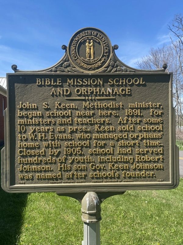
Side 1:
Residents and students alike held the traditions of the school in high esteem. Two became college presidents: Drs. A. B. Mackey and T. W. Willingham. Others who gave years of service to the community well beyond the school era were Dr. . . . — — Map (db m244686) HM
Champ Ferguson born here in 1821. Guerrilla leader with Confederate leaning, but attacked supporters of both sides thruout Civil War in southern Ky., Tenn. Over 100 murders ascribed to Ferguson alone. Hunted by both CSA and USA. Taken after end of . . . — — Map (db m136581) HM
Front
Isaac Denton, Sr., first preacher in region, 1798. He founded the Stockton Valley Church, 1801, and constituted Clear Fork Baptist Church, April 1, 1802; founded Stockton Valley Assn., 1805. Organized first school in area, 1806. . . . — — Map (db m136773) HM
For DeWitt Clinton, 1769-1828. In New York Senate, nine years; U.S. Senate, 1802-03, where he introduced XII Amendment, present method of electing U.S. president, vice president. Mayor, New York, nine years; leader, tax supported school movement. . . . — — Map (db m136583) HM
Twenty-two Kentucky courthouses were burned during Civil War, nineteen in last fifteen months: twelve by Confederates, eight by guerrillas, two by Union accident. See map on reverse side. The courthouse at Albany was burned by guerrillas late in . . . — — Map (db m136768) HM
Thomas E. Bramlette born near here on Jan. 3, 1817. State legislature in 1841. Appointed by Gov. John Crittenden as the commonwealth's attorney, 1848. Circuit judge, 1856-1860. Accepted Federal Army commission in 1861. Raised and commanded 3rd Ky. . . . — — Map (db m136585) HM
William Wood (1773-1851), native of Virginia, was a founder of Cumberland and a leader in Clinton Co. He represented Cumberland Co. (when Clinton was part of it) in the General Assembly for 23 years. One of the founders of Clear Fork Baptist Church, . . . — — Map (db m136771) HM
Side 1:
Born near here in August 1909. Served 16th dist. in state senate, 1952-1959. In 1954 sponsored both Minimum Foundation Act (school support) and lowering the voting age to 18. In 1958 he promoted the veterans bonus legislation & public . . . — — Map (db m244687) HM
Welcome
This trail offers the hiker a relatively easy 4.5 mile loop trough the Cumberland Falls Nature Preserve, which is home to many species of unique and rare plants. The first 1/2 mile of trail follows the original wagon road that brought . . . — — Map (db m292517) HM
Ever since pioneers discovered Cumberland Falls in the late 1700s, visitors have been attracted to its inspiring beauty. In 1875, just a few years after the first homestead here, the first hotel was built on this site. Soon thereafter, Cumberland . . . — — Map (db m280022) HM
Cumberland Falls has instilled many fond memories to millions of visitors since the late 19th century. Its 125-foot wall of water falling 60 feet into a boulder-strewn gorge, produces a whispering mist for the on-looker and a magical moonbow under . . . — — Map (db m281300) HM
Established 1963 by 4-H Clubs of McCreary County, the first such center in the U.S. developed by 4-H Clubs. The original log cabin built in this site in a 200-acre land grant to John Abbott, 1842. Abbott and Indian wife, Oocella, lived in cabin . . . — — Map (db m279104) HM
Marker front: Born in Pine Knot, Ky. on Nov. 23, 1881. Enlisted in U.S. Army, 1901. In 1907, Cpl. Ward was assigned by the Signal Officer to take charge of "all matters pertaining to military ballooning, air machines, and all kindred . . . — — Map (db m30427) HM
Over one hundred years ago, in 1902, Justus S. Stearns of Ludington, Michigan bought 30,000 acres of virgin timberland in Southern Kentucky. When coal was discovered soon afterwards, the Stearns Coal & Lumber Company was in business. The company . . . — — Map (db m233171) HM
Burial site of daughter of Chief Doublehead. Legend is that as a young girl she accompanied her father at signing of Treaty of Sycamore Shoals, 1775, transferring Cherokees' land between Ohio and Cumberland rivers to Transylvania Society. As'Quaw . . . — — Map (db m73737) HM
In 1989 a surface-mining company in Tennessee unearthed this stump buried 30 feet underground. The two-ton stump measures 15 feet in circumference and almost 6 feet in diameter. Geologists from the University of Kentucky indicate this is not a . . . — — Map (db m233172) HM
In 1902, Justus S. Stearns of Ludington, Michigan bought 30,000 acres of virgin timberland in southern Kentucky. When coal was discovered soon afterwards, the Stearns Coal & Lumber Company was established. The company built the town of Stearns to . . . — — Map (db m233173) HM
First Kentucky Oil Well In 1818, Marcus Huling and Andrew Zimmerman were drilling salt wells along South Fort of Cumberland River. On land leased from Martin Beaty they struck oil. Attempts to market it downriver were not successful, so . . . — — Map (db m73739) HM
Taken from parts of Pulaski, Wayne, and Whitley counties, it was last formed of Kentucky's 120 counties.
Named for James B. McCreary, 1838-1918. Lawyer, Col., 11th Ky. Cavalry, CSA. State legislature, 1869-75. Twice governor of Kentucky, . . . — — Map (db m73738) HM
First named Point Isabel. Settled about 1800 by pioneers from the Carolinas and Virginia. During the Civil War the Union army, in 1863, set up a troop rendezvous and supply base here as a prelude to East Tennessee campaign of Gen. Ambrose E. . . . — — Map (db m67874) HM
Before Boy Scouts of America was organized, 1910, a troop of 15 had been formed here, spring of 1908, by Mrs. Myra Greeno Bass. Using the official handbook of English scouting, she guided them hiking and camping, like scouting today. Known as Eagle . . . — — Map (db m214781) HM
The author of such celebrated Appalachian novels as The Dollmaker and Hunter's Horn; social histories include Seedtime on the Cumberland and Flowering of the Cumberland. Born in Wayne County, Arnow spent most of her childhood in Burnside. Moved to . . . — — Map (db m67876) HM
Old Burnside
Point Isabel, later renamed for Union General Ambrose E. Burnside, grew up around the Cumberland River. Beginning in 1833 steamboats like the Rowena (top), were a common site on the river and one of the county's primary forms . . . — — Map (db m244576) HM
On December 31, 1861, Union General George Thomas and his small army of about 3,000 men left Lebanon, Kentucky, and headed for this place, then known as Logan`s Crossroads. For his hardened troops, this 40-mile trek should have been a two or . . . — — Map (db m55025) HM
You are standing in the center of the area where most of the Mill Springs Battle took place on Sunday morning, January 19, 1862. This illustration depicts the scene from a birds eye viewpoint above and behind you. The Union line stood to your left, . . . — — Map (db m62985) HM
After the battle Union troops hastily buried the dead. The Confederate dead were interred in shallow mass graves near where they fell in battle. Some of these graves were so shallow that the bodies in them began surfacing within 48 hours of burial. . . . — — Map (db m128956) HM WM
The Battle - Confederate Retreat
During the battle a small one room log cabin stood here (the foundation stones are still visible). Retreating Federal pickets made a brief but desperate stand in and around this cabin at the beginning of . . . — — Map (db m86151) HM
Soon after the first shots of the battle were exchanged at Timmy's Branch, Confederate surgeons set up a field hospital in a small log house that stood here. Some of the wounded found their own way here; friends carried others. One of the last . . . — — Map (db m137141) HM
Forgotten Men
In the years after the Battle of Mill Springs, the white oak tree that General Felix Zollicoffer's body had been placed under became known as the Zollie Tree. While the tree became a local gathering spot, no effort was made . . . — — Map (db m70008) HM
Mistaken Identity
About seven o'clock the morning of January 19, 1862, Confederate General Felix Zollicoffer rode across the road to your left. Near here, in the dim light and fog, he saw a mounted officer, Union Colonel Speed Fry. Both men . . . — — Map (db m137077) HM
In November 1861, the Confederate army commanded by General Felix Zollicoffer arrived in Mill Springs, Kentucky, on the south side of the Cumberland River. A month later, Zollicoffer had moved 6,000 men to the north side of Cumberland and . . . — — Map (db m88447) HM
Civil War Dead
An estimated 700,000 Union and Confederate soldiers died in the Civil War between April 1861 and April 1865. As the death toll rose, the U.S. government struggled with the urgent but unplanned need to bury fallen Union . . . — — Map (db m88451) HM
Alfred Edward Mathews, a renowned illustrator, created this drawing. We don't know if he participated in the battle, but it is obvious he was here. You are standing approximately where Mathews stood to sketch this scene. Compare the image to the . . . — — Map (db m137102) HM
Union General George H. Thomas placed cavalry here, at Timmy's Branch, on the road between his army and the Confederates. These men acted as an early warning system in case of a surprise attack. It was here that the first shots of the Battle of . . . — — Map (db m137142) HM
For several years the Mill Springs Battlefield Association, with the help of professional archeologists, has located and mapped artifacts on the battlefield. The type of artifact, their placement, and density is used to determine the units present . . . — — Map (db m63059) HM
Lieutenant Balie Peyton, Jr. All battles have their stories of heroism and devotion to duty. All battles have the tragic death of those too young. The story of Balie Peyton, Jr., at Mill Springs is one of those stories. Peyton's story lifts . . . — — Map (db m63039) HM
You are near the center of the battlefield east of the road. Union and Confederate forces clashed violently here Sunday morning, January 19, 1862.
The Union line stood to your left, behind a split-rail fence at the edge of the woods (now part of . . . — — Map (db m137114) HM
Captain Arthur M. Rutledge's Tennessee Light Artillery Battery was organized in Davidson County, Tennessee. Rutledge was a West Point graduate who went on to become the Chief of Ordnance in Polk's Army of Mississippi. Rutledge's Tennessee Light . . . — — Map (db m63121) HM
After the battle, Union soldiers hastily buried the dead. They interred many of the Confederates in shallow mass graves near where they fell. Some graves were so shallow that the bodies began surfacing just days afterward. With the army gone, local . . . — — Map (db m137098) HM
Confederate Defense Line
Late in 1861, Confederates sought to prevent Union forces from occupying strategic points in Kentucky and Tennessee, to maintain rail shipments of vital Confederate supplies from Virginia south and west and to set . . . — — Map (db m88448) HM
This is the site of the Confederate Hospital used by Confederate surgeons after the Battle of Mill Springs. The site is being preserved with the help of a Federal grant from the Land and Water Conservation Fund, administered by the National Park . . . — — Map (db m55459) HM
Beneath this mound rest in sleep that
knows no waking, more than one hundred
Confederate soldiers from Tennessee,
Mississippi, and Alabama, who were killed
in the Battle of Fishing Creek, Jan. 19, 1862.
We know not who they were but . . . — — Map (db m167912) WM
"Every one for himself was the motto." Much of the Confederate Army retreated through this area. They headed south along the Mill Springs Road toward their camps and fortifications just this side of the Cumberland River. Mississippi . . . — — Map (db m63098) HM
Shortly before daylight on January 19, 1862, the lead elements of the Confederate column encountered Union pickets—a guard detachment—at Timmy's Branch about a mile south of here. The Confederates fired on the Union troops, who retreated . . . — — Map (db m137097) HM
Felix K. Zollicoffer: Brig. Gen. Felix K. Zollicoffer, CSA, died here, Jan. 19, 1862, in Battle of Logan's Crossroads (Mill Springs). This Tenn. native was veteran of Seminole War, editor of Nashville Banner, and 3-term U.S. congressman. In heavy . . . — — Map (db m55189) HM
"If it gets too hot for you, shut your eyes my boys - forward!" - Major Gustave Kammerling, 9th Ohio (photo inset) Union Colonel Robert McCook, commanding the Union 3rd Brigade ordered one of the few successful bayonet charges of the Civil . . . — — Map (db m62973) HM
It was midmorning and the battle was raging when directly across the road Union Colonel Robert McCook ordered the 9th Ohio Infantry to charge the enemy. It was one of the few successful bayonet charges of the Civil War and was instrumental in . . . — — Map (db m137109) HM
On this spot fell Gen'l Felix K. Zollicoffer of Tennessee, Jan. 19, 1862. Lieuts. Bailie Peyton Jr., H.M.R. Fogs and more than 150 of their Confederate associates in the Battle of Fishing Creek, here died with Gen'l Zollicoffer for right as they saw . . . — — Map (db m43876) HM
Note: this marker is weathered and partly illegible. Some words are inferred and others are indecipherable. George Henry Thomas was born in Southampton County, Virginia, July 31, 1815. At the age sixteen he was forced to flee his home along . . . — — Map (db m62970) HM
Colonel Speed Fry, commanding the 4th Kentucky Infantry (U.S.), pulled his men back to a split-rail fence on a hill east of the road. As the Union soldiers deployed, the Confederates regrouped in the ravine. They had learned that Confederate General . . . — — Map (db m137112) HM
Battle of Mill Springs
Confederate forces established a defense line across southern Kentucky in fall 1861. Union and Confederate armies fought small-scale actions in the area, but the Battle of Mill Springs was the first major engagement. . . . — — Map (db m88450) HM
About 7 A.M. Confederate General Felix Zollicoffer rode forward to reconnoiter. Near this spot, in the dim light and fog, he saw a mounted officer, Union Colonel Speed Fry of the 4th Kentucky U.S. Volunteers. Both men mistakenly assumed the other to . . . — — Map (db m62934) HM
The evening of January 19, 1862, Union forces pursuing the beaten Confederates halted at a small log school nearby. The Confederates had used the school as a headquarters for their pickets before the battle. Union soldiers rested here as they . . . — — Map (db m137143) HM
Rutledge's Battery, a Confederate artillery unit, fired from this position during the Battle of Mill Springs. This gun is a reproduction of those the battery used—1841 model six-pounder smoothbore cannons.
Captain Arthur M. Rutledge, a . . . — — Map (db m137119) HM
The Confederate army arrived in Mill Springs in November 1861. For some time, Confederate General Felix K. Zollicoffer's pleas for more men and supplies were ignored. Finally, his superior sent the steamboat Noble Ellis up from Nashville . . . — — Map (db m156154) HM
A small building that housed a blacksmith shop stood in this area at the time of the Battle of Mill Springs. According to local tradition, the blacksmith who worked there mined shale, low grade coal, from the ground near his shop. There are several . . . — — Map (db m63097) HM
Shortly before daylight about 6:00 A.M., the struggling Confederate column encountered Union pickets at Timmy's branch one and one half miles south of here and exchanged the first shots of the battle. Alerted by the gunfire, the Union camps (a mile . . . — — Map (db m70012) HM
George Henry Thomas
Virginian George H. Thomas commanded the Union army at the Battle of Mill Springs. Because he was from a prominent slave-holding family many, including President Abraham Lincoln, initially questioned his loyalty. His . . . — — Map (db m137104) HM
The Confederates west of the road fled in disarray after the 9th Ohio Infantry executed a successful bayonet charge. The pursuing Federals turned the tide on the east side of the road and the entire Confederate line broke. The 16th Alabama Infantry . . . — — Map (db m137140) HM
Colonel Speed Fry (photo inset) For much of the battle the Union defense line was behind a rail fence at the top of the hill. Colonel Speed Fry of the Union 4th Kentucky said that his men there came "under a galling fire from the enemy, who . . . — — Map (db m63068) HM
The commander of the 10th Indiana Volunteer Infantry wrote, "The way by which the enemy had retreated gave evidence that they had been in haste to reach their den. Wagons, cannon, muskets, swords, blankets, etc. were strewn all along the road . . . — — Map (db m63186) HM
After the initial contact between the Union and Confederate forces in the foggy half light of the winter morning, Colonel Speed Fry, commanding the 4th Kentucky Infantry (US), pulled his men back to a rail fence on a hill east of the Mill Springs . . . — — Map (db m62999) HM
After Confederate General Felix Zollicoffer was fatally wounded at the Battle of Mill Springs on January 19, 1862, his men placed his body under a white oak tree. In the years that followed, the tree became known as the "Zollie Tree."
Forty . . . — — Map (db m137096) HM
Clearly visible in front of you is the roadbed of the original Mill Springs Road. Feel free to walk the old road to the creek, where you can see the original crossing. Near the creek, between the present road and the original road, is one of the few . . . — — Map (db m55464) HM
These properties make up the site on which the Confederate Army attacked and retreated during the Battle of Mill Springs. These sites are being preserved with the help of a Federal grant from the Land and Water Conservation Fund administered by the . . . — — Map (db m55781) HM
The Last Minutes of the Battle
Union commander General George H. Thomas described the last minutes of the battle: "The 12th Kentucky . . . and the Tennessee brigade reached the field to the left of the Minnesota regiment, and opened fire on . . . — — Map (db m137115) HM
Here, off-duty, 'till the last reveille,
rest the southern soldiers, few in
number, who were slain in this
county during the war of succes-
sion. They fell among strangers,
unknown, unfriended, yet not un-
honored; for strangers' . . . — — Map (db m283997) WM
March 30, 1863, USA force of 1,250 under General Q. A. Gillmore overtook 1,550 Confederate cavalry under Gen. John Pegram, here. Five hour battle resulted. CSA driven from one position to another, withdrew during night across Cumberland. Killed, . . . — — Map (db m67872) HM
Edwin P. Morrow (1877-1935), a native of Somerset, built this house soon after marrying in 1903; he began his Somerset law practice same year. Morrow served in Spanish-American War; appointed U.S. District Attorney for eastern Kentucky by Pres. Taft . . . — — Map (db m67871) HM
CSA General John H. Morgan's first Kentucky raid covered 1000 miles, July 4 to July 28, 1862—24 days. Left Tenn. with 900 men, returned with 1200, captured 17 towns, 300 horses, destroyed Union supplies. Here, July 21, Morgan took over . . . — — Map (db m67870) HM
Kentucky's 27th formed, its territory taken from Lincoln and Green Counties, was named for Count Casimir Pulaski, Polish patriot and soldier of liberty. He came to US when he learned of the Colonies' fight for freedom. A brigadier general in . . . — — Map (db m67854) HM WM
This section of KY 80 was named to honor the memory of a man whose vision foresaw the role it would play in someday - a link in a chain of great highways stretching across the breath of the Commonwealth from the hills of Appalachia to the lakes and . . . — — Map (db m35877) HM
Near the site of this spring Somerset was established as the county seat in 1801 on forty acres given by William Dodson. The path to it became the town's most traveled street in order to drink from the Old Town Spring. Thus a saying became popular, . . . — — Map (db m67858) HM
Laid out, 1809, named for Elijah
and Elza Creel, pioneers whose
son, Reuben, served US in Mexico;
his son Enrique served Mexico in
US. An interpreter for Gen. W. T.
Ward during Mexican War, Reuben
stayed on there, was appointed US
Consul, . . . — — Map (db m244688) HM
Following is a list of the names of service men from Russell County who lost their lives while serving their country during one of the wars as listed
World War I 1917 – 1918….
Cecil Brummett • Matha E Cravens • Earl Dunbar • Fonso . . . — — Map (db m214972) WM
Dec. 25, 1861, part of First Ky. Cav., USA, camped at Webb's Cross Roads to guard stored corn and forage and scout CSA operations. Detachment skirmished with enemy here resulting in one death, CSA. Both armies in area again, 1863. On June 2, 300 CSA . . . — — Map (db m83432) HM
Established, 1825, out of parts of Adair, Wayne, Cumberland. Named for Col. Wm. Russell (1758-1825). Lieut., Revolution; came Fayette Co., Ky. In Indian campaigns of 1791 and '94. At Tippecanoe, 1811. Succeeded Gen. Wm. H. Harrison in command Ind., . . . — — Map (db m83427) HM
Dedicated to the memory of the patriotic citizens of Russell County, Kentucky who entered the service of their country during the World War — — Map (db m214968) WM
A health resort long known as Big Boiling Springs, operated before 1850 by family of Sam Patterson, among the earliest settlers. Log cabins (12) called Long Row were built for guests who came here for amusement, pleasure, and the medicinal iron and . . . — — Map (db m83425) HM
In Dec. 1861, Col. Frank Wolford, USA, with Companies A, B, C and H left Camp Billy Williams enroute to Webbs Cross Roads. Here they guarded forage collected and stored by Lieutenant Silas Adams, Regimental Quartermaster of First Ky. Cavalry. July . . . — — Map (db m83437) HM
The Brown-Lanier House in the Civil War
In late 1861 and early 1862, Union and Confederate armies occupied this area as they vied for control of Kentucky. This house, then owned by Thompson Brown, served at various times as a headquarters for . . . — — Map (db m137065) HM
Near here, January 19, 1862, 4,000 Confederate troops were engaged and defeated by 12,000 Federalists. The Southern leader, General Felix Zollicoffer, was killed in the action. The historic old mill was built in 1840. — — Map (db m69879) HM
An Oasis for Zollicoffer's Army
In November 1861, Confederate General Felix Zollicoffer ordered captains Thomas Estill and Victor Von Sheliha to find a base camp on the Cumberland River. They chose Mill Springs, which had abundant food, . . . — — Map (db m137058) HM
The Confederates Take the Offensive
The Confederates had been in Mill Springs less than a month when two Union armies began moving on their position. Most of the Confederate army was well-positioned across the river at Beech Grove. The . . . — — Map (db m156152) HM
The Cumberland River has fueled the economy of this region for thousands of years.
An Avenue of Commerce
Native Americans hunted deer and turkey here, and harvested the river's mussels and fish. Benjamin Price, who came to this area in . . . — — Map (db m137048) HM
Isaac West built this small house about 1800. When the Civil War began, it was the home of Isaac's son and daughter, Allen and Nancy, and Nancy's family. During its brief occupation of Mill Springs, the Confederate army used the West house and farm . . . — — Map (db m137057) HM
One mile south. First brick house in area. Built by Capt. Isaac West, Revolutionary soldier, who came here about 1798, received land grant in 1799, and built this house, in 1800, of bricks he made himself. Gen. Felix Zollicoffer, CSA, had . . . — — Map (db m156153) HM
For "Mad Anthony" Wayne, born in Penn., 1745. Officer in Revolution, given gold medal by Congress for capturing Stony Point, N. J., 1779. In command, U. S. forces at Fallen
Timbers, 1794, and negotiated Treaty of Greenville, 1795, which
ended . . . — — Map (db m233174) HM
Near this spot Aug., 30, 1861, Elder W.A. "Uncle Billy" Cooper made his famous "plea for peace" and averted bloodshed between the Wayne County Home Guards and the local State Rights Guards.
"Blessed are the Peacemakers" — — Map (db m233175) HM
Established as county seat when Wayne County formed, 1800. Named for home of Thomas Jefferson, who
became third President of U.S. next year. Name was suggested by Col. Micah Taul, the first county
clerk, later Congressman and Col. of Wayne County . . . — — Map (db m233177) HM
In memory of those from Wayne County who paid the supreme sacrifice in World War II and Korean War
World War II
Abbott, Albert • Cross, Hershel C. • Marcum, Edwin P. • Abbott, William F. • Davenport, Lloyd E. • Miller, Henry A. • . . . — — Map (db m233220) WM
Honor Roll
To the men of Wayne County who served their country during the World War this memorial is honorably dedicated 1917-1919
Killed in Action
Bell, Richard • Flynn, Quincey A. • Parmley, Molie • Cooper, Willie B. • Jones, . . . — — Map (db m233223) WM
Beech Grove
In late 1861, Confederate Gen. Felix Zollicoffer advanced into Ky. from Jamestown, Tn. Zollicoffer ordered seizure of area ferry boats to cross his army to the north side of the Cumberland River. Unable to locate adequate boats, . . . — — Map (db m136797) HM
"Their fort was admirable situated on a high piece of ground three-quarters of a mile from the Cumberland River, surrounded with a breastwork and rifle pits, with embrasures for cannon and as strong a position as could be found." — . . . — — Map (db m69982) HM
The Battle - Evening January 19, 1862 The Federal forces pursuing the beaten Confederates halted here near a small log school. This school building had been used by the Confederates as a headquarters for their pickets during their occupation of . . . — — Map (db m55629) HM
Night of January 10-20, 1862 Confederate General Zollicoffer's pleas for more men and supplies to meet the strong Union force he expected went mostly unheeded. General Albert Sidney Johnston did, however, send a river steamer, the Noble . . . — — Map (db m55880) HM
By late December, General Felix Zollicoffer had decided to winter his command at Beech Grove. "The time has come," he wrote, "when huts must be constructed to protect the forces of the Brigade against inclement weather. Commanding officer . . . — — Map (db m69970) HM
"The position ... is a fine basis for operations in front." - Felix K. Zollicoffer Inset photo on left of Gen. Felix K. Zollicoffer In November 1861 Gen. Felix Zollicoffer sent engineer officers Capt. Thomas Estill and Capt. Victor Von . . . — — Map (db m55778) HM
In December 1861, less than a month after the Confederate army arrived in Mill Springs, General Felix Zollicoffer moved most of his army—6,000 men—across the Cumberland River to Beech Grove. Soldiers built earthworks and constructed quarters for . . . — — Map (db m137144) HM
101 entries matched your criteria. The first 100 are listed above. The final 1 ⊳