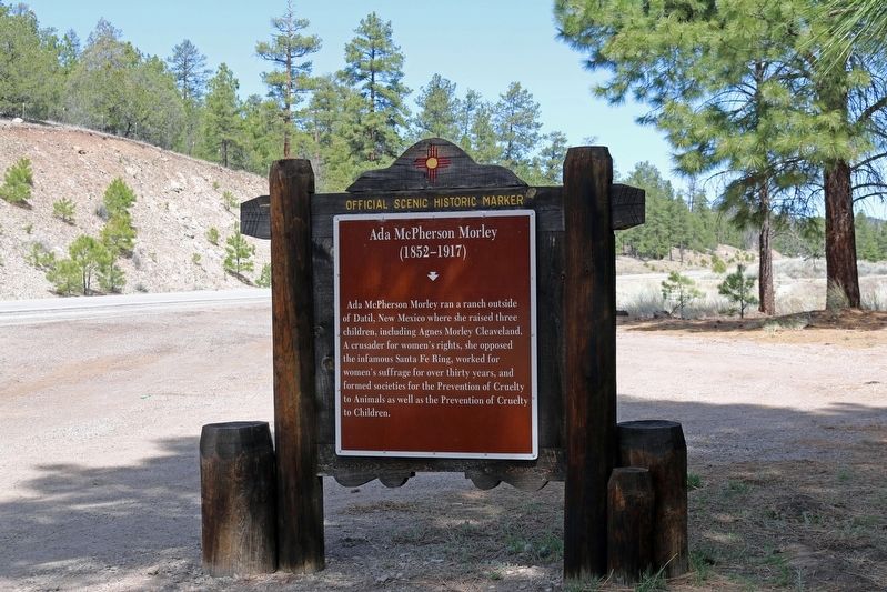
Ada McPherson Morley ran a ranch outside of Datil, New Mexico where she raised three children, including Agnes Morley Cleaveland. A crusader for women's rights, she opposed the infamous Santa Fe Ring, worked for women's suffrage for over thirty . . . — — Map (db m280075) HM
The mountains and the town were named for Juan Ignacio Flores Mogollón, governor of New Mexico from 1712 to 1715. The name also is applied to the Pueblo Indians who abandoned the area in the early 1400s. These mountains were inhabited by Apaches . . . — — Map (db m280076) HM
This steel causeway follows two pipelines which supplied water and water power to the old town of Graham where gold and silver ores were milled from nearby mines in the 1890's. The causeway clings to the sides of a sheer box canyon in Saltwater . . . — — Map (db m280099) HM
Due to the strategic location of our town, folks have always found it a pleasant place to stop, rest, and refresh… The first merchant in town had such a demand for home made pies and they were of such quality that they became justly famous… Local . . . — — Map (db m170399) HM
Spanish word for “burned,” Quemado is located in an extinct volcanic area. This community was first settled in 1880 by José Antonio Padilla, who brought sheep and started the stock raising industry in this part of the state. Quemado was once . . . — — Map (db m280098) HM
"I will show the Texans there is at least one Mexican in the county who is not afraid of an American cowboy"
Elfego Baca - 1884
In October 1884, seven drunken cowboys committed horrific acts against two Mexican men in Upper Frisco, (modern . . . — — Map (db m88497) HM
Population 600 — Elevation 5765 ft.
Located in the San Francisco Valley, Reserve was named upper San Francisco Plaza by its original Hispanic settlers in 1874. The name was later changed to Reserve in recognition of the U.S. Forest Service . . . — — Map (db m280096) HM
Located in the San Francisco Valley, Reserve was named upper San Francisco Plaza by its original Hispanic settlers in 1874. The name was later changed to Reserve in recognition of the U.S. Forest Service headquarters located here. Apaches made . . . — — Map (db m280097) HM
Gila Cliff Dwellings National Monument was established in 1907 by Theodore Roosevelt to protect the prehistoric material culture of the Mogollon people and others who inhabited this area. The first scientific description of a pueblo ruin on the . . . — — Map (db m280095) HM
Although the design on the wall in front of you has faded since it was painted 700 years ago, its meaning remains. Some modern Puebloan people who claim cultural affiliation with the Mogollon interpret similar designs to symbolize rain or clouds. . . . — — Map (db m157799) HM
Forester and wildlife manager — outdoorsman — ecologist — philosopher — and practical idealist — interpreter of nature — pioneer in wilderness preservation. He taught an ethic of the land and by his teaching, his . . . — — Map (db m157798) HM
Bayard Station was first called Hall’s Station, a depot on the Atchison, Topeka, and Santa Fe, serving a tuberculosis sanatorium at nearby Fort Bayard, which was named after Brigadier General George Dashiell Bayard. A settlement grew around the . . . — — Map (db m121901) HM
Sites in the surrounding hills indicate that Indians of the Mogollon culture (A.D. 300 – 1450) lived here long before the Europeans. In the late 19th century, this was a stronghold of Apaches led by Victorio and Geronimo. Today Bayard, which was . . . — — Map (db m280136) HM
Sites in the surrounding hills indicate that Indians of the Mogollon culture (A.D. 300 – 1450) lived here long before the Europeans. In the late 19th century, this was a stronghold of Apaches led by Victorio and Geronimo. Today Bayard, which was . . . — — Map (db m280137) HM
Has been designated a
National Historic Landmark
For the important role it played in the military and medical history of southwest New Mexico
This fort possesses National Significance in commemorating the history of the United States . . . — — Map (db m38303) HM
Thanks, Aldo Leopold, for showing us the importance of wilderness.
As a Forest Ranger, hunter and ecologist, Leopold saw the need to protect the wild lands he enjoyed and valued. Wilderness, to Leopold, was an area still wild enough and big . . . — — Map (db m172221) HM
Since ancient times, Man has harnessed the power of the wind. The earliest known use of wind power is the sailboat, and this technology played an important role in the development of sail-type windmills. Windmills have been around for at least . . . — — Map (db m157899) HM
Located in the Little Hatchet Mountains, Hachita was founded around 1875 as a mining camp. The mountains supplied the camp not only with silver and copper, but also its name, “little hatchet.” By 1884 Hachita grew to 300 residents. Soon after . . . — — Map (db m280138) HM
Named in honor of Lt. W.H. Emory, who passed by here with the Army of the West in 1846. His report to the U.S. Government is the earliest scientific account of this region which then belonged to Mexico.
Elev. 8228 — — Map (db m38210) HM
Fort Bayard - 1866-1900. One of the several posts created on the Apache frontier, Fort Bayard protected the Pinos Altos mining district. Company B of the black 125th Infantry served here, as did Lt. John J. Pershing. In 1900 the fort became a . . . — — Map (db m280139) HM
Most famous of the many historic landmarks in the Black Range country is the Kneeling Nun. So named for its resemblance to a nun kneeling in prayer before a great altar. Many legends have grown up around the giant monolith which rests near the . . . — — Map (db m280140) HM
After eight failed negotiating sessions and the expiration of their labor contract, Mexican-American workers at nearby Empire Zinc mine struck for wage and benefit equality. When an injunction prohibited union members from picketing, the women - . . . — — Map (db m280141) HM
People have lived in the Mimbres Valley since at least 2000 B.C. and probably earlier. Small villages of farmers lived in pithouses—underground single-family structures—by A.D 200. Around A.D. 1000, people began erecting pueblos, similar . . . — — Map (db m121824) HM
Copper has been mined here since 1804. For five years, development by Francisco Manuel Elguea resulted in some 6,000,000 pounds of copper being transported annually to Mexico City by mule train. Brief periods of activity were halted by Apache . . . — — Map (db m280142) HM
Wind and water gradually sculpted the volcanic tuff at City of Rock creating the rows of monolithic blocks that gave this park its name. Camping/picnicking sites are tucked away among these Stonehenge-like formations and the park also features a . . . — — Map (db m280144) HM
Mangas Coloradas was one of the most highly
regarded leaders among the Chiricahua Apaches. Born c 1795, he was noted for his sagacity, diplomacy, and at 6'6" his height. He met with U.S. General Kearny in 1846 and in 1852 negotiated the only . . . — — Map (db m162263) HM
The Mattocks Ruin is a large Mimbres archaeological site with pithouses and a pueblo dating more than 1,000 years ago. The site was once the home of the Mimbres people, Native Americans who left behind extraordinary black and white pottery which . . . — — Map (db m121956) HM
N.M. state Road 78 appeared on maps before 1927, but remained a gravel highway in several sections in Arizona and New Mexico through the 1960s. By 1971, all but one stretch near the border had been paved. Area rancher Curley Traynor was instrumental . . . — — Map (db m121649) HM
Once the seat of Grant County, Pinos Altos, survived conflicts with the Apache. A gold discovery in 1860 by three 49ers from California stimulated a boom that led to the establishment of this mining camp which produced over $8,000,000 of gold, . . . — — Map (db m280145) HM
The Santa Rita copper mine owes its success to modernization programs that began in the 1980s and continue to this day. Mining occurs at the Santa Rita Mine 24-hours a day, 365 days a year. Since 1910, more than two billion tons of material have . . . — — Map (db m157896) HM
In 1909, a consortium of mining engineers and geologists formed the Chino Copper Company. It was here at the Santa Rita Mine that they introduced new mining technology and techniques including the new concept of "open-pit" mining. It took steam, . . . — — Map (db m157889) HM
Reclamation is an important part of modern mining techniques. Freeport-McMoRan has obtained permits from the state of New Mexico to close and reclaim areas to ensure that the environment is protected and the mining areas are fully reclaimed. . . . — — Map (db m157898) HM
Before you is the Santa Rita copper mine, one of the oldest mines in North America.
The Santa Rita Mine, of Chino Operations, is owned by Freeport-McMoran Copper and Gold Inc. Chino produces copper and molybdenum.
An Industry . . . — — Map (db m71523) HM
With the arrival of the railroads in 1898, the Santa Rita Mining Company was able to make a number of major technological advances to mine and process copper ore. The Santa Rita Mining Company was the first to start mining after the arrival of the . . . — — Map (db m157895) HM
From the earliest times, surface ore in this area attracted Native Americans who used the natural copper to make ornaments, trade goods, and weapons. In 1799, during the Spanish colonial period, an Apache Indian showed Jose Manuel Carrasco an . . . — — Map (db m157877) HM
The early years of mining were turbulent, with numerous explorers and adventurers attempting to conduct mining operations here. Fur trappers Sylvester Pattie and son James tried their hand at mining copper and used the underground mines to store . . . — — Map (db m157881) HM
This 1870's style cabin was a gift from movie producer/director Ron Howard. It fits the era in which Billy the Kid lived here. The cabin was a part of the set of his 2003 movie “The Missing.”
The NM Dept. of Tourism negotiated the . . . — — Map (db m121819) HM
Once a lush, grassy cienega ("see-EN-eh-ga") or wetland, this valley has attracted humans for at least a thousand years. Mining activity in the region began in 1804 with Spanish development of the Santa Rita del Cobre mine twelve miles . . . — — Map (db m169745) HM
This is a two-sided marker
Front Side:
Anita Scott Coleman’s mother was a slave and her father a Buffalo Soldier. Raised on a ranch near Silver City, her award-winning essays, stories, and poems emphasized racial pride and black women’s . . . — — Map (db m121818) HM
A renewed appreciation for our history revitalizes downtown Silver City. From Main Street to dump to riverside park, the colorful history of the Big Ditch is now embraced and celebrated. From Dump to Oasis For most of the 20th century, the Big . . . — — Map (db m169779) HM
Each year, summer monsoons bless the arid Southwest with rain — sometimes violently so. This valley drains the Pinos Altos Mountains to the north and the Continental Divide to the west. Unfortunately, town founders — unfamiliar with . . . — — Map (db m169777) HM
Constructed in 2010 through the partnership of the Silver City Main Street Project, Rotary Club of Silver City, New Mexico Main Street Program and the Town of Silver City. The downtown arch and the base for this plaque were constructed using . . . — — Map (db m261951) HM
This Pueblo Revival style building has served as the GFWC social and volunteer center since 1936.
Site No. 1830
A Registered Cultural Property
State of New Mexico — — Map (db m38304) HM
The one-million acre L. C. completely overshadowed other ranches in southwestern New Mexico. At peak operation, 60,000 cattle grazed mountains and grasslands stretching to Arizona, employing 75 cowboys and 100 families to ranch and farm the land . . . — — Map (db m121650) HM
In March 1883, Judge and Mrs. H.C. McComas were killed in this vicinity by a group of Chiricahua Apaches led by Chatto. An extensive manhunt failed to rescue their six-year-old son, who had been taken captive. This incident was part of a violent . . . — — Map (db m280146) HM
Silver City Centennial
1970
Municipal Museum Town of Silver City
New Mexico
Built in 1881 as a private home for Harry B. Ailman Acquired by the town of Silver City in 1926 and dedicated as a historical museum by the town of Silver City in . . . — — Map (db m38307) HM
Returned to this, its original location through the generosity of Wells Fargo Bank, successor to the American National Bank, which occupied this corner for 55 years.
The Town of Silver City
Council Members
Mayor Terry Fortneberry
Judy . . . — — Map (db m38308) HM
In this pioneer cemetery, still in use today, lie the remains of early settlers, merchants, miners, politicians and railroad men who contributed to the development of southwestern New Mexico. Among those buried here are Kathrine Antrim (1829-1874), . . . — — Map (db m121821) HM
Lessons learned in the last century have helped us to restore this landscape for future generations. The early residents of Silver City didn't realize that wood collection and livestock grazing on the hillsides would have a big impact . . . — — Map (db m169778) HM
Silver City is located in the midst of rich mineral deposits. The Santa Rita Copper Mines, opened in 1805, were the second such mines operating in what is now the U.S. A silver strike in 1870 began the commercial mining for which the area is still . . . — — Map (db m280147) HM
This plaque was erected May 10, 1970
commemorating the duplication of the ride
by the Grant County Sheriff’s posse, of the ride of:
John Bullard James Bullard Andrew Hurlbrut
Joseph Yankie John Swisshelm Henry Fuson
Elijah Weeks Richard . . . — — Map (db m126684) HM
• In 1887, the Waterworks provided the very first municipal water supply for Silver City, operated under franchise by the Silver City Water Company.
• In 1925, when sold to Silver City, it included a 30-acre parcel!
• In the 1920s, the . . . — — Map (db m196738) HM
On November 28, 1846 the Mormon Battalion of the U. S. Army West crossed these mountains near this summit enroute to California during the Mexican War. Col. Cooke had dispatched scouts ahead to find the best route. An Indian guide, Charbonneau, . . . — — Map (db m91987) HM
Smugglers once crossed this area with mule trains of contraband from Mexico, to be traded for merchandise in Arizona. In the summer of 1881, a group of Mexican smugglers was killed in Skeleton Canyon by members of the Clanton gang, including Old Man . . . — — Map (db m37770) HM
The infamous Clanton Gang had two crude dugouts here in the 1880s that served as hideouts and a base for wide-ranging outlaw activities, particularly in connection with the Curly Bill Gang’s depredations along the Smugglers’ Trail that passed by . . . — — Map (db m37771) HM
Near this site the US Army operated a camp during World War II. It opened as an internment camp for the Japanese and Japanese-American civilians from 1942-43. It later reopened as the Lordsburg Prisoner of War Camp for Germans and Italians from . . . — — Map (db m60678) HM
Gila Cliff Dwellings National Monument was established in 1907 by Theodore Roosevelt to protect the prehistoric material culture of the Mogollon people and others who inhabited this area. The first scientific description of a pueblo ruin on the . . . — — Map (db m38242) HM
Lordsburg was founded in 1880 on the route of the Southern Pacific Railroad, near that used by the Butterfield Overland Mail Co., 1858-1861. It eventually absorbed most of the population of Shakespeare, a now-deserted mining town three miles south. — — Map (db m38233) HM
Lordsburg was founded in 1880 on the route of the Southern Pacific Railroad, near that used by the Butterfield Overland Mail Co., 1858-1861. The town was named for Delbert Lord, an engineer with the railroad. In 1927, Charles Lindbergh landed his . . . — — Map (db m38244) HM
Lordsburg was founded in 1880 on the route of the Southern Pacific Railroad, near that used by the Butterfield Overland Mail Co., 1858-1861. The town was named for Delbert Lord, an engineer with the railroad. In 1927, Charles Lindbergh landed his . . . — — Map (db m73727) HM
The Lordsburg-Hidalgo Library was founded in 1928 under the leadership of Bethel Vernon Fuller (1888-1976). Mrs. Fuller, president of the Library Board of Trustees from 1928-1969, raised funds to build the WPA Pueblo Revival style building, which . . . — — Map (db m73726) HM
Located at the north end of the Pyramid Mountains, near the old stage stop at Mexican Springs, Shakespeare was first known as Pyramid Station. Later named Ralston, a diamond swindle caused its collapse in 1874. The town was revived as Shakespeare in . . . — — Map (db m38243) HM
(Front): Emma Marble Muir (1873–1959)
Rita Wells Hill (1901–1985)
Janaloo Hill Hough (1939–2005)
Emma Marble Muir arrived at the mining town of Shakespeare in 1882. She and her daughter, Rita Wells Muir, learned . . . — — Map (db m38246) HM
Marker Front: Wide alluvial plains of Southwest New Mexico are feature of basin and range province with isolated fault block mountains scattered like islands from a sandy sea. Volcanic rocks form most of Cedar Mountains to south and Pyramid . . . — — Map (db m42271) HM
In 1902, Phelps, Dodge and Company built the El Paso and Southwestern Railroad to link El Paso, Texas with the copper mines of Bisbee, Arizona, and eventually, with several other mining towns throughout the region. Highway 9, New Mexico’s . . . — — Map (db m37772) HM
The intermediate field system, developed by the U.S. Department of Commerce, greatly increased safety in early commercial aviation. Rodeo Intermediate Field 57A was established in 1930 to enhance navigation for Standard Airlines -later TWA- from . . . — — Map (db m62752) HM
The El Paso and Southwestern railroad was constructed in 1902 by Phelps, Dodge and Company, to link El Paso, Texas with the copper mines of Bisbee, Arizona. New Mexico Highway 9, the "Border Route", between Columbus and Rodeo, parallels the rail . . . — — Map (db m34856) HM
The Columbus Courier newspaper of January 17, 1913 states: "The Columbus State Bank, recently organized, will open for business February 1st." A bank was needed as the 13th Cavalry's 'Camp at Columbus' army post, had been recently established with a . . . — — Map (db m249153) HM
Just across the highway from this point the United States Army established in 1916 its first operational airbase in the United States. It used several cloth-coated biplanes in its unsuccessful punitive expedition against Mexican General Francisco . . . — — Map (db m249431) HM
Headquarters building on the right. The camp was established in 1912 at this location. It housed the 13th Cavalry of 500 plus troops. The headquarters building is one of only a few permanent buildings in the original camp.
This photo shows the . . . — — Map (db m249183) HM
Columbus was founded in 1891 as a U.S./Mexico border station but eventually coalesced around the railroad station three miles to the north in 1903. The area’s history is tied to a March 9, 1916, raid on Columbus by Mexican revolutionary leader . . . — — Map (db m280157) HM
Columbus was founded in 1891 as a U.S./Mexico border station but eventually coalesced around the railroad station three miles to the north in 1903. The area’s history is tied to a March 9, 1916, raid on Columbus by Mexican revolutionary leader . . . — — Map (db m280158) HM
The "Columbus Mercantile Company" was established in 1910 by Lithuanian born Sam Ravel. His brothers, Louis and Arthur, joined him in Columbus in 1911 and 1912 respectively. The store was then renamed "Sam Ravel & Bros".
Selling to the Mexican . . . — — Map (db m249157) HM
This railroad was established to transport copper ore from Bisbee and Douglas to El Paso for refinement. It immediately became a multi-purpose line with passenger and freight business. The passenger carrier became famous for their daily runs from . . . — — Map (db m249179) HM
The 1st Aero Squadron is the U.S. military's oldest aviation unit, created on March 5, 1913. In 1916 the squadron, which comprised 8 airplanes, 11 pilots,
and 34 enlisted men, became the first U.S. Army air combat unit. As a response to Mexican . . . — — Map (db m280159) HM
[Side A:]
In Memory
Citizens Killed – March 9, 1916
W. A. Davidson • Harry Davis • James T. Dean • Dr. H. M. Hart • Bessie James • C.C. Miller • C.D. Miller • J. J. Moore • Wm. T. Ritchie • J. W. Walker
[Side . . . — — Map (db m37791) HM
James Leander Walker came from Leander, Texas in 1910. He was a Line Rider until the "J.L. Walker Hardware & Furniture" business was established.
In 1916, he married Kathryn McKnight who was a school teacher. She along with three other lady . . . — — Map (db m249172) HM
James Todd Dean, the only child of Irish immigrants, was born in Philadelphia, PA. James' mother died when he was less than a year old. James' father then married his deceased wife's sister who raised him. James father, James, was a carpenter by . . . — — Map (db m249155) HM
Site of the Last Hostile Action by Foreign Troops in the Continental United States. Led by General Francisco (Pancho) Villa, insurgent Mexican forces on the night of March 9, 1916 raided camp Furlong a United States army cantonment, and the nearby . . . — — Map (db m37901) HM
Archibald Douglass Frost was born in Richmond, Texas. As a young man, Mr. Frost worked as a CPA in his home state. In 1913, he came to Columbus to homestead and then established the "A.D. Frost Furniture - Hardware".
Mr. Frost married Mary . . . — — Map (db m249156) HM
Pancho Villa State Park commemorates the historic Columbus Raid of 1916. Ruins of Camp Furlong, headquarters for General John Pershing's expeditionary force, still exist at the park. The old Columbus Customs Service building has been restored to . . . — — Map (db m280160) HM
Pancho Villa State Park commemorates the historic Columbus Raid of 1916. Ruins of Camp Furlong, headquarters for General John Pershing's expeditionary force, still exist at the park. The old Columbus Customs Service building has been restored to . . . — — Map (db m280161) HM
On March 9, 1916, Francisco “Pancho” Villa, a major figure in the Mexican Revolution, crossed the international border with a large force, attacking and looting Columbus, New Mexico. Eighteen U.S. soldiers and civilians, and approximately 100 . . . — — Map (db m280162) HM
The original review stand was constructed soon after General John J. (Blackjack) Pershing entered Mexico with his Punitive Expedition to capture, kill or disperse Villa and his army or band. As it turned out they were able to disperse the Villa . . . — — Map (db m249182) HM
Now the site of the Columbus Historical Society Museum the depot was built c. 1902 by the El Paso & Southwestern Railroad which was merged with the Southern Pacific in 1924.
Site No. 390-B
A Registered Cultural Property
State of New . . . — — Map (db m37782) HM
Susan "Susie" Parks operated the telephone switchboard in 1916. She and her husband, Garnet, owned and published the Columbus Courier newspaper and lived in back of the office on Broadway Street. Susie, alone with her infant daughter, Gwen, . . . — — Map (db m249176) HM
The Commercial Hotel, which was destroyed during the Columbus Raid, once stood on this site. In the pre-dawn hours of March 9, 1916, Pancho Villa's raiders broke into the hotel and confiscated the guests' valuables. They then shot and killed W.T. . . . — — Map (db m249174) HM
The First Grease rack installed to service United States Army automotive equipment engaged in field operations. The United States Army used motorized transport for the first time in the 1916 punitive expedition staged from this point against Mexican . . . — — Map (db m249429) HM
William Christopher Hoover, wife Iva and young daughter Mary Ethelyn came to Columbus from Sapulpa, Oklahoma in December 1911. Mr. Hoover had been involved in the banking business as well as being an attorney, judge, etc. in Oklahoma.
Mary . . . — — Map (db m249154) HM
Linking the Southern Pacific railroad with the Atchison, Topeka and Santa Fe railroads at Deming in the Territory of New Mexico. Deming celebrates our state's centennial this March 3, 2012 — — Map (db m121960) HM
This is a two-sided markerFront Side:
Immortalized in literature and film, Kentucky native Carlotta Thurmond was the inspiration for Miss Kitty on television’s “Gunsmoke.” Having toured Europe’s best gambling houses as . . . — — Map (db m121902) HM
Born into slavery, Cathay was liberated in 1861 and worked as a cook for the Union army during the Civil War. In 1866 she enlisted in the U.S. Army as Private William Cathey serving with the Buffalo Soldiers at Fort Cummings and Fort Bayard until . . . — — Map (db m280163) HM
Cooke’s Wagon Road. In 1846, while leading the Mormon Battalion to California during the Mexican War, Lt. Col. Philip St. George Cooke blazed a wagon road from New Mexico to the West Coast. The potential use of the route for the railroad . . . — — Map (db m280164) HM
In 1780, Governor Juan Bautista de Anza passed here while searching for a trade route between Santa Fe and the mines of Sonora, Mexico. Deming, named for Mary Anne Deming, was founded in 1881 when the Santa Fe and Southern Pacific Railroads were . . . — — Map (db m280165) HM
Built in 1916 in reaction to border conflicts arising out of the Mexican Revolution
Site No. 584
A Register Cultural Property
State of New Mexico — — Map (db m38299) HM
Built circa 1930. Building
and mural were Works
Projects Administration
(WPA) projects.
Site no. 42
A Registered Cultural Property
State of New Mexico — — Map (db m196741) HM
Here crossed the first road to Southern California opened for wagons by Capt. Cooke, who passed here in command of the Mormon Battalion, Nov. 1846 – later it became the California Emigrant Road – from 1858-1861, the route of the . . . — — Map (db m38302) HM
Jan. 1941 – The New Mexico National Guard was inducted into federal service. They were trained at Ft. Bliss and became the 200th Coast Artillery (AA).
Sept. 1941 – The 200th Coast Artillery (AA) was sent to the Philippines. . . . — — Map (db m38300) HM
This is a two-sided markerFront Side:
Born in 1827, Mary Ann Deming was married to Charles Crocker, one of the founders of the Central Pacific Railroad. A “silver spike” was driven here in 1881 that commemorated . . . — — Map (db m121958) HM
217 entries matched your criteria. The first 100 are listed above. Next 100 ⊳