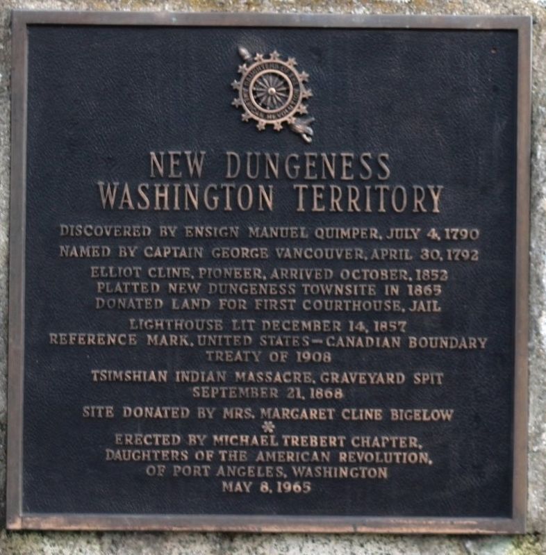
Discovered by Ensign Manuel Quimper, July 4, 1790
Named by Captain George Vancouver, April 30, 1792
Elliot Cline, pioneer, arrived October 1852
Platted New Dungeness township in 1865
Donated land for first courthouse, jail
Lighthouse . . . — — Map (db m294034) HM
Started: 3:00 AM. Sept. 20, 1951 Origin: X, Traveled 18 miles in 6 hours Burned 30,275 acres Destroyed 620,000,000 BD. FT. $100,000,000 lost Be Careful with Fire — — Map (db m290566) HM
In the early 19th century what is today the northwest coast of Washington State might have become a Russian colony, an extension of Alaska, if the Sv. Nikolai voyage had been successful. This could have led to this section of New Albion, the . . . — — Map (db m129579) HM
Bordered by the Strait of Juan de Fuca and the Pacific Ocean, pre-contact Makah held a vast area of inland and coastal territory. These richly forested lands and the seas which teemed with life offered early Makah a wealth of natural resources. The . . . — — Map (db m129586) HM
The Shay locomotive is named for inventor Ephraim Shay of Cadillac, Michigan. The vertical cylinder conveyed power to all the wheels by universal joints and expansion couplings forming a flexible shaft which was rigid in revolution but flexible in . . . — — Map (db m129548) HM
In the last 150 years, the West Olympic Peninsula has seen many changes in timber transport.
photo 1: This picture shows a team of oxen hauling logs off a hillside in the 1890s. In the early days of logging on the Peninsula, oxen were . . . — — Map (db m129493) HM
This Sitka Spruce log came from a tree which was 11’ 8” in diameter, or 37’ 1” in circumference, and 256’ tall. The tree was already 259 years old in 1776 when the Declaration of Independence was signed. Sitka Spruce is native to the fog belt of . . . — — Map (db m290489) HM
Sail and Seal Rocks rise from the seascape in front
of you, where Snow Creek enters the Strait of Juan
de Fuca. This rich and productive marine habitat
attracts fishermen, divers, kayakers—and whales!
Snow Creek overlook is one of the . . . — — Map (db m83679) HM
The temperate rain forest is dominated by Sitka spruce. Except where it penetrates valley such as the Hoh, the Sitka spruce grows along a narrow coastal strip from northern California to Alaska.
High rainfall, fog, and ocean-moderated . . . — — Map (db m83654) HM
According to a seventeenth century account, Apostolos Valerianos discovered a waterway through the northwest corner of North America in 1592 — a Northwest Passage. He reputedly sailed for the Spanish under the name “Juan de Fuca.”
For a . . . — — Map (db m177413) HM
This park is a part of a United States Military
Reservation established in 1862. It was dedicated to public
use in 1904 through the efforts of Dr. Freeborn Stanton
Lewis, pioneer physician, then Mayor of Port Angeles. — — Map (db m291246) HM
Ordered a reservation here for lighthouse and military uses. Later under Congressional Act of March 3, 1863
Part of it became a townsite reserve making Port Angeles the Second National City. — — Map (db m291245) HM
The Spanish Captain Juan Perez sailed north from San Blas in 1774 with orders from Spain to claim the Coast against the Russians. Perez discovered Nootka Sound on the West shore of Vancouver Island and traded with the natives of the Queen . . . — — Map (db m83652) HM
Victor Smith - founder of the City of Port Angeles, the Second National City, June 19, 1862.
Minerva Lewis Troy - Pioneer in Art, Music, Drama, 1890-1960. — — Map (db m293878) HM
To commemorate the discovery of Port Angeles Harbor in 1791 by Lieutenant Francisco Eliza who named it Porto de Nuestra Senora de Los Angeles (Port of our Lady of Angels) — — Map (db m291266) HM
The landscape of the Strait of Juan de Fuca was
carved out by ice-age glaciers 13,000 years ago.
The retreat of the glaciers created deep fjords which
provide abundant food and habitat for many species
of marine mammals.
By the mid-1900’s, . . . — — Map (db m83693) HM
Lighthouse tender boats supplied the Station by traversing Dungeness Bay from the mainland. At least four docks were built over the years. They were often destroyed by storms.
The original dock was constructed circa 1857. It is unknown if . . . — — Map (db m129695) HM
Approximately 10,000 years ago
Dungeness Spit began to form. The Spit is formed from sand and gravel from the Olympic Mountains carried by the Dungeness River into Dungeness Bay.
Debris is also sloughed off the bluffs to the . . . — — Map (db m129716) HM
These sandstone blocks, hewn from a quarry in the Cascades, were hand-carved and incorporated into Aberdeen's historic 1909 Weatherwax High School.
When the school burned down in 2002, the stones were wisely pulled from the ashes, but without . . . — — Map (db m199021) HM
The name "Wishkah is an adaptation of the Chehalis Indian word hwish-kahl, meaning "stinking water." You are now standing upon the Banks of the Moddy Wishkah, home and inspiration to one of the world's greatest musical icons.
Kurt Cobain, . . . — — Map (db m270786) HM
The spirit of the American Doughboy. Who in peace represented the nation of freemen and in the world war fearlessly faced death in defense of human rights and liberty. Cherishing the memories of those who fell, and with gratitude to the survivors of . . . — — Map (db m198823) WM
In 1854, the U.S. Commissioner of Indian Affairs instructed Isaac I. Stevens, Governor of the Washington Territory, to enter into treaties with the coast Indian tribes. Following the initial council meetings here in Cosmopolis, treaty councils were . . . — — Map (db m129124) HM
An atmospheric-style theatre
built in 1928
This property has been
placed on the
National Register
of Historic Places
By the
United States
Department of Interior
1987
and the
Hoquiam Register
of . . . — — Map (db m73008) HM
Registered National
Historic Place
F. Arnold Polson House
and Alex Polson Grounds
Under the provisions of the
National Historic Preservation
Act of 1966, this property possesses
exceptional value in illustrating
American . . . — — Map (db m72802) HM
John James, Hoquiam's first settler, recalled in his memoirs an encounter which aptly, albeit unknowingly, identifies him as Hoquiam's first “librarian:”
One evening Humptulips Pete (an Indian) was sitting by my fire. He asked me . . . — — Map (db m197152) HM
Built for C.N. Byles, known
as the "Father of Montesano,
pioneer banker in 1887 of the
Bank of Montesano, auditor, treasurer,
and mayor of Montesano. Disastrous
investments in Ocosta real estate, and
his death in 1897, forced the sale of
the . . . — — Map (db m303515) HM
In 1912 a committee was formed to construct a fire hall for the 1892 volunteer fire department. They acquired three lots on this corner & moved the post office that was here. James Movic was the contractor; the project bankrupted him & the $490 tile . . . — — Map (db m197150) HM
Built by William Shoe for the Montesano
Telephone Co., this unique brick and stucco building
with two feet thick walls, has also housed West Coast
Telephone, Judge Abel, Dr. Fritz, Healy's Liquor store, Grays
Harbor County Extension, Dr. James . . . — — Map (db m303518) HM
This building, now the oldest commercial building in
Montesang was built expressly for The Vidette in 1911. It is
the third home of the newspaper since its founding. Prior
to 1911, the offices were located across the street, on
the alley side . . . — — Map (db m303517) HM
Tradition links this tree
with the name of
Captain Robert Gray
who on May 7th 1792, entered
this harbor in his ship Columbia.
This tablet was erected in his honor by
Robert Gray Chapter
Daughters of the American Revolution . . . — — Map (db m292590) HM
Just as the cabin tells a story of the site's history, so does nature. The large stumps in the area tell about early logging activity. Notice in the photo how different the cabin must have been with an expansive view before the new forest . . . — — Map (db m115751) HM
Emory Finch, the son of Hoodsport pioneers, moved into Interrorem with his new bride Maybelle Peterson on their wedding day, April 22. 1908. Like her husband, she saw at home in the outdoors. The couple met when she and two friends came over from . . . — — Map (db m116139) HM
Interrorem Ranger Cabin is the oldest Forest Service dwelling on the Olympic Penninsula and one of the oldest in the Northwest.
As you gaze through the trees at Interrorem Ranger cabin, step back in time to the Spring of 1907. From this spot . . . — — Map (db m116138) HM
The name Interrorem, according to the most popular theory, was derived from Latin meaning "between the gold". Others believe it was slang for "Interim," used by those who thought the cabin would be a temporary site for managing the forest. Instead, . . . — — Map (db m116137) HM
Early Forest Rangers were custodians of the forest, riding horseback over mountain trails and camping out, protecting the forest from fires, poachers, and trespassers.
Most were outdoorsmen, former cowboys, trappers and woodsmen. They were hired . . . — — Map (db m116140) HM
It is no wonder that the churning fishing hole one mile down this trail is called Ranger Hole. Emery Finch, and many other early Rangers were avid fishermen, wearing a well traveled path between the cabin and their favorite fishing spot. Fishing was . . . — — Map (db m116141) HM
Sv. Nikolai Mission In September 1808 the Russian American Company (RAC) schooner Sv. Nikolai (Saint Nicholas) set sail from the Russian American Company's fort in Sitka, which was then in Russian territory (now part of the State . . . — — Map (db m129574) HM
Anna Petrovna Anna Petrovna Bulygin, a Russian woman notable for being the first European woman known to live in what is now Washington State, landed with the crew of the Sv. Nikolai. Anna was eighteen years old, the attractive wife of . . . — — Map (db m129585) HM
Escape to the Hoh River Leads to Captivity At dawn following a harrowing, fearful night awaiting retribution, the Russian party reconnoiters, but finds only dense forest growing down to the high-tide surf line. Captain Bulygin decides to take . . . — — Map (db m129588) HM
The tribal name for the Hoh River is Chalak'At'sit (meaning "The Southern River"). The river itself is focal in Hoh tribal identity and folk-history and in traditional economic patterns. The Hoh people were created along the river. Mythic . . . — — Map (db m129587) HM
Thousands of winters before the arrival of the White Drifting-House people, the Ho-qwats, the Quileute Indians and the ghosts of their ancestors lived and hunted near La Push, Washington. For as long as the ageless memory of legend recalls, the . . . — — Map (db m129589) HM
To commemorate the exploration of the waters of the Pacific Northwest by Captain George Vancouver, R.N., whose first camp was on the beach at the mouth of this stream May 2, 1792. — — Map (db m276905) HM
The čičməhán Trail is comprised of 16 sites that naturally divide into a 3-mile, a 6-mile, or a 12-mile loop. The 3-mile loop includes downtown historical sites; the 6 mile loop extends uptown; and the 12-mile loop (best for . . . — — Map (db m179367) HM
For more than 50 years, the bell was used to call volunteer fire fighters to their posts. It is the only known tower of its kind in the United States. It was restored in 2003 by the Jefferson County Historical Society and the City of Port Townsend . . . — — Map (db m155268) HM
Early settlers to the Port Townsend area found a S'Klallam Indian community well established on the protected shores of Port Townsend Bay. This settlement, known as Kah Tai, meaning "to carry" or "pass through," was located on the portage route . . . — — Map (db m179612) HM
The S'Klallam people made their canoes from Western Red Cedar trees ranging from 300-800 years of age. Seats and brackets were made of Yew wood, and paddles carved from Yellow Cedar.
Canoes Came In All Sizes
A freight canoe of good . . . — — Map (db m179378) HM
Commemorating Capt. George Vancouver’s discovery, landing & naming of Port Townsend in honor of the Marquis of Townshend, May 7, 1792.
Donated Dec 1, 1986, by the DeLeo Family, residents of Port Townsend since 1883. — — Map (db m91334) HM
Tucked away in what was once a secluded corner, the cemetery was to be the final resting place for those soldiers and their immediate family members who died at Fort Worden. The first burial in the 360 plots was that of Pvt. Elisha Webb, in . . . — — Map (db m179754) HM
Chief of the Clallam Indians
A Friend of the White People
From this rock
he gave warning of danger
and saved them
from massacre in 1856 — — Map (db m179770) HM
Many in Port Townsend have heard of Chief Chetzemoka (Cheech-Ma-Ham), chief of the S'Klallam. At Point No Point in 1855, he signed the treaty giving up all S'Klallam land for a reservation to be shared with another tribe. Such treaties, pushed . . . — — Map (db m179408) HM
"Blessed are the peacemakers:
for they shall be called
the children of God." Matthew 5:9
"If I am seen coming to you I will not be able to help you further. But each morning I will sit on top of the big rock on the east side of Kai Tai . . . — — Map (db m179771) HM
What was the Chinese Exclusion Act of 1882?
Like many other cultural communities in early Port Townsend, Chinese and Chinese American merchants, families, farmers, and laborers were an important part of the cultural and economic . . . — — Map (db m179707) HM
Who was the "Crimper King" of Port Townsend?
The practice of forced maritime service was known as "crimping" in the 19th Century. Early fortunes were made provisioning out-bound ships with sailors. Maxwell Levy, the "Crimper King" of . . . — — Map (db m179358) HM
What did Port Townsend look like in the 1860s?
You are standing near the site of Port Townsend's first settler cabin. The area was often flooded with seawater. Alfred A. Plummer, age 29, arrived in 1851 with Charles Bachelder and . . . — — Map (db m179690) HM
This is the last remaining
wooden fire bell tower in the
United States.
Port Townsend’s Fire Bell Tower is a 75-foot wooden structure built in 1890 to hold a 1,500 pound brass bell and the city's new $900 fire engine.
. . . — — Map (db m83775) HM
How was early Port Townsend affected by fire?
Port Townsend's earliest buildings were tightly packed wooden structures, that were both lit and heated by fire. The threat of disastrous, multi-building fire was ever-present. Entire . . . — — Map (db m179736) HM
Port Townsend's first stone building was completed in 1874 for Enoch S. Fowler. It served as the Jefferson County Courthouse from 1880-1892 (and was also used as a store, performance hall, Masonic Temple, seamen's chapel, and, since 1916, home of . . . — — Map (db m179527) HM
The Haller Statue and Fountain was donated to the city by Theodore N. Haller "in memory of early pioneers."
After the dedication speech in 1906, Mr. Haller read a poem about the Greek sea nymph, Galatea, and the statue has been known . . . — — Map (db m179703) HM
Under the provisions of the
State Historic Preservation Act of 1967,
this property possesses particular value
in commemorating, or illustrating
American History
Placed on the State Register
Feb. 11, 1972 by the Governor's Advisory . . . — — Map (db m179516) HM
In 1891 architects Batwell & Patrick designed a multi-purpose civic structure to house administrative offices, council chamber, courtroom, fire hall and jail to serve the needs of a city of 20,000.
Port Townsend's city council still meets . . . — — Map (db m129357) HM
Founder of Admiralty Aububon
who led the effort to save
Protection Island as a
sanctuary for nesting seabirds
A gift from Audubon members & friends,
Eleanor's family, Friends of the Arts, and the
City of Port Townsend Public . . . — — Map (db m179412) HM
Chetzemoka's Big Heart, a story by Mary Ann Lambert (1879-1966, also the author of The 7 Brothers of the House of Ste-Tee-Thlum) of the Jamestown S'Klallam Tribe's Lambert/Reyes family, illustrates Chetzemoka's heart, and the power and respect he . . . — — Map (db m179745) HM
In 1989, the Canoe Culture was revitalized with the inception of the Intertribal Canoe Journey. The S'Klallam/Klallam Tribes participate in the Intertribal Canoe Journeys in which Canoe Families from dozens of Tribes travel to one destination . . . — — Map (db m179387) HM
For centuries, the S'Kallam people traded with other Tribes within the continental U.S. and across the Strait in Canada. Direct trade was the Native method of food and materials redistribution across geographical bounds, and from great . . . — — Map (db m179381) HM
Under the provisions of the National
Historic Preservation Act of
October 15, 1966, this property
possesses exceptional value in
commemorating, or illustrating
American history
Placed on the National Register on
July 24, 1973 by . . . — — Map (db m179757) HM
Dedicated May 21, 1948
as a lasting tribute
in honor of those from
Jefferson County
who sacrificed their lives
for their country
in the two World Wars
1917 • World War I • 1918
James A. Anderson · Fred W. Anderson · John W. . . . — — Map (db m179733) WM
Here in the wind-buffeted rain shadow of the Olympic Mountains grow colorful relics of the last ice age. The tiny prairie before you is a remnant of once extensive grasslands that followed the retreat of continental ice over 10,000 years ago. . . . — — Map (db m179767) HM
Dedicated to all the men and women
of Jefferson County who served in
the Korean War
and most especially to
those who made the supreme sacrifice
Herman Felhoelter Capt U.S. Army KIA 16 July 1950
Donald A. Bare Cpl U.S. Army KIA 01 . . . — — Map (db m179752) WM
Begun in 1892 by Port Townsend pioneer Joseph A. Kuhn, this building represented the latest ideas of the time in architecture. Construction was directed by Jonas Guise, then the best known contractor in the area. Bricks came from the yards of . . . — — Map (db m91331) HM
Marvin Shields was a product of the Northwest. He graduated from Port Townsend High School and then went to work in Alaska for the Mineral Basin Mining Company. He enlisted in the Navy in 1962 and joined Naval Mobile Construction Battalion 11. . . . — — Map (db m179361) HM WM
The Jamestown S'Klallam Tribe, like the Northwest Maritime Center, is a 21st century organization with a tremendous appreciation of our seafaring history and respect for those who have preserved and shared their knowledge throughout the . . . — — Map (db m179410) HM
For over 8,000 years Native Americans camped at Point Hudson while migrating from summer camps to winter lodges.
The American explorer, Captain Charles Wilkes, named the area in honor of Commander William L. Hudson in 1841. . . . — — Map (db m179370) HM
Before the shoreline was filled to create the marina, Point Hudson was a popular clamming beach for S'Klallams and a landing point for tribes from locations across the Olympic Peninsula.
Change began as soon as settlers arrived, but grew . . . — — Map (db m179751) HM
It is believed that for thousands of years Point Hudson was used as a seasonal home by the Native American tribes, particularly Klallam and Chemakum. Presence of a freshwater lagoon, a wide variety of shellfish and other seafood easily obtained . . . — — Map (db m179746) HM
This point of land is formed of rocks and sand constantly in motion carried here by wind and waves. These sediments, eroding from nearby glacial bluffs, converge here from the northwest and the south before moving along the spit into deeper . . . — — Map (db m179749) HM
Activated on 15 Dec. 1879, the original light was located atop the lightkeepers house. It was moved to its present position when this structure was built in 1913. The lighthouse has been closed to the public since its automation in Nov. 1976. . . . — — Map (db m197213) HM
Under the provisions of the National Historic Preservation Act of October 15, 1966, this property possesses exceptional value in commemorating, or illustrating American history Placed on the National Register on Sept. 29, 1970 — — Map (db m222603) HM
Hidden Histories
Port Townsend's architectural history is so well preserved, it's easy to overlook the stories that remain hidden. Our city, community, and daily lives are defined by what came before. Today's Port Townsend is in . . . — — Map (db m179704) HM
[(Top plaque)] Under the provisions of the National
Historic Preservation Act of
October 15, 1966, this property
possesses exceptional value in
commemorating, or illustrating
American history.
Placed on the National Register on . . . — — Map (db m197156) HM
In the early 1890s, Port Townsend expected to be the major seaport for the northwest coast, and built to serve a huge population that never came. By 1896, the economic tide reserved, and the town was left high and dry. A century later, historic . . . — — Map (db m179624) HM
Why are there so many Victorian buildings here?
Many of the historical buildings around you were built in the 1880s and 1890s. The facades of these ornate stone, brick, and cast iron structures memorialize the names of their . . . — — Map (db m179442) HM
This site is the last remaining vestige of the natural prairie that spanned the qatáy Valley, between wetland areas. Relatively dry, upland areas of the valley provided camas bulbs (qʷɬúʔi in Klallam and Camassia quamash in Latin) . . . — — Map (db m179762) HM
Did Port Townsend have a railroad?
1880s Port Townsend was a booming seaport and Washington's Port of Entry. Great efforts were made to connect the city with the nation's expanding railway systems. Local business owners and . . . — — Map (db m179536) HM
Under the provisions of the National
Historic Preservation Act of
October 15, 1966, this property
possesses exceptional value in
commemorating, or illustrating
American history
Placed on the National Register on
Sept 29, 1974 by . . . — — Map (db m177418) HM
Port Townsend's strategic location at the entrance to Puget Sound won it the U.S. Customs Service headquarters in 1854, just three years after the town was established.
Every vessel entering Puget Sound from any foreign port was . . . — — Map (db m179374) HM
After signing the 1855 Point No Point Treaty, it was clear that there had been some misunderstandings, and the federal government was failing to follow through on its funding promises. Some of the Tribes of Washington rose up against what they saw . . . — — Map (db m179769) HM
Was there smuggling in Port Townsend?
Until 1911 Port Townsend was a Customs Port of Entry for the United States. Goods from foreign ports arriving in Puget Sound had to stop in Port Townsend and pay taxes. Avoiding customs was . . . — — Map (db m179593) HM
Starrett House Under the provisions of the National Historic Preservation Act of October 15, 1966, this property possesses exceptional value in commemorating, or illustrating American History Placed on the National Register on September 29, . . . — — Map (db m129376) HM
In 1885, George Sterming realized his lifelong dream. On this site he erected the building which still bears his name. The upper floor was devoted to office suites and the ground floor housed the soon to be famous Belmont Restaurant and . . . — — Map (db m179673) HM
The Haller Fountain was brought to Port Townsend by resident Theodore N. Haller to honor his deceased father and brother. After the dedication speech, Mr. Haller read a poem about the Greek sea nymph, Galatea, and the statue has been known by that . . . — — Map (db m91294) HM
Under the provisions of the National
Historic Preservation Act of
October 15, 1966, this property
possesses exceptional value in commemorating, or illustrating
American History
Placed on the National Register on
Sept. 29, 1970 by the . . . — — Map (db m179530) HM
For thousands of years, the S'Klallam ("strong") people lived in villages along the north coast of the Olympic Peninsula, moving with the seasonal resources and living in harmony with nature. In addition to hunting in the mountains and . . . — — Map (db m179376) HM
118 entries matched your criteria. The first 100 are listed above. The final 18 ⊳