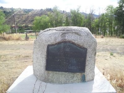
Log Building Completed 1898 Architect: Kirtland Kelsey Cutter, Spokane
Placed on National Register of Historic Places, 1992
Organized by the Rt. Rev. Lemuel H. Wells,
Bishop of the Spokane Missionary District
who presided at confirmations . . . — — Map (db m129263) HM
This site on Ribbon Cliff called Broken Mountain by the Indians experienced a violent earthquake in December, 1872. The shock split the mountain, forming the cliff to the west and causing a huge rock slide which stopped the flow of the Columbia . . . — — Map (db m129261) HM
The Native Americans Prehistoric travelers established trails. The first travelers to cross the Cascade Range were the ancestors of today's American Indians. They followed animal trails and natural passageways which eventually became . . . — — Map (db m156201) HM
In the 1880's and 90's miners ventured up-lake searching for gold, silver, copper, and other metals. Wealth eluded them, but the scenic beauty of Lake Chelan and the Stehekin Valley made a fasting impression on all who passed through.
By 1900 . . . — — Map (db m196820) HM
The building at 238 S. Wenatchee Avenue
is a portion of the original Clark Hotel
which later became the first Chelan County
courthouse. The building had been constructed
by the Wenatchee Development Co in 1893.
When citizens lobbied to . . . — — Map (db m303157) HM
To commemorate the work and achievement of Judge Thomas Burke founder of Wenatchee, and Washington’s first citizen, this enduring tablet is affectionately dedicated by the citizens of Chelan County, to honor him while he is still living among . . . — — Map (db m153400) HM
This complex of two buildings - the former federal building and post office - represent the best examples of federal architecture in Wenatchee.
The first federal building was built in 1917 at the corner of Yakima and Mission. It housed the post . . . — — Map (db m197130) HM
First-class in every class, Stages to meet all Trains. Hot and Cold Water. Rooms with Baths. Livery in connection. Munro Hotel. Autos For Hire. Vehicles and Saddle Horses to all points in Stevens, Ferry and Lincoln counties. Twenty-four years in . . . — — Map (db m291725) HM
The town of Kettle Falls was built
here as a resort center by investors
from New York in 1890. The idea failed
when the Spokane Falls and Northern
Railway bypassed it in 1891. The town's
300 residents and some of its buildings
were moved to . . . — — Map (db m291724) HM
He proved himself a strong and able leader, and although his was not an inherited chieftainship, he was officially recognized as chief of the Okanogan Indians in about the year 1858. His whole life was a series of accomplishments for his people. — — Map (db m274066) HM
Adventurer, Seaman, and Miner
A native of the Pacific Northwest and admired for his bravery,
intelligence, and friendly cooperation, Ranald MacDonald is honored
by the Japanese as their first teacher of the English language and
culture. . . . — — Map (db m303285) HM
John Jacob Astor's fur traders built Fort Okanogan in September, 1811. The British North West Company took possession in the War of 1812. The Hudson's Bay Company owned the Fort from 1821 to 1860. It was moved in the 1830s to the Columbia River. A . . . — — Map (db m266672) HM
Prior to mineral entry in 1896, a Chinese man named Chee Saw and his Indian wife lived on an Indian trail on Myers Creek. The site soon became a mining center with about 250 inhabitants and was named Chesaw after its long time resident. Chesaw . . . — — Map (db m302225) HM
The Chesaw 4th of July Rodeo has been held annually since 1942. Chesaw celebrated the Nation's Independence Day annually from the early 1900's until 1942 with events such as mining competitions, horse races and games. The rodeo facilities were . . . — — Map (db m303497) HM
Conconully sprang alive in 1896, a rip-roaring mining camp known as Salmon City. Fire wiped out most of the town in 1892, in May 1894 a run off flood roared down the north fork of Salmon Creek wiping out the business district. The reservoir below . . . — — Map (db m296629) HM
The lakes at Conconully were created by earthen work dams in the early
1900s to provide agricultural irrigation for farms and orchards to the
south on Pogue Flat. Conconully Reservoir was one of the first two such
Western water storage lakes . . . — — Map (db m303492) HM
This log cabin is a replica of the one that stood on the John Perkins ranch at the head of Johnson Creek and was Okanogan County's first courthouse. In March, 1888, the three commissioners, William Granger, George Hurley and Guy Waring, appointed by . . . — — Map (db m296634) HM
Scotch Creek Basin, bordered by Schalow Mt. on the west and by Dunn Mt. and the Lime belt on the east, provided an ancient Indian trail to the Sinlahekin valley and north to Canada. Contorted sediments in the landmark Barnett Bluff are evidence . . . — — Map (db m223520) HM
When completed in 1941, Grand Coulee Dam was the world's largest concrete structure. It still is today.
President Franklin D. Roosevelt supported this massive federal project to dam the Columbia River because it put people to work during the . . . — — Map (db m196825) HM
In the fall of 1885 Fr. Etienne de Rouge, S.J., recently ordained, found standing a small primitive cabin left by his predecessor, Fr. Urban Grassi, S.J. This cabin marked a favorite meeting place of the Okanogans. They called the site . . . — — Map (db m266715) HM
This is the eastern junction of one of the most historic pathways in Okanogan County, connecting the Okanogan and Methow River valleys. From here, the Chillowist Trail, also known by the Indians as "the old horse trail,” follows the Chillowist Creek . . . — — Map (db m270167) HM
When the nearby Squaw Creek mining boom collapsed in 1898, W.A. Bolinger moved his store to this site - it stands just south of this marker - and the town of Methow was born. A tenth of a mile north of here is a log schoolhouse also moved from . . . — — Map (db m303502) HM
Richard G. Sidley Territorial Police and Customs Collector settled here in 1889. He started an international town, general store, saloon, livery barn, and black smith’s shop. He served as postmaster and kept an eye out for horse thieves. Dominion . . . — — Map (db m154992) HM
Was built in 1914 and served as a twelve year school 1915-1962. In 1962, the high school students were bussed to Oroville as part of a centralization process which was completed in 1969, when the school was closed.
We invite you to tour the . . . — — Map (db m303498) HM
Founded by the Molsons of Montreal, Quebec, as a mining and townsite venture, it boomed in 1900 - died in 1901. Homesteaders came, then the railroad came in 1905. Molson built up again to become the commercial center of the Okanogan Highlands - . . . — — Map (db m154989) HM
Started in 1919, construction of this building was finished in 1920. The
building was praised as one of the most modem and up-to-date bank
buildings in eastern Washington. Featuring two stories and a full
basement, the building is faced with red . . . — — Map (db m303495) HM
December 18, 1925 marked the formal opening of the Cariboo Inn,
approximately one year after fire destroyed the landmark Bureau
Hotel. Strongly promoted by the Commercial Club, the building of
the Cariboo Inn received solid financial support . . . — — Map (db m303499) HM
Lest we
forget
Joe Biart • W.C. Sockwell • Major Hodges • Tom Robinson • Percy Reed • William Hess • James F. Kane • Alvin H. Smith • George F. Dick • Frank M. Clapp • Frank O'Brien • Hughie Frasier • Stanley Bricht • William Morrow • Henry . . . — — Map (db m197127) WM
Queen City of the Okanogan County silver boom, Ruby was born in the spring of 1886. Main Street, following this county road, was 60 feet wide. Both sides were solidly lined with business places for 1/4 mile. Cabins and shacks clung to the hillsides. . . . — — Map (db m265864) HM
This beautiful river valley forms a natural north-south passage, used for centuries by Indians. Later came Hudson’s Bay Company fur brigades, packing pelts from Canada to Fort Okanogan. Hardly had the dust settled from the last brigade (1846) when . . . — — Map (db m129000) HM
Before 1900, the cattlemen had the rangeland to themselves, except for wild horses. Then sheep appeared. Tempers flared instantly. Haystacks put up by sheepmen mysteriously burned. The hostility reached its climax one night in the spring of 1903 . . . — — Map (db m154939) HM
Welcome, folks, to Old Molson, founded in 1900. She was a lively mining camp until a farmer claimed the whole town as part of his homestead. While the dispute raged, disgusted citizens founded New Molson half-a-mile north. People, businesses, the . . . — — Map (db m154982) HM
A French nobleman turned priest, Etienne DeRouge, S.J. established St. Mary's Mission at the invitation of Chief Smitkin in 1886. From a single log cabin, St. Mary's grew into a junior college—complete with dormitories, hospital, band, museum, and . . . — — Map (db m270171) HM
In 1906, 40 acres were set aside for a townsite. A one-room schoolhouse and quarters for a teacher were built. The railroad maintained a crew bunkhouse and quarters for the section foreman’s families. Trains stopped here 20 min. - 1/2 hr. to cool . . . — — Map (db m155004) HM
Just across Lake Osoyoos from here, Hiram F. (Okanogan) Smith, in the late 1850's, became Okanogan County's first white settler. For years, his lonely trading post was a welcome sight to travelers. In 1857 Smith planted 1200 small apple trees . . . — — Map (db m265865) HM
An Indian princess on falling in love with a captured brave was permitted to marry and return with him to his people on the promise that she would not look back. Happy and gay and forgetting her promise, she laughingly looked back and was turned to . . . — — Map (db m265866) HM
In 1886, shortly after their arrival, Lee Ives and his wife Rena built two log cabins near the river bank and started taking in travelers. Their cabins were located very near this spot in what was to become Pateros.
Lee Ives built the Ive's . . . — — Map (db m129012) HM
The first to settle in the area were the Methow Indians. Although they moved frequently in summer to take advantage of various foods (berries, deer and roots), they usually wintered less than one mile from the mouth of the Methow River.
The . . . — — Map (db m128998) HM
The iron U-bolt imbedded in this rock helped many a Columbia River sternwheeler pull herself through the Methow rapids a mile downstream from here. During spring runoff, the rapids boiled. Then, the crew would fasten a cable to the U-bolt ring . . . — — Map (db m266922) HM
By this time, Pateros had about 850 residents. The main street boasted more than forty businesses that included two grocery stores, Elgin Yeager’s Barber Shop, a hardware store, the Pateros Theater and two lumber yards, Brownson and Wagner. There . . . — — Map (db m128996) HM
Pateros has provided a hardy breed of men and women known for their independence, hard work, and patriotism. Over the last century hundreds have served in our armed forces to protect our American way of life. In the early 20th Century several . . . — — Map (db m129013) HM WM
Below this sign you can see the remnants of the China Ditch built by Chinese miners sometime between 1860 and 1880. This ditch carried water from a diversion point three miles up the Methow River to sluice gold from the Columbia River sandbars a . . . — — Map (db m128997) HM
In 1965, the entire downtown area of Pateros was destroyed when Wells Dam, located six miles downstream, was being constructed on the Columbia River. The entire downtown business district of Pateros was leveled. Paralleling the Columbia River, . . . — — Map (db m129014) HM
The head of navigation on the Okanogan River during steamboat days until 1914 when the railroad came. The shrill sound of the boat whistle to open the drawbridge, rattle of freight wagons and ringing of freight bells which served the north half of . . . — — Map (db m207934) HM
In 1886 Wellington French immigrated from Quebec Canada to the Okanagan Valley and homesteaded this ranch on Scotch Creek. He married Mary McCaskill on Nov. 11 1889 in Spokane. She bore four children: Eva, Katie, Robert and Ray, all of whom grew up . . . — — Map (db m207932) HM
Upset by an increasing flow of miners heading for British Columbia gold fields, Indians lay in ambush through the length of this canyon on July 29 1858, as 160 men lead by David McLoughlin approached from the south. The warriors had camouflaged . . . — — Map (db m265862) HM
The Methow Valley Irrigation District canal you can see behind this sign follows the route of the old high line ditch. Both the ditch and the MVID canal have been vital to the Valley's agricultural production. A fruit-growing boom in the early . . . — — Map (db m303506) HM
Only Indians and a few trappers and prospectors knew this lovely valley until the Chief Moses Reservation was opened to settlement in 1886. Then homesteaders began arriving. In 1887, near the river, Jim Byrnes started a trading post. This became . . . — — Map (db m303508) HM
The first town of Bodie was started by prospectors
at the mouth of Bodie Creek, about a mile south of
here in 1896. There was a general store, a restaurant,
a livery barn, blacksmith shop and many homes, all
made of logs. The town was moved to . . . — — Map (db m302227) HM
The first Wauconda came into being after the three Hedge brothers, from Wauconda, IL, discovered a wide ledge of quartz carrying free gold in the Spring of 1896. This discovery touched off a headlong rush to the area as prospectors envisioned . . . — — Map (db m274064) HM
In 1897 three brothers named Hedges found
gold about three miles east of the present
Wauconda store. The town started in 1898 just
east of the Wauconda summit and was named
after the Hedges hometown in Illinois. Several
roads were built to . . . — — Map (db m302233) HM
Here at the forks of the rushing Methow, Boston-bred Guy Waring founded Winthrop in 1891. Trappers, prospectors and homesteaders tramped into his frontier store. In '95 Colonel Thomas Hart came through to carve a narrow-gauge wagon road across the . . . — — Map (db m36497) HM
Before 1910 Box Canyon, barely half a mile long,
intimidated every passing traveler on the Pend Oreille.
It offered three choices. Turn Back, Portage around.
Or try to run the Canyon.
”This was the terror of the river. All we met . . . — — Map (db m291875) HM
His dynamic leadership guided the formation and development of Public Utility District No. 1 of Pend Oreille County and completion of Box Canyon Dam in 1955.
Allan Emrick was a dedicated
Public Utility District employee
who was committed to his family,
his community, and his job.
Much of the fiber optic communication
revolution successes that occurred in
Pend Oreille County in the late 1990s
were . . . — — Map (db m291874) HM
You are looking at Box Canyon Dam, which is owned and operated by the Pend Oreille Public Utility District.
The project was built in 1955. There are four generators in the project that generate 60MW of electricity. This is enough electricity to . . . — — Map (db m197110) HM
Only a few high-powered steamboats were able to make it through the rocks and rapids of Box Canyon until the U.S. Army Corps of Engineers completed blasting and clearing rock to widen and deepen the channel. Before 1907, most passengers and freight . . . — — Map (db m197111) HM
Built just after the turn of the century by Mr. Ross and his son, Carl, who lived here until 1917, this pioneer cabin remains here in near original condition as a tribute to the hardy settlers of the Boundary country. — — Map (db m286040) HM
The Metalines Mining District
The first large waves of white settlers came to the Metalines in the 1850s with the discovery of gold. By the late 1870s, outcroppings of lead, zinc, and silver had also been discovered, bringing a new flood of . . . — — Map (db m285864) HM
Engine Data
478 Horsepower
22 in. cylinder – 42 in. stroke
120 lbs. PSI steam pressure
63,000 lbs. in weight
Wheel Data
16 Ft. in diameter
100 RPM
42 in. face
20,000 lbs. in weight
The . . . — — Map (db m73497) HM
Burials as early as 1888. Purchased by city in 1925. Veterans of multiple wars
and pioneers interred here including Thomas Brown. — — Map (db m303577) HM
This garden is a living tribute to all
of America's veterans and their
families. In silence and respect, this is
a place to remember why millions of
Americans have fought and died for
our liberty and our freedom.
Here we renew our promise to . . . — — Map (db m302868) WM
This Never Forget Garden was made possible
by a partnership of the Society of the Honor Guard - Tomb of the Unknown Soldier,
Spokane Falls Chapter, and Washington State Society
Daughters of the American Colonists.
The "Never Forget . . . — — Map (db m303579) WM
These old mill stones served the people of this area in pioneer days. Two of them came here from Tumwater in 1858-59, after reputedly having been brought
around Cape Horn. They were used here in a grist mill near
Arden - the first American mill . . . — — Map (db m284735) HM
First territorial county seat of Inland Empire 1859–1883 here commenced American government and justice. Directly south of Mill Creek stood United States Fort Colville quarters for 4 companies of infantry and boundary commission 1859–1883 — — Map (db m269423) HM
Commemorating the establishing of a mission among the Spokane Indians on these grounds by the Reverends Cushing Eells and Elkanah Walker from Sept. 1838 to Mar. 1849. On this spot stood the Eells home. — — Map (db m293738) HM
Near here stood Fort Colville of the Hudson's Bay Company
George Simpson • John Work • Archibald McDonald • Angus McDonald
Here began trade, farming, milling, and stock raising in
Stevens County. — — Map (db m284882) HM
In the 1930's President Franklin D. Roosevelt launched a nationwide campaign to build dams, bringing jobs, power and
irrigation to rural communities. Grand Coulee Dam was
constructed on the Columbia River as part of that effort.
By 1940, the . . . — — Map (db m291728) HM
Father Anthony Rivalli visited Fort Colvile in 1845
nearly twenty years after it was established.
He led the Indians of the Kettle Falls area to build a
small chapel of rough logs and brush. By 1847 that
chapel had been replaced by a sturdy . . . — — Map (db m284885) HM
"Back in the day" you would ring this bell to signal the ferry boat operator on the other side of the Columbia River to send the ferry across. The ferry ran
between Inchelium and Gifford about 30 miles south
of here. In its earliest days you . . . — — Map (db m291729) HM