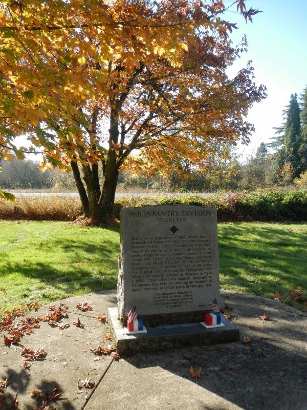
Activated on September 5, 1918 (World War I). Demobilized January 7, 1919. Became Oregon's Reserve Division in 1923. Activated to active duty August 15, 1942 at Camp Adair with orders to be Combat Ready as soon as possible. Trained at Camp Adair, . . . — — Map (db m114386) HM WM
The Quest symbolizes Alice E. Biddle, who in 1870 became the first woman to graduate from what is now Oregon State University. It reflects the energy, dedication and strength of all students in the pursuit of learning. — — Map (db m113343) HM
(Seven panels dealing with topics related to the Applegate Trail are found at this kiosk.)
Applegate Trail
Southern Route to Oregon
In 1846, Jesse Applegate and fourteen others from near Dallas, Oregon, established a . . . — — Map (db m116846) HM
Built in 1888-89, the Benton County Courthouse is the oldest building in Oregon still being used for its original purpose.
The courthouse was designed by Delos D. Neer, a prominent Portland architect, in a style he described as resembling . . . — — Map (db m107360) HM
The Benton County State Bank building was dedicated on July 25, 1907. The bank, built on the ruins of a burned saloon, was representative of a period of growth and prosperity in Corvallis at the beginning of the 20th century.
Corvallis' . . . — — Map (db m117442) HM
The US War Department ultimately selected 55,000 acres at this location for an infantry training site in 1941. Temporary quarters were constructed, and the site was dedicated as Camp Adair in 1942. Camp Adair was designed to train two divisions at . . . — — Map (db m114382) HM
The Corvallis City Hall was located on the southeast corner of Fourth and Madison Streets from 1892 to 1956. This grand brick and stone building with the imposing belltower housed the City Council Chambers, and in addition, provided much of the . . . — — Map (db m112916) HM
The banks of the Willamette River were the focus of early town development. The town plat for Marysville was files on February on February 25, 1851, by Joseph C. Avery, using a portion of his land claim of 1845. The town included property from . . . — — Map (db m117488) HM
The Reach
The Agricultural Reach of Oak Creek drains the croplands and research farm facilities of OSU. The Department of Animal Science manages these agricultural lands. Pastures are used for seasonal grazing and production of hay and . . . — — Map (db m108388) HM
The Episcopal Diocese of Oregon established the first school in the Central Park area. Dr. William Graham, a local physician, donated four lots on the block bounded by Madison, Monroe, Seventh, and Eighth Streets. He stipulated that the building . . . — — Map (db m117365) HM
The First Congregational Church was built here in 1917 to serve a congregation that had outgrown its original 1889 building at Third and Jefferson streets. Designed by architect Roy Dobell, a former instructor at Oregon Agricultural College (OAC, . . . — — Map (db m117268) HM
Fred J. Porter was the great-grandson of Benton County pioneer, Johnson Mulkey.
In the winter of 1845, Mulkey filed a land claim for 640 acres along Oak Creek, on the north side of Baldy Mountain. This was only a few months after Joseph Conant . . . — — Map (db m117266) HM
Mechanical Hall
This structure was built in 1899 to replace the original Mechanical Hall that burned to the ground on September 27, 1898. That fire threw the school year into chaos, since the building had housed the entire engineering program . . . — — Map (db m112864) HM
This is one of the first mill stones or burns to be used in this section of Oregon. This was originally quarried in France and shipped around the horn from New York in 1850 by sailing vessel. In 1852, was transported by oxen team from Portland to . . . — — Map (db m116840) HM
The L.G. Kline Building was built in 1889 for Lewis G. Kline after his successful career as a dry goods merchant in Corvallis.
Kline, a Polish immigrant, came to Corvallis with his wife, Adaline, a Russian immigrant, in 1864. The Klines and . . . — — Map (db m112915) HM
In 1973, Dr. Robert MacVicar, president of Oregon State University, and Gene Hansen, president of the Corvallis Chamber of Commerce, discusses the need to develop a stronger connection between the university and downtown, especially for . . . — — Map (db m117364) HM
A Watershed
A watershed is an area of land from which water drains and flows into a river and its tributaries. Small watersheds, such as Oak Creek’s, become part of larger watersheds when their streams converge. Thus, Oak Creek‘s . . . — — Map (db m108389) HM
On October 27, 1868, the small institution of higher education known as Corvallis College was granted a charter by Oregon's legislative assembly designating it as the state's land grant institution under the provisions of the federal 1862 Morrill . . . — — Map (db m108382) HM
World War I plaque
In Memory of
Earl Blackden
Owen Johnson
R K Wilmot
Foresters Who
Fell in the
World War
1917-1918
World War II plaque
In Memory Of O. S. C.
Foresters
Who Lost Their Lives
In World War II . . . — — Map (db m113266) WM
The first steamboat to reach Corvallis was the sidewheeler Canemah in October of 1851. With this arrival, Corvallis joined Oregon's steamboat era, with tis stories of risk, profit, rivalries, mergers, heroics, innovation and disasters. . . . — — Map (db m117465) HM
Site of the earliest boat landing Lower Town, Marysville, 1851 Presented to City of Corvallis, Oregon Centennial Celebration, June 1957 by the Winema Chapter Daughters of the American Revolution — — Map (db m107333) HM
Agricultural Users
This portion of the Oak Creek watershed is managed as a working agricultural laboratory. Agricultural users include the OSU Dairy Center, beef and sheep production barns, and the Veterinary Medicine Research Farm . . . — — Map (db m108387) HM
The Corvallis Arts Center building began its life as an Episcopal church, constructed in in 1889 just a block south of here. It was one of the products of the influential English emigrants who arrived in Benton County in the late 1800s under the . . . — — Map (db m117279) HM
Ferry service across the Willamette River was established by William F. Dixon, co-founder of Corvallis, in 1848. The service continued for 65 years until the opening of the Van Buren Street Bridge in 1913.
In the 1860s, the ferry was operated . . . — — Map (db m117447) HM
The Incubator House and Poultry Building stood at 26th and Jefferson on the OAC (Oregon Agricultural College, now OSU) campus until 1927, where they formed the headquarters of the Department of Poultry Husbandry.
The Incubator House was the . . . — — Map (db m117612) HM
The Opera House was built on this site in 1870. It was a wooden building with a porch and covered entrance which faced on Fourth Street. The residents of Corvallis raised the money by subscription and donated their labor to build it. Inside there . . . — — Map (db m112917) HM
The 104th Infantry Division was activated on 15 September 1942, at Camp Adair and was named "The Timberwolves." After 18 months of training at Camp Adair and maneuvers in Eastern Oregon and the California-Arizona desert, they moved to Camp Carson, . . . — — Map (db m114384) HM WM
The 70th Infantry Division was activated on 15 June 1943 as "Oregon's Own" and was named "The Trailblazers" in honor of the Oregon Trail Centennial. After a year of training here at Camp Adair the Division moved to Ft. Leonard Wood, Missouri for . . . — — Map (db m114383) HM WM
The Van Buren Street Bridge is Oregon's only remaining example of a movable bridge built using the rare pin-connected truss technology. The use of pins, or bolts, connecting each truss point allowed the bridge to be easily assembled on site after . . . — — Map (db m117491) HM
The Whiteside Theatre opened on November 9, 1922. That evening, the audience enjoyed the silent picture “The Old Homestead,” accompanied by Lilian McElroy on a $20,000 two manual, double touch Wurlitzer organ. That organ was the largest, and the . . . — — Map (db m117434) HM
The 91st Infantry Division was originally activated 5 September 1917 at Camp Lewis, Washington and designated the "Wild West Division." The battle cry "Powder River! Let'er Buck!" was adopted in 1918. During World War I the division fought in the . . . — — Map (db m114385) HM WM
In June 1846 Jesse Applegate, Levi Smith and 11 other men left their homes near Dallas Oregon to develop a southern route from Fort Hall (Idaho) to the Willamette Valley. Their route passed through the gap west of Pigeon Butte, then proceeded . . . — — Map (db m119068) HM
On this knoll stood Ebenezer School-
house, built in 1850. The first school
in the historic Belknap settlement, it was
also used for Methodist Sunday school
and class meetings.
In 1854, the second Methodist Conference
on the West . . . — — Map (db m119276) HM
(Two interpretive displays are located here next to the South Benton Community Museum):
(First Display)
In 1846, Jesse Applegate and fourteen others from near Dallas, Oregon, established a trail south from the Willamette Valley and . . . — — Map (db m116837) HM
United Methodist
Historic Site
No. 323
In memory of the pioneers of the Belknap Settlement who served God faithfully in an untamed land — — Map (db m122508) HM
This variable pitch water wheel was installed in the Long Tom River in 1906 to power the grain & flour machinery at the Adam Wilhelm Flour Mill. It also powered an electric generator that was later installed to provide electricity to the mill & the . . . — — Map (db m119283) HM
Philomath College was chartered November 1865, as the United Brethren School for Oregon, Washington, Idaho, Montana and California. The name combines two Greek words meaning love of learning. The building’s center structure was completed in . . . — — Map (db m122509) HM
On May 11, 1861 Reuben and Mary Jane
Holmes Shipley, former negro slaves,
deeded from their farm purchased from
Charles Bales’ donation land claim, the
original plot for this cemetery.
Buried in Lot 10 are Reuben Shipley, Mary
Jane Shipley . . . — — Map (db m118083) HM
During the first year of the Civil War, Reuben and Mary Jane Shipley donated land to establish this cemetery for the burial of both black and white people. The Shipleys were former enslaved laborers who arrived by wagon with their owners. Mary . . . — — Map (db m234519) HM
Mount Union Cemetery is situated on Reuben and Mary Jane Shipley, one of Oregon's earliest Black pioneer couples. Reuben was born into slavery in Kentucky and was brought to Oregon by his enslaver, Robert Shipley, in 1853. In return for driving . . . — — Map (db m234513) HM
Dr. Wilhelm Keil founded here a Christian co-operative colony patterned after his colony at Bethel, Missouri. Musicians of the settlement made it widely famous. After Dr. Keil's death in 1877 the communal enterprise was dissolved. — — Map (db m114279) HM
This black walnut was planted c. 1884 by the Zimmerman family who were prominent members of the Aurora Colony. Early Aurora settlers were talented and industrious. Their products gained a wide reputation for excellence during the early days of . . . — — Map (db m244246) HM
During the period of Oregon's Provisional Government ( 1841-1849), residents traveled by Indian trails, water courses, or on privative rough-hewn wagon roads etched by emigrant settlers. During the days to the Territorial Government (1849-1859), and . . . — — Map (db m114295) HM
Jonas Will and Andrew Snyder, children of Aurora Colony members, established this then modern mercantile store. Jonas had been an Aurora merchant since 1888. The families ran this business until the 1940's. — — Map (db m114293) HM
Used as a general store. Wm. Keil and Company catered to the trade of some of the mid-valley's best known pioneers by cash or barter. — — Map (db m114294) HM
These Corinthian column segments originally were part of those that graced the west and east entrance porticos of Oregon's first state house. The cornerstone for the original Capitol was laid October 8, 1873. The building was partially . . . — — Map (db m113717) HM
This reproduction of the Liberty Bell was presented to the people of Oregon by direction of The Honorable John W. Snyder Secretary of the Treasury
As the inspirational symbol of the United States Savings Bonds Independence . . . — — Map (db m286757) HM
Founded in 1840 by Methodist missionaries,
Became territorial capital in 1852,
An incorporated city in 1857,
Permanent capital of Oregon in 1864.
W. D. Pugh designed this city hall. Under construction in 1893.Marion County Centennial . . . — — Map (db m63966) HM
In 1922 Thomas Gregor Bligh bought this property from the Salem Elks Fraternal Organization. In 1924, a year after constructing this Mission Revival building, the owner died in an automobile accident. In 1927, is wife Anna sold the property to . . . — — Map (db m287162) HM
The Circuit Rider (south side)Commemorating the labors and achievements of the Ministers of the Gospel, who as circuit riders became the friends, counselors and evangels to the pioneers on every American frontier Robert Booth . . . — — Map (db m157700) HM
In 1867, Willamette University founded the first medical school in the Pacific Northwest – the third such college west of St. Louis.
This college was maintained in Salem from 1867 until 1913 except for the period 1878 to 1895 during which . . . — — Map (db m113737) HM
“May the lives remembered, the deeds recognized, and the spirit reawakened be eternal beacons, which reaffirm respect for life, strengthen our resolve to preserve freedom, and inspire an end to hatred, ignorance and intolerance”
National 9/11 . . . — — Map (db m286371) WM
This downtown block, now site of the Salem Conference Center and The Grand Hotel, has a legacy of hospitality and comfort for those from out of town. The Chemeketa House originally opened here in December of 1870 as Oregon’s premier hotel. It . . . — — Map (db m287041) HM
In 1880, after fire destroyed the wooden buildings here, Samuel Adolph constructed a brick building offering space for three businesses. Smith & Millican, butchers, and Adolph’s saloon were the first two. The third store included jewelers and The . . . — — Map (db m287058) HM
If you were standing here in the 1890s, you could hop on a streetcar and get off at the Capitol or continue to the train station on 12th Street—then considered the outskirts of town.
The first trolleys in Salem were horse-drawn passenger . . . — — Map (db m287044) HM
This site was originally part of the Starkey-McCulley Block to the north and presents a harmonious continuation of that Commercial style with similar second-story fenestration and exterior sheathing. William Anderson, a prominent early Salem . . . — — Map (db m286622) HM
Soon after constructing this Commercial-style building, Arthur Moore moved his bicycle shop into the ground floor and his residence into the second floor, where they also rented apartments. He expanded his shop to include sports equipment. Moore . . . — — Map (db m287184) HM
Originally two buildings, changes in 1923 incorporated a central stairway for access to offices on the second floor. The northern bank portion is probably the only remaining building designed by Holly Cornell (1859-1911), a local architect. For many . . . — — Map (db m286629) HM
Already a hotel and theater owner, Frank D. Bligh built this building, which contained as many as ten separate shop spaces, and the adjoining Capitol Theater, which featured a dome reminiscent of that atop the State Capitol. In 1945 Walter C. . . . — — Map (db m287434) HM
Replacing three buildings from the 1870s, this retail block known as the “White Corner” remained relatively unchanged until the late 1940s. The Breyman/Boise family unified two buildings and removed all decorative ornamentation to model the . . . — — Map (db m286619) HM
This Queen Anne style block, designed by Walter D. Pugh, was built by Asahel Bush and Werner Breyman. It housed retail stores on the ground floor with professional offices on the second floor. The original building was twice the size: the northern . . . — — Map (db m286530) HM
This building was constructed on the site of the Tiger Engine Fire House, No. 2, organized in 1869, continuing as a volunteer organization until 1893 when the city created a paid fire department. A garage with concrete floor was featured in this . . . — — Map (db m286464) HM
A Portland actress and singer, Phillips was working in Manila when the Imperial Japanese Army invaded the Philippines in December, 1941. After the surrender of American and Filipino forces in May of 1942, Phillips became a leader in the underground . . . — — Map (db m287342) HM WM
Located on a prominent downtown commercial intersection, this building has undergone a series of improvements to suit the businesses it has served. It has been owned by many noteworthy Salem names in agriculture and merchandising, including Durbin, . . . — — Map (db m287053) HM
Built by George Guthrie, this theater opened on May 28, 1926, with the silent film “The Volga Boatman” by Cecil B. DeMille. The Elsinore was designed by architect Ellis Lawrence for both stage and film, and movies were often combined with . . . — — Map (db m287435) HM
Salem’s only skyscraper at 11 stories tall, this building was financed by Thomas A. Livesley, a leading hop grower as well as Salem politician and entrepreneur. Elaborate ornamentation decorates the exterior of the eleventh floor upward to the . . . — — Map (db m286972) HM
Chosen by settlers of Oregon country Feb 1, 1842
as the original Board of Trustees
of Oregon Institute
which in 1853 by Act of the Oregon Territorial
Legislature became Willamette University
David Leslie
Jason Lee
Lewis H. Judson . . . — — Map (db m287359) HM
This property has been listed in the
National Register of Historic Places
by the National Park Service
in partnership with the
Oregon State Historic Preservation Office.
Preservation of this historic property is supported by the . . . — — Map (db m287051) HM
The Gray name and date of construction are written in recessed letters on the upper facade. The three Gray brothers had early Salem hardware and construction businesses, but left Salem about 1907. In 1900 they sold the building to Russell Catlin and . . . — — Map (db m286955) HM
This property has been listed in the
National Register of Historic Places
by the National Park Service
in partnership with the
Oregon State Historic Preservation Office.
Preservation of this historic property is supported by the . . . — — Map (db m286730) HM
Salem’s Chinatown existed on this block before the construction of this two-story building. Retail shops occupied the first floor while the “New Salem Hotel” provided lodging. John Hughes married Emma Pringle in 1857. The family opneded a mercantile . . . — — Map (db m287441) HM
This Revival style is inscribed with the builder’s name in bas-relief on the upper level. The elder generation of the family operated the “White House Restaurant” on State Street. Son James, part owner, established a furniture, restaurant and real . . . — — Map (db m287048) HM
This building replaced a feed store and livery of the 1880s, but was storing “junk” according to records of 1921. Since horse and carriage days had passed by the time of this construction, Frank and Emelia Meredith constructed this for an auto . . . — — Map (db m286461) HM
This property has been listed in the
National Register of Historic Places
by National Park Service
in partnership with the
Oregon State Historic Preservation Office.
Preservation of this historic property is supported by the . . . — — Map (db m287185) HM
This Douglas-fir was raised from seed carried to the moon by astronaut Stuart Roosa of the Apollo 14 space mission in 1971. It was the first "Moon Tree" to be planted in Oregon and was planted here by Governor Bob Straub on Arbor Day, April 30, 1976 . . . — — Map (db m286377) HM
This Commercial-style structure was part of the Breyman family’s “White Corner Building,” replacing four wood-frame buildings. Typical in Salem’s downtown, the lower-level storefront has changed over time, with the original architectural features . . . — — Map (db m286658) HM
In August 1945, World War II ended and a spirit was born. The brave men and women who served, returned home and defined the "Greatest Generation." These heroes shined a beacon of hope to the world and built America into the great nation it is. . . . — — Map (db m286748) HM WM
George Pearce was associated with Wade, Pearce & Company. His daughters acquired the site from the company in 1918, but did not construct this Modernistic building until 1940. The sisters were Salem educators: Helen was the first woman graduate of . . . — — Map (db m286656) HM
This property has been listed in the
National Register of Historic Places
by National Park Service
in partnership with the
Oregon State Historic Preservation Office.
Preservation of this historic property is supported by the . . . — — Map (db m287176) HM
Originally built in 1860 as a rooming house, Charles T. Pomeroy and A. A. Keene purchased the building and remodeled it into two retail stores. A central staircase with skylight divides the two stores. Substantial integrity of design has been . . . — — Map (db m287052) HM
If you walk just a couple of blocks further west, you will end up at Riverfront Park, one of Salem’s most well-loved parks. Now you might go to the park to enjoy Salem’s Riverfront Carousel or the World Beat Festival, but before the park . . . — — Map (db m286728) HM
The Reed Opera House, built in 1870 by Oregon Adjutant General Cyrus Reed, contained a 1500 seat theater, and a complex of seven retail stores that constituted the state’s first “shopping mall.” Susan B. Anthony campaigned for women’s suffrage from . . . — — Map (db m286720) HM
The second floor retains the architectural integrity of the Roth Company Grocery Store which operated here through the 1920s, while the YMCA occupied the second floor. In the 1930s, the Roth Company Grocery moved, becoming the Willamette Grocery . . . — — Map (db m286790) HM
This property has been placed on the
National Register of Historic Places
by the United States Department of the Interior
National Park Service
and is subject to the provisions of the Oregon Special Assessment Program
ORS . . . — — Map (db m286508) HM
Salem’s Chinatown was once located right where you are standing. This area was the center of a vibrant community that made up over 10 percent of the city’s population around the year 1900. There were traditional Chinese medicine shops, dry goods . . . — — Map (db m287062) HM
First mounted on a tower behind the 200 block of North High Street. It was then moved to the city hall in 1897. This 2000 lb. bell was used to call Salem firefighters to fires from 1882 to 1924. — — Map (db m286376) HM
137 entries matched your criteria. The first 100 are listed above. The final 37 ⊳