The parish of St. George’s Anglican Church was founded at Duffins Creek (now known as Pickering Village) in 1832. The first incumbent of the parish, the Reverend Adam Elliot, originally met with his parishioners at their homes in an area that . . . — — Map (db m243739) HM
Between 1801 and 1807 a settlement developed here in Pickering Township where the Danforth Road crossed Duffin's Creek. Among the early settlers was Timothy Rogers, a prominent Quaker and colonizer who built a saw and grist-mill in 1809. A . . . — — Map (db m208413) HM
From this site, the rich vibrant tone of this bell could be heard throughout the village. For over fifty years, beginning in 1890, the village bell announced the outbreak of fire. When the First Pickering Company of volunteer firemen was formed . . . — — Map (db m208430) HM
This building was constructed by pioneers who emigrated to this area from Pennsylvania in the early 1800's. Members of the congregation hauled the bricks from the Cherrywood brick-yard. Heads of local families served through the years as trustees. . . . — — Map (db m194577) HM
(west side)Sacred to the Memory of Maj. Robert E. Wallace Pte. Horace O. Kift Pte. James J. Halward Lieut. William K. Kift Sapr. Roy C. Woodward Pte. Howard F. Mackin Pte. John H. Dawe They passed out of the sight of men by the path of duty . . . — — Map (db m147899) WM
Robert Holmes spent a lifetime drawing and painting Canadian wildflowers, depicting many varieties in water-colours. Holmes was born in Cannington and is buried here. After studying at the Ontario School of Art and the Royal College of Art, his . . . — — Map (db m147898) HM
One of Canada's leading publishers, Joseph Atkinson was born here in Clarke Township and, at eighteen, began his journalistic career with the Port Hope Times. He subsequently moved to Toronto where he was employed first with the World and later the . . . — — Map (db m244766) HM
Originally known as Darlington Mills, Bowmanville was founded in 1794 when an American family of Loyalists settled near the site of Vanstone's Mill. The first businesses were established in the river valley south of the mill but are now gone. . . . — — Map (db m245101) HM
When war was declared by Great Britain in 1914, recruitment of Canadian troops soon followed. This mural depicts the ceremony as the town's first volunteers marched off with great pride to board the trains for Halifax. The 136th Battalion spent the . . . — — Map (db m245080) HM WM
Central Public School was not the initial building to occupy this site. The first building was a two story frame structure built about 1840 as Bowmanville's first court house and town hall.
In 1855, as an improvement to education, an assortment . . . — — Map (db m245076) HM
Central Public School
Tower Bell
Established 1889 restored on this site
in recognition of the outstanding
educational contributions by
Tom Turner
Principal 1954-1983
June 28. 1983 — — Map (db m244817) HM
Prior to moving to Church Street, Bowmanville's first fire hall
stood in the location of our present Town Hall. With no horse team of their own, a $10.00 reward was offered to the owner of the first team of horses to arrive at the hall during a . . . — — Map (db m245133) HM
This structure is the third to be used as a town hall in Bowmanville's history. The
first was on the site of Central Public School (NW corner of Elgin and Wellington). It was a large wooden building that also served as a court house and school. . . . — — Map (db m245078) HM
An ardent Canadian and founder of the Canadian Club movement, McCullough was born in Bowmanville and moved to Hamilton in 1888. He and four companions in December, 1892, determined to found an organization which would encourage the study of Canada's . . . — — Map (db m245082) HM
With Mr. Levi Tole conducting auction sales & hawkers of patent medicines pitching their wares, the Church & Temperance St. or Market Square, was a busy centre of downtown activity. On the edge of the square was the town pump. This was a popular . . . — — Map (db m245097) HM
This once prestigious property, the 'Rathskamory Estate' was the residence of Dr. George Lowe. With its well groomed gardens surrounded by stately beech, maple & elm trees, this beautiful ten acre property lay between Lowe & Concession Streets. Also . . . — — Map (db m245208) HM
Both St. Andrew & St. Paul's Churches derive their roots from the same early Presbyterian congregation which began holding formal services in 1843. The first St. Andrew's Church, a small frame building, was opened here in 1842 on a parcel of land . . . — — Map (db m245123) HM
Perhaps the most fervent of the Methodist sects, the Bible Christian Church was formed in southwestern England in 1815 and established in Upper Canada during the 1830s.
Served by itinerant preachers, its small but loyal memberShip . . . — — Map (db m245216) HM
This cairn marks the site of a late 19th century grist mill and miller’s house. The stones are from the foundation of the miller’s house.
In 1874 Jacob Stalter built a mill pond, just north of this site, close to the junction of the Black & . . . — — Map (db m245538) HM
A distinguished authority on tropical diseases, Stanton was born near here and educated at Trinity Medical College, Toronto. In 1907, after serving as house surgeon at the Hospital for Tropical Diseases in London, England, he accepted a . . . — — Map (db m244768) HM
An outstanding humanitarian and churchman, Brent was born near Newcastle and ordained in Toronto in 1887. Following parochial service in Buffalo and Boston, he was elected first Episcopal Bishop of the Philippine Islands in 1901. Confronted by the . . . — — Map (db m244750) HM
On this site in 1866 Samuel Wilmot began to experiment with the artificial breeding of salmon. His success led the federal government in 1868 to enlarge Wilmot’s project into Ontario's first full scale fish hatchery, one of the earliest in North . . . — — Map (db m244767) HM
Robert McLaughlin, a pioneer of the Canadian vehicle industry, was born in the family homestead on this property. In 1867, despite lack of technical training, he built two cutters in his driving-shed which stood near this site. His business . . . — — Map (db m244813) HM
Established in 1869 as a home site, it was then used as a hotel from 1879 to 1897. Albert Cook expanded the building and opened the general store in 1898. Herb Harrison was the proprietor from 1919 to 1949. The store was, and still is, . . . — — Map (db m243793) HM
[English] From 1911 to 1926, this Presbyterian manse was home to Lucy Maud Montgomery, the world-famous author whose writing career was launched in Prince Edward Island. Here at Leaskdale she began her role as a wife and mother, and . . . — — Map (db m199578) HM
In this house the author of “Anne of Green Gables” lived for fifteen years, and here wrote eleven of her twenty-two novels, including “Anne of the Island” (1915) and “Anne’s House of Dreams” (1916). Born in 1874 at Clifton, Prince Edward Island, . . . — — Map (db m199500) HM
[English] A rare surviving example of the grand estates of the inter-war years, Parkwood consists of a richly decorated house set in 12 acres of grounds. The house, originally constructed in 1916-1917 to the designs of the Toronto . . . — — Map (db m208899) HM
Born in nearby Enniskillen, McLaughlin apprenticed in his father's Oshawa carriage works when he was sixteen. Convinced of the potential for growth of the automobile industry, he established in 1907 the McLaughlin Motor Car Company, the first major . . . — — Map (db m198928) HM
[English] A famous industrialist and philanthropist, “Colonel Sam” McLaughlin was a founder of the automotive industry in Canada. Involved in the design and manufacture of carriages and sleighs for his family business, he foresaw . . . — — Map (db m208898) HM
The Borsberry Music Hall was located on the north side of King Street, just east of Simcoe Street, a century ago. The Music Hall had a 700 seat capacity and played host to a number of dramatic and musical productions. The street scene outside the . . . — — Map (db m227851) HM
[west side]They shall not grow old as we that are left grow old Age shall not weary them nor the years condemn At the going down of the Sun and in the morning we will remember them "This monument presented to the City of . . . — — Map (db m227777) WM
[English] In honour of our partnership and for the important role our community has played in Canada’s history, CN donated this commemorative tree in celebration of Canada’s 150th anniversary. Special thanks to the Government of . . . — — Map (db m244309) HM
The evolution of Oshawa’s automobile industry is depicted in this mural. In 1899, the McLaughlin Carriage Factory was destroyed by fire, but rebuilt within one year. The McLaughlin Motor Car Company, founded in 1907, began producing automobiles an . . . — — Map (db m227889) HM
This mural, by local students of O’Neill C.V.I. and Msgr. Paul Dwyer C.H.S., depicts the first stage coach line that operated on Kingston Road (Hwy 2) between Fort Frontenac (Kingston) and Fort York (Toronto), 1817 to 1855. The last stop before . . . — — Map (db m227890) HM
[left panel]This building was made possible by the generous gift of Col. R. S. McLaughlin for the appreciation of music by the people of Oshawa ——— Dedicated in the year of our Lord 1942[right panel]And . . . — — Map (db m227899) HM
Memorial Park serves to honour the sacrifice that was made by the residents of Oshawa, men and women serving our country at war, and is home to two significant architectural features: the Cenotaph and the McLaughlin Bandshell. The Cenotaph, . . . — — Map (db m227900) HM
This mural commemorates the 130 year history of Oshawa’s own Ontario Regiment and its involvement in the nation’s conflicts and UN peacekeeping. All of the medals depicted at the bottom of the mural are accurate representations of Canadian Military . . . — — Map (db m227868) HM
The Lake Ontario waterfront was a favourite gathering spot during the summer. Streetcars running north and south on Simcoe Street were a popular means of getting to the waterfront. Barnhardt’s Pavilion was famous throughout Oshawa and beyond for . . . — — Map (db m227800) HM
This stone marks the location of the chancel of St. George’s Church 1852-1924 ——— Erected by members of the Old Church April 23rd 1939. ——— Rectors Rev. J. Pentland, 1852 Canon J.R. Worrell, 1862 Canon W. Belt, 1869 Rev. H.B. Owen, 1875 . . . — — Map (db m227892) HM
This bell hung in the steeple of the church that occupied this site from 1874 to 1967. The congregation was formed in 1831 in Darlington Township as the Christian Church under the leadership of Elder Thomas Henry and moved to a new building . . . — — Map (db m227947) HM
"A very busy and thriving neighbourhood the harbour must have been in the middle decades of the last century when the Lake was the principal highway, when a great part of what was brought in came to the wharf, as well as most of what was sent . . . — — Map (db m245234) HM
"The house looked much the same as it does now. The buffalo house was behind Henry House and was used for a storage shed after the buffalo were taken away. "
- Betty MacInally
The land where Henry House stands was purchased by the Henry . . . — — Map (db m245223) HM
"It was more of a mystery to the kids of the area. For some reason on the main level of the house there was a pile of leather cuttings.
The kids used to dare one another to get pieces of leather to prove their entry into the house. You were . . . — — Map (db m245228) HM
Ontario’s twelfth prime minister was born in Oshawa and educated at the University at Toronto and Osgoode Hall. A practising lawyer, he was a leader in civic affairs and in 1916-17 served as mayor of Oshawa. During the tollowing years he had various . . . — — Map (db m245225) HM
This Blue Spruce tree has been planted to commemorate the 200th anniversary of the arrival of Captain Benjamin Wilson and family from Vermont in 1790. The Wilsons settled just east of the current harbour location (Lot 4). Together with other early . . . — — Map (db m245256) HM
This montage presents images of Oshawa’s development including the historic Sydenham Harbour, and the Oshawa Carriage Works, the factory operated by the McLaughlin Carriage Company, forerunner of General Motors of Canada. Also depicted are a 1924 . . . — — Map (db m227891) HM
This mural was sponsored by General Motors of Canada. The first panel illustrates members of the McLaughlin family, founders of the McLaughlin Carriage Company and McLaughlin Motor Car Company, forerunner of General Motors of Canada. Other panels . . . — — Map (db m227775) HM
This mural portrays Oshawa’s development with the slogan “Building on a Strong Foundation.” Listed at the top are early companies from Oshawa’s past. The panels below depict scenes from three influential companies — Warren Mills, Williams Piano . . . — — Map (db m227773) HM
Capt. A. W. Hawkins • Capt. A. T. McNabb • Capt. A. F. Tongs • Lieut. S. C. Campbell • Lieut. C. S. Dickson • Lieut. W. S. Ecclestone • Lieut. O. H. Hopkins • Lieut. A. R. McCurdy • Lieut. H. Poupore • Lieut. C. E. Speers • S/Sgt. H. M. Paige • Sgt. . . . — — Map (db m244327) WM
The Argyle was a passenger and freight steamer that docked at Sydenham Harbour in the early 1900’s. It operated between Toronto and Cobourg with stops in Whitby, Oshawa and Bowmanville. The return fare from Oshawa to Toronto was $1.00. Evening . . . — — Map (db m227898) HM
This mural depicts the four corners of downtown Oshawa as it was in 1935. Notice the manually operated traffic signal which was used at busy times of the day. Officer Ed Stauffer is directing traffic as he might have in the summer of 1935. — — Map (db m227799) HM
The Oshawa Generals Major Junior Hockey franchise was established for the 1937-38 season and immediately became a hockey powerhouse by winning seven consecutive Ontario championships through to 1944. The team has won five additional Ontario titles . . . — — Map (db m227776) HM
Commissioned by the VON Durham Branch, this mural depicts the 100 year history to date of the VON in Canada. The VON was founded by Lady Ishbel Aberdeen, the wife of the Governor General, on the request of the National Council of Women as Canada’s . . . — — Map (db m227798) HM
Upper Plaque On this site British Security Co-Ordination operated Special Training School No. 103 and Hydra. S.T.S. 103 trained allied agents in the techniques of secret warfare for the Special Operations Executive (SOE) Branch of the . . . — — Map (db m61880) HM
James Rutledge, chairman of the Board of Education, laid the corner stone for this building on June 9, 1913. The library was funded by the Carnegie Corporation in the United States, and was officially opened by the County Clerk John E. Farewell on . . . — — Map (db m217981) HM
A house on this site, demolished in 1971, was the childhood home of Georgina May Campbell. Under the stage name of May Irwin, she was America’s greatest vaudeville and stage comedienne from the 1880’s to the 1900’s. She is best known for an . . . — — Map (db m218005) HM
On Nov. 2, 1872, the Merryweather steam fire engine shot a stream of water over the top of All Saints Church steeple through 800 feet of hose from a well at Brock and Dundas Streets. The test convinced the Town to purchase the engine. In 1969, . . . — — Map (db m236753) HM
Opened in 1874 by the Governor-General, Lord Dufferin, the Ontario Ladies’ College was established in "Trafalgar Castle", former residence of Nelson Gilbert Reynolds, Sheriff of Ontario County. Built in 1859, "Trafalgar Castle" was visited im 1869 . . . — — Map (db m245264) HM
In the Royal Hotel, Canada’s first Prime Minister, as Leader of the Opposition, delivered a speech on May 2, 1877 in support of the local Conservative candidate Thomas N. Gibbs of Oshawa. The Royal Hotel, operated by James Pringle, was built in . . . — — Map (db m218144) HM
The Terrace, built as a fashionable address for professionals and their offices, is probably one of the finest examples of small-town Ontario row housing still standing in the province. The Whitby Local Architectural Conservation Advisory . . . — — Map (db m218147) HM
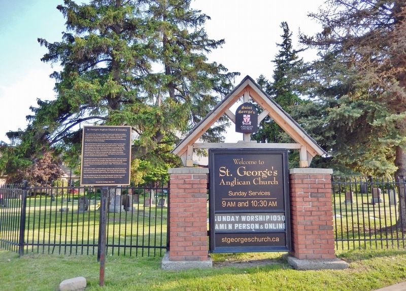
This church acknowledges being on the traditional territories of the Mississaugas of Scugog Island, the Iroquoian speaking Wendat and the 1923 Williams Treaties First Nations — — Map (db m236759) HM
On July 10, 1847 at Scripture's Inn on this site, a public meeting
was called to change the name of Windsor to Whitby because
of confusion in mail and shipping, with Windsor near Detroit. Whitby village was first called Windsor in 1819 by John . . . — — Map (db m245277) HM