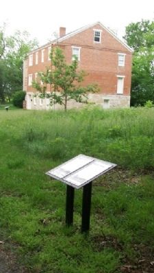
From the early 1840s to 1865 the Oregon-California Trail was the most important route for settlers traveling west. Wagon trains camped at the Iowa, Sac and Fox Mission to take advantage of the spring and the blacksmith. They were followed in the . . . — — Map (db m47930) HM
Two plaques and a medallion are located at this site:
Oregon- California Trail
During the years 1841-1867 over 350,000 persons passed through Casper on their way West. The majority of them traveled through what is now the lobby . . . — — Map (db m92022) HM
Westport
Westport, along with Independence, was a major outfitting point for the Santa Fe, Oregon, and California Trails. Founded in 1834 by John C. McCoy and platted around the trading post he built the previous year, Westport's early . . . — — Map (db m50723) HM
In April, 1852, four brothers, Wesley, Samuel, James and Steven Hill, together with their families, 62 persons in all, left Paris, Monroe County, Missouri, for California.
Their were two deaths along the Platte River and here on the Hamsfork . . . — — Map (db m179619) HM
Original Marker (2008):
Yreka Trail - Splendid Pine Timber
"Passed through splendid pine timber & fur [sic] & spruce ... Passed the dividing ridge of the Shasta Mountains Verry [sic] rough & bad roads this afternoon 18 miles to day . . . — — Map (db m151902) HM
Travelers reached this point over the trail you see stretching out across the prairie to the southeast. They left the last real settlement at Westport Landing or at Independence, some 600 miles from here. Most of them took about 40 days to reach . . . — — Map (db m87332) HM
This ravine started as a set of wagon ruts cut through the grass and soil by heavy iron-shod wheels. It is but one example of the long interaction between man and the environment in this region. This walk to the top of the hill has . . . — — Map (db m87337) HM
To the south stand the Oregon Buttes, a major trail landmark. The name is significant because the Buttes were roughly the beginning of the Oregon Territory and also helped keep emigrants encouraged, even though there were still hundreds of miles of . . . — — Map (db m80499) HM
South Pass was discovered in 1812 by a small band of Astorians led by Robert Stuart as they traveled east with dispatches for John Jacob Astor. It was “rediscovered” in 1824 by a party led by Jedediah Smith as they searched for a winter . . . — — Map (db m80501) HM
Mormon-Carson Pass Emigrant Trail, the heavily-travelled gateway to California gold fields, was blazed in 1848 by discharged members of the Mormon battalion traveling east to join their families.
Five hundred Mormon volunteers, recruited in . . . — — Map (db m10824) HM
The large hill to the north, which became known as “California Hill,” was climbed by thousands of covered wagon emigrants heading west between 1841 and 1860. Many were bound for Oregon. California became the destination of the majority of travelers . . . — — Map (db m51229) HM
Beginning in Independence, Missouri, the Oregon/California Trail passes through present-day Missouri, Kansas, Wyoming, and Idaho. it ends in Oregon, California or Utah - depending on the destination of the pioneers.
While the . . . — — Map (db m90876) HM
For over three decades starting in 1827, Elm Grove Campground, one mile east of near the bridge on Cedar Creek, was an important frontier camp site. Thousands of Santa Fe traders, Oregon and California emigrants, missionaries, mountain men, . . . — — Map (db m20093) HM
The Travelers
For more than four decades, tens of thousands of travelers camped here. The Lone Elm campground was one or two nights out from the frontier "jumping off" points on the Missouri River. The great lone elm tree that gave this . . . — — Map (db m34355) HM
The Santa Fe Trail
The Santa Fe Trail began in 1821 when William Becknell led a small group of men on a trading expedition from frontier Missouri to colonial Santa Fe. Mexico had recently declared its independence from Spain and abolished . . . — — Map (db m34340) HM
"One continual stream of honest looking open harted people going west" - James Cayman, mountain man, captured this sentiment in his diary as he watched pioneers heading west in 1846.
Between 1841 and 1869 nearly 300,000 farmers, . . . — — Map (db m90853) HM
After the last crossing of the North Platte River in the present Casper area, twenty to twenty-five miles east of here, wagons followed the Oregon-California Trail entered a dry, dreary alkali area where fresh water was scarce. Willow Springs was . . . — — Map (db m95592) HM
Grove C. Cook, a native of Kentucky, came to California in 1841 as a member of the Bidwell-Bartleson Party, the first overland emigrant wagon train to set out from the United States to cross the continent to the Pacific Slope.
The party was forced . . . — — Map (db m62419) HM
"the steepest and longest ascent we have made on the route..." - James Wilkins
Looking east across the fields is Big Hill, one of the most difficult obstacles along the 2,000-mile Oregon/California Trail. The trail crosses the Thomas . . . — — Map (db m90851) HM
Many diaries of travelers on the Oregon-California Trail speak of good relations with Native Americans. Indians helped travelers by delivering their letters, pulling their wagons up steep banks, teaching them about edible plants, and keeping watch . . . — — Map (db m47956) HM
Dedicated to
Gregory M. Franzwa
1926 - 2009
Friend of Alcove Spring
Historian-Writer-Publisher
Founder of the
Oregon-California Trails Association — — Map (db m79119) HM
The California Road
Originally a trail through the lands of the Shawnee Indians, running west from Westport through present day Johnson and Douglas Counties, this route was used throughout the 1830's and 1840's by Indians, missionaries, and . . . — — Map (db m50612) HM
In 1849 Joseph Rogidoux III of St. Joseph, Missouri, licensed in the Indian trade, ordered removal of his outfit from the vicinity of Fort Laramie to this strategic pass over Scotts Bluff, where there was ample wood and water. Evidence from several . . . — — Map (db m99134) HM
Originally called Green Point, Indians gathered here for over 3,000 years to fish at Willamette Falls.
George Abernethy arrived here June 2, 1840, with the "Great Reinforcement" of Jason Lee's Willamette Mission. He took 640 acres just north . . . — — Map (db m286204) HM
The Oregon Trail crossing of Willow Creek was an important site on the trail. There was water and forage for the pioneers and their livestock. This was often a location for a layover to rest and equipment repair before pushing on to The Dalles and a . . . — — Map (db m111942) HM
Many hundreds of Overland Trail emigrants died while crossing the continent during the great westward expansion of the mid-Nineteenth Century. Most of these emigrants were buried in unmarked graves beside the trails, and have been lost to history. . . . — — Map (db m148181) HM
Susan C. Haile was born December 20, 1817, in Cape Girardeau, Missouri. She was the youngest child of Joseph and Prudence (Bledsoe) Seawell, natives of Sumner County, Tennessee. Upon the death of Joseph in 1819, Prudence Seawell returned to Sumner . . . — — Map (db m123807) HM
On April 7, 1852, seventeen-year-old Eliza Ann McAuley, with her older brother Thomas and sister Margaret, left Mount Pleasant, Iowa, to travel overland to California. For a time they were accompanied by the "Eddyville Company," led by William Buck . . . — — Map (db m90850) HM
Alcove Spring Park consists of more than 200 acres of native prairie and timber land maintained for the preservation of this historic camping ground on the Oregon-California trail and for the enjoyment of our visitors. The park is owned . . . — — Map (db m79116) HM
The Santa Fe Trail began in 1821 when William Becknell took trade items west and found a ready market in Mexico. He passed through this area before the village of Independence was platted in 1827 as the county seat for newly formed Jackson County. . . . — — Map (db m208242) HM
Pierre Didier Papin
P. D. Papin was a trusted and valued employee of the American Fur Company and its successors for over thirty years. He was born March 7, 1798, In St. Louis. The Papins were a prominent French merchant family in that . . . — — Map (db m133906) HM
The Carson River Route saw more wagon travel during the peak of the Gold Rush than any other emigrant trail. Most of these were Gold seekers headed for the diggings in Placerville, Volcano, Jackson, and Sutter Creek. In 1855, the California State . . . — — Map (db m211982) HM
Below this ridge is what some pioneers dubbed the “Devils Ladder.” A name reflecting the steepness and extreme difficulty that pioneers experienced as they began their ascent over the Sierra Nevada. This climb was usually referred to as . . . — — Map (db m21284) HM
In February of 1844, John C. Fremont led a group of men over these mountains as they struggled to reach Sutter’s Fort. Little did they know that the pass, which lay 20 to 30 feet under the snow beneath them, would be a major route for the Gold Rush . . . — — Map (db m21278) HM
Elisha Stephens was born in South Carolina in 1804 and moved to Georgia with his family at a young age.
However, he was to spend most of the first half of his life in the frontier lands bordering the Missouri River. Like many other Americans of his . . . — — Map (db m55187) HM
Nancy Ann Alien was born November 14, 1832, in Gentry County, Missouri. Her parents were Robert and Marian (Crawford) Ready, natives of Kentucky where they were married in 1826. Nancy was the oldest of four children. Her sister Elenor, "Elen", . . . — — Map (db m148180) HM
Born in Pennsylvania, died in San Jose Dec. 8, 1850
A leader of the Stephens-Townsend-Murphy
Party of 1844
First American M.D. to settle in California
Served as physician, alcalde, and councilman in San Francisco before moving to a farm north . . . — — Map (db m52212) HM
James Williams
California Pioneer
James Williams, age 29 and a native of Cape Girardeau, Missouri, emigrated overland to California in 1843 along with his three brothers – John, age 25; Isaac, age 20; and Squire, age 19 – in a . . . — — Map (db m62440) HM
Sonora was the goal of many emigrants traveling the various overland and sea routes.
The 1852 Clark-Skidmore Party of emigrants from Elizabethtown, Ohio and Lawrenceburg, Indiana struggled to force a wagon train up the Walker River and over the . . . — — Map (db m7566) HM
Wednesday September 15th "Today we traveled up a long hill some 4 miles. Road good, ascent very gradual. When we arrived at the top we got a grand view of the Boise River Valley. It is all filled or covered with dry grass and a few trees . . . — — Map (db m125787) HM
Thursday August 14 "...We had a squally time ascending the bluffs, which are severaly hundred feet high. We passed from a hill to the side of a bluff, upon a high narrow ridge of just sufficient width upon the top for the wagon road, the . . . — — Map (db m125733) HM
Sunday July 27 "Traveled 15 miles 5 miles brought us to a marshy hollow (Hot Springs Creek) which wound to right of the direction were traveling. Traveled in this marsh 3 miles then drove out leaving this marsh to our right..." -- Susan . . . — — Map (db m125751) HM
Saturday August 16 "...we passed a hot springs near the foot of the same range, the water of which was nearly at a boiling temperature, so that one could not hold is finger in it, and a dog careless stepping across it put one foot in and ran . . . — — Map (db m125752) HM
Friday September 10th "...Traveled along the foot of the mountain about 5 miles to another creek and stopped for the night. Plenty of dry bunchgrass. No timber, but willows and sage. Found eight graves here. Made fifteen miles." Parthenia . . . — — Map (db m125754) HM
August the 13th "...the road to day way level but very rocky A long chain of mountains on our right and we travel close to them to day..." -- Absolom B. Harden, 1847
After the transcontinental railroad was completed in 1869, . . . — — Map (db m125755) HM
August 4th "This day we traveled nineteen miles over tolerably rough road ... After watering, we traveled eight and a half miles, which brought us to a barrel creek (Canyon Creek). Here we found a small creek running through a barrel-shaped . . . — — Map (db m125756) HM
Monday October 9th "This evening yellowish granite appeared in needle form fragments and masses. Country mountainous, good grass, water in the creek on which we are camped partially dried up. We struck a large and much travelled Banak trail . . . — — Map (db m125785) HM
August 5th "This morning our road was very hilly for three miles. Here we found water and grass plenty, and brush for fire wood. Having had no water since we left Barrel creek we halted here for a rest. We halted here till 1 o'clock in the . . . — — Map (db m125786) HM
First Overland Emigrant Party
"Left the river on account of the hills which obstructed our way on it, ... Road uncommonly broken, did not reach the river, distance about 4 miles" -- John Bidwell, Saturday, August 14, 1841
"We traveled about . . . — — Map (db m105832) HM
Near here the Elijah P. Utter wagon train was attacked by Indians on September 9 and 10, 1860. The two-day encounter resulted in the deaths of eleven emigrants and an estimated twenty-five to thirty Indians. The forty-four member train was composed . . . — — Map (db m110184) HM
The waters of Rock Creek and the grass that grew along its banks provided a welcome oasis for travelers traversing the arid Snake River Plain. This combination caused the area to become a favorite camping site for Oregon Trail emigrants and a . . . — — Map (db m125406) HM
Beginning in 1849, there plodded up the southern slope of Mount Oread a vast emigration bound for the golden land of California. One branch of the great California and Oregon Trail thus passed over the very ground now part of the university . . . — — Map (db m77573) HM
The Lone Elm Campground
The land here at Lone Elm met the three requirements for a stopover for travelers on the trail...wood, water, and grass. Wood for campfires and wagon repairs, water for the support of people and animals, and grass for . . . — — Map (db m34342) HM
Lone Elm is one of the most historic and important frontier trail camp sites in America and was used as a campground and rendezvous point for all three of our nation's great western roads to the frontier.....the Santa Fe, Oregon, and California . . . — — Map (db m34334) HM
In 1857, Newton Ainsworth claimed this land and allowed the trail travelers to continue camping here. A decade later, the railroads began to make their way west and the great overland trails became a part of history. The need for camping at Lone . . . — — Map (db m34357) HM
The oxen and Conestoga wagon sculpture was originally commissioned in 1994 for use at the Kansas Visitors Center at 119th & Strang Line Road. When the Center closed in 2002 the sculpture was awarded to the City of Olathe. The sculpture has been . . . — — Map (db m34337) HM
Buck and Tip, the Mahaffie oxen, are four years old. They are accurately called "oxen" now that they have reached maturity. Until they reach four years of age, young oxen-in-training are properly referred to as working steers. Weighing in about . . . — — Map (db m34514) HM
The water is of the most excellent kind. The spring is surrounded with Ash Cotton wood and Cedar trees. It is an excellent place to camp for a day or two to wash, recruit the cattle etc. I this day cut the name of the spring in the rock on . . . — — Map (db m79134) HM
The Oregon Trail was the main street of the west from the 1830's to the completion of the first transcontinental railroad in 1869. Farmers, townsmen and restless Americans from all walks of life moved along this route seeking a better life in a . . . — — Map (db m80948) HM
Historians have estimated that between 250,000 and 300,000 emigrants used the Oregon Trail between 1840 and 1869. At least 30,000 emigrants died along the Oregon Trail, leaving an average of 15 graves for every mile of the trail. Disease, . . . — — Map (db m80946) HM
The reservoir before you taps into the famous Scott Spring. The original outlet emanates from the base of a steep rock hill to the east. The refreshing water of Scott Spring offered abundant drinking water to many travelers on the Oregon Trail and . . . — — Map (db m80945) HM
From the 1830's to the 1870's, the 2,000-mile road connecting Missouri river towns with California and Oregon was America's greatest transcontinental highway. Several routes led west from the river, converging into one trail by the time the Fort . . . — — Map (db m80927) HM
The long journey overland to Oregon took about six months. Time, distance, and hardships seasoned the emigrants. They had the ability and had earned the right to mold their own destiny in the new land. The Oregon Trail became a vital part of the . . . — — Map (db m80949) HM
Wagons for trail travel were of the simplest construction. They cost $85.00 each. They were light, strong and carried on sturdy wheels. It was recommended that wheels be made of bois-d-oro, osage of orangewood or white oak. Bolt ends should be . . . — — Map (db m80947) HM
There were many unpredictable hazards on the trail as the wagon trains moved westward. The trail itself presented the worst problems. Streams had no bridges and had to be forded. Their shifting bottoms with pockets of quicksand were dangerous. . . . — — Map (db m80959) HM
Kansas is a land of trails. Even before Kansas became a state in 1861, many people and animals traveled through the area. It is the north-south route for migratory birds. Elk and bison cut paths looking for rivers and other water sources. Native . . . — — Map (db m48660) HM
Each spring thousands of emigrants camped in these hills and meadows waiting for new grass to support their teams along the trail. Wagons lined St. Joseph streets to the east waiting for two to three days to be ferried from this point. The settlers . . . — — Map (db m47467) HM
Hiram Young came to Missouri as an enslaved African American. He earned his freedom step by step. First he purchased his wife Matilda's freedom in the early 1840s. For children to be free, they had to be born to a free mother. The Youngs welcomed . . . — — Map (db m208243) HM
Being at leisure one day, I rode over to Independence [from Westport, in May 1846]. The town was crowded. A multitude of shops had sprang up to furnish the emigrants and Santa Fe traders with necessaries for the journey; and there was an . . . — — Map (db m208146) HM
The entire country had railroad fever in the 1830s, with the dream that one day a railroad might span the continent! In Independence merchants needed to move goods between the town square and the Wayne City steamboat landing on the Missouri River - . . . — — Map (db m208135) HM
People on steamboats loaded with goods traveled upstream on the Missouri River "highway" to Independence, where the overland journey on the Santa Fe, Oregon, and California trails began. Between March and November, steamboats passed by or stopped . . . — — Map (db m208241) HM
It has been estimated that at least 20,000 persons died on the overland trail, between 1842 and 1859. This averages ten graves per mile over the 2,000 mile trail. Of the hundreds who died while crossing Nebraska, only seven identifiable graves . . . — — Map (db m231177) HM
Narcissa Whitman, trail-blazer and martyred missionary, is one of the great heroines of the frontier West. In 1836 she and Eliza Spalding, following the north side of the Platte on horseback, became the first white women to cross the American . . . — — Map (db m223469) HM
The exact location of the Sarepta Fly grace is unknown. The headstone marking her grave was discovered early this century by children playing in a field on the old Dilworth Ranch, not far from this location. It had been covered by prairie grasses . . . — — Map (db m294540) HM
Robidoux Pass was named for Joseph Robidoux III of St. Joseph, Missouri, who established a trading post and blacksmith shop here in 1849, just in time to witness the beginning of the great California gold rush.
This pass is an integral part of . . . — — Map (db m99133) HM
Susan (Susannah) McCord Coon, wife of Isaac Coon, died from the complications of childbirth at this site on August 11, 1860, while on the way to
California from Coles County, Illinois. The child, Robert E. Coon, born on
August 9, survived and . . . — — Map (db m295956) HM
By October 1860 the Van Ornum party reached Farewell Bend. They were survivors of the Elijah P. Utter wagon train that was attacked by Indians on September 9 and 10, just west of Castle Butte in Owyhee County, Idaho. The survivors had escaped the . . . — — Map (db m107220) HM
By October 1860 the Van Ornum party reached Farewell Bend. They were survivors of the Elijah P. Utter wagon train that was attacked by Indians on September 9 and 10, just west of Castle Butte in Owyhee County, Idaho. The survivors had escaped the . . . — — Map (db m107292) HM
In 1846, Jesse Applegate and fourteen others from near Dallas, Oregon, established a trail south from the Willamette Valley and east to Fort Hall. This route offered emigrants an alternative to the perilous “last leg” of the Oregon Trail . . . — — Map (db m116842) HM
Smith, Jackson & Sublette Beaver Trappers
-- In Memory of --
Thomas Daws · John Gaither · John Hanna · Abraham Laplant · Joseph Lapoint · Emmanuel Lazarus · Toussaint Marechal · Martin McCoy · Joseph Palmer · Peter Ranne · . . . — — Map (db m237193) HM
In the spring of 1846 pioneers settling in the western valleys of Oregon encouraged the opening of an alternate wagon route from the states to their settlements—one that avoided the perils of the Columbia River, and one free of control by England's . . . — — Map (db m128076) HM
The Applegate Trail crossed the present boundary of Oregon approximately three miles southeast of here and went around the northern end of the lake which covered much of the basin, passing close to where you are now standing. The route was opened in . . . — — Map (db m112699) HM
About 18 September 1860, 26 survivors of the Utter disaster arrived south of here. Only 10 remained when an army relief expedition arrived 5 weeks later.
On September 9 & 10, in Idaho, the Elijah P. Utter wagon train suffered a two-day . . . — — Map (db m106943) HM
John D. Henderson was the third child of twelve born to Perman D. and Sarah (Trapp) Henderson, both originally of Tennessee. John was born December 30, 1828, in what is now part of downtown Kansas City, then farmland, where his parents had . . . — — Map (db m107039) HM
In 1843, the first large party of emigrants, about 1,000, ventured along the Oregon Trail to the Whitman Mission. Only after 1845 did travelers continue west from the base of the Blues near Cayuse through the present locations of Pendleton and . . . — — Map (db m300475) HM
David R. Koontz was a born in Gallia County, Ohio on September 20, 1829, and was buried here about September 10, 1852. He was the seventh child and youngest son of Martin V. Koontz, bridge builder and carpenter, and Lydia Rickabaugh. The Koontz . . . — — Map (db m111938) HM
"...we came to Bear River Crossing, ... There has been a ferry established here all summer until the later week, when the waters have become so much fallen that it renders it useless The river is now about 150 ft. wide, an average depth of 2 1/2 . . . — — Map (db m105495) HM
"We now skirted the north end of the lake, sometimes traveling in a valley and again along the shore of the lake where the mountains jutted down nearly to its shores." -- Nicholas "Cheyenne" Dawson, narrative, August 26, 1841 — — Map (db m105300) HM
"Having reached the plain the road ran for eight miles over a broken surface...it then forked. The left, which is about six miles the longer of the two, must be taken after rains, and leads to Devil's Hole.... We chose the
shorter cut and after . . . — — Map (db m249726) HM
"Course nearly southwest across desert to 'Short Cut Pass'. Through this pass Chorpenning & Company, the mail contractors, have made a road, but it is so crooked and steep as to scarcely permit our wagons to get up it."
Capt. James H. Simpson, . . . — — Map (db m249722) HM
"A rude stage station was established at Fish Springs, and the lonesome keeper greeted us warmly. The spring was a large pool of water lying
at the base of a low mountain. For three or four miles it sent out a large and copious stream, but the . . . — — Map (db m249730) HM
"At Boyd Station is a well 12 feet deep."
Cornelius Prather July 31, 1862
"Left camp [at Fish Springs] at seven o'clock. Drove on to the first station [Boyd Station] and nooned."
Albert Jefferson Young August 12, 1862
2017 Utah . . . — — Map (db m249756) HM
"Soon after starting it commenced to rain, which softened the road so much as to cause the wagons to stall... At this point the road doubles the point of the range along which we have been traveling."
Captain James H. Simpson, May 7, 1859 . . . — — Map (db m249752) HM
"At sunup came to Willow Springs and camped. This is quite an extensive valley. These springs are deep holes like wells and some so deep there can be no bottom found. Some run over, others stand level full. Every year some stock is lost here by . . . — — Map (db m249496) HM
"16th Passed over some beautiful rich bottoms covered with green grass which is uncommon at this season of the year on this route. Passed over a high divide into a beautiful round valley [Cove Fort]. I shot the largest hare in this valley I have . . . — — Map (db m257255) HM
169 entries matched your criteria. The first 100 are listed above. The final 69 ⊳
Thin black lines indicate changes in relevance. Between each pair of lines entries are ordered geographically but all have the same relevance.
* Inflectional forms of words are their plurals, singulars, and possessives as well as gramatical tenses and similar variations.