1842 entries match your criteria. The first 100 are listed. ⊳
Entries Containing the Word «oregon»
By Barry Swackhamer, June 28, 2017
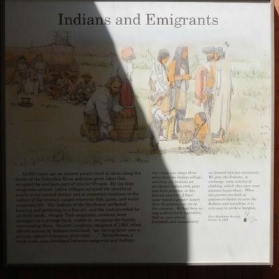
Indians and Emigrants Marker
RANKED BY RELEVANCE, THEN GEOGRAPHICALLY
| 1 ► Oregon, Malheur County, Ontario — Ontario Oregon Trail Kiosk — |
| Near Vietnsm Veterans Memorial Highway (Interstate 84), on the right when traveling west. | |||
| 2 ► California, Trinity County, Trinity Center — California – Oregon Trail / California – Oregon Road — |
| On Scott Mountain Road (Route 3 at milepost 83.3), on the right when traveling north. | |||
| 3 ► Oregon, Wasco County, Mosier — Memaloose Rest Area Oregon Trail Kiosk — |
| On Interstate 84 at milepost 71, on the right when traveling west. | |||
| 4 ► Oregon, Benton County, Corvallis — Peavy Hall War Memorial — |
| Near SW Jefferson Way at SW 30th St. | |||
| 5 ► Oregon, Clackamas County, Wilsonville — Boone’s Landing — |
| Near SW Boones Ferry Road at SW Tauchmann Street. | |||
| 6 ► Oregon, Clatsop County, Seaside — Tsunami — |
| Near South Promenade at Avenue A. | |||
| 7 ► Oregon, Coos County, Coos Bay — Sir Francis Drake 1540-1596 — Circumnavigator and Admiral — |
| Near Cape Arago Highway, 5 miles west of Seven Devils Road. | |||
| 8 ► Oregon, Douglas County, Reedsport — Jedediah Smith — (1799-1831) — |
| On Oregon Coast Highway (U.S. 101) 0.1 miles south of Lower Smith River Road, on the right when traveling south. | |||
| 9 ► Oregon, Douglas County, Reedsport, East Gardiner — Smith, Jackson & Sublette Umpqua Memorial — |
| On Lower Smith River Road (County Road 48 at milepost 1), at Stables Road (County Road 498), on the left when traveling north on Lower Smith River Road. | |||
| 10 ► Oregon, Jackson County, Ashland — Dead Indian Memorial Road |
| On Dead Indian Memorial Rd at Green Springs Highway (U.S. 66) on Dead Indian Memorial Rd. Reported permanently removed. | |||
| 11 ► Oregon, Josephine County, Merlin — Burrell M. Baucom — |
| Near Interstate 5 at milepost 62 near Merlin Road, on the right when traveling north. | |||
| 12 ► Oregon, Lane County, Pleasant Hill — Elijah Bristow — April 28, 1788 - September 19, 1872 — |
| On Oregon Route 58 south of Edenvale Road, on the left when traveling north. | |||
| 13 ► Oregon, Malheur County, Nyse — Starvation Camp — |
| On Succor Creek Highway (Oregon Route 201) near Adams Road, on the left when traveling north. | |||
| 14 ► Oregon, Multnomah County, Cascade Locks — Beacon Rock — |
| Near Hatchery Road, 0.3 miles south of Tanner Creek Road. | |||
| 15 ► Oregon, Multnomah County, Corbett — Broughton’s Expedition — |
| On Columbia River Highway (Interstate 84 at milepost 23), 8.6 miles west of Rooster Rock Park West-bound on ramp, on the right when traveling west. | |||
| 16 ► Oregon, Multnomah County, Troutdale — Sandy River Bridge — |
| On Historic Columbia River Highway at Crown Point Highway on Historic Columbia River Highway. | |||
| 17 ► Oregon, Sherman County, Wasco — Deschutes River Crossing — |
| On Biggs-Rufus Highway (Oregon Route 206) 0.2 miles east of Moody Road (County Road 143), on the right when traveling west. | |||
| 18 ► Oregon, Wasco County, The Dalles — Ancient Indian Fishing Grounds — Wyam Falls — |
| Near Celilo Park Road, 0.1 miles south of Celilo-Wasco Highway (Oregon Road 206), on the right when traveling west. | |||
| 19 ► Washington, Cowlitz County, Kelso — Oregon Trail — |
| On Allen Street (Old U.S. 4) west of 5th Avenue North, on the right when traveling west. | |||
| 20 ► Oregon, Curry County, Harbor — History of the Chetco People — |
| Near Harbor Drive west of Lower Harbor Road, on the right when traveling west. | |||
| 21 ► Washington, Walla Walla County, College Place — Oregon Trail Memorial — |
| On Old Highway 12, 0.2 miles Frenchtown Road. | |||
| 22 ► Oregon, Coos County, Coos Bay — Steve Roland Prefontaine — |
| On Central Avenue just east of Oregon Coast Highway (southbound) (U.S. 101), on the left when traveling east. | |||
| 23 ► Oregon, Benton County, Philomath — Shipley Family Homestead — |
| On James Street, 0 miles east of Newton St, on the left when traveling east. | |||
| 24 ► Oregon, Clackamas County, Oregon City — M11 — Oregon City — Oregon History — |
| On McLoughlin Boulevard (Oregon Route 99) near S. 2nd Street, on the right when traveling south. | |||
| 25 ► Oregon, Clackamas County, West Linn — M15 — Dr. John McLoughlin 1784 - 1857 — Oregon History — |
| On Northbound Rest Area (Interstate 205), on the right when traveling north. | |||
| 26 ► Oregon, Lincoln County, Yachats — Welcome to the Oregon Coast — |
| On Ocean View Drive south of West 2nd Street, on the left when traveling south. | |||
| 27 ► California, Butte County, Oroville — 807 — Oregon City — |
| On Oregon Gulch Road at Oregon City Trail, on the left when traveling south on Oregon Gulch Road. | |||
| 28 ► California, Butte County, Oroville — Oregon City Cemetery — |
| On Oregon Gulch Road. | |||
| 29 ► California, Del Norte County, Crescent City — 645 — Pioneer Stage Road to Oregon — |
| On Elk Valley Road at Parkway Drive, on the right when traveling north on Elk Valley Road. | |||
| 30 ► California, San Francisco City and County, San Francisco, Presidio of San Francisco — U.S.S. Oregon Marine Corps Memorial — |
| Near Lincoln Boulevard at Sheridan Avenue. | |||
| 31 ► California, Shasta County, Anderson — 58 — California – Oregon Road — |
| On Spring Gulch Road at California Highway 273, on the right when traveling east on Spring Gulch Road. | |||
| 32 ► California, Trinity County, Trinity Center — California – Oregon Stage Road — 1860 – 1887 — |
| On Scott Mountain Road (California Route 3). | |||
| 33 ► California, Yuba County, Camptonville — Oregon Creek Covered Bridge — |
| On Alleghany Ridge Road. | |||
| 34 ► Colorado, Sedgwick County, Julesburg — Oregon Trail — |
| On West 1st Street (Route 138/385) near Cedar Street, on the right when traveling east. | |||
| 35 ► District of Columbia, Washington, Southwest Washington, The National Mall — 26/8852 — Rick Bartow (1946-2016) — Wiyot — Oregon |
| Near Jefferson Drive Southwest west of 4th Street Southwest, on the right when traveling east. Reported permanently removed. | |||
| 36 ► Idaho, Ada County, Boise — Old Oregon Trail — |
| Near East Lake Forest Drive near Orchid Way, on the right when traveling west. | |||
| 37 ► Idaho, Ada County, Boise — Old Oregon Trail - West Boise — |
| Near North Eagle Road (State Highway 55) at U.S. 26, on the left when traveling north. | |||
| 38 ► Idaho, Ada County, Boise — 375 — Oregon Trail — |
| On Interstate 84, 1 mile north of Black's Creek Road, on the right when traveling south. | |||
| 39 ► Idaho, Ada County, Boise — Oregon Trail Monument — |
| On West Jefferson Street at North 6th Street, on the right when traveling west on West Jefferson Street. | |||
| 40 ► Idaho, Ada County, Boise — 151 — The Oregon Trail — |
| On Warm Springs Avenue (at milepost 7), 0.1 miles south of Highland Valley Road, on the left when traveling north. | |||
| 41 ► Idaho, Blaine County, Bellevue — Timmerman Junction Oregon Trail Kiosk — |
| Near U.S. 20 at State Highway 75, on the left when traveling west. | |||
| 42 ► Idaho, Canyon County, Parma — Old Oregon Trail — 1844 - 65 — |
| On East Grove Road at Parma Road, on the left when traveling east on East Grove Road. | |||
| 43 ► Idaho, Caribou County, Bancroft — 324 — Oregon Trail Campsite — |
| On Chesterfield Road near 24 Mile Road. | |||
| 44 ► Idaho, Elmore County, Glenns Ferry — 198 — Oregon Trail — |
| On South Commerical Street at W. Madison Avenue, on the left when traveling south on South Commerical Street. | |||
| 45 ► Idaho, Elmore County, Glenns Ferry — 2 — Site 2 ★ Old Oregon Trail Road Crossing — Main Oregon Trail Back County Byway — |
| On Old Oregon Trail Road near Bennett Road, on the right when traveling west. | |||
| 46 ► Idaho, Elmore County, Glenns Ferry — The Oregon Trail — |
| On Three Island State Park near West Madison Avenue, on the right when traveling south. | |||
| 47 ► Idaho, Elmore County, Mountain Home — Oregon Trail 1864 — Site of Old Mountain Home Station — |
| On U.S. 20 near Northeast Teapot Road, on the right when traveling south. | |||
| 48 ► Idaho, Owyhee County, Homedale — Oregon Trail — 1842-1863 — |
| On East Idaho Avenue (State Highway 19) near South 2nd Street East, on the left when traveling west. | |||
| 49 ► Idaho, Power County, American Falls — Coldwater Hill Rest Area Oregon Trail Kiosk — The Oregon Trail — |
| On Interstate 86 at milepost 18 near Cold Water Road, on the right when traveling east. | |||
| 50 ► Idaho, Power County, American Falls — Massacre Rocks on Old Oregon Trail — |
| Near Park Lane near Register Road, on the left when traveling west. | |||
| 51 ► Idaho, Power County, American Falls — Oregon Trail — 1842 - 1883 — |
| On Harrison Street near Bannock Avenue, on the left when traveling east. | |||
| 52 ► Idaho, Power County, American Falls — Oregon Trail — |
| On Falls Avenue at Valdez Street on Falls Avenue. | |||
| 53 ► Idaho, Power County, American Falls — 338 — Oregon Trail — |
| On Interstate 86 at milepost 30 near Register Road, on the right when traveling west. | |||
| 54 ► Idaho, Power County, American Falls — Snake River Rest Area Oregon Trail Kiosk — The Oregon Trail — |
| Near U.S. 86 at milepost 30 near Rock Creek Road, on the right when traveling west. | |||
| 55 ► Kansas, Doniphan County, Highland — The Oregon-California Trail — |
| 56 ► Kansas, Douglas County, Lawrence — California and Oregon Trails Memorial — |
| On Crescent Road at West Campus Road, on the right when traveling east on Crescent Road. | |||
| 57 ► Kansas, Johnson County, Overland Park — Santa Fe and Oregon Trails — |
| On 151st Street, on the right when traveling east. | |||
| 58 ► Kansas, Johnson County, Shawnee — Westport - Santa Fe Trail - Oregon / California Trail — |
| On Shawnee Mission Parkway near Melrose Lane, on the right when traveling east. | |||
| 59 ► Kansas, Leavenworth County, Fort Leavenworth — Santa Fe and Oregon Trails — |
| On Riverside Drive east of Scott Avenue, on the left when traveling east. | |||
| 60 ► Kansas, Leavenworth County, Fort Leavenworth — The Oregon and Santa Fe Trails — |
| On Riverside Drive, on the left when traveling east. | |||
| 61 ► Kansas, Marshall County, Blue Rapids — 26 — Alcove Springs & the Oregon Trail — |
| On Valley Road (State Highway 9) 0.1 miles east of U.S. 77, on the right when traveling east. | |||
| 62 ► Kansas, Marshall County, Blue Rapids — Oregon Trail Memorial Garden — |
| 63 ► Kansas, Pottawatomie County, St. Marys — Site of the Oregon Trail — 1830 - 1876 — |
| On East Bertrand Street (U.S. 24) west of Grand Avenue, on the right when traveling west. | |||
| 64 ► Kansas, Pottawatomie County, Westmoreland — Burial Site of Oregon Trail Traveler — |
| On The Road to Oz Highway (State Highway 99), on the right when traveling south. | |||
| 65 ► Kansas, Pottawatomie County, Westmoreland — Route of the Oregon Trail — |
| On The Road to Oz Highway (State Highway 99), on the left when traveling south. | |||
| 66 ► Kansas, Pottawatomie County, Westmoreland — 20 — The California - Oregon Trail — |
| On The Road to Oz Highway (State Highway 99), on the right when traveling south. | |||
| 67 ► Kentucky, Mercer County, Salvisa — 1751 — Warwick/Oregon / Warwick — |
| On Louisville Road (U.S. 127) at Oregon Road, on the right when traveling north on Louisville Road. | |||
| 68 ► Maryland, Baltimore County, Cockeysville, Hunt Valley — Marble Quarry — Marble - A Rock Remade — Marble for the Oregon Furnace — |
| Near Shawan Road. | |||
| 69 ► Maryland, Baltimore County, Cockeysville, Hunt Valley — Oregon Furnace — |
| Near Kurtz Lane. | |||
| 70 ► Maryland, Montgomery County, Bethesda — Tree I — 1981 stainless steel tubes and steel cables — Kenneth Snelson (b. 1927, Pendleton, Oregon) — |
| 71 ► Missouri, Buchanan County, St. Joseph — The California - Oregon Trail — 1840s & 1850s — |
| 72 ► Missouri, Jackson County, Independence — Here the Oregon Trail Began — |
| On Liberty Street near Lexington Avenue, on the right when traveling north. | |||
| 73 ► Missouri, Jackson County, Kansas City, Red Bridge North — Trail Hazards — Minor Park — Santa Fe, Oregon and California National Historic Trails — |
| Near East 110th Street south of Red Bridge Road. | |||
| 74 ► Missouri, Jackson County, Kansas City, Verona Hills — Oregon and California National Historical Trails / Santa Fe National Historic Trail — |
| On West Santa Fe Trail west of Madison Avenue, on the right when traveling west. | |||
| 75 ► Missouri, Oregon County, Alton — Oregon County — |
| On Main Street just south of Broadway Street, on the left when traveling north. | |||
| 76 ► Montana, Gallatin County, West Yellowstone — 10 — Oregon Short Line 1903 — Rail Car — |
| On Yellowstone Avenue at Electric Street, on the right when traveling west on Yellowstone Avenue. | |||
| 77 ► Montana, Gallatin County, West Yellowstone — 4 — Oregon Shortline Terminus — West Yellowstone Historic District — |
| On Yellowstone Avenue at Canyon Street, on the left when traveling west on Yellowstone Avenue. | |||
| 78 ► Nebraska, Buffalo County, Kearney — Old Oregon Trail — |
| On Central Avenue at Railroad Street, on the right when traveling north on Central Avenue. | |||
| 79 ► Nebraska, Gage County, Beatrice — The De Roin & Oregon Trails — |
| On Court Street (U.S. 136) at 2nd Street, on the right when traveling west on Court Street. | |||
| 80 ► Nebraska, Garden County, Lewellen — Oregon Trail — |
| Near U.S. 26, on the right when traveling south. | |||
| 81 ► Nebraska, Garden County, Lewellen — Oregon Trail — |
| On U.S. 26, on the right when traveling north. | |||
| 82 ► Nebraska, Garden County, Lewellen — The Oregon Trail — |
| Near U.S. 26, on the right when traveling south. | |||
| 83 ► Nebraska, Garden County, Oshkosh — Oregon Trail — |
| On State Highway 27 at Road 54, on the right when traveling south on State Highway 27. | |||
| 84 ► Nebraska, Garden County, Oshkosh — Oregon Trail Memorial — |
| On State Highway 27 at Road 54, on the right when traveling south on State Highway 27. | |||
| 85 ► Nebraska, Jefferson County, Fairbury — Oregon Trail — Representing Rock Creek Station Well — |
| On D Street north of 4th Street, on the right when traveling north. | |||
| 86 ► Nebraska, Keith County, Brule — Oregon Trail - California River Crossing — |
| On Lincoln Highway (U.S. 30) at County Road M, on the right when traveling west on Lincoln Highway. | |||
| 87 ► Nebraska, Keith County, Ogallala — Oregon Trail — |
| On Lawrence Road at West Road 80, on the left when traveling north on Lawrence Road. | |||
| 88 ► Nebraska, Lincoln County, North Platte — Oregon Trail Memorial — |
| Near North Buffalo Bill Avenue, 0.8 miles north of Lincoln Highway (U.S. 30), on the right when traveling north. | |||
| 89 ► Nebraska, Morrill County, Bayard — The Oregon Trail — |
| On State Highway 92, on the left when traveling east. | |||
| 90 ► Nebraska, Morrill County, Bridgeport — Oregon Trail — |
| On State Highway 88 near Road 92, on the right when traveling south. | |||
| 91 ► Nebraska, Morrill County, Bridgeport — Oregon Trail — |
| Near US Highway 26 (State Highway 92) 2.4 miles west of Main Street (Gold Rush Highway) (U.S. 385), on the left when traveling west. | |||
| 92 ► Nebraska, Platte County, Columbus — North Branch, Oregon Trail — |
| On 33rd Avenue (U.S. 30/81) near 7th Street, on the right when traveling south. | |||
| 93 ► Nebraska, Scotts Bluff County, Gering — Oregon Trail — Emigrants reached Scotts Bluff after a long journey across the plains |
| On Old Oregon Trail, on the right when traveling west. Reported permanently removed. | |||
| 94 ► Nebraska, Scotts Bluff County, Gering — Oregon Trail Memorial — |
| On Robidoux Road (also known as Robadeau Pass Road), on the right when traveling west. | |||
| 95 ► Nebraska, Scotts Bluff County, Lyman — Oregon Trail — |
| On Holloway Road (Nebraska Route 79C) near County Road D, on the left when traveling north. | |||
| 96 ► Nebraska, Scotts Bluff County, Scottsbluff — Oregon Trail — |
| Near Old Oregon Trail, on the right when traveling west. | |||
| 97 ► Nebraska, Thayer County, Hebron — Oregon Trail — |
| On Road Q just east of U.S. 81, on the left when traveling east. | |||
| 98 ► Nebraska, York County, York — Nebraska City Cut-Off of the Oregon Trail — |
| On Lincoln Avenue south of 1st Street, on the right when traveling south. | |||
| 99 ► New York, Putnam County, Putnam Valley — Oregon Corners — |
| On Oscawana Lake Road (New York State Route 20) 0.1 miles south of Peekskill Hollow Road, on the right when traveling north. | |||
| 100 ► New York, Rockland County, Sparkill — Gravesite of General John Charles Frémont — 1813 – 1890 — Explorer, Pathmarker, Mapper of the Oregon Trail — |
| On Kings Highway, on the left when traveling east. | |||
1842 entries matched your criteria. The first 100 are listed above. Next 100 ⊳
* Inflectional forms of words are their plurals, singulars, and possessives as well as gramatical tenses and similar variations.