Sent out by First Presbyterian Church of Ithaca in 1834 in response to search of Nez Perce Indians for White Man's Book from Heaven was under leadership of Rev. Samuel Parker. With him went Samuel Allis of Ithaca and Rev. John Dunbar of Auburn . . . — — Map (db m104639) HM
Dedicated to the memory of the intrepid pioneers who blazed the way over the Old Oregon Trail with the first covered wagons in 1843 and won an empire for the United States.
Erected by the American Legion
July 4, 1925 — — Map (db m108048) HM
Of the 2170 miles of the Oregon Trail, approximately 300 miles of ruts remain. Swales created by thousands of wagon wheels and the trampling of draft animals are deep in some areas, shallow in other places. Much of the trail has disappeared due to . . . — — Map (db m108130) HM
Early Oregon Trail emigrants crested the south flank of Flagstaff Hill and, with the Blue Mountains looming to the west, saw a solitary tree in the valley below. Called l’arbre seul (the lone tree) by French-Canadian fur trappers, this large . . . — — Map (db m108122) HM
Beginning in 1843, thousands of Oregon Trail emigrants trekked through this region toward new lives in the West. This epic journey indelibly etched the landscape with wagon ruts, such as those near by. When Henry Griffin, a prospector from . . . — — Map (db m108128) HM
Wagons and cattle of the Great Migration, led by Marcus Whitman in 1843, descended Sept. 25 into Lone Pine valley.
After nearly a month of travel over the hot dry Snake river plains from Fort Hall near Pocatello, Idaho, the cool climate and lush . . . — — Map (db m108157) HM
(Six panels dealing with the Baker Valley portion of the Oregon Trail are found beneath this kiosk) Permanent Settlers
In 1861, Henry Griffin, a prospector from California discovered gold eight miles southwest of the present . . . — — Map (db m111284) HM
(The Farewell Bend Oregon Trail kiosk houses seven panels which deal with the trials and tribulations on this arid portion of the Oregon Trail.)
"Pathway to the "Garden of the World"
Excitement filled the air May 22, . . . — — Map (db m107276) HM
From Alkali Springs, called by many pioneers Sulphur Springs, the emigrants traveled on to Birch Creek, which offered much needed water and grass for their livestock. First named "Riviere aux Bouleaux" by French-Canadian fur trappers, here travelers . . . — — Map (db m107212) HM
The bustling boom town of Sumpter stretched from here westward to Powder River at the peak of the mining boom.
The mining camp was named for Fort Sumter, South Carolina, by five ex-Confederate soldiers who discovered gold near here in 1862. . . . — — Map (db m112914) HM
(Six panels dealing with the Burnt River portion of the Oregon Trail are found beneath this kiosk)
Dear Little Willie
Emigration on the Oregon Trail peaked in 1852 with 10,000 would-be Oregonians. Poor sanitation and . . . — — Map (db m108110) HM
On October 27, 1868, the small institution of higher education known as Corvallis College was granted a charter by Oregon's legislative assembly designating it as the state's land grant institution under the provisions of the federal 1862 Morrill . . . — — Map (db m108382) HM
Here the Pioneers Ended Their
Journey West.
Abernethy Green is the Official
End of the Oregon Trail,
As Designated by the U.S. Congress
In 1978.
Placed in Honor
of the Pioneer Achievements of
Dan Fowler
Oregon . . . — — Map (db m114198) HM
Oregon City, Western Terminus of the Oregon Trail
(about 2200 miles from Independence, MO)
Here at Abernethy Green in the fall of 1845, members of the Barlow-Palmer-Rector Wagon Train entered Oregon City as best they could. Pioneering a . . . — — Map (db m114199) HM
"We claim that country - for what? To make the wilderness blossom as the rose, to establish laws, to increase, multiply, and subdue the earth..." -- John Quincy Adams, Congressional Globe, February 9, 1846
Arguing that God had manifestly . . . — — Map (db m114064) HM
Oregon City - once known as Willamette Falls - was early the site of an Indian salmon fishing village. The falls furnished the power for a lumber mill which began operation in 1842. A flour mill in 1844. A woolen mill in 1864 and the first paper . . . — — Map (db m113515) HM
In the shadow of the tall trees, a stream of travelers crossed ash flows, talus slopes and boggy wetlands along this last stretch of the trail. Some emigrants were forced to abandon their wagons with the death of livestock and walk, carrying their . . . — — Map (db m112341) HM
"Captain" John West was a self-made man. A native of Scotland, he settled on the lower Columbia River near this spot in the early 1850s after trying his luck in the goldfields of California. West built and operated sawmills, ran a general store and . . . — — Map (db m113583) HM
(panel 1)
The Oregon Coast boasts forested headlands, towering dunes of sand, and sparkling lakes and rivers. From the Columbia River south to Bandon, the picturesque coastline is bordered to the east by the peaks of . . . — — Map (db m113658) HM
Prior to the attack on Pearl Harbor, a contingent of Japanese I-Class submarines sailed from Yokosuka via the Marshall Islands to take up positions off Hawaii and the coast of North America. Five of these vessels carried midget two-man submarines . . . — — Map (db m112537) HM
1877 .4 miles up this creek
R.D. Hume started the
first fish hatchery
in Oregon.
1906 Frank Colvin Mgr.
1.6 million fish released.
1926 The state took over the hatchery
1935 The state closed the hatchery
1939 Bob Knox bought . . . — — Map (db m150606) HM
In 1852, gold was found in the beach sands at Whiskey Run, about ten miles north of Bandon. Gold was also found on beaches at South Slough, Bandon, Cape Blanco, Port Orford, Ophir, Pistol River and Gold Beach>
Gold was washed onto the beaches by . . . — — Map (db m176822) HM
This complex ecosystem nurtures a variety of plants and animals.
Vast, sage-covered plains begin at the eastern foot of the Pilot Butte and stretch dramatically to the east and south. This is Oregon’s fabled “High Desert”. The . . . — — Map (db m63094) HM
Southern Oregon is a land of great geographic diversity. Here are the more than 250-million-year-old Klamath Mountains in the south, and to the north and uplifted 50-million-year-old ocean floor and overlying sediments, called “Siletzia” . . . — — Map (db m112535) HM
(Seven panels dealing with the Columbia Plateau and Columbia River portions of the Oregon Trail are found at this kiosk)
Pathway to the "Garden of the World"
Excitement filled the air May 22, 1843 as nearly one thousand Americans left . . . — — Map (db m111946) HM
Who followed this route across the plains at the age of 17 driving oxen and walking barefoot.
He later settled on Shuttler Flat five miles south of this marker and was the first to engage in wheat farming in Gilliam County — — Map (db m101983) HM
“What is it that urges a man to risk his life in these precipitous fossil beds? I can answer only for myself, but with me there were two motives, the desire to add to human knowledge, which has been a great motive all my life, and the . . . — — Map (db m114115) HM
Side A:
Granite, Oregon
Albert G. Tabor first struck gold just below the town of Granite on the Fourth of July, 1862. Tabor named his claim the Independence since his strike was made on Independence Day, and the town that sprang up . . . — — Map (db m106791) HM
"The first locomotive ever run over the first railroad ever built in the state of Oregon"
Early travel on the Oregon Trail was extremely dangerous. The last 100 miles of the journey westward from The Dalles to the Willamette . . . — — Map (db m158538) HM
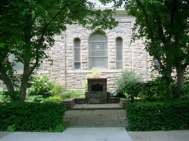
This Southern magnolia was planted in front of the home of Captain John M. and Mary Elizabeth “Lizzie” McCall in memory of their daughter, Elsie, who died in 1890. John McCall was a statesman and entrepreneur who opened many businesses including the . . . — — Map (db m244249) HM
In 1863, on this site, Robert Vinton Beall, an Oregon Trail pioneer and relative to four Maryland governors, built one of the first frame buildings in Jackson County, a Gothic Revival house that is listed on the National Historic Register. Beall and . . . — — Map (db m129534) HM
In 1860, Martha Hanley planted this weeping willow to commemorate the birth of her son. The willow cutting was obtained from the pioneer Luelling Nursery in the Willamette Valley and delivered by Martha's friend Kit Kearney, an express rider, who . . . — — Map (db m244248) HM
We honor all Oregonians who served our state and nation,
who shed their blood in defense of God, Family and Country.
They are Oregon's Fallen War Heroes.
We honor for their valor the men and women
whose names are engraved on these . . . — — Map (db m113049) WM
This magnificent view is preserved and protected by the efforts of the Oregon Roadside Council, which initiated and secured the passage of the Oregon Scenic Areas Act in 1961. 3585 scenic miles of highways were surveyed and selected by the Council. . . . — — Map (db m113382) HM
The Oregon Trunk Railway Bridge, constructed in 1911, was the first structure to cross this spectacular gorge. Prior to construction the only crossing of the Crooked River in this region was located about a mile upstream, where the canyon's sheer . . . — — Map (db m80490) HM
Upper plaque:
National Monument
Set aside by
President Taft
July 12, 1909
Lower plaque: Department of the Interior
National Park Service
Regulations require that all persons entering . . . — — Map (db m63167) HM
The OREGON CAVEMEN, claiming to be direct descendants of the Neanderthal Man of ancient times, incorporated as a unit Oct, 1922 in a ceremony held secretly in the depths of the Oregon Caves...their claimed homeland and a national monument. The . . . — — Map (db m195601) HM
This is Oregon's largest body of water, about 90,000 acres. Indians inhabiting its shores ("People of the Lake") lived well on wild fowl, fish and wocus seeds. The first known white visitors (1825-26) were Hudson's Bay trappers under Tom McKay and . . . — — Map (db m100204) HM
Four years after the end of the War of 1812, Great Britain and the United States agreed their citizens could trade in Oregon country without prejudice to either nation's claim. Both countries strived for that extra influence which could blossom into . . . — — Map (db m87953) HM
(Two of the four interpretive panels highlight local history and other points of interest)Panel 1:
A Bit of History
Named for its vista of the once-larger Goose Lake, ten miles to the south, the high desert town of Lakeview . . . — — Map (db m147365) HM
side 1
The reports of this expedition directed the migration of the western settlement toward the Oregon Country which hitherto had been merely a rendezvous for trappers.
On December 16th 1843 the expedition, while enroute . . . — — Map (db m113809) HM
In 1846, Jesse Applegate and fourteen others from near Dallas, Oregon, established a trail south from the Willamette Valley and east to Fort Hall. This route offered emigrants an alternative to the perilous "last leg" of the Oregon Trail down the . . . — — Map (db m112908) HM
The trail to Oregon was never a single set of wagon ruts etched from Missouri to the Willamette Valley. Wagons often traveled abreast through valleys and plains sometimes widening the trail several miles. In the mountains they constantly attempted . . . — — Map (db m112912) HM
As Oregon entered the 20th century, travel along the coast was a combination of Indian trails, the beach, and a few very muddy roads. In 1892, Ben Jones led a delegation to Corvallis to seek money for road improvements from the County. The county . . . — — Map (db m177287) HM
Conde B. McCullough arrived in Oregon in 1916 to teach engineering at Oregon Agricultural College (today's Oregon State University). He was among a new breed of college-educated engineers, and a pioneer in the movement to create a well-planned . . . — — Map (db m177293) HM
During the 18th century, Native American villages occupied the mouths of nearly every stream along this coastline—including here at Siletz Bay.
References to great flooding and ground shaking events are recorded in the oral traditions of . . . — — Map (db m244254) HM
Columbia River Lightship No. 50: Est. 1892 • No. 604 • withdrawn from duty, 1979
Point Adams: 1875-1899 • Razed 1912
Columbia River Lights: Desdemona Sands: 1902 - Late 40's • Warrior Rock: 1888 to Present (Near St. Helens) • . . . — — Map (db m177186) HM
The city of Newport was named on July 4, 1866.
On that day the townspeople and many visitors gathered to celebrate the ninetieth anniversary of National Independence Day and to name this small fishing and lumbering community.
A tall pole was . . . — — Map (db m114246) HM
Below you is the spectacular Devil’s Punch Bowl which was formed when the roof over two sea caves collapsed. You can watch the ocean waves crash through openings in the sandstone, continually sculpting this unusual formation.
At high tide, the . . . — — Map (db m92643) HM
During the late 19th century thousands of Americans left farms, families and friends to trek the Oregon Trail toward new lives in the West. The trail was nearly 2,000 miles across prairies, mountains and parched deserts. Contrary to popular belief, . . . — — Map (db m106941) HM
This site marks the final resting place of the youngest member of the Lewis and Clark Expedition, born to Sacajawea and Toussaint Charbonneau at Fort Mandan (North Dakota) on February 11, 1805. Baptiste and his mother symbolized the peaceful nature . . . — — Map (db m106876) HM
Overland emigration between 1840 and 1863 brought over 50,000 pioneers to Oregon. Seven miles west of Malheur Butte, weary Oregon Trail emigrants camped at the Malheur River crossing, taking advantage of local hot springs and the first good water . . . — — Map (db m107208) HM
(Inside this kiosk are seven panels which deal with the Malheur River and Meek's Cutoff.
"Pathway to the "Garden of the World"
Excitement filled the air May 22, 1843 as nearly one thousand Americans left Missouri . . . — — Map (db m107077) HM
This black walnut was planted c. 1884 by the Zimmerman family who were prominent members of the Aurora Colony. Early Aurora settlers were talented and industrious. Their products gained a wide reputation for excellence during the early days of . . . — — Map (db m244246) HM
Dedicated to the memory of these men and women from Oregon so their sacrifice will never be forgotten.
Oh, could our fallen brothers know the honor they helped bring to God, and to our country, to their memory now we sing.
You gave your . . . — — Map (db m11979) HM
In Remembrance of the United States Battleship Oregon
(Commissioned July 1896)
and Her Officers and men.
During the Spanish American War this battleship won the admiration of the whole world in her dramatic dash from San Francisco to Key . . . — — Map (db m241332) HM WM
(Seven panels dealing with the Deschutes River Crossing portion of the Oregon Trail are found at this kiosk)
Truly Heart-Breaking!
Oregon Trail emigrants reached the Columbia River after an arduous trek across the dry and . . . — — Map (db m111990) HM
(Six panels dealing with the Deadman Pass portion of the Oregon Trail are found at this kiosk)
Wagon Ruts
More than 50,000 emigrants traveled west on the Oregon Trail between 1840 and 1850. The constant stream of wagons . . . — — Map (db m111563) HM
(Six panels dealing with the Emigrant Springs portion of the Oregon Trail are found beneath this kiosk)
Lost Livestock
Water is scarce in the steep, forested slopes of the Blue Mountains and is often found only at . . . — — Map (db m111537) HM
In Memoriam
Erected 1925 by the
Women's Community Club
of Meacham, Oregon
In honor of those who died
Blazing the Old Oregon Trail — — Map (db m111528) HM
This magnificent view is preserved and protected by the efforts of the Oregon Roadside Council, which initiated and secured the passage of the Oregon Scenic Areas Act in 1961. 3585 scenic miles of highways were surveyed and selected by the Council. . . . — — Map (db m111564) HM
(Six panels dealing with the Pendleton area portion of the Oregon Trail are found at this kiosk)
The Long Walk to Oregon
Contrary to popular belief Oregon Trail emigrants rarely took the reins while seated in their . . . — — Map (db m111578) HM
(Six panels dealing with the Umatilla River Crossing portion of the Oregon Trail are found at this kiosk)
The Road Forks
Early Oregon Trail emigrants crossed the Blue Mountains and traveled north to re-provision at the . . . — — Map (db m111940) HM
Lumber was vital to early settlers of the Grande Ronde Valley. In 1890, Smith and Stanley built a large mill in the small town of Perry, Oregon. Operating the first bandsaw in Union County, the large mill at Perry was producing about 20,000,000 . . . — — Map (db m111440) HM
(Six panels dealing with the Blue Mountian portion of the Oregon Trail are found beneath this kiosk)
The Blue Mountains
Oregon Trail emigrants crossed the Rocky Mountains through South Pass in Wyoming. The ascent and . . . — — Map (db m111466) HM
The Medal of Honor
The Medal of Honor is the highest distinction which can be awarded to a member of the Armed Forces of the United States. It is presented by the President in the name of Congress to an individual who, while serving in the . . . — — Map (db m233547) HM WM
The first covered wagons came into the Rocky Mts. in 1830, they
made their way as far west as Fort Washakie in Wyoming. Efforts
were made to find passable wagon trails through the Mountains to
the Pacific Coast, which goal was finally reached. At . . . — — Map (db m99320) HM
Capital-Salem
After England claimed the region, fur trading posts were established in the 1790s. Meriwether Lewis and William Clark explored the region in 1805, and John Jacob Astor founded his fur trading post in 1811. The first American . . . — — Map (db m194648) HM
The Henrico County town of Sydney, laid out
here in 1817, was slow to develop. Oregon Hill, a
working-class Richmond neighborhood just east
of Belvidere Street, expanded westward across
the county line to this area during the 1850s.
Many white . . . — — Map (db m108168) HM
The Oregon Trail, stretching from Missouri to the Pacific, served as the most important route for settlers traveling west. As many as 1600 wagons a day rumbled over the famous route. The northwestern most extension of the Oregon Trail was the . . . — — Map (db m129173) HM
Front of Marker:
Monument Expedition
Camp One
29 Jan 1906
Left Side of Marker:
This stone is donated by
Gregory L. Meeker
Cousin to Ezra
In honor of Bobby and Helen Meeker who taught their son the love of . . . — — Map (db m39786) HM
(Q & A's presented top to bottom, left to right)
Why is it so small?
A large and heavy wagon could not have made it over the mountains.
Where did people sit?
If they were sick or tired they rode in the back, but . . . — — Map (db m159346) HM
This Monument
marks the junction
of the Oregon Trail
and road to Old Ft.
Fetterman nine
miles north of this
spot. Established
July 10, 1867. Abandoned
May 25, 1882. — — Map (db m92111) HM
The Oregon Trail crosses LaPrele Creek about one mile downstream from Natural Bridge. Before the modern road was built into the gorge, Natural Bridge was difficult to access, and it was only rarely visited by emigrants of the covered wagon era. From . . . — — Map (db m71495) HM
To the south stand the Oregon Buttes, a major trail landmark. The name is significant because the Buttes were roughly the beginning of the Oregon Territory and also helped keep emigrants encouraged, even though there were still hundreds of miles of . . . — — Map (db m80499) HM
The Oregon Trail
In memory of those who passed this way to win and hold the West
Plaque placed by the Historical Landmark Commission of Wyoming
1950 — — Map (db m80504) HM
In 1858, this ancient path, which had been used by Indians, explorers and mountain men as a short cut to the Snake River country was developed by Frederick Lander in to an alternate route on the Oregon Trail. What is commonly called the Lander Trail . . . — — Map (db m80161) HM
In 1847, The Oregon Trail passed by this point where Highway 30 now crosses the Idaho-Wyoming Statelines. Here lies the northern most bend of Bear River in Wyoming before it crosses into Idaho. Skirting wet lands to the north and the south, ruts . . . — — Map (db m90483) HM