1847 entries match your criteria. Entries 101 through 200 are listed.⊲ Previous 100 — Next 100 ⊳
Entries Containing the Word «oregon»
By William Fischer, Jr., June 18, 2017
The Oregon Mission Marker
RANKED BY RELEVANCE, THEN GEOGRAPHICALLY
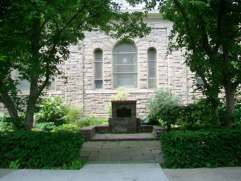
| 101 ► New York, Tompkins County, Ithaca — The Oregon Mission — |
| 102 ► Oregon, Baker County, Baker City — Old Oregon Trail — 1843 — |
| On Auburn Avenue at Bridge Street, on the right when traveling east on Auburn Avenue. | |||
| 103 ► Oregon, Baker County, Baker City — Oregon Trail Memorial — 1843 - 1943 — |
| On Oregon Route 86 near Ruckles Creek Road, on the left when traveling west. | |||
| 104 ► Oregon, Baker County, Baker City — Ruts of the Oregon Trail — |
| Near Oregon Route 86 near Oregon Trail, on the right when traveling west. | |||
| 105 ► Oregon, Baker County, Baker City — The Lone Tree of the Oregon Trail — |
| 106 ► Oregon, Baker County, Baker City — The Lure of Gold — Oregon Trail — Oregon History — |
| On Oregon Route 86 near Oregon Trail, on the right when traveling west. | |||
| 107 ► Oregon, Baker County, Baker City — The Oregon Trail — Route of Wagon Trains — from 1843 to the 1860's — |
| Near Campbell Street near Sunridge Lane, on the right when traveling west. | |||
| 108 ► Oregon, Baker County, Haines — Baker Valley Rest Area Oregon Trail Kiosk — |
| On Interstate 84 at milepost 293 near Medical Springs Highway (Chandler Lane) (Oregon Route 203), on the right when traveling west. | |||
| 109 ► Oregon, Baker County, Huntington — Farewell Bend Oregon Trail Kiosk — |
| Near Huntington Highway (Business U.S. 30) near Interstate 84, on the right when traveling north. | |||
| 110 ► Oregon, Baker County, Huntington — Remnants of the Oregon Trail — |
| On Lockett Road near Vietnam Veterans Memorial Highway (Interstate 84), on the right when traveling south. | |||
| 111 ► Oregon, Baker County, Sumpter — Sumpter, Oregon — |
| On Mill Street at Sumpter Highway (Oregon Route 410), on the right when traveling north on Mill Street. | |||
| 112 ► Oregon, Baker County, Weatherby — Weatherby Oregon Trail Kiosk — |
| Near Interstate 84 near Gate Road/Sisley Creek Road, on the right when traveling north. | |||
| 113 ► Oregon, Benton County, Corvallis — Capitol of Territorial Oregon — 1855 — |
| On SW 2nd Street at SW Adams Avenue on SW 2nd Street. | |||
| 114 ► Oregon, Benton County, Corvallis — Oregon State University — National Historic District — |
| On SW Jefferson Way at SW 15th Street, on the right when traveling west on SW Jefferson Way. | |||
| 115 ► Oregon, Clackamas County, Oregon City — End of the Oregon Trail — |
| Near Washington Street near Abernethy Road, on the right when traveling north. | |||
| 116 ► Oregon, Clackamas County, Oregon City — End of the Oregon Trail — 1845-46 — |
| Near Washington Street near Abernethy Road, on the right when traveling north. | |||
| 117 ► Oregon, Clackamas County, Oregon City — Old Oregon Trail — 1846 — |
| Near Washington Street near Abernethy Road, on the right when traveling north. | |||
| 118 ► Oregon, Clackamas County, Oregon City — Oregon — America's Manifest Destiny — |
| Near Washington Street near Abernethy Road, on the right when traveling north. | |||
| 119 ► Oregon, Clackamas County, Oregon City — M12 — Oregon City Falls — Oregon History — |
| On McLoughlin Boulevard (Oregon Route 99) near S. 2nd Street, on the right when traveling south. | |||
| 120 ► Oregon, Clackamas County, Rhododendron — The Oregon Trail — 1845 — |
| On East Arlie Mitchell Road near Mt. Hood Highway (U.S. 26), on the left when traveling west. | |||
| 121 ► Oregon, Clackamas County, Welches — Emigrant's Final Steps — The Barlow Road — Oregon Trail Mile 1891 — |
| On Mt. Hood Highway (U.S. 26) at Main Park Road, on the left when traveling west on Mt. Hood Highway. | |||
| 122 ► Oregon, Columbia County, Clatskanie — "Captain" John West and Westport, Oregon — |
| Near Columbia River Highway (U.S. 30) near Clifton/Shingle Mill Road, on the right when traveling west. | |||
| 123 ► Oregon, Coos County, Coos Bay — Welcome to the Oregon Coast — |
| On Oregon Coast Highway (U.S. 101) south of Central Avenue, on the right when traveling south. | |||
| 124 ► Oregon, Curry County, Brookings — The Japanese Attack on Oregon — |
| On North Bank Chetco River Road at Oregon Coast Hwy (U.S. 101), on the right when traveling south on North Bank Chetco River Road. | |||
| 125 ► Oregon, Curry County, Gold Beach — First Fish Hatchery in Oregon — |
| On Jerry Flat Road (Oregon Route 595), on the left when traveling east. | |||
| 126 ► Oregon, Curry County, Sixes — Oregon Beach Gold — |
| On Oregon Coast Highway (U.S. 101) 0.1 miles north of Sixes River Road, on the left when traveling north. | |||
| 127 ► Oregon, Deschutes County, Bend — Oregon's Fabled "High Desert" — Pilot Butte Park — |
| Near Pilot Butte Summit Drive. | |||
| 128 ► Oregon, Douglas County, Roseburg — Welcome to Southern Oregon — |
| On Southeast Spruce Street at SE Washington Ave (U.S. 138) on Southeast Spruce Street. | |||
| 129 ► Oregon, Gilliam County, Arlington — Arlington Oregon Trail Kiosk — |
| On Beech Street at Locust Street, on the right when traveling west on Beech Street. | |||
| 130 ► Oregon, Gilliam County, Arlington — This Marks the Crossing of the Old Oregon Trail — Used by Pioneers and Settlers of the Oregon Territory — This Marker in Honor of W.W. Weatherford 1844 - 1926 — |
| On Oregon Route 19, 0.4 miles south of Montague Lane, on the right when traveling south. | |||
| 131 ► Oregon, Grant County, Dayville — An Oregon Fossil Rush — |
| Near John Day Highway (Oregon Route 19) 2 miles north of U.S. 26, on the left when traveling north. | |||
| 132 ► Oregon, Grant County, Granite — Granite, Oregon / Leaving Granite — |
| On West Center Street at Forest Road 73, on the right when traveling east on West Center Street. | |||
| 133 ► Oregon, Hood River County, Cascade Locks — the Oregon Pony — |
| Near Southwest Portage Road near Wa Na Pa Street. | |||
| 134 ► Oregon, Jackson County, Ashland — McCall Magnolia — Magnolia grandiflora — Oregon Heritage Tree — |
| On Oak Street, on the right when traveling south. | |||
| 135 ► Oregon, Jackson County, Central Point — Beall Black Walnut — Juglans nigra — Oregon Heritage Tree — |
| On Beall Ln, on the right when traveling east. | |||
| 136 ► Oregon, Jackson County, Central Point — Hanley Farm Willow — Salix babylonica — Oregon Heritage Tree — |
| Near Hanley Road (Oregon Route 238) 0.5 miles Rossanley Drive (Oregon Route 238), on the right when traveling west. | |||
| 137 ► Oregon, Jackson County, Central Point — Oregon Fallen War Heroes Memorial — |
| Near North Mountain Avenue. | |||
| 138 ► Oregon, Jackson County, Gold Hill — Rock Point, Oregon — |
| On North River Road west of Oregon Route 99. | |||
| 139 ► Oregon, Jefferson County, Terrebonne — Oregon Scenic Highways — |
| Near U.S. 97. | |||
| 140 ► Oregon, Jefferson County, Terrebonne — The Oregon Trunk Railroad Bridge — |
| Near Dalles-California Highway (U.S. 97 at milepost 114), 0.7 miles south of SW Culver Highway, on the right when traveling south. | |||
| 141 ► Oregon, Josephine County, Cave Junction — Oregon Caves National Monument — |
| On Caves Highway (Oregon Route 46). | |||
| 142 ► Oregon, Josephine County, Grants Pass — The Oregon Cavemen — |
| On NW Vine Street at NW Morgan Lane, on the right when traveling north on NW Vine Street. | |||
| 143 ► Oregon, Klamath County, Klamath Falls — Oregon History - Upper Klamath Lake — |
| Near Lakeshore Drive (Route 630), on the right when traveling west. | |||
| 144 ► Oregon, Klamath County, Worden — Resolving the Oregon Question — |
| Near U.S. 97, on the right when traveling south. | |||
| 145 ► Oregon, Lake County, Lakeview — Oregon Outback Scenic Byway — |
| On North 2nd Street at North E Street on North 2nd Street. | |||
| 146 ► Oregon, Lake County, Summer Lake — Fremont Memorial — A Memorial to The Second Fremont Exploring Expedition — to Oregon and North California — |
| On Fremont Highway (Oregon Route 31) south of Thousand Springs Lane (County Route 4-17), on the right when traveling north. | |||
| 147 ► Oregon, Lane County, Cottage Grove — The Applegate Trail - Southern Route to Oregon — Cottage Grove — |
| On North River Road near West Main Street, on the right when traveling north. | |||
| 148 ► Oregon, Lane County, Cottage Grove — The Changing Trail to Oregon — |
| On North River Road near West Main Street, on the right when traveling north. | |||
| 149 ► Oregon, Lincoln County, Depoe Bay — Ben Jones: Father of Oregon’s Coast Highway — |
| On Otter Crest Loop, 0.1 miles north of Miroco Street, on the right when traveling south. | |||
| 150 ► Oregon, Lincoln County, Depoe Bay — Conde B. McCullough: Oregon's Master Bridge Builder — |
| Near Otter Crest Loop, 0.1 miles north of Miroco Street, on the right when traveling south. | |||
| 151 ► Oregon, Lincoln County, Lincoln City — The Cascadia Earthquake — and Tsunami of 1700 — Oregon History — |
| On Oregon Coast Highway (U.S. 101) south of Southeast 54th Drive, on the right when traveling south. | |||
| 152 ► Oregon, Lincoln County, Newport — Lighthouses of the Oregon Coast — |
| On Yaquina Bay State Park, 0.2 miles west of U.S. 101, on the left when traveling east. | |||
| 153 ► Oregon, Lincoln County, Newport — Newport, Oregon — 1866 – 1966 — |
| On Oregon Coast Highway (U.S. 101) south of SW Alder Street, on the right when traveling north. | |||
| 154 ► Oregon, Lincoln County, Otter Rock — Oregon’s Rocky Shores — Devil’s Punch Bowl/Otter Rock — |
| On 1st Street. | |||
| 155 ► Oregon, Malheur County, Adrian — The South Alternate Route of the Oregon Trail — |
| On Roswell Road (Oregon Route 452) at Succor Creek Highway (Oregon Route 201), on the left when traveling west on Roswell Road. | |||
| 156 ► Oregon, Malheur County, Danner — Jean Baptiste Charbonneau — 1805-1866 — Oregon History — |
| On Danner Loop Road near Old Ion Highway, on the right when traveling north. | |||
| 157 ► Oregon, Malheur County, Nyssa — Old Oregon Trail — 1843 - 57 — |
| On Succor Creek Highway (Oregon Route 201) near Adams Road, on the left when traveling north. | |||
| 158 ► Oregon, Malheur County, Ontario — Malheur County's Oregon Trail Heritage — |
| On Thundered Boulevard (U.S. 26) near Lee Road, on the left when traveling east. | |||
| 159 ► Oregon, Malheur County, Vale — Vale Oregon Trail Kiosk — |
| On Washington Street East (U.S. 26) at Short Street North, on the right when traveling west on Washington Street East. | |||
| 160 ► Oregon, Marion County, Aurora — Aurora Colony Black Walnut — Juglans nigra — Oregon Heritage Tree — |
| On Liberty Street Northeast at 3rd Street Northeast, on the right when traveling north on Liberty Street Northeast. | |||
| 161 ► Oregon, Multnomah County, Portland — Oregon Korean War Veterans Memorial — June 25, 1950 - July 27, 1953 — |
| On Memorial Drive east of Center Drive. | |||
| 162 ► Oregon, Multnomah County, Portland, Southwest Portland — In Remembrance of the United States Battleship Oregon — |
| On Oregon 99W. | |||
| 163 ► Oregon, Sherman County, Wasco — Deschutes River Crossing Oregon Trail Kiosk — |
| Near Biggs-Rufus Highway (Oregon Route 209) near Old Moody Road (County Route 143). | |||
| 164 ► Oregon, Umatilla County, Adams — Deadman Pass Oregon Trail Kiosk — |
| Near Forest Road 84 at milepost 228 near Evergreen Lane. | |||
| 165 ► Oregon, Umatilla County, Meacham — Emigrant Springs Oregon Trail Kiosk — |
| Near Old Oregon Trail near Interstate 84, on the left when traveling north. | |||
| 166 ► Oregon, Umatilla County, Meacham — Oregon Trail Memorial — |
| On Old Highway 30 near Main Street, on the right when traveling north. | |||
| 167 ► Oregon, Umatilla County, Pendleton — Oregon Scenic Highways — |
| On Interstate 84 at milepost 224 near County Route 1021, on the right when traveling west. | |||
| 168 ► Oregon, Umatilla County, Pendleton — Pendleton Oregon Trail Kiosk — |
| On Southwest Frazer Avenue near Southwest 1st Street, on the left when traveling west. | |||
| 169 ► Oregon, Umatilla County, Stanfield — Stansfield Rest Area Oregon Trial Kiosk — |
| On Interstate 84 at milepost 185 near Umatilla-Stanfield Highway (U.S. 395), on the right when traveling west. | |||
| 170 ► Oregon, Union County, La Grande — Highway US30 and Perry, Oregon — |
| Near Hamilton Creek Frontage Road near Interstate 84, on the right when traveling north. | |||
| 171 ► Oregon, Union County, La Grande — Hilgard Junction Oregon Trail Kiosk — |
| Near Hilgard Highway (Oregon Route 244) near Interstate 84. | |||
| 172 ► Pennsylvania, Chester County, Phoenixville — Oregon Medal of Honor Recipients — |
| 173 ► Utah, Rich County, Garden City — The First Oregon Trail — |
| On National Park Highway/Oregon Trail (U.S. 89), on the right when traveling south. | |||
| 174 ► Virginia, James City County, Jamestown — Oregon — Quadricentennial Plaza — Jamestown Settlement — |
| On Jamestown Road. | |||
| 175 ► Virginia, Richmond, Oregon Hill — SA-112 — Oregon Hill — |
| On Idlewood Avenue west of South Cherry Street, on the right when traveling east. | |||
| 176 ► Washington, Cowlitz County, Kalama — Oregon Trail 1844 — |
| On North First Street near Geranium, on the right when traveling north. | |||
| 177 ► Washington, Lewis County, Chehalis — The Old Oregon Trail — 1843-1857 — |
| Near Water Street, 0.1 miles south of Stearns Road, on the left when traveling south. | |||
| 178 ► Washington, Pierce County, Puyallup — Old Oregon Trail — |
| Near Spring Street. | |||
| 179 ► Washington, Thurston County, Centralia, Grand Mound — Oregon Trail — |
| On Old Highway 99 SW. | |||
| 180 ► Washington, Thurston County, Olympia — Marking the End of the Oregon Trail 1844 — |
| Near Capitol Way South at Legion Way SE. | |||
| 181 ► Washington, Thurston County, Tenino — Oregon Trail 1844 — |
| On Old Highway 99 SE, on the left when traveling south. | |||
| 182 ► Washington, Walla Walla County, Walla Walla — Oregon Trail Wagon — This authentic replica was built in 1974 — |
| Near Whitman Mission Road near Sweagle Road. | |||
| 183 ► Wyoming, Converse County, Douglas — Junction of the Oregon Trail — |
| On Cold Springs Road (State Highway 91) near Bedtick Road (County Route 8), on the right when traveling west. | |||
| 184 ► Wyoming, Converse County, Douglas — Natural Bridge and the Oregon Trail — |
| Near Natural Bridge Road (County Road 13) 2.5 miles south of Spring Canyon Road (County Road 11). | |||
| 185 ► Wyoming, Converse County, Douglas — Oregon Trail — |
| On Esterbrook Road (State Highway 94 at milepost 10) near County Route 4, on the left when traveling south. | |||
| 186 ► Wyoming, Converse County, Douglas — Oregon Trail — |
| On Natural Bridge Road (County Route 13) near County Route 11, on the left when traveling south. | |||
| 187 ► Wyoming, Converse County, Douglas — The Oregon Trail — |
| On State Highway 96 near Spring Canyon Road (Route 11), on the left when traveling west. | |||
| 188 ► Wyoming, Fremont County, Lander — Old Oregon Trail — |
| On Emigrant Trail near Oregon Bluffs Road, on the right when traveling west. | |||
| 189 ► Wyoming, Fremont County, Lander — Oregon Buttes — |
| On Oregon Buttes Road at Emigrant Trail, on the left when traveling south on Oregon Buttes Road. | |||
| 190 ► Wyoming, Fremont County, Lander — The Oregon Trail — |
| On U.S. 28, on the right when traveling west. | |||
| 191 ► Wyoming, Fremont County, South Pass City — Lander Cut-Off on the Oregon Trail — |
| On Dickinson Avenue (State Highway 28) near Lander Cut-Off Road, on the left when traveling south. | |||
| 192 ► Wyoming, Fremont County, Sweetwater Station — Oregon Trail — 1841 — |
| On Wyoming 789 (U.S. 287) at Sand Draw Road (Wyoming Highway 135), on the right when traveling west on Wyoming 789. | |||
| 193 ► Wyoming, Goshen County, Lingle — Oregon Trail — |
| On State Highway 156 at Power Plant Road on State Highway 156. | |||
| 194 ► Wyoming, Goshen County, Lingle — Oregon Trail — |
| On State Highway 157 near Road 27, on the left when traveling west. | |||
| 195 ► Wyoming, Goshen County, Torrington — Oregon Trail — |
| On CanAm Highway (Route 85) near East 3rd Avenue, on the left when traveling south. | |||
| 196 ► Wyoming, Goshen County, Torrington — Oregon Trail — |
| On CanAm Highway (U.S. 85) near Industrial Park Road, on the left when traveling south. | |||
| 197 ► Wyoming, Goshen County, Torrington — The Oregon Trail — |
| On U.S. 26 near Road 63 (County Route 197), on the right when traveling west. | |||
| 198 ► Wyoming, Lincoln County, Cokeville — Old Oregon Trail — |
| On U.S. 30 near East Main Street (Wyoming Highway 232), on the right when traveling north. | |||
| 199 ► Wyoming, Lincoln County, Cokeville — Oregon Trail 1847 — |
| On U.S. 30 near Wyoming Highway 89, on the right when traveling west. | |||
| 200 ► Wyoming, Lincoln County, Kemmerer — Oregon Trail Memorial — |
| On J C Penney Drive at Pine Avenue (U.S. 189), on the right when traveling east on J C Penney Drive. | |||
1847 entries matched your criteria. Entries 101 through 200 are listed above. ⊲ Previous 100 — Next 100 ⊳
* Inflectional forms of words are their plurals, singulars, and possessives as well as gramatical tenses and similar variations.