On Cooper Square west of East 5th Street, on the right when traveling north.
In 1854, traveling was fraught with danger. Accidents were common, as were pickpockets, gangs, drunks, and kidnappers, with rival police forces watching and arguing over who should help. For African Americans, things were even more perilous.
On . . . — — Map (db m225749) HM
On William Avenue (West Virginia Route 32/24) west of Fifth Street (West Virginia Route 32/21), on the right when traveling east.
Although West Virginia was not universally a "Jim Crow" segregated state, state law required separate facilities for schooling. Davis and Coketon, a community near Thomas, each had separate schools for African American students. The African . . . — — Map (db m236910) HM
On Unnamed cemetery road, 0 miles east of Central Avenue, on the left when traveling east.
Historic burial traditions parallel both the societal structure and economic status of the period. Old Cemetery reveals racially distinct sections reflected in the notable absence of family plots and headstones on the hill’s slope, where a memorial . . . — — Map (db m125858) HM
On Park Lake Drive south of Lake Street, on the right when traveling south.
In 1908, the park board established racially segregated beaches and bathing facilities at Miller Park. Whites had exclusive use of the lake's larger beach and cleaner waters, while the "colored" beach was located in the park's smaller lagoon - a . . . — — Map (db m156962) HM
On Wilson Street at Pennsylvania Avenue on Wilson Street.
The sudden rise of Old West Baltimore’s premier African American community occurred on a foundation of diversity. Even though it was segregated from many white areas, it was still made up of a variety of people. African Americans from all . . . — — Map (db m168824) HM
On Sunken Road, 0.1 miles north of Lafayette Boulevard, on the right when traveling north.
Fredericksburg and Spotsylvania National Military Park became a unit of the National Park System in 1933, at the height of the "Jim Crow" era in the South. "Jim Crow" laws required separate public facilities for Caucasians and people of color. . . . — — Map (db m148432) HM
On Wolfe Street at Princess Anne Street (Business U.S. 17), on the right when traveling west on Wolfe Street.
In the aftermath of the Civil War, many formerly enslaved persons came to Fredericksburg where there was an established free black community. Many of them took work as laborers and servants. Others brought artisan skills to their new community. . . . — — Map (db m149228) HM
On Wolfe Street at Princess Anne Street (Virginia Route 2), on the right when traveling south on Wolfe Street. Reported permanently removed.
In the aftermath of the Civil War, numerous former slaves came to Fredericksburg where there was already an established free black community. Many freedmen took work as laborers and servants. Others brought artisan skills they had practiced in . . . — — Map (db m733) HM
On Keeneys Creek Road (Route 85/2) 3.3 miles west of San Mountain Road, on the left when traveling west.
You are standing in the heart of Nuttallburg's African-American community. The school for black children once stood on the foundation in front of you. The church for blacks stood on the foundation behind you. When coal companies designed their . . . — — Map (db m242430) HM
On Courthouse Square just west of Maryland Avenue, on the right when traveling east.
William B. Gibbs, Jr., teacher and principal of the Rockville Colored Elementary School, thought black educators should receive the same pay as white educators, but he had to take the issue to court.
African-American teachers had to meet the . . . — — Map (db m174772) HM
On Southway north of Greenbelt Road (Maryland Route 193), on the right when traveling north.
Greenbelt was the first of three planned garden towns built and owned by the U.S. Government during the Administration of President Franklin D. Roosevelt. It was a "new deal" experiment in community planning, of note to urban planners throughout . . . — — Map (db m41235) HM
On Saint Claude Avenue (State Highway 46) east of Alabo Street, in the median.
Civil Rights Pioneers On November 14, 1960, four six-year-old children in New Orleans became the first African-Americans to integrate "white only" public elementary schools in the Deep South. On that day, three girls enrolled in McDonogh No. 19 . . . — — Map (db m99584) HM
On Ashburn Road, on the right when traveling south.
On this site stands Ashburn Colored School, a one-room public Schoolhouse built ca. 1892 for African American students. Virginia’s public school system, established in 1870, was racially segregated from its inception. Schools for black children . . . — — Map (db m104314) HM
On Montana Street, 0.1 miles west of South New Braunfels Avenue, on the left when traveling west.
During San Antonio's segregated era these grounds became designated at the burial place for citizens of African descent. Many important historical figures are interred at this location, including Lafayette Walker a leader during Reconstruction . . . — — Map (db m163614) HM
On Tullibody Drive at University Drive North, on the right when traveling north on Tullibody Drive.
Side 1
On Dec. 1, 1955, at Alabama State College (now Alabama State University) in a basement room in Councill Hall, the Montgomery Bus Boycott was planned and publicized after the arrest that day of Rosa Parks, who refused to give up . . . — — Map (db m91279) HM
On Sherman Avenue Northwest south of Morton Street Northwest, on the right.
Dr. Charles R. Drew (1904-1950), renowned for his blood plasma research, was associated with Howard University College of Medicine during most of his career. In 1941 Drew joined a national effort to set up a blood banking process but left because . . . — — Map (db m65523) HM
On Jefferson Street, on the left when traveling east.
Diane Nash attended Fisk University and became a leader and strategist of the student wing of the 1960's Civil Rights Movement. Nash's campaigns were among the most successful of the era. Her efforts included the first successful civil rights . . . — — Map (db m209137) HM
On Enfield Road east of Hopi Trail, on the right when traveling east.
In 1924, local Lions Club members formed the Austin Municipal Golf and Amusement Association to open the first public golf course in the city. The association leased part of the Brackenridge Tract from the University of Texas, and by the fall of . . . — — Map (db m149741) HM
On North Alfred Street just south of Wythe Street, on the right when traveling south.
This is the original entrance to the Robert H. Robinson Library, built in 1940 as the segregated facility for Alexandria's African American residents. — — Map (db m188812) HM
On Oak Street just west of 1st Street South, on the right when traveling west.
The Daughters of Zion Cemetery was established in 1873 by a benevolent organization of African American women known as the Daughters of Zion, who purchased an approximate two-acre plot for African American burials located across from the segregated . . . — — Map (db m189586) HM
Near Benita Fitzgerald Drive, 0.1 miles south of Broker Lane, on the right when traveling east.
In 1954, the U.S. Supreme Court ruled that segregated schools were unconstitutional in Brown v. Board of Education. Many school systems resisted integration. Nearly ten years later many Virginia schools remained segregated. In 1964 the Prince . . . — — Map (db m206649) HM
On Cameron Street east of North Pitt Street, on the right when traveling east.
In honor of all from the City of Alexandria who served and died during World War I
Robert Adams •
George Anderton •
Stanley Bernard •
Herbert Bernhard •
William Bradley •
Bernard Brock •
William Brown •
Christopher Cloxom • . . . — — Map (db m129195) WM
On North Fayette Street south of Queen Street, on the right when traveling south.
This modest, wood-frame building has played an important role in the segregated history of Alexandria. During World War II, the federal government encouraged women to join the war effort by providing safe and affordable day care. In Alexandria, . . . — — Map (db m129190) HM
In 1852 the Atlanta City Council ruled that African Americans were to be buried in a segregated section at the rear of Oakland Cemetery, at the eastern boundary of the original 6 acres. By the beginning of the Civil war, more than 800 persons . . . — — Map (db m64824) HM
On North Galvez Street west of Alvar Street, on the right when traveling west.
William T. Frantz Elementary School at 3811 North Galvez Street in New Orleans became a significant site in the Civil Rights Movement of the 1960s. On November 14, 1960, a six-year-old girl walked through its doors and changed the course of . . . — — Map (db m202739) HM
On North Chaparral Street at Brewster Street, on the left when traveling north on North Chaparral Street.
When the deepwater port of Corpus Christi opened in September 1926, area dock workers formed two racially segregated labor union affiliates of the International Longshoremen's Association (ILA). Caucasian workers formed ILA Local 1224 and African . . . — — Map (db m206774) HM
Near Lee Wayside Road, 0.1 miles east of West James Anderson Highway (U.S. 60), on the left when traveling west.
Union Grove School is representative of the many one-room school for African American students that could be found in the first half of the 20th century in Buckingham County and the surrounding area. The African American members of the . . . — — Map (db m181212) HM
On Noble Street at 9th Street, on the right when traveling north on Noble Street.
Throughout the first half of the 20th century, race relations in the South were dominated by local "Jim Crow" laws. Although in 1960 the Supreme Court ruled that racial segregation violated the Interstate Commerce Act, local laws persisted. . . . — — Map (db m106605) HM
On King Street at Fifth Street, on the left when traveling south on King Street.
Delaware remained a racially segregated society until the mid-twentieth century. Though the segregation of public schools was supported by the “separate but equal” doctrine that had been upheld by the nation’s highest court, the facilities and . . . — — Map (db m165893) HM
On Long Lane at Kuhn Alley, on the right when traveling north on Long Lane.
The first half-acre of this cemetery was purchased in 1867 by a society of Black men calling themselves the “Sons of Goodwill,” and for many years this place was called the “Goodwill Cemetery.” The minutes of the Sons of . . . — — Map (db m18029) HM
On West Columbia Street (State Highway 547) west of South Bolivar Street.
Following emancipation, African Americans struggled for equality, as public facilities, private businesses and neighborhoods were often segregated. When African Americans did find non-agricultural employment it was primarily for manual labor jobs . . . — — Map (db m175240) HM
On East Seventh Avenue at Martin Luther King,Jr. Boulevard, on the right when traveling west on East Seventh Avenue.
"The function of education is to teach one to think intensively and to think critically. Intelligence plus character - that is the goal of true education." - Dr. Martin Luther King, Jr.
Where We Are
The Levy Park neighborhood was built . . . — — Map (db m245734) HM
On East Commerce Street at Sycamore Street, on the right when traveling west on East Commerce Street.
The Cameo Theater, located at 1123 East Commerce, originally served as one of several segregated film facilities for Black people in San Antonio. The theater was built in 1940, but the Leon, the Ritz, and the Keyhole theaters preceded the Cameo. The . . . — — Map (db m245210) HM
In dedication to Julius Ellsberry, the first Black Alabama man to die in World War II; born Birmingham, Ala, 1922.
Enlisted in the U.S. Navy, 1940; First Class Mate [sic] Attendant aboard battleship Oklahoma in the Battle of Pearl . . . — — Map (db m63761) HM WM
On Roxbury Mills or Washington Road (Maryland Route 97) 0.9 miles south of Old Frederick Road (Maryland Route 144).
Site of the first public high school for African Americans in Howard County. Original site of Warfield Academy, became Mount Gregory School in 1867 for African Americans and was the genesis of Mount Gregory Church. Was a public elementary school by . . . — — Map (db m938) HM
You are standing at Ground Zero of the 1963 civil rights struggle in Birmingham. When African-American leaders and citizens resolved to fight the oppression of a strictly segregated society, they were met with vitriol and violence despite their own . . . — — Map (db m73015) HM
On 7th Avenue North west of 24th Street North, on the right when traveling west.
National Register of Historic Places
In many ways, the 1954 Brown v. Board of Education decision fueled the modern Civil Rights Movement. The NAACP's legal team strategically chipped away at the “separate but equal" doctrine to end . . . — — Map (db m188205) HM
Near South Gadsden Street at East Gaines Street, on the left when traveling south.
It took three years of economic and political pressure to desegregate Tallahassee’s downtown lunch counters. Afterward, in 1963 activists turned their attention to the city's segregated movie theaters. Hundreds of students protested, and law . . . — — Map (db m230697) HM
Near Southwest 328th Street, 2.8 miles east of Southwest 117th Avenue when traveling east.
On November 13, 1955 a segregated beach called Homestead Bayfront North was opened where you stand today. The park was created as the result of many "wade-ins;" public protests for Black Americans to be granted access to the waterfront. With the . . . — — Map (db m245791) HM
On Pearl Street, 0.1 miles east of North McLaughlin Street, on the left when traveling west.
Pinehurst is believed to be the earliest segregated African American cemetery in Florida with graves dating back to the 1840s. Similar to San Sebastian, many veterans from the Civil War, WWII, and the Korean War laid to rest here peacefully. — — Map (db m216292) HM
On Pearl Street, 0.1 miles east of North McLaughlin Street, on the left when traveling west.
This cemetery is an early segregated burial site for the African Americans community in Florida with graves dating back to the 1880s. Carved chains on headstones indicate the person was born a slave. Adornments of shells and planted ferns are left . . . — — Map (db m216294) HM
On West Spring Street at West 1st Street, on the left when traveling west on West Spring Street.
In 1880, an 1822 school building on this site became Scribner High School for African-American students, under an 1869 Indiana law mandating public education for African-American children and allowing segregated schools. Modern facility completed . . . — — Map (db m46624) HM
Scholar and educator, Dr. Clement served as the first dean of Louisville Municipal College, the segregated branch of the University of Louisville, from 1931 to 1937. Under his leadership, Municipal attracted an extremely strong faculty and soon . . . — — Map (db m115014) HM
On Solomons Island Road (Maryland Route 2) at Pushaw Station Road, on the right when traveling north on Solomons Island Road.
During the period of racially segregated education, elementary school teacher Brown enlisted the N.A.A.C.P. and attorney Thurgood Marshall to challenge the inequity of separate salary scales for public school teachers based on race. Her case was . . . — — Map (db m5573) HM
On Charles Street at Sumans Avenue, on the left when traveling west on Charles Street.
The Robert Moxley Band was a group of African-American musicians, mostly local slaves, who formed a military-style brass band in the years before the Civil War. The band held regular concerts in what is now Jacob Wheaton Park. In 1863 the U.S. . . . — — Map (db m107363) HM
On Pigeon Roost Road, 0.2 miles north of Camp Creek Blvd, on the left when traveling north.
East Side High was established under the direction of Rev. R.C. George as principal (1958-1968). Henry B. Wilkerson served as the second principal from 1968 to 1970. Opened as a segregated school for African Americans, East Side existed for just . . . — — Map (db m233661) HM
On 25th Avenue at 5th Street, on the left when traveling north on 25th Avenue.
The African-American Business District provided services that Meridian’s black community could not otherwise receive due to Jim Crow laws that kept the South segregated. It was the location of a hotel, restaurants, barber and beauty shops, a . . . — — Map (db m111048) HM
On 13th Street at 28th Avenue, on the right when traveling east on 13th Street.
The 13th Street Colored Branch Library, also known as the Carnegie Library for Blacks, opened in 1913 on a site donated by St. Paul Methodist Church. The library was one of twelve segregated libraries funded by Andrew Carnegie. The one-story, red . . . — — Map (db m140955) HM
On North Main Street at Clark Street, on the left when traveling north on North Main Street.
During Prohibition, Moses Bowlen O'Bannon rented the two-story brick Green Tree Tavern from former brewer Charles Schibi. O'Bannon sold soft drinks and had a license to operate two billiard tables from 1921 until 1930. O'Bannon born in 1873, the son . . . — — Map (db m124883) HM
On Franklin Street just east of Lafayette Street, on the right when traveling east.
This neighborhood was the social and educational hub for the African American community, which included segregated public schools and AME, Methodist, and Baptist churches. Call to hear about this street. — — Map (db m206395) HM
On North Lovington Highway (State Highway 18) 0.1 miles south of Gerry, on the right when traveling south. Reported missing.
Having arrived earlier from Texas with a Master’s degree and a dedication to teaching African-American students, Myrtle Attaway Farquhar accepted a position in 1943 at the segregated Booker T. Washington School in Hobbs. She inspired students to . . . — — Map (db m235225) HM
On West 136th Street at St. Nicholas Avenue, on the left when traveling east on West 136th Street.
The Dorrance Brooks Square Historic District, designated in 2021, is significant for its association with notable and pioneering African American individuals, institutions, and organizations during the Harlem Renaissance in the fields of politics, . . . — — Map (db m210009) HM
On Woodburn Road north of Clark Avenue, on the right when traveling north.
Protests against segregated lunch counters. Here, Feb. 1960, led to 41 arrests. Later acquittals marked noted civil rights victory. — — Map (db m233232) HM
On Mount Vernon Avenue at 20th Street, on the right when traveling east on Mount Vernon Avenue.
The commercial area of Mount Vernon Avenue originated in the early 1900s as a safe haven for African-American people segregated from the primarily white community of the time. Not permitted to enter many businesses in downtown Columbus during the . . . — — Map (db m17471) HM
On Long Street at St. Clair Avenue, on the left when traveling east on Long Street.
The Lincoln Theatre, originally known as Ogden Theatre Lodge, opened on Thanksgiving Day in 1929. Developer Al Jackson was spurred to build the theatre because African-Americans were segregated from the other area theatres. Among the bands that have . . . — — Map (db m17378) HM
On Curtin Road, 0.2 miles south of Porter Road, on the right when traveling south.
Demonstrating that sport can be a powerful force for social change, Penn State led the way in breaking the color barrier in intercollegiate football in the south. By the players' own decision, the team refused an offer to play a segregated deep . . . — — Map (db m65590) HM
On North Fairfield Road just south of Berwyn Baptist Road, on the right when traveling south.
In 1932, Tredyffrin and Easttown school districts began segregating their elementary schools. Local Black families and supporters met at Mt. Zion A.M.E. Church and planned to fight this discrimination. The resulting boycott deprived affected . . . — — Map (db m205616) HM
On Fisher Avenue (Pennsylvania Route 934) at Lackawanna Street, on the right when traveling west on Fisher Avenue.
A stevedore training program was established in 1942 at Fort Indiantown Gap. Soldiers were trained to load and unload cargo using three wood and concrete dry land ships. Many recruits were African Americans whose companies were segregated from their . . . — — Map (db m68010) HM
One of 22 fire companies established under the Philadelphia Fire Department in 1871. In 1919, it became a segregated African American unit whose members distinguished themselves through professional service. Desegregated in 1952. — — Map (db m82993) HM
On Aviation Way near Lt. Col. Hiram Mann Driveway, on the right when traveling north.
(Top left picture):
In April of 1944, Walterboro Army Airfield stopped training fighter groups and switched to advanced individual air combat training. Over 500 black airmen from the training program at Tuskegee trained at the airfield . . . — — Map (db m22611) HM
On West Broad Street at Hillcrest Street, on the right when traveling west on West Broad Street.
A segregated elementary school for African American children existed on this hill since at least 1895. A wooden structure originally built here was replaced in 1935 by the current brick building. The school was renamed to honor Green L. McAdoo . . . — — Map (db m214990) HM
On Dr. D. B. Todd, Jr. Blvd at Jefferson Street, on the right when traveling south on Dr. D. B. Todd, Jr. Blvd.
After the pre-dawn bombing of atty. Z. Alexander Looby's home, approx. 3000 civil rights leaders and students from Tenn. St., Fisk, Meharry, American Baptist College, and Pearl High School marched along this route on April 19, 1960, to meet with . . . — — Map (db m4226) HM
On Jefferson Street, on the right when traveling west.
I.T. Creswell was a Fisk University graduate and spent his entire adult life as a Nashville resident. He was an entrepreneur, activist, motivator, and dreamer. He was dedicated to inspiring young people and creating better opportunities for all . . . — — Map (db m209073) HM
On Jefferson Street, on the left when traveling east.
Elected to the Nashville City Council in 1878, James C. Napier was instrumental in the hiring of black teachers for the segregated public schools and was the first black to serve as council president. His civil involvement included the co-founding . . . — — Map (db m209142) HM
On Jefferson Street, on the right when traveling west.
Mrs. Hayes was a graduate of Tennessee A&I (TSU). Her civic and civil rights accomplishments were many. She and other local women organized committees to walk with a parent and child on the first day of Nashville's school desegregation in 1957. She . . . — — Map (db m209051) HM
Near 26th Avenue South, on the right when traveling west.
Prominently located on Lake Watauga, the 1897 Tennessee Centennial Exposition's Negro Building celebrated black achievements in business, industry, arts and culture.
Planning for the Negro Building occurred during an era of nationwide civil . . . — — Map (db m182160) HM
On North Cumberland Street at Old Holt Road, on the left when traveling north on North Cumberland Street.
Bethel Methodist Church originated as First Methodist Episcopal Church, with the Reverend Owen N. Hypsher as its first minister in 1881. The home church for the former Morristown College, Bethel served as a major hub for Morristown's Black . . . — — Map (db m171104) HM
On Navasota Street near Catalpa Street, on the left when traveling south.
Built by John S. Chase (1925-2012), the first licensed African American architect in the state, this building originally housed the Colored Teachers State Association of Texas. Founded in 1884, the association achieved a number of civil rights . . . — — Map (db m149471) HM
On King Street (Virginia Route 7) at North Alfred Street, on the right when traveling west on King Street.
The Alexandria Library's Kate Waller Barrett Branch (2 blocks north, 1 block east) and the Alexandria Black History Museum (6 blocks north) have an unusual shared history. The library building was constructed in 1938 and named for Dr. Kate Waller . . . — — Map (db m115715) HM
Near Lee Wayside Road near Anderson Highway (U.S. 60). Reported permanently removed.
Union Grove School is representative of the many one-room schools for African-American students in Buckingham County and throughout the area. The African-American members of the community built Union Grove around 1925, and like most schools, . . . — — Map (db m21148) HM
On Gallows Road (County Route 650) north of U.S. 50.
Luther P. Jackson High School, opened in 1954, was the first and only high school in Fairfax County created to serve the African-American community. The school was named after Luther Porter Jackson, a prominent historian, educator and founder of the . . . — — Map (db m176) HM
On Center Street just south of Vine Street, on the right when traveling south.
The house on this property was Herndon's first public school. It was built in 1868 as a one room schoolhouse and expanded to three rooms in the 1870s. It was a segregated school that the Herndon School Association operated for children of all . . . — — Map (db m186869) HM
On South Washington Street (U.S. 29) just south of Tinner Hill Road, on the left when traveling north.
Black children from Falls Church were sent to segregated schools in Fairfax County which ended at 7th grade. Students traveled to Manassas, VA or Washington, DC for high school. — — Map (db m187020) HM
On South Washington Street (U.S. 29) just south of Tinner Hill Road, on the left when traveling north.
The African American community launched letter-writing campaigns and picketed to protest segregated businesses. Ciy businesses integrated without incidents. A cross was burned on the Henderson lawn. Hate mail attributed to the KKK was sent to homes . . . — — Map (db m187028) HM
On South Washington Street (U.S. 29) just south of Tinner Hill Road, on the left when traveling north.
Garland Hicks organized and interracial baseball league. Viola Hudson organized a black girl scout troop. Black men served in segregated units during World Wars I and II. — — Map (db m186997) HM
On Tyler Street west of Dixon Street, on the left when traveling west.
Due to the efforts of local blacks, Fredericksburg Normal and Industrial Institute (FNII) opened in October 1903 at the Shiloh New Site Baptist Church with about 20 students. In 1906 the board of trustees purchased land and a large farmhouse here, . . . — — Map (db m1128) HM
On North 2nd Street at East Leigh Street, on the right when traveling north on North 2nd Street.
Opened in 1904 and demolished in 2009, the hotel that stood here hosted regional and national black luminaries, celebrities, tourists, and leaders including Booker T. Washington. Built by William “Buck” Miller, Miller’s Hotel was one of . . . — — Map (db m89521) HM
On W Leigh Street (Virginia Route 33) at Brook Road, on the right when traveling east on W Leigh Street.
On 1 May 1946, Richmond’s first professional African American police officers were hired and assigned to the First Precinct at Smith and Marshall Streets. They were Howard T. Braxton, Doctor P. Day, Frank S. Randolph, and John W. Vann. On 16 . . . — — Map (db m1896) HM
Near West Graham Road west of Brook Road, on the left when traveling west.
In 1932, the first African American Girl Scout troop in the South began meeting nearby on the Virginia Union University campus. Sponsors of the troop included Lena Watson, Janie Jones, and Mary Virginia Binga. Girl Scouts enjoyed activities such as . . . — — Map (db m133695) HM
On Douglas Road / Front Street (County Route 27) 0.5 miles south of Appalachian Highway (West Virginia Route 32), on the left when traveling south.
Segregated school located along the North Fork of the Blackwater that served Coketon, center of coal and coke empire of H. G. Davis. In 1892 teacher Carrie Williams, represented by J. R. Clifford, state’s first African Amerian lawyer, sued when . . . — — Map (db m82119) HM
On Highway 805 (Kentucky Route 805) at No. 4 Hill, on the right when traveling south on Highway 805.
In the early 1900s, Jenkins and other coal towns saw an increase in their black populations, as African Americans from the rural South moved to the region seeking work in the coal mines. To segregate the children of these families from the white . . . — — Map (db m212050) HM
On South Court Street south of Adams Avenue, on the right when traveling south. Reported permanently removed.
The Freedom Rides
It was a ride meant to awaken the heart
of America to the injustice of its own laws
and traditions.
Freedom Rider John Lewis
The 1961 Freedom Riders did not begin
or end their journey in . . . — — Map (db m164163) HM
On T Street Northwest at Vermont Avenue Northwest, on the left when traveling east on T Street Northwest.
To the northeast rises the tower of Founders Library at Howard University - an institution created in 1867 that has trained and inspired generations of African American leaders and has been a lodestar for its own community.
The highest . . . — — Map (db m130791) HM
On N Street Southwest east of 4th Street Southwest.
Washington's schools and playgrounds were legally segregated from 1862 until 1954. But that didn't stop kids of all backgrounds from playing together. "We didn't understand racial disharmony," said Southwester Gene Cherrico of his childhood on . . . — — Map (db m130916) HM
On West St Clair Street at Camp Street, on the left when traveling east on West St Clair Street.
Ransom Place, established in 1887, was named after Freeman B. Ransom, prominent attorney, civic activist, and business leader in the Indianapolis African-American community. Ransom Place was the first African-American neighborhood in Indiana to be . . . — — Map (db m127961) HM
On Church Street west of North Limestone Street, on the right when traveling west.
Before the Civil War, black Lexingtonians established private schools in churches and educated missionaries who were sent around the world. After 1865, with the support of the Freedmen's Bureau, four free schools for black students were established. . . . — — Map (db m137045) HM
On Harden Street at Hampton Street, on the right when traveling south on Harden Street.
Columbia Hospital "Negro Unit"
Columbia Hospital, est. 1892, opened a segregated wing for African Americans in 1934 at its Hampton St. location. In 1943, it built an expanded "Negro Unit" at the NW corner of Harden and Lady Sts. This 4-story . . . — — Map (db m158928) HM
91 ► Virginia, Hampton, Phoebus — Phenix Hall — Hampton University's College of Education and Continuing Studies — Explore Hampton 2010: From the Sea to the Stars —
On William R. Harvey Way just east of Soldiers Home Road, on the right when traveling east.
George Perley Phenix, a prominent white educator from Maine, was elected the fourth and last principal of Hampton Normal and Agricultural Institute on Jan. 30, 1930. His title was changed to president the following July 1, the same day the . . . — — Map (db m166557) HM
On Hampton Street west of Oak Street, on the left when traveling west.
From 1963 to 1979, this was the office of Dr. Cyril O. Spann (1916-1979), one of the first fully trained African American surgeons in S.C. Born in Chester, Spann fought in World War II and attended nearby Benedict College. After graduating from . . . — — Map (db m219126) HM
On Northumberland Highway (U.S. 360) just east of Old Bethany Road (County Route 703), on the right when traveling east.
Originally known as Northumberland County Training School, this institution opened in 1917, under principal John M. Ellison. Local African Americans raised more than $7,000 to build the school and received additional funding from the Rosenwald Fund. . . . — — Map (db m22954) HM
On South Beachview Drive, 2.3 miles south of Jekyll Island Causeway (Route 520), on the right when traveling south.
On October 23, 1958, a coal mining disaster in Springhill, Nova Scotia trapped 174 men underground. The coverage of this disaster was the first international event to be broadcast live on television.
In the hope of harnessing the media . . . — — Map (db m115128) HM
On South Mill Street at West Main Street (U.S. 25), on the right when traveling north on South Mill Street.
Peaceful Protests for Equality
Lexington's Black Citizens Staged Lunch Counter Sit-ins Here
Peaceful sit-ins to protest segregated restaurants and lunch counters in Lexington stores began in July of 1959-nearly seven months before a . . . — — Map (db m137311) HM
Near Sloss Furnace Entry Road, 0.3 miles east of 32nd Street North, on the right when traveling west.
Despite being dominated by black labor the industrial workplace was rigidly segregated
until the 1960's. Men punched separate time clocks and bathed in separate bath houses. Following the implementation of desegregation laws in the 1960's the black . . . — — Map (db m173370) HM
On Government Boulevard (U.S. 90) 0.5 miles west of Ramsey Road, on the right when traveling west.
The Grand Bay Elementary School for Colored was located on land adjacent to this building. Peter Alba donated the parcel on which the school was constructed in 1919. Soon thereafter, Black residents of Grand Bay and the Board of School . . . — — Map (db m189763) HM
On Martin Luther King Jr. Avenue at Tunstall Street, on the right when traveling north on Martin Luther King Jr. Avenue.
John L. Finley Jr. opened Finley's Pharmacy #1 in 1950. John and his brother, James, established Finley's #2 in 1959, which was later sold to Benjamin F. Jackson, Sr.
James H. Finley, Sr. eventually opened six stores, launching the first black . . . — — Map (db m151219) HM
On State Capitol north of West 4th Street / Capitol Mall, on the left when traveling north.
Facing law and social custom that defined them as second tier citizens, the Little Rock Nine, taking their cue from the ever expanding struggle for civil rights, opted to define themselves quite differently. With the help of stalwart parents, other . . . — — Map (db m128501) HM
Near K Street at Interstate 5, on the right when traveling east.
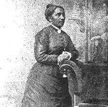
The equality of education in Sacramento area schools had been the focus of a number of reformers. Educator activists in the 19th century are well represented by Sarah Jones, and in the 20th century by Mary Tsukamoto. Jones was an African American . . . — — Map (db m229891) HM
783 entries matched your criteria. The first 100 are listed above. Next 100 ⊳
* Inflectional forms of words are their plurals, singulars, and possessives as well as gramatical tenses and similar variations.