On Fleetwood Heights Road (Virginia Route 685) at Stuart Lane, on the right when traveling east on Fleetwood Heights Road.
The 1863 campaigns for Chancellorsville, Gettysburg, Bristoe Station, and Mine Run exacted an immense toll upon the Army of the Potomac. Union Gen. George G. Meade deemed it vital to rest his command. War Department officials also used this . . . — — Map (db m97493) HM
On Fleetwood Heights Road (Virginia Route 685) at Stuart Lane when traveling east on Fleetwood Heights Road.
Driven from Fleetwood Hill, the Union cavalry pulled back toward the Rappahannock River and halted just beyond cannon range. Observing that the sullen Federals refused to depart, Confederate Gen. J.E.B. Stuart consolidated his defensive line around . . . — — Map (db m97494) HM
On Fleetwood Heights Road (Virginia Route 685) at Stuart Lane, on the right when traveling east on Fleetwood Heights Road.
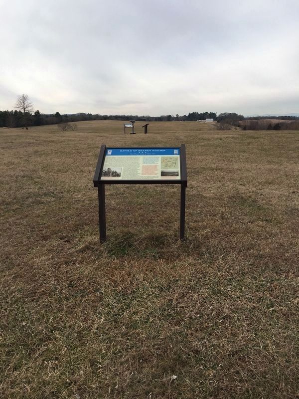
Confederate Gen. J.E.B. Stuart realized that his headquarters here was overrun and that Gen. William E. Jones's Brigade was fighting to survive. Stuart ordered Gen. Wade Hampton's Brigade to fall back from the St. James Church line and recapture . . . — — Map (db m97495) HM
On Fleetwood Heights Road (Virginia Route 685) at Stuart Lane, on the right when traveling east on Fleetwood Heights Road.
Col. H. Judson Kilpatrick formed his brigade on an open plateau to the southeast of Fleetwood Hill, 900 yards from here. He soon received orders to support Lt. Col. Percy Wyndham's Brigade, now fiercely engaged with Gen. William E. Jones's Brigade . . . — — Map (db m97499) HM
On Fleetwood Heights Road (Virginia Route 685) at Stuart Lane, on the right when traveling east on Fleetwood Heights Road.
Union Lt. Col. Percy Wyndham advanced his command from Brandy Station and centered his attack on this spot. To your right, the 1st New Jersey Cavalry ascended the slope. The 1st Maryland Cavalry occupied the center, and to your left, circling around . . . — — Map (db m97501) HM
Near Fleetwood Heights Road (Virginia Route 685) at Stuart Lane, on the right when traveling east.
The commanding view from Fleetwood Hill rendered this “Famous Plateau” an ideal observation post during the war. Today the view looks much as it did in the 1860s.
1. COLE’S HILL
During the winter of 1864, Federal Second Corps . . . — — Map (db m154527) HM
On Newbys Shop Road (Virginia Route 673), on the right when traveling north.
On January 25, 1863, Union general Joseph "Fighting Joe" Hooker replaced Gen. Ambrose E. Burnside as the fifth commander of the demoralized eastern armies in less than two years. On taking charge of the Army of the Potomac, Hooker implemented . . . — — Map (db m154485) HM
On Newbys Shop Road (Virginia Route 673), on the right when traveling north.
On March 17, 1863, Union Gen. William W. Averell led 2,100 horsemen to the northern bank of the Rappahannock River at Kelly's Ford, four miles in front of you, under orders to "rout or destroy" Confederate Gen. Fitzhugh Lee and his cavalry command . . . — — Map (db m154487) HM
On North Main Street (Business U.S. 15), on the right when traveling north.
Confederate cavalry chief Gen. J.E.B. Stuart and Maj. John Pelham, the commander of Stuart’s Horse Artillery, frequented the Virginia House Hotel and often visited the Shackelford family across the street. A warm friendship developed between . . . — — Map (db m12496) HM
Near General Winder Road (Virginia Route 657) 0.3 miles north of James Madison Highway (U.S. 15), on the right when traveling west. Reported missing.
While Union Gen. Christopher C. Augur's division battled in the cornfield to your left, Union Gen. Alpheus S. Williams launched his own attack across the field where you now stand, which was then broken by shocks of tall wheat. The death of Gen. . . . — — Map (db m184365) HM
Near General Winder Road (Virginia Route 657) 0.3 miles north of James Madison Highway (U.S. 15), on the right when traveling west.
"The rattle of musketry, the shouting, cheering and yelling was deafening. The smoke of battle ... made it impossible to see but a short distance. The leaves and small limbs were falling thick and the bark from the timber flying in every . . . — — Map (db m184967) HM
On General Winder Road (Virginia Route 657) 0.3 miles north of James Madison Highway (U.S. 15), on the right when traveling west. Reported missing.
"The infantry were posted in line of battle on the right of the battery, and cheerfully awaited the order which would bring them more actively into the deadly conflict." —Gen. John Pope, USA
"I have come to help whip the Yankees . . . — — Map (db m185346) HM
On General Winder Road (County Route 657) at James Madison Highway (U.S. 15), on the right when traveling west on General Winder Road. Reported permanently removed.
In the summer of 1862, Federal Gen. John Pope threatened to retaliate against Southern civilians who tried to thwart the efforts of his new army. The threats prompted Confederate Gen. Robert E. Lee to issue Gen. Thomas J. "Stonewall" Jackson the . . . — — Map (db m183987) HM
On South Commerce Street, on the left when traveling south on South Commerce Street.
Following the Gettysburg Campaign, Federal officials sought to verify rumors that a substantial part of Gen. Robert E. Lee’s Confederate army had been detached. On September 13, 1863, Federal cavalry moved down the tracks from your left, under . . . — — Map (db m8417) HM
On South Commerce Street at East Davis Street, on the left when traveling south on South Commerce Street. Reported permanently removed.
During the winter of 1863-64, Federal officers quartered in many of Culpeper’s homes. The surrounding landscape was dotted with tents and huts for ten square miles as nearly 100,000 soldiers encamped. Gen. U.S. Grant, commander of all Federal . . . — — Map (db m8419) HM
On Maddens Tavern Road at Youngs Lane, on the left when traveling north on Maddens Tavern Road.
On May 8, 1864, following the Battle of the Wilderness, troopers of the 9th Virginia Cavalry scouted through this region and captured several United States Colored Troops (USCTs) near Madden's Tavern. Private Byrd C. Willis of the 9th recalled, . . . — — Map (db m185516) HM
On General Winder Road (Virginia Route 657) 0.3 miles west of North James Madison Highway (U.S. 15), on the right when traveling west. Reported missing.
"My command did not want to back out. We had backed out enough." —Gen. Nathaniel P. Banks, USA
"Banks is in our front and he is generally willing to fight. And he generally gets whipped." —Gen. Thomas "Stonewall" Jackson, CSA . . . — — Map (db m183957) HM
On North James Madison Highway (U.S. 15) at Dove Hill Road (Virginia Route 642), on the right when traveling south on North James Madison Highway. Reported missing.
"As we came over the brow of the hill our men were fearfully mowed down, but not one faltered. … Our musketry was without any cessation, and theirs was the same. The balls came in perfect sheets around us, besides this, flank . . . — — Map (db m184366) HM
Near North James Madison Highway (Route 642) 0.1 miles north of North James Madison Highway (U.S. 15), on the left when traveling north. Reported missing.
Three days after the battle, after cease-fire, Stonewall Jackson's force withdrew to Gordonsville. At least 405 men were buried on the field. All but one, N.B. Phillips, were in unmarked graves.
The Union army occupied the field for about a . . . — — Map (db m184367) HM
On General Winder Road (Virginia Route 657) at North James Madison Highway (U.S. 15), on the right when traveling north on General Winder Road. Reported missing.
"A shell passed through [Gen. Charles S. Winder's] side and arm, tearing them fearfully. He … lay quivering on the ground. He had issued strict orders that morning that no one, except those detailed for the purpose, should leave his . . . — — Map (db m184368) HM
On Oak Shade Road (County Route 624) at Little Fork Church Road (Route 726), on the right when traveling east on Oak Shade Road.
In the spring of 1861, the Little Fork Rangers (Co. D, 4th Virginia Cavalry), mustered in the yard of Little Fork Episcopal Church. On July 4, the Rangers were presented with a battle flag as they left Rixeyville for the First Battle of Manassas. . . . — — Map (db m72188) HM
On Lee Street west of Berryman Avenue, on the left when traveling west.
The remains of 1,323 Federal soldiers, 148 of them unknown, who died in Danville’s Civil War prisons are interred here. Many died from smallpox which ravaged the six prisons during the winter of 1863-1864.
The names of the dead were recorded . . . — — Map (db m66010) HM
On South Boston Road (Business U.S. 58) at Old Halifax Road, on the left when traveling west on South Boston Road.
Danville residents, feeling vulnerable to enemy attack because of the vast amount of commissary and quartermaster supplies stored in their town and the presence of the Confederate arsenal, petitioned the town council in February 1863 to build . . . — — Map (db m66004) HM
On Loyal Street at Lynn Street, on the right when traveling north on Loyal Street.
Built for use as a tobacco factory and leased to the Confederate government, this building housed many Federal soldiers captured in the Battle of the Crater at Petersburg in July 1864.
It was one of six buildings used in tobacco . . . — — Map (db m66005) HM
Near Craghead Street east of Bridge Street, on the left when traveling east.
When Confederate President Jefferson Davis was informed April 2, 1865, that Petersburg had fallen and Federal armies were approaching, he used the Richmond & Danville Railroad to evacuate his government to Danville.
Ten days later, after . . . — — Map (db m66007) HM
Near Craghead Street east of Bridge Street, on the left when traveling east.
At the outbreak of the Civil War, the Richmond & Danville Railroad was already part of a rail network that would sustain the Confederate Army of Northern Virginia. The Richmond & Danville extension to Greensboro, North Carolina, known as the . . . — — Map (db m66008) HM
Near Craghead Street east of Bridge Street, on the left when traveling east.
By the outbreak of the Civil War, the Virginia General Assembly had chartered only eight railroads totaling 638 miles. The North, in contrast, had developed an immense network of railroads and canals. This transportation network reached into the . . . — — Map (db m66009) HM
On Pine Street west of Sutherlin Avenue, on the right when traveling west.
This Italian villa mansion was the home of Maj. William T. Sutherlin, wartime quartermaster for Danville and one of its most prominent citizens. For one week, April 3-10, 1865, Sutherlin and his wife opened their home to Jefferson Davis and the . . . — — Map (db m66011) HM
On Sycamore Drive at Boydton Plank Road (U.S. 1), on the left when traveling south on Sycamore Drive.
In June 1864, to deny Gen. Robert E. Lee the use of the South Side R.R. and the Richmond and Danville R.R., Gen, Ulysses S. Grant sent Gen. James H. Wilson and Gen. August V. Kautz south of Petersburg on a cavalry raid to destroy track and rolling . . . — — Map (db m17556) HM
On Baltimore Road at Zion Road, on the right when traveling north on Baltimore Road.
In June 1864, to deny Gen. Robert E. Lee the use of the South Side R.R. and the Richmond and Danville R.R., Gen. Ulysses S. Grant sent Gen. James H. Wilson and Gen. August V Kautz south of Petersburg on a cavalry raid to destroy track and rolling . . . — — Map (db m18840) HM
On Reams Drive (Virginia Route 606) 0.1 miles west of Halifax Road (Virginia Route 604), on the right when traveling west.
Welcome to the Reams Station battlefield! In the summer of 1864, two battles of the significant Petersburg Campaign raged across this ground for control of the Petersburg (Weldon) Railroad. Gen. Robert E. Lee's Confederates defended Petersburg and . . . — — Map (db m243283) HM
On Duncan Road (Virginia Route 670) 0.6 miles south of Wheaton Road (Virginia Route 674), on the right when traveling south.
"Time is passing and Richmond is still not ours. I think it cannot be long now before the tug will come which, if it does not secure the prize, will put us where the end will be in sight."
—Gen. Ulysses S. Grant, USA
"The only . . . — — Map (db m184324) HM
Near Duncan Road (Virginia Route 670) 0.6 miles south of Wheaton Road (Virginia Route 674), on the right when traveling south.
"Every point of the enemy's [line] was carefully felt and examined for a weak point; none such, however, was found."
—Gen. John F. Hartranft, USA
"Our boys went into line with their accustomed cheer, and the yankees seeing our . . . — — Map (db m184682) HM
Near Duncan Road (Virginia Route 670) 0.6 miles south of Wheaton Road (Virginia Route 674), on the right when traveling south.
"We expected to 'rush' the rebels, but on reaching the creek we found it too deep for fording, and the enemy in good rifle-pits on the other bank, about 25 yards away."
—Pvt. Richard McBride, 190th Pennsylvania Infantry, USA
"The . . . — — Map (db m184870) HM
Near Duncan Road (Virginia Route 670) 0.6 miles south of Wheaton Road (Virginia Route 674), on the right when traveling south.
"Newspapers try to make the best of our [failed] 'reconnaissance.' This affords a vast deal of amusement, considering there were greater exertions and preparations made for this expedition than any previous one."
—Col. Charles S. . . . — — Map (db m184895) HM
Near Church Road (Virginia Route 672) at Flank Road, on the left when traveling north.
"When a man is on picket at night he is monarch of all he surveys. No one living has more absolute power than he. His word is law."—Corp. Lewis Bissell, 2nd Connecticut Heavy Artillery, USA
"I have seen veterans of three full . . . — — Map (db m85913) HM
Near Church Road (Virginia Route 672) at Flank Road, on the left when traveling north.
"We have set what we call Johnny catchers ... long poles set into the ground with the upper end about as high as a man's head and they are so thick that a rabbit could not crawl through."—Corp. Andrew W. Burwell, 5th Wisconsin . . . — — Map (db m155596) HM
Near Church Road (Virginia Route 672) at Flank Road, on the right when traveling south.
“The charge of Major-Gen. Wright’s veterans under cover of the darkness and mist … will forever live in history as one of the grandest and most sublime actions of the war.”—Sgt. Newton J. Terrill, 14th New Jersey Infantry, USA . . . — — Map (db m184488) HM
Near Church Road (Virginia Route 672) at Flank Road, on the right when traveling south.
“The charge of Major-Gen. Wright’s veterans under cover of the darkness and mist … will forever live in history as one of the grandest and most sublime actions of the war.”—Sgt. Newton J. Terrill, 14th New Jersey Infantry, USA
“The . . . — — Map (db m184489) HM
Near Church Road (Virginia Route 672) at Flank Road, on the right when traveling south.
"There is every indication that a heavy force is being massed in our front, and if a charge is made, this line cannot possibly be held by these few men."
—Unidentified North Carolina picket, CSA
"Nothing could be seen, nothing . . . — — Map (db m184517) HM
Near Church Road (Virginia Route 672) at Flank Road, on the right when traveling south.
As the enemy must have massed on the right of our line, they must have left their own line weak. How would it do for us to attack along the whole length of our line?"
—Gen. Horatio G. Wright, USA
"The enemy swarmed up to the . . . — — Map (db m184530) HM
Near Church Road (Virginia Route 672) at Flank Road, on the right when traveling south.
"Gentlemen we are going to have a h—l of a fight at early daylight ... if any of you have anything to say to your folks, wives, or sweethearts make your story short and get what sleep you can."—Col. James Hubbard, 2nd Connecticut Heavy . . . — — Map (db m184633) HM
Near Church Road (Virginia Route 672) at Flank Road, on the right when traveling south.
"No doubt a few more days will settle the fate of Petersburg. I shall be glad to welcome the dawn of peace, for I am tired of bloodshed."
—Col. Elisha Hunt Rhodes, 2nd Rhode Island Infantry, USA
"A very small effort on the part . . . — — Map (db m184650) HM
On Acorn Drive, 0.1 miles south of Oak Grove Road (County Route 606), on the left when traveling south. Reported missing.
Racing the pursuing Confederate cavalry for the safety of the Union lines at Petersburg after accomplishing most of its mission, Gen. James H. Wilson's command reached Ream's Station about 7 a.m. June 29. Two brigades of Gen. William Mahone's . . . — — Map (db m13774) HM
On Acorn Drive, 0.1 miles south of Oak Grove Road (County Route 606), on the left when traveling south.
In June 1864, to deny Gen. Robert E. Lee the use of the South Side R.R. and the Richmond and Danville R.R., Gen. Ulysses S. Grant sent Gen. James H. Wilson and Gen. August V. Kautz south of Petersburg on a cavalry raid to destroy track and rolling . . . — — Map (db m13776) HM
On Namozine Road (Virginia Route 708) at Cox Road (U.S. 460), on the left on Namozine Road.
The Union attack that broke the back of the Confederate defense of Petersburg and forced Gen. Robert E. Lee to evacuate the Army of Northern Virginia from the city happened here April 2, 1865. You are standing at the end of the Confederate right . . . — — Map (db m155211) HM
On Clay Street at Briggs Street, on the right when traveling north on Clay Street. Reported damaged.
Just west of you is the railbed of the original Petersburg and Weldon Railroad, a major supply line to the Confederate army in Petersburg and Richmond. Because of its importance, the Union army made an effort to destroy the line here at Hicksford . . . — — Map (db m18843) HM
Blenheim, built for Albert and Mary Willcoxon about 1859, contains some of the nation’s best-preserved Civil War soldier writings. More than 110 identified Union soldiers, representing units from New York, Pennsylvania, Michigan, Wisconsin, West . . . — — Map (db m21077) HM
On Main Street (Virginia Route 236) west of Locust Street, on the right when traveling east.
On June 1. 1861, the first major skirmish of the Civil War occurred on the main street of Fairfax Court House. In the pre-dawn hours 50 men of Co. B, Second U.S. Cavalry, led by Lt. Charles H. Tomkins, rode into town firing their weapons. As . . . — — Map (db m626) HM
On Old Burke Lake Road at Burke Road (Virginia Route 652), on the right when traveling north on Old Burke Lake Road.
After the Battle of Fredericksburg in December 1862, most of Confederate Gen. Robert E. Lee's Army of Northern Virginia settled into winter quarters except for Gen. J.E.B. Stuart's cavalry, which instead went on the move. Wade Hampton, Fitzhugh . . . — — Map (db m83049) HM
On Old Burke Lake Road south of Burke Road (Virginia Route 652), on the left when traveling south.
During the Civil War, African American laborers chopped wood and conveyed it to Burke’s Station, a major Federal timber transportation station located here on the Orange & Alexandria Railroad. To supply the Union army and engineers with timber . . . — — Map (db m88520) HM
On Centreville Road (Virginia Route 28), on the right when traveling south. Reported permanently removed.
On July 18, 1861, Gen. Irvin McDowell, the Union army commander, learned that the Confederate army had withdrawn from its Centreville earthworks to a strong defensive position behind Bull Run. McDowell ordered Gen. Daniel Tyler to reconnoiter the . . . — — Map (db m42643) HM
On Centreville Road (Virginia Route 28), on the right when traveling south.
By the early summer of 1861, Americans in both the North and South greeted the outbreak of war with patriotism and expectations of a quick decisive battle to end the conflict. In the North, the public clamored for immediate invasion to crush the . . . — — Map (db m42644) HM
On Centreville Road (Virginia Route 28) 1.3 miles south of Ordway Road (Virginia Route 658), on the right when traveling south.
On July 18, 1861, Gen. Irvin McDowell, the Union army commander, learned that the Confederate army had withdrawn from its Centreville earthworks to a strong defensive position behind Bull Run. McDowell ordered Gen. Daniel Tyler to reconnoiter the . . . — — Map (db m173364) HM
On Fort Drive north of Upperridge Road, on the right when traveling north.
In June 1994, a well-preserved male skeleton was found buried in a then-wooded area a few yards in front of you and reported to authorities. Remnants of a woolen uniform jacket with military-style brass buttons covered the upper half of the remains. . . . — — Map (db m134315) HM
On Braddock Road west of U.S. 29, on the left when traveling west.
Here, where the Warrenton Turnpike turned west from Braddock Road, the Union army marched from Centreville to meet Confederate forces in the first great battle of the Civil War on July 21, 1861. The afternoon, Union soldiers passed by here again, . . . — — Map (db m173378) HM
Near U.S. 29 west of Prince Way, on the right when traveling south. Reported missing.
Following the disastrous defeat at the First Battle of Manassas on July 21, 1861, the Union army retreated toward Centreville late in the afternoon with Confederate forces in pursuit. Thousands of Federal soldiers converged simultaneously at the . . . — — Map (db m75727) HM
Passing armies occupied and fortified Centreville, positioned between Washington, D.C., and Manassas Junction, beginning in July 1861 when Confederate and Union forces met during the war's first significant campaign. As American and British . . . — — Map (db m57135) HM
Near Historic Sully Way, 0.8 miles south of Air and Space Museum Parkway, on the right when traveling south.
At the time of the Civil War, the farms of Sully and Little Sully (no longer standing) were the homes of the Barlow and Haight families respectively. These families, connected by marriage, had come to Virginia from Dutchess County, New York, and . . . — — Map (db m217) HM
On Main Street / Clifton Road (Virginia Route 645), on the left when traveling south. Reported permanently removed.
Devereux Station, constructed in 1863 on the Orange and Alexandria (O&A) Railroad, was located down the tracks to your left. After the Confederate army withdrew from northern Virginia toward Richmond in March 1862, the U.S. Military Railroad . . . — — Map (db m196008) HM
Near Main Street (Virginia Route 645) at Ford Lane, on the right when traveling north. Reported permanently removed.
During the Civil War, the Orange & Alexandria Railroad was strategically important to both the Union and the Confederate armies. Sangster's Station, located 1-3/4 miles to your right where Colchester Road crosses under the railroad tracks, was . . . — — Map (db m196009) HM
On Wolf Run Shoals Road (County Route 610) south of Henderson Road (County Route 643).
During the Civil War, both Union and Confederate forces considered Wolf Run Shoals an essential crossing point on the Occoquan River through 1963. Confederate regiments camped on the south side of the shoals and posted pickets there from the winter . . . — — Map (db m74885) HM
On Chain Bridge Road (Virginia Route 236) south of Main Street (Virginia Route 236), on the right when traveling south. Reported permanently removed.
At different times, Union and Confederate forces occupied the Fairfax County Courthouse at this important crossroads. The flag of each side flew from its cupola during the war, and the building suffered damage.
On April 25, 1861, the Fairfax . . . — — Map (db m43134) HM
Near West Ox Road (Virginia Route 608) 0.1 miles south of Monument Drive, on the right when traveling south.
Senderos de la Guerra Civil en Virginia. El 1 de Septiembre de 1862, una intensa tormenta agregada a los violentos sonidos de la batalla que ocurría aquí. El intento del ejército de la Unión, que estaba retirándose . . . — — Map (db m182222) HM
The historic Reid-Ballard House once stood 140 yards west-northwest of this marker. The original log structure was built by Joseph Reid before the Revolution on land inherited by his wife, Barbara Walker Reid. The house and land passed to succeeding . . . — — Map (db m3216) HM
On Monument Drive at Monument Court, on the left when traveling west on Monument Drive.
The Battle of Ox Hill (or Chantilly) was fought here, in rain and storm, on September 1, 1862. It was a bloody aftermath following the Second Battle of Manassas (August 28-30) where the Union Army under Gen. John Pope was defeated and driven across . . . — — Map (db m212829) HM
On Fairfax Station Road, 0.4 miles west of Ox Road (Virginia Route 123), on the right when traveling west.
The first Fairfax Station depot, built by Irish immigrants in 1852, was a stop on the Orange
and Alexandria Railroad from Alexandria to Gordonsville. Early in 1862, after Confederate forces withdrew, the railroad carried military supplies
and . . . — — Map (db m885) HM
On Fairfax Station Road west of Ox Road (Virginia Route 123), on the right when traveling east.
Monday, August 8, 1864, was a hot and sultry day. Capt. John McMenamin of the 15th New York Volunteer Cavalry and Capt. James Fleming of the 16th New York Volunteer Cavalry had stopped at St. Mary's Church on the Ox Road (now Fairfax Station . . . — — Map (db m186) HM
In the fall of 1861, Fairfax County found itself between two large armies. Confederate Gen. Joseph E. Johnston and his army occupied the Centreville area. The Federal army, still regrouping after the devastating defeat at the First Battle of . . . — — Map (db m115854) HM
On Washington and Old Dominion Trail at Station Street, on the right when traveling south on Washington and Old Dominion Trail.
At midday on March 17, 1863, 40 blue-coated cavalrymen ambled into Herndon Station on the Alexandria, Loudoun & Hampshire Railroad in no-man's-land between Confederate and Union positions. The hamlet contained a depot building and steam-powered . . . — — Map (db m214235) HM
On Station Street north of Elden Street (Virginia Route 228), on the left when traveling north. Reported permanently removed.
On St. Patrick's Day, March 17, 1863, Confederate Capt. John S. Mosby and 40 Partisan Rangers attacked the picket post of the 1st Vermont Cavalry guarding this station on the Alexandria, Loudoun and Hampshire Railroad. The detachment commander Lt. . . . — — Map (db m151048) HM
On Arrowbrook Centre Drive west of Centreville Road (Virginia Route 657), on the left when traveling west.
Laura Ratcliffe, a spy for noted Confederate officers J.E.B. Stuart and John S. Mosby, lived here at Merrybrook after the Civil War. It is the only known remaining house associated with her. During the war, she lived two-and-a-half miles south of . . . — — Map (db m126642) HM
On Richmond Highway (U.S. 1) at Old Colchester Road (Virginia Route 611), on the right when traveling north on Richmond Highway.
During the Civil War, the prominent hilltop location of Pohick Church made it a target for occupation and vandalism, but it also served as an aeronautical center. On November 12, 1861, Union Gen. Samuel P. Heintzelman’s 2nd Michigan Volunteers . . . — — Map (db m65051) HM
Near Chain Bridge Road at Wasp Lane, on the right when traveling east. Reported missing.
On September 11, 1861, Lt. Orlando Poe led a party of U.S. Army Topographical Engineers to map the area around Lewinsville for military use. Col. Isaac Stevens and 1,800 men protected the engineers. Stevens’s command included the 79th New York . . . — — Map (db m208587) HM
On Courthouse Road at Chain Bridge Road (Virginia Highway 123), on the right when traveling east on Courthouse Road.
Before you is Flint Hill Cemetery, the resting place of many of this area's most prominent Civil War-era civilian and military figures. Twenty-four veterans, including four who served in Confederate Col. John S. Mosby's Partisan Rangers, are . . . — — Map (db m59041) HM
On Rose Hill Drive, on the right when traveling west.
On September 28, 1863, Confederate Maj. John S. Mosby raided the house that stood nearby on the bluff at the end of May Boulevard. The day before, Mosby and eight of his men road from Fauquier County toward Alexandria, where Mosby planned to . . . — — Map (db m67535) HM
On Accotink Park Road, on the left when traveling east. Reported missing.
The Lake Accotink access road here lies atop the original road bed of the Orange and Alexandria Railroad, chartered in 1849 to link the port city of Alexandria with Gordonsville in central Virginia. After the war began in 1861, railroads became . . . — — Map (db m2749) HM
On North Center Street, on the left when traveling west.
This six-point, star-shaped earthen fort with a 130-yard perimeter was constructed on the highest point of land in the area. It provided a commanding view of the western and northwestern approaches to Vienna.
Earthwork fortifications, . . . — — Map (db m1527) HM
On Church Street at Dominion Avenue, on the right when traveling north on Church Street.
In 1859, Abram Lydecker, a New Jersey merchant, purchased land in Vienna on which to build a large combination dwelling and store. The Lydecker family was displaced early as the Civil War swirled around the small village. Vienna village changed . . . — — Map (db m1643) HM
On Hunter Mill Road (County Route 674), on the right when traveling north.
For four days in March 1862, the Pennsylvania Reserve Corps camped here. It left Camp Pierpont at Langley on March 10 for Hunter's Mill on orders of Union Gen. George B. McClellan, commander of the Army of the Potomac, who had heard that Gen. . . . — — Map (db m203836) HM
On North Roosevelt Street, on the right when traveling east.
In 1861, Falls Church was a farm village located on the Alexandria-Leesburg Turnpike. On May 24, when Virginia's vote of secession became effective, Union troops crossed the Potomac and occupied Arlington Heights and Alexandria. On June 1, the 2nd . . . — — Map (db m2825) HM
On Park Avenue, on the right when traveling north.
Although soldiers repeatedly overran and raided Cherry Hill Farm during the Civil War, this ca. 1845 farmhouse and the ca. 1856 barn behind it survived almost intact. William Blaisdell, of Massachusetts paid $4,000 for the 66-acre property in 1856. . . . — — Map (db m65407) HM
Near Annandale Road south of Hillwood Avenue, on the right when traveling south.
In 1867, African Americans built Galloway United Methodist Church and established the historic cemetery you are facing. According to local tradition, before and during the Civil War enslaved people on the Dulany plantation secretly worshiped in the . . . — — Map (db m72029) HM
On East Fairfax Street at Douglass Avenue, on the right when traveling east on East Fairfax Street.
You are standing across the street from land that Harriet Brice, a “free woman of color,” purchased in 1864. Together with her husband, George Brice, she struggled to farm the property during the Civil War. Although she had gained her freedom . . . — — Map (db m206332) HM
On West Broad Street (Virginia Route 7), on the right when traveling north.
Confederate Col. John Singleton Mosby's Partisan Rangers (43rd Battalion Virginia Cavalry) conducted raids on Falls Church through the summer and fall of 1864. On the night of October 17, a detachment of Mosby's command rode through the village down . . . — — Map (db m69552) HM
Near North Roosevelt Street at East Broad Street (Virginia Highway 7), on the right when traveling east.
At the beginning of the war, Union commanders were uncertain of Confederate intentions and military capabilities. On June 22, 1861, civilian balloonist Thaddeus S.C. Lowe inflated his racing balloon Enterprise at the Washington Gas Company . . . — — Map (db m41495) HM
On South Washington Street (County Route 237) at East Fairfax Street, on the right when traveling north on South Washington Street.
The Civil War dramatically affected this 1769 Anglican/Episcopal church that stands before you. The congregation disbanded as the war broke out, with some families fleeing the village. Confederate forces occupied the church in August and September . . . — — Map (db m72085) HM
On Atoka Road at John S. Mosby Highway (U.S. 50), on the right when traveling north on Atoka Road.
(Preface): After Confederate Gen. Robert E. Lee's stunning victory at Chancellorsville in May 1863, he led the Army of Northern Virginia west to the Shenandoah Valley, then north through central Maryland and across the Mason-Dixon Line into . . . — — Map (db m171931) HM
On Rogues Road (County Road 602) at Old Auburn Road (County Road 670), on the right when traveling north on Rogues Road.
In October 1863, Confederate Gen. Robert E. Lee's Army of Northern Virginia pushed Union Gen. George G. Meade's Army of the Potomac back toward the fortifications around Centreville. Meade’s army marched along several roads, one of which brought . . . — — Map (db m233658) HM
On John Marshall Highway (Virginia Route 55) at Beverleys Mill Road, on the right when traveling west on John Marshall Highway. Reported permanently removed.
The gap to your left between Biscuit Mountain (the northern promontory of Pond Mountain) on the south and Mother Leathercoat Mountain on the north, described as “that dark, gloomy cleft” in an 1862 issue of Frank Leslie’s Illustrated . . . — — Map (db m167749) HM
On Elk Run Road (County Route 806) at Fernridge Road, on the left when traveling west on Elk Run Road.
Second Manassas Campaign August 22, 1862, was a day of surprises in Fauquier County, most of which were provided by Confederate Gen. J.E.B. Stuart and his 1,500 cavalrymen. Their target was the lightly guarded Union supply depot here at . . . — — Map (db m2750) HM
On Delaplane Grade Road at Winchester Road (U.S. 17), on the left when traveling east on Delaplane Grade Road.
Here at Piedmont Station (now Delaplane) trains were used for
the first time in history to move troops to impending battle.
On July 19, 1861 the fields surrounding this stop on the
Manassas Gap Railroad—which appeared then almost exactly . . . — — Map (db m41648) HM
The Village of Salem (renamed Marshall in 1882) was in the heartland of Col. John Singleton Mosby’s Confederacy. His 43rd Battalion of Partisan Rangers was summoned by the grapevine when needed and executed successful raids, often under the cover . . . — — Map (db m1183) HM
On Edmonds Lane, on the right when traveling west.
Mosby's Confederacy and First Manassas Campaign In the early morning hours of July 19, 1861, thousands of campfire lights burned in the camp of Col. Thomas J. Jackson's brigade which occupied the fields surrounding nearby Paris. Many thoughts . . . — — Map (db m4976) HM
On Maidstone Road, on the left when traveling west.
On November 5, 1862, several weeks after a tainted victory at Antietam, the Army of the Potomac's Commander-in-Chief Gen. George Brinton McClellan established his headquarters here. That same day President Abraham Lincoln wrote the orders relieving . . . — — Map (db m1173) HM
On Kelly's Ford Road (Virginia Route 674) at Kelly's Ford Road (Virginia Route 620), on the right when traveling south on Kelly's Ford Road.
Pickets of the opposing armies frequently exchanged gunfire over the Rappahannock River and occasionally swapped Yankee coffee for Rebel tobacco. On St. Patrick’s Day, 1863, they did both here at Kelly’s Ford, about 100 yards downstream from the . . . — — Map (db m108466) HM
On Remington Road (Business U.S. 15/29) south of Summerduck Road (County Route 651). Reported damaged.
The hamlet of Mill View, present-day Remington, became known as Rappahannock Station to the Civil War armies which campaigned in this area. Here the vital Orange & Alexandria railroad (to your left) crossed the Rappahannock River just behind the . . . — — Map (db m2525) HM
On Main Street/John Marshall Highway (Virginia Route 55) at Old Tavern Road/Fauquier Ave (Virginia Route 245), on the right when traveling east on Main Street/John Marshall Highway.
The Plains, situated on the Manassas Gap Railroad between Piedmont Station and Manassas Junction, was frequently traversed by troops from both sides.
Throughout the war, local resident Edward (Ned) Carter Turner kept a detailed diary. . . . — — Map (db m156110) HM
On John S. Mosby Highway (U.S. 50), on the right when traveling east.
(Preface): After the Battle of Antietam in September 1862, Gen. Robert E. Lee's Army of Northern Virginia escaped to Virginia. President Abraham Lincoln repeatedly urged Union Gen. George B. McClellan to pursue and attack. Following a plan . . . — — Map (db m42491) HM
On John Mosby Highway (U.S. 50) at Hill Road / Trappe Road (County Route 619), on the right when traveling east on John Mosby Highway.
After Confederate Gen. Robert E. Lee's stunning victory at Chancellorsville in May 1863, he led the Army of Northern Virginia west to the Shenandoah Valley, then north through central Maryland and across the Mason-Dixon Line into . . . — — Map (db m3754) HM
776 entries matched your criteria. Entries 101 through 200 are listed above. ⊲ Previous 100 — Next 100 ⊳