By Devry Becker Jones (CC0), January 26, 2019
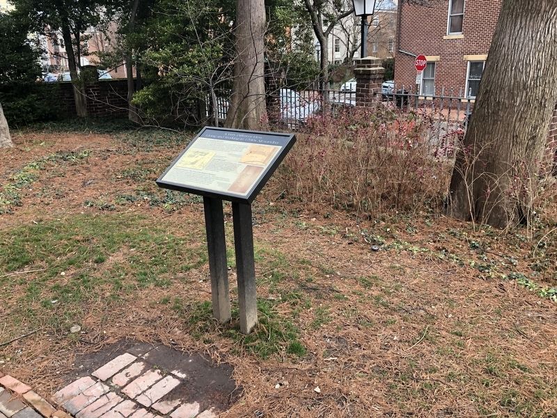
A Very Different View: Living and Working in 1700s Alexandria Marker
| Near North Lee Street south of Cameron Street, on the left when traveling north. |
| On North Fairfax Street south of Cameron Street, on the left when traveling south. |
| Near North Fairfax Street south of Cameron Street, on the right when traveling north. |
| Near Eisenhower Avenue, 0.4 miles west of Cameron Parke Court, on the right when traveling west. |
| On Marcey Road, 0.2 miles north of Overlook Trail, on the right when traveling north. |
| Near North Manchester Street, on the right when traveling north. |
| Near North Manchester Street, on the right when traveling north. |
| Near North Manchester Street, on the right when traveling north. Reported permanently removed. |
| On Washington and Old Dominion Trail south of Wilson Boulevard, on the right when traveling south. |
| On Washington and Old Dominion Trail, 0.1 miles south of 8th Road North, on the right when traveling north. |
| On North Manchester Street, on the right when traveling north. |
| Near Langston Boulevard (U.S. 29) at Fairfax Drive, on the right when traveling south. |
| On South Four Mile Run Drive at South Shirlington Road, in the median on South Four Mile Run Drive. |
| On South Four Mile Run Drive west of Shirlington Road, in the median. |
| On South Four Mile Run Drive at South Shirlington Road, in the median on South Four Mile Run Drive. |
| On South Four Mile Run Drive at South Shirlington Road when traveling east on South Four Mile Run Drive. |
| Near Marcey Road, 0.3 miles north of Overlook Trail, on the right when traveling north. |
| On Marcey Road, 0.3 miles north of North Beechwood Place, on the left when traveling north. |
| On Overlook Trail at Marcey Road, on the right when traveling east on Overlook Trail. |
| Near Marcey Road, 0.2 miles north of Overlook Trail, on the right when traveling north. |
| On Marcey Road, 0.3 miles north of North Beechwood Place, on the right when traveling north. |
| On Pickett Road (Virginia Route 237) at Old Pickett Road, on the right when traveling south on Pickett Road. |
| On Pickett Road (Virginia Route 237) at Old Pickett Road, on the right when traveling south on Pickett Road. |
| On Pickett Road (Virginia Route 237) at Old Pickett Road, on the right on Pickett Road. |
| On Bull Run Drive, 0.1 miles south of Bull Run Drive, on the left when traveling south. |
| Near Old Yates Ford Road (Route 612) at Kincheloe Road, on the left when traveling west. |
| On Outlet, 0.7 miles west of Hampton Road, on the right. |
| On Sandburg Street, on the right when traveling south. |
| On Sandburg Street, on the right when traveling south. |
| On Sandburg Street, on the right when traveling south. |
| On Wilson Boulevard just east of John Marshall Drive, on the right when traveling east. |
| Near Seneca Connector Trail east of Seneca Road (Virginia Route 602), on the left when traveling east. |
| Near Seneca Connector Trail east of Seneca Road (Virginia Route 602), on the left when traveling east. |
| Near Seneca Road, on the right when traveling north. |
| On Station Street north of Elden Street (Virginia Route 228), on the left when traveling north. |
| On Elden Street (County Route 606), on the right when traveling east. |
| On Washington and Old Dominion Trail north of Station Street, on the right when traveling north. |
| On Station Street north of Elden Street (Virginia Route 228). |
| On Washington and Old Dominion Trail just west of Grace Street, on the right when traveling west. |
| Near High Point Road, 2.3 miles south of Gunston Road (Virginia Route 242/600). |
| On Gunston Road (Virginia Route 242) 0.2 miles south of Old Colchester Road (Virginia Route 611), on the right when traveling south. |
| On Occoquan Regional Park Road near Ox Road (Virginia Route 123), on the right when traveling west. |
| On Pohick Bay Drive (County Road 721) 0.7 miles east of Gunston Road (State Route 242), on the right when traveling east. |
| On Occoquan Regional Park Road near Ox Road (Virginia Route 123), on the left when traveling east. Reported permanently removed. |
| On Old Reston Avenue, on the right when traveling north. |
| On Old Reston Avenue, on the right when traveling north. |
| Near Beulah Road (Virginia Route 702) south of Chathams Ford Drive, on the right when traveling south. |
| Near Park Street (County Route 675), on the right when traveling north. |
| On Park Street, on the right when traveling west. |
| Near Beulah Road (Virginia Route 702) south of Chathams Ford Drive, on the right when traveling south. |
| On Hunter Mill Road (County Route 674), on the right when traveling north. Reported missing. |
| On Hunter Mill Road (County Route 674), on the right when traveling north. |
| On Hunter Mill Road (County Route 674), on the right when traveling north. |
| Near Hunter Mill Road (County Route 674), on the right when traveling north. |
| On Washington and Old Dominion Trail west of Maple Avenue East (Virginia Route 123), on the right when traveling west. |
| On Beulah Road south of Chathams Ford Drive, on the right when traveling south. |
| Near Beulah Road (Route 702) south of Chathams Ford Drive, on the right when traveling south. |
| On Talahi Road, on the right when traveling north. |
| Near Beulah Road (Virginia Route 702) south of Chathams Ford Drive, on the right when traveling south. |
| Near Beulah Road (Virginia Route 702) south of Chathams Ford Drive, on the right when traveling south. |
| On Dominion Road at Ayr Hill Avenue, on the right when traveling west on Dominion Road. |
| On Dominion Road at Ayr Hill Avenue, on the right when traveling west on Dominion Road. |
| On Washington and Old Dominion Trail just west of Church Street Northeast, on the right when traveling west. |
| On Washington and Old Dominion Trail, 0.1 miles west of Cedar Lane (Virginia Route 698), on the left when traveling west. |
| Near Beulah Road (Route 702) south of Chathams Ford Drive, on the right when traveling south. Reported damaged. |
| On Meadowlark Gardens Court south of Beulah Road. |
| On Washington and Old Dominion Trail, 0.1 miles west of Grove Avenue, in the median. |
| On Tinner Hill Road just south of South Washington Street (U.S. 29), on the right when traveling south. |
| On Tinner Hill Road just south of South Washington Street (U.S. 29), on the right when traveling south. |
| On Washington and Old Dominion Trail west of Grove Avenue, on the right when traveling west. |
| On Tinner Hill Road just south of South Washington Street (U.S. 29), on the left when traveling north. |
| On Grove Avenue, on the right when traveling south. |
| On North Oak Street, on the right when traveling south. Reported missing. |
| On Grove Avenue, on the right when traveling south. |
| On John Mosby Highway (Route 50) just west of Tall Race Road (Virginia Route 612), on the left when traveling west. |
| On Watson Road (Virginia Route 860) at John S. Mosby Highway (U.S. 50), on the left when traveling north on Watson Road. |
| On Watson Road (Virginia Route 860) at John S. Mosby Highway (U.S. 50), on the left when traveling north on Watson Road. |
| On Ashburn Road (County Route 641), on the right when traveling north. |
| On Jackpit Lane south of Builders Lane, on the left when traveling south. |
| On Smith Switch Road (County Route 607), on the right when traveling north. |
| On Washington and Old Dominion Trail west of Smith Switch Road, on the left when traveling west. |
| On Washington and Old Dominion Trail west of Smith Switch Road, on the left when traveling west. |
| On Northstar Boulevard, on the right when traveling south. |
| On Washington and Old Dominion Trail, 0.1 miles east of Hamilton Station Road (Virginia Route 704), on the left when traveling east. |
| On Irene Road (County Route 706) at Hamilton Station Road (County Route 704), on the right when traveling west on Irene Road. |
| On Irene Road (County Route 706) at Hamilton Station Road (County Route 704), on the right when traveling west on Irene Road. |
| Near Ball’s Bluff Road, on the left when traveling east. |
| Near Balls Bluff Park east of Balls Bluff Road, on the right when traveling west. Reported permanently removed. |
| Near Ball’s Bluff Road, on the right when traveling east. |
| Near Ball’s Bluff Road, on the right when traveling east. |
| On Balls Bluff Park at Balls Bluff Road, on the right when traveling west on Balls Bluff Park. Reported permanently removed. |
| Near Ball’s Bluff Road, on the right when traveling east. |
| Near Ball’s Bluff Road, on the left when traveling east. |
| Near Balls Bluff Park east of Balls Bluff Road, on the right when traveling west. Reported permanently removed. |
| Near Ball’s Bluff Road, on the right when traveling east. |
| Near Ball’s Bluff Road, on the left when traveling east. |
| Near Balls Bluff Park east of Balls Bluff Road, on the right when traveling west. Reported missing. |
158 entries matched your criteria. The first 100 are listed above.
The final 58 ⊳