[Written on the initial marker, provided for context]
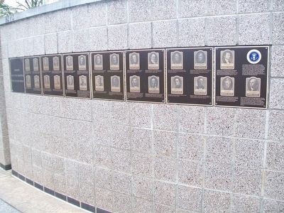
Our Constitution names the President of the United States the Commander in Chief of all the Armed Forces. Presidents who have served in our military are displayed on the following . . . — — Map (db m92384) HM WM
In 1841, Solomon Northup, a free Black man and professional musician, was drugged, kidnapped, and sold as a slave while visiting Washington, DC to attend the funeral of President William Henry Harrison. Eventually, Northup regained his freedom . . . — — Map (db m129923) HM
Oregon Trail Memorial
Erected 1931
Restored 1978
Caribou County 4H Builders Club
In honor of William Henry Harrison of Massachusetts who lost his life on the Oregon Trail about 1850.
Erected by his niece Mrs. Alura F. . . . — — Map (db m106732) HM
Spoke in the oak grove of General William Pickering north of here in the presidential campaign of 1840. He was stumping southern Illinois as a Whig elector for General William Henry Harrison in the Tippecanoe and Tyler Too Campaign. In 1861 . . . — — Map (db m154578) HM
In 1840 Abraham Lincoln, as a Whig elector, campaigned in southern Illinois for William Henry Harrison, Whig presidential candidate. Here in Lawrenceville, on October 28, he had a dispute with a local physician William G. Anderson, who the previous . . . — — Map (db m178177) HM
These millstones were used in the gristmills of John Small in the early 1800s. The mills at Smallsburg were important in the pioneer times of Lawrence County, not only as a place for grinding grain, but as the social center of the area. Small's Mill . . . — — Map (db m178169) HM
The western boundary of the Vincennes Tract passed through this point. The line extended south-southwest thirty-nine miles from present-day Crawford through Lawrence, Wabash, and Edwards counties in Illinois. The Vincennes Tract was seventy-two . . . — — Map (db m98964) HM
The City of Decatur was chosen as the site for the 1860 Republican State Convention with Abraham Lincoln as the most prominent Republican present. As the convention delegates were beginning to take their first, formal balloting, Richard . . . — — Map (db m56912) HM
Lincoln made frequent legal and political trips to Alton putting him in the heart of Alton history.
For nearly twenty-five years before becoming president, Lincoln was a general practice attorney, representing clients in a variety of . . . — — Map (db m133290) HM
John Jacob Hays was born in New York circa 1770. His family emigrated to North America from the Netherlands in 1720. The Hays family belongs to Congregation Shearith Israel, the oldest Jewish Congregation in the United States.
John Jacob Hays . . . — — Map (db m140422) HM
The Last Two American Forts
In 1798, Col. Thomas Hunt began construction on this site of the second American fort at the Three Rivers. this fort, which was completed in 1800, replaced the first, hastily built one erected nearby to the . . . — — Map (db m21219) HM
Thomas Jefferson was born on April 13, 1743 in Shadwell, Virginia. He was a draftsman of the U.S. Declaration of Independence; the nation's first secretary of state (1789-94); second vice president (1797-1801); and as the third president . . . — — Map (db m245086) HM
The town was laid out by Mathias Whetstone in 1830, and named for General James Dill, soldier in the War of 1812, first county recorder, a member of the Indiana 1816 Constitutional Convention, military associate and friend of Generals William . . . — — Map (db m45884) HM
Formed by proclamation of Indiana Territorial Governor William Henry Harrison March 7, 1803. Named in honor of Major General Henry Dearborn, Secretary of War.
The third county to be formed, it was originally much larger. Its present boundaries . . . — — Map (db m22103) HM
1801 Licensed to trade with the Indians in pelts.
1808 Established here a fur trading post.
1812 Interpreter and guide for Gen. William Henry Harrison prior to and during The War of 1812.
1813 Founded . . . — — Map (db m152032) HM
John Conner (1775~1826) FOUNDER OF CONNERSVILLE, March 4, 1813; Scout and Indian Interpreter for General William Henry Harrison; Treaty maker for the 12 Mile Purchase 1809; Indiana State Senator 1815 - 1822; First Sheriff of Fayette County 1819; . . . — — Map (db m225342) HM
This plaque marks the western border of the twelve mile cession negotiated by Governor William Henry Harrison with the Miami, Potawatomi, and Delawares, Treaty of Fort Wayne, September 30, 1809. — — Map (db m44770) HM
On Dec. 17, 1812, Lt. Colonel John B. Campbell with 600 mounted troops arrived at this site under orders to destroy the Miami Indian Villages along the Mississinewa River from here to the present site of Peru.
The destruction of the village on . . . — — Map (db m1512) HM
Plaque A At the dawn of the 1800’s,
Territorial Governor William Henry
Harrison rode horseback through
this valley and grew to admire the
serenity of its hills and streams,
and the intrepid determination of
its pioneer settlers. A . . . — — Map (db m137575) HM
Oldest continuous County Fair existing in Indiana. First fair held Sept. 11 - 14, 1860. Citizens met jan. 1860, organized Harrison County Agricultural Society, adopted constitution which with amendments governs yet today. Ground purchased Mar. 1860 . . . — — Map (db m9634) HM
Territorial Governor, William Henry Harrison, in a treaty with Indians held at Vincennes, secured lands which for the first time opened the entire north bank of the Ohio River for settlement. — — Map (db m45881) HM
Welcome to
"Grouseland"
Built 1803 - 1804
Home of
William Henry Harrison
Governor Indiana Territory 1800 - 1812
President of the United States 1840
Mansion owned and restored by
Francis Vigo Chapter
Daughters of the . . . — — Map (db m167023) HM
The great Shawnee leader lives on as a symbol of Native pride and pan-Indian identity. In the years 1810 and 1811 Tecumseh defended the rights of his people in meetings in Vincennes with William Henry Harrison, Governor of the Indiana Territory. . . . — — Map (db m61831) HM
On July 4, 1800, the western part of the
Northwest Territory became the Indiana Territory.
It covered land that would eventually be included
in the present states of Indiana, Illinois, Michigan,
Wisconsin, and Minnesota.
Vincennes, on the . . . — — Map (db m23266) HM
Marker Plaque Vincennes University was founded in 1801 as Jefferson Academy by William Henry Harrison, Governor of the Indiana Territory and Chartered by the Indiana Territorial Legislature in 1806. The columns of this gateway served as the . . . — — Map (db m23276) HM
Harrison became Governor of Indiana Territory 1800; he administered government of District of Louisiana 1804-1805. In Vincennes, he served as a contact during the expedition; surviving records document his support and his involvement in decisions . . . — — Map (db m23251) HM
The Shawnee orator, diplomat and warrior was born near present-day Dayton, Ohio, in 1768. Tecumseh strove to bond the scattered Native American peoples into a united opposition to white encroachment upon their ancestral lands. In 1791 he joined . . . — — Map (db m132830) HM
The grandson of President William Henry Harrison, Benjamin Harrison was born Aug. 20, 1833, in North Bend, Ohio. The 23rd President of the United States graduated Miami University (Ohio) before opening a law office in Indianapolis in 1854. . . . — — Map (db m132831) HM
Left Plaque
Posey County History
The first recorded white man to come to Posey County was Tom Jones in 1794. Posey County was named in honor of Thomas Posey. Governor of the Indiana Territory at the time it was created on Sept. 7, . . . — — Map (db m48215) HM
Runs northwest-southeast through this point. On September 30, 1809, Indiana Territorial Governor, William Henry Harrison, obtained for the United States almost three million acres from the Potawatomi, Delaware and Miami tribes. — — Map (db m18880) HM
A network of anti-slavery leaders involved families of Isaac Levi, a Revolutionary War veteran. He came to Claytown (Osgood) in 1832 from Vevay where he apparently was part of the Underground Railroad; his brother-in-law, John Ewing of Ohio joined . . . — — Map (db m45940) HM
Here, on this site, military forces commanded by General William Henry Harrison, engaged in battle with the Indians of the Wabash country led by The Prophet, brother of the great Indian leader, Tecumseh. This battle destroyed forever the hope of . . . — — Map (db m36205) HM
Panel One
American Forces.
Men engaged. 910.
General Wm. Henry Harrison Commanding attacked at 4: O’Clock A. M. Indian forces led by Prophet. Number engaged about the same as Americans
Loss. Americans. Killed 37.
“ . . . — — Map (db m36233) HM
Used by Indian tribes and often traveled by Chief Tecumseh prior to defeat of his warriors by Gen. William Henry Harrison at the Battle of Tippecanoe on November 7, 1811. — — Map (db m34920) HM
This stone marks the site, and commemorates the One Hundredth Anniversary of the Heroic Defense, of Fort Harrison by a small body of United States Soldiers, assisted by the settlers against the Indians.
September 4, 1812
The . . . — — Map (db m58391) HM
Built by Gov. Harrison, Oct., 1811, enroute to Tippecanoe to disperse the Indians at Prophet's Town.
Capt. Zachary Taylor defended the Fort against a savage Indian attack, Sept., 1812.
De-activated in 1822. — — Map (db m19796) HM
In the early 1820's, the northern half of Indiana had very little white settlement.
The Miami and Potawatomie Indians had suffered serious defeats at the hands of General Anthony Wayne along the Maumee River (1794) and William Henry Harrison at . . . — — Map (db m215014) HM
Wm. Henry Harrison's army camped one mile southwest of here at the Old Gopher Hill Cemetery Nov. 3, 1811 and Nov. 11, 1811 in route to and from the Battle of Tippecanoe. Several soldiers injured during the battle were buried there. — — Map (db m177430) HM
Indian Boundary Line
marking the
Twelve Mile Purchase
from the Indians by the
Fort Wayne Treaty
in 1809 by
Gov. William Henry Harrison
Placed by the
National Old Trails Chapter
Daughters of the American Revolution . . . — — Map (db m120639) HM
After General William Henry Harrison relieved Fort Wayne, he ordered Colonel James Simrall in September 1812 to prevent further Miami Indian attacks in the area. The Miamis fled as troops destroyed villages, crops, and supplies along Eel River; . . . — — Map (db m1335) HM
Delaware, 1st State
December 7, 1787
1609 • Henry Hudson visited Delaware Bay
1638 • Swedish colonists established Fort Christina, Delaware's first permanent settlement, and founded the colony of New Sweden
1655 • Dutch captured New . . . — — Map (db m47214) HM
Formed in 1815 out of Ohio County. Named for Col. Joseph Hamilton Daveiss. As US attorney for Ky., he prosecuted Aaron Burr in 1806 for treason, in plotting to seize Spanish territory, a friendly nation; but he did not obtain a conviction. Joined . . . — — Map (db m159320) HM
The General and Statesman
Isaac Shelby’s military decisions at the Battle of King’s Mountain in 1779 secured a critical victory for America during the Revolutionary War. Before war’s end, Shelby had also served in the North Carolina . . . — — Map (db m120217) HM
For Capt. Spear Spencer, Kentucky "Corn Stalk" Militia, 1792-1801. With St. Clair and Wayne Indian campaigns. Captain of Militia of Harrison Co., Ind., 1809. Formed Spencer's "Yellow Jackets", joined Gen. Wm. Henry Harrison's command in Tippecanoe . . . — — Map (db m136832) HM
Abraham Lincoln's only political speech in his native state, here, 1840, at age 31. An elector from Illinois, he campaigned for Whig presidential candidate William Henry Harrison. From Shawneetown, across river, Lincoln led parade. Young ladies rode . . . — — Map (db m123604) HM
Through the efforts of the Canton Improvement Association this old and densely populated ethnic neighborhood was named to the National Register of Historic Places in 1978. The two-story red brick row houses are especially noteworthy for their hand . . . — — Map (db m184476) HM
The home of the Cecil Whig newspaper
stood on this site for 82 years. It was first
published by Palmer C. Ricketts in August
1841, in a log cabin built in "The Hollow,"
near the intersection of present-day Main
and Bow streets. The cabin had . . . — — Map (db m233486) HM
In 1826, Jacob Engelbrecht moved to the house across the street near Carroll Creek. He began reporting on the National Road cavalcade that was going by his front door. His priceless diary recorded everything he saw. Travelers he observed included: . . . — — Map (db m2706) HM
Spanning the Cassleman River and supporting 200 years of hooves, boots, sleigh runners, and wheels of every type and description, the Cassleman River Bridge begins its third century on the National Road in Grantsville, Maryland. It is one of the . . . — — Map (db m135702) HM
Spanning the Casselman River and supporting 200 years of hooves, boots, sleigh runners, and wheels of every type and description, the Casselman River Bridge begins its third century on the National Road in Grantsville, Maryland. It is one of the . . . — — Map (db m167079) HM
[Side 1]
Gateway to the West
The overarching theme in the Heritage Area is Garrett County's relationship to the opening and development of America's western frontier in the late 18th and early 19th centuries. In fact Garrett County is . . . — — Map (db m223083) HM
The National Road was the first Federally-funded road project authorized by Congress. A gateway to the western frontier, it began in Cumberland and extended to Vandalia, Illinois. Heavily used from the time it opened, it was America's first . . . — — Map (db m148826) HM
As we were in 1938 complete with a "Hershey Ice Cream" Shop.
Hancock, Md. May 6, 1938
In front of the present day Visitors Center — the famous "Barton House" — or "Ben Beans" stage inn, (dating back to the 1818 era of the . . . — — Map (db m199829) HM
Huron Potawatomi Village
As early as 1825 large numbers of Potawatomi encamped at this location. One of the most prominent Huron Potatwatomi located here was Wabkezhik (Whapcazeek), who was wounded during the 1811 Battle of Tippicanoe Creek . . . — — Map (db m84726) HM
George DeBaptiste, a long-time Mason, and one of Detroit's most active and impassioned black community leaders, lived on this site during the 1850s and 60s. Born in Virginia about 1815, he moved to Madison, Indiana in 1838 and became involved in the . . . — — Map (db m14479) HM
1804...
Land Before the Town
Prior to its settlement, American Indians used the area we now call Rocheport. The closeness to the river, fertile soils, both salt and freshwater springs, and the protection given by the huge bluffs, rock . . . — — Map (db m46345) HM
This old Inn/Tavern is one of the most historic landmarks in Fremont.
The first Poplin (now Fremont) Town Meeting was held here at Lovering's Inn on August 27, 1764, as were many other Town Meetings.
The towns' name was changed from Poplin . . . — — Map (db m115814) HM
Wallpack Township, formed in 1731 out of Hunterdon County, included the present townships of Montague, Sandyston and the former Pahaquarry.
The Delaware River forms the western boundary and the Old Mine Road, supposedly built by Dutch miners . . . — — Map (db m49024) HM
After Gen. William Hull's surrender at Detroit early in the War of 1812, most of Michigan Territory came under British and Indian control. To prevent a possible invasion of Ohio, Gen. William Henry Harrison, commander of the Northwestern Army, . . . — — Map (db m165760) HM
Erected by grateful people to the memory of the pioneer
soldiers of Ohio and other states who fell in defense of their
homes from Indian depredations, and in twhe War of 1812.
Fort Amanda
Erected by order of General William H. . . . — — Map (db m167048) HM
The fort was built, maintained, operated and defended by both militia and regular army companies from primarily Kentucky and Ohio. The Kentuckians, made up of members of the militia, first built and manned the fort in 1812. The Ohioans came to . . . — — Map (db m167088) HM
Side A: John Anderson Ward Farmstead
John Anderson Ward had this Federal style house constructed from 1823-1825 on land inherited from his father, Urbana's founder Colonel William Ward. The Colonel's will stipulated that a local mason . . . — — Map (db m13822) HM
[Mural is on both sides of brick walls on the northern end of town that lie on both sides of the street:]
Wellsville Revitalization Committee Picnic
"Riverside"
Presbyterian Church, USA
525 Riverside Ave.
Founded April 5, 1831 . . . — — Map (db m156060) HM WM
Near this site Fort Huntington was erected by Captain Stanton Sholes' Company May, 1813.
On June 19, 1813, a part of the British flee appeared off the fort but was driven away by a storm and no attack made. General William Henry Harrison and staff . . . — — Map (db m17869) HM
Signed near this location on
Aug. 3, 1795
Line Drawing of the Principal Figures
in the signing of the treaty
1. Anthony Wayne
2. Little Turtle • 3. William Wells
4. William Henry Harrison
5. William Clark • 6. Meriwether Lewis . . . — — Map (db m28801) HM
Side A: Tecumseh
One of the most influential Native Americans of the 19th century, Tecumseh was born in 1768 in the Pickaway settlements on the Mad River and raised by older siblings at Old Town. A prominent Shawnee war leader who vigorously . . . — — Map (db m28646) HM
Gen. William Henry Harrison, United States
Gov. Lewis Cass, Michigan Territory
A Bowery was built to conduct treaty negotiations
with eight Native American Indian Nations
Wyandot, Delaware, Shawanee, Ottawa,
Seneca, Miami, . . . — — Map (db m193031) HM WM
[Front Text] : "Fort Winchester"
General William Henry Harrison ordered the construction of Fort Winchester at the beginning of October 1812 and it was completed October 15. The fort served as a forward observation post and supply . . . — — Map (db m37974) HM
Built by General Wm. H. Harrison in Oct. 1812 and named for General Winchester.
For a time it was the only defensive work against the British and Indians in Northwestern Ohio. — — Map (db m18717) HM
"Spemica Lawba-Johnny Logan"
In September 1786, Captain Benjamin Logan of Kentucky captured a young Indian boy during a raid across the Ohio River on the Machachac tribe towns of the Shawnee nation. Upon returning to Kentucky, Captain Logan . . . — — Map (db m28338) HM
Site of Pioneer Tavern
Headquarters of
General
William Henry Harrison
on the march from
Franklinton to Sandusky
February 1813 — — Map (db m155950) HM WM
Tunes played on fife and drum regulated a soldier's life in camp and
his actions on the battlefield. Heard over the roar of battle and through
the haze of smoke, fifes and drums - field music - communicated orders
to massed troops quickly. . . . — — Map (db m142587) HM
Side A:
Sunbury, Ohio
“An Ohio Stagecoach Town from 1820-1873”
From its beginning in 1816, Sunbury was destined to be a stagecoach town. Anticipating large numbers of stagecoach travelers in Sunbury, the town's founder, Lawrence . . . — — Map (db m18304) HM
In 1812, fearing the outbreak of war with Great Britain and her
Indian allies, many settlers left the area, and local militia companies
began constructing blockhouses as places of refuge. Victims of Indian
attacks included Michael Gibbs, Daniel . . . — — Map (db m150452) HM
Weldon B. Cooke, Thomas W. Benoist, Reinhardt N. Ausmus experimented in early aviation from this site 1912 - 1917
One of Sandusky Shipyard Sites
Sail and Steamboats were built 1864-1933
Among the . . . — — Map (db m242220) HM
Central Ohio was home to Native Americans as early as 10,000 years ago. While we don't know what they called themselves, archaeologists call a group of the earliest peoples, “Mound Builders”. Their society left nearly 200 burial and . . . — — Map (db m30023) HM
Near this spot, June 21, 1813 was held a council between General William Henry Harrison and the Indians comprising Wyandots, Delawares, Shawnees and Senecas with Tarhe the Crane as spokesman resulting in permanent peace with the Indians of Ohio. — — Map (db m59300) HM
Founded by Lucas Sullivant in 1797; the first settlement in the Scioto Valley north of Chillicothe and in Franklin County.
County Seat 1803-24
Annexed to Columbus 1870
[Attached to the building is a National Society of the United States . . . — — Map (db m13060) HM
Plaque A
“River Ohio so called by the Iroquois on account
of its beauty- descended by Sieur Robert de la Salle.”
Discovered by the French explorer LaSalle, about
1670 and claimed by him for Louis XIV of France.
Seized by the . . . — — Map (db m135159) HM
Harrison, later to become the ninth president of the United States,
was a strong supporter of the Cincinnati & Whitewater Canal project
and a major subscriber of stock in the canal company. He sold
land from his North Bend farm for the . . . — — Map (db m238950) HM
Benjamin Harrison (1833-1901) was born here on a farm established by his grandfather, William Henry Harrison. A graduate of Miami University in Oxford, Harrison read law in Cincinnati and then moved to Indianapolis to practice. He became active . . . — — Map (db m82635) HM
Child of the Revolution
In the heat of the Revolutionary War, British
forces attacked the home of Colonel Benjamin
Harrison, who was a signer of the Declaration of
Independence. The marauders torched furniture,
used cattle . . . — — Map (db m167340) HM
Congress Green Cemetery
John Cleves Symmes had grand ambitions. He planned to build a large city here, making it the hub of the Northwest Territory. This very spot would be the middle of a bustling town square.
Things worked . . . — — Map (db m167342) HM
William Henry Harrison was the first
president to die in office. He served
only thirty-two days. The nation had
never before mourned a sitting president.
Harrison's body was placed in a glass
covered coffin in the East Room of the
White . . . — — Map (db m167348) HM
From Ensign to Captain
"If he continues as a military man,” Major John
Mills said of William Henry Harrison, "he will be
a second Washington."
Though Harrison began his military career as a
Low-ranked officer, his . . . — — Map (db m167341) HM
side A
Judge John Cleves Symmes of New Jersey
purchased a huge tract of land "between the Miamis"
(rivers) stretching from the Ohio River to the
Greenville Treaty Line that became known as the
Miami Purchase. Symmes helped found the . . . — — Map (db m82016) HM
Life at North Bend
As the War of 1812 concluded, William Henry Harrison resigned his post, content to make public appearances and live a settled life with his family here in North Bend.
Though his presidential campaign would . . . — — Map (db m167277) HM
Point Farm given by William Henry Harrison February 9, 1773 – April 4, 1841 ninth president of the United States of America to his son, John Scott Harrison, Congressman who reared his son Benjamin Harrison August 20, 1833 – March 13, 1901 . . . — — Map (db m241855) HM
The Political Desert
Recalling the years after he resigned as general,
William Henry Harrison confided that he was,
"in bad health, in bad spirit and feeling more like
a misanthrope than ever in my life before."
Though . . . — — Map (db m167291) HM
The River and the Land
When William Henry Harrison arrived in Ohio in
1791, this was a plentiful land. Alive with thick
forests and flowing streams, the region was
home to animals such as buffalo, bear, elk, and
wild turkey. . . . — — Map (db m167336) HM
…as long as the love of power is a
dominant passion of the human bosom …so long
will the liberty of a people depend on its
own constant attention to its president.
Inaugural Address
March 4, 1841 — — Map (db m167350) HM
That the memory of Ohio's first president and gallant soldier William Henry Harrison may be fittingly commemorated this memorial is erected by a grateful state — — Map (db m167351) HM
175 entries matched your criteria. The first 100 are listed above. The final 75 ⊳