1618 entries match your criteria. Entries 201 through 300 are listed.⊲ Previous 100 — Next 100 ⊳
Historical Markers and War Memorials in South Dakota
November 26, 2022
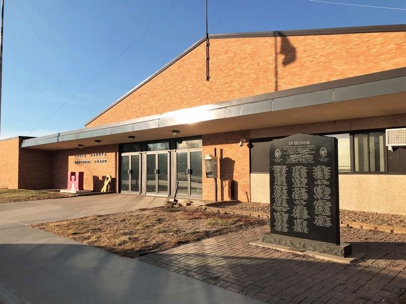
Company A 153rd Engineer Battalion Memorial
| 201 ► South Dakota, Charles Mix County, Wagner — Company A 153rd Engineer Battalion Memorial — In honor — |
| On 297th Street (State Highway 46) 0.2 miles east of Front Avenue Southeast, on the right when traveling west. | |||
| 202 ► South Dakota, Clark County, Clark — 631 — Clark County Veterans Memorial — |
| On 1st Ave. W at Commercial St., on the right when traveling east on 1st Ave. W. | |||
| 203 ► South Dakota, Clark County, Clark — 348 — Samuel Harrison Elrod, — Fifth Governor of South Dakota — |
| On 1st Avenue East at South Commercial Street, on the left when traveling west on 1st Avenue East. | |||
| 204 ► South Dakota, Clark County, Elrod — 472 — Birthplace of South Dakota Amateur Baseball — Garden City - - - - - Six Miles North — |
| On U.S. 212, 0.2 miles west of 433rd Avenue, on the right when traveling east. | |||
| 205 ► South Dakota, Clark County, Willow Lake — CW2 Scott Saboe / We Honor All Veterans Past, Present and Future — |
| On Lincoln Street south of State Highway 28, on the right when traveling south. | |||
| 206 ► South Dakota, Clark County, Willow Lake — Willow Lake Veterans Memorial — |
| On Lincoln Street south of State Highway 28, on the right when traveling south. | |||
| 207 ► South Dakota, Clay County, Beresford — 328 — Southeast South Dakota Experiment Farm — In Memory of Gustavus Norgren — Dedicated to the Early Pioneers of South Dakota — |
| On University Road, 3 miles east of State Highway 19, on the right when traveling north. | |||
| 208 ► South Dakota, Clay County, Burbank, Fairview Township — Burbank — |
| On White Street (469th Avenue) north of Madison Street, on the left when traveling north. | |||
| 209 ► South Dakota, Clay County, Burbank, Fairview Township — 495 — First Rural Electric Cooperative — |
| On State Highway 50 east of 469th Avenue, on the right when traveling west. | |||
| 210 ► South Dakota, Clay County, Centerville, Garfield Township — Dalesburg School / Dalesburg Village — |
| On University Road, 0.5 miles south of 304th Street, on the right when traveling south. | |||
| 211 ► South Dakota, Clay County, Irene — Irene Veterans Memorial — |
| On Main Street (State Highway 46) east of Dakota Avenue, on the right when traveling east. | |||
| 212 ► South Dakota, Clay County, Meckling — Meckling — |
| On Main Street south of State Route 50, on the right when traveling east. | |||
| 213 ► South Dakota, Clay County, Meckling — 414 — Meckling & Lincoln — |
| On Main Street south of State Route 50, on the left when traveling east. | |||
| 214 ► South Dakota, Clay County, Vermillion — 425 — Bruyer Church — |
| On South Dakota Route 50, 3 miles west of Interstate 29, on the right when traveling west. | |||
| 215 ► South Dakota, Clay County, Vermillion — Buhrstone — |
| On East Main Street, 1 mile south of State Route 50, on the right when traveling west. | |||
| 216 ► South Dakota, Clay County, Vermillion — Capt. Arlo L. Olson — Medal of Honor Recipient — |
| Near East Cherry Street east of North Dakota Street, on the right when traveling east. | |||
| 217 ► South Dakota, Clay County, Vermillion — Capt. Joseph J. Foss — Medal of Honor Recipient — |
| Near East Cherry Street east of North Dakota Street, on the right when traveling east. | |||
| 218 ► South Dakota, Clay County, Vermillion — Clay County Veterans Memorial — |
| On West Main Street at High Street, on the right when traveling west on West Main Street. | |||
| 219 ► South Dakota, Clay County, Vermillion — Col. George E. "Bud" Day — Medal of Honor Recipient — |
| Near East Cherry Street east of North Dakota Street, on the right when traveling east. | |||
| 220 ► South Dakota, Clay County, Vermillion — Confluence of the Vermillion and Missouri Rivers — |
| Near South Dakota Street, 1.5 miles south of U.S. 50, on the right when traveling south. | |||
| 221 ► South Dakota, Clay County, Vermillion — Downtown Vermillion — |
| On East Main Street west of Church Street, on the right when traveling west. | |||
| 222 ► South Dakota, Clay County, Vermillion — 495 — First Rural Electric Cooperative — |
| On State Highway 50 west of 469th Avenue, on the right when traveling east. | |||
| 223 ► South Dakota, Clay County, Vermillion — From Lewis and Clark to the Future — |
| On State Highway 19, 0.1 miles north of 312th Street, on the left when traveling north. | |||
| 224 ► South Dakota, Clay County, Vermillion — 706 — Governor Andrew E. Lee — |
| On West Main Street west of South Market Street, on the right when traveling east. | |||
| 225 ► South Dakota, Clay County, Vermillion — 579 — Grand Lodge Constitution Site — First Baptist Church Site — |
| On South Dakota Street at West Chestnut Street, on the right when traveling south on South Dakota Street. | |||
| 226 ► South Dakota, Clay County, Vermillion — Lewis and Clark / Vermillion — Lewis and Clark National Historical Trail — |
| Near South Dakota Street, 1.5 miles south of State Route 50, on the right when traveling south. | |||
| 227 ► South Dakota, Clay County, Vermillion — Lewis and Clark Visit Spirit Mound — August 25, 1804 — |
| On State Highway 19, 0.1 miles north of 312th Street, on the left when traveling north. | |||
| 228 ► South Dakota, Clay County, Vermillion — Lewis and Clark Were Here...and Here... — |
| On State Highway 19, 0.1 miles north of 312th Street, on the left when traveling north. | |||
| 229 ► South Dakota, Clay County, Vermillion — Old Main — National Register of Historic Places — |
| Near East Clark Street north of North University Street, on the right when traveling west. | |||
| 230 ► South Dakota, Clay County, Vermillion — Old Vermillion — |
| On West Main Street, 1 mile south of State Route 50, on the right when traveling east. | |||
| 231 ► South Dakota, Clay County, Vermillion — Old Vermillion — |
| On Canby Street, 1.3 miles south of State Route 50, on the left when traveling west. | |||
| 232 ► South Dakota, Clay County, Vermillion — Prentis Park — |
| On North Plum Street at East Main Street, on the right when traveling north on North Plum Street. | |||
| 233 ► South Dakota, Clay County, Vermillion — 574 — Site of the First Permanent School House in Dakota Territory — |
| On South Dakota Street at East Chestnut Street, on the right when traveling north on South Dakota Street. | |||
| 234 ► South Dakota, Clay County, Vermillion — Spirit Mound — |
| On State Highway 19, 0.1 miles north of 312th Street, on the left when traveling north. | |||
| 235 ► South Dakota, Clay County, Vermillion — The First Baptist Church, Vermillion, South Dakota — |
| On E Main St at N Dakota St on E Main St. | |||
| 236 ► South Dakota, Clay County, Vermillion — University of South Dakota — |
| Near East Clark Street north of North Yale Street, on the right when traveling west. | |||
| 237 ► South Dakota, Clay County, Vermillion — Vermillion — June 24, 1984 — |
| On South Dakota Street, 1.5 miles south of State Highway 50, on the right when traveling south. | |||
| 238 ► South Dakota, Clay County, Vermillion — 413 — Vermillion / Historic Highway — |
| On West Cherry Street, 0.5 miles south of State Route 50, on the left when traveling west. | |||
| 239 ► South Dakota, Clay County, Vermillion — W. O. "Doc" Farber — 1910-2007 — |
| Near East Campus Drive west of North Pine Street, on the left when traveling west. | |||
| 240 ► South Dakota, Clay County, Vermillion — Welcome to Cotton Park — Missouri National Recreational River Water Trail — |
| On South Dakota Street, 0.1 miles south of East Broadway Street, on the right when traveling south. | |||
| 241 ► South Dakota, Clay County, Vermillion, Garfield Township — Dalesburg and Hub City — |
| On 306th Street east of University Road, on the right when traveling west. | |||
| 242 ► South Dakota, Clay County, Vermillion, Garfield Township — Hub City — |
| On 306th Street at University Road, on the right when traveling west on 306th Street. | |||
| 243 ► South Dakota, Clay County, Vermillion, Spirit Mound Township — Canotina Paha | Mountain of Little People — Missouri National Recreational River — |
| On State Highway 19 north of 312th Street, on the left when traveling south. | |||
| 244 ► South Dakota, Clay County, Vermillion, Spirit Mound Township — Daughters of the American Revolution Spirit Mound Monument — |
| Near State Highway 19 north of 312th Street, on the left when traveling north. | |||
| 245 ► South Dakota, Clay County, Vermillion, Spirit Mound Township — Hill of Chalk — Missouri National Recreational River — |
| Near State Highway 19 north of 312th Street, on the left when traveling north. | |||
| 246 ► South Dakota, Clay County, Vermillion, Spirit Mound Township — Hill of Little Spirits — Missouri National Recreational River — |
| Near State Highway 19 north of 312th Street, on the left when traveling north. | |||
| 247 ► South Dakota, Clay County, Vermillion, Spirit Mound Township — Spirit Mound Monument — |
| Near State Highway 19 north of 312th Street, on the left when traveling north. | |||
| 248 ► South Dakota, Clay County, Wakonda — Ophir Lodge Memorial — |
| On 2nd Street west of Iowa Street, on the right when traveling east. | |||
| 249 ► South Dakota, Clay County, Wakonda — The Congregational Church of Star Corner — |
| On 2nd Street west of Iowa Street, on the right when traveling east. | |||
| 250 ► South Dakota, Clay County, Wakonda — Wakonda Veterans Memorial — |
| On 2nd Street at Iowa Street, on the right when traveling east on 2nd Street. | |||
| 251 ► South Dakota, Codington County, Florence — Dexter Cemetery — |
| Near 156th St., 0.3 miles west of 446th Ave. | |||
| 252 ► South Dakota, Codington County, Henry — The Centennial Tree — Planted in 1882 — |
| On Main Street south of 2nd Street, on the right when traveling south. | |||
| 253 ► South Dakota, Codington County, Kranzburg — District No. 5 Public School — |
| On St. Peter St. NW at Hastings Ave. NW, on the left when traveling east on St. Peter St. NW. | |||
| 254 ► South Dakota, Codington County, Kranzburg — Holy Rosary Catholic Church — |
| On Minnesota Avenue south of Saint Joseph Street Northwest, on the right when traveling north. | |||
| 255 ► South Dakota, Codington County, Kranzburg — Holy Rosary Cemetery of Kranzburg / Holy Rosary Catholic Church — |
| On Saint Joseph Street east of Dakota Avenue, on the left when traveling east. | |||
| 256 ► South Dakota, Codington County, South Shore — 452 — Legend of Punished Woman's Lake — |
| On South Dakota Route 20, 1 mile east of 462nd Avenue, on the right when traveling east. | |||
| 257 ► South Dakota, Codington County, Watertown — 34th Signal Company Memorial — |
| On 1st Avenue Southeast east of Broadway Street South, on the right when traveling east. | |||
| 258 ► South Dakota, Codington County, Watertown — Arthur Calvin Mellette — Governor — |
| On 5th Avenue North West at Skyline Drive on 5th Avenue North West. | |||
| 259 ► South Dakota, Codington County, Watertown — Balsiger's Bakery — 113 E. Kemp — Watertown Commercial Historic District — |
| On Kemp Avenue East west of 2nd Street East, on the right when traveling west. | |||
| 260 ► South Dakota, Codington County, Watertown — Carnegie Free Public Library — 27 First Ave. S. E. — Watertown Commercial Historic District — |
| On 1st Avenue Southeast at South Maple, on the left when traveling east on 1st Avenue Southeast. | |||
| 261 ► South Dakota, Codington County, Watertown — Codington County Courthouse — |
| On First Avenue SE, 0.1 miles east of Broadway, on the right when traveling east. | |||
| 262 ► South Dakota, Codington County, Watertown — 591 — Codington County Veterans Memorial — |
| On 1st Avenue Southeast west of Maple Street Southeast, on the right when traveling east. | |||
| 263 ► South Dakota, Codington County, Watertown — 561 — Codington County Vietnam Veterans Memorial — |
| On 1st Avenue Southeast east of Broadway Street South, on the right when traveling east. | |||
| 264 ► South Dakota, Codington County, Watertown — Commercial Building — 11 South Broadway — Watertown Commercial Historic District — |
| On South Broadway south of West Kemp Avenue, on the right when traveling south. | |||
| 265 ► South Dakota, Codington County, Watertown — Commercial Building — 14 W. Kemp — Watertown Commercial Historic District — |
| On Kemp Avenue west of Broadway Street, on the right when traveling east. | |||
| 266 ► South Dakota, Codington County, Watertown — Commercial Building — 23-27 W. Kemp — Watertown Commercial Historic District — |
| On Kemp Avenue West east of 1st Street West, on the right when traveling west. | |||
| 267 ► South Dakota, Codington County, Watertown — Commercial Historic District — |
| On East Kemp Avenue east of North Maple, on the right when traveling east. | |||
| 268 ► South Dakota, Codington County, Watertown — Company H. Monument — 1st Regiment South Dakota Volunteer Infantry — 1899 — |
| On 1st Avenue Southeast east of South Broadway, on the right when traveling east. | |||
| 269 ► South Dakota, Codington County, Watertown — 566 — Dedicated to Freeman Thayer Post Number 59 — Grand Army of the Republic — Department of South Dakota — |
| On 1st Avenue Southeast west of Maple Street Southeast, on the right when traveling east. | |||
| 270 ► South Dakota, Codington County, Watertown — Dedicated to Veterans — |
| Near 11th Street Northeast, 0.1 miles south of 14th Avenue Northeast, on the right when traveling south. | |||
| 271 ► South Dakota, Codington County, Watertown — E.H. Prey Jeweler and Optician — 115 E. Kemp — Watertown Commercial Historic District — |
| On Kemp Avenue East west of 2nd Street East, on the right when traveling west. | |||
| 272 ► South Dakota, Codington County, Watertown — F.E. Tenney Grocery — 15-17 First Ave. S. E. — Watertown Commercial Historic District — |
| On 1st Avenue Southeast east of Broadway Street South, on the left when traveling east. | |||
| 273 ► South Dakota, Codington County, Watertown — Fire and Rescue — |
| On 1st Avenue Northwest east of 3rd Street Northwest, on the left when traveling east. | |||
| 274 ► South Dakota, Codington County, Watertown — First National Bank — 1 South Broadway — Watertown Commercial Historic District — |
| On South Broadway at West Kemp Avenue, on the right when traveling south on South Broadway. | |||
| 275 ► South Dakota, Codington County, Watertown — Foley Block–East End — 118 E. Kemp — Watertown Commercial Historic District — |
| On Kemp Avenue East west of 2nd Street East, on the right when traveling east. | |||
| 276 ► South Dakota, Codington County, Watertown — Foley Block–West End — 114 E. Kemp — Watertown Commercial Historic District — |
| On Kemp Avenue East west of 2nd Street East, on the right when traveling east. | |||
| 277 ► South Dakota, Codington County, Watertown — Forsburg Park Sundial — |
| On State Highway 20, 1 mile east of 351st Ave. | |||
| 278 ► South Dakota, Codington County, Watertown — Freeman Thayer Post Memorial — |
| Near 11th Street Northeast, 0.1 miles south of 14th Avenue Northeast, on the right when traveling south. | |||
| 279 ► South Dakota, Codington County, Watertown — Goss Block and Opera House — 100 E. Kemp — Watertown Commercial Historic District — |
| On Kemp Avenue East at Maple Street East, on the right when traveling east on Kemp Avenue East. | |||
| 280 ► South Dakota, Codington County, Watertown — Home Furniture Company — 17 South Maple — Watertown Commercial Historic District — |
| On South Maple south of East Kemp Avenue, on the right when traveling south. | |||
| 281 ► South Dakota, Codington County, Watertown — John Moodie Dry Goods Company — 123, 125, 127 E. Kemp — Watertown Commercial Historic District — |
| On Kemp Avenue East west of 2nd Street East, on the right when traveling west. | |||
| 282 ► South Dakota, Codington County, Watertown — Kennedy and Gayman Restaurant or Bakery — 16 E. Kemp — Watertown Commercial Historic District — |
| On Kemp Avenue East west of Maple Street East, on the right when traveling east. | |||
| 283 ► South Dakota, Codington County, Watertown — Lebert Building — 10-12 W. Kemp — Watertown Commercial Historic District — |
| On Kemp Avenue west of Broadway Street, on the right when traveling east. | |||
| 284 ► South Dakota, Codington County, Watertown — M.D. Alexander's Furniture Store — 3 South Maple — Watertown Commercial Historic District — |
| On South Maple south of East Kemp Avenue, on the right when traveling south. | |||
| 285 ► South Dakota, Codington County, Watertown — Maurice Hockman — |
| On West Kemp Avenue, 0.1 miles west of Broadway St. S, on the left when traveling east. | |||
| 286 ► South Dakota, Codington County, Watertown — McCarthy Building — 7 South Maple — Watertown Commercial Historic District — |
| On South Maple south of East Kemp Avenue, on the right when traveling south. | |||
| 287 ► South Dakota, Codington County, Watertown — McIntyre Block — 19-21 South Broadway — Watertown Commercial Historic District — |
| On South Broadway south of West Kemp Avenue, on the right when traveling south. | |||
| 288 ► South Dakota, Codington County, Watertown — Mellette Block — 1-3 N. Broadway — Watertown Commercial Historic District — |
| On Broadway Street at Kemp Avenue, on the right when traveling south on Broadway Street. | |||
| 289 ► South Dakota, Codington County, Watertown — Mellette Hill — |
| On Skyline Drive at 7th Avenue North West on Skyline Drive. | |||
| 290 ► South Dakota, Codington County, Watertown — 499 — Mellette House — |
| On 5th Avenue Northwest at Skyline Drive, on the right when traveling west on 5th Avenue Northwest. | |||
| 291 ► South Dakota, Codington County, Watertown — Mercer Block — 11 East Kemp Avenue — Watertown Commercial Historic District — |
| On East Kemp Avenue west of North Maple, on the right when traveling west. | |||
| 292 ► South Dakota, Codington County, Watertown — Minneapolis and St. Louis Depot — |
| On North Broadway Street, 0.1 miles north of 1st Avenue North West. | |||
| 293 ► South Dakota, Codington County, Watertown — O. N. Whistler Meat Market — 17 South Broadway — Watertown Commercial Historic District — |
| On South Broadway south of West Kemp Avenue, on the right when traveling south. | |||
| 294 ► South Dakota, Codington County, Watertown — Office Building — 101-103 W. Kemp — Watertown Commercial Historic District — |
| On Kemp Avenue West at 1st Street West, on the right when traveling west on Kemp Avenue West. | |||
| 295 ► South Dakota, Codington County, Watertown — 498 — Old M. & St. L. Depot Museum — |
| On North Broadway Street, 0.1 miles north of 1st Avenue North, on the right when traveling north. | |||
| 296 ► South Dakota, Codington County, Watertown — Paris Store — 9-11 South Maple — Watertown Commercial Historic District — |
| On South Maple south of East Kemp Avenue, on the right when traveling south. | |||
| 297 ► South Dakota, Codington County, Watertown — Post Office & Auditorium — (Watertown, South Dakota) — |
| On Broadway Street South at 1st Avenue Southeast, on the left when traveling south on Broadway Street South. | |||
| 298 ► South Dakota, Codington County, Watertown — Public Opinion & City Hall — |
| On 3rd St NE at Kemp Ave E on 3rd St NE. | |||
| 299 ► South Dakota, Codington County, Watertown — Rail & Industrial Center — |
| Near Broadway Street North, 0.1 miles north of 1st Avenue North, on the right when traveling north. | |||
| 300 ► South Dakota, Codington County, Watertown — Retail Building — 10 East Kemp Avenue — Watertown Commercial Historic District — |
| On East Kemp Avenue west of South Maple, on the left when traveling west. | |||
1618 entries matched your criteria. Entries 201 through 300 are listed above. ⊲ Previous 100 — Next 100 ⊳