4133 entries match your criteria. Entries 201 through 300 are listed.⊲ Previous 100 — Next 100 ⊳
Historical Markers and War Memorials in Missouri
By Jason Voigt, October 10, 2022
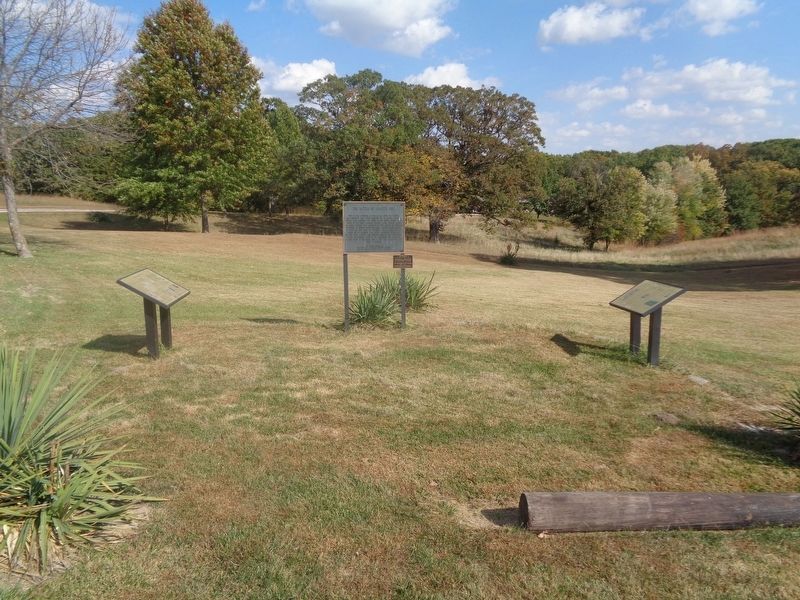
The Battle of Moore's Mill Marker
| 201 ► Missouri, Callaway County, Calwood — The Battle of Moore's Mill — Missouri's Civil War — 1861-1865 — |
| On State Highway JJ, 0.6 miles south of State Highway Z, on the right when traveling north. | |||
| 202 ► Missouri, Callaway County, Calwood — The Battle of Moore's Mill — |
| On State Highway JJ, 0.6 miles south of State Highway Z, on the right when traveling north. | |||
| 203 ► Missouri, Callaway County, Calwood — The Battle of Moore's Mill Mass Grave — |
| On State Highway Z, 0.5 miles west of State Highway JJ, on the left when traveling west. | |||
| 204 ► Missouri, Callaway County, Fulton — Alpha Delta of Beta Theta Pi — Historic Greek Chapter — |
| On Westminster Avenue south of West 6th Street, on the right when traveling north. | |||
| 205 ► Missouri, Callaway County, Fulton — Boone's Rock — |
| On 5th Street at Court Street, on the right when traveling east on 5th Street. | |||
| 206 ► Missouri, Callaway County, Fulton — Callaway County Men at War — Missouri's Civil War — |
| On 5th Street near Court Street, on the right when traveling east. | |||
| 207 ► Missouri, Callaway County, Fulton — Captain James Callaway — |
| On 5th Street at Court Street, on the right when traveling east on 5th Street. | |||
| 208 ► Missouri, Callaway County, Fulton — Fulton — |
| On South Market Street south of St. Louis Avenue, on the right when traveling south. | |||
| 209 ► Missouri, Callaway County, Fulton — Fulton - 1824 — Boone's Lick Road — |
| On East 4th Street east of Court Street, on the left when traveling east. | |||
| 210 ► Missouri, Callaway County, Fulton — Fulton Country Club — Stinson Creek Trail — |
| On East 10th Street at Wood Street, on the left when traveling east on East 10th Street. | |||
| 211 ► Missouri, Callaway County, Fulton — Memorial Park — |
| On 2nd Street at Court Street, on the left when traveling west on 2nd Street. | |||
| 212 ► Missouri, Callaway County, Fulton — President Robert L. D. Davidson — 1909 - 1998 — |
| On Westminster Avenue at 6th Street, on the left when traveling north on Westminster Avenue. | |||
| 213 ► Missouri, Callaway County, Fulton — Robertson Historic District — Historic Fulton Missouri — |
| On 7th Street east of Westminster Avenue, on the left when traveling west. | |||
| 214 ► Missouri, Callaway County, Fulton — The Berlin Wall — |
| On West 7th Street just west of Westminster Avenue, on the left when traveling east. | |||
| 215 ► Missouri, Callaway County, Fulton — The National Winston Churchill Museum — |
| On Westminster Avenue. | |||
| 216 ► Missouri, Callaway County, Fulton — The Winston Churchill Memorial and Library — |
| On Westminster Avenue. | |||
| 217 ► Missouri, Callaway County, Fulton — War Comes to Westminster College — Missouri's Civil War — |
| On Westminster Avenue at 5th Street, on the left when traveling north on Westminster Avenue. | |||
| 218 ► Missouri, Callaway County, Fulton — War Memorial — |
| On 2nd Street west of Market Street (U.S. 54), on the left when traveling west. | |||
| 219 ► Missouri, Callaway County, Fulton — War Memorial — |
| On 5th Street at Court Street, on the right when traveling east on 5th Street. | |||
| 220 ► Missouri, Callaway County, Fulton — Westminster College Columns — |
| On C. F. Lampkin Drive, on the left when traveling south. | |||
| 221 ► Missouri, Callaway County, Fulton — Westminster Hall Threshold — 1911 - 1974 — |
| On C. F. Lampkin Drive, on the right when traveling south. | |||
| 222 ► Missouri, Callaway County, Fulton — William Chrisman Swope Memorial Chapel — Erected A.D. 1917-1918 — |
| On C. F. Lampkin Drive, on the left when traveling south. | |||
| 223 ► Missouri, Callaway County, Fulton — Winston Churchill's “Iron Curtain” Speech — Westminster College Gymnasium — |
| On C. F. Lampkin Drive, on the right when traveling south. | |||
| 224 ► Missouri, Callaway County, Jefferson City — Bicentennial Monument — |
| On Katy Road (County Road 391) 0.6 miles north of Oilwell Road, on the right when traveling north. | |||
| 225 ► Missouri, Callaway County, Jefferson City — History of Jefferson City Area — |
| Near Katy Road, 0.9 miles north of Oilwell Road, on the right when traveling north. | |||
| 226 ► Missouri, Callaway County, Jefferson City — Jefferson City & Fulton Points of Interest — |
| Near Katy Road, 0.9 miles north of Oilwell Road, on the right when traveling north. | |||
| 227 ► Missouri, Callaway County, Jefferson City — Katy Trail State Park — |
| On Katy Road, 0.9 miles north of Oilwell Road, on the right when traveling north. | |||
| 228 ► Missouri, Callaway County, Jefferson City — Lewis and Clark in Missouri — |
| On Katy Road, 0.9 miles north of Oilwell Road. | |||
| 229 ► Missouri, Callaway County, Jefferson City — Missouri State Parks — |
| Near Katy Road, 0.9 miles north of Oilwell Road, on the right when traveling north. | |||
| 230 ► Missouri, Callaway County, Jefferson City — N. Jefferson to Hartsburg — Points of Interest — |
| On Katy Road, 0.9 miles north of Oilwell Road, on the right when traveling north. | |||
| 231 ► Missouri, Callaway County, Jefferson City — N. Jefferson to Tebbetts — Points of Interest |
| On Katy Road, 0.9 miles north of Oilwell Road, on the right when traveling north. Reported damaged. | |||
| 232 ► Missouri, Callaway County, Jefferson City — 5KTR-W004 — The Great Flood of 1993 — Milepost 143.2 — |
| On Katy Road, 0.9 miles north of Oilwell Road, on the right when traveling north. | |||
| 233 ► Missouri, Callaway County, Tebbetts — Fur Trading in Missouri — Milepost 131.3 — |
| On Olive Street (County Route 485) south of County Route 4011, on the left when traveling north. | |||
| 234 ► Missouri, Callaway County, Williamsburg — Gateway to the Boone's Lick — Missouri's Civil War — |
| On Old U.S. 40 west of Missouri Route D, on the right when traveling west. | |||
| 235 ► Missouri, Callaway County, Williamsburg — Grant's Stage Stand - 1821 — Boone's Lick Road — |
| On County Highway 161 near County Highway 142, on the left when traveling north. | |||
| 236 ► Missouri, Camden County, Ha Ha Tonka — American Indians, Trappers and Settlers — Ha Ha Tonka State Park — Missouri State Parks — |
| On Natural Bridge Road, 0.5 miles south of State Highway D, on the left when traveling west. | |||
| 237 ► Missouri, Camden County, Ha Ha Tonka — One Man's Dream — Ha Ha Tonka State Park — Missouri State Parks — |
| On Natural Bridge Road, 0.5 miles south of Missouri Highway D, on the left when traveling west. | |||
| 238 ► Missouri, Camden County, Ha Ha Tonka — Snyder's Legacy — Ha Ha Tonka State Park — Missouri State Parks — |
| On Natural Bridge Road, 0.5 miles State Highway D, on the right when traveling south. | |||
| 239 ► Missouri, Camden County, Ha Ha Tonka — The Water Tower — Ha Ha Tonka State Park — Missouri State Parks — |
| Near Natural Bridge Road, 0.5 miles west of State Highway D, on the left when traveling west. | |||
| 240 ► Missouri, Camden County, Ha Ha Tonka — Water: Sculpting The Landscape — Ha Ha Tonka State Park — Missouri State Parks — |
| On Natural Bridge Road, 0.5 miles west of State Highway D, on the left when traveling west. | |||
| 241 ► Missouri, Camden County, Lake Ozark — Bagnell Dam — |
| On Bagnell Dam Boulevard, on the left when traveling west. | |||
| 242 ► Missouri, Cape Girardeau County, Burfordville — Bollinger Mill/Burfordville Covered Bridge — |
| On County Road 360, 0.1 miles east of State Highway OO, on the right when traveling east. | |||
| 243 ► Missouri, Cape Girardeau County, Cape Girardeau — "Red Rover, Red Rover" — Did you know? — |
| On North Water Street near Broadway Street. | |||
| 244 ► Missouri, Cape Girardeau County, Cape Girardeau — 1673 — Marquette and Joliet — |
| On North Water Street north of Broadway Street, on the right when traveling north. | |||
| 245 ► Missouri, Cape Girardeau County, Cape Girardeau — 1735 — Girardot Post — |
| On North Water Street north of Broadway Street, on the right when traveling north. | |||
| 246 ► Missouri, Cape Girardeau County, Cape Girardeau — 1793 — Planning a City — |
| On North Water Street at Broadway Street, on the left when traveling south on North Water Street. | |||
| 247 ► Missouri, Cape Girardeau County, Cape Girardeau — 1803 — Lewis and Clark — |
| On North Water Street south of Broadway Street, on the left when traveling south. | |||
| 248 ► Missouri, Cape Girardeau County, Cape Girardeau — 1804 — The Louisiana Purchase — |
| On North Water Street south of Broadway Street, on the left when traveling south. | |||
| 249 ► Missouri, Cape Girardeau County, Cape Girardeau — 1821 — Missouri Statehood — |
| On North Water Street south of Broadway Street, on the left when traveling south. | |||
| 250 ► Missouri, Cape Girardeau County, Cape Girardeau — 1838 — The Trail of Tears — |
| On North Water Street south of Broadway Street, on the left when traveling south. | |||
| 251 ► Missouri, Cape Girardeau County, Cape Girardeau — 1861 — The Civil War — |
| On North Water Street south of Broadway Street, on the left when traveling south. | |||
| 252 ► Missouri, Cape Girardeau County, Cape Girardeau — 1863 — The Civil War — |
| On North Water Street south of Broadway Street, on the left when traveling south. | |||
| 253 ► Missouri, Cape Girardeau County, Cape Girardeau — 1870 — St. Vincent's Young Ladies Academy — |
| On North Water Street south of Broadway Street, on the left when traveling south. | |||
| 254 ► Missouri, Cape Girardeau County, Cape Girardeau — 1875 — River Commerce — |
| On North Water Street at Themis Street, on the left when traveling south on North Water Street. | |||
| 255 ► Missouri, Cape Girardeau County, Cape Girardeau — 1880 — The Coming of The Railroad — |
| On North Water Street at Themis Street, on the left when traveling south on North Water Street. | |||
| 256 ► Missouri, Cape Girardeau County, Cape Girardeau — 1909 — President Taft's Visit — |
| On Water Street. | |||
| 257 ► Missouri, Cape Girardeau County, Cape Girardeau — 1916 — The Great Fire — |
| On Water Street. | |||
| 258 ► Missouri, Cape Girardeau County, Cape Girardeau — 1918-1919 — The Big Freeze — |
| On Water Street. | |||
| 259 ► Missouri, Cape Girardeau County, Cape Girardeau — 1924 — The Three "Cape Girardeaus" — |
| On Water Street. | |||
| 260 ► Missouri, Cape Girardeau County, Cape Girardeau — 1925 — Riverboat Jazz — |
| On Water Street. | |||
| 261 ► Missouri, Cape Girardeau County, Cape Girardeau — 1927 — The Big Flood — |
| On Water Street. | |||
| 262 ► Missouri, Cape Girardeau County, Cape Girardeau — 1958 — River Industry — |
| On Water Street. | |||
| 263 ► Missouri, Cape Girardeau County, Cape Girardeau — 1964 — The Great Wall — |
| On Water Street. | |||
| 264 ► Missouri, Cape Girardeau County, Cape Girardeau — 1980 — Riverfest — |
| On Water Street. | |||
| 265 ► Missouri, Cape Girardeau County, Cape Girardeau — 2003 — The Bill Emerson Memorial Bridge — |
| On Water Street. | |||
| 266 ► Missouri, Cape Girardeau County, Cape Girardeau — 32-Pounder Seacoast Gun — Fort D — |
| Near Fort Street at Westport Street, on the right when traveling west. | |||
| 267 ► Missouri, Cape Girardeau County, Cape Girardeau — B'nai Israel Synagogue — Old Town Cape — |
| On South Main Street just south of Merriwether Street, on the right when traveling south. | |||
| 268 ► Missouri, Cape Girardeau County, Cape Girardeau — Bowling for Boredom — Fort D — |
| Near Fort Street at Westport Street, on the right when traveling west. | |||
| 269 ► Missouri, Cape Girardeau County, Cape Girardeau — Cape Girardeau — |
| On North Kingshighway Street (U.S. 61) at South County Park Road, on the right when traveling south on North Kingshighway Street. | |||
| 270 ► Missouri, Cape Girardeau County, Cape Girardeau — Cape Girardeau and the Railroad — |
| Near Aquasmi Street, on the right when traveling south. | |||
| 271 ► Missouri, Cape Girardeau County, Cape Girardeau — Cape Girardeau Freedom Rock Veterans Memorial — Honoring Cape Girardeau County Veterans — Ray "Bubba" Sorensen II — |
| Near North Kingshighway Street (U.S. 61) at County Park Drive, on the right when traveling north. | |||
| 272 ► Missouri, Cape Girardeau County, Cape Girardeau — Cape Girardeau River Crossings — |
| Near Aquasmi Street, on the right when traveling south. | |||
| 273 ► Missouri, Cape Girardeau County, Cape Girardeau — Cape La Croix Creek — |
| On South Central Avenue near William Street. | |||
| 274 ► Missouri, Cape Girardeau County, Cape Girardeau — Captains of Industry — |
| On Water Street. | |||
| 275 ► Missouri, Cape Girardeau County, Cape Girardeau — Champion Beech Tree — |
| On Morgan Oak Street, on the right when traveling east. | |||
| 276 ► Missouri, Cape Girardeau County, Cape Girardeau — Don Louis Lorimier / El Camino Real — |
| On S. Spanish Street (Missouri Route 177) at William Street, on the right when traveling north on S. Spanish Street. | |||
| 277 ► Missouri, Cape Girardeau County, Cape Girardeau — Down the Colorado — Fort D — |
| Near Fort Street at Westport Street, on the right when traveling west. | |||
| 278 ► Missouri, Cape Girardeau County, Cape Girardeau — Dwarfing the Titanic — Did you Know? — |
| On North Water Street. | |||
| 279 ► Missouri, Cape Girardeau County, Cape Girardeau — Entertainers — |
| On Water Street. | |||
| 280 ► Missouri, Cape Girardeau County, Cape Girardeau — Filburn & Sloan Commission House — Old Town Cape — |
| On North Water Street at Themis Street, on the right when traveling south on North Water Street. | |||
| 281 ► Missouri, Cape Girardeau County, Cape Girardeau — Fort D — |
| Near Fort Street at Westport Street, on the right when traveling west. | |||
| 282 ► Missouri, Cape Girardeau County, Cape Girardeau — George & Fred Naeter — 1904-1954 — |
| On Kiwanis Drive at Maria Louise Lane, on the right when traveling west on Kiwanis Drive. | |||
| 283 ► Missouri, Cape Girardeau County, Cape Girardeau — George Drouillard — |
| Near Water Street north of William Street, on the right when traveling north. | |||
| 284 ► Missouri, Cape Girardeau County, Cape Girardeau — George Washington Carver — |
| On Water Street. | |||
| 285 ► Missouri, Cape Girardeau County, Cape Girardeau — Grant Takes Command — Fort D — |
| Near Fort Street at Westport Street, on the right when traveling west. | |||
| 286 ► Missouri, Cape Girardeau County, Cape Girardeau — H&H Building — |
| On Broadway Street just west of North Fountain Street, on the right when traveling west. | |||
| 287 ► Missouri, Cape Girardeau County, Cape Girardeau — Hollywood — |
| On Water Street. | |||
| 288 ► Missouri, Cape Girardeau County, Cape Girardeau — Ivers Square Civil War Monuments — Old Town Cape — |
| On North Lorimier Street just north of Themis Street, on the right when traveling north. | |||
| 289 ► Missouri, Cape Girardeau County, Cape Girardeau — Justice for the Common Man — Did You Know? — |
| On Themis Street just east of North Water Street when traveling east. | |||
| 290 ► Missouri, Cape Girardeau County, Cape Girardeau — Literary Giants / Missouri Mule — |
| On Water Street. | |||
| 291 ► Missouri, Cape Girardeau County, Cape Girardeau — Manitowoc Shipbuilding Company — |
| Near Aquasmi Street, on the right when traveling south. | |||
| 292 ► Missouri, Cape Girardeau County, Cape Girardeau — Marching with the 1st Nebraska — Fort D — |
| Near Fort Street at Westport Street, on the right when traveling west. | |||
| 293 ► Missouri, Cape Girardeau County, Cape Girardeau — Mark Twain / Missouri Generals / George Caleb Bingham — |
| On Water Street. | |||
| 294 ► Missouri, Cape Girardeau County, Cape Girardeau — Marquette Tower — |
| On Broadway Street just east of North Fountain Street, on the left when traveling east. | |||
| 295 ► Missouri, Cape Girardeau County, Cape Girardeau — Merriwether Pump Station — City of Cape Girardeau — Honoring Andy Juden — |
| On Water Street at Merriwether Street on Water Street. | |||
| 296 ► Missouri, Cape Girardeau County, Cape Girardeau — Missouri Mule / The Wild West — |
| On Water Street. | |||
| 297 ► Missouri, Cape Girardeau County, Cape Girardeau — Muralist / Broadcasters — |
| On Water Street. | |||
| 298 ► Missouri, Cape Girardeau County, Cape Girardeau — Nature's River — |
| On North Water Street. | |||
| 299 ► Missouri, Cape Girardeau County, Cape Girardeau — Old Lorimier Cemetery — |
| On North Fountain Street. | |||
| 300 ► Missouri, Cape Girardeau County, Cape Girardeau — Old St. Vincent's Church — 1838 ------ 1982 — |
| Near South Main Street at William Street, on the left when traveling north. | |||
4133 entries matched your criteria. Entries 201 through 300 are listed above. ⊲ Previous 100 — Next 100 ⊳