5703 entries match your criteria. Entries 101 through 200 are listed.⊲ Previous 100 — Next 100 ⊳
Science & Medicine Topic
By Kai NeSmith, November 4, 2023
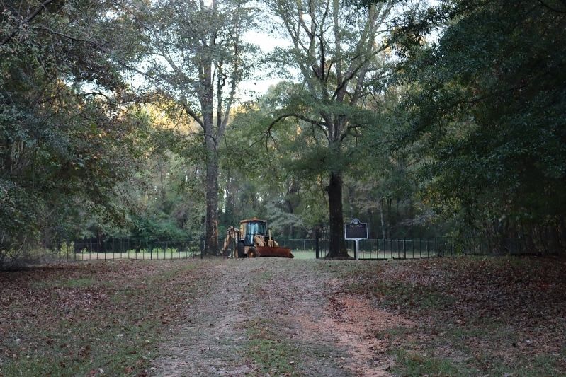
Bryce Hospital Cemetery No.3 & Marker
| 101 ► Alabama, Tuscaloosa County, Tuscaloosa — Bryce Hospital Cemetery No.3 — |
| Near Jack Warner Parkway, 0.1 miles south of 8th Avenue Northeast, on the right when traveling east. | |||
| 102 ► Alabama, Tuscaloosa County, Tuscaloosa — Dr. Peter & Mrs. Ellen Peter-Bryce Gravesite — Tuscaloosa County — |
| Near Bryce Lawn Drive at Campus Drive. | |||
| 103 ► Alabama, Tuscaloosa County, Tuscaloosa — Druid City Hospital School Of Nursing — |
| On Hackberry Lane at 4th Street, on the left when traveling south on Hackberry Lane. | |||
| 104 ► Alabama, Tuscaloosa County, Tuscaloosa — Gorgas House — |
| On Capstone Drive at Colonial Drive, on the right when traveling west on Capstone Drive. | |||
| 105 ► Alabama, Tuscaloosa County, Tuscaloosa — Maxwell Hall — |
| On Stadium Drive north of University Blvd, on the left when traveling north. | |||
| 106 ► Alabama, Tuscaloosa County, Tuscaloosa — Old Bryce Cemetery — |
| On Jack Warner Parkway Northeast south of McFarland Blvd East (U.S. 82), on the right when traveling south. | |||
| 107 ► Alabama, Tuscaloosa County, Tuscaloosa — Oliver-Barnard Hall — College of Arts and Sciences — |
| Near Capstone Drive east of Colonial Drive. | |||
| 108 ► Alabama, Tuscaloosa County, Tuscaloosa — Replica Gates for Northington General Hospital — |
| On McFarland Boulevard East, on the right when traveling north. | |||
| 109 ► Alabama, Tuscaloosa County, Tuscaloosa — Smith Hall, 1908 — |
| On 6th Avenue at Capstone Drive, on the right when traveling north on 6th Avenue. | |||
| 110 ► Alabama, Tuscaloosa County, Tuscaloosa — The Jemison Home — |
| On Greensboro Avenue (State Highway 215) at 13th Street, on the right when traveling north on Greensboro Avenue. | |||
| 111 ► Alabama, Tuscaloosa County, Tuscaloosa — The Little Round House — |
| On Capstone Drive, on the right when traveling east. | |||
| 112 ► Alabama, Tuscaloosa County, Tuscaloosa — Tuomey Hall — College of Arts and Sciences — Erected: 1888, Reconstructed: 20002 — |
| Near Capstone Drive west of 6th Avenue. | |||
| 113 ► Alabama, Tuscaloosa County, Tuscaloosa — Tuscaloosa County Veterans Memorial — |
| On McFarland Boulevard East, on the right when traveling north. | |||
| 114 ► Alabama, Tuscaloosa County, Tuscaloosa — Tuscaloosa Veterans Administration Hospital — |
| On Loop Road, 0.1 miles east of Patton Avenue/Woodland Road, on the right when traveling east. | |||
| 115 ► Alabama, Winston County, Double Springs — Thomas Malcolm Blake — July 18, 1917 to Aug. 26, 1989 — |
| On Alabama Route 195 north of Blake Drive, on the left when traveling north. | |||
| 116 ► Alaska, Denali Borough, Denali National Park — Mountains in Motion / Hot Rocks — |
| 117 ► Alaska, Fairbanks North Star Borough, Fairbanks — FAI-030 — Immaculate Conception Church — |
| On Cushman Street south of Illinois Street, on the right when traveling north. | |||
| 118 ► Alaska, Fairbanks North Star Borough, Fairbanks — James A. Maple — P. E. Arctic Pipeline Pioneer — 1937 - 2001 — |
| On Steese Highway (Alaska Route 2), on the right when traveling north. | |||
| 119 ► Alaska, Juneau Borough, Juneau, Downtown Juneau — Harvesting of the Atom — Amos Wallace, 1967 — Western Red Cedar (Thuja Plicata) — |
| On Calhoun Avenue at West 4th Street, on the right when traveling north on Calhoun Avenue. | |||
| 120 ► Alaska, Kenai Peninsula Borough, Moose Pass — Gold Discoveries Trigger Stampede — |
| On Seward Highway (Alaska Route 1 at milepost 56.6). | |||
| 121 ► Alaska, Ketchikan Gateway Borough, Ketchikan — Crossing a Frontier — St. John's mission brought gospel, school and hospital — |
| Near Mill Street east of Bawden Street, on the left when traveling east. | |||
| 122 ► Alaska, Sitka Borough, Sitka — Forest Service House — |
| On Seward Street at American Street, on the right when traveling east on Seward Street. | |||
| 123 ► Arizona, Apache County, Springerville — 18 — White Mountain Hospital — |
| On South Mountain Avenue, on the right when traveling north. | |||
| 124 ► Arizona, Cochise County, San Simon — The San Simon Rest Area - Percy Jones, Jr. — |
| Near Interstate 10 at milepost 388. | |||
| 125 ► Arizona, Coconino County, Flagstaff — 42-Inch Reflecting Telescope — |
| Near West Mars Hill Road, 0.6 miles west of West Santa Fe Avenue. | |||
| 126 ► Arizona, Coconino County, Flagstaff — Biology — |
| Near East Aspen Avenue west of North San Francisco Street. | |||
| 127 ► Arizona, Coconino County, Flagstaff — Clark Dome Weather Station — |
| Near West Mars Hill Road, 0.6 miles west of West Santa Fe Avenue. | |||
| 128 ► Arizona, Coconino County, Flagstaff — Henry Lee Giclas — December 10, 1910 - April 2, 2007 — |
| Near West Mars Hill Road, 0.6 miles west of West Santa Fe Avenue. | |||
| 129 ► Arizona, Coconino County, Flagstaff — Lowell Observatory — National Historic Landmark — |
| Near West Mars Hill Road, 0.6 miles west of West Santa Fe Avenue. | |||
| 130 ► Arizona, Coconino County, Flagstaff — Raymond Building — 1911 — |
| On North Leroux Street, on the left when traveling north. | |||
| 131 ► Arizona, Coconino County, Flagstaff — The Lawrence Lowell Telescope — |
| Near West Mars Hill Road, 0.6 miles west of West Santa Fe Avenue. | |||
| 132 ► Arizona, Coconino County, Grand Canyon National Park — Colonel Claude Hale Birdseye — 1878-1941 — Explorer • Geographer • Surveyor — |
| Near Hermit Road. | |||
| 133 ► Arizona, Coconino County, Grand Canyon National Park — The Best Section — |
| Near Hermit Road at West Rim Trail. | |||
| 134 ► Arizona, Coconino County, Williams — Rounseville Drugstore — |
| On Historic Route 66 east of North 3rd Street, on the left when traveling east. | |||
| 135 ► Arizona, Gila County, Payson — Zane Grey's Cabin — |
| Near South Green Valley Parkway. | |||
| 136 ► Arizona, Graham County, Fort Thomas — Geronimo — |
| On U.S. 70 at milepost 302, on the left when traveling east. | |||
| 137 ► Arizona, Maricopa County, Chandler, Downtown — Dr. A. J. Chandler — 1859 – 1950 — |
| Near South Marcos Place near West Commonwealth Avenue, on the right when traveling north. | |||
| 138 ► Arizona, Maricopa County, Chandler, Downtown — Price Building — 80 South Marcos Place — |
| On South San Marcos Place north of West Boston Street, on the right when traveling south. | |||
| 139 ► Arizona, Maricopa County, Fort McDowell — Grave of Dr. Carlos Montezuma — (Wassaja) — 1855-1923 — |
| On Beeline Highway (Arizona Route 87 at milepost 190) near North Fort McDowell Road, on the right when traveling north. | |||
| 140 ► Arizona, Maricopa County, Phoenix, Globa — The Original Site of the Desert Mission — Beginnings of John C. Lincoln Hospital — |
| On Eva Street at North 5th, on the right when traveling west on Eva Street. | |||
| 141 ► Arizona, Maricopa County, Scottsdale, South Scottsdale — 1921 - Sterling Drug Store — |
| Near North Brown Avenue at East Main Street. | |||
| 142 ► Arizona, Maricopa County, Scottsdale, South Scottsdale — Herbert "Herb" R. Drinkwater — 28 August 1936 28 December 1997 — |
| 143 ► Arizona, Mohave County, Fredonia — Moamop' — Datura wrightii — |
| Near North Pipe Spring Road, 0.3 miles north of Arizona Route 389, on the left when traveling north. | |||
| 144 ► Arizona, Mohave County, Kingman — Dr. Toler R. White House — Built 1916 — |
| On East Spring Street east of North 5th Street, on the right when traveling west. | |||
| 145 ► Arizona, Navajo County, Holbrook — Giant Logs — |
| Near Petrified Forest Road, 2.3 miles east of U.S. 180. | |||
| 146 ► Arizona, Navajo County, Shonto — Big Sagebrush — Artemisia tridentata — |
| Near Arizona Route 564 at County Route 221. | |||
| 147 ► Arizona, Navajo County, Shonto — Cliffrose — Cowania mexicana, var. Stansburiana — |
| Near Arizona Route 564 at County Route 221. | |||
| 148 ► Arizona, Navajo County, Shonto — Mormon Tea — Ephedra viridis — |
| Near Arizona Route 564 at County Route 221. | |||
| 149 ► Arizona, Navajo County, Shonto — Rabbit Brush — Chrysothamnus nauseosus — |
| Near State Highway 564 at County Route 221. | |||
| 150 ► Arizona, Navajo County, Shonto — Serviceberry — Amelanchier utahensis — |
| Near State Highway 564 at County Route 221. | |||
| 151 ► Arizona, Pima County, Tucson, El Presidio — The Stork's Nest — |
| On North Court Avenue south of West Council Street, on the right when traveling south. | |||
| 152 ► Arizona, Pima County, Tucson, Kitt Peak — Kitt Peak National Observatory — |
| On Arizona Route 386, 12 miles south of of W. Tucson-Ajo Hwy. (Arizona Route 86), on the left when traveling south. | |||
| 153 ► Arizona, Pima County, Tucson, Kitt Peak — Steward Observatory — |
| Near Arizona Route 386, 12 miles south of W. Tucson-Ajo Hwy. (Route 86), on the left when traveling south. | |||
| 154 ► Arizona, Pima County, Tucson, Kitt Peak — The McMath Solar Telescope — |
| On Arizona Route 386, 12 miles south of W. Tucson-Ajo Hwy. (Arizona Route 86), on the left when traveling south. | |||
| 155 ► Arizona, Pima County, Tucson, Kitt Peak — The Vacuum Telescope — |
| Near Arizona Route 386, 12 miles south of W. Tucson-Ajo Hwy. (Arizona Route 86), on the left when traveling south. | |||
| 156 ► Arizona, Pima County, Tucson, Kitt Peak — The WIYN Observatory — |
| Near Arizona Route 386, 12 miles south of W. Tucson-Ajo Hwy. (Arizona Route 86), on the left when traveling south. | |||
| 157 ► Arizona, Pima County, Tucson, North University — Cannon-Douglass Residence — Historic Site — |
| On East Speedway Boulevard west of North Santa Rita Avenue, on the right when traveling west. | |||
| 158 ► Arizona, Pinal County, Florence — First Pinal County Courthouse — Historic Site |
| Reported missing. | |||
| 159 ► Arizona, Pinal County, Florence — George-Brockway House — Historic Site — |
| On South Central Avenue, on the right when traveling north. | |||
| 160 ► Arizona, Pinal County, Florence — Huffman House — 1919 — Historic Site — |
| On East Butte Avenue east of North Park Street, on the right when traveling east. | |||
| 161 ► Arizona, Pinal County, Superior — What is the Story Behind the Picketpost House? — ... a wealthy man built a house and planted a vision — |
| Near U.S. 60 at milepost 223 at Boyce Thompson Road, on the right when traveling east. | |||
| 162 ► Arizona, Santa Cruz County, Nogales — Padre Eusebio Francisco Kino SJ — |
| Near West Kino Park Place. | |||
| 163 ► Arizona, Yuma County, Yuma — Main Cellblock — Yuma Territorial Prison State Historic Park — |
| Near Prison Hill Road, 0.5 miles north of Harold C. Giss Parkway. | |||
| 164 ► Arkansas, Carroll County, Eureka Springs — Sweet Spring Hotel - Huntington Infirmary - Sweet Spring Home — |
| On Spring Street at Pine Street, on the left when traveling east on Spring Street. | |||
| 165 ► Arkansas, Carroll County, Eureka Springs — The Springs — |
| On Spring Street, on the left when traveling north. | |||
| 166 ► Arkansas, Chicot County, Lake Village — Saunders-Pettit-Chapman-Cook Plantation Home — |
| On U.S. 278, 0.4 miles east of U.S. 65, on the right when traveling east. | |||
| 167 ► Arkansas, Craighead County, Jonesboro — Nash-Reid-Hill House — |
| On West Matthews Avenue at Witt Street, on the right when traveling west on West Matthews Avenue. | |||
| 168 ► Arkansas, Crawford County, Van Buren — CSI: Van Buren — |
| Near North 3rd Street, 0.1 miles south of Knox Street, on the right when traveling south. | |||
| 169 ► Arkansas, Crawford County, Van Buren — Dr. Charles Fox Brown House — |
| On Drennen Street at South 6th Street, on the right when traveling east on Drennen Street. | |||
| 170 ► Arkansas, Crittenden County, Marion — Crittenden County Health Department — Erected 1938 Annex 1943 — Courthouse Square Walking Trail — |
| On Court Street west of Cypress Drive, on the right when traveling south. | |||
| 171 ► Arkansas, Faulkner County, Conway — Cherokee Memorial — |
| Near State Highway 319, 1.7 miles west of Old Morrilton Highway (U.S. 64). | |||
| 172 ► Arkansas, Garland County, Hot Springs — Al Simmons — Hot Springs Historic Baseball Trail — |
| On Whittington Ave. at Whittington Place, on the right when traveling east on Whittington Ave.. | |||
| 173 ► Arkansas, Garland County, Hot Springs — Buck Ewing — Hot Springs Historic Baseball Trail — |
| On Reserve Street, on the left when traveling east. | |||
| 174 ► Arkansas, Garland County, Hot Springs — Dead Chief Trail — |
| On Grand Promenade Trail, 0.2 miles south of Fountain Street, on the left when traveling south. | |||
| 175 ► Arkansas, Garland County, Hot Springs — Ral Springs — |
| On Grand Promenade, 0.2 miles south of Fountain Street, on the left when traveling south. | |||
| 176 ► Arkansas, Garland County, Hot Springs — Tufa Terrace Trail — |
| On Grand Promenade Trail, 0.6 miles south of Fountain Street, on the left when traveling south. | |||
| 177 ► Arkansas, Garland County, Hot Springs, Hot Springs National Park — Cold Water Springs — Hot Springs National Park — |
| On Mountain Drive, 0.1 miles south of Fountain Street, on the right when traveling south. | |||
| 178 ► Arkansas, Grant County, Leola — 115 — Officers Killed / Union Wounded — |
| On Arkansas Route 46 at County Road 6, on the right when traveling south on State Route 46. | |||
| 179 ► Arkansas, Phillips County, Helena — Answering a Call for Help — |
| On Walnut Street at Perry Street, on the right when traveling north on Walnut Street. | |||
| 180 ► Arkansas, Phillips County, Helena — The Irish Immigrant — A Part of the Civil War Discovery Trail — |
| Near Pecan Street south of Perry Street, on the right when traveling south. | |||
| 181 ► Arkansas, Pulaski County, Little Rock — Alexander George House — |
| Near East 3rd Street at Dean Kumpuris Street, on the left when traveling east. | |||
| 182 ► Arkansas, Pulaski County, Little Rock, Central High Historic District — Dr. John G. Thornton — (1873 - 1957) — |
| On West 15th Street east of Dr. M.L.K. Jr Drive, on the left when traveling east. | |||
| 183 ► Arkansas, Pulaski County, Little Rock, Downtown — First Site: Arkansas College of Medicine — |
| On W. 2nd Street, on the right when traveling east. | |||
| 184 ► Arkansas, Pulaski County, Little Rock, Macarthur Park — The First Human Dissection in Arkansas — |
| On McMath Avenue at East 11th Street, on the right when traveling south on McMath Avenue. | |||
| 185 ► Arkansas, Randolph County, Pocahontas — Futrell Pharmacy — |
| On West Broadway Street, on the left when traveling west on West Broadway Street. | |||
| 186 ► Arkansas, Washington County, Canehill — Dr. William and Laura Welch House - 1855 — |
| Near State Highway 45 south of Patterson Road, on the right when traveling north. | |||
| 187 ► Arkansas, Washington County, Fayetteville — Advances in Nutrition — |
| Near North Campus Walk south of West Maple Street. | |||
| 188 ► Arkansas, Washington County, Fayetteville — Cotton Stacking — |
| Near West Dickson Street at North Duncan Avenue. | |||
| 189 ► Arkansas, Washington County, Fayetteville — Development of ‘Arksoy’ — |
| On West Maple Street. | |||
| 190 ► Arkansas, Washington County, Fayetteville — First Biological Herbicide — |
| On West Maple Street at Oakland Avenue, on the right when traveling east on West Maple Street. | |||
| 191 ► Arkansas, Washington County, Fayetteville — Nuclear Chemistry — |
| Near North Campus Walk south of West Maple Street, on the right when traveling south. | |||
| 192 ► Arkansas, Washington County, Fayetteville — Statistical Avian Ecology — |
| On North Campus Walk east of North McIlroy Avenue, on the right when traveling east. | |||
| 193 ► Arkansas, Washington County, Fayetteville — Superconductivity — |
| On West Dickson Street east of North Harmon Avenue, on the right when traveling east. | |||
| 194 ► Arkansas, Washington County, Fayetteville — Wide Area Bar Code Reader — |
| On North Campus Walk north of West Dickson Street, on the left when traveling west. | |||
| 195 ► Arkansas, Washington County, Prairie Grove — Dr. James W. and Joy Nelson Webb — |
| On East Buchanan Street (Business U.S. 62) at North Neal Street, on the right when traveling west on East Buchanan Street. | |||
| 196 ► California, Alameda County, Albany — 6 — Site of Albany Hospital — |
| On Marin Avenue at Masonic Avenue, on the right when traveling west on Marin Avenue. | |||
| 197 ► California, Alameda County, Berkeley — Ernest V. Cowell Memorial Hospital — |
| Near Piedmont Avenue. | |||
| 198 ► California, Alameda County, Berkeley — Gilman Hall — University of California — Berkeley, California, 1916-1917 — |
| 199 ► California, Alameda County, Berkeley — Observatory Hill — |
| Near Hearst Avenue at Euclid Avenue. | |||
| 200 ► California, Alameda County, Berkeley — The Lawrence 37-Inch Cyclotron — |
| On Centennial Drive south of Grizzly Peak Boulevard, on the left when traveling south. | |||
5703 entries matched your criteria. Entries 101 through 200 are listed above. ⊲ Previous 100 — Next 100 ⊳