“One of the enemy’s rockets fell on board one of our barges, and, after passing through one of the men (one of only three Americans to die from a British rocket during the entire war in Maryland) set the barge on fire…a barrel of powder and . . . — — Map (db m81057) HM
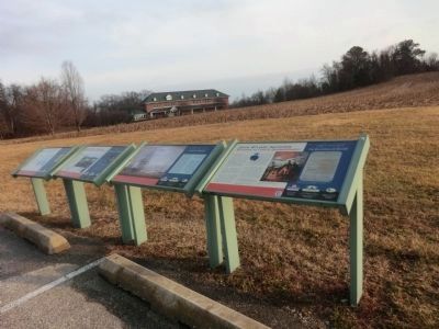
The largest naval engagement in Maryland took place in St. Leonard Creek in June 1814. Americans prevailed in a series of skirmishes June 8-10, but the British ultimately trapped them in the creek. The first battle had little effect.
On June 26, . . . — — Map (db m80898) HM
The replica 18-pounder cannon located on the hill is similar to the type used by American forces during the Battle of St. Leonard Creek. “18-pounder” refers to the weight of the cannonballs, which were approximately five inches in . . . — — Map (db m80929) HM
On Keysville Bruceville Road, on the right when traveling west.
Erected by the Patriotic Order Sons of America and the pupils of the public schools,
June 12, 1915.
Terra Rubra Farm, birthplace and early home of the author of the Star Spangled Banner who died in Baltimore January 11, 1843. — — Map (db m2998) HM
Hard Pressed Militiamen were often assigned elsewhere, leaving hometown defense to those exempted from service due to age or infirmity. Outnumbered, and with limited artillery and ammunition, even the bravest defenders rarely rebuffed an . . . — — Map (db m79526) HM
On Conestoga Street at Water Street, on the right when traveling east on Conestoga Street.
Stone wharf and warehouse were built here by Decree of General Assembly in 1744. Remains of wharf can be seen. Officers' chests left behind by two Companies of Royal American Regiment quartered in winter of 1756-1757 were auctioned by town . . . — — Map (db m144287) HM
On Cherry Grove Road, 0.9 miles west of Stoney Battery Road, on the left when traveling west.
Ancestral home of the De Veazie (Veazey) family; patented to John Veazey ca. 1670. His descendant, Colonel Thomas Ward Veazey, defended Duffy’s Fort, Fredericktown, from the British fleet May 5, 1813, and served as Governor of Maryland, . . . — — Map (db m156563) HM
Mount Harmon offered a vantage point for events unfolding along the Sassafras May 6, 1813. Barges of British marines passed by en route to Georgetown and Fredericktown. As they returned, smoke rose in the skies behind them from the burning of . . . — — Map (db m156570) HM
The Sassafras River, stretching before you, provides a window into four centuries of history at Mount Harmon. Any number of historic events occurred within view of this spot.
European Exploration & Settlement Captain John Smith, the first . . . — — Map (db m156917) HM
On Grove Neck Road, 1 mile west of Sandy Bottom Road, on the right when traveling west.
Built by Dr. John Thompson Veasey, 1825, “of Mount Harmon” as he was known, who, with Colonel Thomas Ward Veasey assisted in the defense of Duffy’s Fort, 1813. He was a greatnephew of George Ross, signer of the Declaration of Independence. His son, . . . — — Map (db m144246) HM
On Grove Neck Road, 1.3 miles west of Pond Neck Road, on the left when traveling west.
Home of General Thomas Marsh Forman (1758–1845), Aide to General William Alexander, known as Lord Stirling, and a representative in the General Assembly, 1790 and 1800. He served with Major George Armistead, Fort McHenry, 1814. A later owner, . . . — — Map (db m144249) HM
On Augustine Herman Highway (Route 213) 0.5 miles south of Mill Lane, on the right when traveling south.
Home of the Lusbys in the early 1700’s. Ruth Lusby and Commodore Jacob Jones married in 1821, made the Anchorage their home and enlarged it in 1835. Jones served on the “Philadelphia” when it ran aground at Tripoli and commanded the . . . — — Map (db m145440) HM
Near Main Street at North Street (Maryland Route 268), on the left when traveling east.
The Star-Spangled Banner National Historic Trail traces the War of 1812 in the Chesapeake. Along the trail you'll encounter tangible evidence of the war and stories that bring the people and events to life. Discover the far-reaching impacts of . . . — — Map (db m154170) HM
Near Main Street at North Street (Maryland Route 268), on the left when traveling east.
British raiders traveled along rivers to Upper Bay towns in 1813. Elkton, at the head of Elk River, expected to be a target, because it could be a landing site for an advance on Philadelphia. Citizens of Elkton built three earthen forts and . . . — — Map (db m154174) HM
On Augustine Herman Highway (Maryland Route 213) at Frenchtown Road, on the left on Augustine Herman Highway.
Frenchtown, one mile west of this marker, was an important link in the north-south travel route during the 18th and 19th centuries. As a depot, it was burned by the British under Admiral Cockburn on April 29, 1813. — — Map (db m1526) HM
About 1750 Zebulon Hollingsworth built the approximately 30 x 30 foot left hand section as a brick two story dwelling. In the mid-1800s it was gutted by fire and rebuilt as three stories with a low pitched roof. Also the two story right hand side . . . — — Map (db m152141) HM
On Bridge Street (Maryland Route 213) 0.1 miles north of Pulaski Highway (U.S. 40), on the right when traveling north.
Built c. 1810–1820 by James Sewall. He was Clerk of Cecil County Court 1805–1841; Brigade Major of Maryland Militia and a Commander at nearby Fort Defiance in War of 1812; one of founders of Trinity Episcopal Church, Elkton in 1832. — — Map (db m145435) HM
On Old Field Point Road, 0.1 miles north of Jones Chapel Road, on the right when traveling south. Reported missing.
About one eighth mile south east on Elk River. American forces here and at Fort Hollingsworth (Elk Landing) repulsed the British under Admiral Cockburn in their attempt to capture Elkton, April 29, 1813. — — Map (db m152198) HM
On Landing Lane at Oldfield Point Road when traveling east on Landing Lane.
About three tenths mile south at Elk Landing, American forces here and at Fort Defiance, about one mile below on Elk River, repulsed the British under Admiral Cockburn in their attempt to capture Elkton, April 29, 1813. — — Map (db m2228) HM
The British took their terror campaign to the Elk River in April 1813. Their target—Elkton—was protected by several forts.
After capturing a gun battery at Frenchtown, British raiders destroyed its storehouses, a fishery, and . . . — — Map (db m146172) HM
Three defensive earthworks safeguarded Elkton---Fort Hollingsworth, here, plus Defiance and Frederick downriver. A 60-foot chain across the channel secured the Elk River. On April 29, 1813, defenders at Fort Defiance fired on approaching . . . — — Map (db m145611) HM
On Main Street at North Street (Maryland Route 268), on the left when traveling east on Main Street.
During the War of 1812 the young United States was embroiled in conflict with Great Britain. From 1812 to 1815 Americans fought to protect their rights and economic independence. They faced superior enemy forces on the homefront and the high . . . — — Map (db m154177) HM
On School House Lane, on the right when traveling west.
Erected to honor the heroism of the men who so bravely defended Fort Duffy and Fredericktown against the British Fleet May 5, 1813 Colonel Thomas Ward Veazey, commanding
Samuel Wroth; D.F. Heath; Moses Cannon; Nicholas Franks; John W. . . . — — Map (db m155571) WM
The Star-Spangled Banner National Historic Trail traces the War of 1812 in the Chesapeake. Along the trail you'll encounter tangible evidence of the war and stories that bring the people and events to life. Discover the far-reaching impacts of the . . . — — Map (db m145483) HM
On North East Beach Road, on the left when traveling west.
From Bulls (or Bull) Mountain, American militia had a commanding view of Elk Neck peninsula. They observed the Upper Chesapeake Bay and North East River to the north and west, and Elk River to the south and east.
As enemy ships approached on . . . — — Map (db m152170) HM
British Admiral Cockburn's flagship arrived in the Upper Bay April 28, 1813, with twelve barges carrying about 450 men. From here, they terrorized residents along the Sassafras, Elk, North East, and Susquehanna rivers.
Thirty-six years . . . — — Map (db m147642) HM
On Broad Street (Maryland Route 7) at Roundhouse Drive, on the right when traveling west on Broad Street.
John and Elizabeth Rodgers owned and operated the mid-18th century Rodgers Tavern here plus a tavern in Havre de Grace. They ran a ferry business between the two. The hostelry here was a popular stop on the Old Post Road.
Their famous . . . — — Map (db m145747) HM
On Philadelphia Road (Maryland Route 7) 0.2 miles east of Jackson Station Road, on the right when traveling east.
After burning much of Havre de Grace May 3, 1813, British raiders crossed the Susquehanna to Cecil County. At Principio Iron Works they captured a five-gun battery and destroyed the foundry complex and the bridge across Principio Creek. More than 40 . . . — — Map (db m145868) HM
On Principio Furnace Road (Maryland Route 7) 0.2 miles east of Jackson Station Road, on the right when traveling east.
A leading iron producer during the Colonial period, Principio held Maryland’s first blast furnace, operating 1725, and first refinery forge, constructed 1728. After the American Revolution, Principio made cannons and other ordnance until the . . . — — Map (db m1481) HM
On S. Main Street (Maryland Route 222), on the left when traveling north.
Port Deposit, then called Creswell’s Ferry, was on high alert May 3, 1813. Smoke rising from towns across the river meant British raiders might strike here.
Port Deposit was spared, perhaps due to its well-defended battery. Or, as legend claims, . . . — — Map (db m145934) HM
On Benedict Avenue, 0.1 miles south of Potomac Avenue, on the right when traveling south.
A forest of masts topped the waters off Benedict August 19-30, 1814. The British anchored ships here during their invasion of Washington, D.C. On August 20, about three miles away at Aquasco Mills, Secretary of State James Monroe watched with . . . — — Map (db m195732) HM
On Prince Frederick (Maryland Route 231) at Benedict Avenue-Mill Creek Road connector, on the right when traveling south on Prince Frederick.
Founded in 1683 as Benedict-Leonardtown. Here a vessel was constructed for Geo. Washington in 1760. In August, 1814, British troops under Gen. Ross landed near here for their march on the City of Washington. — — Map (db m28315) HM
On Prince Frederick Road (Maryland Route 231) at Teague's Point Road, on the right when traveling west on Prince Frederick Road.
Built circa 1768 by merchant and tobacco farmer George Maxwell, Maxwell Hall features massive twin chimneys and foundation stones of English chert. Local tradition holds that in the War of 1812, the British invasion force took possession of Maxwell . . . — — Map (db m28317) HM
On Serenity Farm Rd, 0.1 miles north of Prince Frederick Rd (Maryland Route 231).
Although you see a modern agricultural landscape, the land once known as "Dorsey Farm" and now Serenity Farm, has a history including Native American settlements, tobacco plantations, and military encampments.
Since 10,000 B.C.
Native Americans . . . — — Map (db m137561) HM
On Benedict Avenue at Potomac Avenue, on the left when traveling south on Benedict Avenue.
Residents along the Patuxent watched nervously as wave after wave of British warships approached the tiny town of Benedict. For months enemy raiders had terrorized Southern Maryland. Benedict felt their sting twice in June 1814. Now, August 19-20, . . . — — Map (db m68046) HM
Near Teagues Point Road, 0.1 miles south of Fairfax Court.
Discover the War of 1812 on the Star-Spangled Banner National Historic Trail—a path tracing the troop movements through historic places, inspiring landscapes, charming waterfront towns, and waterways of the Chesapeake region.
The trail . . . — — Map (db m128753) HM
More than 4,000 British troops camped in this valley and surrounding hills August 19, 1814. Leaving their ships anchored at Benedict, they headed north on August 20.
Over the next ten days they marched through grueling heat and storms, defeated . . . — — Map (db m81190) WM
Near Teagues Point Road, 0.1 miles south of Fairfax Court.
George Maxwell and Maxwell's Seat
George Maxwell, a Scottish immigrant, was present in Charles County, MD by 1745. He was a successful Chesapeake merchant with many business ventures and partnerships. Maxwell's Seat was purchased from Charles . . . — — Map (db m128738) HM
More than 4,000 British troops camped here August 20, 1814, awaiting orders. After sailing from Bermuda in cramped quarters, they appreciated being on firm ground. One noted they were “made happy by the very feeling of the green sod under . . . — — Map (db m81188) HM
Near Teagues Point Road, 0.1 miles north of Fairfax Court.
In 1812, the United States of America was less than 30 years old, and only one generation had been raised to adulthood under the American flag. Many people still personally remembered the daring and exhausting fight to win independence from . . . — — Map (db m128731) HM
Near Teagues Point Road, 0.1 miles south of Fairfax Court.
War of 1812
Great Britain had been at war with France since 1793 and imposed several trade restrictions that the newly formed United States of America found unbearable.
On June 18, 1812, the United States of America declared War on Great . . . — — Map (db m128748) HM
British vessels labored through Kettle Bottom Shoals near here in August 1814 during a diversionary expedition up the Potomac. When Americans destroyed Fort Washington (also called Fort Warburton) without firing a shot, the British proceeded . . . — — Map (db m97034) WM
Near Crain Hwy (Maryland Route 301) 0.1 miles south of Clifton Drive.
Captain John Smith Chesapeake National Historic Trail
This unique trail is designed for you to experience by boat. It is America’s first waterway national historic trail and includes more than 3,000 miles explored by Captain John Smith.
The . . . — — Map (db m129104) HM
Near Rose Hill Road, 1.7 miles north of Port Tobacco Road.
Captain John Smith Chesapeake National Historic Trail
“Passing along the coast, searching every inlet, and bay, fit for harbours and habitations…”
Captain Johns Smith, describing his explorations of the Chesapeake region . . . — — Map (db m120538) HM
On Port Tobacco Road, 1.7 miles north of Port Tobacco Road.
Captain John Smith Chesapeake National Historic Trail
This unique trail is designed for you to experience by boat. It is America’s first waterway national historic trail and includes more than 3,000 miles explored by Captain John Smith. . . . — — Map (db m120541) HM
On Chapel Point Rd, 0.5 miles west of Aries Road, on the right when traveling west.
Captain John Smith Chesapeake National Historic Trail
This unique trail is designed for you to experience by boat. It is America’s first waterway national historic trail and includes more than 3,000 miles explored by Captain John Smith. . . . — — Map (db m135485) HM
Near Church Street just north of Church Street, on the left when traveling north.
Governor Charles Goldsborough of Shoal Creek died December 13, 1834. He was the son of Charles and Anna Maria Tilghman Goldsborough.
A Congressman from Maryland, he studied law and was admitted to the bar in 1790. He became a member of the . . . — — Map (db m205034) HM
On Main Street (Maryland Route 16) at Academy Street (Maryland Route 14), on the left when traveling north on Main Street.
Originally “Crossroads,” later “New Market.” Post for trading with Indians erected 1767. In Revolution, “New Market Blues,” volunteer militiamen, were organized in this supply center for Continental army. South on . . . — — Map (db m3979) HM
On Taylors Island Road (Maryland Route 16) 1.1 miles west of Smithville Road, on the right when traveling west.
Last battle of the War of 1812 in the Chesapeake Bay. A tender to the British ship of war "Dauntless" was captured by Joseph Stewart and local militia near James Island on February 7, 1815. Ice along the shore allowed the militia to approach within . . . — — Map (db m4002) HM
On Taylors Island Road, 1.1 miles west of Smithville Road, on the right when traveling west.
This cannon was captured in 1814 from a tender of the British ship of war "Dauntless". Lieut. Phipps and crew of 17 men and one colored woman were taken prisoners at James' Point by Capt. Joseph Stewart's company of militia composed of men from . . . — — Map (db m4003) HM
Local militia attacked a British raiding party whose vessel was icebound near James Island February 7, 1815. Protected by a breastwork of ice, the Americans continued firing until the crew of 20 surrendered.
The two-hour skirmish, the “Battle . . . — — Map (db m78799) WM
The longrifle was a distinctly American weapon developed on the frontier for accuracy and distance. Produced mainly in Pennsylvania, Maryland and Virginia, it became known as the “Kentucky” rifle after a popular song commemorated its use by a . . . — — Map (db m1532) HM
Near Stadium Drive south of South Market Street (Maryland Route 355), on the right when traveling south.
Major who served as a Captain in the 2nd Regt. of Infantry, U.S. Army, under General Andrew Jackson's staff at the Battle of New Orleans in 1814. Promoted to 2nd Lieut 2nd Regt. on Feb. 12, 1801, and Major on Feb. 21, 1814. — — Map (db m213570) HM
In the final months of his life Francis Scott Key enjoyed visits to Terra Rubra farm, his boyhood home not far from Frederick Town. He thought and wrote about the end of life and his hopes of immortality in a life to come.
Key died at his . . . — — Map (db m75758) HM WM
Lieutenant who first served with the Georgetown Artillary in July 1813, and later under Major George Peter as a Lieut. and Quartermaster from June 19 to July 1, 1814. On Aug. 24, 1814 he helped with the deployment of troops in Bladensburg defending . . . — — Map (db m103219) HM
The Thirty Fourth District
·Rotary International·
At Its First Conference
March 1923
Pays This Tribute to
Francis Scott Key
· Author of·
Our National Anthem
⟵·⟶
“And the Star Spangled Banner,
Oh, . . . — — Map (db m104597) HM
The National Society
United Daughters
of 1812
State Presidents
and Charter Members
April 5, 1979
Pay this tribute to
Francis Scott Key
Author of
Our National Anthem
⟵·⟶
“Then Conquer We Must
When . . . — — Map (db m104602) HM
On North Market Street, on the left when traveling north.
Frederick's favorite son is celebrated throughout the US before every kickoff, face-off and first pitch. The author of the “Star Spangled Banner,” Francis Scott Key was born in Frederick County and launched his law career here in 1801. . . . — — Map (db m107306) HM
On South Market Street (Maryland Route 355) south of Fox's Alley, on the right when traveling south.
The man Americans honor as the author of "The Star-Spangled Banner" began his life and career in Frederick County, Maryland. Here he first learned the American values that guided his life.
Key was a child of the American Revolution, and saw . . . — — Map (db m198000) HM
On West Church Street at North Court Street, on the right when traveling west on West Church Street.
Born in what was then northeast Frederick County, Key’s parents first brought him to “Frederick-Town” to be baptized. His parents often rode to the county seat here. Key walked these streets whenever the family came to Frederick. . . . — — Map (db m67248) HM
Near Clarke Place, on the right when traveling west.
1777 Built at direction of Maryland General Assembly
1778-79 Quartered Hessian and Convention prisoners captured at Bennington and Saratoga
1782 Quartered Hessian and Bayreuth Yager Regiments following Cornwallis' surrender
1799 . . . — — Map (db m2739) HM
The limestone barracks in front of you, built in 1778, is among the oldest and most important surviving American military structures in the nation. The barracks consisted of two L-shaped buildings, but only the eastern wing remains today. During the . . . — — Map (db m103369) HM
“Then did I remember that there were gathered around that banner, among its defenders, men who had heard and answered the call of their country — from these mountain sides, from this beautiful valley, and from this fair city of my . . . — — Map (db m103221) HM
Private in the MD Militia under Col. Henry Carberry in 1813, and in the 1st Regt. MD Militia under Capt. John Brengle from Aug. 25 to Sep. 19, 1814. He fought at the Battle of North Point. — — Map (db m108091) HM
In this lot are buried
John Ross Key
Revolutionary War Officer
and
Anne Charlton Key
parents of
Francis Scott Key
author of “The Star Spangled Banner” — — Map (db m241920) HM
2nd Sergeant in the 1st Regt. MD Militia under Capt. John Brengle from Aug. 25 to Sep. 10, 1814, and fought at the Battle of North Point. — — Map (db m108092) HM
On the evening, of September 13, 1814, British warships in Baltimore harbor threatened the sovereignty of the United States. They had already burned Washington, D.C. As they bombarded Fort McHenry, the fate of our new nation was uncertain.
. . . — — Map (db m103175) HM
On Council Street west of North Court Street, on the right when traveling west.
This home General Lafayette lodged as the guest of Colonel John McPherson Dec. 29-30, 1824
_________
1840
Francis Scott Key Author of the National Anthem was inspired here to write the poem that honors his cousin Mrs. . . . — — Map (db m184350) HM
The long history of Frederick Town Barracks records in timber and stone the successful transition from sword to plowshare, from bullets to books.
Funded by the Maryland Legislature in 1777, the Frederick Barracks soon entered service during the . . . — — Map (db m103372) HM
Near Clarke Place, on the right when traveling west.
1776 - 1814 These Barracks Mark the course of the struggle for American Independence Built in 1777 by the British and Hessian prisoners of the Revolutionary War, here were detained those taken at the Battles of Saratoga, Trenton, and Yorktown, . . . — — Map (db m2735) HM
Front: The first ship of the fleet named for Francis Scott Key, Author of the National Anthem. Born 1 August 1773, Died 11 January 1843. Wrote the verse for our National Anthem "The Star Spangled Banner" during the British Fleet's bombardment of . . . — — Map (db m75756) HM WM
Near Dwight D. Eisenhower Highway (Interstate 70) south of Baltimore National Pike (U.S. 40), on the right when traveling east.
Crisscrossed By Transportation Routes, Home To America's Earliest Industries, And Meeting Place For National Leaders, Maryland's Appalachian Region Has Been Pivotal In The Growth Of The Country
Throughout its history, the nation has . . . — — Map (db m116529) HM
Near Dwight D. Eisenhower Highway (Interstate 70) 2 miles west of Maryland Route 17, on the right when traveling west.
Crisscrossed By Transportation Routes, Home To America's Earliest Industries, And Meeting Place For National Leaders, Maryland's Appalachian Region Has Been Pivotal In The Growth Of The Country
Throughout its history, the nation has . . . — — Map (db m196233) HM
Near The National Pike (Alternate U.S. 40) west of Casselman Road.
“The Little Crossings” (of the Little Youghiogeny River now called Castleman’s River).
So called by George Washington when he crossed on June 19, 1755, with General Edward Braddock on the ill-fated expedition to Fort Duquesne (Pittsburgh).
. . . — — Map (db m167051) HM
On Garrett Highway (U.S. 219), on the left when traveling north.
Aide to Gen. George Washington during the revolution, McHenry was a physician, signer of the constitution from Maryland and Secretary of War from 1796-1800. Named in his honor was the Baltimore fort that withstood the British bombardment Sept. . . . — — Map (db m57) HM
On North 2nd Street just north of East Center Street, on the right when traveling north.
The Loar family was a pioneer family in what is now Garrett County, known for their community involvement and philanthropy.
Jacob Loar (d.1827), the German ancestor, came to America in 1774. After the Revolutionary War he bought property around . . . — — Map (db m139059) HM
On the Maryland House rest stop (Interstate 95 at milepost 82).
The Star-Spangled Banner National Historic Trail traces the War of 1812 in the Chesapeake. Along the trail you'll encounter tangible evidence of the war and stories that bring the people and events to life. Discover the far-reaching impacts of . . . — — Map (db m212530) HM
The Star-Spangled Banner National Historic Trail traces the War of 1812 in the Chesapeake. Along the trail you'll encounter tangible evidence of the war and stories that bring the people and events to life. Discover the far-reaching impacts of . . . — — Map (db m152380) HM
On Pennington Ave. at Lodge Lane on Pennington Ave..
Susquehannock Indians
The Susquehannock Indians controlled the upper tributaries of the Chesapeake Bay. John Smith was the first European to encounter them when he explored the Upper Bay in 1608. He described them as "a most noble and . . . — — Map (db m188475) HM
Frenchtown, on the Elk River, was struck on the morning of April 29, 1813. Rear Admiral Cockburn attempted a surprise attack and was greeted with a barrage from the town's battery. The guns had little effect and the British landed and burned the . . . — — Map (db m162134) HM
The town's defenders -- numbering about 20 -- failed to prevent some 400 British troops from coming ashore May 3, 1813.
A gun battery, probably located north of where the lighthouse now stands, was manned single-handedly by John . . . — — Map (db m163660) HM
On Concord Street at Lafayette Street, on the left on Concord Street. Reported missing.
Erected at the mouth of the Susquehanna River in 1827, it is the oldest lighthouse in continuous operation in the United States. Now under automatic control, it was manned by the O’neill Family until 1928. John O’neill was named as the first . . . — — Map (db m165000) HM
On Concord Street at Lafayette Street on Concord Street.
Here on the morning of May 3, 1813, British Forces under Admiral Cockburn landed, sacked, and burned the town. The principal defenses were two small batteries on Concord Point. The “Potato Battery” on high ground, was manned to the last . . . — — Map (db m162149) HM
On Concord Street at Lafayette Street, on the left when traveling north on Concord Street.
John O'Neill led a futile defense when British raiders attacked Havre de Grace May 3, 1813. As other defenders fled, O'Neill briefly manned a cannon alone.
His courage earned O'Neill a presidential appointment as first keeper of the . . . — — Map (db m163824) HM
Five days before the 1813 attack on Havre de Grace, British ships anchored at Spesutia Island, just south of here. Island residents were "greatly terrified" upon their arrival, but were assured they would not be harmed. The Royal Navy used the . . . — — Map (db m170721) HM
As the British savagely burned the buildings in Havre de Grace during their morning attack May 3, 1813, the townspeople ran west for protection to a home that stood near this location. The home, known as Bloomsbury, was owned by Baltimore . . . — — Map (db m166381) HM
The British fleet approached Havre de Grace at dawn on the morning of May 3, 1813 in small launches. Rear Admiral Cockburn favored attacking towns at first light. Havre de Grace residents awoke to the terrifying sounds of bombs exploding and rockets . . . — — Map (db m162135) HM
This cannon of the War of 1812 marks the site of the battery on Concord Point where John O'Neill 1769-1838 served the guns single handed during the British attack upon Havre de Grace May 3, 1813 until disabled and captured.
He was . . . — — Map (db m8182) HM
During the War of 1812, the British sailed up the Chesapeake Bay. After laying siege to Washington, D.C. and burning the White House, and having been held at bay by the patriots in Baltimore, they proceeded to Havre de Grace. Most of the residents . . . — — Map (db m166329) HM
Travelers on the Post Road, the main route of north/south travel, passed through Havre de Grace and crossed the Susquehanna River on a ferry to Perryville. The ferry was chartered in 1695 and remained in use until the first railroad bridge was . . . — — Map (db m164982) HM
On Union Avenue at Congress Street, on the right when traveling south on Union Avenue.
St. John's Episcopal Church survived the British attack on Havre de Grace May 3, 1813. The enemy spared the 1809 structure but damaged the interior. According to a newspaper account: "Finding nothing to steal (the raiders) 'magnanimously' . . . — — Map (db m161527) HM
On N. Washington Street at St. John Street, on the left when traveling south on N. Washington Street.
Rodgers House miraculously survived the 1813 burning of Havre de Grace. Dating from 1788, this is the town's oldest documented structure. John and Elizabeth Rodgers, parents of U.S. Naval hero John Rodgers, operated a tavern here. They also . . . — — Map (db m64144) HM
A target of the British during the War of 1812, Principio Iron Foundry was destroyed on May 3, 1813. the foundry, located on the Northeast River was owned by Samuel Hughes and had a contract with the U.S. Navy. In this raid Hughes' losses included . . . — — Map (db m163658) HM
Little evidence remains of what was once the northernmost navigable deep-water port on the Susquehanna River. The “Upper Ferry” crossed between here and Port Deposit.
When the British attacked May 3, 1813, they helped themselves to a . . . — — Map (db m188579) HM
On the morning of May 3, 1813, the British came ashore at several points and set to work plundering and burning the town. They used Congreve rockets, which made horrible whizzing and popping sounds, to create chaos and terror. The British . . . — — Map (db m163168) HM
During the War of 1812, Havre de Grace was a fishing village, but also played host to many travelers. The Post Road, the main route of land travel in the day, came through town, and travelers used the local ferry at the north end of town to cross . . . — — Map (db m161514) HM
Cannon and rocket fire shook residents of Havre de Grace from their sleep as the British attacked at dawn May 3, 1813. An eyewitness reported: "Distressed people, women and children half naked" ran from their homes. The local militia fled, . . . — — Map (db m59832) HM
The taverns and the ferry made Havre de Grace, originally called Susquehanna Lower Ferry, a successful town in the early 19th century. People arrived via the Post Road, the major route of north/south travel in the day, and crossed the Susquehanna . . . — — Map (db m165853) HM
The British under Rear Admiral George Cockburn attacked Havre de Grace on May 3, 1813. They went from house to house, burning and confiscating belongings along the way. Beds were ripped apart, and furniture and clothing were ruined. "The hills . . . — — Map (db m165851) HM
454 entries matched your criteria. Entries 201 through 300 are listed above. ⊲ Previous 100 — Next 100 ⊳