Near Beach City Road, 0.4 miles Dillon Road, on the right when traveling north.
The Maps and Pictures below identify the approximate locations of roads and buildings that were in Mitchelville circa 1862-1868.The Town of Mitchelville had praise houses, stores, schools and numerous homes. Unfortunately no physical remains of . . . — — Map (db m105156) HM
On Beach City Road near Dillon Road, on the left when traveling east.
In 1862, after Hilton Head's fall to Union
forces in 1861, this town, planned for the
area's former slaves and named for General
Ormsby M. Mitchel, began. — — Map (db m6783) HM
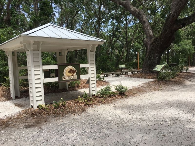
On Beach City Road, 0.1 miles north of Hunter Road, on the right when traveling north.
(front)
The congregation of Queen Chapel can trace its roots to May 1865 when A.M.E. missionaries Rev. R.H. Cain, Rev. James H.A. Johnson and James A. Handy arrived on Hilton Head Island. They visited the Freedman’s town of Mitchelville . . . — — Map (db m104583) HM
Near Beach City Road, 0.4 miles Dillon Road, on the right when traveling north.
Reuniting with family was one of the first concerns of African slaves who escaped to Hilton Head Island. Slavery split up families. Owners could sell family members for profit or punishment. On Hilton Head Island, and places where freedom seekers . . . — — Map (db m105209) HM
Near Beach City Road, 0.4 miles north of Dillon Road, on the right when traveling north.
The Battle of Port Royal
On November 7, 1861, at the Battle of Port Royal Union forces attacked Confederates at Fort Walker on Hilton Head island and Fort Beauregard at Bay Point.The Union deployed the largest amphibious fleet ever assembled . . . — — Map (db m105290) HM
Near Beach City Road, 0.4 miles north of Dillon Road, on the right when traveling north.
During the civil War, Union forces defeated the Confederates on Hilton Head Island at the Battle of
Port Royal on November 7, 1861. Cannon fire from that battle heralded a dawn of freedom for millions of African slaves throughout the South. . . . — — Map (db m105121) HM
Near Beach City Rd, 0.1 miles south of Dillon Rd..
In the spring and summer of 1864, Union officers of the Department of the South on Hilton Head Island became concerned about retaining sufficient troops and equipment to defend Hilton Head, as units were being transferred to participate in campaigns . . . — — Map (db m131823) HM WM
Near Beach City Road, 0.2 miles south of Dillon Road, on the right when traveling south.
The Troops that Built Fort Howell
Construction of Fort Howell was begun by the 32nd U.S. Colored Infantry and completed by the 144th New York Infantry. The 500-man 32nd Colored Infantry was organized at Camp William Penn, Philadelphia, . . . — — Map (db m131839) HM
On Fish Haul Road at Trigger Fish Road, on the right when traveling east on Fish Haul Road.
Confederate Brig. Gen. Thomas F. Drayton was
in command of this area at the time of nearby battle
of Port Royal, November 7, 1861. A brother, Capt.
Percival Drayton, commanded the Union warship
Pocahontas at the same battle. . . . — — Map (db m9966) HM
To honor the memory of two gallant gentleman
of South Carolina. Thomas Fenwick Drayton;
Brigadier-General, C.S.A. and his brother
Commodore Percival Drayton, U.S.N., Captain
of U.S.S. Hartford, and later the first Chief
of Naval Operations. . . . — — Map (db m16499) HM
Near Beach City Road, 0.4 miles north of Dillon Road, on the right when traveling north.
Working for Wages
African slaves who escaped their plantations and worked for the Union military earned between six and eighteen dollars a month as carpenters, blacksmiths, drivers, boatmen, and laborers. Others worked as cooks and servants . . . — — Map (db m105254) HM
On the morning of November 7, 1861, Du Pont's flagship, the Wabash led the fleet into action. As the Union vessels near the sound Confederate batteries at Forts Walker and Beauregard opened fire. Du Pont, having sent ships to test the enemy's . . . — — Map (db m20380) HM
On New Years Day 1863 this plantation owned by John Joyner Smith was the scene of elaborate ceremonies celebrating the enactment of the Emancipation Proclamation. Hundreds of freedman and woman came from Port Royal, Beaufort and the sea islands to . . . — — Map (db m218503) HM
On Dr. Martin Luther King Drive (State Highway S-7-45), on the right when traveling south.
[front text]
One of the first schools for blacks in the South, Penn School, was reorganized as Penn Normal, Industrial and Agricultural School in 1901. As a
result of this change, incorporating principals of education found at both . . . — — Map (db m20294) HM
Near Old Sheldon Church Road north of Trask Parkway (U.S. 21), on the right when traveling north.
Church of Prince William's Parish
known as
Sheldon
Built Between 1745-1755
Burned By the British Army 1779
Rebuilt 1826
Burned By the Federal Army 1865 — — Map (db m106086) HM
On Old Sheldon Church Road near Trask Parkway (U.S. 21), on the right when traveling north.
Text from Front Side
Prince William's Parish Church
(Sheldon Church)
These ruins are of Prince William's Parish Church, built ca. 1751-1757 and partially burned during the American Revolution, with its interior and roof rebuilt . . . — — Map (db m106077) HM
On Old Sheldon Church Road north of Bailey Road, on the right when traveling north. Reported permanently removed.
Ruins of Old Sheldon Prince William's Parish Church Built 1745-55. Burned 1779 by British. Rebuilt 1826. Burned 1865 by Federal Army. Named for ancestral home of the Bull family in Warwickshire, England. ——— Annual Services . . . — — Map (db m26366) HM
On Charleston Highway (U.S. 17) near Boat ramp driveway, on the right when traveling south.
Combahee River Raid
On June 1-2, 1863, a Federal Force
consisting of elements of the 2nd
S.C. Volunteer Infantry (an African-
American unit) and the 3rd Rhode
Island Artillery conducted a raid
up the Confederate-held Combahee
River. . . . — — Map (db m66105) HM
In the early dawn of January 9, 1861, the first shot of the War Between the States was fired from Morris Island by Citadel cadets under the command of Major Peter Fayssoux Stevens. The cadets opened fire with 24 pound siege guns on a Federal ship, . . . — — Map (db m67853) HM
On Saint James Avenue (U.S. 176) north of Wilmer Avenue, on the right when traveling south.
(front)
From the 18th century, the State Road from Charleston and the Road to Dorchester met near here. These paths connected Charleston to the S.C. interior. Travelers from Charleston would have crossed Goose Creek, two miles south, . . . — — Map (db m206675) HM
On Old State Road, on the right when traveling south.
The first bridge here, in use by 1680, had a raised road at either end and was built from split logs with the flat sides up, covered by sand or clay. Traffic over Goose Creek increased significantly after St. James, Goose Creek Church was built . . . — — Map (db m29502) HM
On Stoney Landing Road, on the right when traveling east.
Front Honoring Berkeley County Confederate Soldiers “Deo Vindice” J B Adkins, S Adkins, S Alexander, J Armstrong, J F Avinger, E Ball, I Ball, J M Ball, J Ball, W J Ball, A Ballentine, J J Ballentine, L E Ballentine, W J . . . — — Map (db m54848) HM
On Stoney Landing Road, on the right when traveling east.
This Confederate vessel revolutionized the concepts of war at sea with a torpedo attack on the New Ironsides in Charleston Harbor on October 5, 1863.
Constructed on Stoney Landing Plantation, Berkeley County, on which lands this full . . . — — Map (db m84713) HM WM
The Stony Landing House was built on land which was once part of the 12,000 acre Fairlawn Barony. Fairlawn was granted to Sir Peter Colleton, son of Lords Proprietor John Colleton, on September 7, 1678. John H. Dawson purchased 2,319 acres on . . . — — Map (db m23088) HM
On U.S. 52 at Stoney Landing Road, on the right when traveling north on U.S. 52.
Here in 1863, was constructed the Confederate semi-submersible torpedo boat, "Little David", the first of its type. It was designed by Dr. St. Julien Ravenel, and built with funds raised by Theodore D. Stoney. — — Map (db m23048) HM
On Wassamassaw Lane, 0.3 miles north of U.S. 176, on the right when traveling north.
[Front] Wassamassaw, with several variant spellings during the colonial era, is a Native American word thought to mean “connecting water.” It first referred to the large cypress swamp here, but eventually referred to the community that grew . . . — — Map (db m29135) HM
On Old State Road (U.S. 176) north of Shrike Road, on the right when traveling north.
Burial place of Lt. Col. Olin M. Dantzler, C.S.A. Appointed Brigadier General 1 June 1864 Defender of Charleston, SC and Petersburg, VA His recorded notes to General P.G.T. Beauregard led to the location of the submarine H.L. Hunley in 1995 Killed . . . — — Map (db m134424) HM
This 10-inch mortar, unearthed during the excavations in 1959, is similar to the one which fired the signal shot from Fort Johnson on April 12, 1861. Later in the war, the Confederate defenders of Fort Sumter mounted several of these weapons near . . . — — Map (db m30647) HM
Designed by Thomas J. Rodman, U.S. Army Ordnance Officer, this type of cannon was the largest gun used in combat during the Civil War. These two Rodmans were brought to Fort Sumter as part of the 1870's modernization program. Tube Weight: 50,000 . . . — — Map (db m30641) HM
Discovered during the excavations of Fort Sumter, these rifled guns were installed by Federal troops during the 1870's modernization program. Maximum Range: 6800 yards (6218 M) — — Map (db m30679) HM
Robert Parker Parrott designed the 6.4-inch, 8-inch and 10-inch Parrotts to serve on land or sea. These versatile rifled cannon were simple and inexpensive to construct. This gun, like many of the other weapons in Fort Sumter, was brought to the . . . — — Map (db m30764) HM
When the Confederates opened fire in April 1861, several 8-inch Columbiads were mounted in Fort Sumter. This weapon probably has remained here since then, weathering the Union bombardment of 1863 and the clean up of the 1870's. Archeological . . . — — Map (db m30646) HM
The row of cannon in front of you dates from the Civil War, when radical advances in technology increased power, range, and accuracy. Some large, old smoothbore cannon were "rifled and banded" to enhance firepower. Banding (heating and tightening . . . — — Map (db m30639) HM
The Union Navy blockaded Charleston Harbor from 1861-65, but blockade runners continued to slip in and out, carrying cargo crucial to the economic and military survival of the South. Using neutral ports like Bermuda and Nassau, blockade runners . . . — — Map (db m30691) HM
Load ... Ready ... Fire! A disciplined crew of five men could fire an accurate shot in less than one minute. Teamwork and timing during battle were essential to the crew of this 42-pounder smoothbore cannon, one of 27 guns that occupied these . . . — — Map (db m30922) HM
In 1861 the port of Charleston prospered. Keeping the city open to trade was crucial for Confederate survival. Confederate forts in Charleston Harbor - including Fort Sumter - protected Charleston throughout the war despite Union blockade, warship . . . — — Map (db m30769) HM
Confederate control of Fort Sumter, Fort Moultrie, and supporting fortifications kept Charleston Harbor open despite the blockade by Union ships. The main ship channel passed directly in front of you, between Fort Sumter and Fort Moultrie, within . . . — — Map (db m30702) HM
The flags flying from the five shorter flagpoles that surround the American flag represent the flags flown over Fort Sumter during the Civil War. (Top Left): The First official flag of the Confederacy, known as the "Stars and Bars," or . . . — — Map (db m30817) HM
The First Shot Across the harbor directly in front of you lies Fort Johnson. From Fort Johnson came the shot that began the Civil War. If a Union soldier at Fort Sumter looked toward Fort Johnson at 4:30 a.m., April 12, 1861, he would have seen . . . — — Map (db m30785) HM
Fort Moultrie and Fort Sumter controlled Charleston Harbor. Fort Moultrie, on Sullivan's Island directly in front of you, had been an early harbor defense and was the site of Charleston's famous Revolutionary War palmetto-log fort. Fort Sumter was . . . — — Map (db m30856) HM
On April 12, 1861, Confederate forces bombarded Fort Sumter and the Civil War began. The Federal garrison surrendered the next day and evacuated on the 14th, leaving the fort in Confederate hands. Throughout the Civil War Fort Sumter was the center . . . — — Map (db m30573) HM
The lighthouse in the distance marks the southern tip of Morris Island. In July,1863, Union troops landed there and advanced two-thirds of the way up the island to a Confederate stronghold known as Battery Wagner. Unable to capture the battery by . . . — — Map (db m30376) HM
The Fort Sumter that you see today bears little resemblance to the imposing, three tiered brick fort of 1861. The fort's present appearance is the result of more than 100 years of change. Bombardment, reconstruction, and renovation have reshaped the . . . — — Map (db m30624) HM
Fort Sumter was designed with its strength toward the sea. The gorge, the lightly-armed rear wall facing inland, was vulnerable to attack from Morris Island. Early shelling left the gorge wall in ruins. Continued bombardment reduced the gorge to . . . — — Map (db m30919) HM
On the night of February 17, 1864, the H.L. Hunley set out from Sullivan's Island, directly in front of you, with a torpedo attached to a seventeen-foot spar on her bow. Her target was the U.S.S. Housatonic, anchored four miles . . . — — Map (db m30699) HM
Imagine being here in 1863, surrounded by Fort Sumter's ruins, when this shell (photo below) explodes on the parade ground. Throughout the Civil War the fort was the center of the bitter conflict to control Charleston Harbor. For nearly two years . . . — — Map (db m30627) HM
On April 7, 1863, the Union Navy sent its new force of ironclad warships - eight monitors and the frigate New Ironsides - to attack Fort Sumter. The ironclads attacked from the water directly in front of you. As the Union fleet approached, . . . — — Map (db m30708) HM
In honor of Major Robert Anderson and the one hundred, twenty-eight men of his command who for thirty-four hours: April Twelve-Thirteen, Eighteen hundred and Sixty-one withstood the destructive bombardment of Fort Sumter and withdrew with the . . . — — Map (db m87251) HM WM
Site of three Confederate batteries in the initial attack, 1861. Confederate forces evacuated the island September 7, 1863, after a 58-day siege. Federal batteries on Morris Island bombarded Fort Sumter from 1863 to 1865. — — Map (db m19498) HM
Confederate batteries hidden in the dunes of Morris Island, directly in front of you, commanded the approach to Charleston Harbor. Union forces needed Morris Island, a key location from which to attack Fort Sumter, less than one mile away. On July . . . — — Map (db m84003) HM
Confederates used several field pieces like this 12-pounder mountain howitzer to defend against a surprise landing by Union forces. — — Map (db m30739) HM
This corner of the fort was the site of the only attempt by Union forces to storm Fort Sumter during the Civil War. On the night of September 8, 1863, a Union tugboat towed 500 sailors and marines in small boats to within 400 yards of Fort Sumter, . . . — — Map (db m30725) HM
Fort Sumter's powder was stored in these specially constructed rooms in the corner (angle) of the gorge wall. Protecting gunpowder was critical; the gorge, at the rear of the fort, was considered a safe location. But Fort Sumter was designed to face . . . — — Map (db m30920) HM
The fort wall before you, called the right face, sustained the least damage of any of Fort Sumter's walls (scarps) during the Union bombardment of 1863-65. After the Civil War, the fort's first-tier casemates including those before you, were . . . — — Map (db m30673) HM
Fort Sumter's original sally port (entrance) was located in front of you, in the center of the three-tiered gorge (rear) wall. The lightly armed gorge wall was vulnerable to attack by batteries on Morris Island, and as the war progressed Union . . . — — Map (db m30936) HM
A close look at the wall in front of you reveals Union artillery shells embedded in the brick. They were found during one of the longest sieges in U.S. military history. Batteries on Morris Island, about one mile behind you, and guns on Union . . . — — Map (db m30653) HM
On Chalmers Street west of State Street, on the right when traveling west.
(front)
This was the south end of a large slave trading complex known as The Mart or Ryan's Mart. It was opened in 1856 by Thomas Ryan after the City banned auctions of enslaved people and other goods from streets near the Exchange . . . — — Map (db m242255) WM
Morris Island, across the water directly in front of you, was the scene of the Civil War's first hostile cannon fire, preceding even the bombardment of Fort Sumter. By January 1861, Union troops occupying For Sumter were surrounded by Southern . . . — — Map (db m30724) HM
In 1863 Union forces built a battery about two miles away in the marsh on lower Morris Island (in front of you). They mounted an eight-inch Parrott rifle called the Swamp Angel. This huge gun fired 150-pound shells and was aimed at the city of . . . — — Map (db m30367) HM
In front of you stands a rifled and banded columbiad cannon mounted as a mortar (aimed upward). It is mounted like the gun being inspected by a South Carolina delegation after the evacuation of Fort Sumter by Union troops in April 1861. The . . . — — Map (db m30675) HM
Erected by the United States 1932 In memory of the Garrison Defending Fort Sumter during the bombardment April 12-14, 1861 Major Robert Anderson First U.S. Artillery commandingCorps of Engineers Captain John G. Foster 1st Lieut. George . . . — — Map (db m30916) HM
On Magnolia Plantation Road near Ashley River Road (South Carolina Highway 61).
Rector of nearby St. Andrews Episcopal Church, and owner of Magnolia Plantation before,during, and after the Civil War, he redesigned the plantation's famous
garden, from its original French style of Louis XIV to its present style of English . . . — — Map (db m4977) HM
On Hasell Street at Maiden Lane, on the left when traveling east on Hasell Street.
This residence was constructed by Col. William Rhett (1666-1722), a prominent Charleston merchant and colonial militia leader. In 1706 he led a small fleet of local ships that repulsed a combined French and Spanish invasion of the city. Rhett is . . . — — Map (db m31849) HM
Near Concord Street, on the left when traveling south.
Salvaged from the waters of the tidal zone around Fort Sumter, these bricks were placed in this wall 140 years after the beginning of the Civil War. — — Map (db m67310) HM
Near Calhoun Street at Concord Street, on the right when traveling east.
Fort Sumter, visible in the far distance of Charleston Harbor, looks very different today. Built after the War of 1812, its tow two tiers are gone, destroyed during the Civil War. The fort's center is now dominated by Battery Huger, a huge, black, . . . — — Map (db m47521) HM
On Wentworth Street, 0.1 miles west of Anson Street, on the left when traveling east.
Built c. 1847 by William C. McElheran, this Charleston "single house" became after 1860, part of the C.D. Franke Carriage Factory Complex. The factory, which made cannon carriages for the Confederate Army, remained at this location into the 1890's. . . . — — Map (db m31840) HM
[South side]:
Born in Charleston, S.C.
December 8, 1829,
Died in Columbia, S.C.,
October 6, 1867.
[East side]:
This memorial has been erected with the proceeds of the recent sale of very large editions of the author's . . . — — Map (db m27511) HM
On Meeting Street south of Cumberland Street, on the left when traveling south.
Institute Hall
Institute Hall, built here in 1854, stood until 1861. An Italianate building, it was designed by Jones and Lee for the South Carolina Institute, a progressive organization promoting "art, ingenuity, mechanical skill, and . . . — — Map (db m39371) HM
On Meeting Street south of Cumberland Street, on the left when traveling south.
This building
stands on the site formerly occupied by
S.C. Institute Hall
where, on December 20, 1860,
was signed and ratified the
Ordinance of Secession
which withdrew the state of South Carolina
from the Union and led to the . . . — — Map (db m19240) HM
On Meeting Street at Broad Street on Meeting Street.
P.G.T. Beauregard
General
Commanding Confederate forces Charleston South Carolina
Held this city and harbour inviolate against combined attacks by land and water 1863 1864 1865 — — Map (db m27490) HM
"Almighty God, our heavenly Father, we adore thy love and providence in the history of our country, and especially would we thank thee for our Confederate history
"We thank thee for its pure record of virtue, valor and for the inspiring . . . — — Map (db m27502) HM
Near Vendue Range at Concord Street, on the right when traveling east.
Robert Smalls was born into slavery on April 5, 1839, in Beaufort, South Carolina. In 1851, he was sent to work in Charleston to earn money for his owner. At the age of 23, he was a crewman on the steamer Planter, an armed transport in . . . — — Map (db m94744) HM
On Broad Street, 0.1 miles west of Church Street, on the left when traveling east.
This handsome building, c. 1800 was constructed by Gilbert Chalmers. From 1810 to 1825 it was the home of Gov. John Geddes, who married the builder's daughter. During Gov. Geddes' term in office, Pres. James Monroe visited here. In 1867 Mary . . . — — Map (db m27514) HM
[South side]:
At every board a vacant chair fills with quick tears some tender eye, and at our maddest sport appear those well loved forms that will not die; we lift the glass, our hand is stayed - we jest , a spectre rises up - and . . . — — Map (db m27484) HM
On Mary Murray Drive at 10th Avenue, on the left when traveling west on Mary Murray Drive.
(front)
Hampton Park was once home to the Washington Race Course and Jockey Club. In 1864 this site became an outdoor prison for Union soldiers. Before Charleston fell in Feb. 1865, more than 250 prisoners died and were buried in mass . . . — — Map (db m205351) HM
On Magazine Street west of Logan Street, on the left when traveling west.
Based on the English practice of housing the poor, the first act to establish a work house came locally in 1736. The first building, doubing as a public hospital, opened in 1738 at the southwest corner of Magazine and Mazyck (now Logan) streets. By . . . — — Map (db m206020) HM
On Broad Street, on the right when traveling west.
During the last months of the Civil War, several Union officers were confined by the Confederacy in this house. As retaliation for this imprisonment, President Lincoln moved six hundred Confederate prisoners from Fort Delaware to the stockade at . . . — — Map (db m51783) HM
On Cunnington Avenue, on the right when traveling east.
(North face)
In
The Confederate Army
the Soldiers
Whom this Monument
Commemorates
Illustrated in Death as in Life
The German's Devotion to Duty
Beneath this monument, repose
the remains of
John A. Wagener, . . . — — Map (db m40748) HM
On Meeting Street Road (U.S. 52) near Cunnington Avenue, on the right when traveling north.
(Front text)
Magnolia Cemetery, established in 1850, was named for Magnolia Umbra Plantation, dating back to 1784. The ca. 1800 house built by Col. William Cunnington serves as the cemetery office. This is a fine example of the "rural . . . — — Map (db m23280) HM
On Savage Street, on the right when traveling south.
This two-story frame Greek Revival style residence was constructed in 1872 for Civil War photographer George N. Barnard. The house is distinguished by a one-story front porch supported by jigsaw-cut columns and Italianate style balustrades.
In . . . — — Map (db m51397) HM
On East Battery Street south of Atlantic Street, on the right when traveling south.
Sacred
To the Memory of
Lieut. John Julius Pringle Alston
1st Lieutenant
South Carolina Artillery
Born in Charleston
December 4, 1836
Died in Greenville
September 20, 1863 of Typhoid
Contracted in the defense of his State
At Fort . . . — — Map (db m70312) WM
Near E Battery near Murray Blvd., on the left when traveling south.
↑ Fort Moultrie 1776 First complete victory in Revolution ↑ Fort Sumter 1829 Longest Siege in warfare 1863-186 ↑ Fort Johnson 1704 First shot in Civil War ← Castle Pickney 1794 ← Cooper River Formerly Wando . . . — — Map (db m67961) HM
On South Battery at Meeting Street, on the right when traveling west on South Battery.
In Memory of
The Supreme Devotion of Those Heroic Men
Of the Confederate Army and Navy
First in Marine Warfare
To Employ Torpedo Board
1863 - 1865
Moved by
The Lofty Faith That With Them Died
Crew After Crew
Volunteered
For . . . — — Map (db m47493) HM
On Murray Boulevard at East Battery, on the right when traveling west on Murray Boulevard.
To The
Confederate
Defenders Of
Charleston
—
Fort Sumter
1861-1865
(Around bottom of base:)
Count Them Happy Who For Their Faith And Their Courage Endured A Great Fight — — Map (db m120742) HM
Near East Battery Street near South Battery Street.
This gun was salvaged from the wreck of the U.S.S. Keokuk. The Keokuk was part of a squadron of Federal ironclad ships that attacked Fort Sumter on
April 7, 1863. — — Map (db m19010) HM
On Meeting Street, 0.1 miles south of Broad Street, on the left when traveling north.
Dr. Jean Ernest Poyas built this classic Charleston single house in elegant Adamesque style of architecture. It was purchased in 1837 by Moses Cohen Mordecai, an important historic figure, who added the piazzas and connected the main house to the . . . — — Map (db m27458) HM
On Broad Street at Orange Street, on the left when traveling east on Broad Street.
Site of the St. Andrew's Hall
Designed by Hugh Smith
for
the St. Andrew's Society of Charleston, S.C.
founded in 1729,
the oldest benevolent organization in the State of South Carolina
corner stone laid July 4, 1814,
building destroyed . . . — — Map (db m27469) HM
On East Battery Street, on the left when traveling north.
This cannon and its mate to
to the right are often referred
to as "Confederate Rodmans"
due to their resemblance to
a much better Federal
weapon developed by T.J.
Rodman. — — Map (db m47582) HM
On Meeting Street at Ladson Street, on the right when traveling south on Meeting Street.
This three-story Charleston single house was constructed by local merchant and cooper Joseph Yates after he purchased the property in 1810. The dwelling replaced a two-story wooden house that belonged to colonial politician and military leader . . . — — Map (db m187612) HM
On Church Street, 0.1 miles south of Tradd Street, on the right when traveling south.
Evidence suggests that this house was built after Julius Lilyestrom Lee purchased the property in 1877 for $1,000 from Mary Gadsden and Susan Gibbes, descendants of Joseph Ball. As early as 1879, Lee and business partner Antonio Nielson based their . . . — — Map (db m187608) HM
On East Battery Street near South Battery Street, on the left when traveling north.
was accomplished by the heroic efforts of
Adolphus W. and James C. Lacoste
and others
after engineers of both Federal and
Confederate Armies had pronounced it
impossible.
——
Due to the untiring efforts of
Major John Johnson, . . . — — Map (db m19011) HM
On East Bay Street (U.S. 52) at Waterside (Harbor Seawall walkway), on the right when traveling north on East Bay Street.
Early on May 13, 1862, Robert Smalls, an enslaved harbor pilot aboard the Planter, seized the 149-ft.
Confederate transport from a wharf just east of here. He and six enslaved crewmen took the vessel before dawn
when its captain, . . . — — Map (db m62069) HM
This mortar and its three mates were first used by Federal troops for the bombardment of Fort Sumter in
October, 1863. They may well form the world's largest collection of this type weapon. — — Map (db m19141) HM
On Murray Boulevard, on the left when traveling east.
This mortar and its three mates were first used by Federal troops for the bombardment of Fort Sumter in October, 1863. They may well form the world's largest collection of this type weapon. — — Map (db m47473) HM
On Murray Boulevard, on the left when traveling east.
This mortar and its three mates were first used by Federal troops for the bombardment of Fort Sumter in October, 1863. They may well form the world's largest collection of this type weapon. — — Map (db m47474) HM
549 entries matched your criteria. Entries 101 through 200 are listed above. ⊲ Previous 100 — Next 100 ⊳