On George Washington Highway (Virginia Route 40) at Greenfield Road (County Route 656), on the right when traveling west on George Washington Highway.
Half a mile north is Greenfield, built in 1771 by Isaac Read. Read was a member of the House of Burgesses, 1769-1771, and of the Virginia conventions of 1774 and 1775. He served as an officer in the Revolutionary War, dying of wounds in 1777. — — Map (db m31024) HM
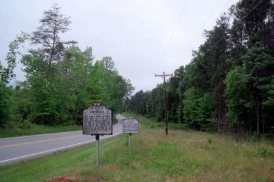
On Jeb Stuart Highway (Virginia Route 92) at Godseys Lane, on the right when traveling west on Jeb Stuart Highway.
Charlotte County. Area 496 square miles. Formed in 1764 from Lunenburg, and named for Queen Charlotte, wife of King George III. Patrick Henry and John Randolph of Roanoke lived in this county, and Henry is buried here. . . . — — Map (db m31001) HM
On Fontaine Avenue (Old U.S. 29) at Appletree Road, on the right when traveling east on Fontaine Avenue.
The site was patented by William Taylor in 1737. The town was established by law in 1762, and was named for Queen Charlotte, wife of George III. Burgoyne’s army, captured at Saratoga in 1777, was long quartered near here. The legislature was in . . . — — Map (db m8643) HM
On East Jefferson Street at Farm Lane, on the left when traveling east on East Jefferson Street.
The Farm stands on a 1020-acre tract acquired by Nicholas Meriwether in 1735 and later owned by Col. Nicholas Lewis, uncle of Meriwether Lewis. A building on the property likely served as headquarters for British Col. Banastre Tarleton briefly in . . . — — Map (db m19582) HM
On Park Street north of East Market Street, on the left when traveling north.
This building, in continuous use as a
courthouse for over 200 years, is one of America’s most historic. No other courthouse has been used by three early
American Presidents at the same time, The original wood frame courthouse was erected on a . . . — — Map (db m19723) HM
On East High Street at Park Street, on the right when traveling east on East High Street.
On 4 June 1781, John “Jack” Jouett Jr. arrived at the Albemarle County Courthouse to warn the Virginia legislature of approaching British troops. The state government under Governor Thomas Jefferson had retreated from Richmond to . . . — — Map (db m18549) HM
On East Jefferson Street at Park Street, on the right when traveling west on East Jefferson Street.
Three miles to the southeast, Thomas Jefferson began the house in 1770 and finished it in 1802. He brought his bride to it in 1772. Lafayette visited it in 1825. Jefferson spent his last years there and died there, July 4, 1826. His tomb is there. . . . — — Map (db m65069) HM
On Park Street north of Jefferson Street, on the right when traveling north.
Site of old Swan Tavern where lived and died Jack Jouett, whose heroic ride saved Mr. Jefferson, the Governor, and the Virginia Assembly from capture by Tarleton June 1781. — — Map (db m18552) HM
On Battlefield Boulevard South (Virginia Route 168) north of Albermarle Drive, on the right when traveling north.
In this vicinity, in 1775, was the southern end of a causeway, with bridges, by which the swamp and stream were crossed. Here William Woodford's Virginia riflemen defended the passage. When Lord Dunmore's British regulars attempted to cross the . . . — — Map (db m29926) HM
Near Albemarle Drive at Holt Drive, on the left when traveling west.
The British erected a fort at Great Bridge early in November 1775. The first decisive land battle of the American Revolution in the south was fought here December 9, 1775. Virginia forces under Col. William Woodford united with the militia of South . . . — — Map (db m241916) HM
On Conquest Drive north of Shea Drive, on the right when traveling south.
(front)
This stone
marks the Battlefield of
Great Bridge
Dec 9 1775
(rear)
This monument
was moved to this location
December 9, 1964
on the 189th anniversary of
the Battle of Great Bridge.
The site of . . . — — Map (db m113670) HM WM
On South Battlefield Boulevard (Virginia Route 168) at Cedar Road (Virginia Route 165), on the right when traveling south on South Battlefield Boulevard.
Site of
Southern Branch Chapel
A Chapel of ease of the Anglican Church
for the
Elizabeth River Parish 1701 - 1761
St. Brides Parish 1761 - 1845
Encampment area for American Patriots
Battle of Great Bridge
December 1775 . . . — — Map (db m48944) HM
Near North Battlefield Boulevard (Business Virginia Route 168) at Watson Road, on the left when traveling south.
In late October 1775, the Virginia Committee of Safety ordered Colonel William Woodford and his 2nd Virginia Regiment, along with five companies of Culpeper Minutemen, to march towards Norfolk and protect “…all friends to the American cause.” The . . . — — Map (db m211241) HM
Near Watson Road at North Battlefield Boulevard (Virginia Route 168), on the left when traveling south.
(side 1)
This monument honors
Patriots who assembled
at this site in the Cause of
American Freedom in 1775
American Patriots
at the Battle
Second Virginia Regiment
Commanded by
Colonel William Woodford,
of . . . — — Map (db m211239) HM
Near North Battlefield Boulevard (Business Virginia Route 168) at Watson Road, on the left when traveling south.
His courage “amid a shower of bullets” helped achieve victory at the Battle of Great Bridge.
Private William (Billy) Flora was a free black from the Portsmouth area and a member of the Norfolk County Militia who served as a . . . — — Map (db m54952) HM
Near Locks Road, 0.6 miles west of North Battlefield Boulevard (Virginia Route 168), on the left when traveling west.
1600s: Woodlands, Marshes and the Great Bridge
The rich forests and fields south of the Elizabeth River and in northeastern North Carolina gave the early settlers in the late 1600s bountiful yields of shingles, naval stores, lumber, grain . . . — — Map (db m211244) HM
Near North Battlefield Boulevard (Business Virginia Route 168) at Watson Road, on the left when traveling south.
“There is great want of a bridge for horse and man over the swamp at the head of the Southern Branch of Elizabeth River…” Norfolk County Deed Book 5, part 2, Orders. page 4, 1686
In the mid-1600s, as the early settlers began to . . . — — Map (db m54948) HM
Near North Battlefield Boulevard (Business Virginia Route 168) at Watson Road, on the left when traveling south.
At daybreak on the morning of December 9, 1775, the British rolled two four-pounder cannon field pieces across the bridge under the cover of smoke from burning buildings and piles of shingles located on the south island. The fires were set by . . . — — Map (db m54947) HM
Near North Battlefield Boulevard (Business Virginia Route 168) at Watson Road, on the left when traveling south.
By the summer of 1775, British control over the Colony of Virginia was in peril and Dunmore looked to Norfolk, the most heavily populated town in Virginia and the largest seaport between New York and Charleston. The occupation of Norfolk and Hampton . . . — — Map (db m54941) HM
Near North Battlefield Boulevard (Business Virginia Route 168) at Watson Road, on the left when traveling south.
Fauquier County, Virginia
Officers of the Culpeper Minute Battalion
At the Battle of Great Bridge
Major Thomas Marshall (1730-1802)
Member, 1st, 2nd, 3rd & 4th Virginia Conventions
Colonel, 3rd Virginia Regiment
Colonel, Virginia . . . — — Map (db m54953) HM
Near North Battlefield Boulevard (Business Virginia Route 168) at Watson Road, on the left when traveling south.
“…to reduce this colony to a proper sense of their duty…to His Majesty’s crown and dignity…”
On November 15, 1775, the day after his success in routing the rebels at Kemp’s Landing, Lord Dunmore issued a proclamation declaring . . . — — Map (db m54942) HM
Near North Battlefield Boulevard (Business Virginia Route 168) at Watson Road, on the left when traveling south.
The Albemarle & Chesapeake Canal did not exist at the time of the Battle of Great Bridge…
...but plans for a canal at Great Bridge were in place more than three years before the battle. In 1772, the need for trade and commerce with North . . . — — Map (db m54955) HM
On Locks Road, 0.6 miles west of North Battlefield Boulevard (Virginia Route 168), on the left when traveling west.
In the early morning of December 9, 1775, two opposing forces faced each other across the Great
Bridge, the British on the north end and the patriots to the south. The battle lasted about thirty minutes...but its outcome will last as long as . . . — — Map (db m211253) HM
Near North Battlefield Boulevard (Business Virginia Route 168) at Watson Road, on the left when traveling south.
I then saw the horrors of war in perfection, worse than can be imagined; 10 and 12 bullets thro’ many; limbs broke in 2 or 3 places…Good God, what a sight! Captain Richard Kidder Meade, Southampton District, 2nd Virginia Regiment . . . — — Map (db m54951) HM
Near North Battlefield Boulevard (Business Virginia Route 168) at Watson Road, on the left when traveling south.
The Thomas Marshall family lived in the backwoods of the Virginia frontier.
Thomas Marshall of Fauquier County served as a vestryman, High Sheriff, and member of the House of Burgesses. He was a close boyhood friend of George Washington, . . . — — Map (db m54954) HM
On Locks Road, 0.3 miles west of North Battlefield Boulevard (Virginia Route 168), on the left when traveling west.
The Great Bridge village evolved to your left, where a bridge spanned the Elizabeth River. An early battle of the Revolution occurred around the bridge on December 9, 1775. The village grew with the completion of the Albemarle & Chesapeake Canal. . . . — — Map (db m211246) HM WM
On Locks Road, 0.6 miles west of North Battlefield Boulevard (Virginia Route 168), on the left when traveling west.
The Battle of Great Bridge, in 1775, influenced everything you see today. Location, lives and legends are all here.
A. Great Bridge Lock Park
Enjoy a boat ramp, playground, picnic shelters and the many inviting vistas. Walk the . . . — — Map (db m48955) HM
Near Locks Road, 0.6 miles North Battlefield Boulevard (Virginia Route 168), on the left when traveling west.
A Safer, Faster Route was Needed
Prior to the Revolutionary War, the most direct routes to transport goods to Norfolk and points north from North Carolina were, either the very slow overland route through the village of Great Bridge, or the . . . — — Map (db m48962) HM
On Airline Boulevard (U.S. 58) 0.1 miles east of Ahoy Drive, on the right when traveling west.
Just north is the birthplace of Commodore Richard Dale (6 Nov 1756 - 26 Feb 1826). He served on the United States brigantine Lexington. The British captured and wounded him several times during the Revolutionary War. Captain John Paul Jones . . . — — Map (db m40678) HM
On Jefferson Davis Highway (U.S. 1) 0.1 miles north of Osborne Road, on the right when traveling south.
The town of Osbornes was named for Captain Thomas Osborne who settled nearby at Coxendale in 1616. During the 17th and 18th centuries, Osborne's plantation wharf was a tobacco inspection station and local shipping center. Thomas Jefferson, . . . — — Map (db m16019) HM
Near Iron Bridge Road (Virginia Route 10) west of Wagners Way, on the right when traveling west.
The 1917 Courthouse stands on the footprint of the first Chesterfield County courthouse built in 1749 and demolished in 1917, against the will of local citizenry. This early preservation case was the subject of heated debate between concerned . . . — — Map (db m133671) HM
On Iron Bridge Road (Virginia Route 10) at Wagners Way, on the right when traveling west on Iron Bridge Road.
This area, known originally as "Cold Water Run," is the site of the first Chesterfield County courthouse, erected in 1750. In 1917 it was demolished and replaced by a larger Georgian Revival brick building that served the county until the 1960s. . . . — — Map (db m19523) HM
On Iron Bridge Road (Virginia Route 10) west of Wagners Way, on the right when traveling west.
Dedicated to all
Chesterfield County
veterans who served
their country
[On the other side of the wall is a series of plaques:]
Afghanistan
2001
Chesterfield County
Remembers
Brandon T. Islip, . . . — — Map (db m133672) WM
On East Hundred Road (Virginia Route 10), on the right when traveling west.
A mile north, on the site of an important Appamatuck Indian village, Sir Thomas Dale established Bermuda Hundred in 1613. The hundred was a traditional English jurisdiction of one hundred families. Dale, the deputy governor and marshal of Virginia, . . . — — Map (db m11662) HM
On Midlothian Turnpike (U.S. 60) 0.2 miles west of Hugenot Road, on the right when traveling west.
Half a mile north stood Black Heath, later owned by Captain John Heth, officer in Continental Army, whose son, Henry Heth, Major-General C.S.A., was born here in 1825. Coal of high quality was mined here. — — Map (db m19043) HM
On Midlothian Turnpike (U.S. 60) 0.2 miles east of Coalfield Road, on the right when traveling east.
South of here are the Midlothian Coal Mines, probably the oldest coal mines in America. Coal was first mined here before 1730, and during the Revolution, coal from these mines supplied the cannon foundry at Westham. The first railroad in Virginia . . . — — Map (db m19044) HM
On Old Buckingham Road, 0.1 miles west of Warminster Drive, on the right when traveling west.
This was the home of Lt. John Trabue, Revolutionary War soldier and patriot, and of his descendants well into the 20th century. Trabue witnessed the surrender of the British forces at Yorktown in 1781 and later became an original member of the . . . — — Map (db m19014) HM
On Jefferson Davis Highway (U.S. 1) at Cogbill Road, on the right when traveling north on Jefferson Davis Highway.
Built before 1732 by Henry Cary, this was the home of Colonel Archibald Cary, a Revolutionary leader of Virginia. The house was moved, 1929-30, to its present location off Cary Street Road in Richmond's West End. — — Map (db m24997) HM
Near Jefferson Davis Highway (U.S. 1) at Marina Drive, on the right when traveling north.
Archibald Cary established an iron forge on the south bank of Falling Creek in 1750. The Chesterfield forge, as it was known, converted pig iron into bar iron. Initially unprofitable and shut down, the forge would be restarted and become . . . — — Map (db m101039) HM
Near Jefferson Davis Highway (U.S. 1) at Marina Drive, on the right when traveling north.
The history associated with Falling Creek Park spans more than 400 years. Numerous industries existed along the creek from the 17th to the early 20th century.
The earliest industry that existed at this location was the first iron furnace . . . — — Map (db m101036) HM
On Jefferson Davis Highway (U.S. 1) at Marina Drive, on the right when traveling north on Jefferson Davis Highway.
Vanished now but for a trace, Falling Creek is the site of the first industrial ironworks in the New World. The close proximity of iron ore, wood for fuel and power provided by the falling water made the Falling Creek site perfect for this . . . — — Map (db m32587) HM
Near Jefferson Davis Highway (U.S. 1) at Marina Drive, on the right when traveling north.
This is the location of the first iron furnace established in the New World, started in 1619 and completed in 1622. Iron ore had been extracted from James River outcrops as early as 1608, and these samples were shipped to England. The Virginia . . . — — Map (db m101038) HM
On Jefferson Davis Highway (U.S. 1) 0.4 miles south of Chippenham Parkway (Virginia Route 150), in the median.
Located eight miles downstream from Richmond, Warwick was an important 18th-century James River port and manufacturing center. During the Revolutionary War, Warwick's craftsmen turned out clothing and shoes, and its mills ground flour and meal for . . . — — Map (db m16014) HM
On Hull Street Road (U.S. 360) 1.6 miles west of Sappony Road, on the right when traveling west.
Here Anthony Wayne took station in July, 1781, to prevent the British from moving southward. Here, April 3, 1865, Longstreet's, Hill's and Gordon's corps of Lee's army, retreating from Petersburg toward Danville, crossed the river. — — Map (db m18876) HM
On Academy Street west of Lord Fairfax Highway (U.S. 340), on the right when traveling west.
In memory of
1746 James Ireland 1806
Minister of the Gospel
Born in Edinburgh, Scotland and converted in Frederick County, Va.
Baptized and ordained at Sandy Creek, N.C. Imprisoned at Culpeper,
Va. for preaching the gospel organizer . . . — — Map (db m221644) HM
On South Greenway Avenue (U.S. 340) at West Main Street (Virginia Route 723), on the right when traveling north on South Greenway Avenue.
A half-mile east, Revolutionary War hero Daniel Morgan began this limestone Georgian mansion in 1779 while on furlough. He named it for the Battle of Saratoga in which he had recently distinguished himself. The house was probably constructed by . . . — — Map (db m1813) HM
On Harry Byrd Highway (Route 7) at Blueridge Mountain Road (Virginia Route 601), on the right when traveling west on Harry Byrd Highway. Reported missing.
Clark County. Area 171 Square Miles. Formed in 1836 from Frederick, and added to from Warren. Named for George Rogers Clark, Conqueror of the Northwest. Lord Fairfax and General Daniel Morgan, Revolutionary hero, lived in this . . . — — Map (db m1394) HM
On John Mosby Highway (U.S. 17 / 50) at Bishop Meade Road (Virginia Route 255), on the right when traveling west on John Mosby Highway.
This 30-square-mile scenic landscape illustrates the evolution of a unique rural community. Unlike the rest of the Shenandoah Valley, where mostly Scots-Irish and German immigrants settled on small farms, Virginia Tidewater gentry occupied most of . . . — — Map (db m1848) HM
On Brandy Road (Business U.S. 15/29) at James Madison Highway (U.S. 15/29), on the right when traveling east on Brandy Road.
Two miles south is the grave of Betty Washington Lewis, the younger sister of George Washington. She was born in Westmoreland County in 1733 and married Fielding Lewis in May 1750, becoming his second wife. Her husband purchased land in 1752 and . . . — — Map (db m4429) HM
On Oaklawn Boulevard just west of South Blue Ridge Avenue, in the median.
Col. John Jameson (1751-1810) owned land nearby. He served as the Culpeper County court clerk (1772-1810) and a captain in the Culpeper Minute Men battalion during the Revolutionary War. In Sept. 1780, while serving under Gen. Benedict Arnold in New . . . — — Map (db m23962) HM
On Sperryville Pike (U.S. 522) west of Virginia Avenue, on the left when traveling west.
On the hill to the south the famous Culpeper Minute Men were organized in 1775. John Marshall, later chief Justice of the Supreme Court, was a Lieutenant. — — Map (db m8321) HM
On North Main Street (Virginia Route 229) at Carpenter Drive, on the left when traveling north on North Main Street.
Here is buried General Edward Stevens, who served at Brandywine, Camden, Guilford Courthouse and Yorktown. He died on August 17, 1820. — — Map (db m23960) HM
On North Blue Ridge Avenue, 0.1 miles south of West Edmondson Street, on the right when traveling south.
Major Gabriel Long (b. 1751) served as Lieutenant in Captain John Jameson's Company, Culpeper Minutemen Battalion which mustered here in the Fall, 1775 and fought victoriously at Great Bridge in December 1775 to rid Virginia of British . . . — — Map (db m170194) HM WM
Near Monument Lane, on the right when traveling north.
Honoring the Culpeper Minute Men. Virginia's first, who organized in this field & fought their first battle at Great Bridge 1775 Erected by Culpeper Minute Men Chapter, DAR 6-14-71 — — Map (db m12710) HM
Near North Blue Ridge Avenue, on the right when traveling south.
Shortly after the revolutionary conventions held in the spring and summer of 1775, Culpeper County lieutenant James Barbour began organizing a 300-man battalion in the counties of Culpeper, Orange, and Fauquier. Yowell Meadow, then called Clayton's . . . — — Map (db m12703) HM
On York Road (State Road 600) at Germanna Highway (State Highway 3), on the right when traveling east on York Road.
Founded in 1782, Stevensburg sits at the important intersection of the Old Carolina Road and Kirtley Road - the intersection where you now stand. The community is named for General Edward Stevens, a local Revolutionary War leader and state . . . — — Map (db m152625) HM
On Cartersville Road (Virginia Route 45) 0.1 miles south of Tavern Road, on the left when traveling south.
Early in June 1781, Maj. Gen. Friedrich Wilhelm von Steuben saved some military stores at Point of Fork from British troops and then retreated south to Staunton River before being called to join Lafayette's forces. On 16 June Steuben crossed to the . . . — — Map (db m18357) HM
On Columbia Road at Boston Hill Road, on the right when traveling west on Columbia Road.
One mile north; home of Carter Henry Harrison, land patented, 1723. Harrison, as a member of the Cumberland Committee of Safety, wrote the instructions for independence (adopted April 22) presented by the county delegates to the Virginia convention . . . — — Map (db m21117) HM
On Anderson Highway (U.S. 60) at Foster Road, on the right when traveling west on Anderson Highway.
Near this place from the porch of Effingham Tavern on 22 April 1776, Carter Henry Harrison, a member of the Cumberland Committee for Safety, read the Resolutions of Cumberland County to citizens gathered there. These resolutions called for the . . . — — Map (db m67315) HM
On North Main Street (State Highway 45) at River Road (County Route 600), on the right when traveling south on North Main Street.
Near here is the site of Bizarre, owned in 1742 by Richard Randolph of Curles. In 1781, his grandson, John Randolph of Roanoke, took refuge at Bizarre with his mother on account of Arnold's invasion. John Randolph lived here until 1810, when he . . . — — Map (db m30204) HM
On North Main Street (State Highway 45) at River Road (County Route 600), on the right when traveling south on North Main Street.
Cumberland County. Area 293 square miles. Formed in 1748 from Goochland, and named for the Duke of Cumberland, second son of King George II. The earliest call for independence came from this county, April 22, 1776.
Prince . . . — — Map (db m30212) HM
On South Boston Road (U.S. 58) at Kentuck Road (Virginia Route 729), on the right when traveling east on South Boston Road.
In 1766 John Dix established his ferry approximately three miles south of here on the Dan River. During the American Revolution, in February 1781, the ferry was a strategic site in Gen. Nathanael Greene's “race to the Dan,” the pursuit . . . — — Map (db m108313) HM
On Main Street (County Route 607) at McClure Street, on the right when traveling north on Main Street.
The only known Revolutionary War soldier buried in Dickenson County rests on knoll, to the left of intersection McClure and Mullins Avenues (State Highway 83). Died in 1849 at home of his son John who, in 1829, was the first settler on Holly Creek . . . — — Map (db m90759) HM
On Dickenson Highway (Virginia Route 83) just east of McClure Street and Ida Lane, on the right when traveling east. Reported permanently removed.
Near here on Holly Creek, John Mullins settled in 1829, becoming the second settler in Dickenson County. His father John Mullins, the only known Revolutionary War soldier resting in this county, spent his last years here with his son. He died in . . . — — Map (db m221004) HM
Near Dickenson Highway (Virginia Route 83) at Clintwood Main Street, on the left when traveling west.
John and Ollie (Cox) Mullins and their children, the first permanent settlers of European descent in this area, came here from North Carolina about 1829. The family lived along Holly Creek and claimed thousands of acres of land in the vicinity. . . . — — Map (db m221031) HM
On Cox Road (U.S. 460) 0.8 miles east of Rocky Hill Road (Virginia Route 153), on the right when traveling east.
Nottoway County. Area 310 Square Miles. Formed in 1788 from Amelia, and named for an Indian tribe. Tarleton passed through this county in 1781. Here lived William Hodges Mann, Governor of Virginia 1910-14.
Dinwiddie . . . — — Map (db m31874) HM
On Gatewood Road (Virginia Route 656) at Boydton Plank Road (U.S. 1), on the right when traveling south on Gatewood Road.
British Lt. Gen. Charles Cornwallis ordered cavalry commander Lt. Col. Banastre Tarleton to raid Southside Virginia in the summer of 1781. Tarleton left Surry County before turning back. His objective was to destroy stores of ammunition, clothing, . . . — — Map (db m180009) HM
On Cox Road (U.S. 460) 0.7 miles east of County Road F-804, on the right when traveling east.
John Banister, Revolutionary leader, is buried one mile to the south. A tobacco planter and entrepreneur, Banister operated sawmills and flour mills near Petersburg. He lived at Battersea, an architecturally distinguished house about 10 miles east . . . — — Map (db m180072) HM
On Cox Road (U.S. 460) 0.8 miles east of Tranquility Lane, on the right when traveling east. Reported permanently removed.
One mile to the south is the site of Hatcher's Run Plantation and the grave site of Col. John Banister (D. 1787), first mayor of Petersburg and prosperous entrepreneur. Banister represented Dinwiddie County in the House of Burgesses (1765-1775) and . . . — — Map (db m19007) HM
On South Main Street (U.S. 301) at Greensville Avenue, on the right when traveling south on South Main Street.
William McKendree was born in King William County in 1757. He soon moved with his family to present-day Greensville County, and later served in the Revolutionary War. In 1786, the county licensed him to keep a tavern at his house (12 miles south). . . . — — Map (db m18943) HM
On South Main Street (U.S. 301) 0.1 miles north of Battery Avenue, on the right when traveling north.
At this point Tarleton, the British cavalryman, crossed the Meherrin River, May 14, 1781. Sent ahead of Cornwallis's army, he had raided through Southampton and Greensville counties. — — Map (db m18941) HM
On US 17 north of Spindle Shop Road, on the right when traveling north.
This was the principal church of St. Anne's Parish, which was formed in 1704 from Sittenburne Parish and encompassed Essex County. According to tradition, part of the present church was built about 1719 with an addition constructed in 1731, but . . . — — Map (db m7407) HM
Near Mount Vernon Memorial Highway (Virginia Route 235) at George Washington Memorial Parkway, on the right when traveling east.
George Washington was very fond of horses and dogs and owned many during his lifetime. Both animals could be found in the forest as part of various activities at the estate, such as foxhunts. The American Kennel Club credits George Washington for . . . — — Map (db m182650) HM
Near George Washington Parkway (Virginia Route 400) at Mount Vernon Highway (Virginia Route 235).
This marker commemorates the establishment of the Purple Heart decoration by General George Washington, Commander-in-Chief of the Continental Army, on August 8, 1782.
The Purple Heart Trail memorializes those patriots who were awarded the . . . — — Map (db m14173) HM
On Wolf Run Shoals Road (County Route 610) south of Henderson Road (County Route 643).
During the Civil War, both Union and Confederate forces considered Wolf Run Shoals an essential crossing point on the Occoquan River through 1963. Confederate regiments camped on the south side of the shoals and posted pickets there from the winter . . . — — Map (db m74885) HM
On Chain Bridge Road (Virginia Route 123) south of Main Street (Virginia Route 236).
Honoring those patriots who served and died advancing the cause of American Independence
1775 - 1783
Alexander, George •
Ashford, George •
Athey, Benjamin •
Benter, William •
Bryant, William •
Carlyle, George W. •
Chapin, . . . — — Map (db m218414) WM
On Gunston Road (Virginia Route 242) at Old Colchester Road, on the left when traveling east on Gunston Road.
Gunston Hall, four miles to the east, is one of the most noted colonial places in Virginia. The land was patented in 1651 by Richard Turney, who was hanged for taking part in Bacon's Rebellion in 1676. In 1696 the second George Mason acquired it. . . . — — Map (db m205) HM
On Gunston Road (Virginia Route 242) 0.2 miles south of Old Colchester Road (Virginia Route 611), on the right when traveling south.
Gunston Hall
The house and grounds convey the measured pace of an 18th century colonial plantation and the underlying grace of Southern hospitality. This is a setting of a simple dignity, of quiet orderliness from which "a . . . — — Map (db m197451) HM
On Old Colchester Road (Virginia Route 611) north of Greene Drive, on the right when traveling south.
Some of the features shown here that were prominent on Mason Neck in Fairfax County during the marches of the Armies of the American War of Independence, exist today through generations of historic preservation efforts. The rich natural . . . — — Map (db m198378) HM
Near Richmond Highway (U.S. 1) at Old Colchester Road (Virginia Route 611), on the right when traveling north.
Revolutionary Soldier
Peter Wagener, III
1744 - 1798
Placed by
Fairfax County Chapter
DAR 1974
Original grave site in Colchester, Virginia marked by Fairfax County Chapter December 1955 — — Map (db m168136) HM WM
On Old Colchester Road (Virginia Route 611) north of Greene Drive, on the right when traveling south.
It was no picnic
A bivouac for the allied armies was not simply a bed to rest for the night, but a place with a daily set of demanding chores. Hundreds of oxen and horses needed to be unhitched, fed, watered, and secured for the night, . . . — — Map (db m198377) HM
Near Richmond Highway (U.S. 1) at Old Colchester Road (Virginia Route 611), on the right when traveling north.
This marker honors the service of the Revolutionary War Patriots and War of 1812 Veterans buried or memorialized on the grounds of historic Pohick Church
Revolutionary War Patriots
Patriot Charles Alexander, Sr •
Patriot Susanna Pearson . . . — — Map (db m168133) HM WM
On Old Colchester Road (Virginia Route 611) north of Greene Drive, on the right when traveling south.
Late in the American War for Independence, allied generals George Washington and the Comte de Rochambeau received good news. A French fleet under Admiral de Grasse carrying 3,000 French soldiers was headed for the Chesapeake Bay. Following the . . . — — Map (db m243223) HM
Near Richmond Highway (U.S. 1) near Telegraph Road and Old Colchester Road (County Route 611).
The remains from 29 graves were brought here from the Wagener family cemetery at Stisted, their plantation on the Occoquan River near Colchester. The Second Peter Wagener (1717–1774), Clerk of the Fairfax County Court (1752–1772), served . . . — — Map (db m202) HM
On Old Colchester Road (Virginia Route 611) north of Greene Drive, on the right when traveling south.
Colchester is the colonial tobacco port town on Mason's neck that witnessed the passage of the allied French and American armies on their way to and from Yorktown, Virginia in 1781 and 1782. The town provided a route to an Occoquan River ford for . . . — — Map (db m198373) HM
On Gunston Road (Virginia Route 242) 0.2 miles south of Old Colchester Road (Virginia Route 611), on the right when traveling south.
In the early 1600s explorer John Smith discovered a boot-shaped peninsula between the Potomac and Occoquan rivers. He called it Dogue Neck after the Dogue Indians living there. Later the name changed to Mason Neck, when it became home to the . . . — — Map (db m197423) HM
On Richmond Highway (U.S. 1), on the right when traveling east.
Dr. William Brown, Revolutionary War physician, was born in Scotland and raised in Maryland. After studying medicine at the University of Edinburgh, he established a practice in Alexandria. In 1775 he became surgeon of the 2nd Virginia Regiment. In . . . — — Map (db m127853) HM
On Mount Vernon Memorial Highway, 0.1 miles west of Mount Vernon Highway (Virginia Route 235), on the right when traveling west.
On August 14, 1781, Generals Washington and Rochambeau received news that a large French fleet under the command of Admiral de Grasse was headed for the Chesapeake Bay carrying 3,000 French soldiers. There the British general, Cornwallis, was . . . — — Map (db m902) HM
Near Mount Vernon Highway (Virginia Route 235) at George Washington Memorial Parkway.
While its location on the Potomac was usually a blessing—both for its beautiful views and commercial opportunities—Mount Vernon's safety was threatened by activities on the river during times of war.
American Revolution (1775-1783)
In . . . — — Map (db m147908) HM
On Mount Vernon Memorial Highway, 0.1 miles west of Mount Vernon Highway, on the right when traveling west.
General Washington, in 1781, rode 60 miles in one day from Baltimore to Mount Vernon, which he had not visited for over 6 years. General Rochambeau arrived next day with his and Washington’s staff. They spent Sept. 10 and 11 at Mount Vernon before . . . — — Map (db m883) HM
On East Fairfax Street at South Washington Street (County Route 237), on the right when traveling north on East Fairfax Street.
The first church on this site was built in 1734 and was in Truro Parish. George Washington was elected a vestryman, October 3, 1763. In 1765 the church fell within the newly created Fairfax Parish, of which Washington was chosen a vestryman. The . . . — — Map (db m4189) HM
800 entries matched your criteria. Entries 101 through 200 are listed above. ⊲ Previous 100 — Next 100 ⊳