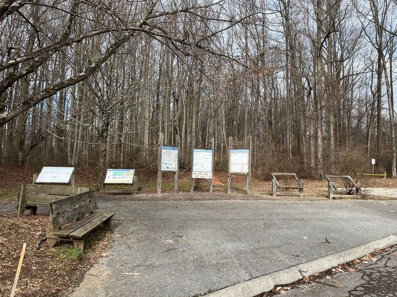
Near South Old Baltimore Pike west of Iron Hill Road, on the right when traveling west.
Welsh Tract Church
William Penn granted a 30,000 acre tract of land to three Welshmen, (David Evans, William Davis, and William Willis) in 1701. They and their followers had left southern Wales in search of religious freedom. In encouraging . . . — — Map (db m238421) HM
Near South Old Baltimore Pike east of Whittaker Road, on the right when traveling west.
1800
Total Pencader Population: 2,132 100%
Number of Free Black Residents in Pencader:201 9% of Total Population
Number of Free Black Persons Living in Free Blk. . . . — — Map (db m238418) HM
Near South Old Baltimore Pike east of Whittaker Road, on the right when traveling west.
"Almost all of the Africans who came to America before 1865 were enslaved… Struggling to establish stable lives despite harsh conditions. Once they were legally free, their troubles were far from over, since African Americans were . . . — — Map (db m238415) HM
On Robert L. Melson Lane near Whitaker Road, on the left when traveling north.
One of the first tasks the Welsh performed was the establishment of two houses of worship. Among the Welsh were both Baptist and Presbyterian and the Baptist built their church on the north side of Iron Hill in 1703. Rebuilt in 1746, it remains . . . — — Map (db m158217) HM
On Maryland Avenue (Delaware Route 4) at Ashley Place, on the right when traveling east on Maryland Avenue.
Ashton Richardson built Ashley Mansion in 1804 on land he inherited from his father. A prominent Quaker, Ashton Richardson owned several milling operations and was considered one of the most eligible bachelors in the area. After marrying in 1807, . . . — — Map (db m196413) HM
Tradition states that a young Irish immigrant moved to the local area in 1786 and sought out a Methodist minister from Wilmington to preach in Newport. By the early nineteenth century, a permanent Methodist Society had been established in the area. . . . — — Map (db m92147) HM
On Main Street, 0.1 miles west of US 13 South, on the right when traveling east.
Believed to be one of the smallest Quaker Meeting Houses in the nation, the Appoquinimink Friends Meeting House was built in 1785 by David Wilson and presented to the Friends as a gift. Local tradition identifies this structure as a stop on the . . . — — Map (db m10308) HM
On Old State Road (Delaware Route 299) at Taylor Bridge Road, on the right when traveling east on Old State Road.
Delaware clock-maker of great distinction and silversmith lived and labored here for about thirty years until his death in 1797. Was a prominent member of Old Drawyers Presbyterian Church. Made contract with State of Delaware in 1776 for manufacture . . . — — Map (db m236871) HM
Near US 13, 1 mile north of High Street, on the right when traveling south.
The history of this congregation may be traced to the 1670s, when Dutch and Swedish members of the "Reformed Church" were gathering locally for worship. By the first decade of the 18th century the settlement of persons largely of Scottish descent . . . — — Map (db m10538) HM
In 1831, a Methodist Society was organized in this community. The congregation was incorporated as Cantwell's Bridge Methodist Episcopal Church in 1832. A small meeting house known as "Brickbat Church" was subsequently constructed on land provided . . . — — Map (db m10539) HM
On Market Street at Stewart St., on the right when traveling west on Market Street.
The Presbyterian Church, on the opposite corner across the intersection, now occupies the site originally intended as Port Penn's market square. Dr. David Stewart, Sr., believed to be the founder of Port Penn, envisioned a central market similar . . . — — Map (db m10395) HM
On Market Street (Delaware Route 9) at Stewart Street, on the right when traveling east on Market Street.
Port Penn
Presbyterian Church
is listed in the
National Register
of Historic Places
by the United States
Department of the Interior
c. 1856
— — Map (db m174825) HM
On Mt. Lebanon Road, on the left when traveling west.
This congregation was organized in 1812. For a number of years services were conducted by Methodist “circuit riders” in members’ homes and local schools. On March 7, 1834, Thomas and Hannah Aldred donated land at this location on which to build a . . . — — Map (db m175220) HM
On Union Church Road, 0.1 miles east of US 13, on the right when traveling west.
A log church was built here in 1789 on land donated by Joseph Dickinson. The church was named "Dickinson's Chapel" in his honor. Francis Asbury and many other pioneers of American Methodism conducted services here. Levi Scott, a native of this area . . . — — Map (db m10608) HM
On Blackbird Forest Road, on the right when traveling west.
Scott Church and its congregation grew from a Sunday school that was started in Blackbird in 1886. By 1898, the church was incorporated and a site for the church was purchased. Construction began in 1899 and the church was dedicated on Sunday, . . . — — Map (db m94187) HM
"The Rocks," a natural landing on the Christina River, was critical to Wilmington's Underground Railroad network. Captain James Watson Fountain outfitted a schooner to secretly carry freedom-seekers north from North Carolina and Virginia. Black . . . — — Map (db m226518) HM
On North Walnut Street at East 3rd Street on North Walnut Street.
Organized about the year 1769. Early meetings held in academy woods, Gilpin’s Wharf and Thelwell’s School. Church Built in 1789.
Dedicated to Bishop Francis Asbury. Here is buried Allen McLane, Lieutenant in Caesar Rodney’s Regiment 1779; . . . — — Map (db m92275) HM
On North Market Street, on the right when traveling south.
This building, once known as the Morrow Building, symbolizes the founding of an organized Jewish community in Delaware. Jews have been present in Delaware since the 1650's. Until the late 19th Century, the Jewish community was too small to maintain . . . — — Map (db m166679) HM
On North French Street at East 9th Street, on the left when traveling south on North French Street.
On this site in 1805 an historic institution in the Black experience was built. Its membership was commended by Bishop Francis Asbury when he visited the new church in 1806.
"The Africans here have a house to . . . — — Map (db m217948) HM
In 1805 a group of African-Americans, desiring greater freedom of worship, withdrew from Asbury Methodist Episcopal Church to form a separate congregation. Led by Peter Spencer and William Anderson, they established what was then known as the . . . — — Map (db m14757) HM
On North French Street, 0.1 miles north of East Eighth Street, on the right when traveling south. Reported permanently removed.
Born a slave, Bishop Spencer was the father of Delaware’s independent Black church movement. In 1813, he founded the Union Church of Africans, presently known as the African Union Methodist Protestant Church. The mother AUMP church . . . — — Map (db m144198) HM
On East 5th Street, on the right when traveling west.
Established in 1813 by free African American Peter Spencer, the Union Church of Africans was the first independent African American religious denomination in the United States. After leaving Asbury Methodist Episcopal Church to start Ezion . . . — — Map (db m94195) HM
On French Street, on the right when traveling north.
The cradle of African-American Catholicism in Delaware, St. Joseph Church was organized in 1889 by Father John A. DeRuyter of the Josephites. Services were first held in the basement of St. Mary’s Church on 6th and Pine Streets. Incorporated as St. . . . — — Map (db m10919) HM
On East 7th Street at Spruce Street, on the left when traveling east on East 7th Street.
Zion Church in New York City, organized in 1796, was the catalyst by which the African Methodist Episcopal Zion denomination was established in 1821. By the 1870’s a number of Wilmington residents had affiliated themselves with this growing . . . — — Map (db m11011) HM
The oldest existing school in Delaware, Wilmington Friends was founded in 1748. It resided in the first meeting house of the Wilmington Meeting of the Religious Society of Friends (Quakers) at Fourth and West Streets, which had been built ten . . . — — Map (db m140064) HM
On Northern Delaware Greenway Trail, on the right when traveling south.
Not Just Workers, But Family
For as long as this was a family business, workers at Bancroft Mills were treated as members of the family. Long before workers had any rights, Joseph Bancroft and his sons provided decent wages and benefits not . . . — — Map (db m240816) HM
Near Northern Delaware Greenway Trail, on the left when traveling north.
Bancroft Mills became a leading manufacturer through one family's business sense and Quaker values.
The Founder
Joseph Bancroft was both a devout Quaker and a wise businessman. By keeping his company up-to-date on new trends and . . . — — Map (db m240759) HM
On Concord Pike (U.S. 202) 0.2 miles north of Woodlawn Rd..
On December 30, 1835, a group of local residents met at the Talley School House to organize themselves as a congregation of the Episcopal Church. The old school, which was located on Naaman’s Road, was purchased the following February to serve as a . . . — — Map (db m128090) HM
On Stadium Drive south of West 18th Street, on the right when traveling south.
A standout athlete, Dominic "Dom" Montero, was a three-time All-Philadelphia Catholic League football selection. With Dim, Salesianum - the smallest school in the league - was a co-champion in 1934. Later, at LaSalle College, Dim earned Little . . . — — Map (db m217913) HM
The origin of this congregation can be traced to 1875, when members of a Sunday School class affiliated with First Baptist Church met to plan the organization of a separate church to serve the needs of the city's African-American residents. . . . — — Map (db m13583) HM
Near Newark Union Road, 0.1 miles north of Baynard Boulevard, on the left when traveling north.
Newark Union Church was built in 1845 near the site of a 1704 poplar log Quaker meetinghouse and burial ground. The church was originally a one-room, two-story fieldstone structure built by Lewis Zebley and Joseph Sharpley for $800. Renovations in . . . — — Map (db m197040) HM
On North Walnut Street (Business U.S. 13), on the right when traveling north.
On May 10, 1846, a group of African-American residents of Wilmington who had affiliated themselves with the African Methodist Episcopal Church held a meeting for the purposes of electing trustees and organizing as a corporate body. At the time, . . . — — Map (db m168200) HM
On N. Pine Street at East 6th Street, on the right when traveling north on N. Pine Street.
This church was founded in 1858 and dedicated the same year by Bishop (now Saint) John N. Neumann of Philadelphia. Referred to at the time as a ‘model of beauty, simplicity, solidity and economy,” the church represents an example of the Byzantine . . . — — Map (db m92277) HM
On North Walnut Street (Business U.S. 13) at East 7th Street on North Walnut Street.
This Historic Trail links the historical, social, and cultural patterns of development in Wilmington. The commercial and residential structures along this trail recreate the vitality and historic importance of 17th and 18th-century Wilmington. The . . . — — Map (db m130469) HM
On North French Street north of East 8th Street, on the right when traveling north.
In memory of the 6,000,000 men, women, and children, victims of hatred whom the Nazi's brutally murdered only because they were Jews.....
and the world remained silent. — — Map (db m215951) WM
On Weldin Road at Foulk Road (Delaware Route 261), on the right when traveling west on Weldin Road.
תנצב״ח
Eternal witnesses of man's need for the world brotherhood
Nathan H. Arenson •
Nathan Balick •
Arthur M. Blatman •
Nathan Blume •
Morton Carlis •
Herman Cohen •
Charles Edelberg • . . . — — Map (db m174916) WM
On Blacksmith Hill Road, on the right when traveling west.
E. I. du Pont and other Brandywine mill owners built this school in 1817. E. I. du Pont's daughter, Victorine, taught at this nondenominational school for 40 years and served as its superintendent. About 150 children attended every Sunday morning . . . — — Map (db m231917) HM
On Clayton Street, on the right when traveling north.
This church dedicated to the glory of God
in honor of Saint Elizabeth
Parish founded:
In 1908 by the newly appointed pastor, Father William Temple.
First Mass celebrated:
On June 1, 1908, by the Most Rev. John J. Monaghan, D.D., . . . — — Map (db m231517) HM
On South Harrison Street south of Linden Street, on the left when traveling south.
As the first century of our parish and the second millenium of our Catholic faith draw to a close we dedicate this bell which called the faithful to prayer for eight decades to our immigrant fathers and mothers who founded St. Hedwig . . . — — Map (db m217935) HM
On South Harrison Street south of Linden Street, on the left when traveling south.
St. Hedwig's R.C. Church
has been placed on the
National Register
of
Historic Places
November 12, 1982
Very Rev. Thomas F. Gardocki, Pastor
— — Map (db m196475) HM
On W. 19th Street at Tower Road, on the left when traveling east on W. 19th Street.
The origin of this congregation is traced to the early 19th century when the Brandywine Manufacturer's Sunday School was established to serve the spiritual and educational needs of the families of workers in the industrial community on the . . . — — Map (db m13589) HM
On West 9th Street at North Dupont Street, on the left when traveling east on West 9th Street.
By the late 1800s, the opportunities offered by Wilmington’s expanding economy made it a desirable destination for persons from Italy seeking freedom and prosperity. Settlement accelerated in the early 20th century, and in 1924, the Bishop of . . . — — Map (db m145724) HM
On South Park Drive at West Street on South Park Drive.
This church originally stood at the corner of 10th and Market Streets and was the first Presbyterian church in the city. It was constructed in 1740, just after Wilmington received its charter from King George II. Following the Battle of the . . . — — Map (db m13557) HM
On North West Street at South Park Drive, on the right when traveling north on North West Street.
This is the original Presbyterian Meeting House built in 1740 near Tenth & Market Streets
Presented by The First Presbyterian Church of Wilmington, Delaware to The Society of Colonial Wars in the State of Delaware and The National Society of . . . — — Map (db m240742) HM
Near North Church Street (U.S. 13) at East 7th Street, on the right when traveling north.
These are the earliest dated fieldstone markers in the churchyard. Along with the carved initials, 1726 is still visible.
The initials stand for Kathrina and Brita Cock, Swedish sisters who died from typhoid fever within two days of each . . . — — Map (db m174903) HM
Near North Church Street (U.S. 13) at East 7th Street, on the right when traveling north.
This small stone is probably one of the oldest still visible in the churchyard. It is not known who M. B. was or when he or she died.
The stone is typical of the simple rough markers of the late 1600s and early 1700s. — — Map (db m174891) HM
Near North Church Street (U.S. 13) at East 7th Street, on the right when traveling north.
He served as pastor of Calvary Church, Rockdale PA from 1838 until 1841, at which time he was consecrated as first bishop of the Diocese of Delaware. Prior to Lee's consecration, affairs of the Episcopate had been administered by Assistant . . . — — Map (db m174913) HM
Near North Church Street (U.S. 13) at East 7th Street, on the right when traveling north.
The Brinckles are an old Delaware family. The Rev. Samuel G. Brinckle was the first Rector of Christ Church, Christiana Hundred, "preaching almost until the time of his death in 1863," Gertrude Brinckle was the longtime librarian at the . . . — — Map (db m174890) HM
Near North Church Street (U.S. 13) at East 7th Street, on the right when traveling north.
Horace Burr was a physician, an author and served in the Delaware Legislature. At Old Swedes he was Senior Warden and Vestryman. His 1899 translation of the early Swedish church records is still used today and is a valuable genealogical research . . . — — Map (db m174866) HM
Near North Church Street (U.S. 13) at East 7th Street, on the right when traveling north.
Born Halland, Sweden, Christiern first appears Old Swedes Church records in 1714. The daughter of Elizabeth Justis and Matthias Peterson, Maria descends from Måns and Brita Andersson who arrived on Kalmar Nyckel in 1640. Christiern and Maria . . . — — Map (db m174896) HM
Near North Church Street (U.S. 13) at East 7th Street, on the right when traveling north.
Dr. Joseph Capelle was a surgeon in the French army serving under General Rochambeau's command. After serving throughout the Revolutionary War, he decided to make his home here in America. He became a respected practitioner, a founding member of . . . — — Map (db m174904) HM
Near Church Lane (U.S. 13) at East 7th Street, on the right when traveling north.
As noted at marker #8 "Iron Letters on the Church," wrought iron letters were hammered into the mortar on this east wall, above the altar window. Originally the lettering was "LUX-L.I. TENEBR ORIENS-EX ALTO." (Light from on high . . . — — Map (db m174906) HM
Near North Church Street (U.S. 13) at East 7th Street, on the right when traveling north.
Miss Montgomery was the daughter of Capt. Hugh Montgomery, of Revolutionary War fame. She was prominent in Wilmington society in the first half of the 19th century. A successful teacher, she was also a founding member of the Female Bible Society. . . . — — Map (db m174908) HM
Near North Church Street (U.S. 13) at East 7th Street, on the right when traveling north.
These French families fled a slave insurrection in Santo Domingo in 1791 and relocated to Wilmington. Peter Bauduy helped convince his friend Éleuthère Irénée duPont to settle here, and was an early partner of duPont's.
Some members of these . . . — — Map (db m174910) HM
Near North Church Street (U.S. 13) at East 7th Street, on the right when traveling north.
Preparations to celebrate the 300th anniversary of the consecration of Old Swedes in 1998 produced some unexpected results.
Painters removed dozens of coats of paint from the south doors in preparation for painting. They found carved . . . — — Map (db m174892) HM
In 1638 a colony from Sweden landed at the Rocks nearby. There they built Fort Christina, worshiped therin until 1667 and then built a log church at Cranehook on South side of Christiana River. In 1698, inspired by their pastor, Eric Bjork, they . . . — — Map (db m11014) HM
Near North Church Street (U.S. 13) at East 7th Street, on the right when traveling north.
Notice the numerals on the bell tower's north side and the letters on the south side.
The church was built with a hip roof at both ends. Before the consecration in 1699, Matthias de Foss, a blacksmith of the colony, forged iron letters and . . . — — Map (db m174846) HM
Near North Church Street (U.S. 13) at East 7th Street, on the right when traveling north.
Over 15,000 people are buried here at Old Swedes. Many, like Miss Vining, are buried in unmarked graves. Her grave is believed to be in the southern area of the yard.
Mary was the daughter of John Vining, a Chief Justice and Speaker of the . . . — — Map (db m174909) HM
Near North Church Street (U.S. 13) at East 7th Street, on the right when traveling north.
By 1750 the heavy roof had begun to force the thick walls apart, most noticeably on the north side, and much earlier than on the south side (see mark #14). Four stone "buttresses" were built to counter this effect. Years later, these open porticos . . . — — Map (db m174914) HM
Near North Church Street (Route 13) at East 7th Street, on the right when traveling north.
Upon arrival from Sweden in 1697, Pastor Eric Björk began his quest to build a stone church to replace the decaying log structure on the south bank of the Christina River that had served the Swedish Lutheran congregation. Helga Trefaldighet . . . — — Map (db m174436) HM
Near North Church Street (U.S. 13) at East 7th Street, on the right when traveling north.
Maj. Daniel Adams •
John Brynberg •
Peter Brynberg •
Dr. Joseph Capelle •
Thomas Coxe •
Matthew Cripps •
James Cunningham •
Benjamin Elliot •
Lt. John Hendrickson •
Timothy Jackson •
Maj. Peter Jaquett •
Griffith Jordan • . . . — — Map (db m174440) WM
Near North Church Street (U.S. 13) at East 7th Street, on the right when traveling north.
By 1763, the foundation proved inadequate and the heavy roof began o force the thick walls apart. To counter this development, two large stone buttresses were built. In 1774, the gallery was built to add 25 new pews. The stairs were placed . . . — — Map (db m174911) HM
Near North Church Street (U.S. 13) at East 7th Street, on the right when traveling north.
1638: Peter Minuit with a crew of Dutch sailors and Swedish soldiers, landed the Kalmar Nyckel and the Fogel Grip at a natural outcropping of rocks on the Minquas Kill. They named the river and the fort they built for Sweden's Queen . . . — — Map (db m174888) HM
Near North Church Street (U.S. 13) at East 7th Street, on the right when traveling north.
Their ancestor became Lutheran, fled the Netherlands to avoid persecution, and settled on the Brandywine, calling his place "Vendever's Island."
In the presence of William Penn, Dr. Cornelius and Jacob Vandever became naturalized citizens in . . . — — Map (db m174905) HM
Near North Church Street (U.S. 13) north of East 6th Street, on the right when traveling north.
Upon completion of Old Swedes, the church bell was being hung in a tree on the north side of the church. Those living across the river and to the south complained they could not hear the bell, so a wooden scaffold was erected on the south side . . . — — Map (db m217893) HM
On North French Street south of East 9th Street, on the right when traveling south.
Born a slave, Bishop Peter Spencer was the father of Delaware's independent Black church movement. In 1813, he founded the Union Church of Africans, presently known as the African Union Methodist Protestant Church. The mother AUMP church stood on . . . — — Map (db m215949) HM
On North French Street south of East 9th Street, on the right when traveling south.
Dedicated to the wisdom and works of the Reverend Peter Spencer and his followers who founded here in 1813 the Union Church of Africans - the first Black church in America wholly controlled by descendants of Africans. — — Map (db m215950) HM
On 4th Street at West Street, on the right when traveling west on 4th Street.
Grew from New-Wark Meeting established 1682. Present house is third in this vicinity. Friends School begun here in 1748 has operated continuously. Among 3,000 buried in yard are founders of Wilmington, John Dickinson, "Penman of the Revolution," and . . . — — Map (db m10943) HM
On Washington Street just north of West 5th Street, on the right when traveling south.
Tabernacle Full Gospel
Baptist Church
built c. 1866
has been placed on the
National Register
of Historic Places
by the United States
Department of the Interior — — Map (db m217939) HM
On West 4th Street (Route 9) at Shipley Street, on the right when traveling east on West 4th Street.
Born August 21, 1789, in Upper Darby, Pennsylvania, Garrett came to Wilmington in 1822. A prominent merchant, his home and business were located nearby on Shipley Street. Garrett was committed to the anti-slavery efforts of his Quaker faith. He is . . . — — Map (db m67356) HM
On 5th Street at Washington Street, on the left when traveling west on 5th Street.
The first Meeting House on this site was built in 1738. It was replaced in 1748 when a larger building was constructed. The old Meeting House was then converted into a school. Known as Wilmington Friends School, it was relocated to a new facility in . . . — — Map (db m10941) HM
On Rosa Parks Drive east of South Market Street (Business U.S. 13), on the right when traveling east.
"For the sake of peace, love, and nothing but that..."
referring to the break with the Asbury Methodist Church of Wilmington,
Reverend Peter Spencer
The August Quarterly, originally known as the Big Quarterly, is the oldest . . . — — Map (db m130484) HM
On N. Broom St. near W. 20th Street, on the left when traveling north.
Salesianum School, a Catholic high school for young men, stood at 8th and West Streets from its founding in 1903 until its move to this location in 1957. The original "House of Sales" was pioneered by Rev. Charles Fromentin, Rev. James Isenring and . . . — — Map (db m13580) HM
On West 12th Street at North Madison Street, on the right when traveling west on West 12th Street.
In May 1852, this parcel of land was purchased by Bishop (now Saint) John N. Neumann of Philadelphia. From the early 1850s through the late 1870s, this was the primary cemetery for Wilmington’s Catholics. Those buried here represented all walks of . . . — — Map (db m10916) HM
On Foulk Road (Delaware Route 261) at Kimbrough Drive, on the left when traveling north on Foulk Road.
The roots of this congregation can be traced to the efforts of Methodist pioneer Thomas Webb, who visited this area to spread the message of his faith in the years prior to the American Revolution. Influenced by his sincerity and eloquence, a local . . . — — Map (db m128089) HM
Near Kirkwood Highway (Delaware Route 2) at Newport Gap Pike (Delaware Route 41), on the right when traveling west.
On June 23, 1903, George White, a black farm laborer, was lynched near this site by a mob of white citizens. After being accused of murdering a white girl on June 16, Mr. White was taken to the New Castle County Workhouse to await trial. On
June . . . — — Map (db m195011) HM
On Main Street, on the right when traveling south.
Built in 1884 to replace an earlier structure, this site originally served as St. John's Methodist Protestant Church. St. John's was part of a larger group of churches that organized and conducted an annual camp meeting along Broad Creek. In 1902, . . . — — Map (db m245049) HM
The roots of this congregation can be traced to 1809, when a house of worship was constructed to serve the needs of the many residents of this area who were members of the Methodist Episcopal Church. First known as Elzey Moore’s Meeting House, the . . . — — Map (db m60464) HM
On South Market Street (Business U.S. 13) at 3rd Street, on the left when traveling south on South Market Street.
Formerly known as Cannon's Chapel, the first church building was constructed in the early 1870's on East High Street (then known as Concord Road). The Church was incorporated on July 16, 1877. In 1887, the Trustees of the Church purchased land at . . . — — Map (db m244978) HM
On Chaplain's Chapel Road at Deer Forest Road on Chaplain's Chapel Road.
Methodism came to this area in the late 18th century when pioneering circuit riders such as Francis Asbury visited local residents to spread the message of their faith. The origin of this congregation can be traced to 1859, when the members of two . . . — — Map (db m38655) HM
On North Main Street at Church Street, on the right when traveling north on North Main Street.
A patent for 1200 acres called Attawattacoquin, upon which the house and outbuildings stand, was granted in 1684 by Charles Calvert, 3rd Baron Baltimore, 2nd Proprietor and 6th and 9th Proprietary Governor of Maryland, to Christopher Nutter, a . . . — — Map (db m193782) HM
On Molly Field Road (County Route 407), on the right when traveling north.
For many years local Methodists were forced to
travel a considerable distance to attend services.
In 1873, Houston’s School House was established
as a preaching place within the local circuit.
The success of this effort stimulated interest
. . . — — Map (db m61105) HM
Before the settlement of the boundary dispute between Delaware and Maryland, this area was considered to lie in Maryland. On July 5, 1755, responding to the request of members of the Church of England residing in the upper portion of Worcester . . . — — Map (db m39556) HM
On Ward Lane just north of Vines Creek Road (Delaware Route 26), on the right when traveling north.
The Rev. Edward Dingle of England settled at Dagsboro, Del. Nov. 11, 1753, also built St. Martin's Church, Worcester Co. MD. 1756 completed 1759. He died 1763 and was buried with his wife under St. Martins pulpit as was the English custom. — — Map (db m190339) HM
On Line Church Road, on the right when traveling west.
On January 31, 1785, Planner Shores sold a one acre lot to the trustees of the local Methodist Society. A part of a tract known as “Pleasant Grove”, the land was located on the border of Delaware and Maryland. The deed stipulated that a preaching . . . — — Map (db m49925) HM
On Saint George Road, on the right when traveling south.
The roots of this church can be traced to the efforts of Reverend Elijah Hitch, a local preacher of the Methodist Episcopal denomination, who was invited by area residents to hold services in their homes during the spring of 1842. Later meetings . . . — — Map (db m245585) HM
On East State Street, on the right when traveling west.
St. Stephen's UMC was formed in 1964 through the merger of Mt. Olive Methodist Protestant and First Methodist Church creating a unified congregation of approximately 800 members. In 1889, Mt. Olive incorporated and a church located at the corner of . . . — — Map (db m245581) HM
On Clayton Avenue (County Route 401), on the right when traveling south.
A "society" of the African Methodist Episcopal Church was established in this area by the 1830's. The first church was purchased in 1857. On February 28, 1890 land was purchased at this site for the purpose of construction of a new church. Annual . . . — — Map (db m37323) HM
On Omar Road (County Route 54), on the right when traveling east.
In the 17th century, the colony of Maryland was founded as a refuge for Catholics and members of other religious faiths then subject to persecution. Many of the early settlers of this region, then a part of Maryland, were Presbyterians who had been . . . — — Map (db m122258) HM
On Clayton Avenue / Main Street (County Route 54) near Frankford Avenue, on the right when traveling south.
In 1819, a group of Methodists purchased a parcel of land north of present-day Frankford. A frame chapel was erected, and on March 4, 1820, the members of the congregation met there to elect trustees and formally organize themselves as Antioch . . . — — Map (db m37256) HM
On Omar Road (County Road 54) at Vines Creek Road (State Route 26), on the right when traveling west on Omar Road.
The roots of this congregation can be traced to the late 1700’s, when Methodist pioneers such as Francis Asbury and Freeborn Garrettson visited this area to propagate the faith. Meetings were held in the open air and in private residences. By 1816 a . . . — — Map (db m38381) HM