After filtering for Maine, 69 entries match your criteria.
Colonial Era Topic
By Devry Becker Jones (CC0), November 11, 2021
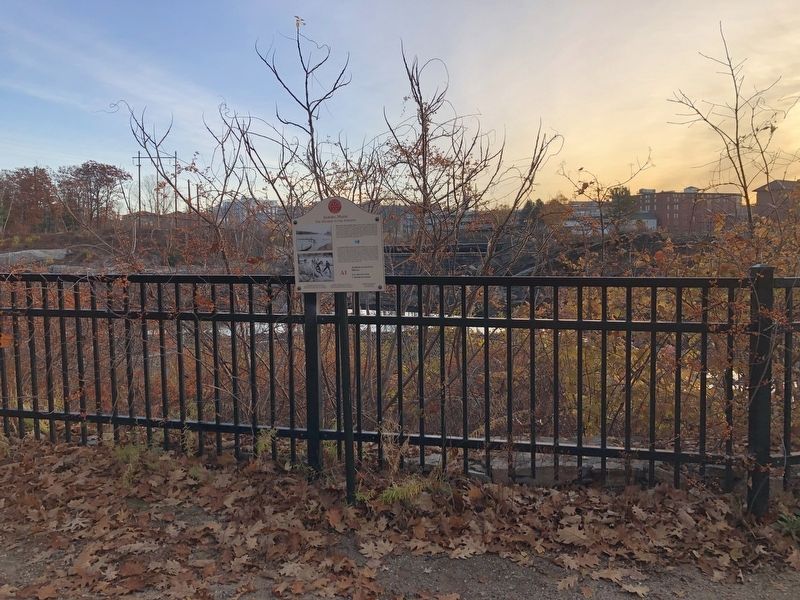
Androscoggin Log Drives / Les Draves Sur L'Androscoggin Marker
| 1 ► Maine, Androscoggin County, Auburn — A1 — Androscoggin Log Drives / Les Draves Sur L'Androscoggin — Auburn, Maine — The Museum in the Streets® — |
| On Auburn Riverwalk, 0.1 miles north of Great Falls Plaza, on the left when traveling east. | |||
| 2 ► Maine, Androscoggin County, Auburn — Map — Auburn, Maine — The Museum in the Streets — |
| On Main Street (Maine Route 136) 0.1 miles south of Court Street (U.S. 202), on the right when traveling north. | |||
| 3 ► Maine, Androscoggin County, Auburn — Map — Auburn, Maine — The Museum in the Streets — |
| On Auburn Riverwalk, 0.2 miles north of Court Street (U.S. 202), on the right when traveling north. | |||
| 4 ► Maine, Androscoggin County, Auburn — Bonney Park — |
| On Auburn Riverwalk just east of Main Street (Maine Route 136), in the median. | |||
| 5 ► Maine, Androscoggin County, Auburn — A10 — Wabanaki History / Les Wabanaquis — Auburn, Maine — The Museum in the Streets® — |
| On Auburn Riverwalk just east of Main Street (Maine Route 136), in the median. | |||
| 6 ► Maine, Androscoggin County, Lewiston — Map — Lewiston, Maine — The Museum in the Streets — |
| On Oxford Street just north of Beech Street, on the right when traveling north. | |||
| 7 ► Maine, Androscoggin County, Lewiston — Map — Lewiston, Maine — The Museum in the Streets — |
| On Lisbon Street (Maine Route 196) 0.1 miles south of Journal Alley, on the right when traveling north. | |||
| 8 ► Maine, Aroostook County, Madawaska — Acadian Landing Site — Acadian Cross Historic Shrine — National Register of Historic Places — |
| On Fournier Siding (Siding Road), 0.4 miles north of Main Street (U.S. 1). | |||
| 9 ► Maine, Aroostook County, Madawaska — Du Premier Débarquement des Acadiens àu Madawaska — The first landing of the Acadians in Madawaska — juin 1785 — |
| On Main Street (U.S. 1) just west of Fournier Siding, on the right when traveling west. | |||
| 10 ► Maine, Aroostook County, Madawaska — Genealogy, Massive French & Acadian Family Reunions — La généalogie. Ces grands rassemblements de familles acadiennes et françaises — |
| On Main Street (U.S. 1) just west of Fournier Siding, on the right when traveling west. | |||
| 11 ► Maine, Aroostook County, Madawaska — Territoire de Madawaska — |
| On Main Street (U.S. 1) just west of Fournier Siding, on the right when traveling west. | |||
| 12 ► Maine, Cumberland County, Brunswick — Site of Fort Andross and Fort George — |
| 13 ► Maine, Cumberland County, Portland, Downtown — County of Cumberland — |
| On Federal Street just east of Pearl Street, on the right when traveling east. | |||
| 14 ► Maine, Cumberland County, Portland, Downtown — In 1745 — |
| On Congress Street at Pearl Street, on the right when traveling north on Congress Street. | |||
| 15 ► Maine, Cumberland County, Portland, East Bayside — Eastern Cemetery — Chartered 1668 — |
| On Congress Street near Mountfort Street, on the right when traveling north. | |||
| 16 ► Maine, Cumberland County, Portland, East Bayside — Olde Saint Paul's Parish — Founded 1763 — |
| On Congress Street just north of Locust Street, on the right when traveling south. | |||
| 17 ► Maine, Cumberland County, Portland, East Bayside — The Site of Fort Loyal — |
| On Commercial Street / Thames Street at India Street, on the left when traveling north on Commercial Street / Thames Street. | |||
| 18 ► Maine, Cumberland County, Portland, East End — George Cleeves Memorial — |
| On Eastern Promenade at Congress Street, on the right when traveling west on Eastern Promenade. | |||
| 19 ► Maine, Cumberland County, Portland, East End — Welcome To Fort Sumner Park — |
| On North Street just south of Melbourne Street, on the right when traveling north. | |||
| 20 ► Maine, Cumberland County, Portland, Stroudwater — Stroudwater Burying Ground — |
| On Westbrook Street, 0.1 miles west of Congress Street (Maine Route 22), on the left when traveling west. | |||
| 21 ► Maine, Cumberland County, Portland, Waterfront District — Casco Bay's four thousand years of sustainable, stable productivity — |
| On Commercial Street (U.S. 1A) just south of Franklin Street (U.S. 1A), on the left when traveling south. | |||
| 22 ► Maine, Cumberland County, South Portland — Early Settlement — |
| 23 ► Maine, Cumberland County, South Portland — First Congregational Church of South Portland — |
| On Fort Road, on the left when traveling north. | |||
| 24 ► Maine, Hancock County, Bar Harbor — Ocean Highways — Acadia National Park — |
| On Paradise Hill Road, on the left when traveling south. | |||
| 25 ► Maine, Kennebec County, Augusta — Map — Augusta, Maine — The Museum in the Streets — |
| On Cony Street just west of Arsenal Street, on the left when traveling west. | |||
| 26 ► Maine, Kennebec County, Augusta — Birds and Fish of the Kennebec — |
| On Cony Street at the East Side of the Kennebec River Bridge, on the left when traveling west on Cony Street. | |||
| 27 ► Maine, Kennebec County, Augusta — Cushnoc Trading Post — 1628 - 1661 — |
| 28 ► Maine, Kennebec County, Augusta — 1 — Cushnoc Trading Post / Le Comptoir Commercial De Cushnoc — Augusta, Maine — The Museum in the Streets® — |
| Near Cony Street. | |||
| 29 ► Maine, Kennebec County, Augusta — 2 — Gunshots Reverberate on the Kennebec / Des coups de fusil résonnent sur le fleuve Kennebec — Augusta, Maine — The Museum in the Streets® — |
| 30 ► Maine, Kennebec County, Augusta — 3 — Old Fort Western / Le vieux Fort Western — Augusta, Maine — The Museum in the Streets® — |
| On Cony Street, on the left when traveling west. | |||
| 31 ► Maine, Kennebec County, Augusta — Old Fort Western on the Kennebec — A National Historic Landmark — |
| On Water Street north of Oak Street, on the right when traveling north. | |||
| 32 ► Maine, Kennebec County, Winslow — Fort Halifax — Oldest Blockhouse in the United States — |
| Near Halifax Street (U.S. 201) 0.2 miles north of China Road (Maine Route 137), on the left when traveling north. | |||
| 33 ► Maine, Kennebec County, Winslow — Fort Halifax Park — |
| Near Halifax Street (U.S. 201) 0.2 miles north of China Road (Maine Route 137). | |||
| 34 ► Maine, Knox County, Thomaston — The Voyage of Captain George Waymouth — |
| On City Avenue / Main Street, on the left when traveling west. | |||
| 35 ► Maine, Lincoln County, Pemaquid — John Cogswell and Family — |
| Near Bristol Road. | |||
| 36 ► Maine, Lincoln County, Pemaquid — Ralph Blaisdell and Family — |
| Near Bristol Road. | |||
| 37 ► Maine, Sagadahoc County, Phippsburg — Sites of Forts in this Area — |
| 38 ► Maine, Waldo County, Prospect — Conflict and Prosperity on the River — |
| 39 ► Maine, Waldo County, Prospect — Pemtegwacook — |
| 40 ► Maine, Waldo County, Searsport — Liberty Tree Memorial — |
| On Main Street (U.S. 1) at Elm Street, on the right when traveling east on Main Street. | |||
| 41 ► Maine, Washington County, Calais — Building A Community / Tout à bâtir — |
| 42 ► Maine, Washington County, Calais — Imagining the Settlement / La colonie telle qu'on l'imagine — |
| 43 ► Maine, Washington County, Calais — Lessons Learned / Leçons durement apprises — |
| 44 ► Maine, Washington County, Calais — Saint Croix Island — |
| 45 ► Maine, Washington County, Calais — Settling on Saint Croix Island / Colonisation de l'île Sainte-Croix — |
| 46 ► Maine, Washington County, Calais — Strangers Offshore / Étrangers du grand large — |
| 47 ► Maine, Washington County, Calais — Trapped For The Winter / Prisonniers de l'hiver — |
| 48 ► Maine, Washington County, Calais — Welcome to Saint Croix Island International Historic Site / An Enduring Legacy — Bienvenue au lieu historique international de l'île-Sainte-Croix / Un précieux héritage — |
| 49 ► Maine, Washington County, Columbia Falls — Early Settlers of the Pleasant River — American Revolution Bicentennial 1776-1976 — |
| On Main Street at the Pleasant River, on the left when traveling east on Main Street. | |||
| 50 ► Maine, Washington County, Jonesboro — Lumber Mill — |
| On Harrington Toad (U.S. 1) at Station Road, on the right when traveling north on Harrington Toad. | |||
| 51 ► Maine, Washington County, Machias — First Permanent English Settlement in Machias Bay — 1763 - 1904 — |
| On Main Street (Maine Route 192) at Free Street, on the left when traveling west on Main Street. | |||
| 52 ► Maine, York County, Biddeford — A Stone Fort — |
| On Main Street (Maine Route 9) at Emery Street, on the right when traveling west on Main Street. | |||
| 53 ► Maine, York County, Biddeford — Map — Biddeford, Maine — The Museum in the Streets — |
| On Water Street at Sullivan Street, on the right when traveling east on Water Street. | |||
| 54 ► Maine, York County, Biddeford — Map — Biddeford, Maine — The Museum in the Streets — |
| On Main Street at Adams Street, on the left when traveling west on Main Street. | |||
| 55 ► Maine, York County, Biddeford — Civil War Memorial — |
| On Adams Street at South Street, on the right when traveling south on Adams Street. | |||
| 56 ► Maine, York County, Biddeford — 4 — Fort Saco in 1693 / Le Fort Saco en 1693 — Biddeford, Maine — The Museum in the Streets® — |
| On Main Street (Maine Route 9) at Emery Street, on the right when traveling west on Main Street. | |||
| 57 ► Maine, York County, Biddeford — 2 — Samuel Peirson's House / La Maison Samuel Peirson — Biddeford, Maine — The Museum in the Streets® — |
| On Water Street at Pierson's Lane, on the right when traveling east on Water Street. | |||
| 58 ► Maine, York County, Biddeford — 3 — The James Sullivan Home / Le Résidence de James Sullivan — Biddeford, Maine — The Museum in the Streets® — |
| On Water Street at Main Street (Maine Route 9), on the left when traveling west on Water Street. | |||
| 59 ► Maine, York County, Kennebunk — Map — Kennebunk, Maine — The Museum in the Streets — |
| On Main Street (Route 1) at Water Street, on the left when traveling west on Main Street. | |||
| 60 ► Maine, York County, Kennebunk — Map — Kennebunk, Maine — The Museum in the Streets — |
| On Summer Street (Maine Route 9A/35) at Elm Street, on the right when traveling east on Summer Street. | |||
| 61 ► Maine, York County, Kennebunk — 23 — The Butland Shipyard and Cemetery / Le chantier naval Butland et le Cimetière — Kennebunk, Maine — The Museum in the Streets® — |
| Near Friendly Pines Lane south of Constitution Road, on the right when traveling east. | |||
| 62 ► Maine, York County, Kennebunk — 16 — The James Hubbard Home / La demeure James Hubbard — Kennebunk, Maine — The Museum in the Streets® — |
| On Summer Street (Maine Route 9A/35) at Plummer Lane, on the right when traveling east on Summer Street. | |||
| 63 ► Maine, York County, Kennebunk — 24 — The Larrabee Garrison / Le Fort Larrabee — Kennebunk, Maine — The Museum in the Streets® — |
| Near Oceanview Road, 0.1 miles west of Florence Circle, on the right when traveling west. | |||
| 64 ► Maine, York County, Kennebunk — 2 — The Mousam River / Le Fleuve Mousam — Kennebunk, ME — The Museum in the Streets — |
| On Water Street just south of York Street (U.S. 1), on the right when traveling south. | |||
| 65 ► Maine, York County, Kittery — Province of Maine Marker — |
| On US 1 South, on the left when traveling south. | |||
| 66 ► Maine, York County, Old Orchard Beach — 1 — Staples Inn — Old Orchard Beach, Maine — The Museum in the Streets — |
| On Portland Avenue at Imperial Street, on the right when traveling south on Portland Avenue. | |||
| 67 ► Maine, York County, Wells — Farmhouse — Who has stayed in this big house? — Historic Laudholm Farm — |
| On Skinner Mill Road north of Laudholm Farm Road, on the right when traveling north. | |||
| 68 ► Maine, York County, Wells — Laudholm Farm: The foundation of the Wells Reserve — |
| Near Skinner Mill Road north of Laudholm Farm Road, on the right when traveling north. | |||
| 69 ► Maine, York County, York — Sewall's Bridge — First Pile Bridge in America — |
| On Lindsay Road at Organug Road on Lindsay Road. | |||