On West Appion Way at Snyder Avenue, on the right when traveling west on West Appion Way.
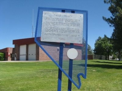
Centrally located between the first Nevada settlement at Genoa and the precious metal deposits of the Comstock Lode, Eagle Valley, site of present Carson City, was a vital link in land communications.
One of the key California emigrant routes, . . . — — Map (db m20802) HM
On Kings Canyon Road, 0.1 miles south of Cooper Springs Court, on the right when traveling south.
Originally a Washoe Indian trail, Kings Canyon served as a gateway to Lake Tahoe following the gold rush to California. Eagle Station was established in 1851 near the mouth of the canyon, Dr. Benjamin King built his ranch the next year, and others . . . — — Map (db m163164) HM
"Continue descending but passing over sandy hills on the south of the road [south of Hwy 50]... Good grass and water 2 miles [to Clear Creek]" - James H. Compton, Sep 20, 1853 — — Map (db m228421) HM
On North Carson Street (Lincoln Highway) (Business U.S. 395) at West Robinson Street, on the left when traveling north on North Carson Street (Lincoln Highway).
Now:
U.S. 50 • San Francisco to Salt Lake City
U.S. 30 • Salt Lake City to Philadelphia
U.S. 1 • Philadelphia to New York City — — Map (db m128552) HM
On North Carson Street (Lincoln Highway) (Business U.S. 395) north of West Robinson Street, on the left when traveling north.
Honour to the Nevada men who were riders in the July 19 to 28, 1960 Centennial Reenactment of the Pony Express
Monument Erected by the
Pony Express Club of Nevada
National Pony Express Centennial Association
Dwight D. . . . — — Map (db m128554) HM
On U.S. 50, 23 miles north of Nevada Route 722, on the right when traveling north.
Replacement Marker
Abundant grass and brush found near springs and intermittent streams in Edwards Creek Valley were important ecological areas for Native Americans. Shoshone Indians wandered seasonally to gather wild seeds and small . . . — — Map (db m67146) HM
Near U.S. 50, 22 miles west of Nevada Route 722, on the right when traveling west.
In 1861, the rocks composing the walls of this stage station and freighter stop were in neat rows and roofed with bundles of willow. It was one part of "Stagecoach King" John Butterfield's Overland Mail & Stage Company Road Systems, which at the . . . — — Map (db m67145) HM
On U.S. 50, 11 miles north of Nevada Route 722, on the left when traveling north.
Replacement Marker
Rock Creek was an important stagecoach stop on the Overland Mail Stage Company's historic line along the Simpson route between Salt Lake City and Genoa, Nevada, which was operated by John Butterfield (1861-1866) and . . . — — Map (db m67144) HM
On U.S. 50 at milepost 46.5, on the right when traveling west.
Sand Mountain, dominating the Salt Wells Basin, is a prominent landmark in Nevada's early history. The Northern Piute know it as Kwazi, the name of the snake that inhabits the dune, its backbone forming the crest of the mountain. Captain James . . . — — Map (db m69653) HM
Two small rooms at the southwest end of the station were originally one large room and shared a common wood floor. The wall which now separates the two rooms was built on top of the floor some time later. The center room was probably used for . . . — — Map (db m127117) HM
Near Lincoln Avenue (U.S. 50) 25 miles east of Maine Street (U.S. 95), on the left when traveling east.
"The Mail Must Go Through"
From April 3, 1860 to November 21, 1861, mail was delivered by the Pony Express between St. Joseph, Missouri and Sacramento, California. It was a relay system between 190 stations along the route. A fresh horse was . . . — — Map (db m142572) HM
Near U.S. 50, 11 miles north of Nevada Route 722, on the right when traveling north.
Competing with time, distance, harsh climate, and hostile Indians, the Pony Express carried important communications from the East and the West across 2,000 miles in only 10 days.
The "Pony," as it was called, is an outstanding . . . — — Map (db m67142) HM
On U.S. 95, 0.9 miles south of Interstate 80, on the left when traveling south.
"Long before sunrise our teams were on the trail marching forward on the desert. Very little to note save the dust & brightness of the glittering sand. Now & then a grave, little donage & dead stock." - John Clark of Virginia, Aug 21, 1852 — — Map (db m149414) HM
Near U.S. 95 at Interstate 80, on the right when traveling south.
Whichever direction your travels take you, you're going to have a similar experience to what the California-bound emigrants had. You're going to see the same country, except for the towns and the ranch meadows. The big difference, though, is that . . . — — Map (db m67359) HM
Near U.S. 95 at Interstate 80, on the right when traveling south.
The 40 Mile Desert, beginning here, is a barren stretch of waterless alkali wasteland. It was the most dreaded section of the California Emigrant Trail. If possible, it was traveled by night because of the great heat.
The route was first . . . — — Map (db m67348) HM
Near U.S. 95 at Interstate 80, on the right when traveling south.
Look at the barren country south of here just beyond this Rest Stop. This is the Forty-Mile Desert--a barren stretch of waterless alkali wasteland. It was the single-most dreaded section of the entire California Trail from the banks of the Missouri . . . — — Map (db m67357) HM
On Nevada Route 50 west of Route 361, on the right when traveling west.
"We left camp at 6 this morning passed through Middle and West Gate This kanyon that these passes or gates are in is the most beautiful one we passed through yet we have not traveled only 15 miles to day." - Elizabeth Duncan Oct 4, 1867 . . . — — Map (db m155193) HM
Near Nevada Route 361 south of Lincoln Highway (U.S. 50), on the right when traveling south.
Middlegate was named in 1850 by James Simson as he mapped the route for the Overland Stage Company. In his journal he writes that he thought the cuts in the mountains looked like 'gates' so he named each cut Westgate, Middlegate, and Eastgate to . . . — — Map (db m89452) HM
On Pahrump Valley Highway (Nevada Route 160 at milepost 17), on the left when traveling west.
This portion of the Old Spanish Trail was discovered in January, 1830, by Antonio Armijo during his first trip from Santa Fe to Los Angeles. The spring just north of this marker provided excellent water and fed meadows of luxuriant grass for draft . . . — — Map (db m213760) HM
On Village Boulevard at Diamond Street, on the left when traveling east on Village Boulevard.
Stretching for 130 miles across Clark County, this historic horse trail became Nevada's first route of commerce in 1829 when trade was initiated between Santa Fe and Los Angles. The trail was later used by the wagons of the "49ers" and Mormon . . . — — Map (db m29218) HM
On Canyon Road, 0.6 miles north of Industrial Road, on the right when traveling north.
Originally a Native American trail, Bootleg Canyon – also called the Hooch Highway was a well-known backdoor into Boulder City and the Hoover Dam construction site during prohibition. Bootleggers brewed illegal alcohol in stills hidden in . . . — — Map (db m29324) HM
On East Lake Mead Drive (Nevada Route 564) 0.1 miles south of Pyrenees Court, on the left when traveling north.
On January 8, 1830, the first pack train to pass from Santa Fe, New Mexico to Los Angles crossed Las Vegas Valley. Antonio Armijo, a merchant in Santa Fe, commanded the train and roughly sixty men. The successful completion of the journey opened a . . . — — Map (db m29247) HM
On Arrowhead Trail Road, 0.1 miles south of Mission Drive, on the right when traveling south.
The name, "Arrowhead Trail" likely originated from the former San Pedro, Los Angeles, and Salt Lake Railroad's logo, an arrowhead. Prior to 1850, New Mexican trading caravans from Santa Fe en route to Los Angeles used this segment of the Old Spanish . . . — — Map (db m212309) HM
The first automobile road to connect Los Angeles and Las Vegas was the Arrowhead Trail Highway. Planned, promoted and built beginning in the second decade of the twentieth century, this was one of the named interstate highways of the Good Roads . . . — — Map (db m103380) HM
On East Ogden Avenue at North Casino Center Boulevard (Nevada Route 602), on the right when traveling north on East Ogden Avenue.
Opened in 1937 at 5th Street (Las Vegas Boulevard) and Garces, the Nevada Motel was the first auto court in Las Vegas to identify itself as a "motel". In its last years in business it operated in conjunction with the Sweetheart Wedding Chapel next . . . — — Map (db m64028) HM
In 1843-1844 Capt. John C. Fremont explored the West. He named the Old Spanish Trail and the Great Basin - a vast region whose rivers drained inland, not to the sea. He first trekked to Oregon, then south through California, then back eastward . . . — — Map (db m241714) HM
Spanish Trail caravans wound between watering holes across the Mojave Desert. Mormon wagon trains followed much of the Spanish Trail, but since wagons could haul water and feed, this opened up short-cuts. The railroad broke new ground by building . . . — — Map (db m241717) HM
For centuries before the Spanish arrived in the Southwest, native peoples traded goods across the network of routes that became the Old Spanish Trail. The Spanish called all the first people "Indians", later identifying them as Pueblos, Apaches, . . . — — Map (db m241719) HM
For more than 150 years this ten-acre parcel preserved the ruts of the Old Spanish Trail between Las Vegas Springs and Mountain Pass.
When Spain owned the Southwest, Santa Fe and Los Angeles were the only two centers of government and . . . — — Map (db m241707) HM
On South Cimarron Road, on the right when traveling north.
Spanish Trail routes crossed deserts and mountain ranges far from Mexican settlements and government authorities. Horses and mules were in short supply to conduct the Santa Fe-Missouri trade opened in 1821 by Americans from Missouri. Outlaws and . . . — — Map (db m241725) HM
The most dangerous section of the Old Spanish Trail crossed the Mojave Desert; it is extremely hot in the summer and without major rivers running through it. Springs and the Amargosa River (which drains into Death Valley) made it possible to . . . — — Map (db m241722) HM
During the Mexican War, Mormon men served as a special battalion in the U.S. Army. They left lowa in July 1846 and marched through the Southwest to San Diego, building roads and American outposts along the way. They fought the Battle of San . . . — — Map (db m241721) HM
Spanish Trail travelers through Clark County followed changing routes as they learned shortcuts and new sources of water, but the trail always connected watering holes. Spanish Trail pioneer Antonio Armijo and early fur trappers depended on the . . . — — Map (db m241712) HM
On East 1st North at North Sandhill Boulevard, on the left when traveling east on East 1st North.
Abram Woodbury, one of the first permanent settlers in Mesquite, built a new home here circa 1919 and opened a mercantile store. He also built overnight cabins for tourists and operated Mesquite's first gas station. Abram purchased gasoline by the . . . — — Map (db m46762) HM
Stretching for 130 miles across Clark County, this historic horse trail became Nevada’s first route of commerce in 1829 when trade was initiated between Santa Fe and Los Angeles. The trail was later used by the wagons of the “49ers” and . . . — — Map (db m1414) HM
On Mesquite Boulevard, on the right when traveling east.
It was under William Abbott’s supervision that Mesquite was founded on a firm foundation. —Howard Pulsipher, Mesquite Pioneer.
At the age of eight, William journeyed from his birthplace in Ogden, Utah, to Bunkervile, . . . — — Map (db m1447) HM
On Glendale Boulevard, on the left when traveling east.
About 1922, J. H. Nicolaides overheard two state highway engineers talking about the new route Arrowhead Trail Highway would take in southern Nevada. Realizing a service station would be necessary at the crossing the road would make over the Muddy . . . — — Map (db m114821) HM
On Highway 160 west of Benedict Drive, on the right when traveling west.
Stretching for 130 miles across Clark County, this historic horse trail became Nevada's first route of commerce in 1829 when trade was initiated between Santa Fe and Los Angeles. The trail was later used by the wagons of the "49'ers" and Mormon . . . — — Map (db m89437) HM
Las Vegans claimed to be the originators of this all-weather route between Los Angels and Salt Lake City. From the beginning, the Arrowhead Trail was a "grass roots" effort including promotion by various chambers of commerce and volunteer . . . — — Map (db m78741) HM
On Valley of Fire Highway, on the right when traveling east.
John J. Clark was born in Canada in 1844.
He enlisted as a private in Company F of
the New York Infantry in 1862, serving
actively in the Civil War. After being shot
in the hand and contracting typhoid
fever, he was honorably discharged
6 . . . — — Map (db m32812) HM
On Mountain Vista Street, 0.1 miles south of East Russell Road, on the left when traveling south.
This historical marker commemorates the valor and service of pioneer scout Rafael Rivera, the first Caucasian of record to view and traverse Las Vegas valley. Scouting for Antonia Armijo's sixty man trading party from Abiquiu, N.M. in January 1830. . . . — — Map (db m29167) HM
On Lincoln Highway (U.S. 50) west of Kings Canyon Road, on the right when traveling west.
“A gradual ascent [rough road], the latter portion in a ravine [of Clear Creek], to the top of a ridge [at Spooner Summit].”
- William Bartlett [Bartlett’s Guide], Aug 13, 1853
Guidebook Available
Trails West Inc. P.O. Box 12045 Reno . . . — — Map (db m224084) HM
On Lincoln Highway (U.S. 50 at milepost 13) west of Kings Canyon Road, on the right when traveling west.
Over the years, this canyon was used for lumbering, cattle and sheep grazing, as well as for its water resources. Today, it is part of Lake Tahoe Nevada State Parks’ Marlette-Hobart Backcountry Management Area.
With over a million visitors each . . . — — Map (db m229311) HM
On Lincoln Highway (U.S. 50 at milepost 13) west of Kings Canyon Road, on the right when traveling west.
This beautiful trail, with spectacular views of Lake Tahoe's high country, follows the route of an old flume and tunnel system that carried water from Marlette Lake to Virginia City. Originally built in 1877, the tunnel eventually collapsed and the . . . — — Map (db m229309) HM
On Centerville Lane (Nevada Route 756) at Nevada Highway 88, on the left when traveling west on Centerville Lane.
This was the name given to the present Centerville Lane on the 22nd day of October 1894 when it was declared a public road by order of the county commissioners. Opening of the road was made contingent on the willingness of ranchers along the section . . . — — Map (db m10801) HM
On Foothill Road (Nevada Route 206) at Old Kingsbury Grade Road, on the right when traveling south on Foothill Road.
Dagget Pass Trail, named for C.D. Dagget, who acquired land at its foot in 1854, was earlier called Georgetown Trail. Replaced in 1860 by the wagon road built by Kingsbury and McDonald, for which they received a Territorial Franchise in 1861, it . . . — — Map (db m21892) HM
On Genoa Lane at Main Street, on the right when traveling west on Genoa Lane.
Whichever direction your travels take you, you’re going to have a similar experience to what the California-bound immigrants had. You’re going to see the same country, except for the towns and ranch meadows. The big difference, though, is that . . . — — Map (db m98183) HM
Near Foothill Road, on the right when traveling north.
"We passed around a barren portion of the mountain, where there gushed from the base... almost a thousand springs of hot water in half a mile,... The springs form a hot water lake all along their course." - William R. Rothwell, Aug 18, 1850 — — Map (db m99871) HM
Near Main Street, on the right when traveling north.
"At the... foot of the mountains, the Mormons... have established a trading post.... Passing on from this place, as fast as we could,... to save what money we had, we continued up Carson Valley" - Edward Patterson, Jul 11, 1850 — — Map (db m99870) HM
On Jacks Valley Road/Main Street (Nevada Route 206), on the right when traveling south.
[Front of Marker:]
Genoa
Original Home Station
April 3, 1860 – Aug. 30, 1860
Relay Station
Sep. 1, 1860 – Nov. 20, 1861
By
Town of Genoa
Genoa Volunteer Fire Department
Carson Valley Historical Society . . . — — Map (db m20663) HM
On Genoa Lane at Main Street, on the right when traveling west on Genoa Lane.
You’re now standing at the western edge of the Great Basin. If you were an emigrant headed to California, you would have entered the Great Basin 450 miles back along the trail in southern Idaho, or 500 miles back in Salt Lake City if you had taken . . . — — Map (db m98142) HM
On Main Street north of Genoa Lane (Nevada Route 206), on the right when traveling north.
What is this place?
Mormon Station State Historic Park is the site of a California Trail trading post. The John Reese party established the post in 1851 as a business venture. Travelers passing through often referred to Reese’s post as . . . — — Map (db m229108) HM
Near Main Street north of Genoa Lane (Nevada Route 206), on the right when traveling north.
The trading post at Mormon Station was an important supply stop for gold seekers on their way to California. Heading through Nevada, travelers followed the Humboldt River until it reached its end at the Humboldt Sink. What came next was a brutal 40 . . . — — Map (db m229306) HM
Near Main Street north of Genoa Lane (Nevada Route 206), on the right when traveling north.
This type of wagon is known as a “prairie schooner.” Designed to be as light and agile as possible, prairie schooners were the wagon of choice for emigrants traveling across the California Trail. The name stems from the white canvas covers giving . . . — — Map (db m229304) HM
Near Main Street north of Genoa Lane (Nevada Route 206), on the right when traveling north.
At trading stations and other remote settlements throughout the West, nearly all goods had to be brought in from elsewhere. This need for supplies led to the development of the freight wagon. Freight wagons were built for the sole purpose of hauling . . . — — Map (db m229303) HM
On US Highway 50 (U.S. 50) near Lake Parkway, on the left when traveling east.
(back) The Pony Express Started on April 3, 1860. The original route from Johnson Pass (Echo Summit) to Genoa went through Hope Valley to Woodfords Station.
On May 14, 1860 the new toll road over Daggett Pass opened to foot and horse . . . — — Map (db m432) HM
On Esmeralda Avenue at 5th Street on Esmeralda Avenue.
Built in 1909 by A.F. Neidt, a cement contractor who also poured most of the early sidewalks in Minden. The home was later occupied by Annie Hickey Raycraft, who offered room and board for "unmarried lady" school teachers. — — Map (db m23833) HM
On U.S. 395, 0.4 miles north of Stockyard Road, on the right when traveling north.
William H. Boyd was granted a Utah Territory Franchise December 19, 1861, to provide a road to join Genoa to the Cradlebaugh Toll Road, the trunkline to the mining district of Esmeralda. Boyd's Toll Road is still visible to the northwest and . . . — — Map (db m150168) HM
On Esmeralda Avenue east of Fourth Street, on the right when traveling north.
Ground was broken for the garage in 1911, with structure additions in 1917 and 1927. The initials stand for the owner Clarence Oliver Dangberg. Later, under the ownership of the Fred "Brick" Hellwinkel family, the C.O.D. garage was the oldest . . . — — Map (db m23514) HM
"We soon entered the lower end of Carson Valley. The steep mountains on our right, are thickly covered with pines... on the east side of the valley, the mountains present no green thing; all is naked and dreary." - Franklin Langworthy, Oct. 9, 1850 — — Map (db m99867) HM
On Esmeralda Avenue at Fourth Street, on the right when traveling north on Esmeralda Avenue.
First opened in 1910 by Chris Christoffersen. This was the first store in Minden of its type, selling dry goods, clothing, shoes, and cameras. Later, the store was operated by Lin Blondin and Ken Watson. In time, it became known as Town and Country . . . — — Map (db m23578) HM
Near Foothill Road, on the right when traveling south.
"The trail, on leaving camp, entered a strip of upland, covered with wild sage and brush and through which run several mountain streams of much beauty." - Silas Newcomb, Aug 28, 1850 — — Map (db m99819) HM
On The Lincoln Highway (U.S. 50 at milepost 3.1), on the left when traveling west.
Toll Roads
Johnson's Cutoff, also called the Carson Ridge Emigrant Road, passed over Spooner Summit and down Clear Creek from 1852 through 1854, but was rugged and little used. With discovery of the Comstock Lode in 1859, Spooner Summit . . . — — Map (db m69714) HM
On Chestnut Street, on the right when traveling east.
"We have to cross the river four times... on each side of you there is a perpendicular wall of vast rock... overhanging the road so one has a feeling very near bordering on fear as he passes under those precipices" -- Lewis Beers, Aug 3, 1852 — — Map (db m149731) HM
On Tomera Road near Nevada Route 278, on the right when traveling west.
“The trail or road… ascends a considerable hill 1/3 mile ahead of us… the water here is cool, but too alkaline to be agreeable. Hot Springs in the river-bank, sulphur, &c.” —
J. Goldborough Bruff, Sep 7, 1849 . . . — — Map (db m81179) HM
On Old Highway 40 (Chestnut Street), on the left when traveling north.
In December 1828, Peter Skene Ogden and his trapping brigade (Hudson's Bay Company's Fifth Snake Country Expedition) were the first European Americans to enter here. Joseph Paul, one of Ogden's trappers, died nearby - the first white man to die and . . . — — Map (db m136726) HM
On Tomera Road near Nevada Route 278, on the right when traveling west.
By the time emigrants reached this spot, they had enjoyed fairly good traveling for the past ten days or so, as they followed the Humboldt River road. But here they faced their first big physical challenge along the route. If they stayed along the . . . — — Map (db m81204) HM
Near Interstate 80 at milepost 292, on the right when traveling west.
Whichever direction your travels take you, you're going to have a similar experience to what the California-bound emigrants had. You're going to see the same country, except for the towns and the ranch meadows. The big difference, though, is that . . . — — Map (db m67507) HM
On Idaho Street, 0.1 miles north of 14th Street, on the left when traveling north.
Whichever direction your travels take you, you're going to have a similar experience to what the California-bound emigrants had. You're going to see the same country, except for the towns and the ranch meadows. The big difference, though, is that . . . — — Map (db m146802) HM
Near Interstate 80 at milepost 292, on the right when traveling west.
About two miles southwest of this marker, the Greenhorn Cutoff ascended and wound through the hills for about twelve miles to avoid river crossings in Carlin Canyon. — — Map (db m70353) HM
On Idaho Street, 0.1 miles north of 14th Street, on the left when traveling north.
Centuries of water runoff from mountain peaks cut channels through Nevada's mountain formations and deserts, creating river corridors that support a variety of wildlife and plants. One such river is the Humboldt, which flows across most of northern . . . — — Map (db m146801) HM
Near Interstate 80 at milepost 292, on the right when traveling east.
This site is approximately 2½ miles from the Humboldt wagon trail. Hoppe-Lienhard traveled west with the Harlan-Young wagon train in 1847 to Fort Sutter. History reveals this party was part of the group which was responsible for the California . . . — — Map (db m67461) HM
Near Interstate 80 at milepost 292, on the right when traveling west.
California Trail ruts and swales wind across Northern Nevada some touched only by the forces of nature since they were made by emigrant wagon trains on their way west in the mid 1800s.
Many of these irreplaceable historic trail segments lie on . . . — — Map (db m67505) HM
On Commercial Street at 7th Street on Commercial Street.
During the 1800's this site was used as a bivouack-camp area for the "Sagebrush Clippers." These wagons served the mining districts of the area almost exclusively. The name of this colorful area was derived from the Missouri Mule, a cousin of the . . . — — Map (db m105208) HM
Near Interstate 80 at milepost 292, on the right when traveling west.
You are at the entrance to The National California Emigrant Trail Interpretive Center. The purpose of the center is to gather and display historical knowledge about the emigrants who made the trek to California in the 1840s, 1850s, and 1860s. . . . — — Map (db m67509) HM
Near Interstate 80 at milepost 292, on the right when traveling west.
Across the valley you can see the canyon of the South Fork River, a major tributary to the Humboldt River. This portal is also the western end of the infamous Hastings Cutoff, which rejoined the main California Trail not far from the California . . . — — Map (db m67506) HM
Near Interstate 80 at milepost 292, on the right when traveling west.
The California Emigrant Trail extended approximately 2,000 miles from the Missouri River to California. Today you are standing on a segment of the trail that followed the Humboldt River for about 280 miles across northern Nevada. It was the only . . . — — Map (db m67508) HM
Near Interstate 80 at milepost 292, on the right when traveling east.
Across the Humboldt Valley southward from this point a deeply incised canyon is seen opening into the valley. Through that canyon along the South Fork of the Humboldt ran the disaster-laden route called the Hastings Cutoff. It joined the . . . — — Map (db m67460) HM
"We had to descend a bad hill to get down to the creek, where we nooned near some well springs." -- Byron McKinstry, Aug 10, 1850
Guidebook available
Trails West Inc, P.O. Box 12045 Reno NV 89510 — — Map (db m138454) HM
On Old US 40 at Union Pacific Railroad Overpass, on the right when traveling west on Old US 40.
These springs, seen as marshy spots and small ponds of water in the meadows here, are the Humboldt Wells, a historic oasis on the California Emigrant Trail. Here, during the period 1845–1870, hundreds of covered wagons each year rested and . . . — — Map (db m1373) HM
Near Wendover Boulevard west of North Gene L. Jones Way, on the right when traveling west.
In 1912, roads were dirt, bumpy and dusty in dry weather; impassable in wet weather. Asphalt and concrete roads were yet to come. To get from coast-to-coast, it was much easier to take the train. The Lincoln Highway Association conceived the first . . . — — Map (db m131448) HM
On Pilot Road north of Interstate 80, on the right when traveling north.
The high, symmetrically shaped mountain seen rising to the north is Pilot Peak. In the period 1845-1850, it was a famous landmark and symbol of hope and relief to the Reed-Donner party and all other wagon train pioneers who traveled the 70-odd . . . — — Map (db m67544) HM
Near Wendover Boulevard west of North Gene L. Jones Way, on the right when traveling west.
The Victory Highway monument is a representation of the earlier bronze eagle markers of the 1920s. Original eagle markers were to be located at each county line with a plaque dedicated to the sons and daughters who served their country in World War . . . — — Map (db m131450) HM
Near Pilot Road, 0.2 miles north of Interstate 80, on the right when traveling north.
The Bidwell-Bartleson wagon train was the first emigrant party to see Pilot Peak in 1841. Four years later, Captain John c. Fremont also saw this distinctive landmark, but from the Cedar Range in Utah - some 75 miles away. He wanted to establish a . . . — — Map (db m67545) HM
On Wendover Boulevard, 0.5 miles west of U.S. 93, in the median.
Wendover Will has been greeting travelers to Wendover since 1952. His name comes from the founder of the State Line Hotel & Casino, Mr. William “Bill” Smith, who started the State Line Service, a cobble stone service station, on the . . . — — Map (db m75211) HM
On Veterans Memorial Hwy (U.S. 95) at 4th Street, on the right when traveling east on Veterans Memorial Hwy.
1908 - West Side Elementary School.
1910 - Manual training & domestic science classes.
1917-1920 - Goldfield School of Mines.
1931 - Was used by Novackclub Inc. as a golf club factory.
1945 - The building & adjacent land was . . . — — Map (db m115936) HM
Near Interstate 80 at milepost 258, on the right when traveling east.
You have arrived at this place by driving east on Interstate Highway 80. Did you know that since entering Nevada you have been traveling along the route of the historic California Trail? From 1843 to 1869, an estimated 250,000 people made the trek . . . — — Map (db m67441) HM
Near Interstate 80 at milepost 258, on the right when traveling east.
Whichever direction your travels take you, you're going to have a similar experience to what the California-bound emigrants had. You're going to see the same country, except for the towns and the ranch meadows. The big difference, though, is that . . . — — Map (db m67440) HM
Near Interstate 80 at milepost 258, on the right when traveling east.
7 miles southeast of here was a favorite pioneer crossing of the Humboldt River, Gravely Ford. Campsite of the Donner Party, here occurred the Snyder-Reed fight, as Snyder lashed at Reed he missed and hit Reed's wife. Reed then killed Snyder. Reed . . . — — Map (db m67443) HM
Looking at the broad valley of the Humboldt River before you, close your eyes and imagine how it would have been in the mid-1800s. Instead of the sounds of traffic on I-80, you can almost hear the creak of wagon wheels. You might hear the sounds of . . . — — Map (db m81206) HM
Near Interstate 80 at milepost 187, on the right when traveling west.
Whichever direction your travels take you, you're going to have a similar experience to what the California-bound emigrants had. You're going to see the same country, except for the towns and the ranch meadows. The big difference, though, is that . . . — — Map (db m67431) HM
Near Interstate 80 at milepost 187, on the right when traveling west.
"The water is warm and tastes but little better than soap suds. We use acid in all the water we drink, by that means we manage to get along, although we are all anxious to get off this river" - Ephriam Brandiff, Aug. 16, 1852 — — Map (db m70354) HM
Near West Winnemucca Boulevard, 173 miles Interstate 80.
"The road still continues on the south side of the river, there is also one on the north side and I believe it is the old one. The one on the south side is said to be the best." - Joseph Middleton, Sep 18, 1849
Guidebook available
Trails . . . — — Map (db m138455) HM
On Melarkey Street (U.S. 95) at W. Winnemucca Boulevard (Nevada Route 289), on the right when traveling north on Melarkey Street.
"Saw in this distance a flag flying denoting a trading post, rode over to it but found the most they had to sell was very poor whiskey. ... These traders get a great price for everything they sell." - Henry S. Anable, Aug. 25, 1852 — — Map (db m70355) HM
Near South Bridge Street just north of West Fifth Street, on the right when traveling north.
Dedicated on the Pilgrimage to ‘Mucca on 3 Rabia I, 1380 A.H. (Mohammedan Calendar). Brought by caravan from the sea at Crescent City, California, to dedicate the opening of the new trade route from Winnemucca to the sea and to affirm the . . . — — Map (db m170925) HM
On Museum Avenue near Maple Avenue, on the left when traveling west.
Between 1841 and 1869, up to 250,000 emigrants followed the California Trail along the Humboldt River to California. in 1846, the Donner Party traveled along this trail and Donner Party teamster, John Snyder was killed in a dispute with wagon master . . . — — Map (db m141453) HM
155 entries matched your criteria. The first 100 are listed above. The final 55 ⊳