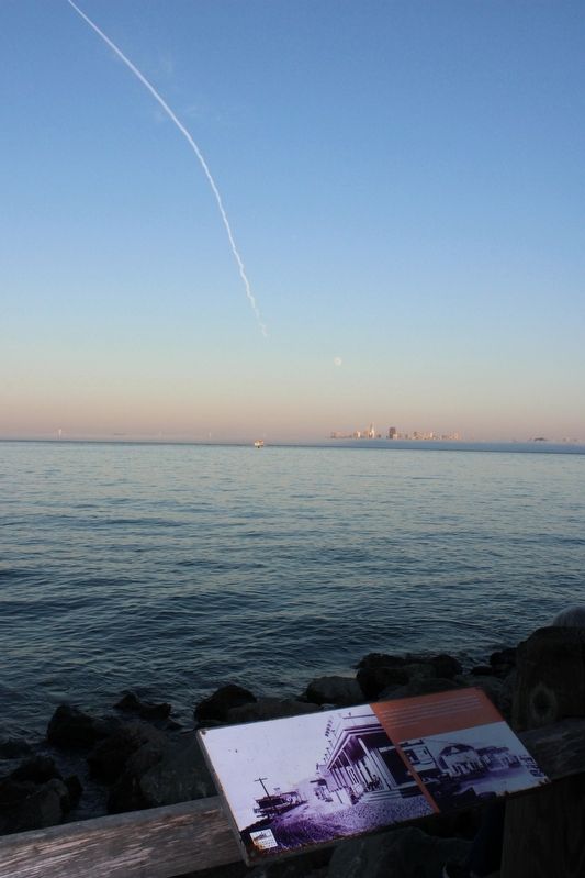
Sausalito, like other small coastal towns, had unpaved roads that led though town and up into the hills. The image on the left shows the condition of the streets circa 1890. This would soon change. As travel on the ferries and rails increased, so . . . — — Map (db m232209) HM
Marker One:
Before the Golden Gate Bridge opened in 1937, Sausalito was a transportation hub. In 1868 the Sausalito Land and Ferry Company established itself in a general office building and ferry dock in Sausalito at the foot of . . . — — Map (db m232201) HM
Three plaques provide an historical overview of the the Sausalito ferry terminals.
c. 1890
In 1907 the rail system in Sausalito was expanded to consolidate facilities so that interurban trains could operate only from Sausalito. . . . — — Map (db m102437) HM
BCE 2000-1800s
The indigenous Coast Miwok people inhabit Marin County
1769
The Spanish Ship San Carlos becomes the first European vessel to enter San Francisco Bay. The explorers anchor and begin charting the bay
1775
Spanish . . . — — Map (db m232198) HM
For thousands of years Native Americans lived in the Bay Area harvesting animals, salt, and acorns. The changes they made to the landscape were limited. They used fire to shape oak woodlands and grasslands. cultivated plants, and collected salt . . . — — Map (db m102474) HM
Be Safe! Stay on the trail.
Cliffs are unstable and plant life is fragile.
The Point Bonita Lighthouse has guided ships through the hazardous Golden Gate Strait into San Francisco Bay since 1855. This lighthouse has witnessed a remarkable . . . — — Map (db m232190) HM
In 1775, the packet San Carlos, first known Spanish ship to enter San Francisco Bay, anchored in this cove while her commander, Lieut. Juan Manuel de Ayala, directed the first survey of the bay. Ayala named this island Isla de los Angeles. . . . — — Map (db m143405) HM
Center Panel:
Ayala Cove
Preventing the Spread of Disease
Close your eyes and imagine this cove full of ships and sailors, buildings and noisy machines, doctors, cleaning staff, and nervous travelers hoping to complete their . . . — — Map (db m203263) HM
Over 100,000 years ago Angel Island was part of the mainland and the ocean was 26 miles to the west. As glaciers from the last ice age melted, sea levels rose and saltwater filled the ancient river valley below, creating San Francisco Bay and Angel . . . — — Map (db m203781) HM
The view ahead could have looked quite different had the Reeds Port Project, a proposed development of several thousand homes, been built over Richardson Bay in the 1950s. Fortunately, this vital habitat was saved by concerned local residents who . . . — — Map (db m203902) HM
This 1974 photo shows the Olson Boat Works, one of the last vestiges of the olden days along the multi-use path. The building was demolished soon after this photo was taken, to make way for a new house on land that was the target of vigorous but . . . — — Map (db m203891) HM
Downtown Tiburon and Harbor
Originally name “Punta de Tiburon” (Shark Point) by Spanish explorers in 1775, downtown Tiburon today is a quaint village in an extraordinary waterfront setting. You’ll find delightful shops and enticing . . . — — Map (db m203883) HM
Constructed in 1885 as
part of the San Francisco
and North Pacific Railroad
Tiburon Terminal, this
Depot was the railroad and
ferry link to San Francisco
until 1967. The Terminal,
opened in 1884, served
passengers and freight.
The Depot . . . — — Map (db m145142) HM
For 84 years, from 1884 to 1967, Tiburon was a railroad town. It started when rail pioneer Peter Donahue moved his North Bay operations down from Petaluma to Point Tiburon to become the rail and ferry terminus for the San Francisco & North Pacific . . . — — Map (db m204399) HM
From a vista point near the 1,156 long, 130 foot high bridge, completed in 1966, the site of Bagby lies east under, and sometimes exposed beside, the back waters of Lake McClure. Bagby's history passed through three definite development eras. From . . . — — Map (db m5957) HM
While miners worked nearby streams and veins for gold, George W. Coulter served their needs as merchant and hotel proprietor. His first store, established in 1850, was a tent stocked with merchandise hauled in by pack train. Coulter and the town . . . — — Map (db m46330) HM
Mirror Lake was once regarded by park scientists as a stream-fed lake slowly filling in to become a meadow. As hydrologists have developed a more complex understanding of the water's dynamics, they now theorize that the "lake" is a pool in a . . . — — Map (db m81952)
Perhaps only three or four hundred years ago, an enormous rockfall dumped boulders across this canyon, damming Tenaya Creek. During spring and early summer, the stream backs up into the two pools on either side of the dam.
Tinkering with . . . — — Map (db m81950) HM
Nowhere else on earth are there so many spectacular waterfalls in such a concentrated area.
During the spring, torrents of water from melted snow thunder over Yosemite's precipices. By August, the "ephemeral" falls disappear; others, like the . . . — — Map (db m81943) HM
The Tioga Road, one of the few roads that crosses the Sierra Nevada, reaches the highest point of any at Tioga Pass (9,945ft, 3km). It provides a gateway to the park, wilderness, and high country. The long winters and rigorous road-opening . . . — — Map (db m192086) HM
The stage was set for the creation of Vernal and Nevada Falls when two major fractures developed in the otherwise solid granite walls. Glaciers ground and carved away the downhill side of the fractures, leaving the two vertical waterfalls, sometimes . . . — — Map (db m192080)
Water-stage data recorded at this station are transmitted, via satellite, to the U.S. Geological Survey computer in Reston, Virginia.
The computed streamflow of the Merced River at Happy Isles Bridge is printed at a computer terminal in the . . . — — Map (db m192078)
Before 1850
Before European settlement, the Pomo peoples occupied much of the North Coast of California. The Navarro River formed the boundary between the Northern and Central Pomo. Navarro Beach was seasonally occupied as a place to . . . — — Map (db m116795) HM
Our Captain's voice boomed above the roar of the surf. "Heave about! Turn the ship!"
With a mighty jolt a rock took our rudder and punched a hole in her hull. The Frolic was sinking and none of us knew how to swim! Captain Faucon, bless . . . — — Map (db m96476) HM
The clatter of lumber and the shouts of longshoremen at Laguna Point began in 1883. Schooners and steamships moored here to take on loads of Mendocino's valuable redwood lumber
Laguna Point
In 1883, the Laguna Point loading operation . . . — — Map (db m96629) HM
The Point Cabrillo Light Station was built in 1908 by the US Lighthouse Service to protect the "Doghole Schooners" that plied the lumber trade between San Francisco and the Redwood Coast. These steam ships and sailing vessels were known for their . . . — — Map (db m543) HM
This site and natural landmark has been a welcome guide to safe navigation for ships along the rugged Mendocino coast since 1870, destroyed by 1906 earthquake, two years later stately tower was erected. — — Map (db m64770) HM
(This monument is made up of three plaques. The first plaque is on the front.)
This monument is dedicated to the fifteen young men from Yawatahama, Japan who sailed 11,000 kilometers across the Pacific in a 15 meter wooden boat to realize . . . — — Map (db m64325) HM
These trees are dedicated to the memory of those United States Submariners who made the ultimate sacrifice, so that we might live in freedom. — — Map (db m38981) HM
First known as California Ranche Crossing, then as Belt’s Ferry. The site of a large Indian Rancheria. The Post Office at Merced Falls opened Sept. 4. 1856. The flour and woolen mills were built in 1854 and 1867. The town was destroyed by fire in . . . — — Map (db m46956) HM
In the 19th and early 20th centuries, most settlements in Big Sur had only narrow trails to connect them to Monterey in the north and San Simeon in the south. Bulky items too large to be carried by mules had only one way in or out - by sea. But the . . . — — Map (db m197535) HM
Well into the 20th century, travel by land along California's coast was arduous and time consuming. Steamships and schooners offered a faster and more reliable means of transporting goods and people over long distances. The main landings along the . . . — — Map (db m197532) HM
This rocky point, connected to the mainland by a sand spit, is a geologic formation called a tombolo. Because of its prominence, Point Sur provided an excellent location for a lighthouse and fog signal to warn ships of the hazardous coastline and . . . — — Map (db m200912) HM
Spanish explorers and later New England hide and tallow traders found the Big Sur coastline a great hazard. Heavy fogs and extreme winds caused the wreck of many vessels on this coast. The Gold Rush of 1849 dramatically increased coastal shipping. A . . . — — Map (db m68643) HM
This anchor is from one of four 19th Century sailing ships wrecked off Stillwater Cove, and placed here by the Monterey History and Art Association in 1972. — — Map (db m63426) HM
Monterey's world-famous sardine industry depended on the courage and skill of cannery divers. Sardines were pumped ashore from floating hoppers through underwater pipes that had to be installed, repaired, replaced, realigned and maintained in order . . . — — Map (db m30004) HM
The real neighborhood of John Steinbeck’s Cannery Row.
Real people and places in the neighborhood of Monterey’s old Ocean View Avenue inspired fictional characters and establishments in the mind of John Steinbeck. Published in 1945, his . . . — — Map (db m55081) HM
Recurring winter storms wreaked havoc on the Monterey fishing fleet every few years (top). On April 29, 1915, such a storm, with 60-mile-per-hour winds, destroyed or damaged nearly 50 boats. On Thanksgiving morning 1919, more than 93 vessels were . . . — — Map (db m55214) HM
□ Look out upon these waters.
□ Their recorded history began when Juan Rodriguez Cabrillo sighted the "Bay of Pines" on Nov. 17, 1542.
□ Sebastian Viscaino was first to touch land Dec. 16, 1602. He claimed the land for . . . — — Map (db m30347) HM
This harbor is the home of....
Monterey's Commerical Fishing Fleet.
It once boasted the largest sardine fishing industry in the world, an industry that flourished until the late 1940's. Commercial fishing was pioneered and developed here by . . . — — Map (db m29859) HM
In the formative days of the Monterey fishing industry, the working boats were too small to carry both a crew and a catch. The fishermen towed a second boat called a “lighter,” which could hold 25 to 60 tons of sardines.
Since the . . . — — Map (db m55163) HM
To Honor the Ingersoll Family and all who served aboard the two USS Ingersolls:
DD-652
1943-1946--WWII
1951-1970--Korea and Vietnam
DD-990
1980-1998—Desert Storm — — Map (db m234805) WM
These boats were first introduced here at Lovers Point in the early 1890s. Launched from the narrow cove's wooden pier, the boats offered passengers a canopied window to the underwater flora and fauna around Lovers Point.
Nathaniel Roscoe "Dad" . . . — — Map (db m41574) HM
The building across the cove is Hopkins Marine Station. It was the first marine laboratory on the West Coast, founded in 1892. Part of Stanford University, its facilities are dedicated to the study of marine life.
What biologists at Hopkins . . . — — Map (db m41618) HM
“The Oil House”
*****************************
The structure you see before you is a fuel storage house commonly referred to as an ‘oil house’. This oil house was constructed in 1899.
In the 1880’s, before the conversion to . . . — — Map (db m63689) HM
The anchor on display here is from the coastal steamer Gipsy sunk off what is now known as Cannery Row on September 27, 1905. At night a substitute Captain mistook a red construction warning lantern at the foot of Hoffman Ave. in New Monterey for . . . — — Map (db m63704) HM
Dense fog, dark night, jagged rocks and bounding surf have always made navigating these waters difficult. On a foggy night in 1896, the iron-hulled St. Paul slammed in the submerged rocks. The crew and livestock cargo were rescued . . . — — Map (db m92509) HM
Operated by Hiram Cory, this was one of the first ferries to cross the Salinas River. The Monterey County Board of Supervisors regulated the toll, which was, in 1877:
Buggy and horse, 25 cents:
Buggy and horses, 37½ cents:
Four horses and . . . — — Map (db m224487) HM
Near this site was located the Embarcadero de Napa. While the exact date of establishment is unknown, it is recorded that Captain John Sutter sent his schooner Sacramento here in 1844 to get lime from Nicholas Higuerra, the first nonnative . . . — — Map (db m25754) HM
Historic Commerce Along Napa River
As other modes of transportation became more dominant, the waterfront declined. But in the 21st century, Napa has turned again to embrace the river. Much of the riverfront as been redesigned and . . . — — Map (db m92484) HM
Long considered nature's thoroughfare for pioneer settlement and development, the Napa River has played a major role in the growth and prosperity of Napa County. From its headwaters near Mt. St. Helena to its southern mouth merging with San . . . — — Map (db m92527) HM
One and one half miles north of here, at the second crossing of Chiles Creek, is the spot known as “Whiskey Crossing”. Although shrouded in folklore, the origin of the name is based upon a probable incident that took place in the early . . . — — Map (db m54591) HM
History
There has been a dam at the end of Summit Valley since the 1870's as you can see if you look closely at the top photograph here. To the left of the dam you can also see the buildings that used to be the "downtown" Soda Springs . . . — — Map (db m129582) HM
Said to be from a pirate ship commanded by Jean Lafitte in the battle of New Orleans, January 8, 1815.
It is also said that Lafitte's privateering steps left a wake of blood from the mainland to Barataria Bay.
But don't believe everything you . . . — — Map (db m189871) HM
According to legend, Lester Pelton got his idea for a more powerful waterwheel from seeing a cow stick its nose into a stream of water. Patented in 1878, the divided metal cups of Pelton's wheel worked much the same way as the cleft between the . . . — — Map (db m155281) HM
Named for Richard Henry Dana. Described in his book "Two Years Before the Mast" as the most romantic California spot. In the glamorous days of the Ranchos, 1830-1840, Yankee vessels traded supplies for hides here. — — Map (db m188539) HM
Named for Richard Henry Dana. Described in his book "Two Years Before the Mast" as the most romantic California spot. In the glamorous days of the Ranchos, 1830-1840, Yankee vessels traded supplies for hides here. — — Map (db m234924) HM
This plaza is dedicated in memory of Don Hansen, the founder of Dana Wharf Sportfishing and Whale Watching - the first business to operate from Dana Point Harbor in 1971.
Don loved the ocean and was dedicated to the conservation of
marine . . . — — Map (db m233230) HM
Phil Edwards rode waves in the '50s and '60s with a style that surpassed other surfers, turning with finesse and walking the board. His friendship with Hobie Alter and Bruce Brown drew him to Dana Point where he worked in Hobie's shop as he became . . . — — Map (db m189513) HM
In 1835, Dana arrived on board the brig Pilgrim, a tall-masted sailing ship out of Boston, bound for the California coast. For reasons of health, Dana had left his studies at Harvard and at age 19 signed onto the Pilgrim as a common sailor. . . . — — Map (db m188544) HM
The Notorious Wave
Back in the day, if you dared, you grabbed your board and headed for Killer Dana. The wave was known as Dana Cove when the weather was calm - but when the surf was over 10 feet, Killer Dana's thick, right-breaking curl . . . — — Map (db m183042) HM
Local landowners gave Sam Talbert the job of draining "Gospel Swamp." He built a river levee, and dredged huge ditches on the east side of all major roads that ran south to the ocean. — — Map (db m59489) HM
This windmill is one of 1,200 such water-pumping devices that once served the Irvine Ranch before modern water systems were available. Jim, a long-time employee of Irvine Ranch Water District, was responsible for dismantling and reconstructing it . . . — — Map (db m52247) HM
Side 1
10 Million Years Ago
You are standing on what once was the bottom of a deep ocean basin. Over millions of years, geological upheaval raised the coastal plain and caused dramatic changes in the shoreline.
Mixocetus was . . . — — Map (db m195044) HM
To create Lake Mission Viejo from farmland, the original valley topsoil was removed all the way down to the clay bed during grading. The lake bottom was replace with impermeable soils to help reduce water seepage and prevent decomposition of . . . — — Map (db m188709) HM
On October 10, 2016, Lake Mission Viejo became the first swimming lake in California to use advanced purified water instead of drinking water for supplemental lake refill — — Map (db m230343) HM
History
The Oso Creek Trail started in April 1997 as a community collaboration where volunteers gather in late spring to celebrate the Earth and the arts in Mission Viejo. The trail is nestled along the riparian corridor of the Oso Creek . . . — — Map (db m196334) HM
History
The Oso Creek Trail started in April 1997 as a community collaboration where volunteers gather in late spring to celebrate the Earth and the arts in Mission Viejo. The trail is nestled along the riparian corridor of the Oso Creek . . . — — Map (db m226735) HM
Historic building built in 1905 as the hub
of the original Balboa land development as
well as the terminus for the Pacific Electric
railway from Los Angeles, restored in 1962
by Ducommun Realty Company. The cupola has
long served as a . . . — — Map (db m189920) HM
1870
On September 10th, Captain Samuel S. Dunnels entered Newport Bay for the first time on the steamship Vaquere. The landing was below this site and designated "Newport". The McFadden brothers operated a regular shipping service between . . . — — Map (db m196756) HM
The original wharf at this site was completed in the winter of 1888-89 and was connected by railroad with the hinterland in the winter of 1890-91. It served as a shipping and distributing point for Orange, San Bernardino, and Riverside counties . . . — — Map (db m146157) HM
On September 10, 1870, Captain Samuel S. Dunnells and William A. Abbott opened Newport Bay to commerce when they entered it for the first time on the Sternwheel steamer Vaquero. The landing was designated "Newport" - a new port - by James . . . — — Map (db m157267) HM
Balboa Island was literally lifted from the sea due to the efforts of William Steppe Collins. In 1906, Collins began dredging around a two acre mud flat in Newport Bay, and within a few years he had created the 160 acre residential island that . . . — — Map (db m190043) HM
This pioneering water project, a model of efficiency and economy, was first built of clay in 1879. After flood damage, it was rebuilt with rock and concrete in 1892. Each dam reached down to bedrock, forcing ground water to the surface where it was . . . — — Map (db m50028) HM
San Clemente Island is the southernmost of the eight California Channel islands. The 56 square miles island received its named in November 1602 when Spanish explorer Sebastian Vizcaino sailed passed it while mapping the region. It represents . . . — — Map (db m190450) HM
Welcome to historic San Clemente Pier. The original San Clemente Municipal Fishing and Pleasure Pier was built by San Clemente city founder Ole Hanson in 1928. In 1939 and again in 1983, heavy storms severely damaged the pier making it necessary to . . . — — Map (db m190447) HM
For Many years the Mission has been the focal point of Capistrano Valley. During the 1800's the Mission was active in it's religious and agricultural endeavors; it also maintained large herds of cattle and developed an industry of hide-curing. The . . . — — Map (db m197258) HM
Ortega was the scout who blazed the trails for the 1769 Spanish expedition from San Diego to Sonoma, and discovered San Francisco Bay. — — Map (db m199145) HM
Soon after the founding of the Mother Colony at Anaheim in 1857, Anaheim Landing was established as a port of entry for the Santa Ana Valley by the Anaheim Landing Co. Despite the treacherous entrance conditions which caused several disasters, . . . — — Map (db m50304) HM
The San Gabriel River flows 43 miles (69 km) through Los Angeles and Orange Counties, California in the United States. Measured to its highest headwaters in the Angeles National Forest, along, the Prairie Fork in the San Gabriel Mountains, the river . . . — — Map (db m214795) HM
Battle of the Paracel Islands represents the Indomitable spirit of the Republic of Vietnam against Communist China
This Hoang Sa Monument was proposed by Mayor Tri Ta & Vice Mayor Kimberly Ho and approved by the Westminster City Council . . . — — Map (db m195525) WM
Water from the Santa Ana River was largely responsible for the transformation of this arid valley into productive agricultural land. Irrigation companies in Orange County were in operation as early as the 1860s. The two largest were the Santa Ana . . . — — Map (db m59529) HM
This lined section of the Cajon Canal (Circa 1923) helped bring water from the Santa Ana River to Rancho Santa Ana and several northern Orange County communities during the early development of the county. Construction of the original, unlined . . . — — Map (db m164929) HM
The Cajon Canal is one of the oldest and most significant historical resources in the city of Yorba Linda. During the late 19th and early 20th centuries, the canal was instrumental in facilitating the early growth and development of north Orange . . . — — Map (db m164926) HM
Adventurer and first fruit rancher in Placer County. In 1848 he found gold in the Auburn Ravine, which led to the settlement of a mining camp that later became Auburn.
Lord Sholto Douglas Ch. 3
E Clampus Vitus
1975. — — Map (db m686) HM
[Kiosk Side A:]
Gold Discovered Just Downstream in Auburn Ravine!
On May 16, 1848, just downstream in Old Town Auburn where North Rich Ravine meets Auburn Ravine, gold was discovered by a Frenchman named Claude Chana. After leaving . . . — — Map (db m52355) HM
History
At one time canals laced the Sierra foothills and the mountains above. Many still exist as do the reservoirs the canals linked. Originally the canals were used to funnel water to hydraulic and pacer mining. The system was well in . . . — — Map (db m129768) HM
Controlling the flow of water through Lake Tahoe's Truckee River outlet
The Donner Lumber and Boom Company built the first dam across the Truckee River outlet in Tahoe City in 1872. Water released through the dam controlled the flow of . . . — — Map (db m112966) HM
Timber baron and transportation mogul, D.L. Bliss – a one time Nevada banker – was best known for the railroads and steamships that he introduced to the Lake Tahoe Basin. He organized the Carson & Tahoe Lumber & Fluming Co. in 1871 and . . . — — Map (db m34505) HM
The first outlet works were constructed in 1870 by Colonel A.W. Von Schmidt. The stone and timber crib structure soon passed to the Donner Lumber & Boom Co. who continued to regulate, for a fee, the water flow for floatation of logs and, later, . . . — — Map (db m143497) HM
Think about the people who made Tahoe City what it is today. They were frontiersman and adventurers, hunters and fishermen, lumberjacks and miners, school teachers, newspapermen, and ladies of the night. They ranged from Washoe Indians, who called . . . — — Map (db m34899) HM
On July 17, 1877, Thomas Blythe, a San Francisco financier, filed the first legal claim for Colorado River water rights. Oliver Callaway planned a diversion dam and canal which opened in 1877 to irrigate the Palo Verde Valley. This made possible the . . . — — Map (db m50678) HM
Dedicated to the many pioneers that recognized the potential and value to our Valley of a gravity irrigation system, and the sacrifices made obtaining it.
In particular, to honor the following three persons, whose contributions uniquely . . . — — Map (db m39444) HM
When Jim Taylor acquired his ferry in 1922, he had just completed his connecting, hand-made highway on both sides of the Colorado River. His plan to attract the Los Angeles to Phoenix traffic had faded with the continued success of the . . . — — Map (db m138178) HM
The first commercially significant hydroelectric plant in California, designed and built by Gustavus Olivio Newman, went into service here in 1888. Utilizing the flow of the Riverside Water Company Canal to produce about 225 kilowatts of power used . . . — — Map (db m50704) HM
646 entries matched your criteria. Entries 201 through 300 are listed above. ⊲ Previous 100 — Next 100 ⊳