On West Commerce Street (Mississippi Route 145) at Franklin Street, on the right when traveling west on West Commerce Street.
Formed 1834; chartered 1837; in 1849 it was made county seat of Monroe, the first county in the state north of Vicksburg. Cotton trade center and former port for Mobile trade. — — Map (db m102590) HM
On East Commerce Street (Mississippi Route 145) at Locust Street, on the right when traveling west on East Commerce Street.
Hernando DeSoto & his expedition entered present Monroe Co. following an Indian trail from Buttahatchie River. They crossed the Tombigbee R. ¼ mi. E. Dec. 16, 1540 & marched up what is now this street. — — Map (db m102601) HM
On Highland Drive (Mississippi Route 25) at Meadowbrook Circle, on the right when traveling south on Highland Drive.
Area E. of Tombigbee R., S. of Gaines' Trace ceded in Chickasaw Council House Treaty, 1816. Became part of Monroe Co., 1821. South portion severed, 1830, at formation of Lowndes Co. — — Map (db m102611) HM
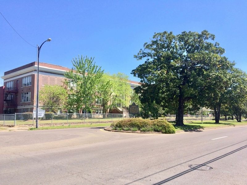
On U.S. 278 at Cotton Gin Road, on the right when traveling east on U.S. 278.
South one mile. Initially an Indian trading post at southern terminus of Gaines Trace. Named for the cotton gin built by U.S. Government for the Chickasaw ca. 1801, it grew into an important river town and cotton market with formation of Monroe . . . — — Map (db m102613) HM
On Wolfe Road, 0.3 miles north of Wolfe Circle, on the right when traveling north.
The Church of Jesus Christ of Latter-Day Saints was organized on April 6, 1830. Missionaries first arrived in northeastern Mississippi in 1839. Here at Mormon Springs many converts to the church were baptized. Using stones to dam the stream, they . . . — — Map (db m244673) HM
Near U.S. 278 east of Splunge Road, on the left when traveling east. Reported missing.
To protect the first white settlers on tributaries of the Buttahatachie River, Gov. David Holmes created Monroe County June 20, 1815 from land between the Tombigbee and Black Warrior Rivers. — — Map (db m173888) HM
On U.S. 45 at Camargo Road, on the right when traveling south on U.S. 45.
2 mi. NW was the flourishing port of Camargo, named by veterans for their Mexican war camp. The town had a steamboat landing, schools, cemetery, and church. Confederates won a skirmish here, July 14, 1864 — — Map (db m50325) HM
On Mississippi Route 25 south of Elm Street, on the right when traveling south.
Smithville had its beginning on December 3, 1836, when Co Chubby,
a Chickasaw Indian Co-signatory of the Treaty of Pontotoc, sold
Section 6, Township 12S, Range 9E to James D. Couch.
About 1840, William Smith purchased land at this site and . . . — — Map (db m173895) HM
On Jefferson Street (State Highway 145) 0.2 miles south of South Street, on the right when traveling south.
West 15 miles is the site which gave name to last treaty with the Choctaws, Sept. 7, 1830, whereby the remaining tribal lands in the state were opened to white settlement. — — Map (db m92655) HM
On College Street at Broadway Street, on the right when traveling east on College Street.
In September 1857 the Mississippi
and Tennessee Railroad arrived
here, drawing businesses and
residents from nearby Panola,
also known as Panola Landing,
a port on the south bank of the
Tallahatchie River. The new
railroad hub was named . . . — — Map (db m173899) HM
On Willow Lane at Crabapple Lane, on the right when traveling north on Willow Lane.
There were several Indian mounds constructed (1200-1400 A.D.) in Cary at the time of the Civil War. During the Steele's Bayou Expedition, the area was flooded from the overflow of the Mississippi and Yazoo Rivers. These mounds provided high and dry . . . — — Map (db m160876) HM
On State Highway 1, 0.7 miles west of U.S. 61, on the right when traveling west.
Rear Admiral David D. Porter’s flotilla arrived here late in the afternoon of March 16, 1863, after working all day to clear overhanging branches and uproot huge cypress trees in the 3 ½ miles from Steele’s Bayou though Black Bayou to Deer . . . — — Map (db m154539) HM
On State Highway 1, 0.7 miles west of U.S. 61, on the right when traveling west.
Union gunboats under Admiral David Porter reached this site on March 16, 1863, in Steele's Bayou Expedition. Sherman came here, then moved north to protect boats from the Confederate forces. — — Map (db m154540) HM
On 1st Avenue NW north of Choctaw Street, on the right when traveling north.
Early Settlement and Historic Preservation
The area was first settled in the early 1800s. In 1840, Willie Magee built a grist
mill on Little Goodwater Creek, inside the present city limits. The community
grew and in 1900 was . . . — — Map (db m114491) HM
On 1st Avenue NW north of Choctaw Street, on the right when traveling north.
Simpson County is located in the
Gulf Coastal Plain within the Pearl
River watershed, and is graced with
numerous rivers, streams, and springs.
One such spring is McNair Springs,
which along with Saratoga Springs,
feeds the Okatoma . . . — — Map (db m114487) HM
On Main Street at Swan Lake Road, on the right when traveling south on Main Street.
The September 1955 acquittal of J.W. Milam and Roy Bryant for the murder of 14-year-old Emmett Till fueled further racial violence. Clinton
Melton was an outspoken black man who was gunned down here 2-1/2 months later by Milam’s friend Elmer . . . — — Map (db m89871) HM
On Thomas Street, 0.1 miles south of Gipson Avenue, on the left when traveling south.
This site was the home of J.W. Milam, who along with his half-brother, Roy Bryant, murdered 14-year-old Emmett Till on August 28, 1955. The two men confessed to journalist William Bradford Huie, during which Milam claimed he and his brother . . . — — Map (db m89876) HM
On Sharkey Road at River Road, on the right when traveling east on Sharkey Road.
On August 31, 1955, Emmett Till's body was found 2.6 miles to the
southeast. Fishermen discovered the body on a piece of land
adjacent to the Tallahatchie River, where it had been dumped
presumably as a warning to the black community. A cotton . . . — — Map (db m173984) HM
On North Court Street at West Court Street, on the right when traveling east on North Court Street.
In August 1955 the body of Emmett Till, a 14-year-old black youth from Chicago, was found in the Tallahatchie River. On September 23, in a five day trial held in this courthouse, an all-white jury acquitted two white men, Roy Bryant and J.W. Milam, . . . — — Map (db m89870) HM
On North Front Street at West Main Street, on the right when traveling north on North Front Street.
Began as R. R. station near Senatahoba Creek. Chartered 1860. Occupied and partly burned by Union Army in Civil War. Became county seat in 1873. — — Map (db m102569) HM
Near Natchez Trace Parkway (at milepost 293.2), 0.3 miles west of John Rankin Highway (County Road 1).
The parkway bridge is named in honor of United States Representative Jamie L. Whitten who for years fought for funds in Congress to complete the Natchez Trace Parkway and the Tennessee-Tombigbee Waterway.
His vision helped make possible this . . . — — Map (db m84731) HM
Near Natchez Trace Parkway (at milepost 293.2), 0.3 miles west of John Rankin Highway (County Road 1).
The Tennessee-Tombigbee Waterway has three main parts. The largest section from Demopolis, Alabama, north to Amory, Mississippi, utilizes the Tombigbee River but changes and shortens the existing channel with dams, locks, and short cuts. From Amory . . . — — Map (db m84732) HM
Near Natchez Trace Parkway (at milepost 293.2), 0.3 miles west of John Rankin Highway (County Road 1).
In the mid 1700's Sieur de Bienville, founder of Mobile, recommended to Louis XIV, a waterway connecting the Tennessee River with the Tombigbee River. Later, American settlers also recognized the advantages of such a shortcut. Residents of Knox . . . — — Map (db m84730) HM
On State Highway 15, 0.3 miles south of South Central Avenue, on the right when traveling south.
Home ½ mi. SE. Last Chickasaw king, giving name to King's Creek & King's Ford Rd. (this highway). Authorized Monroe Mission; signed Pontotoc Creek Treaty, 1832, & led party to Indian Territory, where he died, 1840. — — Map (db m96767) HM
On State Highway 3, 0.5 miles north of Old Highway 3, on the left when traveling north.
Panel 1 General Beauregard in April 1862 ordered Captain D.B. Harris, Chief Engineer, Vicksburg, Miss., to proceed with the construction of the Battery on Yazoo River and use booms, rafts and piles. Admiral Farragut, while besieging Vicksburg in . . . — — Map (db m160930) HM
On Levee Street south of Grove Street, on the left when traveling south.
The longest continually-running melodrama in the world began with modest roots on March 28, 1936 by Julia Arnold on a U.S. Army Corps of Engineers barge that had been redesigned to resemble a riverboat and renamed the Dixie Belle.
"Gold in the . . . — — Map (db m190836) HM
On Levee Street north of Clay Street, on the left when traveling north.
Vicksburg voters opposed secession but once the war began they supported the Confederacy, over 2500 local men joining the Southern ranks.
The first attack on Vicksburg was in the spring of 1862. The enemy was repulsed, Col. James Autry telling . . . — — Map (db m104036) HM
On Levee Street south of Grove Street, on the left when traveling north.
Probably one of the most picturesque views of Vicksburg is that of the two bridges over the Mississippi River. The first bridge was constructed in 1930 for $6,500,000 to transport vehicles and trains.
It was, at that time, the only bridge across . . . — — Map (db m190853) HM
On Fort Hill Road south of Connecting Avenue, on the right when traveling south.
Capt. T. N. Johnston.
A detachment of the company served two 10-inch Columbiads in a position, not in the park about 150 yards northwest of this tablet, from May 18 to the end of the defense, July 4, 1863. They were creditably and . . . — — Map (db m109450) HM
On Fort Hill Road north of North Fort Hill Street, on the left when traveling north.
Capt. T.N. Johnston
A detachment of the company, under Lieut. P.R. Cousins, served one 7-inch Brooke's rifled gun in a position, not in the park, about 233 yards west of this tablet, from May 18 to June 28, 1863, when it was disabled . . . — — Map (db m109530) HM
On Fort Hill Road south of Elizabeth Street, on the right when traveling south.
One 42-pounder smoothbore gun was mounted in a position, not in the park, near the end of the spur known as "Devil's Backbone" and about 100 yards west of this tablet from May 18 to the end of the defense, July 4, 1863. It was not in exclusive . . . — — Map (db m110840) HM
On Navy Circle west of South Washington Street (U.S. 61).
U.S. Battery Benton. Acting Master J. Frank Reed.A detachment of Battery E, 1st Missouri Light Artillery under Lieut. Joseph B. Atwater and a detail of enlisted men of the 34th Iowa Infantry, all under Acting Master J. Frank Reed of the gunboat . . . — — Map (db m39567) HM
On Levee Street north of Clay Street, on the right when traveling north.
The C.S.S. Arkansas, an ironclad built in Yazoo City, met the Union vessels Queen of the West, Tyler and Carondelet on July 15, 1862, on the Yazoo River. Moving into the Mississippi, the Arkansas ran past thirty-nine . . . — — Map (db m103751) HM
On Levee Street north of Clay Street, on the right when traveling north.
Not a clean place, Catfish Row was Vicksburg's commerce hub where horse-drawn wagons connected with steamboats and trains. Not particularly a clean place, it was busy with laborers, lined with saloons, and thriving with underground activities. If . . . — — Map (db m190975) HM
On Levee Street north of Clay Street, on the left when traveling north.
Prior to the construction of a bridge in 1930 across the Mississippi River at Vicksburg, train cars crossed to Louisiana on "ferries for trains" called transfer boats. The inclines at Kleinstown in Vicksburg and Delta Point in Louisiana were . . . — — Map (db m103989) HM
On State Highway 465 at Muddy Bayou Road, on the left when traveling north on State Highway 465.
In March, 1863, Maj. Gen. William T.
Sherman's XV Corps assembled at Eagle
Bend to march inland approximately one
mile along Muddy Bayou to Steele's
Bayou. There, the troops were to be
loaded onto transports and used in
Admiral Porter's naval . . . — — Map (db m187814) HM
On January 13, 1861, the steamer A.O. Tyler, en route downriver to New Orleans, was fired on by militia sent to protect Vicksburg. The Tyler, which was later used as a U.S. timberclad gunboat, was searched and released. The firing on . . . — — Map (db m103747) HM
On Washington Street (Business U.S. 61) north of Jackson Street, on the left when traveling north.
The vessels which have served as the Mississippi always pulled "double duty" serving both as a Corps work vessel and as the MRC's river inspection vessel and public meeting venue. During the traditional high-water and low-water seasons each . . . — — Map (db m162994) HM
On Cherry Street at Jackson Street, on the right when traveling north on Cherry Street.
Warren County Court House
The Reverend Newit Vick, Vicksburg's founder, originally planned to build his home on this site; however, after he and his wife both fell victim to yellow fever in August of 1819, this site was set aside to . . . — — Map (db m115506) HM
On Main Street at Adams Street, on the right when traveling east on Main Street.
Lakemont
Lakemont was built in 1835 by Judge William Lake who served in the United States Congress (1855-1856) and in the Mississippi House of Representatives (1859-1861). In 1861, while campaigning for the Confederate Congress, Judge Lake . . . — — Map (db m115493) HM
On Washington Street (Business U.S. 61) north of Jackson Street, on the left when traveling north.
The Mississippi River Commission (MRC) was established on June 28, 1879 by an Act of Congress. Congress tasked the MRC with the mission to develop plans to improve the condition of the Mississippi River, foster navigation, promote commerce, and . . . — — Map (db m162993) HM
On Washington Street (Business U.S. 61) north of Jackson Street, on the left when traveling north.
Commissioned in 1961, the Mississippi IV plied the Mississippi River for more than 30 years. Though it was the fourth Corps vessel to bear the name "Mississippi," she was the first to employ diesel power, and this shift brought with it the . . . — — Map (db m162989) HM
When William McKinley, the 25th president of the United States (1897-1901), visited Vicksburg on May 1, 1901, cotton was “king” in Vicksburg and Warren County, as is evidenced by this arch of cotton bales (each weighing about 450 pounds) that . . . — — Map (db m190968) HM
On Grove Street west of Washington Street (Business U.S. 51), on the right when traveling west.
Railroad Depot
Built in 1907, the Illinois Central, Yazoo, and Mississippi Valley Railroad Depot was the busiest rail station in the state. Construction cost was $60,715 and 22 passenger and freight trains came and went every day. These . . . — — Map (db m115435) HM
On Monroe Street north of Grove Street, on the right when traveling north.
Seargent Smith Prentiss (1808-1850)
Built before 1837 this was once the office of Seargent Smith Prentiss, a famous lawyer and politician. Prentiss was well known and loved as a remarkable orator. Daniel Webster, one of the foremost . . . — — Map (db m115444) HM
On Cherry Street at China Street, on the right when traveling north on Cherry Street.
Magruder-Morrissey House
Since Union prisoners were housed next door at the Warren County Jail, the house suffered only minor damage from Union bombing during the siege. Tom Morrissey, a creative entrepreneur, purchased this home in 1907. . . . — — Map (db m115533) HM
On Washington Street (Business U.S. 51) at Crawford Street, on the right when traveling south on Washington Street.
This area was originally Sky Parlor Hill. During the Civil War, locals entrapped by the Siege (1863), would gather here to watch the battles between Confederate and Union forces. This is depicted in the painting "From Sky Parlor Hill" along with the . . . — — Map (db m115422) HM
On Drummond Street at Speed Street, on the right when traveling south on Drummond Street.
In 1881 Frederick Speed and Thomas Foster purchased the 210-acre Lonewood Plantation in this area. They divided the land into lots that sold for about $600 each. Both partners wanted to name the newly formed town after the other. The final decision . . . — — Map (db m115540) HM
On February 2, 1863, the U.S.S. Queen of the West, a converted ram, attacked the C.S.S. Vicksburg, then lying at the city's landing. Almost completely destroyed in the action, the Vicksburg's engines were removed and sent to . . . — — Map (db m103748) HM
Torrential rains in the fall of 1926 and spring of 1927 set the stage for one of our Nation's worst natural disasters. Levees held back the water until breaks occurred at Mound Landing, MS and Pendleton, AR on April 21, 1927.
Bt the time the . . . — — Map (db m190862) HM
The largest and most powerful sternwheel towboat ever launched (318 feet long, 61 feet wide), the steamer Sprague, was constructed in 1901 by the Dubuque Boat and Boiler Works in Iowa for the Monongehela River Consolidated Coal and Coke . . . — — Map (db m190860) HM
On Levee Street north of Clay Street, on the right when traveling north.
On April 24, 1865, the Sultana left Vicksburg with over 2,300 Union soldiers aboard, many of whom were former prisoners of war. Some 200 civilians were also on board, despite a legal limit of 376 people. Due to a faulty boiler, the . . . — — Map (db m103749) HM
On Levee Street north of Clay Street, on the left when traveling north.
The Sultana, a side-wheel steamboat built in Cincinnati in 1863, was 260' long and was designed to carry only 376 people along with its cargo.
On April 24, 1865, the Sultana docked in Vicksburg to pick up Union soldiers recently released from . . . — — Map (db m103996) HM
On Levee Street at Grove Street, on the left when traveling north on Levee Street.
In April of 1861, rumors of Civil War became a reality at Charleston harbor when Fort Sumter was fired upon by Southern forces. Many leaders, both North and South, believed that a dash to capture the opposing side's capital city would bring a quick . . . — — Map (db m239678) HM
On Walnut Street south of Crawford Street, on the right when traveling south.
The mission of the U.S. Army Corps of Engineers in the
Mississippi Valley is accomplished by two complementary
programs. The Mississippi River Commission (MRC) is responsible for evaluating projects that impact the Mississippi
River from Canada . . . — — Map (db m212990) HM
The Cairo is the sole survivor of the fleet of river gunboats built by the Union during the Civil War with the object of controlling the lower Mississippi River. Designed by Samuel Pook and built by James B. Eads, the 175-foot ironclad . . . — — Map (db m35953) HM
On Levee Street north of Clay Street, on the left when traveling north.
The river determined the location of Vicksburg to be on the hills above the Mississippi, safe from floods. The river was the highway of Mid-America, the lifeblood of the town and a haven for flatboats, barges, snag boats, dredges, steamboats and . . . — — Map (db m103987) HM
On Levee Street north of Clay Street, on the left when traveling north.
Vicksburg's first floodwall, built to keep annual spring flood waters from disrupting commercial activity along Levee Street, was completed in 1924. It was financed on a shared basis agreement between the City of Vicksburg, the Yazoo and Mississippi . . . — — Map (db m104062) HM
On Confederate Avenue, on the left when traveling east.
Capt. Henry Cuibor:
Lieut. William Corkery;
Lieut. Cornelius Heffernan.
The battery was engaged: at Grand Gulf, the evening of March 31, against Admiral Farragut’s vessels. Casualties, killed 2, wounded 2, total 4, Capt. Henry Cuibor . . . — — Map (db m134029) HM WM
On Pemberton Circle at Confederate Avenue, on the right when traveling south on Pemberton Circle.
1st Louisiana Heavy Artillery, {Colonel C. A. Fuller.
{Lieut. Col. D. Beltzhoover.
8th Louisiana Heavy Artillery Battalion, Major F. N. Ogden
22nd Louisiana (Detachment). Captain Samuel Jones.
1st Tennessee Heavy . . . — — Map (db m115576) HM
On Grant Circle west of Grant Avenue, on the left when traveling east.
Companies D and K were assigned to duty on gunboats by order of Major General U.S. Grant, dated February 18, 1863; Company D, under Captain Eberlee P. H. Stone served during the campaign and siege of Vicksburg on gunboat "Tyler" . . . — — Map (db m109750) HM
On Grant Circle west of Grant Avenue, on the left when traveling east.
This regiment was detailed for service on gunboats by order of Maj. Gen. William T. Sherman, dated February 6, 1863; before that date it was attached to 1st Brigade, 1st Division, 15th Corps, Army of the Tennessee. Casualties: . . . — — Map (db m109753) HM
Near Union Avenue, 0.6 miles north of Pemberton Avenue, on the right when traveling north.
Capt. Frederick Sparrestrom;
Lieut. John W. Lowell.
By a collision between the transports "Horizon" and "Moderator", about 3 a.m., May 1, while the battery was crossing the river to Bruinsburg, Mississippi, . . . — — Map (db m109632) HM
Had you stepped aboard the USS Cairo
during the Civil War, the conversations may
have surprised you. So many languages! Stroll
the decks and you might have heard French,
Danish, Russian, German, and accents from
Ireland, England, and the . . . — — Map (db m109464) HM
Near Confederate Avenue, 0.1 miles east of Connecting Avenue.
In mid-19th century America, rivers were highways. And
the Mississippi was the greatest of them all—the nation's
main artery for commerce leading all the way to the Gulf
of Mexico. By early 1863, two Confederate strongholds
still blocked Union . . . — — Map (db m109452) HM
Look down to your left to see one of Cairo's restored firebox doors. Coal shoveled into the fireboxes heated the boilers. Steam from the boilers powered Cairo's engines and drove the paddle wheel. A gunboat without steam could not move . . . — — Map (db m110400) HM
During the 19th century, rivers meant trade and transit—none more than the Mississippi. This mighty artery of commerce was the nation's single greatest economic feature. In late 1862, Vicksburg remained the primary Confederate stronghold along . . . — — Map (db m104226) HM
On Union Avenue, 1.9 miles west of Grant Avenue, on the left when traveling south.
The Vicksburg Campaign would not have been planned and could not have been conducted on the lines on which it was successfully made without the assistance of the Navy. About 26 gunboats and light-draughts of the Mississippi Squadron, with necessary . . . — — Map (db m170111) HM
This powerful winch helped the crew haul heavy lines, move guns on the gun deck, and pull in the anchor. Steam from the boilers powered the capstan. In an emergency, this essential tool was turned by hand with wooden spokes inserted into the hub at . . . — — Map (db m110402) HM
The tall wooden stacks you see towering above the boat are skeletal reproductions of the original chimneys. When Cairo sank, its smoke stacks were visible above the surface of the water. A sister boat, the Pittsburg, knocked down the . . . — — Map (db m110368) HM
Steam-driven propulsion systems like the one you see
here powered riverboats churning up and down western
rivers in the mid-1800s. Cairo's engines and boilers are
among the oldest and best surviving examples of this
type of machinery. . . . — — Map (db m109468) HM
On Navy Circle west of Washington Street (Business U.S. 61), on the left when traveling north.
Vital supplies of food, clothing, medicine, European-made rifles and soldiers arrived here from the south and west. They were then shipped by rail to the troops fighting in the east. By early 1863, Vicksburg and Port Hudson, Louisiana, were the last . . . — — Map (db m105445) HM
Ironclad gunboats had long, flat-bottomed hulls to navigate shallow rivers. Loaded with heavy boilers, engines and guns, the hull tended to droop at the ends from uneven weight. This caused the center of the boat to hump up like a hog's . . . — — Map (db m110398) HM
On Grant Avenue north of Howe Lane, on the right when traveling north.
Co. D. Capt. Eberlee P.H. Stone,
Served on Gunboat "Tyler" and on
U.S.S. "Tuscumbia."
Co. K. Capt. Elijah P. Curtis.
Served with detachments of other
companies on Gunboat "Petrel."
Casualties:
Co. D. Bombardment Grand . . . — — Map (db m109792) HM
On Union Avenue, 1.9 miles west of Grant Avenue, on the left when traveling south.
This impressive monument salutes the US Navy's role in the success at Vicksburg. In the spring of 1863, Grant needed to change tactics. Having failed to penetrate Confederate defenses north of Vicksburg, he decided to move his large and . . . — — Map (db m109343) HM
Cairo's officers slept separately from the enlisted men. Officers' quarters were on the gun deck on either side of the paddle wheel. Here they escaped the heat from the fireroom and boilers.
[Caption]
The captain's quarters . . . — — Map (db m110371) HM
On Clay Street west of Union Avenue, on the right when traveling west.
Front
Ohio
Ninety Sixth Infantry,
Lieut. Col. Albert H. Brown
Col. Joseph W. Vance.
1st Brig.10th Div.,13th Corps.
Rear
This regiment was ordered to remain at
Perkins' Landing, Louisiana, when . . . — — Map (db m104260) WM
Cairo's 15-foot wide paddle wheel is made up of five, 22-foot-diameter "spiders"—the web-like iron arms and circles that form the spokes of the wheel. The paddles, or "buckets," were probably simple wood planks. If damaged, they could . . . — — Map (db m110372) HM
Look up. That circle of sloping iron plates overhead shielded Cairo's pilothouse. From this exposed perch atop the upper deck, the pilot steered the gunboat and the officer on duty kept a watchful eye on the river. Orders to the engine room . . . — — Map (db m110405) HM
Plenty of Firepower
Ironclads like the USS Cairo came equipped
with 13 heavy cannon. It took a crew of six men
to position and fire each gun. As Cairo prowled
the rivers north of Vicksburg, it could use its
cannon . . . — — Map (db m109470) HM
On Louisiana Circle west of Washington Street (Business U.S. 61), on the left when traveling north.
Lookouts spotted Union vessels on the Mississippi River
and sounded the alarm. Within minutes, the night sky
blazed with the light of burning cotton bales and tar
barrels. In forts like the one you are in, Confederate
gunners knew just where to . . . — — Map (db m105440) HM
Meet the deadline or pay $200 a day. James Eads had
agreed to these terms for the construction of seven new
ironclads. To speed production, a partner shipyard built
three of the boats, including the one in front of you. Eads'
shipyard built the . . . — — Map (db m109447) HM
Rudders on either side of the paddle wheel steered the gunboat. These sturdy wooden fins were controlled by cables attached to the wheel in the pilothouse. Well-aimed enemy fire could cut the steering cables and disable the gunboat.
[Photo . . . — — Map (db m110373) HM
On Cairo Museum Circle at Connecting Avenue on Cairo Museum Circle.
In 1861 the United Sates Navy was faced with the daunting task of taking control of the Mississippi River from the Confederacy. With few ships capable of navigating the shallow inland waters, necessity gave birth to the Brown Water Navy. This . . . — — Map (db m240620) HM
On December 12, 1862, the ironclad boat Cairo was sunk
in the Yazoo River while mine-clearing. The vessel was
found in 1956. It was raised, restored and relocated here.
The Cairo is the only remaining ironclad of its type . . . — — Map (db m109443) HM
The skylights provided light for the
gun deck and the engine room and for
inspection of the paddle wheel. The
frame of the skylights has been
ghosted with the light-colored glu-
laminated wood.
During the southern summer, Cairo . . . — — Map (db m110084) HM
On March 13, 1863, Union Rear Admiral David D. Porter commanded a squadron of five "City Series" ironclads and ram General Sterling Price on a bold expedition to find a route into the Yazoo River above the Confederate fortifications north of . . . — — Map (db m109426) HM
History
Completion of Plans: July 6, 1861
Request for Proposals: July 18, 1861
Contract Signing: August 7 1861
Contract Delivery: October 10, 1861
Actual Delivery: January 15, 1862
Building Site: Mound City, Ilinois . . . — — Map (db m110060) HM
On December 12, 1862, Cairo was part of a
mine-clearing expedition on the Yazoo River.
Her commander, hearing small arms fire coming
from up ahead, steamed around the rest of the
boats and into unexplored waters. Suddenly,
explosions . . . — — Map (db m109448) HM
On Grant Crcle west of Grant Avenue, on the left when traveling east.
Company A was detailed for service on gunboats, March 6, 1863, its operations after that date during the campaign and siege of Vicksburg are not of record; Company D served for a time at Gen. Grant's headquarters and, later, was assigned to duty on . . . — — Map (db m109752) HM
The Cairo is the sole survivor of the fleet of river gunboats built by the Union during the Civil War with the object of controlling the lower Mississippi River. Designed by Samuel Pook and built by James B. Eads, the 175-foot ironclad vessel . . . — — Map (db m109469) HM
This historic park commemorates the campaign, siege and defense of Vicksburg during the Civil War. The Union victory here in 1863 established Federal control of the Mississippi River and split the Confederacy in two. Although the war continued for . . . — — Map (db m104225) HM
On Union Avenue, 0.3 miles north of Connecting Avenue, on the left when traveling south.
(front statue)
David Dixon Porter
Commanded the Mississippi Squadron from October 1862 to September 1864 as Acting Rear Admiral U.S. Navy. Engaged in operations on the Mississippi River and tributaries leading up to and during the . . . — — Map (db m89099) HM WM
The wheelhouse enclosed the paddle wheel. Wheelhouses were not armor-plated. They were vulnerable to cannon fire from batteries atop forts and long high riverbanks.
[Caption]
Water ran off the paddle wheel and into the latrine to . . . — — Map (db m110370) HM
Near South Walnut Street south of Main Street when traveling west.
The Mainline Mississippi River Levee was originally built in the 1800s. Following the flood of 1927, Congress passed the Flood Control Act of 1928, creating the Mississippi River & Tributaries (MR&T) Project. The notches at Main and Central Streets . . . — — Map (db m107729) HM
This relic is all that remains of Mississippi's River Bridge that was dedicated to B.G. Humphreys, completed June 16, 1940, and opened to traffic September 17, 1940. A two lane thru-truss design bridge, at the time of its completion its main span . . . — — Map (db m90214) HM
Near Central Street west of South Walnut Street when traveling north.
The Greenville Gage on the Mississippi River is located near the U.S. Highway 82 Mississippi River Bridge. In 1927, when the levee broke near Mound Landing, the Greenville Gage would have reached 65.4 feet. During the 2011 Flood, the Mississippi . . . — — Map (db m107734) HM
On Washington Avenue east of South Walnut Street, on the right when traveling east.
Russian immigrant Sam Stein arrived in Greenville by riverboat in 1905. Here he founded a retail enterprise that would remain in his family for generations. On this site in 1964, his son Jake Stein opened the first Stein Mart store. By the 1980s, . . . — — Map (db m107659) HM
On South Broad Street at North Deer Creek Drive East, on the right when traveling north on South Broad Street.
Jim Henson, creator of the Muppets, grew up and played along Deer Creek during the years 1936-1948, exploring its flora and fauna from here to Stoneville. Sometimes he was joined by his friend, Kermit Scott. These experiences and fond memories . . . — — Map (db m12942) HM