After filtering for New Brunswick, 61 entries match your criteria.
Waterways & Vessels Topic
By William Fischer, Jr., July 29, 2017
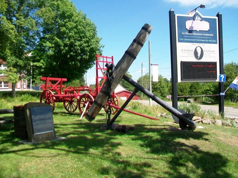
18th Century Anchor and Marker
| 1 ► New Brunswick, Albert County, Hopewell Cape — 18th Century Anchor — |
| On Main Street (New Brunswick Route 114) at Hopewell Cross Road, on the left when traveling north on Main Street. | |||
| 2 ► New Brunswick, Carleton County, Hartland — Hartland Salmon Pool / Fosse à saumon de Hartland — |
| On Main Street (Route 105) at Maple Street, on the right when traveling south on Main Street. | |||
| 3 ► New Brunswick, Carleton County, Hartland — St. John River — |
| Near Main Street (Route 105) north of Hartland Hill Bridge Road, on the right when traveling south. | |||
| 4 ► New Brunswick, Carleton County, Hartland — Town of Hartland — |
| Near Main Street (Route 105) south of Mill Street, on the right when traveling south. | |||
| 5 ► New Brunswick, Carleton County, Woodstock — George Connell House / Maison George Connell — 124 Connell Street / 124, rue Connell — |
| On Connell Street (New Brunswick Route 550) at Queen Street, on the left when traveling south on Connell Street. | |||
| 6 ► New Brunswick, Charlotte County, Bayside — In Champlain’s Footsteps / Sur les traces de Champlain — |
| Near New Brunswick Route 127, 9 kilometers south of New Brunswick Route 1, on the right when traveling south. | |||
| 7 ► New Brunswick, Charlotte County, St. Andrews — St. Croix River — La Rivière Sainte-Croix — |
| Near Water Street close to King Street, on the right when traveling east. | |||
| 8 ► New Brunswick, Charlotte County, St. Stephen — A whale of a tale / Historie de cétacé — |
| On St. Stephen Drive (County Route 3) at New Brunswick Route 170, on the left when traveling south on St. Stephen Drive. | |||
| 9 ► New Brunswick, Charlotte County, Welshpool — Campobello Company and Hotels — Le Campobello Company et les Hôtels — |
| 10 ► New Brunswick, Charlotte County, Welshpool — Friar's Head / Le Cap Friar — |
| 11 ► New Brunswick, Charlotte County, Welshpool — Lubec, Maine — |
| 12 ► New Brunswick, Charlotte County, Welshpool — Lubec, Maine — |
| 13 ► New Brunswick, Charlotte County, Welshpool — Mulholland Point / La pointe Mulholland — |
| 14 ► New Brunswick, Charlotte County, Welshpool — Mulholland Point / La Pointe Mulholland — |
| 15 ► New Brunswick, Charlotte County, Welshpool — Passamaquoddy Tidal Power Project — Projet de Centrale Électrique Marée Motrice — |
| 16 ► New Brunswick, Charlotte County, Welshpool — Passamaquoddy Tribe / La Tribu Passamaquoddy — |
| 17 ► New Brunswick, Charlotte County, Welshpool — Roosevelt Campobello International Park — Le Parc International Roosevelt de Campobello — |
| 18 ► New Brunswick, Kent County, Rexton — The Masts / Les Mâts — |
| Near North Street, 0.3 kilometers east of Rue Main (New Brunswick Route 134), on the right when traveling east. | |||
| 19 ► New Brunswick, Kent County, Rexton — Village Historique de Rexton / Rexton Historic Village — |
| On Rue Main (New Brunswick Route 134) just north of Cail Court, on the right when traveling north. | |||
| 20 ► New Brunswick, Kent County, Rexton — Wooden Ships and Iron Men / Navires en Bois et Hommes de Fer — |
| Near North Street, 0.3 kilometers east of Rue Main (New Brunswick Route 134), on the right when traveling east. | |||
| 21 ► New Brunswick, Saint John County, Saint John — An Island Abounding With Life — Une île pleine de vie — Harbour Passage Trail — |
| On Prince William Street at Saint James Street, on the left when traveling north on Prince William Street. | |||
| 22 ► New Brunswick, Saint John County, Saint John — Clearing Customs in Style — Franchir les douanes avec grâce — Harbour Passage Trail — |
| On Water Street at Duke Street, on the right when traveling south on Water Street. | |||
| 23 ► New Brunswick, Saint John County, Saint John — Colonel Gabriel G. Ludlow — First Mayor of Saint John | Premier maire de Saint John — |
| Near Lancaster Avenue, 0.2 kilometers east of Bridge Road (New Brunswick Route 100), on the left when traveling east. | |||
| 24 ► New Brunswick, Saint John County, Saint John — Defending the Harbour — À la défense du port — Harbour Passage Trail — |
| On Union Street just west of Smythe Street when traveling west. | |||
| 25 ► New Brunswick, Saint John County, Saint John — First Marine Compound Engine — La Première Machine Compound de Marine — |
| On Peters Wharf at Water Street, on the right when traveling east on Peters Wharf. | |||
| 26 ► New Brunswick, Saint John County, Saint John — First Steam Fog Horn — La Premiere Corne de Brume a Vapeur — |
| On Peters Wharf at Water Street, on the right when traveling east on Peters Wharf. | |||
| 27 ► New Brunswick, Saint John County, Saint John — Fishing the Harbour — La pêche dans le port — Harbour Passage Trail — |
| Near Chesley Drive (New Brunswick Route 100) at Bentley Street, on the right when traveling north. | |||
| 28 ► New Brunswick, Saint John County, Saint John — John Robertson — Lord of the North / Le Lord du Nord — |
| Near Lancaster Avenue, 0.2 kilometers east of Bridge Road (New Brunswick Route 100), on the left when traveling east. | |||
| 29 ► New Brunswick, Saint John County, Saint John — Koluskap and Beaver — Koluskap et le castor — |
| Near Lancaster Avenue, 0.2 kilometers Bridge Road (New Brunswick Route 100), on the left when traveling east. | |||
| 30 ► New Brunswick, Saint John County, Saint John — Land of the Dawn — La terre de l’aurore — |
| Near Lancaster Avenue, 0.2 kilometers east of Bridge Road (New Brunswick Route 100), on the left when traveling east. | |||
| 31 ► New Brunswick, Saint John County, Saint John — Partridge Island — L’île Partridge — |
| Near Smythe Street at North Market Wharf, on the right when traveling south. | |||
| 32 ► New Brunswick, Saint John County, Saint John — Rebels Attack — Les attaques des rebelles — |
| Near Lancaster Avenue, 0.2 kilometers east of Bridge Road (New Brunswick Route 100), on the left when traveling east. | |||
| 33 ► New Brunswick, Saint John County, Saint John — Robert Foulis — |
| Near Lancaster Avenue, 0.2 kilometers east of Bridge Road (New Brunswick Route 100), on the left when traveling east. | |||
| 34 ► New Brunswick, Saint John County, Saint John — Saint John – The Working Port — Saint John, port en activité — Harbour Passage Trail — |
| On Long Wharf, 0.1 kilometers west of Smythe Street, on the left when traveling west. | |||
| 35 ► New Brunswick, Saint John County, Saint John — Saint John Harbour Defensive Network — Réseau défensif du port de Saint John — Provincial Historic Site | Lieu historique provincial — |
| On Union Street, 0.03 kilometers west of Smythe Street when traveling west. | |||
| 36 ► New Brunswick, Saint John County, Saint John — Samuel de Champlain — Names St. John River on June 24, 1604 / Il nomme le fleuve Saint-Jean le 24 juin 1604 — |
| Near Lancaster Avenue, 0.2 kilometers east of Bridge Road (New Brunswick Route 100), on the left when traveling east. | |||
| 37 ► New Brunswick, Saint John County, Saint John — Shedding Light on the Three Sisters Mystery — Faire la lumière sur le mystère des trois sœurs — Harbour Passage Trail — |
| On Prince William Street at Saint James Street, on the left when traveling north on Prince William Street. | |||
| 38 ► New Brunswick, Saint John County, Saint John — Simonds, Hazen and White — A Partnership / Un partenariat — |
| Near Lancaster Avenue, 0.2 kilometers east of Bridge Road (New Brunswick Route 100), on the left when traveling east. | |||
| 39 ► New Brunswick, Saint John County, Saint John — The "Three Lamps" — |
| On Prince William Street at Saint James Street, on the left when traveling north on Prince William Street. | |||
| 40 ► New Brunswick, Saint John County, Saint John — The Marco Polo — Le Marco Polo — |
| On Market Square near Chipman Hill, on the left when traveling east. | |||
| 41 ► New Brunswick, Saint John County, Saint John — The Largest in British North America — La plus grande en Amérique du Nord britannique — Harbour Passage Trail — |
| On Water Street north of Prince William Street, on the left when traveling north. | |||
| 42 ► New Brunswick, Saint John County, Saint John — The Marco Polo / Le Marco Polo — The Fastest Ship in the World / Le navire le plus rapide du monde — |
| On Water Street north of Prince William Street, on the left when traveling south. | |||
| 43 ► New Brunswick, Saint John County, Saint John — The Saint John Harbour Bridge | Le pont du port de Saint John — Connecting the City | Un accès à la ville — Harbour Passage Trail — |
| Near Navy Way, 0.1 kilometers east of Chesley Drive (New Brunswick Route 100), on the right when traveling east. | |||
| 44 ► New Brunswick, Saint John County, Saint John — The Tides of Fundy — Les Marées de Fundy — Harbour Passage Trail — |
| Near Navy Way, 0.1 kilometers east of Chesley Drive (New Brunswick Route 100), on the right when traveling east. | |||
| 45 ► New Brunswick, Saint John County, Saint John — The Troop Fleet in the Days of Sail — |
| On Prince William Street close to Duke Street. | |||
| 46 ► New Brunswick, Saint John County, Saint John — West meets East — L’ouest et l’est se rencontrent — Harbour Passage Trail — |
| On Water Street just south of Princess Street, on the right when traveling south. | |||
| 47 ► New Brunswick, Saint John County, Saint John — William Kilby Reynolds — Buider, Reversing Falls Bridge / Bâtisseur du pont des Chutes réversibles — |
| Near Lancaster Avenue, 0.2 kilometers east of Bridge Road (New Brunswick Route 100), on the left when traveling east. | |||
| 48 ► New Brunswick, Saint John County, Saint John — Wolastoq Park — Le parc Wolastoq — |
| Near Lancaster Avenue, 0.2 kilometers east of Bridge Road (New Brunswick Route 100), on the left when traveling east. | |||
| 49 ► New Brunswick, Saint John County, St. Martins — Shipbuilding in New Brunswick / L’Industrie de la Construction Navale au Nouveau-Brunswick — |
| On Main Street, 0.2 kilometers south of Big Salmon River Road, on the right when traveling north. | |||
| 50 ► New Brunswick, Victoria County, Grand Falls — A Changing Waterfall / Une chute au debit varie — |
| 51 ► New Brunswick, Victoria County, Grand Falls — Bridges and Piers / Ponts et piliers — |
| On Broadway Boulevard (New Brunswick Route 130), on the left when traveling north. | |||
| 52 ► New Brunswick, Victoria County, Grand Falls — O. B. Davis Park and Lovers' Lane — Parc O. B. Davis et sentier des Amoureux — |
| On Broadway Boulevard (New Brunswick Route 130) just north of Laforest Street, on the left when traveling north. | |||
| 53 ► New Brunswick, Westmorland County, Moncton — An Economic Engine / Un moteur économique — Riviére Petitcodiac River — |
| Near Westmorland Street at Assomption Boulevard. | |||
| 54 ► New Brunswick, Westmorland County, Moncton — Aquatic Species / Les espèces aquatiques — Riviére Petitcodiac River — |
| Near Assomption Boulevard, 0.2 kilometers east of Westmorland Street, on the right when traveling east. | |||
| 55 ► New Brunswick, Westmorland County, Moncton — Arrival and Survival — Arrivée et survie — Ankunft und Überleben — |
| Near Main Street (New Brunswick Route 106) 0.1 kilometers west of Wheeler Boulevard, on the right when traveling east. | |||
| 56 ► New Brunswick, Westmorland County, Moncton — Journey to a New Country — Voyage vers un nouveau pays — Reise in ein neues Land — |
| Near Main Street (New Brunswick Route 106) 0.1 kilometers west of Wheeler Boulevard, on the right when traveling east. | |||
| 57 ► New Brunswick, Westmorland County, Moncton — Settlers Landing — |
| Near Main Street (New Brunswick Route 106) 0.1 kilometers west of Wheeler Boulevard, on the right when traveling east. | |||
| 58 ► New Brunswick, Westmorland County, Moncton — The Art of Advertising / L’art de la publicité — |
| On Downing Street north of Assomption Boulevard, on the right when traveling north. | |||
| 59 ► New Brunswick, Westmorland County, Moncton — The Shipbuilding Era / La construction navale — Riviére Petitcodiac River — |
| Near Assomption Boulevard, 0.2 kilometers east of Westmorland Street, on the right when traveling east. | |||
| 60 ► New Brunswick, Westmorland County, Moncton — The Tidal Bore / le mascaret — Riviére Petitcodiac River — |
| Near Main Street (New Brunswick Route 106) just west of Wheeler Boulevard, on the right when traveling east. | |||
| 61 ► New Brunswick, Westmorland County, Sackville — HMCS/NCSM Sackville — |
| On Bridge Street (New Brunswick Route 106) at Weldon Street, on the left when traveling east on Bridge Street. | |||