On Market Street (U.S. 17) just west of North 4th Street, on the right when traveling west.
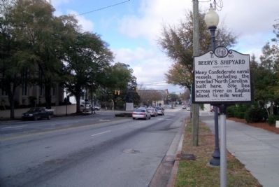
Many Confederate naval vessels, including the ironclad “North Carolina,” built here. Site lies across river on Eagles Island, ¼ mile west. — — Map (db m28627) HM
On Market Street at North Water Street, in the median on Market Street.
On the west side of the river
a little south of the causeway
was Beery's Shipyard, where the
Confederate ironclad North Carolina
was built in 1862 for the protection
of the port. The ironclad Raleigh
was constructed at . . . — — Map (db m28628) HM
On North Water Street north of Market Street, on the left when traveling north.
For 150 years regional customs were administered here. In 1819, the United States government purchased the property for a custom house, a place where duties were paid and ships were cleared to enter or leave the port of Wilmington. In 1844, the . . . — — Map (db m226275) HM
On North 3rd Street at Princess Street, on the right when traveling north on North 3rd Street.
Eighteen miles below Wilmington stood Fort Fisher, which kept the port of Wilmington open for the Confederacy during almost the entire Civil War. On December 24 and 25 1864 it withstood the greatest bombardment in the history of the world up to that . . . — — Map (db m224854) HM
On North 3rd Street just north of Princess Street, on the right when traveling north.
The beginning of Wilmington was opposite the junction of the rivers, in 1730, and called New Liverpool. In 1733 a settlement was made at the foot of Market Street, named Newton, and here Gov. Gabriel Johnston and other officials located in 1734. In . . . — — Map (db m224889) HM
On Boones Mill Road (U.S. 158) 0.5 miles west of Barrows Mill Road, on the left when traveling east. Reported permanently removed.
On July 28, 1863, Union Col. Samuel P. Spear's cavalrymen came thundering through Jackson from Federal-occupied Winton to destroy the Wilmington and Weldon Railroad Bridge over the Roanoke River at Weldon. Confederate Gen. Matt W. Ransom and his . . . — — Map (db m43394) HM
On Boones Mill Road (County Road 1137) 0.1 miles east of U.S. 158, on the right when traveling east.
On July 28, 1863, some of Confederate Gen. Matt W. Ransom's men were bathing here in the Boone's Mill pond, when suddenly bullets began splashing into the water. At the same time, Ransom and his staff galloped across the mill bridge shouting . . . — — Map (db m180511) HM
On U.S. 158/301, 0.3 miles east of Sycamore Street, on the right when traveling west.
Early channel of trade, its valley long an area of plantations. Frequent floods until 1952, since controlled by Kerr Dam. Old name was "Moratuck." — — Map (db m222088) HM
On Lejeune Boulevard (State Highway 24) near the Main Gate for Marine Corps Base, Camp Lejeune, on the right when traveling east. Reported missing.
Established 1 May 1941 by the U. S. Marine Corps for amphibious training. Named for Lt. Gen. John A. Lejeune, USMC, 13th Commandant, 1920 - 1929. — — Map (db m23693) HM
On South Marine Boulevard (Business U.S. 17) at Old Bridge Street, on the right when traveling east on South Marine Boulevard.
Federal gunboat Ellis attacked this town Nov. 23, 1862, then ran aground downstream. It was abandoned under Confederate crossfire. — — Map (db m77113) HM
Near Fla Camp Road, 0.4 miles west of Hammock Beach Road, on the left when traveling west.
Onslow County, with its beautiful beaches, rivers, streams and woods, was considered an ideal destination for many out of town sportsmen in the early 20th century. Dr. William Sharpe, a New York based neurosurgeon, began visiting Onslow County in . . . — — Map (db m77097) HM
Near Fla Camp Road, 0.4 miles west of Hammock Beach Road, on the left when traveling west.
Union Gen. Benjamin F. Butler’s capture of Hatteras Inlet in August 1861 gave Federal forces a foothold from which they could launch attacks up the rivers and sounds of eastern North Carolina. Confederate authorities decided to construct earthen . . . — — Map (db m168280) HM
Near South Water Street at East Ehringhaus Street, on the left when traveling south.
After Union Gen. Ambrose E. Burnside captured Roanoke Island on February 8, 1862, he dispatched Commander Stephen C. Rowan to destroy the Mosquito Fleet, which had been annoying U.S. naval vessels. Confederate Commodore William F. Lynch’s fleet . . . — — Map (db m56812) HM
Near Moores Creek Drive, 0.2 miles west of North Carolina Route 210.
As you walk across this modern boardwalk spanning
Moores Creek, imagine marching an army through
tangled forests and swampy lowlands like these on a
dark February night. Days of rain have drenched
troops and pushed creeks out of their . . . — — Map (db m218477) HM
Near Moores Creek Drive, 0.2 miles west of North Carolina Route 210.
Nearby Moores Creek not only figured in the battle but was critical to the naval stores economy, Surrounded by pine forests that generated tar and turpentine but with few passable roads to get the heavy barrels to market, the colonists used an . . . — — Map (db m218596) HM
Near Moores Creek Drive, 0.2 miles west of North Carolina Route 210.
If we enter, in the winter, a part of the forest that is about to be converted into a "turpentine orchard," we come upon negroes engaged in making boxes [boxed pine trees], in which the sap is to be collected the following spring. . . . — — Map (db m218597) HM
Near Moores Creek Drive, 0.2 miles west of North Carolina Route 210.
The change in forest says it all: longleaf pines are now rare in this area. Although the naval stores industry thrived well into the 19th century, it was doomed as soon as the first ironclad ships put to sea. Pine tar from longleafs was no longer . . . — — Map (db m218603) HM
Near Moores Creek Drive, 0.2 miles west of North Carolina Route 210.
… in those parts there is great plenty of Timber for building of Ships, and also to produce Pitch, Tarr & Rozin … – Colonial Records of North Carolina, 1704
At the time of the battle, patriot leaders . . . — — Map (db m218575) HM
On U.S. 17 south of Washington Acres Road (County Route 1582), on the left when traveling south.
Confederate breastworks were constructed in this vicinity in 1862 to protect Wilmington from an attack from the north and for coastal defense. — — Map (db m77116) HM
On South Main Street just south of Court Street, on the right when traveling south.
The current courthouse structure, circa 1932, is the third courthouse built on this site. The original land conveyance occurred in 1792 and consisted of 6 acres donated to Person County by Dempsey Moore, "in consideration of the good-will of the . . . — — Map (db m218123) HM
Near Pearson Falls Road, 0.4 miles west of Fork Creek Road (North Carolina Road 1100), on the left when traveling west.
Since 1931 the Tryon Garden Club has
been devoted stewards of this 90-foot
waterfall and botanical sanctuary. This
cove forest is an example of one of the most
diverse habitats of native plants, trees,
birds, and wildlife on earth.
During . . . — — Map (db m240910) HM
Near Pearson Falls Road, 0.4 miles west of Fork Creek Road (North Carolina Road 1100), on the left when traveling west.
Welcome to Pearson's Falls and Glen, a botanical preserve comprised of
268 acres This sanctuary has been owned and maintained since 1931 by
the Tryon Garden Club, a nonprofit 501(c)(3) organization.
Located in the foothills of the Blue Ridge . . . — — Map (db m240907) HM
On Andrew Hunter Road just west of West Main Street (State Highway 22), on the left when traveling west.
"Faith Rock" two hundred yards down the river is where Andrew Hunter in 1781 escaping from David Fanning, Tory, rode Fanning's horse, Red Doe, down the rock into the river and to safety. — — Map (db m172035) HM WM
Near Faith Rock Road, 0.8 miles Andrew Hunter Road, on the right when traveling east.
With its headwaters beginning north of here near High Point and Jamestown, the Deep River flows 125 miles through rolling Piedmont hills past many forming mill towns. The Deep joins the Haw River in Chatham County, becoming the Cape Fear River, . . . — — Map (db m172038) HM
On Washington Street at Henry Street, on the right when traveling east on Washington Street.
The mural of the river boatmen is a tribute to the men who were responsible for the economic development of the vast interior region along the Dan River. The most prominent figures in the mural, the African American boatmen in the foreground, . . . — — Map (db m214863) HM
On Church Street (State Highway 700) west of Boone Road, on the right when traveling east.
Built here in 1813 by James Barnett. Later it powered the largest continuously operating textile complex in the northern piedmont. — — Map (db m63015) HM
On famous trading path used by Indians and early settlers. There Greene, retreating from Cornwallis, crossed on Feb. 2, 1781. East 1 mi. — — Map (db m33930) HM
On Memorial Highway (U.S. 64/74) at Arcade Street, on the left when traveling west on Memorial Highway.
In Spring of 1927, this sixty-room hotel was opened simultaneously with the incorporation of the Town of Lake Lure (sister city of Lake Como, Italy) and the completion of the Lake Lure Dam which formed the lake, along with other matching . . . — — Map (db m234194) HM
On U.S. 221 at Green Street, on the right when traveling north on U.S. 221.
Founder of Syracuse, N.Y., early advocate of Erie Canal. Moved to N. Carolina, 1829. Land and mining speculator.
Grave is 50 yds. east. — — Map (db m14598) HM
On State Highway 740, 0.2 miles north of Falls Road (County Road 1719), on the right when traveling north.
The Town of Badin and the Narrows Dam on the Yadkin River were important in the history of hydroelectric engineering, industry, and community planning in North Carolina.
The River Yadkin is reduced about twenty-five . . . — — Map (db m175741) HM
On Perch Road, 0.2 miles west of U.S. 52, on the right when traveling west.
Attempted ca. 1820-25 by Hiram Jennings for Yadkin Navigation Co. Hamilton Fulton was consultant. Never completed. Ruins located 5 miles S.W. — — Map (db m39653) HM
Near State Highway 28, 7.8 miles east of U.S. 129, on the left when traveling east.
Fontana DamFontana Dam, a multi-purpose dam on the Little Tennessee River, is 480 feet high, TVA’s highest. Begun soon after Pearl Harbor, it was completed in less than three years. Water stored here helps control floods. Released water . . . — — Map (db m160563) HM
Near State Highway 28, 7.8 miles east of U.S. 129, on the left when traveling east.
• Fontana is the highest concrete dam east of the Rocky Mountains. • Construction of Fontana Dam began in 1942 and was completed in 1944. • Fontana provides 238 miles of shoreline and 10,230 acres of water surface for recreation activities. • . . . — — Map (db m160573) HM
Near Pickens Highway (U.S. 178) at Main Street (State Road 1156), on the right when traveling south.
The Cherokee called the river Long Man. Its journey begins outside of Rosman, where the North and West Forks join. The river gains identity as East and Middle Forks merge. The French Broad then gathers all other Transylvania rivers and creeks . . . — — Map (db m237098) HM
Near Spring Street at South Main Street (U.S. 401), on the right when traveling east.
In 1858, Stephen Fuquay, while plowing on his farm, discovered this natural spring. The water was found to have a high mineral content and many people were drawn to drink from the gourd left hanging on a nearby tree. A general store and hotels were . . . — — Map (db m233705) HM
Near Bass Lake Road (State Road 1393) 0.1 miles south of Salem Ridge Road, on the right when traveling south.
Fed by three creeks, this lake once powered a grist mill, and it has been a favorite spot for fishing, family picnics and baptisms for 150 years. In the late 1800s, Needham Norris had a grist mill here. In 1892, John Mills bought the property and . . . — — Map (db m233797) HM
On Morrisville Carpenter Road west of Church Street (North Carolina Road 1637), on the right when traveling west.
During the Triassic Period, 220 million years ago, continental plates began to move apart and rip holes in the Earth's crust. The result was a large lake in the fissure that stretched from what today is modern Morrisville to Chapel Hill. Over time, . . . — — Map (db m232916) HM
Near Hickory Avenue, on the right when traveling south.
On February 17th, 1864 the CSS H.L. Hunley was the first submarine to sink an enemy ship in combat. The sub was lost that night as well, when it sank just outside Charleston Harbour in SC. with all eight crew members perishing. Crew member James A. . . . — — Map (db m63250) HM
Just upstream from this location, a dam has slowed the waters of the Neuse River for more than 150 years. The greenway bridge is a great place to see the dam.
Mid-1800s — Paper Mill
In the mid-1800s, the original Miburnie Dam was . . . — — Map (db m90146) HM
Look around. Would this be a good place to cross the river? For hundreds of years, people have crossed the Neuse River in this area on horseback or by stagecoach, wagon or car.
1700s – Smith’s Ferry
In the 1700s before bridges were . . . — — Map (db m90147) HM
Listen! That sound of rushing water is the Neuse River flowing over the remnants of an old mill dam. In the early to mid-19th century, this was the site of a bustling industrial enterprise known as Stone's Mills. Carts and wagons arrived here . . . — — Map (db m90145) HM
On State Highway 94 at North 7th Street, on the left when traveling west on State Highway 94.
Josiah Collins, Sr., and partners drained part of 100,000-acre tract near Lake Phelps with 6-mile canal, completed 1788; mouth 2 mi. southeast. — — Map (db m57010) HM
On Mackeys Road (State Highway 308) at Mackeys Ferry Road, on the right when traveling east on Mackeys Road. Reported missing.
Established by permission of King George II. Operated for 203 yrs. making 8 mile trips from Mackeys to Edenton.
The largest vessel to operate was the John W. Garrett, a twin side wheel steamer 351 ft. x 41 ft. It carried railroad passengers, . . . — — Map (db m226504) HM
On East Main Street at Adams Street, on the left when traveling east on East Main Street.
Confederate troops led by Brig. Gen. R. F. Hoke achieved a brilliant victory in the capture of Plymouth from the United States military and naval forces, April 17-20, 1864.
The iron-clad “Albemarle,” commanded by Capt. J. W. Cook, . . . — — Map (db m57065) HM
Near East Water Street at Madison Street, on the left when traveling east.
In 1863, 19-year-old engineer Gilbert Elliott contracted with the Confederate Navy Department to construct an ironclad gunboat designed by John L. Porter, the navy’s chief architect. Elliott built the vessel at Edwards Ferry on the Roanoke River, . . . — — Map (db m56972) HM
The iron clad ram, the CSS Albemarle was the most successful Confederate ironclad of the Civil War and twice defeated the Union Navy. Build in a cornfield on the Roanoke River near Scotland Neck, the Albemarle played a pivotal role in the Battle of . . . — — Map (db m62228) HM
Near East Water Street at Adams Street, on the left when traveling east.
CSS Albemarle, which had been built in a cornfield beside the Roanoke River in 1863-1864, helped drive the U.S. Army from Plymouth in April 1864 and defeated seven U.S. gunboats in May. The ironclad ram seemed invincible, but 21-year-old US. . . . — — Map (db m56975) HM
On East Main Street at Albemarle Drive, on the left when traveling west on East Main Street.
The Confederate ironclad ram "Albemarle" sank the Union gunboat "Southfield", April 19, 1864, one mile N.E. in the Roanoke River. — — Map (db m57019) HM
On East Water Street at Madison Street, on the right when traveling west on East Water Street.
The Brooke Rifle is named after its developer, Commander John Mercer Brooke (CSA), who served as Chief, Dept. of Ordnance and Hydrography. While closely resembling the popular Parrott Gun used by the Union, the Brooke Rifle is considered to be the . . . — — Map (db m57028) HM
On Laurel Lane east of Wonderland Trail, on the right when traveling east.
Blowing Rock thrives on its natural beauty and outdoor activities. Hiking
the Glen Burney Trail, which begins in the center of town, is a prime example.
The Trail follows New Year's Creek, whose waters flow down the mountain to
the Johns River . . . — — Map (db m229026) HM
In 1917, Walter
Alexander began
development of Mayview
Park, one of Blowing Rock's
first and most grand
residential developments.
Envisioned originally as a
Mayview Park development
amenity for swimming,
fishing, and beautiful
strolls, . . . — — Map (db m229066) HM
Near Blue Ridge Parkway (at milepost 296.4), on the right when traveling south.
The flat meadowland and bog here are believed to be the site of an ancient lake. Silt deposited from feeder streams filled the lake bed, resulting in rich soil that supports a wide variety of plants. Nearby rock outcrops provide shelter from the . . . — — Map (db m163900) HM