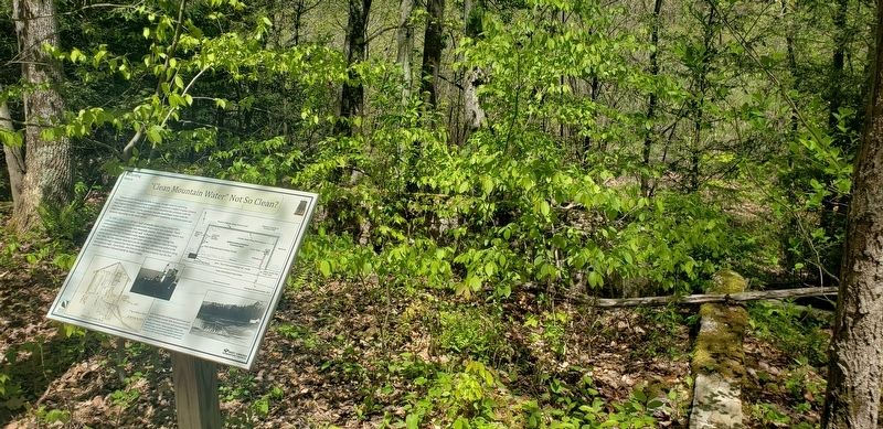
Near Tyrone Road (County Road 75) 0.1 miles south of Quartz Drive, on the right when traveling east.
Reliance on the Monongahela River to supply enough water to a growing Morgantown meant the overall year-round quality remained a subject of great concern. West Virginia University researchers in the 1920s identified the problems with the river . . . — — Map (db m174748) HM
Near University Avenue north of College Avenue, on the right when traveling north.
Bell
of the
Armored Cruiser
U.S.S. West Virginia
Commissioned: 23 Feb 1905
Decommissioned: 1 Sept 1920
Dedicated to the memory
of those West Virginians
who gave their lives in
the service of their country
by
Alpha Phi Omega . . . — — Map (db m134302) WM
On Cheat Lake Trail at Bunker Hill Road (County Road 71), on the right when traveling south on Cheat Lake Trail.
In 1912, the Cheat Haven and Bruceton Railroad was constructed along the Cheat River as a short connector line between the Baltimore and Ohio Railroad in Cheat Haven, Pennsylvania and the Kendall Lumber Company operations near Ice's Ferry, West . . . — — Map (db m178381) HM
On Old Cheat Road at Canyon Road (County Route 67) on Old Cheat Road.
One half mile north of this marker stood the house where George Washington stopped in September 1784 and conferred with leading men of this section “pursuing my inquiries respecting the navigation of the western waters”. Eager to . . . — — Map (db m117094) HM
On Smithtown Road (County Road 73) 0.1 miles south of Kisner Hill Road (County Road 73/13), on the right when traveling west.
Monongalia County. Formed, 1776, from District of West Augusta. All or parts
of 21 other counties, including three in Pennsylyania, were carved from it. Named for the
Monongahela River, bearing an Indian name, which means the "River of . . . — — Map (db m173483) HM
Near Tyrone Road (County Road 75) 0.1 miles south of Quartz Drive, on the right when traveling east.
The Main Dam Keeps Water In…
The dam you are standing on held back the water flowing into the reservoir. The crews mostly used materials found on site during construction. To help ensure strength and impermeability of the core and prevent . . . — — Map (db m174249) HM
On College Avenue east of University Avenue, on the left when traveling east.
[Top left plaque:]
Doris "Dorie" Miller
First African American Hero of WWII
In Recognition of Extraordinary
Courage in Battle
Aboard the U.S.S. West Virginia
Pearl Harbor
December 7, 1941
[Bottom left . . . — — Map (db m170445) HM WM
Near Monongahela Boulevard (U.S. 19) 0.2 miles south of Evansdale Drive, on the right when traveling south.
Traces of a nineteenth century wagon road may be seen behind this sign. This section of the road ran parallel to the location of the existing Service Road.
Before the damming of the Monongahela River, low water
levels frequently allowed . . . — — Map (db m175435) HM
Near Frontier Street at University Avenue, on the left when traveling north.
Where Banks Cave in
The name "Monongahela" comes from a Lenape (Delaware) word meaning "falling banks." The river flows north from present-day Fairmont, WV to Pittsburgh, PA, along a course of uncertain depths. Until the late 19th . . . — — Map (db m200884) HM
Near Frontier Street at University Avenue, on the left when traveling north.
From Humble Beginnings
Until the construction of the first Star City Bridge in 1951, Star City residents and travelers crossed the Monongahela River by ferry. The earliest recorded operator of a ferry at Star City was Jesse Martin, listed . . . — — Map (db m200288) HM
Near Frontier Street at University Avenue, on the left when traveling north.
Something in the Water
In the 1800s deep and surface coal mines operated unregulated. By the 1960s, the Monongahela River had become the most polluted major river system in the U.S. due to acid mine drainage. Many tributaries flowing into . . . — — Map (db m201257) HM
On West Virginia Route 3 just south of County Route 8, on the right when traveling south.
William J. Humphreys. Nearby noted meteorological physicist born 2/3/8162; died 11/10/1949. John Hopkins U. Ph.D., 1897; Director Mt. Weather Observatory 1905; famous for 1909 research on stratosphere; retired, Weather Service, 1935. Winds . . . — — Map (db m83986) HM
On North Washington Street (U.S. 522) at Independence Street, on the right when traveling north on North Washington Street.
Nearly 30 years after colonial travelers, including a teenaged George Washington, pitched tents and "took the waters" in stone lined pools, the Virginia Legislature in 1776 established a town called Bath on 50 acres around the warm mineral . . . — — Map (db m117303) HM
On Congress Street at North Washington Street (U.S. 522), on the right when traveling west on Congress Street.
The historic spa town of Bath is known to the world by its post office name of Berkeley Springs.
From the time he was 16 through the reading of his will in 1799, George Washington ate, slept, owned land and bathed in and around Berkeley . . . — — Map (db m117301) HM
On Fairfax Street at U.S. 522, in the median on Fairfax Street. Reported missing.
Berkeley Springs
Washington first came here, 1748. Fairfax gave the springs to the public. Established as town, 1776. Virginia treated her sick soldiers here. Gen. Washington, Gen Buchanan, Gen. Gates, Charles Carroll and others bought lots . . . — — Map (db m13016) HM
Near Fairfax Street, on the right when traveling south.
One of oldest spas in South, warm mineral spring waters first used by Native Americans for reputed healing powers. Frequently visited by George Washington. Land granted to Virginia by Lord Fairfax in 1776, but used as a health resort since 1750s. . . . — — Map (db m13113) HM
These healing springs, visited by Washington, 1748, were given to Virginia by Lord Fairfax. Helpful in treating infantile paralysis, rheumatism, diabetes and other diseases. Temperature of water is always 74 degrees. — — Map (db m13114) HM
On South Washington Street (U.S. 522) south of Bath Street, on the right when traveling north.
Bryan Fairfax, Thomas Bryan Martin, Trustees, and George William Fairfax. All three were nephews of Thomas Sixth Lord of Fairfax, owner of the "Northern Rappahannock Rivers. Bryan Fairfax was the next in line to become the Ninth Lord Fairfax, but . . . — — Map (db m117385) HM
On Middle Fork Road at Picnic Circle, on the left when traveling west on Middle Fork Road. Reported unreadable.
Insider tip — the word is pronounced Ca-cay-pun.
Cacapon Mountain runs north/south and divides Morgan County into the heavily forested mountainous western segment and the more populous and settled east. The mountain ends at Panorama . . . — — Map (db m159473) HM
On South Washington Street (U.S. 522) south of Liberty Street, on the right when traveling south.
For more than 200 years, the area bordering the park and springs on which the Country Inn stands, has been the historic spa town's center of hospitality.
In September 1784, George Washington stayed at Sign of the Liberty Pole and Flag . . . — — Map (db m117309) HM
On Fairfax Street at Mercer St., on the right when traveling east on Fairfax Street.
George Washington, surveyor for Lord Fairfax, visited "ye fam'd warm springs" first, Mar. 17, 1748. Later he brought his family "to try the effect of the waters" in 1768. When "Ye Town of Bath" was incorporated in October 1776, Washington bought . . . — — Map (db m117310) HM
On Hancock Road (Federal Route 522), on the right when traveling south.
Beautiful panorama of West Virginia, Pennsylvania, and Maryland. It overlooks the Chesapeake and Ohio Canal which was started by George Washington and associates in order to improve communication with the west. — — Map (db m97341) HM
On Fish Hatchery Road (County Road 38/10) just east of Valley Road (U.S. 522), on the left when traveling east.
What was once West Virginia's only bass fish hatchery now produces nearly 70,000 pounds of trout a year.
Ridge Fish Hatchery was opened in 1931 through the influence of two local men: Vernon Johnson, Chairman of the Fish and Game Commission . . . — — Map (db m159475) HM
On West Virginia Route 9 at Sir John Run Road, on the right when traveling west on State Route 9.
Sir John's Run was named for Sir John Sinclair, the quartermaster for General Braddock on expedition in 1755 against the French at Fort Duquesne. James Rumsey demonstrated his steamboat here in 1785. — — Map (db m13152) HM
On Sir Johns Run Road (County Road 3) at Slonaker Lane (County Road 3/1), on the left when traveling north on Sir Johns Run Road.
On January 1, 1862, Confederate Gen. Thomas J. "Stonewall" Jackson led four brigades west from Winchester, Va., to secure Romney in the fertile South Branch Valley on the North Western Turnpike. He attacked and occupied Bath on January 4 . . . — — Map (db m159462) HM
On North Washington Street (U.S. 522) just north of Fairfax Street, on the left when traveling north.
Nearly 300 years ago the town was developed adjacent to the 250 million year old warm mineral springs. Berkeley Springs has always been about promoting and preserving clean water. Today, the town is green, committed to integrating environmental . . . — — Map (db m159458) HM
On West Virginia Route 9, on the right when traveling west.
Today's View Panorama Overlook marks the north end of Cacapon Mountain's 30-mile march. Composed of Oriskany sandstone, it plunges nearly 1000 feet into the Potomac River, which bends along the base of the Overlook as it heads downstream . . . — — Map (db m167603) HM
On Craigsville Road (West Virginia Route 20) 2.2 miles south of West Webster Road in Craigsville (West Virginia Route 55).
Scenic view of Gauley River which rises in Pocahontas County at elevation of 4100 feet and flows southwesterly to join New River, forming Great Kanawha. Cranberry, Cherry, Meadow, Williams Rivers are its tributaries. — — Map (db m179421) HM
On Old U.S. 19 just east of U.S. 19, on the left when traveling south.
Site of first ferry in Nicholas County to
cross Gauley River nearby. Owned
first by William McClung; lost in court
case to Ed Hughes. Family operated
until 1903, when county built bridge
for $7,200. Vital transportation link
for settlers and . . . — — Map (db m138101) HM
On Summersville Lake Road (West Virginia Route 129) 0.3 miles west of Reservoir Street, on the right when traveling west.
Summersville Reservoir
Constructed
Under the Supervision
of the
United States Army
Corps of Engineers
Huntington District
1960 - 1966
District Engineer: Col. S. Malevich 1959-1962
District Engineer: Col. H. W. . . . — — Map (db m165258) HM
On Summersville Lake Road (West Virginia Route 129) 2.6 miles west of U.S. 19, on the right when traveling east.
As the primary purpose of the Summersville Lake
Project is flood control, the U.S. Army Corps of
Engineers continuously monitors rainfall and stream
flow conditions. To prevent downstream flooding, the
USACE monitors stream gauges in both . . . — — Map (db m138072) HM
On Summersville Lake Road (West Virginia Route 129) 2.6 miles west of U.S. 19, on the right when traveling east.
1) Only a relatively small force is required to move the valve.
2) Excellent flow regulation over a wide range of discharges can easily be obtained.
3) Ability to oxygenate water, benefiting downstream ecosystems.
At the time of . . . — — Map (db m138069) HM
On Zoo Circle, 0.4 miles south of Waddington Drive, on the left when traveling north.
Bald Eagle
Bald eagles are large birds of prey found throughout North America. They typically prefer habitats near lakes, streams, or rivers where they can hunt for their primary prey of fish. However, bald eagles also regularly . . . — — Map (db m196428) HM
On North Wabash Street, 0.1 miles north of Zane Street (U.S. 40/250), on the left when traveling north.
Imagine the Wheeling Island landscape in front of you filled with thousands of marching soldiers, galloping horses, and booming cannons. Clouds of woodsmoke and gun smoke hung over the fields that stretch north along the back channel of the Ohio . . . — — Map (db m200542) HM
On Market Street just north of 23rd Street, on the right when traveling south.
George E. Flaccus was a wholesale food dealer. He opened his business, which specialized in fancy groceries and the manufacture of minced meats on this N.W. corner of Market Street in 1881.
Wheeling's population had grown to 30,000. The City . . . — — Map (db m196464) HM
In June 1816, Henry Miller Shreve launched his steamboat "Washington" from Wheeling, where it was built. The boat represented a major shift from the Fulton-Livingston design of larger steamships. Its minimal draft made it particularly well suited to . . . — — Map (db m142393) HM
Baltimore and Ohio Railroad
Arrived in Wheeling January 13, 1853
Ohio River Railroad
Incorporated in 1881
Pittsburgh, Cincinnati & St. Louis Railway
Incorporated in 1868
Pittsburgh, Wheeling & Kentucky Railway . . . — — Map (db m196412) HM
"this was a considerable Village contains about fifty houses...it is situated on the east side of the river on an elevated bank; the landing is good, just below the town and on the side big Wheeling creek emtys itself into the . . . — — Map (db m71105) HM
Near Main Street north of 20th Street, on the left when traveling north.
The name Wheeling comes from the Delaware Indian word, Wihling, meaning “place of the skull” – Wih is the Delaware word for head and ling is their word for place. Legend has it that Native Americans were so angered by a white . . . — — Map (db m198420) HM
The Wheeling Wharf played a crucial role in bringing people and products to and from our growing city. The port has seen the arrival of visitors such as Lafayette, Meriwether Lewis, Mark Twain, and thousands of steamboat passengers. The port was . . . — — Map (db m71134) HM
On Zoo Circle, 0.4 miles south of Waddington Drive, on the left when traveling north.
The number of white-naped cranes is rapidly declining due to habitat loss and military activities.
Found in the wetlands, their habitat is declining due to agriculture, mainly farming rice and cattle.
Severe drought conditions in their . . . — — Map (db m196430) HM
On West Virginia Route 7 at Lime Plant Road (County Route 46), on the right when traveling west on State Route 7.
In 1784 George Washington, Bushrod Washington, James Craik and his son made a horseback journey to inspect their western lands and investigate the feasibility of building a canal from the Potomac River to westward waters. On their return trip, they . . . — — Map (db m20842) HM
On South Buffalo Street (West Virginia Route 72) south of West Main Street, on the right when traveling south.
In Commemoration of the Great Flood of November 4-5, 1985
•
Dedicated to the resilient Citizens of Rowlesburg, West Virginia
•
Historic Cheat River Flood Water Crest 36.9 Feet
•
Destruction of 118 Homes - Damage of 55 Houses - Loss . . . — — Map (db m198785) HM
On Charleston Road (West Virginia Route 62) south of A Street (Local Road 35/11).
The nearby highway is part of route
traversing W.Va. from Lewisburg to
Point Pleasant memorialized by the
state to commemorate the march of
the American Colonial army of 1,200
men led by Andrew & Charles Lewis.
After a month's march this . . . — — Map (db m11454) HM
On Charleston Road (West Virginia Route 62) south of A Street (Local Road 35/11).
This “Poca River Tract” of
7,276 acres was acquired by
George Washington, and
surveyed by Wm. Crawford, 1773.
It bordered Kanawha River, "12
miles and 227 poles."
Washington’s nephew, Lawrence,
resided at Red House Shoals. — — Map (db m11453) HM
On Charleston Road (U.S. 35) at Frazier Lane, on the right when traveling south on Charleston Road.
Red House Shoals. Oldest community on the Kanawha River between Charleston and Point Pleasant, being settled circa 1795. In 1819, steamboat “Robert Thompson” failed to navigate the shoals here on a trip to Charleston. This led to an . . . — — Map (db m85690) HM
On Winfield Road (West Virginia Route 817) 0.4 miles north of Tompkins Crossing Road, on the right when traveling north.
Putnam County. Formed in 1848 from Cabell, Mason, and Kanawha. Named for Gen. Israel Putnam, a Revolutionary War hero. The county is cut by trails made by American bison to the Ohio River. Its oldest town, Buffalo, is named for them. . . . — — Map (db m178696) HM
On Ritter Drive (U.S. 19) at Grandview Road (West Virginia Route 307), on the right when traveling north on Ritter Drive.
Grandview Park (11 miles N.), 878 acres, derives name from an overhanging cliff 1300 ft. high. In basal Pennsylvanian rocks. New River in this area has cut a steep-walled gorge through Mauch Chunk strata of late Mississippian Age. — — Map (db m42174) HM
On Hinton Road (West Virginia Route 3) at Joes Ridge Road (County Road 3/25), on the right when traveling east on Hinton Road.
A severe drought that began in 1939 caused a prolonged water crisis for the City of Beckley. After a frozen water main burst and water usage was restricted, officials ordered a better water supply be provided. The solution was to access nearby Glade . . . — — Map (db m197782) HM
Before you is an excellent view of the upper gorge area of New River Gorge National River. This section of the gorge is broad and the river is wide, unlike the steep V-shaped canyon found downstream of Sandstone Falls. As the New River cut its way . . . — — Map (db m100024) HM
On West Virginia Route 20 just south of Bluestone Park Road, on the left when traveling south.
The Lilly Truss Bridge was determined to be eligible for the National Register of Historic Places for its association with the creation of the Bluestone Dam and Bluestone Lake. It was built to provide a transportation link across the lake. The . . . — — Map (db m132561) HM
On West Virginia Route 20, 0.2 miles south of Bluestone Park Road, on the left when traveling south.
During the Civil War, Pack's Ferry
was a strategic river crossing for
Federal troops in the area. On the
morning of August 6, 1862, 900 men
and 2 artillery guns of Confederate
Col. G. C. Wharton's command fired
on 23rd Ohio soldiers . . . — — Map (db m132560) HM
On Ballengee Street at 1st Avenue on Ballengee Street.
On February 27, 1871, Summers County was formed from parts of Fayette, Greenbrier, Mercer, and Monroe counties. Summers County was named for George W. Summers, a prominent jurist and legislator from Virginia then West Virginia. Summers County was . . . — — Map (db m243866) HM
This ancient and spectacular river gorge, the rugged sandstone cliffs and overlooks, the unbroken, diverse Appalachian forest ecosystem, and the-hiStoric Bluestone Turnpike Trail, is protected as Bluestone National Scenic River. This publicly owned . . . — — Map (db m140104) HM
Bluestone River
The Bluestone River begins at an elevation of about 3,500 feet above sea level on East River Mountain, Tazewell County, Virginia. After flowing about 77 miles the river empties into the New River at an elevation of . . . — — Map (db m140101) HM
Bluestone River
The Bluestone River begins at an elevation of about 3,500 feet above sea level on East River Mountain, Tazewell County, Virginia. After flowing about 77 miles the river empties into the New River at an elevation of . . . — — Map (db m140102) HM
On West Virginia Route 20, 0.2 miles north of County Route 18, on the left when traveling south.
Name derived from the hollow stemmed shrub
Spiraea alba which grows profusely along Big
and Little Pipestem creeks. The first white
man to see Pipestem was Christopher Gist,
1750, while exploring for the Ohio Land
Company. Shawnee . . . — — Map (db m132562) HM
On Meadow Creek Road, 0.7 miles west of Interstate 64, in the median.
Before the coming of the railroad and the whitewater rafting industry, commerce along the New River was
carried by long, flat-bottomed boats called batteaux. The New River has always been an important travel
corridor through the rugged Appalachian . . . — — Map (db m179213) HM
On Temple Street (West Virginia Route 20) south of Faith Lane (County Road 7), on the right when traveling south.
William Richmond Homeplace. Near here was homestead of William Richmond (1752-1850). A veteran of he Revolution, he came here in 1799 likely as the first permanent white settler. The prolific family operated a ferry across the New River for . . . — — Map (db m229268) HM
On North Pike Street (U.S. 50) at Victory Avenue (U.S. 119), on the left when traveling west on North Pike Street.
Great dam built by the United States Government two miles south on the Tygarts Valley River River to control floods in the Monongahela Valley. It is 210 feet high and 1780 feet long. It forms a lake of over 4000 acres, 73 miles around. — — Map (db m75029) HM
Near Paul E. Malone Road (County Road 9/7) 0.4 miles south of Parkview Road (County Road 44), on the right when traveling south.
President Franklin Roosevelt implemented the New Deal programs to revitalize the nation's economy during the Great Depression. Recreation and infrastructure projects provided employment opportunities. More than 55,000 West Virginia men were . . . — — Map (db m180891) HM
On Rail Falls Road (County Road 27/3) 0.2 miles south of Douglas Road (County Road 27), on the right when traveling south.
This area, part of the community of Coketon, was once the site of a large coal mining and processing complex, pictured in the main photo below. Underground mining ended here in the 1950s. A few foundations remain, along with some coke ovens, but . . . — — Map (db m210123) HM
Near Canyon Point Road (County Road 29/2) east of Blackwater Falls Road (County Road 29), on the right when traveling east.
Early visitors to this area scrambled down a boulder-strewn path and climbed over fallen trees to view Blackwater Falls. As one of today's visitors, you are enjoying a boardwalk of more than 200 steps that will take you to the closest viewing . . . — — Map (db m153050) HM
On Camp 70 Road at Brown Mountain Trail, on the left when traveling east on Camp 70 Road.
Approximately 820 feet east of here, Camp 70 Road intersects the historic Fairfax Line, the western boundary of about 5,000,000 acres inherited by Thomas Lord Fairfax in 1719. In 1746 a survey party that included Peter Jefferson, father of Thomas . . . — — Map (db m210152) HM
Near Canyon Point Road (County Road 29/2) 0.1 miles east of Blackwater Falls Road (County Road 29) when traveling south.
Beginning in 1853, David Hunter Strother, writing under the pen name of "Porte Crayon," wrote a series of articles about his various adventures into the Blackwater region for Harper's New Monthly Magazine. His colorful descriptions and . . . — — Map (db m153051) HM
The resistant Homewood and Conoquenessing sandstones, the “Salt Sands” of the driller, form the Canyon Walls and Blackwater Falls. These sands produce oil and natural gas in West Virginia and commercial brines on the Kanawha and Ohio . . . — — Map (db m69720) HM
On Poplar Street, 0.1 miles south of Mill Street, on the left when traveling south.
In the spring of 1861, Union forces into northwestern Virginia to secure the vital Baltimore and Ohio Railroad, protect important turnpikes, and support Unionists against Confederates. The two sides fought numerous engagements between June . . . — — Map (db m159726) HM
On 1st Street (U.S. 219) at Water Street, on the left when traveling west on 1st Street.
Rocks of destruction shaped with pride, form an ark of strength for those who survived, and a monument of glory for those who died, in the Flood of November 4-5, 1985.
Cleta M. Long
In memory of
Raymond D. Bonner 1926 - . . . — — Map (db m153103) HM
On Main Street (State Highway 72) at 1st Street (U.S. 219), on the right when traveling north on Main Street.
John Crouch, pioneer settler, established "tomahawk rights" here in 1766, but the town was not incorporated until 1893. Here Shavers Fork and Blackwater unite to form the Cheat River. Hu Maxwell, the historian, lived near.
After the battles of . . . — — Map (db m23641) HM
On Seneca Trail (U.S. 219) 0.2 miles south of Kempton Road (West Virginia Route 9), on the right when traveling north.
The Fairfax Stone (½ Mi. E.) marking the Potomac's headwaters, was a corner of Lord Fairfax's vast estate. The line of 1736 was checked in 1746 by a survey on which Peter Jefferson, father of Thomas Jefferson, was engaged. — — Map (db m3945) HM
On W. Kempton Road (County Route 9) at Seneca Trail (U.S. 219), on the right when traveling north on W. Kempton Road.
The Fairfax Stone (½ Mi. E.) marking the Potomac's headwaters, was a corner of Lord Fairfax's vast estate. The line of 1736 was checked in 1746 by a survey on which Peter Jefferson, father of Thomas Jefferson, was engaged. — — Map (db m234616) HM
On Appalachian Highway (West Virginia Route 32) south of U.S. 219, on the right when traveling south.
To the southwest is Blackwater Falls, 63 feet high, and its rugged gorge. It drains lovely Canaan Valley, which may be seen from the mountain top, 3700 feet high. It was made famous in “Blackwater Chronicles” by “Porte . . . — — Map (db m74823) HM
On Blackwater Canyon Trail, on the right when traveling north.
The Story of a River
Welcome to the Thomas Interpretive Area. During the 19th century this area was renowned as a remote, forlorn wilderness, but the discovery of coal in the region and the advent of the Industrial Age, became a center of . . . — — Map (db m153092) HM
On Wells Street (West Virginia Route 2) at Elizabeth Street, on the left when traveling west on Wells Street.
Charles Wells settled here in 1776 and the first county court was held at his home. The town was named in 1815 for the Wells sisters and was incorporated in 1839. A ferry across the Ohio was established here in 1818. — — Map (db m80251) HM
On Court Street (West Virginia Route 37) east of Vancouver Street, on the right when traveling east.
Named during the War between the States. At the junction of the Tug and Big Sandy rivers, in 1789, Charles Vancouver and 10 companions built a log fort and attempted a settlement on land surveyed in 1770 by John Fry for George Washington. — — Map (db m136675) HM
On Court Street (West Virginia Route 37) east of Vancouver Street, on the right when traveling east.
Steam Boat traffic reached Fort Gay in the 1830s but relied on a sufficient water level. During dry periods, boats could not run. Throughout the 19th century, efforts were made to build a system of locks and dams to allow year-round boat traffic and . . . — — Map (db m137332) HM
On Mountain Parkway (West Virginia Route 20) 0.2 miles south of Panther Lick Road (County Road 20/3), on the right when traveling south.
Favorite gathering site for Jerry's Run and nearby residents during late 1800s-early 1900s; as well as rest stop for tired travelers for refreshing sulphur water. Nearby, a brief Civil War skirmish in 186 resulted in killing of Confederate James . . . — — Map (db m178890) HM
On McGraw Avenue just south of North Main Street (West Virginia Route 15), on the right when traveling south.
By the late 19th century, visionaries had begun to see the potential of the natural beauty of Webster Springs and the "therapeutic" value of the sulphur waters. In 1897, a small hotel was built by Johnson Camden on the lower end of this bottom. . . . — — Map (db m178886) HM
On Lock Three Road just south of Wells Lock Road (Local Road 14/7), on the right when traveling south.
Built 1867-74 by Kanawha Navigation
Company at cost of $60,000, Dam is
289 ft. long with 42 ft. wide base
anchored to bedrock. Lockchamber is
22 ft. wide and 125 ft. long with a
11.8 ft. lift. Purchased by Federal
Government, 1905. and . . . — — Map (db m174330) HM
On Fort Boreman Drive, 1 mile south of Robert Byrd Highway (U.S. 50), on the right when traveling north.
The Ohio River, called La Belle Riviere (the beautiful river) by the French, derives its name from an Iroquois word meaning "good river” or "large river”. The Ohio flows generally along a southwesterly 981-mile course from Pittsburgh, PA, to Cairo, . . . — — Map (db m189921) HM
The confluence of the Ohio and Little Kanawha Rivers is known as “the Point.” It was the site of downtown Parkersburg’s earliest settlement and the stopping place for several famous people. George Washington paused here in his trip down . . . — — Map (db m73580) HM
On Rolling Rock Road, 0.1 miles west of Volcano Road (Local Route 5), on the left when traveling west.
In memory of the U.S.S. Cisco SS 290, whose 76 officers and men gave their lives for their country so that others could remain free. The Cisco was lost on September 28, 1943 in an antisubmarine attack at 9° 9' 47" N, 121° -44'E, by . . . — — Map (db m172599) HM WM
184 entries matched your criteria. Entries 101 through 184 are listed above. ⊲ Previous 100