On North Western Avenue at West 6th Street, on the right when traveling north on North Western Avenue.
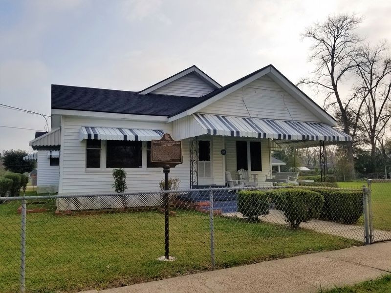
David L. May and Jeanette Ross May, husband and wife, were prominent African-American citizens of the City of Crowley, Louisiana. They began a life-long commitment to the community in the 1920's, and in 1980 were named Crowley's Outstanding . . . — — Map (db m189298) HM
On Hickory Flat Road, 1.4 miles north of U.S. 165, on the left when traveling north.
This property served as the first African-American school in Allen Parish until 1945. The land was deeded to the church in 1911 by Julian and his wife Modeste Captain. *School established in 1880 with Lawrence Shaw as first teacher. The original . . . — — Map (db m189219) HM
On Lessard Street at Williams Street, on the right when traveling north on Lessard Street.
This quiet neighborhood between the river and the railroad retains a number of historic features related to the struggles and achievements of Louisiana African Americans. The Rosenwald School building in front of you was relocated from a site 15 . . . — — Map (db m155974) HM
It began in 1912, Booker T. Washington, President of Tuskegee Institute,
approached Julius Rosenwald, President of Sears, Roebuck and Company, with
an idea for a pilot program that was to have a dramatic impact on the face of
America. . . . — — Map (db m154213) HM
On Charles Street east of Lessard Street, on the right when traveling east.
Many of the Africans brought to
Louisiana during the colonial period
were from the Senegambia area
of West Africa. The Africans who
were brought to America were selected
largely because of their agricultural and
technological knowledge and . . . — — Map (db m243974) HM
Near Mississippi Street (State Highway 18) at Iberville Street, on the left when traveling north.
(left panel)
"We are still anxious as we have ever been to show the world that the latent courage of the African is aroused, and that , while fighting under the American Flag, we can and will be a wall of fire and death to the enimies of . . . — — Map (db m86323) WM
On Williams Street east of Lessard Street, on the right when traveling east.
The enslaved workers passed travel instructions from
plantation to plantation by song. They brought from
Africa the custom of creating songs that transmit
factual information. In America, the enslaved
Africans turned song into codes that . . . — — Map (db m244010) HM
Near Mississippi Street (State Highway 18) near Crescent Park Circle, on the right when traveling north.
Imagine the landscape in front of you in the late 1600s: the wild wetlands of the fierce Chitimaches Indians. Sieur de la Salle sailed his ship past here in 1682, claiming all he surveyed for France. But in 1806, Englishman William Donaldson . . . — — Map (db m156746) HM
On Williams Street east of Lessard Street, on the left when traveling east.
The Underground Railroad was not underground,
not a railroad, and not a single route or system of
trails. It was the term used to describe both random
and concerted effort for people to free themselves
from bondage. Louisiana's stories of . . . — — Map (db m244012) HM
On Williams Street east of Lessard Street, on the left.
The enslaved Africans who worked as
cooks on the plantations had access to food
supplies which aided runaways. The cypress
swamps of Louisiana became a magnet for
runaways and free blacks. A common bond
developed between the African . . . — — Map (db m244019) HM
On Ashland Road (State Highway 3251) 0.2 miles east of River Road (State Highway 75), on the right when traveling west.
Once enslaved at Ashland Plantation, became noted 19th century African American jockey. Rode the horse Lecompte to victory over Lexington in 1854 in New Orleans. Inducted into the Louisiana Racing Museum Hall of Fame in 1997. — — Map (db m84995) HM
On State Highway 929 at Prairieville Fair Grounds Road, on the left when traveling east on State Highway 929.
(side 1)
The Ascension Parish Negro Fair Association, Inc.
The APNFA, Inc. was established September 22, 1950 by concerned citizens in the Prairieville area. The Association assisted and encouraged the advancement of farming, . . . — — Map (db m85750) HM
On State Highway 308 at Freetown Rd., on the left when traveling south on State Highway 308.
Israel Baptist School. In 1872, Reverend Osborne Dickerson and the First Israel B. C. congregation organized the Baptist Church School on this site to provide formal education for African American children. In 1877, Assumption Parish School . . . — — Map (db m86041) HM
On Legion Drive near North Preston Street (State Highway 452), on the left when traveling east.
Organized in 1889 under the leadership of Rev. J.W. Womack of Beggs, Oklahoma. Rev. and Mrs. Womack opened the first private "colored" school in Avoyelles Parish. Rev. A.L. Holmes was pastor of this church for 37 years. — — Map (db m138654) HM
On South Preston Street (State Highway 452) near East Mark Street, on the right when traveling south.
Frame structure with Greek Revival influence was built for the Black Catholic families of Marksville and staffed by the Holy Ghost Fathers. Rev. Fr. T.J. Nolan was the first pastor and this church was built by Rev. Fr. John Cooney. — — Map (db m117651) HM
On South Preston Street (Louisiana Route 452) south of East Mark Street, on the right when traveling south.
Established September 1919, In Marksville, Louisiana by the Diocese of Alexandria, LA primarily for Black Catholics, a common practice of that era. Originally staffed by Holy Ghost Fathers. Currently, serves a congregation of 90% plus Black . . . — — Map (db m214333) HM
On East Mark Street west of South Preston Street, on the left when traveling west.
Founded by
Rev. Fr. Nicholas Juderman
as a school for Black Catholic
children. Land donated by
Daughters of the Cross.
Funding obtained from
Mother Katherine Drexel,
founder of the Sisters of
the Blessed Sacrament.
Opened in 1917. First . . . — — Map (db m122502) HM
On North Main Street north of West Bon Temps Street, on the left when traveling north.
Site of general store and post office where Sam Bass mailed Solomon Northup's letter to obtain his freedom from being kidnapped into slavery. Northup was a free man of color living in Saratoga, New York and was hired to play violin in Washington, . . . — — Map (db m122414) HM
On North Main Street (State Highway 115) north of Mark Street, on the right when traveling north.
Solomon Northup, a free man of color from New York, was lured
to Washington, D.C. in 1841 and kidnapped into slavery.
Brought to New Orleans, he was sold to spend 12 years as a
slave in Central Louisiana arriving on the Red River in
Alexandria. . . . — — Map (db m120959) HM
On Johnson Koran Road, 1 mile north of State Highway 527, on the left when traveling north.
At this site in 1868, Isaac Williams
and thirty other African American
men were arrested and unlawfully
convicted and sentenced to one year
in the penitentiary for holding a
Loyal-League meeting. Four months
later, with the advice and consent . . . — — Map (db m144214) HM
On Williamson Parkway west of State Highway 1, on the left when traveling west.
Blues singer from Mooringsport, La. (1888-1949). He played 12 string guitar on Shreveport’s Fannin St., sang his way out of prison, and became a folk hero with songs like “Goodnight Irene,” “Bourgeois Blues,” and “Midnight Special.” — — Map (db m139521) HM
On Dixie Shreveport Road (Louisiana Route 3049) 0.5 miles north of Whitefield Circle, on the right when traveling north.
The former Rosenwald School at Cash Point was built in 1923-24 for a cost of $2,300.00 as a two teacher frame school. The Rosenwald Fund was developed by Julius Rosenwald, CEO of Sears, Roebuck & Company, and educator, Booker T. Washington in . . . — — Map (db m175959) HM
Near Texas Avenue north of Lawrence Street, on the right when traveling north. Reported missing.
1057 Texas Avenue founded in 1866. Oldest Black Baptist Church in Shreveport. Built Present location in 1903. Romanesque Revival Style, by noted Architect N. S. Allen — — Map (db m180320) HM
On Texas Street (U.S. 80/79) west of Austin Place, on the right when traveling east.
Built 1923 by the Court of Calanthe, an early African-American woman's organization. Served as the Court of Calanthe's headquarters for many years as well as housing the offices of Black professionals. Roof Garden at top of building was used for . . . — — Map (db m141014) HM
On Weinstock Street west of Pierre Avenue, on the left when traveling west.
Built 1917 as Central Colored High School. Later a Junior High School and today an Elementary School. Listed in National Register of Historic Places, 1991. — — Map (db m142859) HM
On Texas Avenue (U.S. 80) west of Levy Street, on the right when traveling west.
Opened in 1883. City's first Black Cemetery established by and for Black citizens. Many prominent early African-American Shreveporters are buried here, From 1868 to 1874 this site was the campus of Shreveport University, a Baptist College. Entrance . . . — — Map (db m143748) HM
On U.S. 79 at Hatter Street, on the left when traveling north on U.S. 79.
Haynesville Colored School was built in 1927 on twelve acres of land donated by Verge White. From 1933-1959, the school was named Haynesville Colored High School. The name was changed in 1960 to Carter G. Woodson High School with the class of . . . — — Map (db m180167) HM
On U.S. 79 north of Dawson Street, on the right when traveling north.
AKA pot liquor. Broth made from boiling greens and pork fat. Fed South's hungry by early 1850s. In 1935, Senator Huey Long praised its value. — — Map (db m220563) HM
On St. John Road (Parish Road 173) 0.1 miles north of Buster Johnson Road.
On this site in 1916, the St. John community donated land and logs to construct a Rosenwald school building for the negro children of the community. Earlier schools were established at St. John Missionary Baptist and later a small one room . . . — — Map (db m180161) HM
On Friendship Road just west of Wright Road, on the right when traveling west.
From 1965-1937, the Friendship CME Church served as the house of worship in Claiborne Parish where the Claiborne Parish Civic League (CLPL), a local activist organization, met and organized plans to bring fair and just changes throughout the parish . . . — — Map (db m180149) HM
On North 1st Street (State Highway 568) south of Greathouse Street, on the right when traveling south.
For more than a quarter of a century, Frank Morris operated one of the most successful African-American businesses in Concordia Parish. From the late 1930s until 1964, Morris’ shoe shop on Hwy. 84 in Ferriday was one of the busiest establishments in . . . — — Map (db m126998) HM
On North 1st Street at Greathouse Street, on the right when traveling north on North 1st Street.
Will Haney, a World War I vet, was one of Ferriday's leading African-American businessmen who made his living selling insurance, managing rental property and operating a laundry and hotel. But he is nationally known for his famous cafe and . . . — — Map (db m119690) HM
On North 1st Street at Greathouse Street, on the right when traveling north on North 1st Street.
Leon "Pee Wee” Whittaker
was born circa 1906. He was raised mostly by his mother, Kizzie who could play
"most anything” remembered Pee Wee. Mrs. Whittaker took Pee Wee on tour with her band until he was old
enough to go to . . . — — Map (db m119732) HM
On Louisiana Avenue (State Highway 586) at South 3rd Street, on the right when traveling east on Louisiana Avenue.
Louisiana and Mississippi have long shared a close musical relationship. One of the most important musical paths was that between Natchez and Ferriday, where African American entrepreneur Will Haney operated Haney’s Big House for several . . . — — Map (db m79555) HM
On North Boulevard near St. Louis Street, on the right when traveling east.
Frank Hayden, one of Louisiana's most acclaimed sculptors and a Southern University professor of Fine Art, was an inspiring artist who created work that ranged from the monumental to the intimate. His bronze and wood sculptures have an aesthetic . . . — — Map (db m172830) HM
On North Third Street at Spanish Town Road, on the right when traveling south on North Third Street.
Despite the passage of the 1964 Civil Rights Act, the struggle for equality continued.
On August 10, 1967, Bogalusa civil rights activist A.Z. Young, with Robert "Bob" Hicks and Gayle Jenkins, led the march from Bogalusa to Baton Rouge where he . . . — — Map (db m179443) HM
Near North 3rd Street at Spanish Town Road, on the left when traveling north.
Boom, boom, boom! Cannon fired all day across these grounds on September 21st, 1779, until the British flag finally came down. The Spanish victor's troops included African-Americans, Native-Americans, and French-Acadian refugees, in this, the . . . — — Map (db m138445) HM
On Capitol Lake Drive near Capitol Access Road, on the right when traveling east.
This monument honors the brave service and sacrifices of all African-American Veterans
and their families from Louisiana and nationwide. It begins with the 1863 Siege at
Port Hudson, Louisiana, the first time Black soldiers had the opportunity to . . . — — Map (db m232815) HM WM
On Thomas H. Delpit Drive at Louise Street, on the right when traveling south on Thomas H. Delpit Drive.
There is no place you or I can go, to think about or not think about, to summon the presences of, or recollect the absences of slaves; nothing that reminds us of the ones who made the journey and of those who did not make it. There is no . . . — — Map (db m117112) HM
Near Essen Lane (State Road 3064) south of Interstate 10, on the right when traveling south.
This building was originally a double-pen slave cabin from Welham Plantation built circa 1840. Upon relocation in 1871, it was converted to a blacksmith's shop. It retains its mortise-and-tenon construction, but has been modified with a new . . . — — Map (db m112712) HM
Near Essen Lane (State Road 3064) south of Interstate 10, on the right when traveling south.
This two-room house is thought to be the oldest of the other Welham Plantation slave cabins because of its unusual construction. Note the 'one-by-twelve' inch boards across the front. It has beveled edge siding on the front wall. The framing is of . . . — — Map (db m112056) HM
On West Stadium Dive north of South Stadium Drive, on the right when traveling north.
Ja'Marr Chase cemented his name as one of the top players
in SEC history in 2019, winning the Biletnikoff Award as the
nation's top receiver and becoming the first wide receiver in
LSU history to earn unanimous All-America honors. In . . . — — Map (db m173602) HM
On West Stadium Street north of South Stadium Drive, on the right when traveling north.
One of the most dynamic players in LSU history, Odell Beckham Jr. established himself as a threat to score every time he touched the football. As a junior in 2013, he shattered the LSU single-season record for all-purpose yards with 2,315. He was . . . — — Map (db m107798) HM
Near Essen Lane (State Road 3064) near 10, on the right when traveling south.
Originally built as a slave cabin, this building was later converted into the kitchen for the Overseer's House. Its use as a schoolhouse began in the late 1800's and continued into the 1930's. The structure was moved to the museum from Welham . . . — — Map (db m113545) HM
Near Essen Lane (State Road 3064) south of Interstate 10, on the right when traveling south.
Slave purchases represented large monetary investments for plantation owners. Returns on investments were possible only when the slaves were healthy and able to perform their duties. Most planters arranged for a doctor to tend to the sick on a . . . — — Map (db m112058) HM
Near Essen Lane (State Road 3064) south of Interstate 10, on the right when traveling south.
This cabin, and the one across from it, were occupied by slaves on the Welham Plantation in the Antebellum Period.After the Civil War, they remained occupied by tenant farmers, sharecroppers, and finally plantation workers until the 1960's. These . . . — — Map (db m112055) HM
Near Essen Lane (State Road 3064) south of Interstate 10, on the right when traveling south.
This cabin from Welham Plantation is furnished in the fashion of a tenant farmer's or sharecropper's dwelling. Although the furnishings are simple and rustic, the post-bellum plantation worker was the least able to make, purchase, or barter for . . . — — Map (db m112713) HM
Near Essen Lane (State Road 3064) south of Interstate 10, on the right when traveling south.
Tyrone Plantation in Rapides Parish was the largest in the parish, supporting 3,200 acres of cotton fields. It was built in 1843 by George Mason Graham.In addition to plantation life, Graham worked with board members and founded a learning . . . — — Map (db m112054) HM
Near Essen Lane (State Highway 3064) south of Interstate 10, on the right when traveling south.
Marker 1
Uncle Jack
This bronze statue of an elderly black man was created to memorialize the accomplishments and contributions of the African-Americans in nineteenth century Louisiana. The statue was the brainchild of Jackson L. . . . — — Map (db m88234) HM
On Leon Netterville Drive south of James J Prestage Street, on the right when traveling south.
In memory of P.B.S. Pinchback, the first African American governor in U.S. history. Pinchback, Governor of Louisiana from Dec. 9, 1872 to Jan. 13, 1873, was born free on May 10, 1837. He was a Union Army Officer during the Civil War. In 1868, . . . — — Map (db m85026) HM
On Leon Netterville Drive at James J Prestage Street, on the right when traveling south on Leon Netterville Drive.
This institution was established in 1880 under an 1879 constitutional mandate to educate "persons of color". It was originally located in New Orleans, being one of the first colleges for blacks to receive Federal land scrip funds for agriculture and . . . — — Map (db m85680) HM
On Scenic Highway (U.S. 61) near Harding Blvd. (Louisiana Highway 408), on the right when traveling south.
First State institution of learning for Blacks. Founded in New Orleans in 1880, as State declared college. Became land grant college in 1890, moved to Baton Rouge in 1914. Founder and first president, Dr. J. S. Clark, native of Louisiana. — — Map (db m87221) HM
On Scenic Highway near Teal Street, on the right when traveling north.
In 1917, Taylor M.E. Church was founded as the
first Methodist church in Scotlandville (nee:
Scotland) by twelve visionary African-American
Methodists. In 1922, the name changed to
Camphor Memorial M.E. Church. In 1968, its
current name was . . . — — Map (db m163429) HM
Marker middle
Winter Quarters
Winter Quarters, the country home of Haller and Julia Nutt, is the only plantation home along Lake Saint Joseph that survived the Vicksburg campaign. The Nutts were Union sympathizers who . . . — — Map (db m90405) HM
On State Highway 562, 0.1 miles south of Chester Road, on the right when traveling south.
Best known as the composer & original performer of the rock classic "Louie Louie,” Berry was a Rhythm & Blues, Doo Wop, Rock & Roll pioneer. His work with The Flairs, The Robins, Etta James, The Pharaohs, & many others guarantees his place among . . . — — Map (db m245274) HM
On Main Street (State Highway 8) at 2nd Street (State Route 8) on Main Street. Reported permanently removed.
On this site occurred the Colfax Riot in which three white men and 150 negroes were slain. This event on April 13, 1873, marked the end of carpetbag misrule in the South. — — Map (db m34602) HM
On Graham Street west of Ash Street, on the right when traveling west.
On this site stood the former Grant Parish Training School. Established in 1937, it served as the high school for the African-American population. In 1954 Grant Parish Training School became Mary E. Graham High School. Many young men and women . . . — — Map (db m136235) HM
On Iberia Street west of East Washington Street, on the right when traveling west.
Booker T. Washington's Historic Visit to Howe Institute April 14, 1915
National attention was drawn to New Iberia when celebrated
orator, educator and presidential adviser, Booker T. Washington,
visited Howe on April 14, 1915, as part of . . . — — Map (db m189356) HM
On French Street at Field Street, on the right when traveling west on French Street.
Along with leaders of the newly formed NAACP chapter, Drs. Dorsey, Pierson, Scoggins, and Williams were violently expelled from Iberia Parish on May 17-18, 1944, because they supported Black workers, who successfully petitioned the federal . . . — — Map (db m145416) HM
On South Iberia Street west of East Washington Street, on the right when traveling west.
Site of the first organized school for Black students in Iberia Parish, controlled by the Union 6th District Missionary Baptist Association, with Mr. Jonas Henderson, Sr. , principal and a dedicated staff of professionals. — — Map (db m98518) HM
On West Main Street near Iberia Street, on the right when traveling north.
In 1897, Dr. Emma Wakefield became the first
Black woman to earn a medical degree in Louisiana.
Born and raised in New Iberia to state senator
Samuel Wakefield & Amelia Valentine Wakefield,
Emma graduated with honors from the . . . — — Map (db m129769) HM
On East Main Street (State Highway 182) near Bridge Street, on the right when traveling north.
Everyone's heard of Louis Armstrong, the most famous New Orleans jazz trumpeter, but few know the music that inspired Armstrong came from William "Bunk" Johnson in the 1910s. Thirty years later, Armstrong and other jazz enthusiasts lifted "Bunk" . . . — — Map (db m98678) HM
On State Highway 1 south of Cpl. Herman Brown Jr. Street, on the right when traveling north.
A Memorial to Paulin Verret by his children in 1926. He was a free African-American wealthy planter in Bayou Goula prior to Civil War. Land donated was forty-eight feet wide and three arpents deep, for African-Americans of Iberville. — — Map (db m91983) HM
On Warren Road (State Highway 988) 1 mile south of South River Road, on the right when traveling south.
On March 13, 1889, Rev. Robert Morrison established the Nazarene Baptist Church one and one half miles north of this site on Australia Point where the community of Morrisonville developed. Due to levee setbacks in 1921 residents relocated to . . . — — Map (db m87258) HM
On Bayou Paul Lane, 0.1 miles north of Bayou Paul Rd., on the right when traveling north.
Established by the United Sons and Daughters Benevolent Society, the Bayou Paul Colored School provided elementary education for African-American children in the Bayou Paul community and served as a meeting hall for the Society. The Society built . . . — — Map (db m92741) HM
On Franklin Avenue (State Highway 23) at Virgil Street, in the median on Franklin Avenue.
Founded 1815 by education philanthropist John McDonogh. Also known as Freetown where his freed slaves settled and Gouldsboro for railroad magnate Jay Gould. Incorporated 1913 into City of Gretna. — — Map (db m80976) HM
On First Street near Huey P. Long Avenue, on the right when traveling north.
On February 27, 1948, Royal Brooks, a 44-year old African
American man and union member of Local 309 FTA-CIO, boarded a
bus at Ferry Landing Terminal in Gretna, Louisiana. The woman in
front of him paid her fare of one nickel and then realized . . . — — Map (db m149207) HM
On River Road (Highway 611-1) north of Shrewsbury Road, on the left when traveling south.
Opened at 110 Shrewsbury Road in 1944 to serve African Americans during segregation. Proprietor Ellis L. Marsalis, Sr., was Jazz musician family patriarch & Civil Rights pioneer. Closed in 1986. — — Map (db m104702) HM
On Decatur Street near 4th Street, on the left when traveling north.
Established by the Good Shepherd Family Burial Society of Kenner, around 1860, by a group of African-American men for religious, benevolent and literary purposes. The organization was chartered on December 14, 1898. The present site was purchased . . . — — Map (db m125334) HM
First black City Councilman (1979), first black Assistant to the Mayor (1982), educator religious leader, civil rights activist, a great humanitarian. — — Map (db m96470) HM
Near Minor Street at 4th Street, on the right when traveling south.
The Kenner White Sox baseball team was organized in 1932 by Henry "Teddy" Stewart. Many of the players subsequently played in the Negro American League.
A resolution adopted by the city of Kenner on January 17, 2002 recognizing the Kenner . . . — — Map (db m86153) HM
Established by the Love and Charity Benevolent Society in 1837, by a group of African-American men and women, for religious, benevolent and literary purposes. The organization was chartered on June 13, 1903. The present site was purchased on . . . — — Map (db m125302) HM
Near Fisher Road near Surrey Street (State Road 728-8).
BROUSSARD HOUSE: A Large Acadian Plantation Home La Maison Broussard dates to 1790, and is the oldest building in Vermilionville. It was the home of Armand Broussard, who immigrated to Louisiana as a child from Acadian Canada. . . . — — Map (db m136621) HM
On Carmel Drive (State Road 94) 0.3 miles east of Louisiana Avenue, on the left when traveling east.
On July 9, 1913, Father Keller purchased farm land once owned
by the sister of the King of
France, from Louis Domengeaux to
establish Holy Rosary Institute in Lafayette, Louisiana.
The Institute opened September 1913 as an industrial . . . — — Map (db m120896) HM
On September 15, 1953, Clara Dell Constantine, Martha Jane Conway, Charles Vincent Singleton, and Shirley Taylor attempted to enroll at Southwestern Louisiana Institute, now known as the University of Louisiana at Lafayette. They were denied, due to . . . — — Map (db m66243) HM
On East Main Street at Gordon Street on East Main Street.
Dr. Butler's Drug Store on Gordon Street was known as a place that
provided affordable health and comfort to the ill and large vanilla ice cream
cones to the youngsters. Dr. Butler's story represents a very special African
American success . . . — — Map (db m224617) HM
Built: c. 1910
Architectural Style: Prairie Queen Anne
For years, many residents fondly remembered their visits to Dr.
Butler's Drug Store on Gordon Street. It was known as a place
that provided affordable health and comfort to the ill as . . . — — Map (db m225687) HM
Built c 1880 Architectural Style - Modified French Creole Good Hope Hall was known originally as "True Friends Hall.
It was built by the True Friends Association in Freetown,
a settlement that offered sanctuary and compassion to
many . . . — — Map (db m225134) HM
On Lagarde Street at East 11th Street, on the right when traveling north on Lagarde Street.
This first Negro church in Thibodaux was established in 1865 on Coulon Plantation and lated located on Green St. In 1942 the church building was moved to the present site. The first pastor was Rev. F. James. The church was responsible for the . . . — — Map (db m85037) HM
On East 12th Street at Goode Street, on the left when traveling east on East 12th Street.
Established in 1880, this is one of the earliest African-American cemeteries in Thibodaux. It serves three church congregations: Moses Baptist Church, Allen Chapel AME Church , Calvary Methodist Church. — — Map (db m92135) HM
On Legends Avenue (State Highway 149) just south of Interstate 20, on the left when traveling south.
Mr. A.D. Smith, Sr., was a beloved educator, civic, religious
and political leader. In 1939, he began a teaching career
in Bienville Parish that spanned thirty-one years, including
serving as the first Principal of the GSU Laboratory School,
and . . . — — Map (db m157217) HM
Near Legends Avenue, 0.3 miles south of Interstate 20, on the right when traveling south.
Bennie T. Woodard began his twenty-four
year tenure as Grambling's first mayor in
September 1953. Under his leadership
Grambling achieved Village then Town status
eventually, the status of the first incorporated
African American municipality . . . — — Map (db m150421) HM
On Legends Drive (State Highway 149) south of Interstate 20, on the left when traveling south.
Calvin, Wilkerson was a
renowned entrepreneur and a caring
and compassionate member of the Grambling
community. Wilkerson was one of the first
African Americans to serve on the Lincoln
Parish School Board and he worked to get
blacks . . . — — Map (db m150730) HM
On Legends Avenue (State Highway 149) 0.3 miles south of Interstate 20, on the left when traveling south.
In 1901, the North Louisiana Colored
Farmers Relief Association asked the
Tuskegee Institute's Booker T. Washington to
find a man capable of setting up an agricultural
and industrial school in North Louisiana.
Charles P Adams was that man. . . . — — Map (db m160083) HM
Near Legends Avenue (State Highway 149) 0.3 miles south of Interstate 20, on the left when traveling south.
Douglas L. Williams, a Zachary,
Louisiana native, is best known for his MVP
performance in Super Bowl XXII while
playing for the Washington Redskins against
the Denver Broncos. He was the first African
American quarterback to win the Super . . . — — Map (db m160422) HM
Near Legends Avenue (Highway 149) 0.3 miles south of Interstate 20, on the left when traveling south.
Dr. Alice Brown Smith began her career in the
Grambling College teacher education program in 1957,
after serving as a Jeanes Supervisor for over ten years
in Mississippi, a special class of Black educators in the
South. At Grambling, she . . . — — Map (db m158528) HM
Near Legends Avnue, 0.3 miles south of Interstate 20, on the left when traveling south.
Dr. Earl Lester Cole was a man of enormous integrity and
credibility who devoted his entire professional career to
Grambling State University spanning nearly half a century,
and he also contributed much to the growth of the
Grambling community. . . . — — Map (db m151942) HM
Near Legends Avenue (State Highway 149) 0.3 miles south of Interstate 20, on the left when traveling south.
Dr. Johnson was the 3rd president of Grambling State
Univ. In the span of 14 years, he brought a new dimension
of progress & enhancement to the university, with a 10-point
plan for improvement. He stabilized & doubled enrollment,
strengthened . . . — — Map (db m150974) HM
Near Legends Avenue (State Highway 149) 0.3 miles south of Interstate 20, on the left when traveling south.
Dr. Leon Whittaker had a distinguished career in
Education, produced scholarly and Christian writings,
and was known for his expertise in Career Counseling
and Placement, Dean of Students, Vice President of
Student Affairs, Interim Dean of . . . — — Map (db m158529) HM
Near Legends Avenue (State Highway 149) 0.3 miles south of Interstate 20, on the left when traveling south.
Dr. Ruth Bradford had a distinguished career in
religion, business, education, philanthropy and
politics and was noted for her community spirit.
She also had a pioneering spirit that made her a
"Woman of Firsts” - the first woman to be . . . — — Map (db m159018) HM
On Legends Avenue (State Highway 149) 0.3 miles Interstate 20.
Edward R. Jones was sworn in for his second
consecutive term as the 7th mayor of the city of
Grambling on December 30, 2014. He previously
served two terms on the Grambling City Council
and as Mayor Pro Tempore during his second
term as . . . — — Map (db m150942) HM
On Legends Avenue near Interstate 20, on the left when traveling south.
Frederick Hobdy was the
winningest coach in Louisiana collegiate
basketball history with 572 victories between
1957 and 1986. His teams won 7 Southwestern
Athletic Conference titles and the National
Athletic Intercollegiate . . . — — Map (db m150350) HM
Near Legends Drive (State Highway 149) 0.3 miles south of Interstate 20, on the left when traveling south.
Henry Louis Dyer (born in Baton Rouge, LA) is a
former Grambling College All-American, as well as,
American football running back in the National Football
League for the Los Angeles Rams and the Washington
Redskins. He was Grambling's leading . . . — — Map (db m159016) HM
On Legends Avenue south of Interstate 20, on the right when traveling south.
John "Porky" Williams, Jr. served
as mayor of Grambling for two terms from
1995 until 2002. Before becoming mayor,
Williams served as alderman under the
leadership of Mayor B.T. Woodard. During
his tenure as mayor, he sought the best
for . . . — — Map (db m150590) HM
On Legends Avenue, 0.3 miles south of Interstate 20, on the right when traveling south.
LaFayette Fate Richmond was born in 1864
& led the establishment of the North Louisiana
Colored Agricultural Relief Association. The
goal was to promote economic self-sufficiency
for African Americans and racial uplift through
Vocational . . . — — Map (db m150375) HM
On Bennett Road at W Martin Luther King Jr Avenue (State Highway 150), on the right when traveling north on Bennett Road.
In 1882 sixteen churches met at Liberty Hill Baptist Church in Knowles, Louisiana about three miles north of Grambling to establish the Liberty Hill Baptist Association, an organization of churches in north-central Louisiana. The Association brought . . . — — Map (db m234403) HM
Near Legends Drive (State Highway 149) 0.3 miles south of Highway 20, on the left when traveling south.
Loester "L.D.” Land spent forty years as an educator,
civic and church leader. Though his contributions to
black education will always be remembered, one of his
most notable contributions was his effort to strengthen
the voting power & . . . — — Map (db m159017) HM
On Igoe Inn Road (Parish Route 32) at Railroad Drive, on the right when traveling south on Igoe Inn Road.
Founded in 1906 by T. A. Howard, I. W. Howell, L. W. Perry, Horace Williams, W. A. Garner, B. A. Howell, J. A. Douglass, E. M. Howell, J. S. Johnson & C. H. Land. Summer programs for education and cultural interests. Declined after the local college . . . — — Map (db m234404) HM
218 entries matched your criteria. The first 100 are listed above. Next 100 ⊳