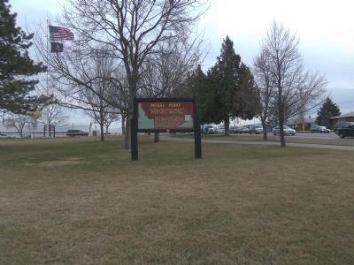
On Main Street at Franklin Road, on the right when traveling north on Main Street.
All Idaho land surveys refer to a
beginning point --"Initial Point"--
16 miles directly south of here.
When he began surveying Idaho in 1867, Lafayette Cartee, first surveyor general of Idaho Territory, established the initial point on a . . . — — Map (db m53439) HM
On U.S. 91 at milepost 30.2 near South Old Oxford Highway, on the right when traveling north.
You are standing in the outlet of ancient Lake Bonneville, a vast prehistoric inland sea, of which Salt Lake is modern remnant
Covering over 20,000 square miles when it overflowed here about 14,500 years ago, its winding shoreline would have . . . — — Map (db m105831) HM
Near Main Street near U.S. 30, on the right when traveling west.
Long before white men discovered these springs, Sept. 9, 1812, Indians gathered here to use the free hot water.
Except wheen they found hot springs, pre-historic Indians had a hard time getting hot water. The wove watertight baskets into . . . — — Map (db m124585) HM
On Main Street near U.S. 30, on the right when traveling west.
(This marker is composed of series of photographs and their captions.)
Good for what ails you!
Idaho's hot springs have drawn people to them for hundreds, if not thousands, of years. Long before indoor plumbing and hot water . . . — — Map (db m108255) HM
On U.S. 20 at Twin Buttes Road, on the right when traveling east on U.S. 20.
Big Butte
Towering 2500 feet high, two over lapping rock domes form a 300,000 year-old butte that dominates this lava plain.
After a hot flow of molten rhyolite (acidic rock) boiled up through older lava, a second rhyolite dome pushed up a . . . — — Map (db m103820) HM
On Interstate 15 at milepost 101.3, on the right when traveling north.
Molten rock, forced upward for 30 to 50 miles through fissures in the earth, has cooled into the hard lava found here.
Continued pressure from below has made great cracks in the contorted surface. This lava solidified only a few thousand . . . — — Map (db m108346) HM
On U.S. 20 at Twin Buttes Road, on the right when traveling east on U.S. 20.
Three Buttes
Rising above this level plain of lava flows and windblown soils these high landmarks are recent additions to Idaho’s landscape.
East Butte (farthest east) flowed up and cooled quickly about 600,000 years ago, while Big Southern . . . — — Map (db m103818) HM
Near U.S. 20 at State Highway 75, on the left when traveling west.
(Five panels in the kiosk deal with the history of Goodale's Cutoff and the surrounding area)
Idaho's Emigrant Trails
Westward-bound emigrants entered Idaho after crossing Thomas Fork Valley. They soon encountered the climb . . . — — Map (db m110138) HM
On State Highway 75 at milepost 161 near Salmon River Road (Forest Road 215), on the right when traveling south.
Rising as a small stream in the valley to the south, the Salmon winds 420 miles across Idaho before flowing into Snake River.
Discovered in 1895 by Lewis and Clark, and explored with great difficulty by fur traders and prospectors, the . . . — — Map (db m110050) HM
On U.S. 95 at milepost 504 near Deep Creek Loop (State Highway 2), on the left when traveling north.
Moving from the north down this valley, the edge of the continental ice sheet blocked rivers and formed glacial lakes.
Then as the ice gradually melted, a lake rose here behind the receding ice dam, and extended up Kootenai valley into . . . — — Map (db m122174) HM
On U.S. 2, 0.4 miles south of Old US Highway 2, on the right when traveling south.
[front side] Constructed in 1964, the 1223 ft. long steel truss bridge spans the Moyie River Canyon at a height of 464 ft. It replaces the old bridge built in 1923 and 1¼ miles of narrow, winding highway. It is the second highest bridge in . . . — — Map (db m73505) HM
Near U.S. 20 at milepost 265,, 1.2 miles west of Van Buren Boulevard, on the right when traveling east.
The shallow arc of Idaho’s Snake River Plain spans southern Idaho, gently rising from west to east. Current theories suggest that the plain marks the path of continental movement over a deep hotspot now lying beneath the Yellowstone Plateau. As the . . . — — Map (db m71602)
Walking off trails may be destroying these spatter cones which are some of the rarest volcanic features on the face of the earth.
Photographs taken at different times demonstrate that unrestricted visitor use left these fragile volcanic cones . . . — — Map (db m80429) HM
On U.S. 26/93 near North Laidlaw Park Road, on the right when traveling east.
On old maps, this region was referred to as "the Cinder Buttes." Towering above the surrounding landscape by more than 700 feet (200 meters) and spreading across an area of more than three square miles (eight square kilometers) the tallest and . . . — — Map (db m140015) HM
Look for lava and ice stalactites ("lavacicles" and "icicles") on the ceiling and walls of this lava tube. They were formed by dripping hot lava and melting ice. Born of fire, this cave now retains ice year-round—a cool place to visit on a hot . . . — — Map (db m92943)
On U.S. 26/93 near North Laidlaw Park Road, on the right when traveling east.
Beginning in the 1850s, armed skirmishes broke out between Shoshone Indians and emigrants traveling by wagon train to the west. Many pioneers tried new paths through Idaho that would avoid the Snake River, where they were most vulnerable to attack. . . . — — Map (db m140017) HM
Indian Tunnel is named for the mysterious stone circles that lie near the path to this large lava tube. Ancient stone structures are visible in many locations throughout the Monument. Archeologists believe that some of these structures may have had . . . — — Map (db m183501)
On U.S. 20, 1.5 miles west of Craters Loop Road, on the right when traveling east.
The Strangest 75 square miles on the North American continent Comment from an early traveler The landscape before you was explosively created by volcanic eruptions. Cracks in the earth's crust allowed lava to blast, plop, . . . — — Map (db m92942)
This silent volcano made some noise approximately 6,500 years ago when eruptions ejected cinders and pumped out lava from the crater.
Today, the shady north-facing slope of this cinder cone supports a forest of Limber pines and a few larger . . . — — Map (db m140026) HM
From this vantage point, you gaze across 25 miles of lava to Big Southern Butte. Early pioneers, following Goodale’s Cutoff from the Oregon Trail, used this land mark to navigate around the rugged lavas of the Snake River Plain. As a traveler today, . . . — — Map (db m70595) HM
On U.S. 26/93 near Loop Road, on the right when traveling east.
Before you lies the Great Rift, a 52-mile (84 kilometer) long system of fissures which a chain of volcanoes erupted. Crescent Butte is the oldest of these cinder cones, created during the earliest eruptions here about 15,000 years ago.
North . . . — — Map (db m140027) HM
On U.S. 20 west of Craters Loop Road, on the right when traveling east.
Say the word volcano and usually the image flashes to mind of a single great symmetrical cone. But, the volcanic activity in Craters of the Moon National Monument and the Snake River Plain has taken a different form.
Parallel cracks in the . . . — — Map (db m71601)
On State Highway 33 at N 1480W (County Highway 1480), on the right when traveling west on State Highway 33.
John Day’s River
Fur traders named this stream for John Day, a pioneer trapper who died in the valley north of here, Feb. 16, 1820
John Day had started west with John Jacob Astor’s Pacific Fur Company that discovered Snake River . . . — — Map (db m103827) HM
On Turner Road at River Road, on the left when traveling west on Turner Road.
Bear River has its source in lakes on the north slope of Hayden Peak, 12,485 feet in elevation, near the western limit of Utah's high Uintas. The horseshoe shaped river follows a course 500 miles long, but its mouth is only 90 miles from its source. . . . — — Map (db m140343) HM
On State Highway 34 near U.S. 30, on the right when traveling south.
Geological processes created the complex landscape of southeastern Idaho and eventually determined the routes covered wagons would take along the Oregon Trail. In their journals, trail emigrants often wrote something about the two volcanic cinder . . . — — Map (db m140253) HM
Near East 1st Street South near South Main Street.
Many Oregon & California bound emigrants mention seeing ten to twelve foot hight white mounds and cones in their diaries and journals while passing through the Soda Springs area in the mid-1800s. Often, one of the first natural curiosities that . . . — — Map (db m106251) HM
On Soda Point Power Plant Road near Reservoir Road, on the right when traveling south.
Until about 28,000 years ago, Bear River used to flow northwest from here through Portneuf Canyon into Snake River.
Then these lava eruption blocked that route, diverting Bear River south into what now is Salt Lake. At that time a large . . . — — Map (db m106728) HM
On State Highway 34 near Blackfoot River Road, on the right when traveling west.
Noticeable for their distinct shapes, China Hat and nearby China Cap are rhyolite domes that intruded and pierced the basalt of the Blackfoot Lava Field. The basaltic phase of this volcanic province was active in middle Pleistocene around 500,000 . . . — — Map (db m105966) HM
On East 2nd Street South (U.S. 30) near South Main Street, on the right when traveling west.
In 1958, Dr. Evan and Lois Kackley donated the Yellowstone Coach to the City of Soda Springs. According to Dr. Kackley's written letters to the city council he stated, "This particular coach was used to carry Pres. Theodore Roosevelt and the . . . — — Map (db m106694) HM
On Soda Point Power Plant Road near Reservoir Road, on the right when traveling south.
Towering 1200 feet above the waters of Bear River is Sheep Rock, a prominent landmark described in emigrant diaries and journals as they traveled west on the Oregon and California trails. Trapper and mountain men, in the early 1830s, indicate that a . . . — — Map (db m106737) HM
On East 2nd Street South near South Main Street, on the right when traveling west.
Free clear sparkling soda water still is available in a beautiful Soda Springs city park located 2 miles from here.
A prime attraction for more than 160 years, soda water from these springs was marketed nationally after rail service . . . — — Map (db m106256) HM
On Soda Point Power Plant Road near Reservoir Road, on the right when traveling south.
Lava eruptions west of Sheep Rock at least 140,000 years ago blocked the Bear River from draining into the Snake River system. Instead, the Bear was forced to drain into what was then Lakes Thatcher and Bonneville to the south. The Bear River's . . . — — Map (db m106847) HM
On U.S. 30 near South 3rd Street West, on the left when traveling west.
In this area are a group of springs famous to Oregon Trail travelers, most of whom stopped to try the "acid taste and effervessing gasses" of the waters.
Earlier, fur traders often -- less elegantly -- called the place "Beer Springs" after . . . — — Map (db m105967) HM
The gently sloping mound around the geyser is travertine. The stone often develops into flights of pools enclosed within little dams.
These dams form through a mix of water and carbon dioxide which makes carbonic acid, and dissolved calcium . . . — — Map (db m109952) HM
On Wayan Loop Road (State Highway 34) near Wayan Loop Road, on the right when traveling east.
Rising to an elevation of more than 9,800 feet, Cariboo Mountain -- visible north of here -- has two of Idaho's highest gold camps.
Jesse "Cariboo Jack" Fairchild discovered gold high on Cariboo Mountain in August, 1870, and a mining rush . . . — — Map (db m105965) HM
On Circle Creek Overlook Road near City of Rocks Road (Highway 3075 S), on the left when traveling west.
This vast scene holds many intriguing stories. If the land could speak, it would tell of pioneers and wagons crossing the wide Ralf River Valley from Strevell Pass to Emigrant Canyon bound for California in 1843-1882. The land would speak of stage . . . — — Map (db m123956) HM
On Twin Sister Road (Road 3400 S) near Birch Creek Road, on the left when traveling south.
They rise in a cone-like form from the bottom of the valley to a height of from 400 to 600 feet they are round and quite regular in form, tapering gradually to a point. -- Emigrant journal entry (Sawyer) describing the Twin Sisters, circa . . . — — Map (db m123994) HM
On State Highway 27 at milepost 1,, 0.2 miles north of 1800 South Road, on the right when traveling south.
A vast display of towering granite rocks (16 miles southeast of here) attracted emigrants who were on their way to California. A gold rush visitor, July 14, 1849, reported that "you can imagine among these massive piles, church domes, spires, . . . — — Map (db m31637) HM
On Twin Sister Road (Road 3400 S) near Birch Creek Road (Junction Valley Road), on the right when traveling west.
One day west of the City of Rocks: Never saw such dust! In some places it was actually to the top of the forewheels! Fine white dust; more like flour. Our men were a perfect fright, being literally covered. -- Emigrant journal entry, circa . . . — — Map (db m124025) HM
On A-2 Clark County Road (Main Street) near Old Highway 22, on the right when traveling east.
( six panels are located beneath the interpretive site shelter:)
A Region Where History Was Made
The scenic routes shown on this map will take you to several historic and scenic landmarks in northeastern Idaho. You will . . . — — Map (db m124526) HM
On West Pierce Street (State Highway 11 at milepost 17) near West 7th Street, on the right when traveling east.
This marker was dedicated
1957
to commemorate the arrival of the Lewis and Clark Expedition at Weippe Prairie, Idaho, Sept. 23, 1805. Also to honor the memory of Dr. J.T. Moser who pioneered here in the 1890's and to honor the memory of his . . . — — Map (db m121440) HM
On Larson Road near Cemetery Road, on the right when traveling east.
Welcome to Weippe Prairie
This has always been a traditional gathering place for the Nez Perce people where camas bulbs are harvested and baked each year. The blue flower of the camas lily grow so thick here in the spring time that from . . . — — Map (db m121610) HM
Near Doublespring Pass Road (Forest Road 116) near Forest Road 679, on the left when traveling east.
There are no records from explorers’ journals or pioneers’ memories of earthquakes occurring in this area. Scientists have not detected activity in recent time. But, old fault scars indicate that earthquakes occurred before. Geologists recognized . . . — — Map (db m109708) HM
Near Doublespring Pass Road (Forest Road 116) near Forest Road 679, on the left when traveling east.
• The scarp before you extends for 21 miles, paralleling the mountain front. In some places, multiple scarps formed.
• Ground motion, or “ground roll,” did $15,000,000 damage to roads and buildings in the Challis and Mackay areas. . . . — — Map (db m109709) HM
Near Doublespring Pass Road (Forest Road 116) near Forest Road 679, on the left when traveling east.
Idaho is part of the world’s longest mountain chain above sea level. This chain extends from the tip of South America to Alaska’s north coast. The widest section is in the western United States - from the Sierra Nevada to the Rocky Mountains. The . . . — — Map (db m109706) HM
On U.S. 93 at Doublespring Pass Road, on the right when traveling north on U.S. 93.
On October 28, 1983, a major earthquake fracture, 26 miles long and 7 miles deep, surfaced as Lost River Valley slid away from Mount Borah.
During that rock shift, Mount Borah’s ridge front rose about 6 inches, while this valley subsided 9 . . . — — Map (db m109704) HM
On U.S. 93 at Fish Hatchery Road, on the left when traveling north on U.S. 93.
Known as Goddin's River in the days of the fur trade. This stream originally was named for the trapper who discovered it.
Thyery Goddin, a prominent Iroquois who explored this river in 1819 or 1820, had come here with Donald Mackenzies fur . . . — — Map (db m109705) HM
On U.S. 93 at Doublespring Pass Road, on the right when traveling north on U.S. 93.
Idaho’s highest peak, 12,662 feet, is named for William E. Borah, who served in the United States Senate from 1907 until his death in 1940.
Ten or a dozen large but shallow inland seas have covered this area in the past billion years. They . . . — — Map (db m109703) HM
Near State Highway 75 near Yankee Fork Road, on the left when traveling west.
Alexander Ross and his Hudsons Bay Company fur trappers were the first white men to visit these hot springs. His dairy describes camping "at the boiling fountain" when they came here on October 1, 1824.
Hot springs result when hot water reached . . . — — Map (db m110040) HM
On Northeast Teapot Road near Worth Lee Road, on the right when traveling west.
Saturday August 16 "...we passed a hot springs near the foot of the same range, the water of which was nearly at a boiling temperature, so that one could not hold is finger in it, and a dog careless stepping across it put one foot in and ran . . . — — Map (db m125752) HM
On U.S. 36 at milepost 12.9 at North Sage Ridge Road, on the right when traveling north on U.S. 36.
Diverted into this valley by lava flows, the Bear River deposited a huge, mostly red clay delta here where it entered a vast inland sea that covered much of Utah.
About 14,500 years ago , its shoreline suddenly went down about 80 feet . . . — — Map (db m105834) HM
On Weston Canyon Road (State Highway 36) near West 300 South, on the left when traveling west.
The Pass of the Standing Rock was held sacred by the ancient ones of the Shoshone and other Native American Tribes long before John C. Fremont's exploratory party came to Weston Canyon on August 29, 1843. Fremont's surveyors spent the entire day . . . — — Map (db m140345) HM
On Mesa Falls Scenic Byway (State Highway 47) near Forest Road 386, on the right when traveling north.
John Colter after serving with the Lewis and Clark Expedition journeyed to the Teton Yellowstone Country in 1807, and became the first mountain man to see the Teton Mountain Range. Early fur trappers gathered in the valley at the base of the Teton . . . — — Map (db m108571) HM
On U.S. 20, 0.1 miles north of Anderson Mill Canyon Road, on the right when traveling north.
Volcanic Calderas
Some 2,000,000 years ago, massive eruptions of hot rock boiled for 60 miles from this high rim on across Yellowstone Park.
An exceptionally large crater remained when that lava surface collapsed. Another smaller caldera . . . — — Map (db m103937) HM
Near Ritchie Road, 0.4 miles north of County Road E2350S.
Thousands of years ago, immense flows of water from alpine glaciers and high levels of precipitation sent waters cascading over a broad area of the Snake River Canyon directly into the Snake River. Weak joints in the basalt walls gave way to these . . . — — Map (db m71547)
On U.S. 30 at milepost 176,, 1.8 miles south of E 2000 S, on the left when traveling north.
Fossil bones of zebras, beaver, otter, pelicans and other water birds are found in sediments left from a 3,400,000 year old pond on the bluff across the river. Lava flows, pouring out over the plains on this side, met and dammed up sedimentary . . . — — Map (db m31598) HM
Near Ritchie Road, 0.4 miles north of County Road E2350S.
Few places in Idaho or the United States show evidence of spring water more clearly than in Malad Gorge. These springs flow from the vast Snake River Aquifer through porous pillow basalts. On the opposite side of the canyon, where the river widens, . . . — — Map (db m71549)
Near Ritchie Road, 0.4 miles north of County Road E2350S.
Woody's Cove
This deep, basalt canyon was formed similar to Malad Gorge – by a retreating cataract, a huge waterfall. About four million years ago, local volcanoes spewed enormous amounts of lava over the area. Then, about one . . . — — Map (db m71593)
Near Bell Rapids Road near Upper Salmon Falls Road, on the right when traveling west.
Idaho was a very different place during the Pliocene Epoch (three to four million years ago). Like much of the planet, this area was warmer and more humid, with annual rain fall of 20 inches. Studies of ancient pollen found in the sand and clay . . . — — Map (db m139552) HM
Near Bell Rapids Road near Upper Salmon Falls Road, on the right when traveling west.
Can you find traces of the three ancient lakes that helped form Hagerman Valley and preserved the fossils found here? The first, known as Lake Idaho, covered most of present-day southwestern Idaho about three to eight million years ago. Over time, . . . — — Map (db m139556) HM
Near Bell Rapids Road near Upper Salmon Falls Road, on the right when traveling west.
The rock layers in the bluff across the river are made of sediments - particles of sand, silt, and clay. These layers, called strata, were carried here by the ancient Snake River and were deposited as the river entered an ancient lake. This process . . . — — Map (db m139554) HM
Near Bell Rapids Road near Upper Salmon Falls Road, on the left when traveling west.
The features before you testify to a fiery volcanic past. Distant hills, called buttes, are actually "shield" volcanoes. Named for their shape, these shield volcanoes formed when lava flowed from cracks, or vents, in the earth's crust. Over the past . . . — — Map (db m139611) HM
On Pine Street near U.S. 95, on the right when traveling south.
Before the continent was called America, before settlers came looking for land, the Nez Perce people lived and traveled throughout a vast area we now know as Idaho, Oregon, and Washington. They lived a semi-nomadic lifestyle, following the growing . . . — — Map (db m141249) HM
Near U.S. 12 at milepost 121, on the right when traveling west.
(This marker is composed of two panels and is presented here as if the panels were joined.)
The land today looks much the same as it did to Lewis and Clark. Today, as stewards of this beautiful land, we have an opportunity to leave a . . . — — Map (db m123213) HM
Near North Main Street (U.S. 95) near North Dixon Street, on the right when traveling north.
Before recorded history, the area we know as Riggins was on the west coast of the North American Continent. Thousands of miles to the west was the Pacific Plate, covered by ocean with only a few high points rising above the water. This plate was . . . — — Map (db m119411) HM
On U.S. 95 at Old White Bird Hill Road, on the right when traveling north on U.S. 95.
A vast mountain wilderness, cut by the mile deep Salmon River Canyon stretches across Idaho south and east of here.
Travel through the Salmon River Mountains always was hard in the early days.
An 1872 railroad survey showed the Salmon . . . — — Map (db m109667) HM
On U.S. 93 at milepost 51,, 0.8 miles north of Golf Course Road, on the right when traveling north.
More than a century ago, fur trappers and emigrants followed an old Indian trail that crossed here on its way to Oregon.
Hudson's Bay Company traders preferred this route between Fort Hall and Fort Boise, but early emigrant wagons had to . . . — — Map (db m31500) HM
On State Highway 97 at milepost 96 near East Wolf Lodge Bay Road, on the left when traveling north.
Look to the north: blocking the northward passage of the rivers which form this lake, a great dam of glacial ice once towered above the horizon as far as the eye can see. When the glacier melted, about 600,000 years ago, it left a moraine - a . . . — — Map (db m122872) HM
On Harrison Road (State Highway 97 at milepost 67) near East O'Gara Road, on the left when traveling north.
Glacial activity about 9000 to 12000 years ago created this lake out of what previously had been the valley of a river.
The ice sheet occupied major valleys north of here. As the glacier receded, melt waters flooded across the outlet of this . . . — — Map (db m122125) HM
On State Highway 53 near North Beck Road, on the left when traveling west.
A long, glaciated valley, extending from British Columbia this far into Idaho, brought part of a continental ice sheet past here thousands of years ago.
Rocks and boulders transported here by glacial ice backed up Lake Coeur d'Alene. Then a . . . — — Map (db m122127) HM
On Tower Rock Road near Redtail Lane, on the left when traveling east.
Clark's "Pirimids" are lessons in erosion and deposition. Looks closely at the columns to see layers of sediment: sandstone, gravel, and larger rocks that were eroded from ancient hills and deposited in valleys millions of years ago. Time and . . . — — Map (db m123683) HM
Near Forest Road 158 at Warm Springs Road (Forest Road 185) when traveling south.
Filling in the Blanks
The maps of North America carried by Lewis and Clark showed only a vast, uncharted space between the Mandan villages of the Missouri Rier and the Pacific Coast. The mountains separating the Missouri and Columbia . . . — — Map (db m109507) HM
On Warm Springs Road (Forest Road 158) near Lewis and Clark Highway (Forest Road 013), on the right when traveling south.
First Taste of the Columbia
"we proceeded on to the top of the dividing ridge from which I discovered immence ranges of high mountains still to the West of us with their tops partially covered with snow. I now decended the mountain . . . — — Map (db m109543) HM
Near Lemhi Pass Road near Lewis and Clark Highway (Forest Road 013), on the right when traveling south.
High Point of the Journey
"thus far I had accomplished one of those great objects on which my mind has been unalterably fixed for many years.," wrote Meriwether Lewis, 456 days after setting out from St. Louis.
Lewis, George . . . — — Map (db m109504) HM
On Warm Springs Road (Forest Road 185) near Back Road (County Road 28), on the left when traveling east.
About 50 million years ago, this was one of the most violent landscapes on Earth. A sub-surface mass of molten rock rose and subsided in cycles, spewing gas, mineral fragments and ash in explosions hundreds of times more powerful that an atomic . . . — — Map (db m109446) HM
On State Highway 162 near Yellow Bird Road, on the right when traveling west.
Most of Camas Prairie's wind blown soil rests upon Columbia River lava flows. Coming from a series of widespread eruptions, they covered older, eroded granite rocks here some 6 to 17 million years ago.
Some earlier volcanic extrusions, . . . — — Map (db m140897) HM
On State Highway 33, 1.5 miles east of Butte Road, on the right when traveling east.
Menan Buttes
Two cones of glassy lava are located directly south of here. The largest rises 800 feet above the surrounding plain.
Hot molten lava, erupting from great depth, met cold surface water in the wet flood plain of Snake river: the . . . — — Map (db m103901) HM
On State Highway 33 at Plano Road, on the right when traveling east on State Highway 33.
The Three Tetons
The giant peaks to the southeast were a famous early western landmark known to fur hunters and mountain men.
Perhaps as early as 1819, French-speaking trappers were calling them the Trois Tetons - - the three breasts. More . . . — — Map (db m103907) HM
On U.S. 12 at milepost 11 near U.S. 95, on the left when traveling east.
The basalt arch on the hillside across the road depicts támsoy ka・?alatálo, insects Ant and Yellowjacket, locked in combat. Many features in this river valley relate to nimi・pu・ (Nez Perce) traditional stories. . . . — — Map (db m121414) HM
Near Watson's Store Road near 403 Road, on the left when traveling east.
For thousands of years the river scene at this village site hardly changed. The stream was full of fish, served as a trade route for neighboring tribes, and attracted wildlife to this green corridor.
While the river fostered a life of bounty and . . . — — Map (db m121715) HM
Twin Springs is an oasis amid rolling hills of sagebrush; or as the early pioneers described "an endless sea of Artemisia". Wildlife, birds and people are drawn to Twin Springs' still water and rich grasses. Indigenous people traveled this valley . . . — — Map (db m124144) HM
On Interstate 84 at milepost 269, on the right when traveling north.
20,000 years ago, this land was under water. Not far to the north, you can see the old shore of Lake Bonneville. Formed in a basin from which no river reached the ocean, this became the largest lake in North America. Finally the lake rose high . . . — — Map (db m32888) HM
On I.O.N. Highway No. 456 (U.S. 95 at milepost 14) near Summer Camp Road, on the left when traveling south.
The name applied to these mountains and the whole surrounding region is an outdated spelling of the word "Hawaii".
Fur-trading ships brought Hawaiian natives -- then called "Owyhees" -- to the Northwest. In 1818, Donald Mackenzie brought the . . . — — Map (db m110212) HM
On Interstate 84 at milepost 1,, 1.9 miles north of U.S. 95, on the right when traveling east.
The valley of the Snake, historic passage from the Midwest to the Northwest, has been a primary route for travel since the days of Indians and fur traders.
The Oregon Trail forded the river at Old Fort Boise, the Hudson's Bay Company 12 miles . . . — — Map (db m23195) HM
On Interstate 86 at milepost 18 near Cold Water Road, on the right when traveling east.
(There are five historical panels in this kiosk:)
Idaho's Emigrant Trail
Westward-bound emigrants entered Idaho after crossing Thomas Fork Valley. They soon encountered the climb and descent of Big Hill, witnessed nature's . . . — — Map (db m124029) HM
Near U.S. 86 at milepost 30 near Rock Creek Road, on the right when traveling west.
(There are five historical panels in this kiosk:)
Idaho's Emigrant Trails
Westward-bound emigrants entered Idaho after crossing Thomas Fork Valley. They soon encountered the climb and descent of Big Hill, witnessed . . . — — Map (db m124037) HM
On State Highway 33 at milepost 136.5 at Trouts Ranch Road, on the left when traveling north on State Highway 33.
Flanked by rock formations more than 2 1/2 billion years old, these 3 granite peaks rose up less than 9 million year (ago), very new as mountains go. They are still rising.
Hinged at the base of the ridge before you, a block of rock 40 . . . — — Map (db m108353) HM
On U.S. 30 at milepost 190,, 0.6 miles north of N 1000 E, on the right when traveling north.
When John C. Fremont came this way mapping emigrant roads in 1843, he found an important Indian village at Fishing Falls (Kanaka rapids) about 4 miles above here. He reported that native salmon spearers there were "unusually gay...fond of laughter; . . . — — Map (db m31652) HM
On U.S. 30 at milepost 187,, 0.1 miles Chisholm Drive, on the left when traveling north.
In 1812, Joseph Miller found 100 lodges of Indians spearing thousands of salmon each afternoon at a cascade below here. Each summer they dried a year's supply. After 1842, they also traded salmon to Oregon Trail emigrants. John C. Fremont marveled . . . — — Map (db m31597) HM
On U.S. 30 at milepost 187,, 0.1 miles south of Chisholm Drive, on the left when traveling north.
Old lava flow changed the geologic structure of this area and thus created a multitude of famous springs here. Over thousands of years, volcanic activity repeatedly spread lava over the Snake River plain, slowly forcing the river southward in a . . . — — Map (db m31595) HM
Near State Highway 50, 0.3 miles north of County Road E3900N, on the left when traveling north.
The Flood that Reshaped Southern Idaho
The Snake River Canyon is one of Idaho's most recognizable geologic features. Volcanic forces dating back more than 10 million years ago created the canyon. But it took the second largest flood in . . . — — Map (db m70474)
On Twin Falls Grade near 4050 North Road, on the right when traveling north.
(This marker is composed of photographs and the captions associated with them.)(top left)
Carved by a Flood
Lake Bonneville, the bigger ancestor of Salt Lake, flooded this area about 15,000 years ago. Twin . . . — — Map (db m125565) HM
On U.S. 30 at milepost 234,, 0.2 miles west of E 3500 N, on the right when traveling east.
In 1811 the Hunt party likened the terrific torrent of the Snake River three miles east of here to a boiling caldron, adding the the old Scottish word "linn," meaning a waterfall. They had lost a man and a canoe in a roaring chute upstream. . . . — — Map (db m31523) HM
(Three panels are found at the Shoshone Falls kiosk:)
The Niagara of the West The Discovery of Shoshone Falls
No one knows the first non-native person to set eyes upon them. The Wilson Hunt expedition of fur trappers passed through . . . — — Map (db m125458) HM
On U.S. 93 at milepost 50,, 0.1 miles Bridgeview Road, on the right when traveling south.
4 miles east of here, the Snake River falls in thunder 210 feet over a rocky ledge higher than famous Niagara. Indians, trappers, and travellers all knew the "Great Shoshonie." Now the waters upstream have been harnessed for irrigation and power, . . . — — Map (db m31520) HM