By Rebecca Maxwell, March 12, 2012
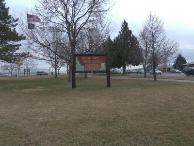
Initial Point Marker at Storey Park
| On Main Street at Franklin Road, on the right when traveling north on Main Street. |
| On U.S. 91 at milepost 30.2 near South Old Oxford Highway, on the right when traveling north. |
| Near Main Street near U.S. 30, on the right when traveling west. |
| On Main Street near U.S. 30, on the right when traveling west. |
| On U.S. 20 at Twin Buttes Road, on the right when traveling east on U.S. 20. |
| On Interstate 15 at milepost 101.3, on the right when traveling north. |
| On U.S. 20 at Twin Buttes Road, on the right when traveling east on U.S. 20. |
| Near U.S. 20 at State Highway 75, on the left when traveling west. |
| On State Highway 75 at milepost 161 near Salmon River Road (Forest Road 215), on the right when traveling south. |
| On U.S. 95 at milepost 504 near Deep Creek Loop (State Highway 2), on the left when traveling north. |
| On U.S. 2, 0.4 miles south of Old US Highway 2, on the right when traveling south. |
| Near U.S. 20 at milepost 265,, 1.2 miles west of Van Buren Boulevard, on the right when traveling east. |
| On U.S. 26/93 near North Laidlaw Park Road, on the right when traveling east. |
| On U.S. 26/93 near North Laidlaw Park Road, on the right when traveling east. |
| On U.S. 20, 1.5 miles west of Craters Loop Road, on the right when traveling east. |
| On U.S. 26/93 near North Laidlaw Park Road. |
| On U.S. 26/93 near Loop Road, on the right when traveling east. |
| On U.S. 20 west of Craters Loop Road, on the right when traveling east. |
| On State Highway 33 at N 1480W (County Highway 1480), on the right when traveling west on State Highway 33. |
| On Turner Road at River Road, on the left when traveling west on Turner Road. |
| On State Highway 34 near U.S. 30, on the right when traveling south. |
| Near East 1st Street South near South Main Street. |
| On Soda Point Power Plant Road near Reservoir Road, on the right when traveling south. |
| On State Highway 34 near Blackfoot River Road, on the right when traveling west. |
| On East 2nd Street South (U.S. 30) near South Main Street, on the right when traveling west. |
| On Soda Point Power Plant Road near Reservoir Road, on the right when traveling south. |
| On East 2nd Street South near South Main Street, on the right when traveling west. |
| On Soda Point Power Plant Road near Reservoir Road, on the right when traveling south. |
| On U.S. 30 near South 3rd Street West, on the left when traveling west. |
| On Wayan Loop Road (State Highway 34) near Wayan Loop Road, on the right when traveling east. |
| On Circle Creek Overlook Road near City of Rocks Road (Highway 3075 S), on the left when traveling west. |
| On Twin Sister Road (Road 3400 S) near Birch Creek Road, on the left when traveling south. |
| On State Highway 27 at milepost 1,, 0.2 miles north of 1800 South Road, on the right when traveling south. |
| On Twin Sister Road (Road 3400 S) near Birch Creek Road (Junction Valley Road), on the right when traveling west. |
| On A-2 Clark County Road (Main Street) near Old Highway 22, on the right when traveling east. |
| On West Pierce Street (State Highway 11 at milepost 17) near West 7th Street, on the right when traveling east. |
| On Larson Road near Cemetery Road, on the right when traveling east. |
| Near Doublespring Pass Road (Forest Road 116) near Forest Road 679, on the left when traveling east. |
| Near Doublespring Pass Road (Forest Road 116) near Forest Road 679, on the left when traveling east. |
| Near Doublespring Pass Road (Forest Road 116) near Forest Road 679, on the left when traveling east. |
| On U.S. 93 at Doublespring Pass Road, on the right when traveling north on U.S. 93. |
| On U.S. 93 at Fish Hatchery Road, on the left when traveling north on U.S. 93. |
| On U.S. 93 at Doublespring Pass Road, on the right when traveling north on U.S. 93. |
| Near State Highway 75 near Yankee Fork Road, on the left when traveling west. |
| On Northeast Teapot Road near Worth Lee Road, on the right when traveling west. |
| On U.S. 36 at milepost 12.9 at North Sage Ridge Road, on the right when traveling north on U.S. 36. |
| On Weston Canyon Road (State Highway 36) near West 300 South, on the left when traveling west. |
| On Mesa Falls Scenic Byway (State Highway 47) near Forest Road 386, on the right when traveling north. |
| On U.S. 20, 0.1 miles north of Anderson Mill Canyon Road, on the right when traveling north. |
| Near Ritchie Road, 0.4 miles north of County Road E2350S. |
| On U.S. 30 at milepost 176,, 1.8 miles south of E 2000 S, on the left when traveling north. |
| Near Ritchie Road, 0.4 miles north of County Road E2350S. |
| Near Ritchie Road, 0.4 miles north of County Road E2350S. |
| Near Bell Rapids Road near Upper Salmon Falls Road, on the right when traveling west. |
| Near Bell Rapids Road near Upper Salmon Falls Road, on the right when traveling west. |
| Near Bell Rapids Road near Upper Salmon Falls Road, on the right when traveling west. |
| Near Bell Rapids Road near Upper Salmon Falls Road, on the left when traveling west. |
| On Pine Street near U.S. 95, on the right when traveling south. |
| Near U.S. 12 at milepost 121, on the right when traveling west. |
| Near North Main Street (U.S. 95) near North Dixon Street, on the right when traveling north. |
| On U.S. 95 at Old White Bird Hill Road, on the right when traveling north on U.S. 95. |
| On U.S. 93 at milepost 51,, 0.8 miles north of Golf Course Road, on the right when traveling north. |
| On State Highway 97 at milepost 96 near East Wolf Lodge Bay Road, on the left when traveling north. |
| On Harrison Road (State Highway 97 at milepost 67) near East O'Gara Road, on the left when traveling north. |
| On State Highway 53 near North Beck Road, on the left when traveling west. |
| On Tower Rock Road near Redtail Lane, on the left when traveling east. |
| Near Forest Road 158 at Warm Springs Road (Forest Road 185) when traveling south. |
| On Warm Springs Road (Forest Road 158) near Lewis and Clark Highway (Forest Road 013), on the right when traveling south. |
| Near Lemhi Pass Road near Lewis and Clark Highway (Forest Road 013), on the right when traveling south. |
| On Warm Springs Road (Forest Road 185) near Back Road (County Road 28), on the left when traveling east. |
| On State Highway 162 near Yellow Bird Road, on the right when traveling west. |
| On State Highway 33, 1.5 miles east of Butte Road, on the right when traveling east. |
| On State Highway 33 at Plano Road, on the right when traveling east on State Highway 33. |
| On U.S. 12 at milepost 11 near U.S. 95, on the left when traveling east. |
| Near Watson's Store Road near 403 Road, on the left when traveling east. |
| On Blanch Spring Road near Old Highway 37. |
| On Interstate 84 at milepost 269, on the right when traveling north. |
| On I.O.N. Highway No. 456 (U.S. 95 at milepost 14) near Summer Camp Road, on the left when traveling south. |
| On Interstate 84 at milepost 1,, 1.9 miles north of U.S. 95, on the right when traveling east. |
| On Interstate 86 at milepost 18 near Cold Water Road, on the right when traveling east. |
| Near U.S. 86 at milepost 30 near Rock Creek Road, on the right when traveling west. |
| On State Highway 33 at milepost 136.5 at Trouts Ranch Road, on the left when traveling north on State Highway 33. |
| On U.S. 30 at milepost 190,, 0.6 miles north of N 1000 E, on the right when traveling north. |
| On U.S. 30 at milepost 187,, 0.1 miles Chisholm Drive, on the left when traveling north. |
| On U.S. 30 at milepost 187,, 0.1 miles south of Chisholm Drive, on the left when traveling north. |
| Near State Highway 50, 0.3 miles north of County Road E3900N, on the left when traveling north. |
| On Twin Falls Grade near 4050 North Road, on the right when traveling north. |
| On U.S. 30 at milepost 234,, 0.2 miles west of E 3500 N, on the right when traveling east. |
| On Champlin Road near North 3339 East. |
| On U.S. 93 at milepost 50,, 0.1 miles Bridgeview Road, on the right when traveling south. |