On River Drive just south of Center Street (Kentucky Highway 1144), on the right when traveling north.
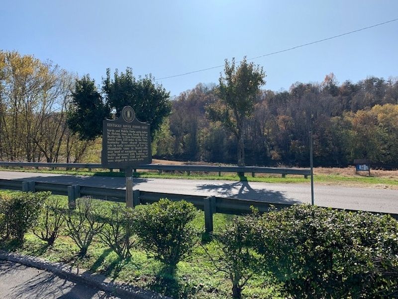
North and Middle Forks unite below St. Helens, then join South Fork at Beattyville to form Kentucky River, which flows 255 miles to the Ohio. Kentucky River played primary role in early commerce of Lee Co. Steamboats came to Beattyville, near head . . . — — Map (db m159523) HM
On Broadway Street east of North 7th Street, on the right when traveling east.
Irving Shrewsbury Cobb, 1876-1944.
One of Paducah's famous sons. "A first-class humorist from a conversational gesture to a book wit who made all the world laugh with him."
Author of more than sixty books, short story writer, recipient of . . . — — Map (db m47263) HM
Gen. William Clark, the founder of Paducah, designated the Second Street area as a location for public affairs. The original name for Second Street was "Market" reflecting its use as a trading center. The original Market House was built of logs in . . . — — Map (db m49752) HM
On Broadway Street at Manne Way/North Second Street, on the right when traveling west on Broadway Street.
In 1827, Gen. Wm. Clark purchased 37,000 acres of land, including the site on which Paducah now stands, for $5. This land, part of a Revolutionary War grant to his brother, George Rogers Clark, was secured from George Woolfolk, of Louisville, who . . . — — Map (db m47259) HM
On North Water Street, on the right when traveling west.
This chain secured the Paducah Wharfboat until 1930 It was originally used as a stay-chain in 1861 in the fortifications on the river in Columbus, KY It was presented to the city of Paducah in 1987 by the Dismukes Family
Julian M. Dismukes . . . — — Map (db m174534) HM
On North 8th Street south of Adams Street, on the right when traveling south.
Traditionally on August 8, African Americans assemble in Paducah to celebrate freedom and pay tribute to their roots. They gather annually for dances, ballgames, and picnics, as a family occasion and in a spirit of community remembrance. In some . . . — — Map (db m158747) HM
On North 5th Street at Park Street, on the right when traveling east on North 5th Street.
During the Civil War, Paducah was the first city in Ky. where an African American regiment, the 8th U.S. Colored Heavy Artillery, was officially organized & credited to the state. Parts of other black regiments also recruited here. Slaves who . . . — — Map (db m154726) HM
On Broadway Street at 6th Street, on the right when traveling west on Broadway Street.
During February 1864, the Adjutant General of the U.S. Army, Lorenzo Thomas, under the direction of the Secretary of War, Edwin L. Stanton, authorized the recruitment of African Americans by the Union Army in Kentucky. The 8th United States Heavy . . . — — Map (db m48462) HM
On North 5th Street at Park Street, on the right when traveling north on North 5th Street.
Col. Albert P. Thompson, fell here in Battle of Paducah, March 25, 1864, victim of Union cannonball. He commanded the 3rd Ky. Inf. CSA. The battle climaxed Gen. Nathan B. Forrest's memorable raid seeking medical supplies and munitions. Thompson, a . . . — — Map (db m154944) HM
On Broadway Street at 3rd Street (Business U.S. 60), on the right when traveling east on Broadway Street.
McCracken County Chapter chartered May 14, 1917. Organized by Mrs. A.R. Meyers, with W. F. Paxton as first Chairman. Initial WWI fund drive raised $42,000. During great Ohio Valley Flood of 1937 carried on an amazing evacuation and relief program. . . . — — Map (db m47253) HM
On Alben Barkley Drive (U.S. 62) at Cardinal Lane, on the right when traveling east on Alben Barkley Drive.
Angles
Home of Alben W. Barkley, 1937-56. A good example of Greek Revival architecture. Built in 1868 by Col. Quintus Quincy Quigley. Location on sharp angles of three tracts of land source of its name. In early married life Barkley and wife . . . — — Map (db m158844) HM
Ann I. Baker Ann Baker had idea for professional women's club in Paducah. Business Women's Club held first meeting, Sept. 1920, chartered Oct. 1920. Name changed to Paducah Business and Professional Women. Baker also served as first president . . . — — Map (db m47242) HM
Area riverbeds are rich with mussels whose shells, when polished, have a luster suitable for processing into "pearl" buttons. In the late 19th century, mussels were harvested by brailing from the river bottoms; they were then cooked in vats for meat . . . — — Map (db m49181) HM
Alben William Barkley (1877~1956)
Elected McCracken County Attorney, County Judge, U.S. Representative, and U.S. Senator, Barkley served Harry Truman as Vice-President and was known as the "Veep". He was re-elected to the U.S. Senate in 1955. . . . — — Map (db m49749) HM
On Broadway Street east of 6th Street, on the right when traveling east.
Alben W. Barkley, Congressman, U.S. Senator and Vice President, began practice of law here, 1901. He had read law for two years in offices of Rep. Charles K. Wheeler and Judge Wm. Sutton Bishop, the old Judge Priest of Irvin Cobb's stories. . . . — — Map (db m47262) HM
On 25 March 1864, Confederate Major General Nathan Bedford Forrest seized the city of Paducah. His purpose was to strike Federal forces, break up guerilla bands, recover deserters, recruit and reoutfit his men. He arrived in the outskirts of the . . . — — Map (db m154941) HM
On South Water Street at Kentucky Avenue, on the right when traveling north on South Water Street.
In 1966, Mayor Tom Wilson, a civic-minded Paducah native, was encouraged by then Kentucky Governor Ned Brethitt, to organize a celebration of the state's bicentennial. He envisioned festivities right on the riverfront where the city's history . . . — — Map (db m49194) HM
On Broadway Street at 7th St, on the left when traveling east on Broadway Street.
Paducah's oldest institution. Founded 1832. First edifice erected 1842 on northwest corner Broadway at 4th. Relocated 1875 on southwest corner Broadway at 7th. Moved to present site 1896. Destroyed by fire 1929; rebuilt 1930. Judge Wm. Sutton . . . — — Map (db m47265) HM
On North Water Street at Jefferson Street, on the right when traveling north on North Water Street.
This scene shows Broadway, Paducah's main street, in the 1940's when the downtown area was the center for the community's retail, business, and entertainment activities. Such downtown landmarks as the Guthrie Building, 1937 Post Office, Palmer House . . . — — Map (db m49517) HM
On South Water Street south of Broadway Street, on the left when traveling south.
The Chickasaw tribe claimed all of Kentucky and Tennessee west of the Tennessee River until a treaty in 1819. Therefore, on November 11, 1803, traders, trappers and Chickasaw natives took little notice of the Lewis and Clark Expedition, Corps of . . . — — Map (db m48706) HM
On Jefferson Street near North 19th Street, in the median.
Chief of sub~tribe of Chickasaw Indians, who lived and hunted in this area until Jackson Purchase, 1818. Land here then owned by Gen. William Clark, who founded Paducah; named it in honor of friendly chief. Statue sculptured by Lorado Taft, 1909, . . . — — Map (db m4768) HM
Paducah has long been the foremost hub of the inland marine waterways. Thus, many towboat companies have located here.The christening of the Towboat Eleanor is indicative of the significance of each new vessel that joins the home fleet of the Port . . . — — Map (db m49187) HM
On Broadway Street, 0.1 miles west of South 28h Street, on the left when traveling east.
Organized in Paducah in 1906 from a six-week tent meeting. Oldest of Churches of Christ in area. Until one-room structure on Goebel Ave. was built in Aug., 1906, meetings held under tree. Second location, 19th and Broadway, dedicated 1924 and . . . — — Map (db m185618) HM
On Broadway Street just east of North 2nd Street, on the right when traveling east.
The organizer of the American Red Cross in 1881, Clara Barton, came to Paducah March 13, 1884, on the steamboat "Josh V. Throop" to help direct relief work during the Ohio River flood. Relief boats traveled from Pittsburgh to Cairo in first flood . . . — — Map (db m158788) HM
On Broadway Street at 3rd Street (Business U.S. 60), on the left when traveling east on Broadway Street.
Here stood the headquarters of Col. Stephen G. Hicks, commander of the USA occupation forces here during Battle of Paducah March 25, 1864. Next day Col. Hicks ordered sixty private homes that had been used by CSA forces as cover near the fort burned . . . — — Map (db m233416) HM
Construction in the 1840s, the two-story Greek Revival structure overlooking the Paducah riverfront was originally the location of the Branch Bank of Louisville, one of the community's first banks. After the Civil War, the building was used for many . . . — — Map (db m49175) HM
On North 5th Street at Park Street, on the right when traveling north on North 5th Street.
Albert P. Thompson, was born near Murray in Calloway County, Kentucky in 1829. He moved to Paducah and practiced law with the firm of Bigger, Thompson, and Roe there before the Civil War. At the beginning of the War he was elected Lt. Colonel of the . . . — — Map (db m154940) HM
On Broadway Street west of 3rd Street (Business U.S. 60), on the left when traveling east.
On this site stood the office of Reuben Saunders, M.D., credited with discovering that hypodermic use of morphine~atropine halted cholera during epidemic here in 1873. Telegraphed prescription to other plague~stricken areas.
Accepted by Materia . . . — — Map (db m47252) HM
On Park Avenue (Business U.S. 60) west of North 16th Street, on the right when traveling west.
(side 1)
Outstanding pioneer physician in Western Kentucky for 50 years. Born in Frankfort; died in Paducah. Buried in this cemetery beside his son, Dr. John Bartlett Saunders (1840-1873), also a physician of eminence. John migrated to . . . — — Map (db m47218) HM
On South Nelson Park Road, on the right when traveling north.
Front
Dr. Nelson was born in Paris, Ky. and graduated from Lincoln High School in Paducah. During World War I he served in combat as a 1st lieutenant. Returning to his studies, he earned a Bachelor of Arts degree from Howard University in . . . — — Map (db m146182) HM
On The Foot of Broadway east of Water Street, on the right when traveling east.
The Commonwealth of Kentucky may have declared herself neutral when secession of the Southern states began, but Paducah and most of Western Kentucky took a strongly southern stand. Many of the young men from Paducah enlisted in the Confederate Army . . . — — Map (db m154926) HM
This building served as Fire Station #5 at 17th and Broadway, from 1910 until 1973, when it was replaced with a modern two-bay structure. In 1910 the city had nine pieces of horse-drawn fire-fighting equipment, including the ladder-hose wagon and . . . — — Map (db m49751) HM
On Broadway Street east of Keiler Street, on the right when traveling east.
Organized as mission, New Bethel Church 1839; constituted as church Nov. 14, 1840. First met courthouse at 2nd and Kentucky; 1st building, 300 block Broadway; 2nd and 3rd
buildings at 5th and Jefferson. Second building seized by Union army, 1861, . . . — — Map (db m158838) HM
On Audubon Drive at Sunset Avenue, on the right when traveling south on Audubon Drive.
Organized, 1849, affiliated with Campbell-Stone Movement in plea for Christian Unity. Located at Seventh and Jefferson, 1895-1965. Tower Bell, cast in 1868, used on area river packets sixty years. Murrell Blvd. Congregation merged following 1937 . . . — — Map (db m158845) HM
On South Water Street south of Broadway Street, on the left when traveling south.
Established in 1827, Wilmington served as the first County Seat. During the flood of February 1832, Braxton Small, serving as the first County Court Clerk for McCracken County (1825-1858), removed all records to Paducah from the original Courthouse . . . — — Map (db m48708) HM
On Broadway Street at North Water Street, on the left when traveling east on Broadway Street.
First Log Cabin
Here in April 1821, three years after the Jackson Purchase, the first home, a round-log cabin, was built by James and William Pore. Only a few Indians remained. James Davis, his wife and three sons, built a shelter soon . . . — — Map (db m47213) HM
On North 7th Street at Jefferson Street, on the right when traveling north on North 7th Street.
Organized October 29, 1842, at home of Judge James Campbell on Broadway, with eight charter members. Rev. A. W. Campbell served as first pastor. Met in homes and courthouse until 1848, when church was built near corner of Third and Kentucky. Moved . . . — — Map (db m158796) HM
On North Water Street at Jefferson Street, on the right when traveling north on North Water Street.
The centerpiece of this mural is the February 1948 cover of the Enthusiast magazine featuring officers David Drew and Jullian Pryor Slaughter on their Harleys flanking the statue of Chief Paduke. Also shown are: Paducah motorcycle racer "Tennessee . . . — — Map (db m49515) HM
On Broadway Street (Business U.S. 45) at South 15th Street, on the right when traveling east on Broadway Street.
In a grove of trees at this site, CSA Gen. Nathan B. Forrest had headquarters, Battle of Paducah, March 25, 1864. USA Fort Anderson attacked, warehouses burned, about 60 homes destroyed by USA after battle. CSA lost 300 men, withdrew that night. . . . — — Map (db m91819) HM
Union fortification built 1861 and named for Kentuckian Robt. Anderson of Fort Sumter fame. Led by Gen. N.B. Forrest. CSA forces attacked fort on March 25, 1864, seized supplies, and burned wharf. CSA Col. Albert Thompson of Paducah killed. Next day . . . — — Map (db m154942) HM
On Fountain Avenue at Monroe Street, on the right when traveling north on Fountain Avenue.
Congregation organized in 1892 as
a mission. Original church built
at 10th & Trimble Sts. In 1908,
Fountain Ave. Methodist Episcopal
Church, South was erected here at
a cost of $35,000; it has been in
continual service since. In . . . — — Map (db m158819) HM
On The Foot of Broadway east of South Water Street.
Gen. George Rogers Clark visited this spot, 1778.
Gen. Ulysses S. Grant landed here Sept. 6, 1861 to occupy Paducah for Federal Union.
Capt. Jack B. Sleeth laid first successful submarine cable, 1847. It reached from foot of Campbell St. . . . — — Map (db m154666) HM
On Madison Street at Fountain Avenue, in the median on Madison Street.
Heroic statue of this Confederate erected in 1909 by his sons and United Daughters of Confederacy. Born in Maryland. Chief engineer, 1855-56, New Orleans and Jackson Railroad, first to enter Paducah. Joined Confederates July 5, 1861. Killed in . . . — — Map (db m158818) HM
Grace Church was organized in 1848 in the home of Adam Rankin Hickman. First structure, built of lumber cut in Louisville and floated downstream, was located on riverfront near Market Street. Consecrated on April 21, 1851.
During Civil War . . . — — Map (db m233373) HM
On North 5th Street north of Park Avenue, on the right when traveling east.
On this spot, September 6, 1861, Gen. U.S. Grant read proclamation to citizens of Paducah announcing that the Union Army was taking possession of town "to defend you" against Confederate attack. The "enemy" had taken "possession of and planted his . . . — — Map (db m154943) HM
On Park Avenue (Business U.S. 60) at North 16th Street, on the right when traveling west on Park Avenue.
Grave of John T. Scopes
Here is buried the man who, at age 24, taught Darwin's theory of evolution to a Dayton, Tennessee, biology class. The Paducah native and University of Kentucky graduate violated a Tennessee law forbidding the . . . — — Map (db m47216) HM
On North 4th Street (Business U.S. 60) south of Jefferson Street, on the right when traveling south.
Site of a one-story frame store, Hummel's Gunshop. He came here in 1861. Federal soldiers occupying Paducah in Civil War brought their firearms to him for repair. When the Confederates raided the city, March, 1864, they looted his shop, but he had . . . — — Map (db m158791) HM
On Broadway Street east of North 6th Street, on the left when traveling east.
Established in 1897, it is also known as the Fraternity Building. During WWII, it was home of the Paducah-McCracken County Draft Board. Nearly 5,000 men & women from the Paducah area served in the war. It was designated a Kentucky Landmark in 2002 . . . — — Map (db m154672) HM WM
This property has been placed on the National Register of Historic Places
by the United States Department of the Interior
Hank Bros and Jones Hardware 1897
G.E. Hank · H.R. Hank · Maj. T.T. Jones — — Map (db m233375) HM
On Broadway Street east of South Water Street, on the right when traveling east.
(front:)
Here the Tenn. River flows into the Ohio. Owen's Island opposite Kentucky Ave. There in 1779 George Rogers Clark's small army landed to prepare for its defeat of the British in the Illinois country. In 1780 Col. John Donelson . . . — — Map (db m154667) HM
Still recovering from the flood that was the worst disaster experienced in the United States up to that time, the new year, 1938, started with what many feared was a prelude to another debacle. At Paducah, the Ohio River froze solid. The riverfront . . . — — Map (db m49169) HM
On North Water Street at Jefferson Street, on the right when traveling north on North Water Street.
In 1960, Illinois Central 2613, a Mountain type engine with 4-8-2 wheel arrangement, became the last steamer to operate on the railroad, ending a 190 year tradition. Western Kentucky, with its many coal mines, were among the last places in the U.S. . . . — — Map (db m49520) HM
On Buckner Lane at South Sycamore Drive, on the right when traveling west on Buckner Lane.
Organized in 1887, as mission of First Baptist Church. Constituted as the Second Baptist Church in January, 1894, with twenty-two members. First building located 9th and Ohio. Moved to Murrell Boulevard in February, 1922, and changed to present . . . — — Map (db m158843) HM
On Kentucky Avenue at South Water Street, on the right when traveling east on Kentucky Avenue.
(obverse)
This Mikado type steam locomotive is dedicated to Illinois Central men and women, past and present, and to the importance of the railroad to Paducah's history and commerce. No. 1518 is the last "Iron Horse" owned by the ICRR. . . . — — Map (db m47206) HM
Near Park Avenue (Business U.S. 60) near North 16th Street, on the right when traveling west.
Native of Paducah, famed wit and humorist; newspaper reporter, war correspondent and feature writer; author of books, short stories, movie scripts and plays. Started career with local paper. Moved to New York, 1904, to Hollywood, 1934. Beloved, . . . — — Map (db m47217) HM
On Broadway Street at 3rd Street (Business U.S. 60), on the right when traveling east on Broadway Street.
Irvin S. Cobb Said: "Here in Paducah one encounters, I claim, an agreeable blend of Western kindliness, and Northern enterprises, superimposed upon a Southern background. Here, I claim, more chickens are fried, more hot biscuits are eaten, . . . — — Map (db m47251) HM
8,500 square mile area, former tribal lands of Chickasaw Indians. United States paid $300,000 for tract in 1818 after negotiations by General Andrew Jackson and Governor Isaac Shelby. Bordered by Tennessee, Ohio and Mississippi Rivers, now comprises . . . — — Map (db m154546) HM
On North 2nd Street north of Jefferson Street, on the right when traveling south.
Lewis and Clark in McCracken County
Lewis and Clark, with the nucleus of the Corps of Discovery, stayed in present McCracken Co. in Nov. 1803 while traveling down the Ohio River on their journey to the Pacific. Clark returned 1827 to . . . — — Map (db m47208) HM
On North 6th Street just south of Park Avenue (Business U.S. 60), on the left when traveling south.
Liberty of Texas 1836
From here 18 “Paducah Volunteers” led by Capt. Amon B. King embarked for Texas in 1835 in response to Sam Houston's appeal for aid in fight for freedom from Mexico. Two weeks after The Alamo, in battle at . . . — — Map (db m158792) HM
On Broadway Street (Business U.S. 45) just east of North 19th Street, on the right when traveling east.
Home of Linn Boyd, 1800-59, stood 500 ft. south. Served in Kentucky Legislature, U.S. Congress, wrote resolution to annex Texas. House Speaker, 1851-55. Proposed for Vice President by Ky. delegates at Democratic Convention, 1856, which chose . . . — — Map (db m158830) HM
Lock and Dam 52, completed in 1928, is located at Ohio River Mile 939.9. This site, and Lock and Dam 53, are the only remaining movable wicket dams on the Ohio. Both will be removed when the Olmsted Locks and Dam become operational. When the . . . — — Map (db m49179) HM
On North 3rd Street (Business U.S. 60) near Jefferson Street, on the left when traveling east. Reported missing.
Museum of the American Quilters Society opened April 25, 1991. Meredith and Bill Schroeder dedicated this facility to promote, preserve and perpetuate quilting. Paducah, Kentucky, home of the American Quilters Society, is visited by thousands of . . . — — Map (db m203410) HM
On July 2, 1996, the City of Paducah was visited by marine royalty. All three of the Delta Queen Steamboat Company's boats docked simultaneously at the Port of Paducah. The Delta Queen, Mississippi Queen and American Queen frequent this community . . . — — Map (db m49190) HM
Paducah's first heavy industry was a marine ways to build and repair river craft. Elijah Murray of St. Louis got a contract in 1843, but it did no materialize until 1853. These works have been in continuous operation ever since, with a brief . . . — — Map (db m49170) HM
In May, 1913, Paducah held a homecoming celebration to excite and entertain the public and to offset the negative image of the city given the nation by media reports of the flood that year. The first event had Mayor Thomas N. Hazelip welcoming the . . . — — Map (db m49171) HM
On North 3rd Street (Business U.S. 60) west of Jefferson Street, on the left when traveling south.
The National Quilt Museum opened on April 25, 1991. The museum was founded by Meredith and Bill Schroeder and works to honor and promote the work of today's quiltmaker. The museum is a destination for quilters and art enthusiasts, receiving visitors . . . — — Map (db m147877) HM
Near Jefferson Street at North 2nd Street, on the right when traveling west.
As Meriwether Lewis and William Clark wound their way westward, they encountered many indigenous people. The Native Americans portrayed here represent those who helped Lewis and Clark during their travels to the Pacific Ocean. The flag that the . . . — — Map (db m47210) HM
On Jefferson Street just south of North 24th Street, in the median.
He was born in New Orleans and moved to Ballard County, KY. In 1843, he was graduated from Transylvania University in 1847 for the practice of law. In 1851 he was elected commonwealth attorney and in 1867 he was elected to the state senate . . . — — Map (db m170151) HM
On Broadway Street (Business U.S. 45) at South 23rd Street, on the right when traveling north on Broadway Street.
Named for Otis Dinning, Sr., basketball coach at Washington Jr. High
1926-1938 and Tilghman High School
1938-1963. He never had a losing
season. His overall coaching record
was 738-262. Tilghman won 22
District tournaments and went to
State 6 . . . — — Map (db m170147) HM
It was common practice in post-Civil War America for communities to be depicted in bird's-eye views showing buildings, people, animals boats, rivers, streams and railroad lines. This mural recreates an 1873 Bird's-Eye View Map of Paducah which now . . . — — Map (db m233440) HM
On North Water Street at Jeffferson Street, on the right when traveling north on North Water Street.
While the river has usually been Paducah's best friend, flood waters turned it into the community's enemy in 1884, 1913, and again 1937. The area's most devastating event of the twentieth century was the flood of 1937 when 90% of Paducah was covered . . . — — Map (db m49518) HM
On Alben Barkley Drive (U.S. 62) at Clint Hill Boulevard, on the right when traveling east on Alben Barkley Drive.
Founded at 707 Broadway in 1932, this is oldest non-denominational two-year college in Ky. Originally private, Paducah. Jr. College was a municipal institution, 1936-1968. In 1949-53 college became focal point of NAACP's successful . . . — — Map (db m158847) HM
Paducah Marine Supply and Service, owned and operated by Hougland Barge Line, was one of the first floating boat stores on the inland waterways.
The operation had its own fleet of towboats, barges and a machine and carpentry shop. Houghland Barge . . . — — Map (db m49182) HM
On Broadway Street west of North 5th Street, on the left when traveling east.
Paducah's colorful history from the time of the Chickasaw Indians through the age of steamboats and steam locomotives is depicted on a mural in Post Office building. History and legend of our city, painted by local artists, was presented to the . . . — — Map (db m154956) HM
On North 8th Street (Business U.S. 45) at North H C Mathis Drive (U.S. 45), on the right when traveling east on North 8th Street.
Paducah, Kentucky
McCracken county seat, founded by Gen. William Clark of Lewis and Clark Expedition at confluence of Ohio and Tennessee Rivers. Named for legendary Indian Chief Paduke. Home of Vice Pres. Alben Barkley and birthplace of Irvin . . . — — Map (db m146587) HM
Paducah architecture reflected the settlers' different religious faiths. These institutions helped unite the early settlers of the community. Broadway United Methodist Church is the oldest, founded 1832 at 4th and Broadway. It relocated to the . . . — — Map (db m49757) HM
On Broadway Street east of North 5th Street, on the left when traveling east.
Paducah, only major Kentucky city with an Indian name, was named in honor of legendary Indian Chief Paduke by Gen. William Clark when he platted town in 1827. Village first named Pekin. The Paducahs, Chief Paduke's sun-tribe of Chickasaw Indians, . . . — — Map (db m154955) HM
Paducah's river industry was the city's lifeblood. Steamboats and tobacco were critical to the area's economy in the late 1880's. Mule-drawn transfer wagons moved hogshead barrels of tobacco that weighed around 1,600 pounds each. Nearly 20,000 . . . — — Map (db m233415) HM
Paducah's Riverfront was a critical break-in-bulk point on the nation's inland waterways system. Cargo from deeper draft vessels, as well as passengers and mail, would be loaded and unloaded on to packet boats that ran regular routes on the . . . — — Map (db m49177) HM
On South Water Street at Broadway Street, on the left when traveling south on South Water Street.
Evidence of Native Americans in the lower Ohio Valley includes the Paleo Indians, who lived in this area near the end of the last Ice Age, about 13,000 years ago. Often called Big Game Hunters, they were efficient, nomadic, hunters, fisherman, and . . . — — Map (db m48704) HM
USA, USN, USAF, USMC, USCG
Purchase area service men who lost their lives in Vietnam.
Beard, Leon •
Bradley, Given W. •
Clements, Robert A. •
Colson, Ronald S. •
Cruse, James D. •
Doom, Charles L. •
Dunigan, Jerry W. •
Emerson,Robert . . . — — Map (db m47524) HM
On Park Avenue just east of North 5th Street, on the right when traveling north.
Melinda Bula made this quilt using fusible appliqué and heavy thread painting after her only son became a United States Marine. As quilters, we work out our life changes and challenges in cloth. Melinda had no idea of the impact this quilt would . . . — — Map (db m174540) HM
On Park Avenue just west of North 4th Street, on the left when traveling west.
won the AQS Best of Show at the AQS Quilt Show in Paducah. This quilt was the first machine-quilted quilt to to win the top award. It was voted one of the 100 Best Quilts of the 20th Century and has been . . . — — Map (db m174539) HM
This riverfront park is dedicated to Raymond C. Schultz, celebrated public official who served as McCracken County Judge Executive from 1974 to 1985. An Ohio county native, Judge Schultz was born July 8, 1911. He was a graduate and lecture at the . . . — — Map (db m47240) HM
On The Foot of Broadway east of Water Street, on the right when traveling south.
Ride Round the Rivers
This unique pleasure-boat tour is an eighty-mile loop from Paducah up the Tennessee, through Kentucky Lock, up Kentucky Lake, through the Land-Between-The-Lakes Canal, down Barkley Lake, through Barkley Lock, down the . . . — — Map (db m154961) HM
In 1884, Robert S. Davis recalled that the first building was a round-log cabin, about sixteen feet square, erected by the Pore brothers, James and William, in April of 1821. Davis identified four families living at the site at that time. Records in . . . — — Map (db m233439) HM
On Kentucky Avenue at Marine Way, on the left when traveling east on Kentucky Avenue.
First courthouse at Wilmington, 1824~32. Second courthouse, a two story brick structure, 36 feet square, built near here at a cost of $3,049, on land given by Gen. William Clark, founder of Paducah. Courthouse also provided meeting place for various . . . — — Map (db m47243) HM
On Broadway Street east of South 6th Street, on the right when traveling east.
St. Francis de Sales Catholic Church is the oldest church in Paducah located on original site. Property purchased May 8, 1848, for $225 by Father Elisha Durbin. First church built 1849 and was enclosed with a fence as livestock roamed at large . . . — — Map (db m154671) HM
On North Water Street at Jefferson Street, on the right when traveling north on North Water Street.
In the early 1940's, Paducah-McCracken County was known as the strawberry capital of the world. Schools excused students to pick berries. Entire families were involved in this agricultural event. Freight cars carried thousands of crates of berries . . . — — Map (db m49519) HM
On Joe Clifton Drive (U.S. 60) at Madison Street, on the right when traveling north on Joe Clifton Drive.
An organized Jewish community has existed in Paducah since 1864 when Paducah Chevra Yeshurun Burial Society was chartered. The first Jewish house of worship in Paducah was established in 1871, located on the east side of South Fifth between Clark . . . — — Map (db m158842) HM
Paducah: Mid~America's Gateway to the Gulf
This historic waterway reaches from Paducah to Mobile, providing a navigational artery between the upper Mississippi, Ohio and Tennessee Rivers and the Gulf of Mexico's east~west Intracoastal Waterway and . . . — — Map (db m47241) HM
On Jefferson Street just west of North 29th Street, in the median.
The Ohio Valley Flood of 1937 was the greatest natural disaster in the history of the U.S. and drove over one million citizens from their homes. This location marks the water's western edge in Paducah at the height of the flood, Feb. 2, 1937. . . . — — Map (db m158841) HM
Nelson was a graduate of Lincoln High School, commissioned officer in WWI, and president of several major universities. He marched with Ghandi in India and with Dr. King in Alabama.
Burks Chapel AME,7th and Ohio, ran the first school for Negro . . . — — Map (db m49753) HM
On Park Street at North 4th Street on Park Street.
The Flood Wall
Paducah's $8,000,000 flood wall was built by the U.S. Corps of Engineers, is twelve miles long and protects the city to a height three feet above the 1937 flood level. The Flood of 1937 could not occur again in Paducah . . . — — Map (db m154725) HM
On Lone Oak Road (U.S. 45) at Lovelaceville Road (Kentucky Highway 1322), on the right when traveling south on Lone Oak Road.
On this site stood the massive tree for which the town of Lone Oak was named in 1900. The town, first known as Pepper's Mill, was renamed to obtain a local post office. The tree was cut down in 1903 and was used for a bonfire on Christmas night . . . — — Map (db m158867) HM
This scene depicts a captain, a highly trained and skilled professional, standing his normal 6-hour navigation watch in a typical pilothouse. He is looking out over a 15-barge town with 24,000 tons of cargo. His location is down bound, passing the . . . — — Map (db m49192) HM
On North Water Street at Jefferson Street, on the right when traveling north on North Water Street.
Through the depression, a struggling telephone industry crept along with advancing technology. In 1940 progress stopped. Most personnel and materials were used to win W.W.II. The local telephone system became outdated. In 1945 the boys came home and . . . — — Map (db m49516) HM
On Kentucky Avenue at 7th Street on Kentucky Avenue.
Gen. Lloyd Tilghman, soldier and rail builder, lived here, 1852~61. Born, Maryland, 1816. Graduated West Point, 1836. In the Mexican War (1846~48).
Chief engineer, 1855~56, New Orleans and Jackson Railroad, first to enter Paducah.
In Civil War . . . — — Map (db m47266) HM
113 entries matched your criteria. The first 100 are listed above. The final 13 ⊳