Near North Lee Street south of Cameron Street, on the left when traveling north.
Alexandria's Changing Shoreline
In 1749 the town of Alexandria was laid out on 10 to 15 foot bluffs around a crescent of shallow water. The back edge of John Carlyle's property, where you are standing now, was about 15 feet above the Potomac . . . — — Map (db m129171) HM
On North Fairfax Street south of Cameron Street, on the left when traveling south.
This unique building, constructed of stone and set back from the street, was built by John Carlyle, a British merchant and one of the original founders of Alexandria. Witness to both domestic life and war, today the house stands as a museum . . . — — Map (db m156562) HM
Near North Fairfax Street south of Cameron Street, on the right when traveling north.
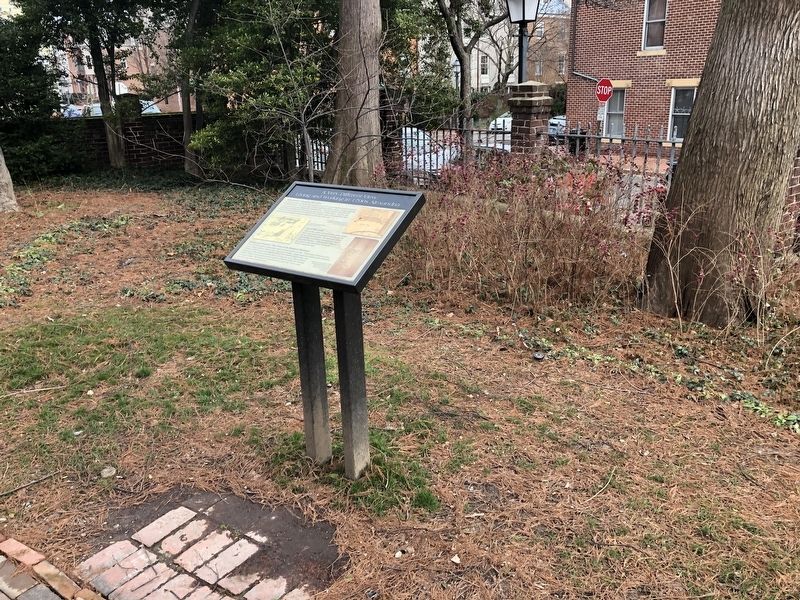
Civil War Comes to Carlyle House
If you stood in this spot 150 years ago, you would be inside a building! In 1848 James Green purchased Carlyle House and the building in front of you, the first Bank of Alexandria. He turned it into a hotel . . . — — Map (db m129170) HM
Near Eisenhower Avenue, 0.4 miles west of Cameron Parke Court, on the right when traveling west.
Few facilities in Northern Virginia offer the variety of recreation options presented by Cameron Run Regional Park. Lying adjacent to the Capital Beltway in Alexandria, Cameron Run is serenity carved among glass and metal — a day long vacation of . . . — — Map (db m197469) HM
If you arrived here by train on a summer Sunday afternoon in the 1870s, you would find crowds of people enjoying Arlington's premier amusement park.
This wooded spot near the confluence of Lubber Run and Four Mile Run was a natural place for a . . . — — Map (db m67491) HM
On Marcey Road, 0.2 miles north of Overlook Trail, on the right when traveling north.
Potomac Overlook Regional Park was founded by NOVA Parks in 1971 with a 3-fold mission statement in mind: (1) preserve the land; (2) educate the public on natural and cultural history and (3) provide a natural setting for recreation and exercise. . . . — — Map (db m197942) HM
Near North Manchester Street, on the right when traveling north.
In June 1945 the scene nearby would have included the multiple tracks, gas-electric combine, electric substation, and passenger station shown below. As of 1912 Bluemont Junction served as the hub of the multi-line Washington & Old Dominion Railway. . . . — — Map (db m24924) HM
Near North Manchester Street, on the right when traveling north.
If you were a passenger on the Washington & Old Dominion Railway heading into Georgetown, you would first have to pass through Rosslyn, Virginia, a 15-minute train ride from here. The first Rosslyn Terminal dated from 1906, with the establishment . . . — — Map (db m24926) HM
Near North Manchester Street, on the right when traveling north. Reported permanently removed.
The Bluemont Branch of the Washington & Old Dominion was not the railroad’s only line. The Great Falls & Old Dominion Railroad arose in 1906 from the vision of two prominent men. Sen. Stephen B. Elkins of West Virginia had prospered through coal, . . . — — Map (db m24925) HM
On Washington and Old Dominion Trail south of Wilson Boulevard, on the right when traveling south.
The Bluemont Branch of the Washington & Old Dominion was not the railroad's only line. The Great Falls & Old Dominion Railroad arose in 1906 from the vision of two prominent men.
Sen. Stephen B. Elkins of West Virginia had prospered through . . . — — Map (db m214185) HM
On Washington and Old Dominion Trail, 0.1 miles south of 8th Road North, on the right when traveling north.
In 1900, the Virginia state legislature passed a law that required separation of races in public spaces. This included schools, restaurants, hotels and public transportation—which at that time was primarily the use of trains. This was nicknamed . . . — — Map (db m214186) HM
On North Manchester Street, on the right when traveling north.
The railroad that became the Washington & Old Dominion was born in Alexandria in response to the competition in shipping posed by the port in Baltimore, which was served by the Baltimore & Ohio Railroad. The B&O was diverting farm produce from . . . — — Map (db m24920) HM
Near Langston Boulevard (U.S. 29) at Fairfax Drive, on the right when traveling south.
In August 1940, when this photograph was taken, passenger service on the Washington & Old Dominion was losing money and was being phased out. Passenger service stopped altogether in April 1941, but resumed two years later to support the national war . . . — — Map (db m55964) HM
On South Four Mile Run Drive at South Shirlington Road, in the median on South Four Mile Run Drive.
The Nauck community has a long and diverse history. The area that now comprises the Nauck neighborhood was originally granted to John Todd and Evan Thomas in 1719. The land was later acquired by Robert Alexander and sold to John Parke Custis in . . . — — Map (db m2504) HM
On South Four Mile Run Drive west of Shirlington Road, in the median.
The 100-ft wide W&OD has been called "the skinniest park" in Virginia. But it is also one of the longest parks, 45 miles of paved trail for walking, running cycling and skating and more. Built on the roadbed of the former Washington & Old . . . — — Map (db m131543) HM
On South Four Mile Run Drive at South Shirlington Road, in the median on South Four Mile Run Drive.
Time Line
March 20, 1847 - Incorporated as the Alexandria &
Harper’s Ferry Railroad.
March 15, 1853 - The corporate name changes to the Alexandria, Loudoun & Hampshire Railroad Company.
February 25, 1855 - . . . — — Map (db m2500) HM
On South Four Mile Run Drive at South Shirlington Road when traveling east on South Four Mile Run Drive.
W & OD Trail.
The 100-foot-wide Washington and Old Dominion Railroad Regional Park (W&OD Trail) features a 45-mile asphalt trail for walking, running, skating, bicycling and other activities and a 33-mile parallel, gravel bridle path for . . . — — Map (db m2406) HM
On Marcey Road, 0.3 miles north of North Beechwood Place, on the left when traveling north.
Barns were an integral part of life for early farmers who once tilled the local soils. They housed livestock and were used for storing feed, produce, and farm equipment. Though the farmers are now gone, the remains of the old barns can still be . . . — — Map (db m197941) HM
On Overlook Trail at Marcey Road, on the right when traveling east on Overlook Trail.
The Donaldson family lived and farmed here from the 1840's to the 1930's. During that time, this straight, wide path was a farm road they used for getting around. The Donaldsons were "market farmers", growing crops like wheat, oats, corn, potatoes, . . . — — Map (db m197939) HM
Near Marcey Road, 0.2 miles north of Overlook Trail, on the right when traveling north.
This natural spring was referred to as the "Indian Spring" by local farmers in the early 1900's who found arrowheads and other artifacts left behind by the land's former occupants.
Today, many springs in Arlington have gone dry as the . . . — — Map (db m197944) HM
On Marcey Road, 0.3 miles north of North Beechwood Place, on the right when traveling north.
Explore the natural world on 67 acres of wild and cultivated land at Potomac Overlook Regional Park in Arlington, Virginia. Hike two miles of trails while following interpretive displays to learn about the park's natural and cultural history. . . . — — Map (db m197927) HM
On Pickett Road (Virginia Route 237) at Old Pickett Road, on the right when traveling south on Pickett Road.
The City of Fairfax — since its settlement in the 1700s — has been at the heart of Northern Virginia's government and business activities. Home to more than 20,000 residents and 23,000 business and government employees, Fairfax is an independent . . . — — Map (db m197034) HM
On Pickett Road (Virginia Route 237) at Old Pickett Road, on the right when traveling south on Pickett Road.
In the late 1950s, the Northern Virginia Planning District Commission and a group of citizens from several local jurisdictions came together to protect Northern Virginia's rich heritage of woods, meadows, lakes and streams from the threat of . . . — — Map (db m197049) HM
On Pickett Road (Virginia Route 237) at Old Pickett Road, on the right on Pickett Road.
The 100-foot-wide Washington & Old Dominion Railroad Regional Park (W&OD Trail) features a 45-mile asphalt trail for walking, running, skating, bicycling and other activities and a 33-mile, parallel, gravel bridle path for horseback riding and . . . — — Map (db m197050) HM
On Bull Run Drive, 0.1 miles south of Bull Run Drive, on the left when traveling south.
During the American Civil War (1861-1865), soldiers from both the Union North and the Confederate South built huts known as "winter quarters" to live in during the winter months when fighting and troop movements were usually minimal.
The Bull . . . — — Map (db m152386) HM
Near Old Yates Ford Road (Route 612) at Kincheloe Road, on the left when traveling west.
This burial ground of enslaved people is tangible evidence of the system of slavery which existed in Virginia until the end of the Civil War when the 13th Amendment to the Constitution banned the practice. These individuals were held in bondage . . . — — Map (db m197390) HM
On Outlet, 0.7 miles west of Hampton Road, on the right.
Discover Fountainhead Regional Park, 2,000 acres of rugged adventure in Fairfax Station, Virginia. Whether you're a cyclist, kayaker, hiker or miniature golf aficionado, Fountainhead is your destination for outdoor sports. Riders of all ability . . . — — Map (db m197389) HM
On Sandburg Street, on the right when traveling south.
In May 1898 the Spanish-American War came to Northern Virginia with the establishment of Camp Russell A. Alger (below). The 1,400-acre camp, south of where you are now located, encompassed the fields and forests of the former Woodburn Manor . . . — — Map (db m24873) HM
On Sandburg Street, on the right when traveling south.
As an attraction for potential home-buyers, the Loring Land and Improvement Company constructed a railroad station on the site just to your right for the planned subdivision of Dunn Loring. An 1880s advertisement notes that "Good railroad . . . — — Map (db m24875) HM
On Sandburg Street, on the right when traveling south.
The railroad that became the Washington & Old Dominion was born in Alexandria in response to the competition in shipping posed by the port in Baltimore, which was served by the Baltimore & Ohio Railroad. The B&O was diverting farm produce from the . . . — — Map (db m24874) HM
On Wilson Boulevard just east of John Marshall Drive, on the right when traveling east.
Bring the family for a day of outdoor fun at Upton Hill Regional Park! Splash, slide and soak at the beach-themed Ocean Dunes Waterpark. Tee up at the deluxe minigolf, practice in one of our batting cages, or take a walk on the trails – our . . . — — Map (db m151009) HM
Late afternoon on June 27, 1863, Confederate Gen. J.E.B. Stuart began assembling his cavalry brigades at Dranesville. To avoid the Union Army of the Potomac (90,000-strong) then crossing the Potomac upstream at Edwards Ferry, Stuart ordered . . . — — Map (db m59678) HM
Near Seneca Connector Trail east of Seneca Road (Virginia Route 602), on the left when traveling east.
A mature deciduous forest, rich in American beech, oak, tulip poplar, and hickory trees, blankets and ancient headland of the Potomac River Gorge, white sycamore, silver maple, and boxelder trees dominate the flood-washed lowlands. A quiet . . . — — Map (db m197947) HM
Near Seneca Connector Trail east of Seneca Road (Virginia Route 602), on the left when traveling east.
The half-buried stones you see here were part of a house once occupied by Irish-born Stephen and Eliza Kelley. Although Kelleys owned 190 acres nearby, they were living in this house on Gilbert Vanderwerken's property in the 1870s.
The red . . . — — Map (db m197948) HM
Near Seneca Road, on the right when traveling north.
This will become the great avenue into the Western Country. - George Washington
The stone wall you see nearby is not just any stone wall; it was built here in the late 1700s as part of George Washington's . . . — — Map (db m59681) HM
On Station Street north of Elden Street (Virginia Route 228), on the left when traveling north.
Herndon grew up around this railroad station. The town received its name in 1858 when the Alexandria, Loudoun & Hampshire Railroad (later the W&OD) arrived and a post office was established in the newly built station.
Herndon quickly became . . . — — Map (db m152) HM
On Elden Street (County Route 606), on the right when traveling east.
In the years before motor vehicles came to dominate transportation, business was never better for the Washington & Old Dominion Railway. Demand for passenger and freight service boomed, while the W&OD's owners balked at spending the money necessary . . . — — Map (db m44101) HM
On Washington and Old Dominion Trail north of Station Street, on the right when traveling north.
In 1900, the Virginia state legislature passed a law that required separation of races in public spaces. This included schools, restaurants, hotels and public transportation—which at that time was primarily the use of trains. This was nicknamed . . . — — Map (db m214237) HM
On Station Street north of Elden Street (Virginia Route 228).
The railroad that became the Washington & Old Dominion was born in Alexandria in response to the competition in shipping posed by the port in Baltimore, which was served by the Baltimore & Ohio Railroad. The B&O was diverting farm produce from the . . . — — Map (db m153) HM
On Washington and Old Dominion Trail just west of Grace Street, on the right when traveling west.
The 100-foot-wide Washington and Old Dominion Railroad Regional Park (W&OD Trail) features a 45-mile asphalt trail for walking, running, skating, bicycling and other activities and a 33-mile, parallel, gravel bridle path for horseback riding and . . . — — Map (db m186871) HM
Near High Point Road, 2.3 miles south of Gunston Road (Virginia Route 242/600).
An ecotone is a transition between two adjacent ecosystems. Areas where these different habitats meet and overlay support plant and animal species from both constraints. Because of this, they’re often the busiest and best places for observing an . . . — — Map (db m98164) HM
On Gunston Road (Virginia Route 242) 0.2 miles south of Old Colchester Road (Virginia Route 611), on the right when traveling south.
Gunston Hall
The house and grounds convey the measured pace of an 18th century colonial plantation and the underlying grace of Southern hospitality. This is a setting of a simple dignity, of quiet orderliness from which "a . . . — — Map (db m197451) HM
On Occoquan Regional Park Road near Ox Road (Virginia Route 123), on the right when traveling west.
From the turn of the century until the late 1960’s nine kilns on this site were operated by inmates of the Lorton correctional facility.
The bricks stacked inside this kiln are ready to be baked. For 4 to 5 days coal fires in each of the . . . — — Map (db m2346) HM
On Pohick Bay Drive (County Road 721) 0.7 miles east of Gunston Road (State Route 242), on the right when traveling east.
Choose your next adventure at Pohick Bay Regional Park in Lorton, Virginia. Bring the kids for a day of splashing and sliding at Pirate's Cove Waterpark. Spend a day on the bay with our canoe, paddleboard, stand up paddleboard and kayak rentals; . . . — — Map (db m197466) HM
On Occoquan Regional Park Road near Ox Road (Virginia Route 123), on the left when traveling east. Reported permanently removed.
Adjacent to this park a group of women was imprisoned in 1917 for demanding the right to vote. The road to Occoquan Workhouse had started in 1848.
In July 1848 at the Seneca Falls Convention in New York, officially opening the American women’s . . . — — Map (db m168931) HM
On Old Reston Avenue, on the right when traveling north.
Sunset Hills Station, shown below in the 1960s, stands as a reminder that today's Reston was not the first "new town" to be planned for this area. In 1886 Dr. Carl Wiehle bought a large parcel of land north and south of the railroad tracks. He . . . — — Map (db m25074) HM
On Old Reston Avenue, on the right when traveling north.
Accidents happened on the Washington & Old Dominion. Mishaps resulted from washouts of the roadbed, loose rails, rotting ties, or from livestock wandering across the tracks. Crew negligence also played a part. One of the earliest and most serious . . . — — Map (db m25005) HM
Near Beulah Road (Virginia Route 702) south of Chathams Ford Drive, on the right when traveling south.
This tree was first identified from a fossil found in Japan in 1941. That same year a living specimen was discovered in a remote part of China. Since its discovery, fossil evidence has shown that during a warm period called the Paleocene-Eocene . . . — — Map (db m151336) HM
Near Park Street (County Route 675), on the right when traveling north.
On June 17, 1861, at this bend in the railroad, a Union train carrying 271 men of the 1st Ohio Volunteers was ambushed by nearly 700 South Carolina infantry and cavalry. Amid artillery fire, the Ohioans jumped from the platform cars and took cover . . . — — Map (db m26761) HM
Electrification arrived in 1912, after the Great Falls & Old Dominion Railroad and the Southern Railway’s Bluemont Branch were consolidated into the Washington & Old Dominion Railway. The new owners brought modern interurban trolley cars. Wire . . . — — Map (db m2095) HM
Near Beulah Road (Virginia Route 702) south of Chathams Ford Drive, on the right when traveling south.
Gardiner C. Means and Caroline F. Ware had a farm and home here from 1935 to 1988.
They donated this land to become Meadowlark Botanical Gardens.
Part of this historic log cabin was enclosed by their house and was used as their living . . . — — Map (db m151340) HM
On Hunter Mill Road (County Route 674), on the right when traveling north. Reported missing.
This station was called a flag stop—a passenger would step out and flag down the train to catch a ride.
The railroad was owned by the Southern Railway at this time and was operated as a steam railroad. Wires were installed in 1912 when . . . — — Map (db m1933) HM
On Hunter Mill Road (County Route 674), on the right when traveling north.
The 1860 Alexandria, Loudoun, and Hampshire Railroad station at this junction was called a flag stop - a passenger would step out and flag down the train to catch a ride. At the time that the 1900 picture to the left was taken, the railroad was . . . — — Map (db m24791) HM
On Hunter Mill Road (County Route 674), on the right when traveling north.
At the beginning of the American Civil War in mid-1861, Union General Irvin McDowell, Commander, Army of Northeastern Virginia, knew that his army lacked an adequate supply of wagons. The Alexandria, Loudoun, and Hampshire Railroad (today's W&OD . . . — — Map (db m24864) HM
Near Hunter Mill Road (County Route 674), on the right when traveling north.
On October 18, 1864 Reverend John B. Read, a lay preacher at the Falls Church Baptist Church, was executed in dense pine woods by the railroad bridge here at Piney Branch. Early that morning a contingent of Confederate Colonel John Singleton Mosby's . . . — — Map (db m24865) HM
On Washington and Old Dominion Trail west of Maple Avenue East (Virginia Route 123), on the right when traveling west.
The Washington & Old Dominion Railroad had competition. In 1904 the Washington, Arlington, & Falls Church Railway began service from Washington, D.C., to Vienna, Virginia, along a route parallel to the W&OD.
Besides offering passengers the . . . — — Map (db m214397) HM
On Beulah Road south of Chathams Ford Drive, on the right when traveling south.
"The Bell of Peace and Harmony" was donated by Gyunggido Province as a symbol of peace and partnership. The Korean Bell Garden is the first Korean Bell Garden constructed in the United States.
Gyunggido Province, with its long history of . . . — — Map (db m151335) HM
Near Beulah Road (Route 702) south of Chathams Ford Drive, on the right when traveling south.
The cabin may have been the earliest structure on a 966-ace tract owned by William Gunnell. Gunnell's son, Henry, possibly built the first (eastern) section around 1740-50. Constructed of hewn oak, it was a single room with a fireplace. The stone . . . — — Map (db m151337) HM
On Talahi Road, on the right when traveling north.
The Bluemont Branch of the Washington & Old Dominion was not the railroad’s only line. The Great Falls & Old Dominion Railroad arose in 1906 from the vision of two prominent men. Sen. Stephen B. Elkins of West Virginia had prospered through coal, . . . — — Map (db m27121) HM
Near Beulah Road (Virginia Route 702) south of Chathams Ford Drive, on the right when traveling south.
What you see before you is one of the most unique buildings in the Washington, D.C. region. Created via a joint effort between NOVA Parks and the Korean American Cultural Committee (KACC), this endeavor began with a . . . — — Map (db m155263) HM
Near Beulah Road (Virginia Route 702) south of Chathams Ford Drive, on the right when traveling south.
For the first time in United States history, one of the most beautiful botanic gardens will hold a Korean Bell Garden. Strategically located in Washington, DC, this bell garden will be not only in the capital of the United States but also the . . . — — Map (db m151333) HM
On Dominion Road at Ayr Hill Avenue, on the right when traveling west on Dominion Road.
The railroad that became the Washington & Old Dominion was born in Alexandria in response to the competition in shipping posed by the port in Baltimore, which was served by the Baltimore & Ohio Railroad. The B&O was diverting farm produce from the . . . — — Map (db m2094) HM
On Dominion Road at Ayr Hill Avenue, on the right when traveling west on Dominion Road.
Vienna Station, shown in the center of the photograph below in 1864, has stood here since the arrival of the Alexandria, Loudoun & Hampshire Railway (later the Washington & Old Dominion Railway) in 1859. The farm community of Ayr Hill consisted of . . . — — Map (db m2090) HM
On Washington and Old Dominion Trail just west of Church Street Northeast, on the right when traveling west.
The 100-foot-wide Washington and Old Dominion Railroad Regional Park (W&OD Trail) features a 45-mile asphalt trail for walking, running, skating, bicycling and other activities and a 33-mile, parallel, gravel bridle path for horseback riding and . . . — — Map (db m184082) HM
On Washington and Old Dominion Trail, 0.1 miles west of Cedar Lane (Virginia Route 698), on the left when traveling west.
In the late 1800s and early 1900s, city folk rode the train out to Wedderburn, a popular summer resort and fairground. In later years the rail stop served commuters.
This three-sided shelter (below) was typical of many small stop . . . — — Map (db m214530) HM
Near Beulah Road (Route 702) south of Chathams Ford Drive, on the right when traveling south. Reported damaged.
farming began in the 18th century by the original landowner, William Gunnell, continued through most of the 20th century thanks to the efforts of Dr. Gardiner Means and his wife, Dr. Caroline Ware. The longtime New Englanders came here when Dr. . . . — — Map (db m151341) HM
Beauty, conservation, education and discovery flourish throughout the year at this 95-acre botanical garden of large ornamental display gardens and unique native plant collections. Walking trails, lakes, more than 20 varieties of cherry trees, . . . — — Map (db m198006) HM
On Washington and Old Dominion Trail, 0.1 miles west of Grove Avenue, in the median.
Built by Northern Virginia Regional Park Authority in 1992, the bridge resolved critical transportation and safety concerns of the 45-mile long W&OD Trail.
The name honors those local citizens who provided political and financial support for . . . — — Map (db m214537) HM
On Tinner Hill Road just south of South Washington Street (U.S. 29), on the right when traveling south.
This historic site is a testament to the long African American struggle to gain equality and civil rights. It also honors a moment of triumph for the human spirit.
African American life in Falls Church predates the 1700s. Enslaved . . . — — Map (db m151023) HM
On Tinner Hill Road just south of South Washington Street (U.S. 29), on the right when traveling south.
This sculpture by Martha Jackson Jarvis, is a historical marker, and a symbol as well as a work of art.
The Zig Zag runs along the line that divides the Tinner Hill neighborhood into the City of Falls Church and Fairfax County portions. The . . . — — Map (db m187038) HM
On Washington and Old Dominion Trail west of Grove Avenue, on the right when traveling west.
The 100-ft wide W&OD has been called "the skinniest park" in Virginia. But it is also one of the longest parks, 45 miles of paved trail for walking, running, cycling and skating and more. Built on the roadbed of the former Washington & Old . . . — — Map (db m214558) HM
On Tinner Hill Road just south of South Washington Street (U.S. 29), on the left when traveling north.
This historic site is a testament to the long African American struggle to gain equality and civil rights. It also honors a moment of triumph for the human spirit.
African American life in Falls Church predates the 1700s. Enslaved and free . . . — — Map (db m187039) HM
On Grove Avenue, on the right when traveling south.
The railroad that became the Washington & Old Dominion was born in Alexandria in response to the competition in shipping posed by the port in Baltimore, which was served by the Baltimore & Ohio Railroad. The B&O was diverting farm produce from the . . . — — Map (db m2902) HM
On North Oak Street, on the right when traveling south. Reported missing.
Accidents happened on the Washington & Old Dominion. Mishaps resulted from washouts of the roadbed, loose rails, rotting ties, or from livestock wandering across the tracks. Crew negligence also played a part. One of the earliest and most serious . . . — — Map (db m2899) HM
On Grove Avenue, on the right when traveling south.
In 1912, from the station that stood nearby to your right, you could board a modern interuban passenger coach at 7:34 a.m. and arrive in Georgetown by 8:00 sharp. It was a new century and Washington, D.C., was on the move. The demand was heavy in . . . — — Map (db m2901) HM
On John Mosby Highway (Route 50) just west of Tall Race Road (Virginia Route 612), on the left when traveling west.
A teenager named Daniel Dangerfield worked in Aldie sometime during the 1840s, possibly here at Aldie Mill. Enslaved, he received no pay for his work, having been rented out to the miller by a local farmer and enslaver, French Simpson, who lived . . . — — Map (db m173653) HM
The trail before you has had many names and descriptions in the hundreds of years it’s been in use. Its history is much longer than its 250 mile in Virginia might suggest. The original northern terminus in Virginia lay at Conroy Island in the . . . — — Map (db m224195) HM
On Watson Road (Virginia Route 860) at John S. Mosby Highway (U.S. 50), on the left when traveling north on Watson Road.
Discover a slice of Civil War history, part of the study area for the battle of Aldie, at Gilbert's Corner Regional Park in Aldie, Virginia. The 156 acre park offers hiking trails, interpretive signage and rolling countryside with a view of the . . . — — Map (db m151324) HM
On Watson Road (Virginia Route 860) at John S. Mosby Highway (U.S. 50), on the left when traveling north on Watson Road.
Imagine this landscape thousands of years ago, when Native Americans passed through the area on their foot path. Traveling along the eastern section of the current United States, south before winter arrived and north before the summer months, . . . — — Map (db m151326) HM
On Ashburn Road (County Route 641), on the right when traveling north.
At least two different railroad stations stood where you are now standing. When the Alexandra, Loudoun & Hampshire Railroad (later the W&OD) arrived in 1860, the aptly named crossroads of Farmwell became one of the many rail stops that served . . . — — Map (db m20282) HM
On Jackpit Lane south of Builders Lane, on the left when traveling south.
The Belmont Ridge area has a very rich natural and cultural history — both of which have always been linked. The two most prominent natural features are Goose Creek, the largest waterway in Loudoun County and the Luck Stone Quarry, which is . . . — — Map (db m214391) HM
On Smith Switch Road (County Route 607), on the right when traveling north.
The shelter or "waiting shed" in the photograph below stood across the road from where you are now located. Crossing the track was Norman's Station Road (now called Smith's Switch Road). These three-sided shelters were typical of many small . . . — — Map (db m20277) HM
On Washington and Old Dominion Trail west of Smith Switch Road, on the left when traveling west.
The 100-ft wide W&OD has been called "the skinniest park" in Virginia. But it is also one of the longest parks, 45 miles of paved trail for walking, running, cycling and skating and more. Built on the roadbed of the former Washington & Old . . . — — Map (db m214395) HM
On Washington and Old Dominion Trail west of Smith Switch Road, on the left when traveling west.
Time Line
March 20, 1847 - Incorporated as the Alexandria &
Harper’s Ferry Railroad.
March 15, 1853 - The corporate name changes to the Alexandria, Loudoun & Hampshire Railroad Company.
February 25, 1855 - . . . — — Map (db m214394) HM
On Northstar Boulevard, on the right when traveling south.
"Mount up, the Yankees are coming!" -Pvt. Richard Moran April 1, 1863 prior to the "Battle of Miskel's Farm" Pvt. Richard (Dick) Moran is buried at this site. Moran was a member of the 43rd Va. Cavalry and leading member of "Mosby's . . . — — Map (db m20011) HM
On Washington and Old Dominion Trail, 0.1 miles east of Hamilton Station Road (Virginia Route 704), on the left when traveling east.
The Washington & Old Dominion Railroad switched from electric to diesel power during World War II. In 1941-42 the railroad bought its first three diesel-electric engines. Each General Electric engine had 380 horsepower and weighed 44 tons. Later . . . — — Map (db m214373) HM
On Irene Road (County Route 706) at Hamilton Station Road (County Route 704), on the right when traveling west on Irene Road.
One of the oldest on the line, Hamilton's train station dates from 1870. It was not in the original plan. When the Alexandria, Loudoun & Hampshire Railway (later the Washington & Old Dominion) was established in the 1840s, its owners intended to . . . — — Map (db m26961) HM
On Irene Road (County Route 706) at Hamilton Station Road (County Route 704), on the right when traveling west on Irene Road.
The railroad that became the Washington & Old Dominion was born in Alexandria in response to the competition in shipping posed by the port in Baltimore, which was served by the Baltimore & Ohio Railroad. The B&O was diverting farm produce from . . . — — Map (db m27066) HM
Near Ball’s Bluff Road, on the left when traveling east.
The 15th Massachusetts Infantry provided an initial scouting patrol on the night of October 20 and the troops for the raiding party the next morning. Five companies, roughly 300 men, were to attack a Confederate camp. Devens positioned his men . . . — — Map (db m2223) HM
Near Balls Bluff Park east of Balls Bluff Road, on the right when traveling west. Reported permanently removed.
The 15th Massachusetts Infantry led the Federal advance at Ball's Bluff. Rebuffed in the morning's fight, the 15th fell back to the small field that existed here in 1861. Private Rowland E. Bowen of the 15th Massachusetts described the action . . . — — Map (db m168070) HM
Near Ball’s Bluff Road, on the right when traveling east.
The 17th Mississippi Infantry was the last Confederate unit to arrive on the field. These 600-700 fresh troops showed up late in the afternoon and tipped the balance of what had been a hard but evenly fought contest up to that point. The . . . — — Map (db m157213) HM
Near Ball’s Bluff Road, on the right when traveling east.
The 18th Mississippi Infantry was sent from nearby Edward's Ferry and arrived near here around 3:00 p.m. Colonel Erasmus Burt ordered his men forward across the then open field unknowingly into a deadly crossfire between the two wings of the Union . . . — — Map (db m157214) HM
On Balls Bluff Park at Balls Bluff Road, on the right when traveling west on Balls Bluff Park. Reported permanently removed.
The 18th Mississippi Infantry was sent from nearby Edward's Ferry and arrived at the battlefield at two-thirty [p.m.]. Lieutenant Colonel Thomas Griffin of the 18th Mississippi described the situation: "Taking a position on the right of the 8th . . . — — Map (db m168046) HM
Near Ball’s Bluff Road, on the right when traveling east.
The 1st California was one of four regiments that made up the “California Brigade” commanded by Colonel Edward D. Baker, U.S. Senator from Oregon and close friend of President Lincoln. In April, 1861, Baker helped to organize what was . . . — — Map (db m2230) HM
Near Ball’s Bluff Road, on the left when traveling east.
Companies D and I of the 20th Massachusetts (the “Harvard Regiment”) followed the 15th Massachusetts across the Potomac with orders to serve as a rear guard and cover the withdrawal of the 15th Massachusetts following what was hoped would be a . . . — — Map (db m157271) HM
Near Balls Bluff Park east of Balls Bluff Road, on the right when traveling west. Reported permanently removed.
The 20th Massachusetts Infantry followed the 15th Massachusetts across the Patomac River. Acting initially as rear guard, the 10th occupied this area throughout the day. Among the ranks of the 20th was Lieutenant Henry L. Abbott who described the . . . — — Map (db m168057) HM
Near Ball’s Bluff Road, on the right when traveling east.
The 42nd New York (“Tammany Regiment”) was commanded by Col. Milton Cogswell, the only West Point-trained officer among the senior Union commanders at Ball’s Bluff. Five companies of the 42nd participated in the battle. With the death . . . — — Map (db m157216) HM
Near Ball’s Bluff Road, on the left when traveling east.
The 8th Virginia Infantry was a local unit made up of six companies from Loudoun, two from Fauquier, and one each from Fairfax and Prince William counties. Commanded by Colonel Eppa Hunton, the Regiment arrived on the field about 12:30 p.m. . . . — — Map (db m2211) HM
Near Balls Bluff Park east of Balls Bluff Road, on the right when traveling west. Reported missing.
Colonel Eppa Hunton, commanding the 8th Virginia Infantry from Loudoun County and other areas of Northern Virginia, arrived at Ball's Bluff at about one p.m. Deploying here at the edge of a small field, Hunton's 8th Virginia joined in the battle. . . . — — Map (db m168073) HM
158 entries matched your criteria. The first 100 are listed above. The final 58 ⊳