On East Bay Bike Path east of County Road (Rhode Island Route 114), on the right when traveling east.
Early Plymouth colonists called Barrington "The Garden of the Colony" for its beautiful location on Narragansett Bay and the Providence River, its numerous streams and meadows, and its fertile soil.
- from Bicknell, A History . . . — — Map (db m223012) HM
On East Bay Bike Path at New Meadow Road, on the right when traveling west on East Bay Bike Path.
"When workers were building the Barrington Bridge in 1914, my grandmother, Maria Balia, who lived nearby would serve them drinks that she kept cold in her well. The workers used to go to her house every day and sit under the grape . . . — — Map (db m222998) HM
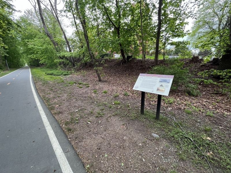
On Wampanoag Trail (Rhode Island Route 114) at Kyle Circle, on the right when traveling north on Wampanoag Trail.
Osamequin Nature Preserve and Bird Sanctuary is named in honor of the Massasoit (Great Leader) Osamequin (or Ousamequin) of the Pokanoket Tribe. Osamequin, which means Yellow Feather, led his people in helping the settlers of the Plymouth Colony . . . — — Map (db m223753) HM
On County Road (Rhode Island Route 103/114) at Mathewson Road, on the right when traveling west on County Road.
"I remember the spectacular view of the Barrington River in the Spring and Summer; the boats were moored in the beautiful harbor which gave the police access to our community from both land and water."
- Police Officer Joseph . . . — — Map (db m223004) HM
On Ferry Road (Rhode Island Route 114) south of Old Ferry Road, on the right when traveling south.
The Mount Hoge Bridge was immediately heralded as a triumph of engineering and remarkably beautiful structure. Steinman had began with an inherently graceful bridge form and then given special attention in the artistic design of the entire . . . — — Map (db m186854) HM
Near Hope Street (Rhode Island Route 114) south of Court Street, on the right when traveling north.
Named in honor of
Raymond Earl Bliven
Corporal 16th Co. 5th Regt.
U.S. Marine Corps
Born August 5 1897
Killed in Action in France
June 23 1918 — — Map (db m222947) WM
On Ferry Road (Rhode Island Route 114) east of Old Ferry Road, on the right when traveling south.
The Mount Hope Bridge was built as a private toll bridge by the Mount Hope Bridge Co. after state proposals for a public bridge were defeated. In 1927, Dr. David B Steinman, the noted New York bridge engineer, produced the design for a graceful . . . — — Map (db m186853) HM
On Hope Street (Rhode Island Route 114) south of Court Street, on the left when traveling south.
World War I •
World War II •
Korean War •
Vietnam War •
Miscellaneous Conflicts •
Persian Gulf •
World War II •
Korean War •
Vietnam War •
Afghanistan •
Iraq •
Combat Merchant Marines
Oath of . . . — — Map (db m222954) WM
On Thames Street at Constitution Street, on the left when traveling south on Thames Street.
In appreciation of the US Coast Guard who have served their country and the State of Rhode Island and the Town of Bristol since 1935 — — Map (db m222756) HM WM
On High Street just north of Congregational Street, on the right when traveling north.
In January 1680, following King Philip’s War, Plymouth Colony sold the area “known by the name of Mount Hope Neck and Poppasquash Neck”, which was part of Sowams, the ancestral home of the Pokanoket Tribe. Following the sale, four wealthy Boston . . . — — Map (db m186127) HM
On High Street south of Bradford Street, on the left when traveling south.
Organized and first church edifice built on Bristol Common 1683. Oldest Congregational church in Rhode Island. Second church building erected 1784. This building erected 1856. — — Map (db m222915) HM
On Wood Street south of State Street, on the right when traveling north.
Erected in memory of the stalwart founders and builders of Bristol those courageous men and women whose dauntless spirit and renowned achievements have become the everlasting heritage of this town — — Map (db m222923) HM
Near Thames Street near State Street, on the left when traveling north.
Finney's Distillery was discovered during demolition of the structure of the original Bank of Bristol (shown below, center). For nearly thirty-five years, two hundred gallons of rum were made each day. The rum was placed in barrels called . . . — — Map (db m222816) HM
Near Thames Street north of John Street, on the left when traveling north.
In 1675, after King Philip's War, the lands known as Mount Hope were ceded to Plymouth Colony. Plymouth sold the area that became the Town of Bristol and its deep water harbor to four proprietors, who laid out streets relative to the waterfront. . . . — — Map (db m222772) HM
On State Street west of Thames Street, on the left when traveling west.
Today, Bristol's waterfront embodies the town's many successful efforts to repurpose its maritime-related resources and structures. The creation of the Bristol Waterfront Historic District in 1975 encouraged residents to work actively towards . . . — — Map (db m222783) HM
Near Thames Street at Bradford Street, on the right when traveling south.
With the collapse of the DeWolf empire in 1825, Bristol's golden years came to an abrupt halt. Although the maritime economy would eventually rebound, it would never reach the plateau it had known prior to 1825. By the 1830s, new pressures on . . . — — Map (db m222828) HM
Near Thames Street at Bradford Street, on the right when traveling south.
In Bristol's early years, the waterfront was an important means of transportation. In addition to ships engaged in the trans-Atlantic merchant trade, smaller boats ferried people and goods around both Narraganset Bay, and beyond to cities like . . . — — Map (db m222836) HM
On Thames Street south of Franklin Street, on the right when traveling south.
After the Civil war, Bristol's economy shifted to the production of rubber goods. In 1865, August O. Bourn established the National Rubber Company on Wood Street and began manufacturing rubber using vulcanizing technology, which had been recently . . . — — Map (db m222849) HM
Near Thames Street south of John Street, on the right when traveling south.
Flood awareness is important to Bristol's community of residents, businesses and visitors. These historic photos depict the destruction to the town from the 1938 and 1954 Hurricanes.
❶ The D'Wolf Inn stood on this . . . — — Map (db m222764) HM
On Thames Street south of Franklin Street, on the right when traveling south.
Flood awareness is important to Bristol's community of residents, businesses and visitors. These historic photos depict the destruction to the town from the 1938 Hurricane.
Near Tower Street (at milepost 0.7), 0.2 miles south of Tower Street.
In the 'Miery Swamp,' 100 feet W.S.W. from this spring, according to tradition, King Philip fell, August 12, 1676, O.S. This stone placed by the R.I. Historical Society. December, 1877. — — Map (db m86296) HM
On Thames Street north of State Street, on the left when traveling north.
In 1818 James DeWolf and his brother built the DeWolf Warehouse. The DeWolf family engaged in numerous sea-related enterprises that included the slave trade, rum distilleries, privateering, merchant marine, insurance, banking and Cuban sugar and . . . — — Map (db m222814) HM
On Hope Street (Rhode Island Route 114) at Bradford Street, on the right when traveling north on Hope Street.
In grateful recognition of the veterans of Bristol Rhode Island who gave their lives to defend the liberties of the world
~ In memory of ~
Almeida, Anthony •
Barboza, Joseph •
Barboza, Manuel M. •
Barron, Robert K. • . . . — — Map (db m222893) WM
Near Metacom Avenue (Rhode Island Route 136) 0.1 miles south of Mount Hope Avenue, on the right when traveling north.
Mount Hope (originally Montaup in the Pokanoket language) is a wooded promontory on the eastern shore of Bristol, Rhode Island overlooking the part of Narragansett Bay known as Mount Hope Bay. Before the European settlers arrived in New England, . . . — — Map (db m186121) HM
On Mount Hope Bridge (Rhode Island Route 114) 0.1 miles south of Old Ferry Road, on the left when traveling south.
Connecting Providence plantations settled by Roger Williams 1636 with the island of Rhode Island settled by John Clarke 1638 (purchased from the Indians and originally called Aquidneck)
On the nearby shores of Mount Hope lived the Wampanoag . . . — — Map (db m198190) HM
On Hope Street (Rhode Island Route 114) south of Wardell Street, on the right when traveling north.
This Federal Style mansion designed by Russel Warren was built by George DeWolf in 1810. Money received from the trading of enslaved people funded its construction. The DeWolf family financed 88 slaving voyages accounting for 60 percent of all . . . — — Map (db m222899) HM
Near Hope Street (Rhode Island Route 114) south of Court Street, on the right when traveling north.
Dedicated to the following employees who entered the Armed Forces of our country
Margaret Black •
W. Steven Burns •
Harold Connery •
Francis Connery •
Norman Cologne •
J. Raymond Dugan •
Harris Fonseca •
Carmelo Ficarra • . . . — — Map (db m222950) WM
Near Thames Street north of John Street, on the right when traveling south.
Dedicated in memory of
Specialist Michael Andrade
169th/115th MP Company
U.S. Army RI National Guard
May this boardwalk be a place for reflection, prayer and joy for all who visit. A place to remember and honor the sacrifices of all . . . — — Map (db m222781) WM
On Hope Street (Route 114) at Church Street, on the right when traveling south on Hope Street.
Organized by members of the Church of England 1718. First church erected on this spot 1720. Burned by the British May 25, 1778. Second church erected 1786. removed to make way for a larger one 1833. Third church burned Dec. 5, 1858. Fourth church . . . — — Map (db m222933) HM
On Hope Street (Rhode Island Route 114) at State Street, on the left when traveling north on Hope Street.
"Loafers' Corner"
The
Easterbrooks-Paull Block
1899
has been placed on the
National Register
of Historic Places
by the United States
Department of the Interior — — Map (db m222909) HM
On Hope Street (Rhode Island Route 114) south of Burnside Street, on the right when traveling north.
The Herreshoff Manufacturing Company was started here in 1863 by John B. Herreshoff with his brother Nathanael G. Herreshoff as designer.
The Company designed and built many famous vessels including Seagoing Torpedo Boat No. 1 U.S.S. Cushing . . . — — Map (db m222724) HM
On Thames Street north of Franklin Street, on the left when traveling north.
The War of Independence
Voice of the People
In response to the "Boston Tea Party" the citizens of Bristol in the Town Meeting of February 28, 1774 adopted an 11-point resolution in support which included these words: . . . — — Map (db m222856) HM WM
On Burnside Street east of Hope Street (Rhode Island Route 114), on the right when traveling east.
The America's Cup is not only the most prestigious and exciting yacht race in the world, but it is also a blending of each competing country's best technology and talent. All of the racing teams from each country engage their best naval . . . — — Map (db m222749) HM
On Ferry Road (Rhode Island Route 114) south of Old Ferry Road, on the right when traveling south.
For centuries travelers have come here, where the waters narrow between Mount Hope Bay and Narragansett Bay, to come over to Aquidneck Island. Before 1929, the trip was made by water. The Wampanoag people, who were the earliest residents of Mount . . . — — Map (db m190085) HM
On Hope Street (Rhode Island Route 114) at State Street, on the left when traveling north on Hope Street.
1917 - 1918
In honor and in memory of the citizens of Bristol, R.I. who served in World War I
[Names listed]
American Legion
Memorial Square
This square is dedicated in honor of the citizens of Bristol who served in the wars of our . . . — — Map (db m222902) WM
On Main Street (Rhode Island Route 114) at Miller Street, on the right when traveling south on Main Street. Reported damaged.
Rhode Island College, now Brown University, was founded on this site with the Rev. James Manning as its first President.
The First Commencement was held here in 1769, when the student enrollment was 29.
The College moved to its . . . — — Map (db m222989) HM
On Water Street south of Haile Street, on the left when traveling south.
The Sowams Heritage Area includes Barrington, Bristol, East Providence, Providence, and Warren RI, and Rehoboth, Seekonk and Swansea, MA. Sowams means "Southern Area” and was the historic home of the Pokanokets (later described as Wampanoags) . . . — — Map (db m155910) HM
On Child Street (Rhode Island Route 103) at Hugh Cole Road, on the right when traveling east on Child Street.
The town of Warren was first settled by people from the Pokanoket Tribe, later known as the Wampanoag. The Pokanoket controlled the land from Plymouth to the eastern shores of Narragansett Bay. In 1620, “Osamequin”, which translates as “Yellow . . . — — Map (db m223848) HM
Near Asylum Road, 0.3 miles west of Cole School Road, on the left when traveling north.
In memory of Hugh Cole. Born London, England, 1627. Died Swansea, Mass, 1699. An honorable and useful citizen of Plymouth Colony. Many years a representative of Swansea, Mass. A sergeant in King Philip's War, 1675. An esteemed friend of King . . . — — Map (db m223850) HM
On Baker Street at Water Street, on the right when traveling west on Baker Street.
In October of 2000 the Massasoit Park Revitalization Committee rehabilitated and re-dedicated this park for the community of Warren as a recreational space for the Historic Waterfront District.
In the “Sacred Circle,” East, West, North and . . . — — Map (db m188388) HM
On Main Street (Rhode Island Route 114) at Market Street, on the right when traveling south on Main Street.
This tablet was erected
May 25, 1897
by the
Benevolent Baptist Society
Incorporated Aug. 29, 1785.
First Officers
Pres. Nathan Miller •
V.Pres. Ebenezer Cole •
Treas. Robert Carr •
Sec. Wm Turner Miller . . . — — Map (db m222986) HM
On Church Street west of Main Street (Rhode Island Route 114), on the right when traveling west.
This truly magnificent building has been a light in both the spiritual and navigational life of Warren.
The first Methodist sermon ever preached in Warren was by Rev. Daniel Smith in 1789. The Rev. Jesse Lee, noted pioneer of . . . — — Map (db m222983) HM
On Water Street south of State Street, on the right when traveling south.
Rhode Island was the center of the American transatlantic slave trade, accounting for the majority of American slave voyages from 1700 until 1808.
More than 110,000 Africans were forcibly taken from their homeland on Rhode Island ships and . . . — — Map (db m150887) HM
On Jefferson Street west of Main Street (Rhode Island Route 114), on the left when traveling west.
The Warren Artillery Company
~ incorporated May 17, 1842~ supported Governor King during the "Dorr Rebellion." In recognition, the state and town each gave the company $500 toward the total cost of $3,000 to build an "armory and public . . . — — Map (db m222980) HM
On North Main Street (Rhode Island Route 114) west of Crescent Street, on the right when traveling west.
Dedicated in memory of
Army Sgt.
Ronald James Wilkinson
Sgt. Wilkinson, a native of Warren, was born February 29, 1948 and was killed in action February 23, 1969 in Bien Hoa, South Vietnam, during the "Second Tet Offensive" . . . — — Map (db m222996) WM
On Market Street at Kickemiut Road on Market Street.
In memory of those from Warren killed in action in Vietnam. PFC Lester M DeRiso • Capt Edward C. Krawczyk • Sgt Ronald J. Wilkinson • Cpl Richard C. Brule.
Service-Sacrifice-Honor — — Map (db m66343) WM
On State Street west of Main Street (Rhode Island Route 114), on the left when traveling east.
Revolutionary War •
War of 1812 •
Civil War •
Spanish American War •
World War I •
World War II •
Korean War •
Vietnam War •
Persian Gulf •
Operations Enduring Freedom, Iraqi Freedom •
Died While in Service of Our Country • . . . — — Map (db m222982) WM
On Main Street (Rhode Island Route 114) at Jefferson Street, on the right when traveling north on Main Street.
Indigenous people known today as the Pokanoket Tribe had made their home in the Town of Warren for thousands of years prior to the arrival of the first European settlers.
The town and the surrounding area was called Sowams, and the land . . . — — Map (db m222960) HM
On Washington Street at Main Street, on the right when traveling west on Washington Street.
Washington St. so called since 1835. In colonial days, known as Ferry Lane; later, as King St. On the corner opposite stood Burr’s Tavern, which in Revolutionary times played host to Washington; Jefferson, De Lafayette, De Castellux, Putnam and . . . — — Map (db m66344) HM
On Water Street north of Sisson Street, on the left when traveling north.
William Schaff is a veteran of the local arts scene known primarily for his album artwork for bands such as Okkervill River, Godspeed You! Black Emperor and the Mighty Mighty Bosstones. He is also the founder of Warren's "Fort Foreclosure," a . . . — — Map (db m222994) HM
On Flat River Road (Rhode Island Route 117) east of Brenda Drive (Walker Lane), on the right when traveling east.
Dedicated to the citizens of the Town of Coventry who made the supreme sacrifice serving their Country • • • Erected by the Coventry Garden Club May 30, 1949 — — Map (db m152527) WM
Near Taft Street, on the right when traveling north.
This American Liberty Elm was named after “The Liberty Tree: Our Country’s First Symbol of Freedom.” On the morning of August 14, 1765 Boston awakened to discover two effigies of British official hanging from the branches of a towering elm in . . . — — Map (db m83422) HM
On Flat River Road (Rhode Island Route 117) east of Brenda Drive (Walker Lane), on the right when traveling east.
This American Liberty Elm was named after "The Liberty Tree: Our Country's first Symbol of Freedom." On the morning of August 14, 1765, the people of Boston awakened to discover two effigies suspended from an elm tree in protest of the hated Stamp . . . — — Map (db m152526) HM
On Flat River Road (Rhode Island Route 117) east of Brenda Drive (Walker Lane), on the right when traveling east.
In Memory of Major Edouard J. Jacques For his dedicated service to the United States of America having received the Distinguished Flying Cross from the 8th Army Air Force during WWII (1944-1945), the R.I. Star, & for his dedicated service to the . . . — — Map (db m152528) HM WM
Near Taft Street, on the right when traveling north.
Of the generals of the American Revolution, second only to Washington. Built this house in 1770 and lived in it as a private. He joined the army at Cambridge in 1775. — — Map (db m83586) HM
On Taft Street, on the right when traveling north.
Coventry High School and the National Student Council honor Maj. Gen. Nathanael Greene Rhode Island Delaware New Hampshire Maryland Massachusetts Virginia New York North Carolina Connecticut . . . — — Map (db m83411) HM
On Taft Street, on the right when traveling north.
Homestead OverviewIn 1770, this house was built by 27 year-old Quaker and iron-master, Nathanael Greene. The building is a well-preserved 18th Century structure of simple, yet refined design. The iron forge, which was located on the Pawtuxet . . . — — Map (db m83326) HM
Near Taft Street, on the right when traveling north.
Cemetery HistoryThe first Greene family interment occurred in 1786 with the death of Miss Margaret Greene, daughter of Jacob (General Greene’s brother) and Margaret Greene. There are seventeen identified interments in the cemetery and four . . . — — Map (db m83400) HM
Used as Headquarters for the French
Troops on their march to and from
Yorktown 1781-1782
Maj. Gen. Nathanael Greene
Gen. Lafayette
Gen. Rochambeau
RI Commemorative Committee for
Maj. Gen. Nathanael Greene
Coventry . . . — — Map (db m189625) HM
On Railroad Street at Log Bridge Road, on the left when traveling west on Railroad Street.
The village of Summit was called Perry’s Hollow in the 18th century.
Located on a ridge between the Flat River and the Moosup River Watersheds, the name “Summit” signified a high point along the adjacent railroad line.
Summit developed when the . . . — — Map (db m107453) HM
On Peirce Street south of Armory Street, on the left when traveling south.
Armory of the
Kentish Guards
has been placed on the
National Register
of Historic Places
in 1970
by the United States
Department of the Interior — — Map (db m223020) HM
General James Mitchell Varnum Brigadier General of the Continental Army was instrumental in creating the Rhode Island Black Regiment which provided the first genuine route to freedom for Afro-American people in Rhode Island — — Map (db m58174) HM
On Court House Lane, on the right when traveling east.
On June 12, 1775
The General Assembly for the state of Rhode Island met on this site and enacted a resolution to charter and arm two sloops for the protection of trade and appointed Abraham Whipple to be commander with the rank and power of . . . — — Map (db m58263) HM
Near Church Street, on the right when traveling east.
1774-1974
Kentish Guards Drill Field
To those Kentish Guardsmen who in 1774 utilized this field to prepare themselves for the conflict that assured our independence. This tablet was dedicated on the 200th Anniversary of the Kentish Guards . . . — — Map (db m58261) HM
On Peirce Street south of Armory Street, on the right when traveling north.
Dedicated November 11, 1980
Albert J. Michaud
U.S. Army
Albert J. Michaud Jr.
U.S. Navy
In their memory and those who made the supreme sacrifice for the freedom of others. — — Map (db m223023) WM
On Main Street (U.S. 1) south of Division Street, on the right when traveling north.
Stationed at the Varnum Memorial Armory
15 July 1918 through 14 January 1996
Seventy Seven Years and Six Months of ServiceFrom, Unit
June 1916, Varnum Provisional Training Co. •
July 1918, 16th Co. R.I. State Guard • . . . — — Map (db m223029) HM WM
On Marlborough Street at Long Street, on the left when traveling south on Marlborough Street.
Built in 1872 by William Northup on the former site of Scalloptown. This chapel was the first fully integrated congregation in East Greenwich. — — Map (db m58389) HM
On Main Street (U.S. 1) south of Division Street, on the right when traveling north.
Founders
Oct. 1, 1907.
Howard V. Allen •
Benjamin H. Arnold •
D. Ray Arnold •
George E. Bailey* •
Henry D. Banks •
Walter O. Barber •
Albert S. Benson •
Thomas W. Black, Jr. •
Nathaniel H. Brown* •
William A. Browning* . . . — — Map (db m223030) HM WM
On Main Street at Division Street, on the right when traveling north on Main Street.
Erected by Varnum Continentals 1914 on the second site of Rhode Island Central Bank, first bank in East Greenwich 1840-1857
To the memory of
James Mitchell Varnum
of East Greenwich
Brig. Gen. Continental Army 1777-1779 • . . . — — Map (db m223025) HM WM
On Point Avenue, 0.2 miles east of Elgin Street, on the right when traveling east.
Location: Conimicut Shoal, entrance to Providence River, Narragansett Bay
41 43 01 N 71 20 42 W
Originally Established: 1868
Present Light House Established: 1882 / Automated: 1963
Construction Material: Cast iron / Present Optic: 250 mm . . . — — Map (db m198179) HM
On Main Avenue (Rhode Island Route 113) at Walnut Glen Drive, on the right when traveling west on Main Avenue.
The Peter Freeman Lot (Warwick Historical Cemetery #26) is an historic cemetery protected by State and City regulations. The Lot is described as 100 feet by 75 feet in size, containing 22 individuals (with 20 inscribed headstones and one . . . — — Map (db m150256) HM
Conanicut Battery
A Revolutionary Fort
Built by Americans in 1776
Grounds cleared and tablet placed by the Daughters of the American Revolution of Rhode Island — — Map (db m56383) HM
On Beavertail Road south of Clarkes Village Road, on the left when traveling south.
In 1829, Congress appropriated $1,250 for a 600-pound fog bell for Beavertail. Prior to that time the keeper fired a cannon on foggy nights. That same year a fog bell house was built adjacent to the tower.
Beavertail has probably seen more . . . — — Map (db m88667) HM
On Fort Wetherill Road, on the left when traveling south.
Situated atop 50-70 foot high cliffs with clear views of the horizon and Block Island to the south. Fort Wetherill held an important strategic position within an extended harbor defense system of Narragansett Bay during World Wars I and II.
The . . . — — Map (db m189619) HM
The Harbor Mine or Torpedo Complex was constructed during the period of 1908 to 1911 as part of a comprehensive harbor defense system for Narragansett Bay. The two-story concrete structure served as a Mine Storage Warehouse in which the parts . . . — — Map (db m56683) HM
On Beavertail Road south of Clarkes Village Road, on the left when traveling south.
1678
Town of Jamestown is incorporated. There are about 150 residents.
1705
Jamestown Town Council orders that a Watch House be built at "Beaver Tail."
1712
Jamestown Town Council . . . — — Map (db m88673) HM
On Narragansett Avenue east of North Road, on the left when traveling east.
Memorial
To The Veterans
of
Jamestown, Rhode Island
Who Served In The
Spanish - American War
World War One
World War Two
The Korean War
The Vietnamese War — — Map (db m88699) WM
Beavertail Light was lit with whale oil for many decades. Whale oil was smoky, hard to light at cold temperatures, and the quality varied greatly. In addition, early lights were dim and burned twenty to thirty gallons of oil a month.
In the . . . — — Map (db m56679) HM
This area along the crest of Prospect Hill was an integral part of the Narragansett Bay coastal defense system from 1916 to 1945. From here, military observers had an unobstructed view of the approaches to the Bay, as well as East and West passages . . . — — Map (db m56678) HM
On Beavertail Road, on the right when traveling south.
Below this concrete cap sits the stone foundation Beavertail's 1749 lighthouse.
Initially built to provide safe passage into Newport's colonial harbor, it was designed and built by Peter Harrison, "America's first architect," who later designed . . . — — Map (db m56457) HM
On Beavertail Road south of Clarkes Village Road, on the left when traveling south.
The first assistant keeper at Beavertail Light was hired about 1859. It appears that the early assistant keepers shared part of the keeper's quarters or lived in one of the outbuildings on site.
In 1898, the U.S. Lighthouse Board added this . . . — — Map (db m88631) HM
On Beavertail Road south of Clarkes Village Road, on the left when traveling south.
The current tower was built in 1856 to replace a deteriorating 1753 structure.
The granite tower rises to a height of 40.9 feet and measures 10 feet on each side. It is constructed of 27 rows of granite blocks, weighing a total of 180 tons. . . . — — Map (db m88666) HM
Near Beavertail Road south of Clarkes Village Road, on the left when traveling south.
Although most lighthouse keepers were married, at many small lighthouses they lived a solitary life while their families remained on the mainland. Beavertail, being on Conanicut Island, allowed the keepers and their family to live at the site. . . . — — Map (db m88672) HM
On Beavertail Road south of Clarkes Village Road, on the left when traveling south.
You are looking at the West Passage, one of two entrances to Narragansett Bay, New England's largest estuary. There are over 30 islands in the bay. There is very little commercial shipping in the West Passage since it is much shallower than the . . . — — Map (db m88640) HM
On Beavertail Road south of Clarkes Village Road, on the left when traveling south.
What resembles a submarine on the surface just over a mile southwest of this point is all that remains of the Whale Rock Lighthouse.
Whale Rock is a flat ledge about a half acre in size, yet it claimed at least eight ships and six lives . . . — — Map (db m88648) HM
On Fort Wetherill Road, on the right when traveling east.
Historically, the rocky cliffs behind and above the buildings of the Harbor Mine Complex were of military significance to Rhode Island's earliest colonists, who built earthen fortifications on its headland and installed cannon to protect nearby . . . — — Map (db m242649) HM
This Tablet erected by the Rhode Island Society of Colonial Wars in recognition of the exceptional services rendered by Col. Benjamin Church
His fearless leadership and effective command during King Philip's war 1675-1676 — — Map (db m52392) HM
665 entries matched your criteria. The first 100 are listed above. Next 100 ⊳