5049 entries match your criteria. The first 100 are listed. ⊳
Horticulture & Forestry Topic
By Mark Hilton, September 25, 2022
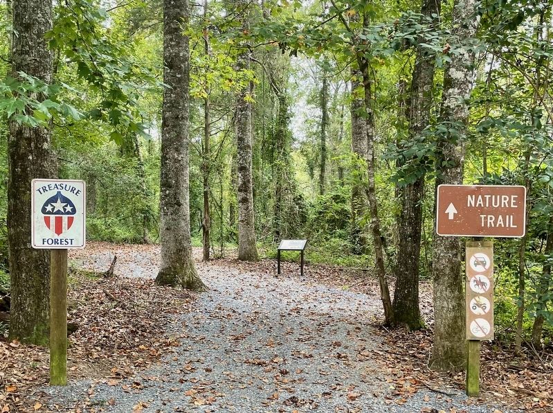
Alabama Forests Marker
1 ► Alabama, Autauga County, Marbury — Alabama Forests —  |
| Near County Road 63 0.3 miles south of County Road 530, on the right when traveling south. | |||
| 2 ► Alabama, Autauga County, Prattville — Pratt Homesite — Circa 1842 — |
| On Bridge Street at Gin Shop Hill Road, on the right when traveling west on Bridge Street. | |||
| 3 ► Alabama, Baldwin County, Daphne — City of Daphne — Incorporated July 8, 1927 — |
| On Main Street at Manci Avenue, on the right when traveling south on Main Street. | |||
| 4 ► Alabama, Baldwin County, Foley — City of Foley Camellia Walk — |
| On North McKenzie Street near Laurel Avenue. | |||
| 5 ► Alabama, Baldwin County, Stockton — Bartram’s Trail — |
| On Alabama Route 59 at milepost 56, on the right when traveling north. | |||
| 6 ► Alabama, Barbour County, Eufaula — The Tree That Owns Itself — |
| On Cotton Avenue at Highland Avenue on Cotton Avenue. | |||
| 7 ► Alabama, Bullock County, Union Springs — Chunnenuggee Public Garden — 1847 — |
| On Peachburg Road (County Road 40) east of County Road 30, on the right when traveling east. | |||
| 8 ► Alabama, Butler County, Greenville — Bartram's Trail — |
| On Sherling Lake Road (County Road 44) 1 mile west of Braggs Road (State Route 263), on the right when traveling west. | |||
| 9 ► Alabama, Butler County, Greenville — The Camellia City / Greenville — |
| On East Commerce Street (Alabama Route 10) at Posey Street, on the right when traveling west on East Commerce Street. | |||
| 10 ► Alabama, Butler County, Greenville — The Camellia Gardens at Beeland Park / Registered Camellias of Butler County — |
| On East Commerce Street (Alabama Route 10) west of Flowers Street, on the left when traveling west. | |||
| 11 ► Alabama, Cherokee County, Gaylesville — W.P. Brown & Sons Lumber Company — |
| On County Road 15 at State Route 35, on the right when traveling north on County Road 15. | |||
| 12 ► Alabama, Clarke County, Fulton — Fulton, Alabama — |
| On Main Street Circle west of Main Street South, on the right when traveling west. | |||
| 13 ► Alabama, Clarke County, Jackson — City of Jackson — |
| On Commerce Street (Alabama Route 177) at Magnolia Drive, on the right when traveling west on Commerce Street. | |||
| 14 ► Alabama, Clarke County, Rockville — Bartram's Trail — |
| On Rockville Road (County Road 15) at Stimpson Sanctuary Road, on the right when traveling south on Rockville Road. | |||
| 15 ► Alabama, Clay County, Delta — Managing Public Land — |
| Near Alabama State Road 281 (Alabama Route 281). | |||
| 16 ► Alabama, Clay County, Delta — Won't You Be My Neighbor — |
| Near Alabama State Road 281 (Alabama Route 281). | |||
| 17 ► Alabama, Colbert County, Cherokee — Welcome! — Natchez Trace Parkway — |
| Near Natchez Trace Parkway (at milepost 327.3), 2.7 miles east of N Pike (County Route 21), on the left when traveling east. | |||
| 18 ► Alabama, Colbert County, Leighton — The Shaw Home — Colbert County — |
| On Shaw Road 0.2 miles 6th Street, on the left when traveling north. | |||
| 19 ► Alabama, Colbert County, Sheffield — Forest Elders — |
| On Thunder Road. | |||
| 20 ► Alabama, Colbert County, Tuscumbia — Petrified Conifer Tree / Petrified Lycopod Tree Stump — |
| On S. Main Street. | |||
| 21 ► Alabama, Colbert County, Tuscumbia — The Moon Tree — |
| On North Jefferson Street. | |||
| 22 ► Alabama, Covington County, Opp — The Depot / Opp, Alabama — |
| On South Main Street (U.S. 331/84) north of Cummings Avenue (U.S. 331/84), on the left when traveling north. | |||
| 23 ► Alabama, Covington County, Sanford — Town of Sanford — |
| Near County Road 67 at U.S. 84, on the right when traveling west. | |||
| 24 ► Alabama, Dallas County, Cahaba — Black Belt Transformations — |
| On Capitol Avenue at Cahaba Road, on the right when traveling east on Capitol Avenue. | |||
| 25 ► Alabama, DeKalb County, Valley Head — Site of Cherokee Council Tree — |
| On Railroad Avenue at Mountain Street, on the right when traveling west on Railroad Avenue. | |||
| 26 ► Alabama, Elmore County, Wetumpka — William Bartram Arboretum — 1739 - 1823 — |
| Near West Fort Toulouse Road 0.2 miles south of Jackson Park Road. | |||
| 27 ► Alabama, Escambia County, Andalusia — Dixon Home Place / History of the Dixon Home — |
| On Dixon Center Road 1.6 miles north of U.S. 29, on the right when traveling north. | |||
| 28 ► Alabama, Escambia County, Pollard — The Lindsey-Fitzgerald House — |
| On Misella Street at Lamosa Street, on the right when traveling south on Misella Street. | |||
| 29 ► Alabama, Houston County, Cottonwood — Cottonwood, Alabama — |
| On County Road 55 at Cottonwood Road (State Road 53), on the right when traveling south on County Road 55. | |||
| 30 ► Alabama, Jackson County, Estillfork — Walls of Jericho — |
| Near Alabama Route 79, on the right when traveling south. | |||
| 31 ► Alabama, Jackson County, Stevenson — Wet, Wild, and Wonderful — |
| On City Park Road south of Kentucky Avenue ( Route 17), on the left when traveling south. | |||
| 32 ► Alabama, Jefferson County, Clay — The Cahaba Heart River of Alabama — |
| On Old Springville Road / County Road 30, on the left when traveling north. | |||
| 33 ► Alabama, Lawrence County, Moulton — A Significant Forest — |
| Near Alabama Route 33 0.2 miles south of County Route 67, on the left when traveling south. | |||
| 34 ► Alabama, Lawrence County, Moulton — Birds of North Alabama — |
| Near Alabama Route 33 0.2 miles south of County Route 67, on the left when traveling south. | |||
| 35 ► Alabama, Lawrence County, Moulton — Explore the Forest — |
| Near Alabama Route 33 0.2 miles south of County Route 67, on the left when traveling south. | |||
| 36 ► Alabama, Lee County, Auburn — Chewacla State Park — (CCC) — |
| On Murphy Drive 0.2 miles east of Wrights Mill Road (County Road 33), on the right when traveling east. | |||
| 37 ► Alabama, Lee County, Auburn — Founders' Oak — |
| Near Garden Drive 0.1 miles west of South College Street ( Route 15), on the left when traveling west. | |||
| 38 ► Alabama, Lee County, Auburn — The Cullars Rotation / The Alvis Field and Cotton Rust — |
| Near Woodfield Drive 0.1 miles east of South College Street ( Route 15), on the right when traveling east. | |||
| 39 ► Alabama, Lee County, Auburn — The Old Rotation — |
| On Lem Morrison Drive 0.1 miles north of Duncan Drive, on the right when traveling north. | |||
| 40 ► Alabama, Macon County, Tuskegee — Bartram's Trail — |
| On Forest Road 949 0.2 miles north of State Route 186, on the left when traveling north. | |||
| 41 ► Alabama, Madison County, Huntsville — 680.AL3 — Joe B. Shirley Fire Tower |
| Near Cabin Drive. Reported missing. | |||
| 42 ► Alabama, Madison County, Huntsville — The Columns — Sweet Homegrown Alabama — |
| Near Bob Wallace Avenue Southwest. | |||
| 43 ► Alabama, Madison County, Huntsville — Van Valkenburgh Daylily Garden — |
| Near Bob Wallace Avenue Southwest. | |||
| 44 ► Alabama, Marshall County, Albertville — Liberty Tree Memorial — |
| Near Jackson Street at Baltimore Avenue. | |||
| 45 ► Alabama, Mobile County, Dauphin Island — John F. Porter, Jr. Goat Tree Reserve / The Goat Tree — |
| On Cadillac Avenue west of Grant Street, on the right when traveling west. | |||
| 46 ► Alabama, Mobile County, Grand Bay — William Bartram Trail — Traced 1773-1777 — Deep South Region — |
| Near Interstate 10 2 miles east of Franklin Creek Road. | |||
| 47 ► Alabama, Mobile County, Semmes — Blackwell House — EST 1951 — Mobile County — |
| On Moffett Road (U.S. 98) 0.6 miles south of Snow Road North, on the right when traveling south. | |||
| 48 ► Alabama, Mobile County, Theodore — The Story of Bellingrath Gardens — A Gift to Posterity — |
| Near Bellingrath Gardens Road (County Route 18) 1.4 miles east of Bellingrath Road (County Route 59), on the right when traveling east. | |||
| 49 ► Alabama, Montgomery County, Hope Hull — William Bartram — 1739 ~ 1823 — |
| On Federal Road 0.9 miles south of Cloverfield Road (County Road 24), on the left when traveling south. | |||
| 50 ► Alabama, Montgomery County, Montgomery — Camellia Designated Alabama State Flower — |
| On Monroe Street east of North Bainbridge Street, on the right when traveling east. | |||
| 51 ► Alabama, Montgomery County, Montgomery — Civil War Laurel Oak Tree — |
| Near Monroe Street at Dexter Avenue. | |||
| 52 ► Alabama, Montgomery County, Montgomery — Judy's Garden — Judy Brown Youngblood — July 5, 1941 - September 10, 2013 — |
| On North Hull Street at Columbus Street, on the right when traveling north on North Hull Street. | |||
| 53 ► Alabama, Montgomery County, Montgomery — Sycamore Tree — |
| On Monroe Street at North Union Street, on the right when traveling east on Monroe Street. | |||
| 54 ► Alabama, Montgomery County, Montgomery — Tree of Hippocrates — Platanus orientalis — (Sycamore) — |
| On East South Boulevard at Morrow Drive, on the right when traveling west on East South Boulevard. | |||
| 55 ► Alabama, Montgomery County, Montgomery — Washington Elm Tree — |
| Near North Bainbridge Street at Monroe Street. | |||
| 56 ► Alabama, Montgomery County, Montgomery, Centennial Hill — "Moon Tree" — |
| Near Dexter Avenue at Monroe Street. | |||
| 57 ► Alabama, Morgan County, Decatur — Our History — U.S. Fish and Wildlife Service — Wheeler National Wildlife Refuge — |
| On Wheeler Wildlife Boat Launch north of Route 67, on the right when traveling north. | |||
| 58 ► Alabama, Russell County, Fort Mitchell — Bartram's Trail — |
| On Alabama Route 165 north of Creek Trail, on the right when traveling north. | |||
| 59 ► Alabama, Washington County, Yarbo — Yarbo — |
| On Jordan Street (Alabama Route 17) at Ingram Saw Mill Road, on the right when traveling south on Jordan Street. | |||
| 60 ► Alaska, Juneau Borough, Juneau — Grace Taeko Akiyama — 1927 - 1996 — |
| On Franklin Street at Marine Way (Alaska Route 7), on the left when traveling north on Franklin Street. | |||
| 61 ► Alaska, Ketchikan Gateway Borough, Ketchikan — Ketchikan has a strong history of community service — |
| Near Bawden Street, on the right when traveling north. | |||
| 62 ► Alaska, Ketchikan Gateway Borough, Ketchikan — Ketchikan Shingle Mill — 1904-1918 — Men worked on the Creek too … for a while! — |
| Near Creek Street. | |||
| 63 ► Alaska, Ketchikan Gateway Borough, Ketchikan — Trees of Monumental Value — |
| On Totem Bight Road, on the right when traveling south. | |||
| 64 ► Alaska, Matanuska-Susitna Borough, Sutton-Alpine — Rita Pfauth Memorial Garden — Rita Pfauth — (1924-1987) — |
| On Chickaloon Way north of Glenn Highway Milepost 61.6 (Alaska Highway 1), on the right when traveling north. | |||
| 65 ► Alaska, Matanuska-Susitna Borough, Sutton-Alpine — Walt Myar Memorial Garden — Walt Myar — (1914-2009) — |
| On Glenn Highway (State Highway 1 at milepost 61.6) east of Chickaloon Way, on the left when traveling east. | |||
| 66 ► Alaska, Matanuska-Susitna Borough, Sutton-Alpine — Wild Plants — |
| On Glenn Highway (State Highway 1 at milepost 61.6) east of Chickaloon Way, on the left when traveling east. | |||
| 67 ► Alaska, Sitka Borough, Sitka — Forest Service House — |
| On Seward Street at American Street, on the right when traveling east on Seward Street. | |||
| 68 ► Alaska, Skagway Borough, Skagway, Dyea — Avenue of Mountain Ash Trees — |
| On 1st Avenue at Broadway, on the left when traveling west on 1st Avenue. | |||
| 69 ► Alaska, Skagway Borough, Skagway, Dyea — Nature Always Succeeds! — Pullen Creek StreamWalk — |
| On Broadway, on the right when traveling south. | |||
| 70 ► Alaska, Skagway Borough, Skagway, Dyea — Restoring the Past: Historic Preservation at the Moore Homestead — Historic Moore Homestead — Klondike Gold Rush National Historical Park — |
| On 5th Avenue east of Broadway, on the left when traveling east. | |||
| 71 ► Alaska, Skagway Borough, Skagway, Dyea — The Emergence of a Domesticated Landscape: The Homestead Becomes an Urban Residence — Historic Moore Homestead — Klondike Gold Rush National Historical Park — |
| On 5th Avenue east of Broadway, on the left when traveling east. | |||
| 72 ► Alaska, Skagway Borough, Skagway, Dyea — The Garden City of Alaska — |
| On 7th Avenue east of Broadway, on the right when traveling east. | |||
| 73 ► Alaska, Southeast Fairbanks Census Area, Deltana — Welcome to the Delta Junction Bison Range — |
| On the Alaska Highway (State Highway 2) west of the Gerstle River (9-span) Bridge, on the left when traveling west. | |||
| 74 ► Arizona, Apache County, Adamana — Roosevelt's Tree Army: The CCC — |
| On Puerco Loop east of Petrified Forest Road, on the left when traveling south. | |||
| 75 ► Arizona, Cochise County, Tombstone — 35 — Rose Tree — Museum — |
| On South 4th Street at Toughnut Street, on the right when traveling north on South 4th Street. | |||
| 76 ► Arizona, Cochise County, Tombstone — The Rose Bush Story — |
| Near South 4th Street north of East Toughnut Street, on the right when traveling north. | |||
| 77 ► Arizona, Coconino County, Flagstaff — American Elm — |
| On Knoles Drive. | |||
| 78 ► Arizona, Coconino County, Flagstaff — Flagstaff's Founding — |
| Near East Aspen Avenue. | |||
| 79 ► Arizona, Coconino County, Flagstaff — Logging Wheels — |
| Near Route 66 at South Beaver Street. | |||
| 80 ► Arizona, Coconino County, Flagstaff — Logging Wheels — |
| On Fort Valley Road, on the right when traveling north. | |||
| 81 ► Arizona, Coconino County, Flagstaff — The McCormick Rose — |
| On Knoles Drive. | |||
| 82 ► Arizona, Coconino County, Flagstaff — The Riordan Building — |
| On West Route 66 (Business Interstate 40) at West Riordan Road, on the right when traveling east on West Route 66. | |||
| 83 ► Arizona, Coconino County, Flagstaff — Two Spots — Arizona Lumber and Timber Company Steam Engine — |
| On East Santa Fe Avenue (U.S. 89), on the right when traveling east. | |||
| 84 ► Arizona, Coconino County, Fredonia — Where There's Smoke... — |
| On Grand Canyon Highway (Arizona Route 67), on the left when traveling south. | |||
| 85 ► Arizona, Coconino County, Grand Canyon Village — Grandview Lookout Tower — Fire Lookout — |
| On Coconino Rim Road 1.3 miles south of Desert View Drive ( Route 64), on the left when traveling south. | |||
| 86 ► Arizona, Coconino County, North Rim - Grand Canyon — Maintaining Mountain Meadows — |
| On Cape Royal Road, on the right when traveling east. | |||
| 87 ► Arizona, Coconino County, Sedona — 7 — USFS Range House — City of Sedona Landmark No. 7 — |
| On Brewer Road, on the left when traveling south. | |||
| 88 ► Arizona, Coconino County, Williams — Rounseville Drugstore — |
| On Historic Route 66 east of North 3rd Street, on the left when traveling east. | |||
| 89 ► Arizona, Coconino County, Williams — Welcome to Williams — Gateway to the Grand Canyon — |
| Near West Railroad Avenue west of North Grand Canyon Boulevard. | |||
| 90 ► Arizona, Gila County, Payson — C.C.C. Co. 807 — Texas-Arizona — 1933 — |
| Near Arizona Route 260 at milepost 267.9. | |||
| 91 ► Arizona, Gila County, Payson — Mogollon Rim Country Firefighters Memorial — |
| Near South Green Valley Parkway 0.5 miles north of Main Street. | |||
| 92 ► Arizona, Gila County, Payson — Ranger Station — |
| Near South Green Valley Parkway. | |||
| 93 ► Arizona, Gila County, Payson — The Dude Fire — |
| On Fire Control Road or "Control Road" (Route NF 64) 13.8 miles east of Route 260, on the left when traveling east. | |||
| 94 ► Arizona, Gila County, Payson — These Trees Planted in Memory of the Firefighters Who Died in the Dude Fire June 26, 1990 — |
| On Myrtle Point Trail 0 miles north of NF 431, on the left. | |||
| 95 ► Arizona, Maricopa County, Glendale — Fruit Packing Shed — at Sahuaro Ranch… — |
| Near North 59th Avenue. | |||
| 96 ► Arizona, Maricopa County, Glendale — Orchards — at Sahuaro Ranch… — |
| Near North 59th Avenue. | |||
| 97 ► Arizona, Maricopa County, Wickenburg — The Jail Tree — |
| On North Tegner Street at Wickenburg Way, on the right on North Tegner Street. | |||
| 98 ► Arizona, Mohave County, Fredonia — Pipe Spring National Monument — |
| Near North Pipe Spring Road 0.3 miles north of Route 389, on the left when traveling north. | |||
| 99 ► Arizona, Navajo County, Overgaard — Travel on a Journey Through Time... — Stop 1 — |
| On Black Canyon Road, on the right when traveling north. | |||
| 100 ► Arizona, Pima County, Summerhaven — Lemmon Rock Lookout Tower — Coronado National Forest — |
| Near no nearby road. | |||
5049 entries matched your criteria. The first 100 are listed above. Next 100 ⊳