14994 entries match your criteria. The first 100 are listed. ⊳
African Americans Topic
By Jimmy Emerson, June 24, 2026
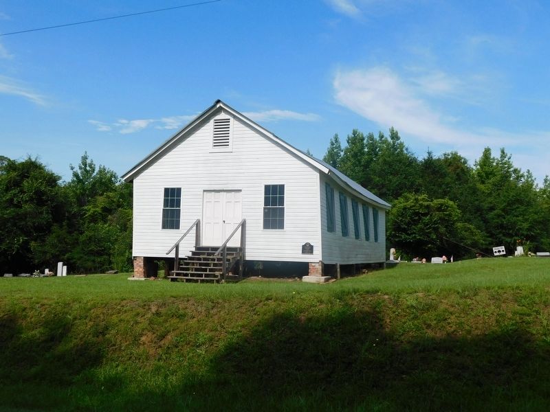
Old Mulberry Schoolhouse & Marker
1 ► Alabama, Autauga County, Mulberry — Old Mulberry Schoolhouse — c. 1895 —  |
| On County Road 9 South north of Alabama Highway 14, on the left when traveling north. | |||
| 2 ► Alabama, Autauga County, Prattville — First Missionary Baptist Church — Autauga County — |
| On 7th Street at N Court Street, on the right when traveling west on 7th Street. | |||
| 3 ► Alabama, Autauga County, Prattville — Happy Hollow — |
| On East Sixth Street 0.4 miles east of North Northington Street, on the right when traveling west. | |||
| 4 ► Alabama, Autauga County, Prattville — Mount Sinai Rosenwald School — Autauga County — |
| On County Road 57 just north of County Road 6, on the right when traveling north. | |||
| 5 ► Alabama, Autauga County, Prattville — North Highland Park — |
| On Martin Luther King Drive north of Cone Street, on the right when traveling north. | |||
| 6 ► Alabama, Autauga County, Prattville — Old Kingston Historical Cemetery — |
| On County Road 21 0.1 miles south of County Road 40, on the left when traveling south. | |||
| 7 ► Alabama, Autauga County, Prattville — Sallie Mae Hadnott — (1920-1991) — |
| On Upper Kingston Road at Hadnott Way, on the right when traveling north on Upper Kingston Road. | |||
| 8 ► Alabama, Autauga County, Prattville — Wilson Pickett, Jr. — March 18, 1941 - January 19, 2006 — |
| On South Chestnut Street at 1st Street, on the right when traveling south on South Chestnut Street. | |||
| 9 ► Alabama, Baldwin County, Bay Minette — Lynching in America / The Lynching of Rueben Sims — Community Remembrance Project — |
| On Courthouse Square at U.S. 31, on the left when traveling north on Courthouse Square. | |||
| 10 ► Alabama, Baldwin County, Bay Minette — Stephen J. Boykin / The American Banner — |
| On Shedrick Hardy Parkway 0.1 miles south of Rain Drive, on the right when traveling south. | |||
| 11 ► Alabama, Baldwin County, Blakeley — The United States Colored Troops (USCT) at the Battle of Fort Blakeley — |
| On Battlefield Road, on the left when traveling east. | |||
| 12 ► Alabama, Baldwin County, Daphne — Little Bethel Baptist Church: — |
| On Main Street (County Road 98) at Magnolia Avenue, on the right when traveling north on Main Street. | |||
| 13 ► Alabama, Baldwin County, Daphne — Yancey Crane Cemetery — Baldwin County — |
| On U.S. 98 north of Whispering Pines Road, on the right when traveling north. | |||
| 14 ► Alabama, Baldwin County, Fairhope — Nancy Lewis / Stewart the Picture Man — |
| On South Bancroft Street, on the left when traveling south on South Bancroft Street. | |||
| 15 ► Alabama, Baldwin County, Loxley — Jenkins Farm / Jenkins Farmhouse — |
| On Jenkins Farm Road 0.2 miles east of U.S. 90, on the right when traveling east. | |||
| 16 ► Alabama, Baldwin County, Spanish Fort — 1st Division, U.S. Colored Troops — |
| On Speckle Trout Route 0.1 miles north of General Canby Drive, in the median. | |||
| 17 ► Alabama, Baldwin County, Spanish Fort — The Town of Blakeley / The Battle of Fort Blakeley — |
| On Alabama Route 225 at Upper Shay Branch Road, on the right when traveling south on Alabama Route 225. | |||
| 18 ► Alabama, Baldwin County, Stockton — Public Education in Baldwin County / Little Red Schoolhouse Historic Site — |
| On Alabama Route 225, on the left when traveling north. | |||
| 19 ► Alabama, Barbour County, Bakerhill — Freemount Junior High School — |
| On Alabama Route 131 at Dennis Road, on the left when traveling west on Alabama Route 131. | |||
| 20 ► Alabama, Barbour County, Clio — Dedicated to Memory of African Slaves — |
| Near Alabama Route 51 north of Clio Short Road, on the right when traveling north. | |||
| 21 ► Alabama, Barbour County, Eufaula — Historic St. Luke A.M.E. Church — Barbour County — |
| On T V McCoo Boulevard South at E Union Street, on the right when traveling south on T V McCoo Boulevard South. | |||
| 22 ► Alabama, Barbour County, Eufaula — Old Negro Cemetery / Fairview Cemetery — |
| Near North Randolph Avenue at East Browder Street. | |||
| 23 ► Alabama, Barbour County, Eufaula — The Lynching of William "Willie Lee" Jenkins — |
| On East Broad Street at Riverside Drive, on the left when traveling east on East Broad Street. | |||
| 24 ► Alabama, Barbour County, Eufaula — Van Buren School — |
| On South TV McCoo Boulevard at East Hunter Street, in the median on South TV McCoo Boulevard. | |||
| 25 ► Alabama, Barbour County, Midway — Ramah Baptist Church & Cemetery — Barbour County — |
| On Springhill Road (County Road 89), on the right when traveling west. | |||
| 26 ► Alabama, Bibb County, Centreville — Centreville Cemetery — Bibb County — |
| Near Mill Street 0.2 miles south of Walnut Street (State Route 25), on the right when traveling south. | |||
| 27 ► Alabama, Bibb County, Centreville — Mt. Sinai Community Cemetery — Bibb County — |
| On Chestnut Street 0.1 miles east of SW Davidson Drive, on the right when traveling east. | |||
| 28 ► Alabama, Blount County, Oneonta — The Gamble School — |
| On Sand Valley Road 0.3 miles north of U.S. 231, on the left when traveling north. | |||
| 29 ► Alabama, Bullock County, Aberfoil — Aberfoil School — Bullock County — |
| On Alabama Route 239 0.4 miles south of U.S. 29, on the right when traveling south. | |||
| 30 ► Alabama, Bullock County, Midway — First Baptist Missionary Church 1875 — |
| On Old Troy Road, on the left when traveling west. | |||
| 31 ► Alabama, Bullock County, Midway — Old Fellowship Baptist Church Cemetery — |
| On Enon Road just north of County Road 89, on the left when traveling north. | |||
| 32 ► Alabama, Bullock County, Midway — Old Merritt School Midway Community Center — |
| On Old Troy Road, on the left when traveling west. | |||
| 33 ► Alabama, Bullock County, Midway — 1998 — St. James C.M.E. Church — Railroad Street Midway, Alabama — |
| On Railroad Street, on the right when traveling west. | |||
| 34 ► Alabama, Bullock County, Union Springs — Chunnenuggee Public Garden — 1847 — |
| On Peachburg Road (County Road 40) east of County Road 30, on the right when traveling east. | |||
| 35 ► Alabama, Bullock County, Union Springs — Eddie Kendricks — Wes Hardin, Muralist - August 2019 — |
| On Conecuh Avenue East just east of North Prairie Street, on the right when traveling west. | |||
| 36 ► Alabama, Bullock County, Union Springs — Union Springs, Alabama — |
| On North Prairie Street, on the right when traveling north. | |||
| 37 ► Alabama, Butler County, Greenville — Butler Chapel A.M.E. Zion Church — Butler County — |
| On Parmer Street at Oglesby Street, on the right when traveling east on Parmer Street. | |||
| 38 ► Alabama, Butler County, Greenville — Coleman-Crenshaw House — |
| On Crenshaw Road when traveling east. | |||
| 39 ► Alabama, Butler County, Greenville — First Missionary Baptist Church of Greenville — Butler County — |
| On South Street east of South Perry Street, on the right when traveling east. | |||
| 40 ► Alabama, Calhoun County, Anniston — 1031 Gurnee Avenue — 1952 — |
| On Gurnee Avenue south of West 11th Street, on the left when traveling south. | |||
| 41 ► Alabama, Calhoun County, Anniston — 416 W. 15th Street — c. 1925 — |
| On West 15th Street at Glenaddie Avenue, on the right when traveling east on West 15th Street. | |||
| 42 ► Alabama, Calhoun County, Anniston — 50 Years Later — Freedom Riders National Monument — |
| Near Gurnee Avenue south of West 11th Street, on the left when traveling south. | |||
| 43 ► Alabama, Calhoun County, Anniston — 509 W. 15th Street — c. 1900 — |
| On West 15th Street at Glenaddie Avenue, on the right when traveling west on West 15th Street. | |||
| 44 ► Alabama, Calhoun County, Anniston — 7 — Anniston Memorial Hospital — May 14, 1961 — Anniston Civil Rights Trail — |
| On East 10th Street, on the right when traveling east. | |||
| 45 ► Alabama, Calhoun County, Anniston — 6 — Anniston Public Library Desegregation — September 15-16, 1963 — Anniston Civil Rights Trail — |
| On East 10th Street at Wilmer Avenue, on the right when traveling east on East 10th Street. | |||
| 46 ► Alabama, Calhoun County, Anniston — Freedom Riders — |
| On Albert P. Brewer Highway (State Highway 202) west of Old Birmingham Highway, on the right when traveling east. | |||
| 47 ► Alabama, Calhoun County, Anniston — 3 — Greyhound Bus Station Protest, May 14, 1961 — Anniston Civil Rights Trail — |
| On Gurnee Avenue north of West 10th Street, on the right when traveling north. | |||
| 48 ► Alabama, Calhoun County, Anniston — Horror and Disbelief — 1:55 p.m. - 2:30 p.m. — Freedom Riders National Monument — |
| Near Gurnee Avenue south of West 11th Street, on the left when traveling south. | |||
| 49 ► Alabama, Calhoun County, Anniston — Prelude / Arrival — Freedom Riders National Monument — |
| Near Gurnee Avenue south of West 11th Street, on the left when traveling south. | |||
| 50 ► Alabama, Calhoun County, Anniston — Pursuit / Trapped — Freedom Riders National Monument — |
| Near Gurnee Avenue south of West 11th Street, on the left when traveling south. | |||
| 51 ► Alabama, Calhoun County, Anniston — Rescue / Escape — Freedom Riders National Monument — |
| Near Gurnee Avenue south of West 11th Street, on the left when traveling south. | |||
| 52 ► Alabama, Calhoun County, Anniston — 10 — Saint John United Methodist Church — Anniston Civil Rights Trail — |
| On East D Street at South Christine Avenue, on the left when traveling east on East D Street. | |||
| 53 ► Alabama, Calhoun County, Anniston — 9 — Seventeenth Street Missionary Baptist Church, Organized 1887 — Anniston Civil Rights Trail — |
| On West 17th Street at Cooper Avenue, on the right when traveling west on West 17th Street. | |||
| 54 ► Alabama, Calhoun County, Anniston — 1 — Southern Railway Station Attack — January 2, 1961 — Anniston Civil Rights Trail — |
| On West 4th Street east of Spruce Avenue, on the right when traveling east. | |||
| 55 ► Alabama, Calhoun County, Anniston — The Ambush / The Police — Freedom Riders National Monument — |
| Near Gurnee Avenue south of West 11th Street, on the left when traveling south. | |||
| 56 ► Alabama, Calhoun County, Anniston — The Burning Bus — Freedom Riders National Monument — |
| Near Gurnee Avenue south of West 11th Street, on the left when traveling south. | |||
| 57 ► Alabama, Calhoun County, Anniston — The Freedom Rides — Freedom Riders National Monument — |
| Near Gurnee Avenue south of West 11th Street, on the left when traveling south. | |||
| 58 ► Alabama, Calhoun County, Anniston — 5 — The Human Relations Council — Anniston Civil Rights Trail — |
| On Gurnee Avenue south of 12th Street, on the right when traveling south. | |||
| 59 ► Alabama, Calhoun County, Anniston — 4 — The Murder of Willie Brewster — July 15, 1965 — Anniston Civil Rights Trail — |
| On West 11th Street at Gurnee Avenue, on the right when traveling west on West 11th Street. | |||
| 60 ► Alabama, Calhoun County, Anniston — The Photograph — Freedom Riders National Monument — |
| Near Gurnee Avenue south of West 11th Street, on the left when traveling south. | |||
| 61 ► Alabama, Calhoun County, Anniston — The Segregationists — Freedom Riders National Monument — |
| Near Gurnee Avenue south of West 11th Street, on the left when traveling south. | |||
| 62 ► Alabama, Calhoun County, Anniston — The Selection Process — Freedom Riders National Monument — |
| Near Gurnee Avenue south of West 11th Street, on the left when traveling south. | |||
| 63 ► Alabama, Calhoun County, Anniston — Trailways Attack — Seeking Justice — |
| On Noble Street at East 9th Street, on the right when traveling north on Noble Street. | |||
| 64 ► Alabama, Calhoun County, Anniston — 2 — Trailways Bus Station Attack — May 14, 1961 — Anniston Civil Rights Trail — |
| On Noble Street at 9th Street, on the right when traveling north on Noble Street. | |||
| 65 ► Alabama, Calhoun County, Anniston — Triumph — Freedom Riders National Monument — |
| Near Gurnee Avenue south of West 11th Street, on the left when traveling south. | |||
| 66 ► Alabama, Calhoun County, Anniston — 8 — West 15th Street Historic District — Anniston Civil Rights Trail — |
| On West 15th Street west of Walnut Avenue, on the right when traveling west. | |||
| 67 ► Alabama, Calhoun County, Anniston — Who Were the Riders? — Freedom Riders National Monument — |
| Near Gurnee Avenue south of West 11th Street, on the left when traveling south. | |||
| 68 ► Alabama, Calhoun County, Hobson City — Town of Hobson City, Alabama — |
| On Martin Luther King Drive east of Douglas Street, on the right when traveling east. | |||
| 69 ► Alabama, Calhoun County, Jacksonville — Honoring the Trailblazers — September 7, 1965 — Freedom of Choice in Education 1965 — |
| On Pelham Road North at College St SW on Pelham Road North. | |||
| 70 ► Alabama, Calhoun County, Ohatchee — Janney Furnace — |
| On Janney Road 0.1 miles east of Spring Road, on the left when traveling east. | |||
| 71 ► Alabama, Chambers County, Five Points — Five Points, Alabama: Town of Five — |
| On U.S. 431 0.1 miles south of County Route 222, on the right when traveling south. | |||
| 72 ► Alabama, Chambers County, Fredonia — New Hope Rosenwald School — |
| Near County Road 267 0.8 miles north of County Road 216, on the left when traveling north. | |||
| 73 ► Alabama, Chambers County, La Fayette — Joe Louis — (Barrow) — |
| On Lafayette Street North (U.S. 431) at 1st Avenue Southwest, on the right when traveling north on Lafayette Street North. | |||
| 74 ► Alabama, Chambers County, LaFayette — Chambers County Training School — Chambers County — |
| On 1st Street SE at 7th Street SE, on the left when traveling south on 1st Street SE. | |||
| 75 ► Alabama, Chambers County, LaFayette — Essie J. Handy Memorial Cemetery — Chambers County — |
| On B Street 0.4 miles south of 2nd Street SW, on the right when traveling south. | |||
| 76 ► Alabama, Chambers County, LaFayette — Vines Funeral Home and Ambulance Service — |
| On B Street at 1st Place SW, on the right when traveling north on B Street. | |||
| 77 ► Alabama, Chambers County, Valley — Lanier High School — |
| On Cherry Drive at North 13th Avenue, on the right when traveling west on Cherry Drive. | |||
| 78 ► Alabama, Cherokee County, Centre — Hatcher School — 1949-1969 — |
| On Jackson Drive east of Bay Springs Road, on the left when traveling east. | |||
| 79 ► Alabama, Cherokee County, Centre — Mose Hampton 1808-1885 — Early Black Leader and Inventor in Cherokee County — |
| On West Main Street at Watson Drive, on the right when traveling west on West Main Street. | |||
| 80 ► Alabama, Choctaw County, Gilbertown, Womack Hill — Little Place Cemetery / Mt. Pleasant Baptist Church Womack Hill Community — Choctaw County — |
| On Little Drive (Little Place Cemetery Drive) 0.2 miles east of Ararat Road (County Route 23), on the left when traveling east. | |||
| 81 ► Alabama, Choctaw County, Lisman — Gilfield Missionary Baptist Church — Choctaw County — |
| On Alabama Route 10 east of Mt Nebo Road, on the right when traveling west. | |||
| 82 ► Alabama, Choctaw County, Spring Hill — Springhill Missionary Baptist Church Cemetery — Choctaw County — |
| On Ararat Road (County Route 23) 7.2 miles north of Pleasant Hill Road, on the right when traveling east. | |||
| 83 ► Alabama, Clarke County, Carlton — 74 — Hal's Kingdom — Legends & Lore — |
| On Carlton Road at Hal's Road, on the left when traveling west on Carlton Road. | |||
| 84 ► Alabama, Clarke County, Carlton — Mt. Nebo Death Masks — |
| On Mt. Nebo Road 0.4 miles north of Belqueen Road, on the right when traveling west. | |||
| 85 ► Alabama, Clarke County, Coffeeville — Clarke County Training School — Clarke County — |
| On U.S. 84 west of Miller Howze Road, on the left when traveling west. | |||
| 86 ► Alabama, Clarke County, Grove Hill — Colored and White Soldiers of World War I — |
| Near West Cobb Street. | |||
| 87 ► Alabama, Clarke County, Thomasville — Williams’ Temple CME Church — |
| On Davis Avenue East east of East Front Street. | |||
| 88 ► Alabama, Coffee County, Elba — Mulberry Heights School — Coffee County — |
| On Adams Avenue north of Jones Street, on the right when traveling north. | |||
| 89 ► Alabama, Coffee County, Glenwood — Antioch Primitive Baptist Church — |
| On County Road 306 at County Road 316, on the left when traveling west on County Road 306. | |||
| 90 ► Alabama, Colbert County, Cherokee — A Chickasaw Planter — Natchez Trace Parkway — |
| Near Natchez Trace Parkway (at milepost 327.3), 1.4 miles east of N Pike (County Route 21), on the left when traveling east. | |||
| 91 ► Alabama, Colbert County, Cherokee — Cherokee High School — |
| On Middle School Road north of Old Lee Highway (County Road 20), on the left when traveling north. | |||
| 92 ► Alabama, Colbert County, Cherokee — Something to Chew on — Natchez Trace Parkway — National Park Service, U.S. Department of the Interior — |
| On Natchez Trace Access Road (at milepost 320.3), 0.4 miles north of Natchez Trace Parkway. | |||
| 93 ► Alabama, Colbert County, Leighton — Leighton Training School — Colbert County — |
| On Jimmy Hughes Street at 1st Street, on the right when traveling west on Jimmy Hughes Street. | |||
| 94 ► Alabama, Colbert County, Sheffield — 101 Memorial — World War I — |
| Near Hatch Boulevard. | |||
| 95 ► Alabama, Colbert County, Sheffield — Percy Sledge / Producer Quin Ivy — "When A Man Loves A Woman" / NORALA and Quinvy Studios — |
| On East 2nd Street at North Nashville Avenue, on the right when traveling east on East 2nd Street. | |||
| 96 ► Alabama, Colbert County, Sheffield — Sheffield Colored School / Sterling High School — |
| On Sterling Boulevard near Southeast 11th Avenue, on the left when traveling east. | |||
| 97 ► Alabama, Colbert County, Sheffield — The Birth of VFW Post #8640 — |
| On Sterling Boulevard at East 4th Avenue, on the left when traveling south on Sterling Boulevard. | |||
| 98 ► Alabama, Colbert County, Tuscumbia — “William Mansel Long, Sr. Memorial Drive” — |
| On South High Street at East 10th Street, on the right when traveling south on South High Street. | |||
| 99 ► Alabama, Colbert County, Tuscumbia — Shady Dell — Colbert County — |
| On East 8th Street, on the left. | |||
| 100 ► Alabama, Colbert County, Tuscumbia — Trenholm High School — |
| On Trenholm Memorial Drive east of South High Street, on the right when traveling east. | |||
14994 entries matched your criteria. The first 100 are listed above. Next 100 ⊳