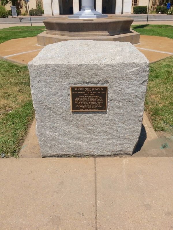
In honor of
Major Charles L. Kelly, MSC, U.S. Army
1925 - 1964
Dust-Off Pilot Extraordinary
Killed in action by small arms fire
while attempting to approach a hot LZ
near Vinh Long, Viet Nam on 1 July 1964
after . . . — — Map (db m96555) WM
"It is for us the living, rather, to
be dedicated here...
to the great task remaining
before us...
that from these honored dead we
take increased devotion to that
cause for which they gave the last
full measure of devotion, . . . — — Map (db m75613) WM
In honor of
1Lt Sharon A. Lane, ANC, U.S. Army
1943 - 1969
FAMC Staff Nurse, 1968 - 1969
Killed by enemy mortar round while
serving with honor
312th Evac Hospital, Chu Lai, Viet Nam
Only ANC Officer to die as a result . . . — — Map (db m96560) WM
1917 1918
In Memory
of the
Officers Nurses
and Enlisted Men
of the
Medical Department
United States Army
Who Lost Their Lives
During the
World War
This Tablet is Erected
by their Coworkers of
the Medical Department . . . — — Map (db m96553) WM
The Rocky Mountains proved a formidable barrier to early aviation, leaving Colorado in a familiar position: bypassed. As with the railroads fifty years earlier, transcontinental air traffic went through Wyoming; Colorado had to make do with a . . . — — Map (db m70525) HM
By Denny Haskew National Sculptor’s Guild City of Brighton Colorado May 2002 The night before an important event the tribe would gather around the pow wow circle chanting. The members of the Society of the Sacred Arrow would rush into the center of . . . — — Map (db m289392) HM
This boarding house was built in 1908 by the Reinhardt family. A pear tree grew thru the front porch leading the Brighton community to calling it the “Tree House.” Phil and Jeanette Daily purchased the house in 1967. In 2010, the house was . . . — — Map (db m289393) HM
Historic City Hall was initially built as the first permanent Adams County Courthouse. The courthouse was designed in 1904 by architect John James Huddart, who also designed the Brighton Armory. In 1906, builder A.B. McDonald completed the . . . — — Map (db m203311) HM
In honor of
1Lt John Harold Buckley (1896-1918)
Longmont, Colorado
Lost his life in World War I,
on a mission behind German lines.
Buckley Field 1942-1947
Denver Naval Air Station
1947-1959
Buckley Air National Guard Base . . . — — Map (db m75593) HM WM
Early Years of Statehood
In the early years of statehood, silver strikes at Leadville and Aspen brought settlers and money into Colorado. Rail lines, smelters, and refineries were built, and large coalfields were opened up.
The High . . . — — Map (db m119387) HM
This farmhouse is the only one still standing on the Refuge, where 200 families once lived. Rose and Gottlieb Egli raised eight children in
this house. — — Map (db m255718) HM
Rocky Mountain Arsenal National Wildlife Refuge
Located just eleven miles northeast of downtown Denver, the Refuge is the largest contiguous open space in the Denver metropolitan area. A major environmental restoration program will be . . . — — Map (db m119390) HM
This Headquarters area is dedicated in honor of all the Rocky Mountain Arsenal employees who accomplished the production, demilitarization, and environmental restoration at the Arsenal from 1942 until 2012 — — Map (db m162066) HM WM
As the focus changed to environmental cleanup, Building 111 became the headquarters of this new mission-and of a public-private partnership among the U.S. Army, Shell Oil Co. and U.S. Fish and Wildlife Service. Years of
Partnership Called . . . — — Map (db m163885) HM
Arsenal Beginnings
Building 111, also known as the “White House, "was located north of the flagpole area. The building was the U.S. Army's headquarters
from the time the Arsenal was established in 1942 until the building was . . . — — Map (db m163883) HM
In 1942, women and men of the U.S. Army built this Arsenal that helped achieve victory in WWII and the Cold War. With thanks to our partners, the U.S. Army, Shell Oil Company and their contractors, we dedicate this flagpole to the employees of . . . — — Map (db m119380) HM
Above this sign, a mile away, 230 buildings once stood. The U.S. Army constructed South Plants in 1942 to produce chemical weapons for World War II — — Map (db m156147) HM
The Fourteeners
There are 58 peaks in the Colorado Rocky Mountains that are above 14,000 feet in height. While 54 are generally acknowledged to be "14ers", most people who want to climb them want to climb all 58. They are contained in six . . . — — Map (db m119395) HM
Commerce City
Commerce City was incorporated as Commerce Town in 1952 and became Commerce City in 1970. In 2004 the Prairie Gateway, a 917-acre parcel of land located along the western edge of the Rocky Mountain Arsenal National Wildlife . . . — — Map (db m119381) HM
Dedicated Veterans Day 2003 Artist: Hai Ying Wu
Veterans and the American Flag symbolize our nation's strength and unity, and continue to be a source of pride and inspiration for millions of Americans.
This Memorial serves to honor and . . . — — Map (db m202817) WM
Ma Barker's infamous son, Lloyd "Red" Barker traded in a life of crime for a life in Westminster in the 1940s. Lloyd grew up as part of the Barker Gang, described by FBI Director J. Edgar Hoover as "the toughest gang of hoodlums the FBI has ever . . . — — Map (db m69547) HM
The value of one's life can be measured by how he or she has added value to the lives of others. In 2003 this statue was dedicated to those who gave freely of their time to serve Westminster Citizens through the fire service and community activities. — — Map (db m4648) HM
According to Outdoor Life (April, 2004), Old Mose was the most famous grizzly ever to appear in their publication. This one bear was responsible for a myriad of depredations. Known for his distinctive footprint (he was missing two toes on . . . — — Map (db m160761) HM
The only Adams State College football team to
play in a NAIA Division 1 National Championship
Coaching Staff
Head Coach - Jeff Geiser
Assistant Coaches
Lynn Schuett, Chris DeLorenzo, Deano Crumley,
Bill Stone, Dan McMinimee, John . . . — — Map (db m160787) HM
Shortly after its creation in 1921, Adams State Normal School got caught in a political crossfire and received no state funding for construction. But Alamosa residents, quick studies when it came to higher education, raised the money to keep the . . . — — Map (db m160878) HM
The first U.S. citizen known to have seen the site of present-day Alamosa, Lt. Zebulon M. Pike, was arrested nearby in 1807 for trespassing on Spanish soil. But the Spanish were trespassers themselves—the Utes occupied the land. The conflicting . . . — — Map (db m160914) HM
[Map captions, clockwise from top right, read]
• Penitente Canyon [informational]
• Great Sand Dunes National Park [informational]
• Stations of the Cross Shrine [informational]
• The Fort Garland Museum is a . . . — — Map (db m160927) HM
This monument is placed here to preserve the important history of the start of the whole San Luis Valley, by the Denver and Rio Grande Railroad's entrance to Alamosa.
The work train arrived in Alamosa in late 1877, and the first passenger train . . . — — Map (db m160877) HM
Colorado's first home railroad was begun in 1871. William J. Palmer, Civil War veteran and founder of the Denver and Rio Grande, felt that transportation was the key to success in this new, undeveloped land.
"Narrow gauge" railroad was a new . . . — — Map (db m160929) HM
Designated
Landmark
City of Alamosa
Historic Registry
————————————
Dickey-Springer
Post No. 113
American Legion
Laid by
Charles G. Dawes . . . — — Map (db m160804) HM
Emblematic of the courage, fortitude, and vision of those stalwart pioneers and valiant railroad builders who foresaw a great future in the Southwest, this monument is installed to guide the way for posterity in this mighty empire.
The SPMDTU was founded on November 26, 1900, and is the oldest Hispanic civil rights organization in the United States. It was founded in Antonito, by Celedonio Mondragón and six others to fight discrimination in the fields, in the mining . . . — — Map (db m281520) HM
First Lieutenant Thomas C. Bland — Co-Pilot Captain William T. Grimm — Navigator Captain Arthur Galvin — Fire Control Officer Captain Dixon L. Walters — Electronic Warfare Officer Staff Sergeant Damon V. Kanuha — Flight Engineer Staff Sergeant Mark . . . — — Map (db m295632) HM WM
[northwest face of memorial] To challenge social and economic injustice a civil rights movement spread across the USA after World War II. The 1960s and 1970s were prominent years in that struggle. The Chicano Movement became a . . . — — Map (db m295601) HM
[left panel] This is the site of the late “Mexican School” where Hispano-American students were forced to attend, separate from whites, despite being US citizens and being proficient in English. It is also here where Hispano . . . — — Map (db m281521) HM
William H. “Billy” Adams Adams State University's founder and namesake, William H. “Billy” Adams (1861-1954), was a strong advocate for rural education. For a period of 50 years, Billy Adams held several offices in Colorado . . . — — Map (db m294413) HM
The Utes called this valley “Tavi-we-a-gat” or Big Valley. They came here following in the footsteps of their ancestors along this Camino; their dogs pulled their belongings along the now paved byway. This fertile valley provided . . . — — Map (db m71876) HM
You have entered the land of the Río Bravo del Norte, the northernmost outpost of sixteenth century Spain. To the Spanish people, the San Luis Valley was a wild and unexplored place known only to the Native people. Amidst the beauty and towering . . . — — Map (db m71878) HM
Travel the route of these explorers and read Lt. Pike’s own words from his journal.
U.S. Army Expedition to explore the United States new southwest boundary with New Spain.
The men:
Lt. Zebulon M. Pike Dr. John H. Robinson Sgt. . . . — — Map (db m71882) HM
Isolated from the rest of Colorado, the San Luis Valley is often a forgotten place. For Native American tribes including the Utes, Apache, Navajos, and others, this Valley is a source of life - a place where humans and spirit enter and leave . . . — — Map (db m71875) HM
¡Bienvenidos! Caminantes!
Come! Take a walk with us. We know an old song, El Caminante, which tells of taking a long walk along the ancient roads. Like the first prehistoric inhabitants, you too are a ‘caminante’, or one who walks upon . . . — — Map (db m71877) HM
“We can see the Dunes and the Crestone Needles from all over our ranch. When we are lost, that’s what we navigate by.”
--local rancher
Whether traveling on foot, by horseback, Model A, or the . . . — — Map (db m71051) HM
"Totally Unique and Unexpected!"
—park visitor
Welcome to the high elevation desert that is Great Sand Dunes! Does this landscape strike you as amazing, bizarre or totally out of place. If so, you’re not . . . — — Map (db m71050) HM
The scale of the Great Sand Dunes can be difficult to judge. The dunes you see from here are only the front lines of a sea of dunes that covers many square miles.
How far do the dunes extend into the distance? The dunes are 8 miles (13km) . . . — — Map (db m104717) HM
This landscape is the result of dramatic climate changes that affected plants, animals, and humans. In ancient times, large shallow lakes existed on today's valley floor, and American Indians of the Clovis culture pursued great herds of large . . . — — Map (db m160699) HM
In an attempt to settle unknown territory, the Mexican government offered a large gift of land, la merced, for anyone brave enough to attempt to settle the San Luis Valley. Mexican land grants made it possible for even a poor man to . . . — — Map (db m160677) HM
Pioneer conservationist
and founding member
of the Moffat - Hooper - Mosca
Service League for his many years
of dedicated service to the
preservation of the natural beauty
of the San Luis Valley — — Map (db m160692) HM
You have entered the land of the Río Bravo del Norte, the northernmost outpost of sixteenth century Spain. To the Spanish people, the San Luis Valley was a wild and unexplored place known only to the Native people. Amidst the beauty and towering . . . — — Map (db m160674) HM
Travel the route of these explorers and read Lt. Pike’s own words from his journal.
U.S. Army Expedition to explore the United States new southwest boundary with New Spain.
The men:
Lt. Zebulon M. Pike Dr. John H. Robinson Sgt. . . . — — Map (db m160680) HM
29th January. Thursday. Finding the distance too great to attempt crossing immediately to the river, in a direct line, we marched obliquely to a copse of woods, which made down a considerable distance from the mountains. Distance 17 miles. Saw . . . — — Map (db m145393) HM
Different Life Zones Exist in the Mountains
Imagine climbing the mountain in front of you. You might notice it gets cooler as you ascend. As the temperature drops, moisture in the air condenses, precipitation increases, and creates different . . . — — Map (db m71056) HM
On January 27, 1807, U.S. Army Lt. Zebulon Pike and nine soldiers (affectionally called "Dam'd Set of Rascals" by Pike) crossed the Sangre de Cristo Mountains over Medano Pass to enter the territory of New Spain. On orders of his commander, Pike's . . . — — Map (db m160702) HM
You are about to step into the Great Sand Dunes Wilderness. Its mood changes with the seasons, from the spacious solitude of winter, to spring and summer fun and play. Whatever the season of your visit, this unexpected wilderness offers . . . — — Map (db m71057) HM
Mountains and passes were important in the formation
of the sand dunes.
You are looking at the Sangre de Cristo Mountains. Prevailing southwesterly winds carrying sand across the San Luis Valley were blocked by the mountains.
As the . . . — — Map (db m71055) HM
As you travel through these sandy grasslands, notice the bright white surface deposits visible along the highway to the west. The sabkha forms where sand is seasonally saturated by rising ground water. When the water evaporates away in late . . . — — Map (db m160687) HM
You are looking across a sandy grassland that is a vital part of the Great Sand Dunes geological system. The sand sheet lies between the dunefield and the sabkha. Its deepest portions may be remnants of an ancient lake system, but the surface is . . . — — Map (db m160700) HM
¡Bienvenidos! Caminantes!
Come! Take a walk with us. We know an old song, El Caminante, which tells of taking a long walk along the ancient roads. Like the first prehistoric inhabitants, you too are a ‘caminante’, or one who walks upon . . . — — Map (db m160668) HM
Ready or not, with the Treaty of Guadalupe Hidalgo in 1848, Hispano settlers (pobladores) of the San Luis Valley became Americans overnight. The pobladores of the large land grants were legally granted citizenship of the United . . . — — Map (db m160679) HM
On January 28, 1807, Lt. Zebulon Pike and his small band of tattered, hungry, foot-sore soldiers camped near here, having just crossed this snowy Sangre de Cristo Mountains. Under orders from General James Wilkinson to explore the southwestern . . . — — Map (db m71884) HM
High-Five Plains Towns
Watkins, Bennett, Strasburg, Byers, Peoria, Deer Trail, Agate, Godfrey, Cedar Point, Riverbend—most of these Colorado high plains towns were founded around the time when the Kansas Pacific Railroad arrived in . . . — — Map (db m70522) HM
This bell was purchased in 1926 by the Fireman’s auxiliary and the town for $140. The 40 inch bell weighs 1100 pounds. It was used to summon the volunteer firemen until 1950 when a siren was installed. It was on the water tower until 2012 and . . . — — Map (db m257631) HM
Alfred Packer was born on January 21, 1842, in Allegheny County, Pennsylvania. He served in the Union Army during the Civil War and was discharged in June 1863 for epilepsy. Packer traveled to the Rockies and worked for the mines for 9 years. In . . . — — Map (db m182105) HM
In the early part of the 20th century, Denver served as both the state capital and the Arapahoe County seat. An amendment to the Colorado Constitution creating a new City and County of Denver was passed by Colorado voters in 1902. This left . . . — — Map (db m130140) HM
A duplicate casting of the bronze plaque on the front of this monument was dedicated in Bega, New South Wales, Australia by the Littleton Delegation on April 22, 1986 through the generous contributions of
P.W. Anderson • Arapahoe Sertoma Club • . . . — — Map (db m289469) HM
The first railroad to reach present-day Littleton was the Denver & Rio Grande on October 28, 1871. The line was being built by William Jackson Palmer to connect Denver to the resort community he had just founded, Colorado Springs. Richard Little's . . . — — Map (db m177545) HM
These gentlemen have fostered international understanding since 1954. Through their inspiration, regular social and cultural exchanges maintain a lasting friendship between Bega, New South Wales, Australia and Littleton, Colorado, USA. Hundreds of . . . — — Map (db m289467) HM
One of the earliest buildings in Littleton was the J. D. Hill General Store. Julius D. Hill, known as J.D., was born in Massachusetts in 1843 and served in the Union Army during the Civil War. Hill came to Littleton in 1870 and was employed by the . . . — — Map (db m177629) HM
This memorial is dedicated to the millions of men and women of the United States who served their country during World War II. The cause was freedom. Their actions and sacrifices will always be remembered. November 11, 2000
American Theater of War . . . — — Map (db m46114) HM
The Main Street Historic District preserves the unique mix of historic buildings in Downtown Littleton that remind us of Littleton’s evolution from an agricultural settlement to a town and eventually to the city we enjoy today. In 2004, downtown . . . — — Map (db m289593) HM
The evolution of mass transit in Denver has resembled a cross-town commute — a long stop-and-go journey. It began in 1871, when the Denver Horse Railroad Company started running horse-drawn coaches over tracks laid in the middle of downtown’s dirt . . . — — Map (db m177560) HM
At various points in its history, the Rough and Ready Mill churned out flour, lumber, and livestock feed. But the end product was always the same: growth for Littleton. Built in 1867 by pioneers Richard Little, Joseph Bowles, and John Lilley, among . . . — — Map (db m177558) HM
Colorado CannibalAside from his conviction for cannibalism, Alfred Packer was a fairly commonplace frontier character: He came West to find his fortune but found trouble instead. Packer, like most, brought his woes upon himself. A . . . — — Map (db m177559) HM
In 1951 the US Information Agency made a documentary film of a rural newspaper in smalltown America to promote freedom of the press. This 20-minute black-and-white film, "Small Town Editor," featured the Littleton Independent and it's editor G. . . . — — Map (db m289466) HM
Historic Town Hall stands in the middle of Littleton’s four-block Main Street and provides the focal point of its downtown area. A bond issue was approved in April 1919 to fund the project at 2450 West Main Street. It replaced the town hall . . . — — Map (db m289299) HM
The Weston Lodge Number 22 of the Ancient Free and Accepted Masons was organized in Littleton in 1872. It was named for Allyn Weston, a Harvard graduate who had published a Masonic magazine in Detroit before moving to Colorado in 1860 to practice . . . — — Map (db m177636) HM
Erected by Union Pacific Railroad in commemoration of Comanche Crossing Centennial
Marking point where rails were joined to form the first continuous land link by railroad across the U.S. — — Map (db m107232) HM
A continuous chain of rails, from the Atlantic to the Pacific had long been a vision of pioneer railroaders and frontier tamers. It became a reality at 3:00 pm on August 15, 1870 at a point 928 feet east of railroad milepost 602, near Comanche . . . — — Map (db m87596) HM
A continuous chain of rails from Atlantic to Pacific -- long a vision of pioneer railroaders and frontier-tamers -- became reality at 3:00 P.M. on August 15, 1870. At a point 3,812 ft. east of the depot in what now is Strasburg, Colorado. Near . . . — — Map (db m17596) HM
From ancient times to the present, the forest before you has provided many of the things people need to survive and thrive. Game animals and fish, along with berries, roots, and other plant foods, provide sustenance. Clear mountain rivers, creeks, . . . — — Map (db m295502) HM
Imagine that a group from a foreign country claimed your home as their own. Their culture is very different and they don't speak your language. You learn that you can defend your ownership, but only in the other's language and by rules you don't . . . — — Map (db m295554) HM
What is a National Heritage Area? A national heritage area is a region recognized by the United States Congress for its unique qualities and resources — natural, scenic, cultural, historic, and recreational. Rich in history, religion, . . . — — Map (db m295490) HM
Long before anyone claimed this land as their own, it was used for hunting, gathering, and spiritual pursuits by various groups of indigenous people. Navajos, Utes, Apaches, Pueblos, and other tribal groups migrated to and through the area. . . . — — Map (db m295553) HM
A major encounter between the U.S. Army and a large group of Utes and Jicarilla Apaches occurred here in July 1848. Old Bill Williams, the famous scout and guide, was badly wounded while fighting the Utes, who had once adopted him as a tribesman. — — Map (db m280188) HM
[left to right]
This Payan corrugated jar was found here at the Pit House site and was used for storage of corn, beans and wild seeds.
Mancos [and] Payan Corrugated
This style of pottery was often used for cooking. The corrugations helped . . . — — Map (db m160560) HM
The Northern San Juan Surface Pit House that was constructed here is composed of one large room used as a dwelling area and 3 rectangular room blocks used for storage.
[Left illustration caption reads]
Typical cross-section of surface pit . . . — — Map (db m160562) HM
2521 entries matched your criteria. The first 100 are listed above. Next 100 ⊳