Commemorates the Historic Discovery by William Parker Foulke in Haddonfield, New Jersey, 1858 Historic Fossil The 1858 find was the most complete dinosaur skeleton unearthed anywhere in the world up until that time. It was the first that . . . — — Map (db m114425) HM
William Cutter House
Built at the end of the 18th century, this farm house at 115 Amboy Avenue was the home of William Cutter (1778-1838), father of successful clay magnate, Hampton Cutter (1811-82). William Cutter’s great-grandfather, Richard . . . — — Map (db m125780) HM
In 1881 David Baldwin discovered small fossilized bones
on what is now Ghost Ranch. He mailed the bones to
paleontologist Edward Drinker Cope in Philadelphia. Cope had been through the area in the late 1870s and had urged Baldwin to explore and . . . — — Map (db m75212) HM
The Cohoes Mastodont was discovered during the excavation for Harmony Mill #3 in 1866. The mill is sometimes referred to as the "Mastodon Mill" for this reason. When all the bones were recovered, they were kept at the Harmony Mills Office on . . . — — Map (db m41622) HM
In Colonial Times An
Indian Trail Ascended
The Helderberg Cliffs
At This Point From The
Lowlands To The East
State Ed Dept 1932
Friends of Thacher Park 2014
— — Map (db m77125) HM
At this site, on September 14, 1914, this park was formally dedicated in memory of John Boyd Thacher. His widow, Emma Treadwell Thacher, donated the 350 acres to the state of New York to be preserved as a public park. The Thachers, whose summer home . . . — — Map (db m77243) HM
The historic Arsenal is one of two buildings in Central Park predating the park. It was designed by esteemed architect Martin T. Thompson (1786-1877) and built between 1847 and 1851 by the State of New York as a storage repository for the storage . . . — — Map (db m137070) HM
Grimes Glen Home of the oldest fossil tree found and mounted by D. Dana Luther, Naples, N.Y. Now in State Education building, Albany, N.Y. — — Map (db m125503) HM
1st U.S. Science expedition remains exhibited London & Amer. philosoph. Society, Philadelphia. Dig Painted by Charles W. Peale, 1810. — — Map (db m49822) HM
This exhibit is the only visible proof of the other, ancient world that lies hidden beneath the landscape.
380 million years ago, Gilboa was located on the shore of the inland Catskill Sea. This was a tropical world, situated about twenty . . . — — Map (db m153153) HM
The Bird Homestead provides a rare glimpse into 19th century life on a small family farmstead in a thriving maritime village. This outstanding Greek Revival house, circa 1835, has survived intact, along with several farm buildings. Owned by one . . . — — Map (db m193149) HM
During the Triassic Period, 220 million years ago, continental plates began to move apart and rip holes in the Earth's crust. The result was a large lake in the fissure that stretched from what today is modern Morrisville to Chapel Hill. Over time, . . . — — Map (db m232916) HM
Dominion Land Company Mound
An Early Woodlands Period Structure
In the early 1800s, Prosper Wetmore wrote about his childhood
memories of native mounds in the ravine area of Northwestern
Clinton Township. At that time, he recalled two . . . — — Map (db m108853) HM
Around 1867, along the shale cliffs of the lakeshore of Sheffield Lake, Jay Terrell found fossils of a "terrible fish" later named in his honor as Dinichthys Terrelli. This animal, now known as Dunkleosteus terrelli, was a massive arthrodire (an . . . — — Map (db m67502) HM
Centennial Terrace and Quarry. In 1931, the France Stone Company ceased operations. Robert Burge leased 19 acres of the site for recreational swimming and opened Centennial Quarry in 1934. Five years later, Burge and associates opened . . . — — Map (db m94772) HM
Wisconsin age glacial deposits of clay silt soils cover dolomite limestone bedrock in this area.
Geologists tell us that this limestone bedrock was created 400 million years ago during the Silurian
Geologic age: During this age the area we now . . . — — Map (db m166629) HM
About 14,000 years ago, the last glacier receded from this area. Mastodons, mammoths, and giant beavers, roamed the region. The ancestors of American Indians arrived in Ohio during this time. These Paleoindians were hunters and gatherers. By 800 BC, . . . — — Map (db m136902) HM
The Cranberry Prairie, southwest of this marker, is a part of Ohio's natural history. The place was named for the cranberries that grew in a swamp here prior to drainage of the area. The Cranberry Prairie was created by centuries of peat . . . — — Map (db m239064) HM
Miamisburg Mound, the largest conical earthwork in Ohio, originally was sixty-eight feet high with a diameter of three hundred feet. One excavating attempt in 1869 reduced the height to its present sixty-five feet. The mound was then partially . . . — — Map (db m166080) HM
This is the highest and largest of the many conical burial mounds in Ohio. Erected in prehistoric times by the so-called Mound Builders. It stands as an imposing memorial to those first Ohioans.
The mound is 70 feet in height; 877 feet in . . . — — Map (db m164256) HM
Indian Trail Caverns, first opened in 1927, is one of many caves that occur on the dolomite ridge traversed by State Route 568 in Wyandot and Hancock counties. Sheriden Cave, a karst sinkhole associated with the caverns, was discovered in 1989. It . . . — — Map (db m93656) HM
In 1899 the Oklahoma Territorial Legislature created a natural history museum to preserve Oklahoma’s rich heritage. More than 100 years later, the Sam Noble Oklahoma Museum of Natural History was built to protect the museum’s priceless . . . — — Map (db m143652) HM
Small discoveries reveal the past. Three spear points found near the ribs of an imperial mammoth in Oklahoma suggest that people lived here at the end of the last Ice Age.
Archaeologists believe that these nomadic people traveled from one . . . — — Map (db m194467) HM
The gypsum and shale buttes before you are relics of millions of years of geologic history. The white gypsum and red-brown shale were deposited in shallow seas that covered all of western Oklahoma and the Texas Panhandle during the Permian Period, . . . — — Map (db m183142) HM
Did you know that dinosaurs once lived in Oklahoma? A long time ago there were different plants and animals all over the state. One of the animals was the Saurophaganax Maximus, which roughly means "ruler of the lizard eaters." It is now the . . . — — Map (db m174619) HM
“What is it that urges a man to risk his life in these precipitous fossil beds? I can answer only for myself, but with me there were two motives, the desire to add to human knowledge, which has been a great motive all my life, and the . . . — — Map (db m114115) HM
Marker 1 Shows an overview map of the National Monument with other points of interest.
Marker 2 Like Icing on a Cake. "Between 16.6 million and 15 million years ago, eastern Oregon sat above the nascent Yellowstone hot spot's . . . — — Map (db m108677) HM
The history of the west is linked with the idea of finding a new home in a challenging land. We call it homesteading.
During the Pleistocene epoch, homesteaders in the Fort Rock Basin were mammoths, camels, horses, flamingos, and . . . — — Map (db m113604) HM
A rock or boulder carried from its original source by an act of nature is called an erratic. This granite erratic was deposited near Harrisburg, Oregon about 12,000 years ago. Geologists say it was carried there by an iceberg during the . . . — — Map (db m99224) HM
This piece of petrified wood was found near the mouth of Moffett Creek when the Columbia River Highway was widened in 1950. The wood turned to stone as the fiber of the original tree, which lived during the early Miocene age (26 million years ago), . . . — — Map (db m99223) HM
Northern Paiute Indians and a few mountain men were the only residents of the John Day Country before 1860. Cavalry troops passed through the John Day River drainage looking for the best route from the Columbia River to Fort Boise. One company, . . . — — Map (db m71675) HM
(Three panel make up this marker.)
Climate changed doesn't happen overnight, nor is it a smooth process. The Painted Hills contain a record of both long term climate change as well as the fluctuations that occurred along the way. As . . . — — Map (db m158073) HM
Through this dry land in 1865 rode a pioneer minister and amateur scientist named Thomas Condon. It was the first of his many visits. Imagine his reaction when he discovered the imprints of countless fossilized leaves near these Painted Hills, . . . — — Map (db m71698) HM
Diplodocus carnegii lived 150 million years ago, when dinosaurs dominated the land. Carnegie Museum paleontologists first discovered the remains in Wyoming on July 4, 1899. A new species, the dinosaur was named after Andrew Carnegie, the museum's . . . — — Map (db m189203) HM
Three rivers draining the western slopes of the Allegheny Mountains meet at the Pittsburgh Point. The Monongahela flows from the mountains of West Virginia and the Allegheny comes down from northern Pennsylvania. Together the two rivers join to form . . . — — Map (db m152155) HM
This park is a legacy of industrialist Henry Clay Frick and his daughter Helen. From modest beginnings — he was born to a Mennonite farmer and whiskey distiller in 1849 — Henry Frick became one of America's most influential and . . . — — Map (db m156155) HM
Conneaut Lake is a kettle lake formed by the receding glacier during the last Ice Age, about 12,000 years ago. As the glacier melted, a large block of ice partially embedded in accumulated sediment formed the depression, which became the lake. . . . — — Map (db m74623) HM
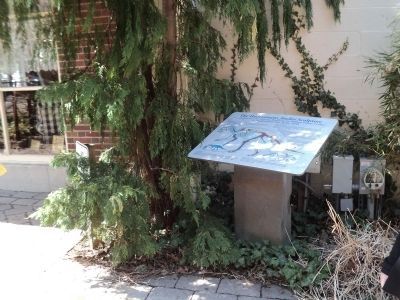
In ancient seabottom rocks exposed in this stream, the Holotype Specimen of a rare fossil sponge was found by Paleontologist Kenneth E. Caster. In 1939 in recognition of the support which brought the sciences of geology and paleontology to such . . . — — Map (db m64970) HM
The Scripture Rocks are a type of rock called sandstone. Sandstone is composed of rounded grains of river sand that became cemented together to make a hard durable stone. This sand was deposited 320 million years ago when western Pennsylvania was a . . . — — Map (db m195312) HM
In 1968, John W. Leap and workers at a nearby peat bog discovered the bones of a large mastodon that died about 12,000 years ago. These large, tusked mammals (Mammut americanum) lived throughout North America from 5.2 million to 10,000 years ago. . . . — — Map (db m182691) HM
Internationally renowned vertebrate paleontologist and zoologist, Cope lived and worked here in his later years. He wrote many scientific papers describing hundreds of fossils & living animals and is famous for his long-standing feud with O.C. Marsh . . . — — Map (db m82812) HM
When Philadelphia's natural history museum opened in 1828, the mysteries of nature, from fossils to beetles, were revealed to the public, organized and labeled in Latin and Greek. The collections expanded so rapidly, the Academy outgrew its . . . — — Map (db m230957) HM
In 1801, Charles Willson Peale excavated a mastodon skeleton in upstate New York. Afterwards, he made this painting that shows how he did it. Eventually Peale displayed the skeleton in his Philadelphia Museum. In this garden, you see an artist’s . . . — — Map (db m106384) HM
Gigantic Mammoths, ancestors of the elephants of today, once roamed freely across the High Plains of North America. A repository of their remains, along with other prehistoric animals, lay undisturbed until their discovery over 26,000 years later, . . . — — Map (db m184458) HM
This trail features seven types of animals that once lived in the area now known as Badlands National Park. Each of these lineages met a different fate as the climate changed. Some moved, some adapted to the changes, and some are now extinct. . . . — — Map (db m114175) HM
In the days when oreodonts walked this land, the rock layer before you was not rock but the muddy bottom of a streambed. Over time, those sediments hardened into the thick horizontal band of grayish red stone you see here.
Thin ribbons of . . . — — Map (db m137007) HM
Rock layers in Badlands National Park contain fossils that show a dramatic cooling and drying of global climate over millions of years. The oldest rock layers contain marine fossils, roughly 70 million years old, from when this area was . . . — — Map (db m113124) HM
Oredonts were common throughout the Badlands, but became extinct. Their fossil remains provide evidence of their lives and habitat. Fossils can develop over time when animal or plant remains are quickly covered in sediment and replaced by . . . — — Map (db m113122) HM
Dogs have changed and adapted over millions of years. Members of the dog lineage gradually evolved in to the wolf by growing longer, stronger legs and a shorter tail. This increased size led to increased strength and power to hunt food and . . . — — Map (db m113177) HM
Prehistoric alligators lived in swampy conditions, as they do today.
Physically, alligators have changed mostly in size over the last several million years. Modern alligators are larger, growing up to 14 feet long. Ancient alligators grew . . . — — Map (db m113092) HM
The discovery of this specimen led to the golden age of paleontology in North America. After acquiring this fossil from fur traders, Dr. Hiram Prout wrote about it in 1846. His description captured the attention of scientists. At that time, . . . — — Map (db m113176) HM
Ammonite fossils found in the park are evidence that this area was under water 75 million years ago. Some ammonites could grow to more that three feet across and served as a food source for giant mosasaurs and other predators.
The Western . . . — — Map (db m113115) HM
Your fossil discovery begins a scientific process. Every detail is important, even the area around the find. A fossil and its surroundings reveal what types of plants and animals existed and how they lived, died, and changed.
The . . . — — Map (db m113123) HM
Fossils can reveal how animals lived and died, and what their environment was like. Evidence from one of the park's nimravid fossils offers crime-scene clues. The size and location of the holes in the forehead of this fossil match the knife-like . . . — — Map (db m113121) HM
This scrap iron sculpture was created to commemorate Sue, the largest, most complete and best preserved T-Rex found to date! Ninety percent of her original bones were found. Only a foot, an arm and a few ribs and vertebrae are missing. Sue was . . . — — Map (db m153969) HM
(side 1)
The changing of global sea levels over millions of years was a major factor in determining the ancient geography of Minnehaha County. Through much of geologic time, salty warm-water seas covered the interior of the United . . . — — Map (db m124175) HM
During the last major Ice Age — 12,000 to 25,000 years ago — Middle Tennessee was home to many animals that are extinct today, including the saber-tooth tiger, the mammoth, and the mastodon. In 1885, the tusk of a mastodon, an Ice Age ancestor of . . . — — Map (db m173819) HM
These two large rocks are "petrified logs" found in the Savannah area. Paleontologists refer to them as being "permineralized", meaning that after the trees were buried, groundwater added ("per-") minerals in them that fossilized them.
Wood . . . — — Map (db m184129) HM
The historical significance of the Bledsoe's Lick-Castalian Springs area extends far beyond Isaac Bledsoe's choice of this site for his settlement. It includes:
• Evidence of animal life in the ice age 30,000 years ago.
• Artifacts left by . . . — — Map (db m180177) HM
The sedimentary rocks along the trail between Johnson City and Elizabethton consist of, from oldest to youngest, the Honaker dolomite (a modified limestone), Nolichucky Shale, and Knox Group limestones. They range in age from 542-488 million years . . . — — Map (db m184068) HM
Size: 69 feet long
Weight: 66,000 pounds
Diet: Herbivore
Habitat: Montana, New Mexico, Texas and Utah
Period: 70-65 million years ago (Cretaceous) — — Map (db m189402) HM
Size: 20 feet long
Weight: 880 pounds
Diet: Carnivore
Habitat: North America and Asia
Period: 154 to 144 million years ago (Jurassic) — — Map (db m189437) HM
Size: 6 feet tall
Weight: 385 pounds
Diet: Camivore
Habitat: Western-central Europe and North America
Period: 55-45 million years ago (Ice Age) — — Map (db m189440) HM
Size: 46 feet long
Weight: 17,000 pounds
Diet: Carnivora
Habitat: Argentina, South America
Period: 95 million years ago (Cretaceous) — — Map (db m189399) HM
Size: 40 feet long
Weight: 44,000 pounds
Diet: Herbivore
Habitat: China, India, Kazakhstan and Pakistan
Period: 33-23 million years ago (Ice Age) — — Map (db m189443) HM
Size: 8 to 10 feet tall
Weight: 8,000 to 12,000 pounds
Diet: Herbivore
Habitat: North and Central America
Period: 33.9 Million years to 11,000 years ago — — Map (db m189436) HM
Size: 79 in - 98 in
Weight: 660 pounds
Diet: Carnivore
Habitat: Every continent, except Australia and Antarctica
Period: 1,600,000 to 11,000 years ago (Ice Age) — — Map (db m189434) HM
Size: Up to 30 feet long
Weight: 4,400 pounds
Diet: Herbivore
Habitat: Colorado, Oklahoma and Utah
Period: 154 to 144 million years ago (Jurassic) — — Map (db m189435) HM
Mammoth Lake, formerly a cavernous sand pit, has had a vital influence on the development of Clute and the surrounding area. In prehistoric times, nomadic Native American tribes lived in this region, hunting abundant game that thrived near the . . . — — Map (db m171534) HM
Tiny horses and hippopotamus-like animals once roamed a more humid Big Bend. For a glimpse into the parks tropical past, take a short trail to the fossil bone display and the overlook beyond. — — Map (db m95632) HM
Stone tool fragments were discovered in 1965 and 1972 on the shores of Lake Theo, named for former landowner Theodore Geisler. Archeological testing in 1974 revealed a campsite and bison butchering and processing area dating back to the age of . . . — — Map (db m155170) HM
In this vicinity is a prehistoric archeological site discovered in 1969 near the Clear Fork of the Brazos River. Archeologists have conducted extensive scientific excavations and attribute most of the cultural materials to the Paleo-Indian Period. . . . — — Map (db m81124) HM
The first of this distinctive type of early man dart point was found by 15-year-old Val Keene Whitacre in 1941, in a caliche quarry on Running Water Draw. In 1944, quarry workers uncovered a fossil bone deposit, which was noted by scientists . . . — — Map (db m155149) HM
Probably formed during the Pleistocene epoch by the
underground passage of the Cibolo River, Cascade Cavern presents an interesting mix of geological, archeological,and historical features. It exhibits a combination of the joint and the dip and . . . — — Map (db m46924) HM
Cited as one of most prolific fossil fields of lower Pliocene age at time of discovery, these beds are about 13,000,000 years old. Geologists of Rio Bravo Oil Company found them in 1928 on C.C. Coffee Ranch, and their reports brought specialists . . . — — Map (db m55797) HM
Known today as Swan Lake, this is the site of an archeological excavation that yielded one of the largest assortments of fossils found in a single locality in Texas. They were discovered in 1939 when highway engineers were digging for caliche to use . . . — — Map (db m182766) HM
Fossilized dinosaur tracks in the Paluxy riverbed tell an ancient story of two dinosaurs, the fierce predator Acrocanthosaurus, and Sauroposeidon - its prey.
Acrocanthosaurus - Equipped to Kill!
With teeth like . . . — — Map (db m236479) HM
The Taylor Site
Dinosaur tracks upstream from this panel at the Taylor Site are fossilized tracks with a denser in-fill material that dates to over 100 million years ago. These ancient dinosaur tracks have eroded in several different ways: . . . — — Map (db m186849) HM
The Ballroom Site
In 2009, scientists mapped hundreds of dinosaur tracks along this stretch of the Paluxy River.
Hundreds of dinosaur tracks lie underwater upriver from here. Unfortunately most are either submerged, or are not . . . — — Map (db m186850) HM
Formerly known as Brontosaurus, "thunder lizard," Apatosaurus was among the largest of land animals that ever lived. One specimen measured 75 feet long and probably weighed 33 tons. Its brain was the size of a human fist. It lived in the Late . . . — — Map (db m186801) HM
The Blue Hole Site
The Blue Hole is located on a rocky ledge down to your right.
Millions of years ago, a small pack of fierce predatory Acrocanthosaurus dinosaurs left tracks in soft mud near here most likely while hunting . . . — — Map (db m186851) HM
Formed 100,000,000 years ago, tracks of 3 kinds of dinosaurs are preserved in the limestone below Paluxy River. Types include Acrocanthosaurus (a meat-eater), Camptosaurus (plant-eater who left 3-toed bird-like tracks), and Pleurocoelus (a . . . — — Map (db m137798) HM
The animals portrayed by these models are two of the most familiar and well known of all dinosaurs. However, these two animais did not live at the same time. The brontosaur died out over 40 million years before the tyrannosaur appeared. Nor were . . . — — Map (db m186802) HM
Fossils are remnants of ancient plants and animals preserved in stone. They provide the evidence scientists use to describe the past history of life on earth.
Fossils come in two types: some are petrified remains of an organism, like bones or . . . — — Map (db m236448) HM
These and other models were built by artist Louis Paul Jonas (1894-1971) under commission by Sinclair Oil Company for its exhibit at the New York City World's Fair of 1964 and 1965.
Jonas began with hundreds of sketches and models, resulting . . . — — Map (db m186794) HM
Which dinosaurs left their tracks here at Dinosaur Valley State Park?
Visitors often think that the dinosaur tracks in the park were made by Tyrannosaurus rex and Apatosaurus, the models in front of you.
Although famous and . . . — — Map (db m186809) HM
In 1938, Roland (R.T.) Bird traveled all over the United States in search of fossils for the American Museum of Natural History in New York.
The dinosaur tracks that he found here sent shockwaves through the scientific world. There were . . . — — Map (db m236483) HM
One day, about 105 million years ago, a small herd of four-footed, plant-eating dinosaurs fled southward along an ancient shoreline. Their mortal enemy, a two-footed, meat-eating dinosaur, pursued close on their heels. The evidence of their passage . . . — — Map (db m236431) HM
T. rex was a spectacularly fearsome beast, the largest carnivore ever to walk the earth. One specimen measured 50 feet long and may have weighed 8 tons. Its monstrous 3-foot jaws bore 60 serrated teeth up to 7 inches long, perfect for slicing . . . — — Map (db m186791) HM
These life-size dinosaur models came to Dinosaur Valley State Park after thrilling audiences at the 1964-65 World's Fair in New York.
In 1969, when fair sponsor Sinclair Oil merged with Atlantic Richfield and dropped its Dino logo, Glen . . . — — Map (db m186785) HM
In these shifting seas of sand, rich in stone evidences of primitive men, today's visitors find flint points, sandstone metates and manos of peoples who were here as early as 10,000 years ago and late as the 1870s. Bones of great mammoths and . . . — — Map (db m73307) HM
On Dec. 29, 1982, Texas Highway Department archeologists uncovered the skeleton of a pre-historic human female at the Wilson-Leonard Brushy Creek Site (approx. 6 mi. SE). Because of the proximity of the grave site to the town of Leander, the . . . — — Map (db m114979) HM