On Indian Mounds Park west of South 5th Street, on the left when traveling north.
Warmer climate ends the Ice Age and encourages the growth of different plants. Deciduous trees replace open spruce woodlands. Many Ice Age animals become extinct, and woodland animals such as white-tailed deer are more common. About 7,000 years ago . . . — — Map (db m150277) HM
On South 12th Street north of State Street, on the right when traveling north.
This Greek Revival style mansion was built in 1835 by John Wood, Quincy's first settler, who erected a log cabin in 1822 at Front and Delaware Streets. The Society was formed in 1896, acquired the mansion in 1907, and maintains museum displays, loan . . . — — Map (db m187255) HM
On Hampshire Street at North 5th Street, on the right when traveling east on Hampshire Street.
With a population of nearly 13,000 in 1858, Quincy was the Adams County seat and the third largest city in Illinois. Quincy boasted a strong, growing economy based on its transportation, milling, pork packing, and light industry. In 1853 . . . — — Map (db m58755) HM
On Indian Mounds Park, 0.1 miles west of South 5th Street, on the right when traveling west.
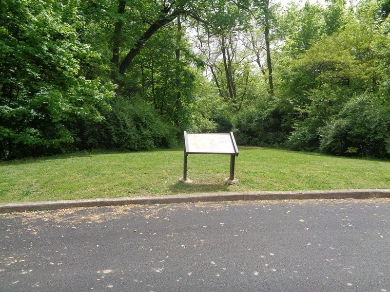
Farming changes almost every part of life and leads to the development of Mississippian culture. Mississippian farmers grow corn, squash, beans, and some native plants. They also hunt, gather, and fish, producing enough food to feed towns and . . . — — Map (db m150286) HM
On Indian Mounds Park, 0.1 miles west of South 5th Street, on the left when traveling north.
People arrive in North America from Asia more than 14,000 years ago at the end of the last Ice Age. The formation of glaciers lowers sea level and exposes a wide land bridge connecting Asia and North America where the Bering Sea is today.
In . . . — — Map (db m150287) HM
On Indian Mounds Park, 0.1 miles west of South 5th Street, on the left when traveling east.
In 1804, the Sac and Fox cede their land between the Illinois and Mississippi Rivers to the United States. Nine years later, General Howard and 1,400 mounted rangers burn a Sac village near the future site of Quincy. Legend has it that the . . . — — Map (db m150073) HM
On Maine Street at 16th Street, on the left when traveling east on Maine Street.
Timbered hills, tall
prairie grasses, ravines, creeks,
and springs were prominent features of Quincy in Lincoln's
time. Originally called "Bluffs," the town grew along the Mississippi's east bank and on the heights . . . — — Map (db m156922) HM
On South 9th Street at State Street, on the right when traveling south on South 9th Street.
Began in 1829 with Michael Mast, from Forchheim, Baden. In the early 1830s many immigrants from that area settled here, followed closely by the Hessians. In the 1840s and '50s our ancestors were pouring in mainly from Westphalia and Hanover. Soon . . . — — Map (db m181391) HM
On Maine Street east of North 4th Street (U.S. 24), on the right when traveling west.
Mormons in Missouri were forced to flee their homes or face death because of an "extermination order" issued in 1838 by Governor Lillburn Boggs. Many of them crossed into Illinois at Quincy and were made welcome by the people here. In April 1839 . . . — — Map (db m149828) HM
On U.S. 24 at State Route 96, on the right when traveling west on U.S. 24.
In 1673 the areas of the Mississippi and Illinois Rivers were explored by Frenchmen Louis Joliet and Father Jacques Marquette. Their voyages resulted in French claims on the area until 1763 when, by the Treaty of Paris, France ceded the land to . . . — — Map (db m150015) HM
On Indian Mounds Park west of South 5th Street, on the right when traveling west.
Woodland people invent pottery for food storage and cooking and the bow and arrow for hunting and protection. They live in small villages, and they require raw materials and finished objects through long-distance trade.
They bury their dead . . . — — Map (db m150278) HM
On Washington Avenue (U.S. 60/62) at Fort Defiance Road, on the right when traveling north on Washington Avenue.
Pierre Francois Xavier de Charlevoix, a French Jesuit, reported as early as 1721 that the land at the confluence of the Mississippi and Ohio Rivers would be a strategic location for settlement and fortification. Nearly a century later, in 1818, the . . . — — Map (db m144870) HM
On Bunch Road west of Illinois Route 3, on the right when traveling south.
In 1673 Louis Jolliet and Father Jacques Marquette explored the Illinois country for France. By the 1763 Treaty ending the French and Indian War, this area passed to England. During the American Revolution, George Rogers Clark's men captured it for . . . — — Map (db m161171) HM
On Old U.S. 51 (Illinois Route 37) 1.1 miles south of Redman Road.
Pierre Francois Xavier de Charlevoix, a French Jesuit, reported as early as 1721 that the land at the confluence of the Mississippi and Ohio Rivers would be a strategic location for settlement and fortification. Nearly a century later, in 1818, . . . — — Map (db m161727) HM
On 3rd Street (Illinois Route 127) at Main Street, on the right when traveling north on 3rd Street.
Illinois Confederacy Indians roamed this prairie land, rich in game, which became Illinois County of Virginia. Ceded in 1784 to the United States it was successively included in the Northwest, Indiana; and in 1809, Illinois Territory. Formed in . . . — — Map (db m34169) HM
On College Avenue, on the right when traveling west. Reported missing.
In 1912, at age 24, John Posch came to the United States with a dime in his pocket and a bag of tools. In Austria, he had apprenticed for four years as a shoemaker and passed his test to work the trade. In Greenville, he started up his business in a . . . — — Map (db m144104) HM
On West Main Street just west of North 3rd Street (Illinois Route 127), on the right when traveling west. Reported missing.
Constructed as a two story house, this is thought to be the oldest building still standing in Greenville. It as built by Kendall Morse, younger brother of Stephen Morse, who co-founded Almira College. The brothers were some of the most prosperous . . . — — Map (db m144598) HM
Near College Avenue at 3rd Street (Illinois Route 127), on the left when traveling west.
In memory of the
who are buried in
Bond County
Amos Balch • Ansel Birge
Welshier Buchanan • William Burgess
Allen Comer • John Etzler
Daniel Ferguson • John Floyd
Boling Grigg • Bonham Harlan
T. S. Hubbard • Joseph Hunter . . . — — Map (db m34127) HM
On West Main Street (Illinois Route 140) just east of North Maple Street (Illinois Route 140), on the right when traveling east.
In the 1820s, not far from where you stand, passengers could board a stagecoach traveling west to Alton, Ill., or east to the Illinois Capitol at Vandalia.
According to local lore, if passengers at the town tavern were waiting for a coach, the . . . — — Map (db m144132) HM
On State Street at Park Street, on the right when traveling east on State Street.
The village square may be quiet today, but from the mid-1800s through the early 1900s, the ring of hammers bending iron and shaping steel echoed down these streets.
Northwest of where you stand, blacksmiths shaped horseshoes, linked chains, . . . — — Map (db m144110) HM
On Highway 24 (U.S. 24) west of County Road 1250 E (County Route 1250), on the left when traveling west.
In 1824 Cornelius Vandeventer a native of Ohio, became the first permanent settler in this area. Additional pioneers came over the next few years from Kentucky, Tennessee, Virginia, and North Carolina. In 1829 Alexander Curry purchased a claim on . . . — — Map (db m149875) HM
On County Road 1950E, 0.2 miles south of County Road 1900N, on the right when traveling north.
In memory of Enos and Elizabeth Mercer Matson
who came here in 1836
Peter and Jane Dawson Matson
who came here in 1845
these two brothers and their families
came from St. Clairsville, Belmont County, Ohio — — Map (db m195957) HM
On East Peru Street (U.S. 6), on the right when traveling west.
This two-story frame structure was the home of abolitionist Owen Lovejoy, who was born in Maine in 1811. Lovejoy moved into the house in 1838, when he became a Congregationalist minister. He was leader in the formation of the Republican Party in . . . — — Map (db m44351) HM
On Princeton Street (U.S. 6) near East Street, on the right when traveling west.
In memory of Bureau County Pioneers. Sunk the first third Vein Coal mine in Hall Township in 1879. Sold in 1888 to C.W. & V. Coal Co. Mine closed in 1913. The town of Seatonville located on land owned by Seaton Brothers was named for them. This . . . — — Map (db m44350) HM
On West Dakota Street (U.S. 6) just east of North Strong Avenue, on the right when traveling east.
Pioneer resident of Spring Valley. Achieved national prominence in the settlement of the Pennsylvania Anthracite Miners Strike in 1902 with the co-operation of President Theodore Roosevelt.
President of United Mine Workers, 1889-1908. Author . . . — — Map (db m164894) HM
First permanent white settlers in Bureau County
May 4, 1828
First farmer, having plowed first furrow
June 10, 1828
Parents of first while child born within county
Jan. 15, 1830
First postmaster of Bureau County
1831
The . . . — — Map (db m44826) HM
On East Main Street (U.S. 52) at Randolph Street, on the right when traveling north on East Main Street.
On this ground stood the Indian wigwam occupied by Aaron Pierce and his wife, Harriet Bellows Pierce, and their four children, November 4, 1828, first white settlers of Savanna.
Erected in honor of his mother, Sila Pierce Bowen, by Frank Pierce . . . — — Map (db m42660) HM
Abraham Lincoln first saw Beardstown in the Spring of 1831 as he, two friends, and Denton Offutt steered Offutt's flatboat laden with merchandise on their way to New Orleans. He returned in 1832, first in March to help get the steamer . . . — — Map (db m57693) HM
On East Oak Street west of Heather Drive, on the left when traveling west.
Lincoln’s Mahomet
Upper Section
The village of Middletown-Mahomet was platted by Daniel Porter in 1832 on the west bank of the Sangamon River near its headwaters. The main street of the village was actually a new road, made necessary by . . . — — Map (db m24374) HM
On South Main Street north of West Market Street, on the left when traveling north.
This memorial is in honor of the pioneer farm families who settled in Christian County and have passed their farms down through the generations to cultivate and to care for this rich Christian County, farm land for the future.
When the . . . — — Map (db m237374) HM
On East Main Street west of 2nd Street, on the right when traveling east.
It's a story often told on the National Road. Two towns, both poised to prosper, grow up within walking distance of one another. One thrives. The other fades into the footnotes of history.
In the 1830s, Ewing Chancellor settled land along an . . . — — Map (db m152559) HM
On West Main Street west of South Central Avenue (Illinois Route 49), on the right when traveling west.
With the opening of the National Road through this area, small communities began to the established along the route, one of which was Casey. The first settler was John Lang, a native of Scotland. Lang and family arrived from Ohio in 1838 and bought . . . — — Map (db m152488) HM
Near North 10th Street north of East Alabama Avenue, on the right when traveling north.
With the completion of the National Road (Cumberland Road) through Clark County in 1834, a settlement known as Cumberland was established in this vicinity. The settlement consisted mainly of workmen who moved here for the purpose of securing . . . — — Map (db m188290) HM
On Darwin Ferry Road at North Union Street, on the left when traveling east on Darwin Ferry Road.
Darwin was the Clark County seat from 1823 to 1838. The County Courthouse was one block south from 1819 to 1823. The county seat was Aurora, once located two miles north. Two blocks east was the Darwin Steamboat Landing on the Wabash River. The . . . — — Map (db m152464) HM
On North 8th Street west of Michigan Avenue (Illinois Route 1), on the right when traveling south.
Built at the intersection of Illinois' first state road and America's first federal highway, Marshall was a gateway community for immigrants traveling west. It was founded in 1835 by Illinois Gov. Joseph Duncan and Col. William B. Archer. . . . — — Map (db m152562) HM
To Commemorate
The Hundredth Anniversary of
Marshall, Illinois
Founded by
William B. Archer
and to Honor
George Rogers Clark
for whom the county was named — — Map (db m104797) HM
On East Main Street at Mill Street, on the left when traveling east on East Main Street.
The Linn Family
The ancestors of the Linn Family immigrated from Ireland in 1809. They eventually settled in Parker Township in Clark County Illinois, near Westfield in 1864. Walter Linn and his family moved to Martinsville in the late . . . — — Map (db m242006) HM
On East Clarksville Road (County Route 2150 N) 0.6 miles east of North 580th Street, on the right when traveling east.
On this site stood Margaretta Post Office, which served many northwestern communities of Clark County from 1840 to 1861. It was named for Margaret, wife of the postmaster, William B. Marrs. Mail was carried to the post office first in saddlebags by . . . — — Map (db m184585) HM
On North 2nd Street just west of North Clinton Street, on the right when traveling east.
The City of Breese was named after Sidney Breese, Chief Justice of the Supreme Court of Illinois. This community owes a debt of gratitude to our ancestors who came to Breese when it was only a wide place in the road. Today, in 2008, the City . . . — — Map (db m178657) HM
Near Franklin Street (U.S. 50) 0.2 miles east of 1st Street, on the left when traveling east.
In the early 1800’s, when wildlife roamed the vast prairie of what is now Illinois, herds of bison would cross the Kaskaskia River near the present day City of Carlyle. A natural “ford” was located here and allowed for an easier . . . — — Map (db m98932) HM
On County Route 040 N east of Route 1420 E, on the right when traveling east.
In 1837 Thomas Lincoln erected a cabin on a tract of land situated one-half mile to the east. Here he resided until his death in 1851. Abraham Lincoln visited here frequently, and after 1841 held title to forty acres of land on which his parents . . . — — Map (db m30933) HM
On Lincoln Highway Road (County Road 1520E) just south of County Road 150N, on the right when traveling south.
Left Panel: “This will certify that the foregoing plot of the town of Farmington laid by me as proprietor is correct.
Witness my hand and seal this 30th day of April 1852.”
J. J. . . . — — Map (db m30979) HM
On Old State Road (State Highway 7) 0.8 miles east of Lake Road (County Road 280E), on the left when traveling west.
On this spot stood the Clapboard Inn, General Store, and Post Office of the early settlers, including the Lincoln family.
The survey of the Village shows thirty-seven lots. Main Street, sixty feet wide, ran immediately with the State Road and . . . — — Map (db m10991) HM
On South 17th Street at Broadway Avenue on South 17th Street.
A Prairie Landscape Heritage
Tribes of Pottawatomie, Kickapoo, and Winnebago were known to have inhabited the region, but the first settlers of Mattoon found mostly open prairie. Timber was scarce and early settlers could see for miles, . . . — — Map (db m188951) HM
The Old Settlers' Cemetery was established in 1845 by Peter Bohlander. Originally known as the Bohlander Family Burial Grounds, it was part of the Peter Bohlander Farm. This cemetery was donated by Mr. Bohlander for the benefit of his friends and . . . — — Map (db m236967) HM
Historien Om
[the story of]
The story of Andersonville begins as a cherry orchard In the 1850s and evolves throughout the years, adding several layers of identity: first as a Swedish settlement on the outskirts of . . . — — Map (db m235738) HM
On Foster Avenue (U.S. 41) at Clark Street on Foster Avenue.
On this site stood the Andersonville School in the northeastern corner of the sub-division called Andersonville. Here in 1857 arrangements were made for the township's first election.
Erected by
Chicago's Charter Jubilee . . . — — Map (db m235664) HM
Near North Narragansett Avenue north of Fullerton Avenue. Reported damaged.
Born in Ribe, Denmark
May 3, 1849
Died in Barre, Massachusetts
May 26, 1914
Friend of the children, defender of the poor and suffering, champion of American ideals.
If I were asked to name a fellow man who came near to . . . — — Map (db m246030) HM
On South Halsted Street north of West 34th Street when traveling north.
Inspired by the vast, untouched prairies
Long before Bridgeport looked the way it does now, Native Americans walked the area trails formed by the large, migrating herds of bison that made pathways through the oceans of tall-grass prairies and . . . — — Map (db m244240) HM
On 35th Street near Cottage Grove Avenue, on the right when traveling west.
From 1847 until his death in 1861, Stephen Douglas was both a powerful U.S. senator and an influential Chicago resident. Douglas moved from Vermont to southern Illinois at age 20 to begin his career in law and politics, rising quickly among the . . . — — Map (db m235224) HM
On East 37th Street at South King Drive, on the right when traveling east on East 37th Street.
Ida B.Wells
July 16, 1862 - March 25, 1931
The Ida B. Wells Homes stood in this area
for over sixty years from 1941-2002.
They consisted of over 1,600 units located
between 37th & 39th Streets and
King Drive & Cottage Grove. . . . — — Map (db m181805) HM
On South State Street at East 35th Street, on the right when traveling north on South State Street.
In 1770, a Black man, Jean Baptiste Pointe DuSable,
began trading goods with Native Americans.
DuSable High School honors him. By 1840, Blacks
settled in Chicago's “Black Metropolis"
now known as Bronzeville.
(panel two:)
The . . . — — Map (db m187382) HM
On Lake Street near Central Park Avenue, on the right when traveling west.
Chicago’s Boulevards are one of the city’s most overlooked treasures, and one of the largest and oldest boulevard systems in the nation. The 28-mile system contains 540 acres of green space, and provides a link between seven inland parks and . . . — — Map (db m241131) HM
Near North Forest Glen Avenue south of North Latham Avenue, on the right when traveling north.
This vernacular carpenter-builder house is one of the oldest-surviving buildings in the Forest Glen neighborhood. It has Queen Anne-style wood details typical of the carpenter guides popular at the time and is remarkably intact. It was built by . . . — — Map (db m248200) HM
On North Prescott Avenue at North Livermore Avenue, on the right when traveling west on North Prescott Avenue.
This distinctive example of a railroad suburb, platted in 1894, was built near the Chicago, Milwaukee & St. Paul Railroad, and many early residents were company officials. — — Map (db m242955) HM
On North Elston Avenue at North La Crosse Avenue, on the right when traveling north on North Elston Avenue.
This memorial spire and cross is erected to the Glory of God in salutary tribute to the memory of our founders and to all who have dedicated themselves to the mission of this church upon its 75th anniversary.
On October 8, 1893, our pioneer . . . — — Map (db m136423) HM
On North Long Avenue south of Higgins Avenue, on the left when traveling north.
This house originally served as the home of Henry Esdohr and his family. Located initially at what is now Long Avenue and Higgins Avenue (5425 Higgins), it was purchased by park officials and moved to this location on May 2, 1921.
After the . . . — — Map (db m248249) HM
On South Ellis Avenue at East 49th Street on South Ellis Avenue.
Once referred to as the "Lake Forest of the South,"
this residential suburb was annexed to Chicago in 1889.
It was home to many of the city's leading industrialists,
who built residences designed by such notable architects
as George Maher, . . . — — Map (db m188828) HM
On North Boulevard, on the right when traveling west.
Knonawen
The Potawatomi word for connected (the act of talking to others)
La palabra Potawatomi para la conexión (el acto de platicar con otros)
A Crossroads and Gathering Place
For thousands of years, Native people . . . — — Map (db m242495) HM
[Front side text:]
Zhegagoynak
Pronounced zhu-gah-goy-nak
Place of Wild Onions
For thousands of years, this place—now known as Chicago—has been a thriving center of Indigenous life. Potawatomi people lived on and took care of this . . . — — Map (db m242488) HM
On West La Salle Street at North Stockton Street, on the right when traveling east on West La Salle Street.
This stone vault is the oldest structure standing within the Chicago Fire zone. It was erected in 1858 for Ira Couch, a wealthy hotelier who died at age 50 while wintering in Cuba. Though some theories exist, there is no official answer as to why . . . — — Map (db m10664) HM
On North Michigan Avenue, on the left when traveling south.
John Kinzie, fur trader, settled near this spot in the early years of the nineteenth century. One of a band of courageous pioneers — who with their lives at stake — struggled through the wilderness, breaking soil for the seeds of a future . . . — — Map (db m99401) HM
On Rush Street south of East Huron Street, on the right when traveling north.
Cyrus McCormick revolutionized farming. Taking up his father’s interest in agricultural technology, he invented the horse-drawn mechanical reaper in 1831. He was 22. Three years later, he patented it, but he worked another six years to improve it . . . — — Map (db m234728) HM
In the early 1800s and 1900s, Old Town was a thriving community of immigrants, laborers, brewers and civic leaders who contributed to the early success of Chicago.
William B. Ogden – resident of Old Town and first mayor of Chicago from . . . — — Map (db m47607) HM
On North Wells Street, on the right when traveling north.
In the 1830s, the marshland of what is today
known as Old Town was settled by a group of
Roman Catholic immigrants from southern Germany.
As farmers and laborers, the settlers converted
marshland into meadows and gardens, growing
cabbage, . . . — — Map (db m188253) HM
On Ontario Street west of Rush Street, on the right when traveling west.
A visionary businessman who became Chicago's first mayor, William Butler Ogden helped to write the city charter, oversaw construction of nearly 100 miles of city streets, and built Chicago's first railroad.
Like many early settlers, Ogden was a . . . — — Map (db m234659) HM
On Calumet Ave at 18th Street, on the right on Calumet Ave.
From roughly 1620 to 1820, the territory of the Potawatomi extended from what is now Green Bay, Wisconsin, to Detroit, Michigan, and included the Chicago area. In 1803, the United States government built Fort Dearborn at what is today Michigan . . . — — Map (db m67806) HM
On South Calumet Avenue south of East Cullerton Street, on the right when traveling south.
A rare survivor of the stately mansions built on the Near South Side prior to the Great Chicago Fire of 1871, this also ranks as one of the city's best examples of Second Empire architecture. Built by banker Calvin Wheeler, it was remodeled in the . . . — — Map (db m69591) HM
Near Newark Avenue north of Bryn Mawr Avenue. Reported missing.
This house documents the evolution of Norwood Park, from a farm community to a residential neighborhood. The small south wing had its origins as the home of Mark Noble, one of the first settlers in the area. An Italianate-style addition and other . . . — — Map (db m239935) HM
Designed as a "model home," this Queen Anne-style house was built for Irving Park land developer Charles N. Loucks. It is a fine example of "pattern book architecture," building designs sold through the mail--a popular method used to keep pace with . . . — — Map (db m66329) HM
On West Saint Paul Avenue west of Wells Street, on the left when traveling east.
Settled in the 1850s by German immigrants, this area was virtually destroyed by the Fire of 1871. Most of these wood cottages and brick and stone townhouses date to the last decades of the 19th century. After World War II, this area became the focus . . . — — Map (db m242471) HM
On North Hermitage Avenue south of West Leland Avenue, on the left when traveling north.
Hog Butcher for the World. Tool Maker, Stacker of Wheat, Player with Railroads and the Nation's Freight Handler; Stormy, husky, brawling. City of the Big Shoulders...
The first five lines from Sandburg's 1914 poem "Chicago"
Poet, . . . — — Map (db m234538) HM
On LaSalle Street at Illinois Street, on the right when traveling south on LaSalle Street.
This building survives from the heyday of Chicago's cable car system, the largest in the United States during the late nineteenth century. Originally housing a pair of Corliss engines, the Powerhouse served as a critical mass transit link between . . . — — Map (db m240250) HM
On North Rogers Avenue at North Clark Street, on the right when traveling west on North Rogers Avenue.
Clark Street honors George Rogers Clark, whose brother, William Clark, with Ninian Edwards and Auguste Chouteau, in 1816 negotiated Indian treaty ceding land including Chicago site from Rogers Avenue to Lake Calumet.
Near East McFetridge Drive west of Special Olympics Drive, on the right when traveling west.
The Field Museum acknowledges that it resides within the traditional homelands of the Hoocąk (Winnebago/Ho'Chunk), Jiwere (Otoe), Nutachi (Missouria), and Baxoje (lowas); Kiash Matchitiwuk (Menominee); Meshkwahkîha (Meskwaki); . . . — — Map (db m232758) HM
Considered the founders of Chicago, Catherine (1756 - 1809) and Jean Baptiste (1745 - 1818) Point du Sable established a fur trading post on this site in the 1770s or early 1780s, approximately a half century before Chicago was incorporated. This . . . — — Map (db m99739) HM
On North Streeter Drive at East Illinois Street, on the left when traveling south on North Streeter Drive.
Water Marks mosaic sculptures celebrate something few people know. Chicago owes its greatness to a canal built over 150 years ago.
Generations of French fur traders and American travelers―nation builders―dreamed of . . . — — Map (db m81423) HM
African-Caribbean, born in St.Marc, Haiti
In the 1770's he opened the first trading post,
beside the Chicago River, establishing
the settlement that became Chicago.
The DuSable homestead was located near this site.
This monument was . . . — — Map (db m79428) HM
On West Wacker Drive at North LaSalle Street on West Wacker Drive.
On this site about 1834, Gurdon S. Hubbard built Chicago’s first warehouse for storing pork and other pioneer produce. Because of its size and substantial construction early skeptics called the building "Hubbard’s Folly." — — Map (db m47692) HM
On North Michigan Avenue at Madison Street, on the right when traveling south on North Michigan Avenue.
Born in New Jersey, Ward grew up in Niles, Michigan. He left school at 14 to work as a laborer and then a clerk. In 1865 he moved to Chicago, where he clerked briefly in the dry goods emporium of Field, Palmer and Leiter. His next job, selling a St. . . . — — Map (db m237359) HM
These carved granite fragments are from the Illinois Central Station which stood at the southwest edge of Grant Park for more than 75 years. Bradford Lee Gilbert, a prolific architect of American railroad buildings, designed the massive . . . — — Map (db m99761) HM
On South Clark Street at West Jackson Blvd (U.S. 66), on the right when traveling north on South Clark Street.
On this site stood, in 1851, the
first Jewish house of worship
in the State of Illinois
and the middle Northwest.
Kehlath Anshe Mayriv
Congregation Men of the West
Now known as K.A.M. Temple
Established 1847
Dedicated by the
Jewish . . . — — Map (db m134416) HM
Near this site in 1833, the log store of John S.C. Hogan, was this section’s only post office, serving settler from miles around. Eastern mail was delivered once a week from Niles, Michigan.
Erected by
Chicago’s Charter Jubilee
Authenticated . . . — — Map (db m47724) HM
On North Michigan Avenue at East Randolph Street, on the right when traveling south on North Michigan Avenue.
On this site, then the lake shore, Jean Baptiste Beaubien, Chicago's second civilian, in 1817, built a “mansion” to which he brought his bride, Josette LaFramboise. It remained their home until 1845. — — Map (db m72205) HM
On South La Salle Street at West Monroe Street, on the left when traveling east on South La Salle Street.
This bench mark designates the primary datum for the City of Chicago. It is from this point that all heights in the city are measured.
"The city datum is hereby established as a plane 17.640 feet below the bench mark cut on top of the bottom . . . — — Map (db m248526) HM
On Upper Wacker Drive at West Lake Drive, in the median on Upper Wacker Drive.
The Sauganash Hotel was built
in 1831 on what is now the south
east corner of Lake Street and
Wacker Drive. It was Chicago's
first hotel and it soon became the
social center of town.
In 1833, prominent local citizens
met in the Sauganash . . . — — Map (db m183335) HM
On West Wacker Drive at North State Steet on West Wacker Drive.
This was Chicago’s main business street in 1834, connecting the village with Fort Dearborn. Years before this also was the site of a trading post with the Indians.
Erected by
Chicago’s Charter Jubilee
Authenticated by Chicago Historical . . . — — Map (db m47691) HM
On North Leavitt Street at West Cortez Street, on the right when traveling south on North Leavitt Street.
This well-preserved collection of workers cottages, single-family houses, Chicago-style flat buildings, and small apartments form a distinctive residential streetscape that tells the story of German, Polish, and, ultimately, Ukrainian immigrants who . . . — — Map (db m234579) HM
On West Cortez Street near North Oakley Boulevard.
This well-preserved collection of workers cottages, single-family houses, Chicago-style flat buildings, and small apartments form a distinctive residential streetscape that tells the story of German, Polish, and, ultimately, Ukrainian immigrants who . . . — — Map (db m234581) HM
On Evergreen Avenue, on the right when traveling north.
Erected by Henry Graves,
son of Dexter Graves, one of the pioneers of Chicago. Dexter Graves brought the first colony to Chicago, consisting of thirteen families arriving here July 15th, 1831 from Ashtabula, Ohio, on the schooner Telegraph and . . . — — Map (db m94353) HM
On West Lunt Avenue west of North Campbell Avenue, on the right when traveling west.
Philip Rogers, born in Ireland, came to Rogers Park about 1834 and bought 1600 acres from the government. First lived in a log house at Lunt and Western Avenues. Died in 1856. Village named after him in 1844. — — Map (db m68565) HM
On North Damen Avenue south of West Le Moyne Street, on the right when traveling north.
Charles aged 19 left Vermont to arrive in Chicago in 1839. A true pioneer, he was an egalitarian dedicated to honesty, hard work, family, neighborhood and country. He was well known for his ability and willingness to do whatever was needed most, . . . — — Map (db m229433) HM
625 entries matched your criteria. The first 100 are listed above. Next 100 ⊳